The Climate of
Iceland
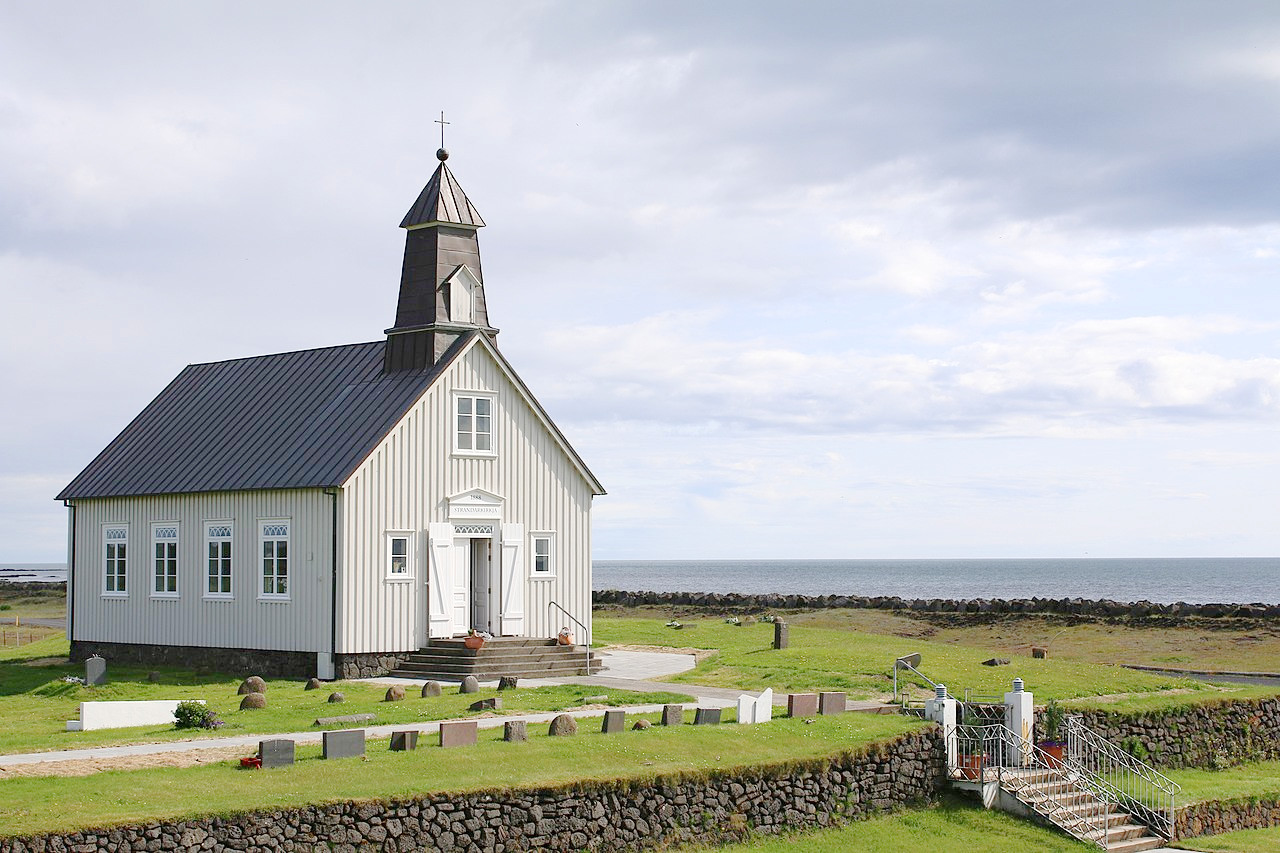 Church at Strandir
Climate Map
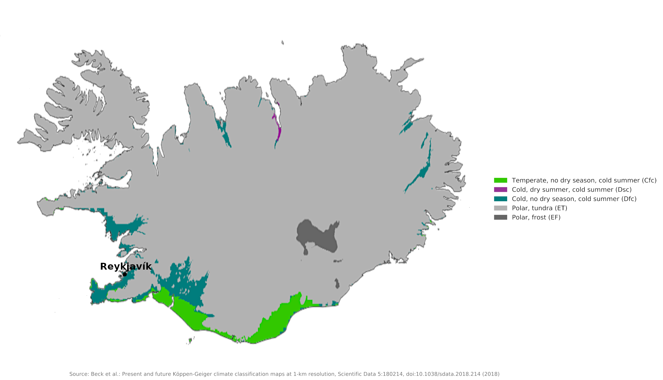 Climate map of Iceland
What is the climate of Iceland like?
Iceland is an island in the stormiest region of the North Atlantic, between Norway and Greenland. It consists mainly of a central volcanic plateau, with elevations from about 700 to 800 meters (2,300–2,625 feet), ringed by mountains, the highest of which is Hvannadalshnúkur (2,110 m / 6,920 ft). The largest glacier in Europe, Vatnajökull, is in southeast Iceland. There are also many lakes, snowfields, hot springs, and geysers (the word "geyser" itself is of Icelandic origin).
Two features control Iceland's weather and climate: it lies in the track most frequented by depressions throughout the year; it also lies in the path of the current of warm oceanic water called the Gulf Stream. Consequently the weather is disturbed and changeable throughout the year but during the winter the temperatures at sea level are surprisingly mild for the latitude. (The Arctic Circle just touches the north coast of the island.) There are no extreme temperature variations between seasons, although frequent weather changes are usual, particularly in the south, which experiences many storms and heavy precipitation.
Iceland lies across from the great storm track of the North Atlantic. Running from the southwest to the northeast, this storm path gives Iceland some of the most changeable weather in the world. In the middle of winter, big storms hit the island between five and seven times a month. The prevalence of low pressure in the region has led to the official naming of the Icelandic Low, centered over Iceland and southern Greenland.
Inland Iceland is mountainous, and these higher areas are covered with snow throughout the year and there are extensive ice fields at higher levels. Although very cold air from the Arctic occasionally affects the island in winter and spring, and drifting ice may block inlets on the north coast, the main port and capital, Reykjavik, is ice free throughout the year. The summers are generally cool and cloudy with brief spells of fine, pleasant weather. Much of the winter precipitation is snow and autumn and winter are the wettest seasons.
The mean annual temperature at Reykjavík is about 5°C (about 41°F), with a range from 1°C (33°F) in January to 12°C (53°F) in July. In the northwestern, northern, and eastern coastal regions, which are subject to the effects of polar currents and drifting ice, temperatures are generally lower. Windstorms of considerable violence are characteristic during much of the winter season.
Annual rainfall ranges between about 1,250 and 2,000 millimeters (50 to 80 inches) along the southern coast, but is only about 500 millimeters (20 inches) along the northern coast. The southern slopes of some of Iceland’s interior mountains receive up to about 4,500 millimeters (180 inches) of precipitation per year.
| Climate data for Reykjavík (1991–2020) | |||||||||||||
|---|---|---|---|---|---|---|---|---|---|---|---|---|---|
| Month | Jan | Feb | Mar | Apr | May | Jun | Jul | Aug | Sep | Oct | Nov | Dec | Year |
| Average high °C (°F) | 3.1 (37.6) | 3.3 (37.9) | 4.0 (39.2) | 6.8 (44.2) | 9.8 (49.6) | 12.7 (54.9) | 14.6 (58.3) | 13.9 (57.0) | 11.1 (52.0) | 7.5 (45.5) | 4.5 (40.1) | 3.3 (37.9) | 7.9 (46.2) |
| Daily mean °C (°F) | 0.7 (33.3) | 0.6 (33.1) | 1.2 (34.2) | 3.7 (38.7) | 6.7 (44.1) | 9.8 (49.6) | 11.6 (52.9) | 11.0 (51.8) | 8.2 (46.8) | 4.9 (40.8) | 2.2 (36.0) | 0.8 (33.4) | 5.1 (41.2) |
| Average low °C (°F) | −1.8 (28.8) | −1.9 (28.6) | −1.3 (29.7) | 1.2 (34.2) | 3.9 (39.0) | 7.7 (45.9) | 8.8 (47.8) | 8.7 (47.7) | 5.9 (42.6) | 2.7 (36.9) | −0.2 (31.6) | −1.6 (29.1) | 2.7 (36.8) |
| Average precipitation mm (inches) | 83.0 (3.27) | 85.9 (3.38) | 81.4 (3.20) | 56.0 (2.20) | 52.8 (2.08) | 43.8 (1.72) | 52.3 (2.06) | 67.3 (2.65) | 73.5 (2.89) | 74.4 (2.93) | 78.8 (3.10) | 94.1 (3.70) | 843.3 (33.20) |
| Average snowfall cm (inches) | 19.9 (7.8) | 17.1 (6.7) | 23.2 (9.1) | 12.1 (4.8) | 1.6 (0.6) | 0.0 (0.0) | 0.0 (0.0) | 0.0 (0.0) | 0.0 (0.0) | 1.4 (0.6) | 8.7 (3.4) | 17.8 (7.0) | 101.8 (40.1) |
| Source: Icelandic Meteorological Office | |||||||||||||
Iceland is known for its long summer days, and long winter nights. At the summer solstice there are 21 hours of daylight at Reykjavík. During midwinter, the sun never climbs higher than three degrees above the horizon, and on 21 December there are only around 4 hours of daylight. In the far north of the island during winter, there is a short period of time when the sun is not visible at all.
When is the best time to visit Iceland?
Best time to visit Iceland is June–September.
References
- E. A. Pearce, Charles Gordon Smith, (1990) The Hutchinson World Weather Guide, John Murray Press. ISBN 1859863426
- Timothy L. Gall, (ed.), (2003), Worldmark Encyclopedia of the Nations, Eleventh Edition, Thomson Gale
- Defense Technical Information Center, (1974), DTIC ADB000808: Iceland - Troubled Ally. United States Naval War College
- Hugh Chisholm, (ed.), (1911), Encyclopædia Britannica, Eleventh edition, Cambridge University Press
The Climate of
Iceland
In summary:
Although close to the Arctic Circle, Iceland’s climate is fairly mild because of the Gulf Stream, part of which almost encircles the island. The mean annual temperature at Reykjavík is about 5°C (about 41°F), with a range from -1°C (31°F) in January to 11°C (52°F) in July. In the northwestern, northern, and eastern coastal regions, temperatures are generally lower.
Annual rainfall in the north ranges from 300 to 700 mm (12 to 28 in); in the south, 1250 to 2000 mm (50 to 80 in); and in the mountains, up to 4500 mm (180 in). Winters are long and fairly mild, summers short and cool. Summer days are long and nights short; in winter, days are short and nights long.