.jpg)
.jpg&oldid=510372863)
.jpg)
.jpg&oldid=476694385)
.jpg)
.jpg&oldid=593467689)
The Geography of
Albania
Why visit Albania?
One of the things that makes Albania a beautiful country is its diverse landscape. From its stunning coastline to the impressive mountains, Albania is very picturesque and beautiful. The people are hospitable and friendly, which makes travelling to Albania a pleasure. Albanian culture is also interesting and unique. There are a lot of traditions and rituals that are unique to the country. This country is a great place to visit, and we would highly recommend it to anyone.
Contents
Map
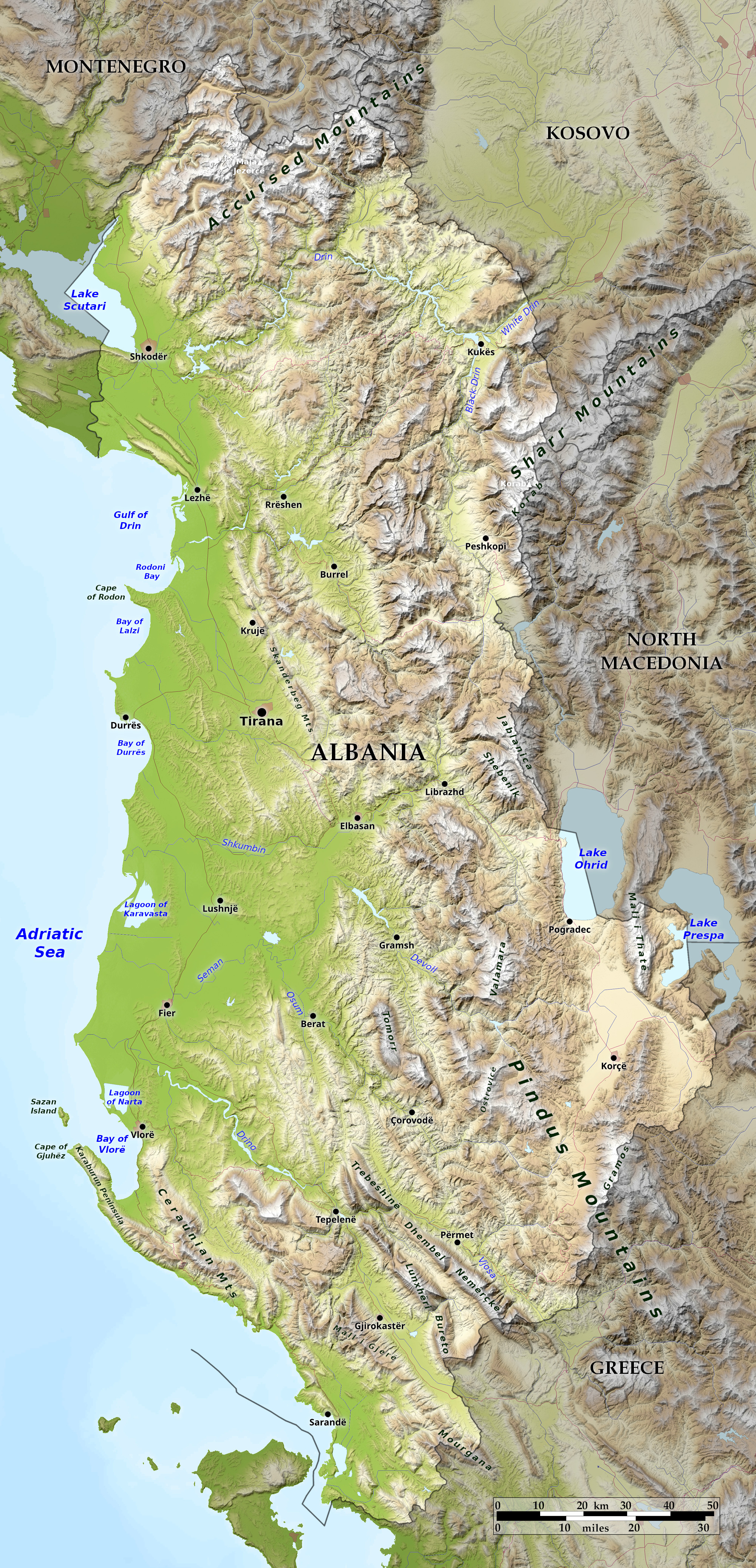 Relief map of Albania
What is the landscape of Albania like?
.jpg)
"Stairs leading up to the Castle in Kruje where Skanderbeg and his troops withstood three sieges by the Ottomans" by CIA World Factbook
.jpg&oldid=593467658)
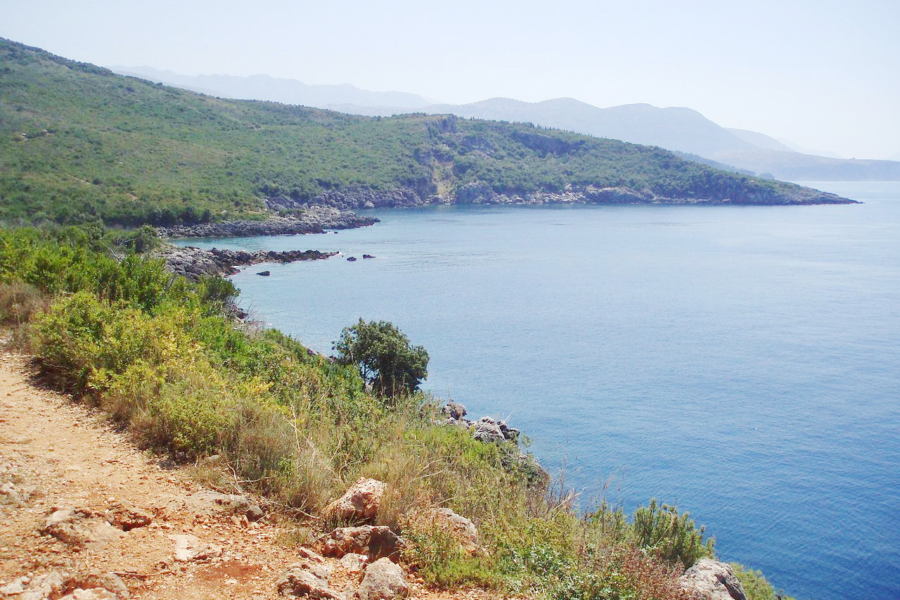
Albania is a relatively small country situated on the east side of the Adriatic Sea to the north of Greece. Its greatest width (from east to west) being 95 miles and its greatest length (from north to south) 210 miles
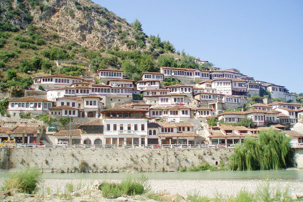
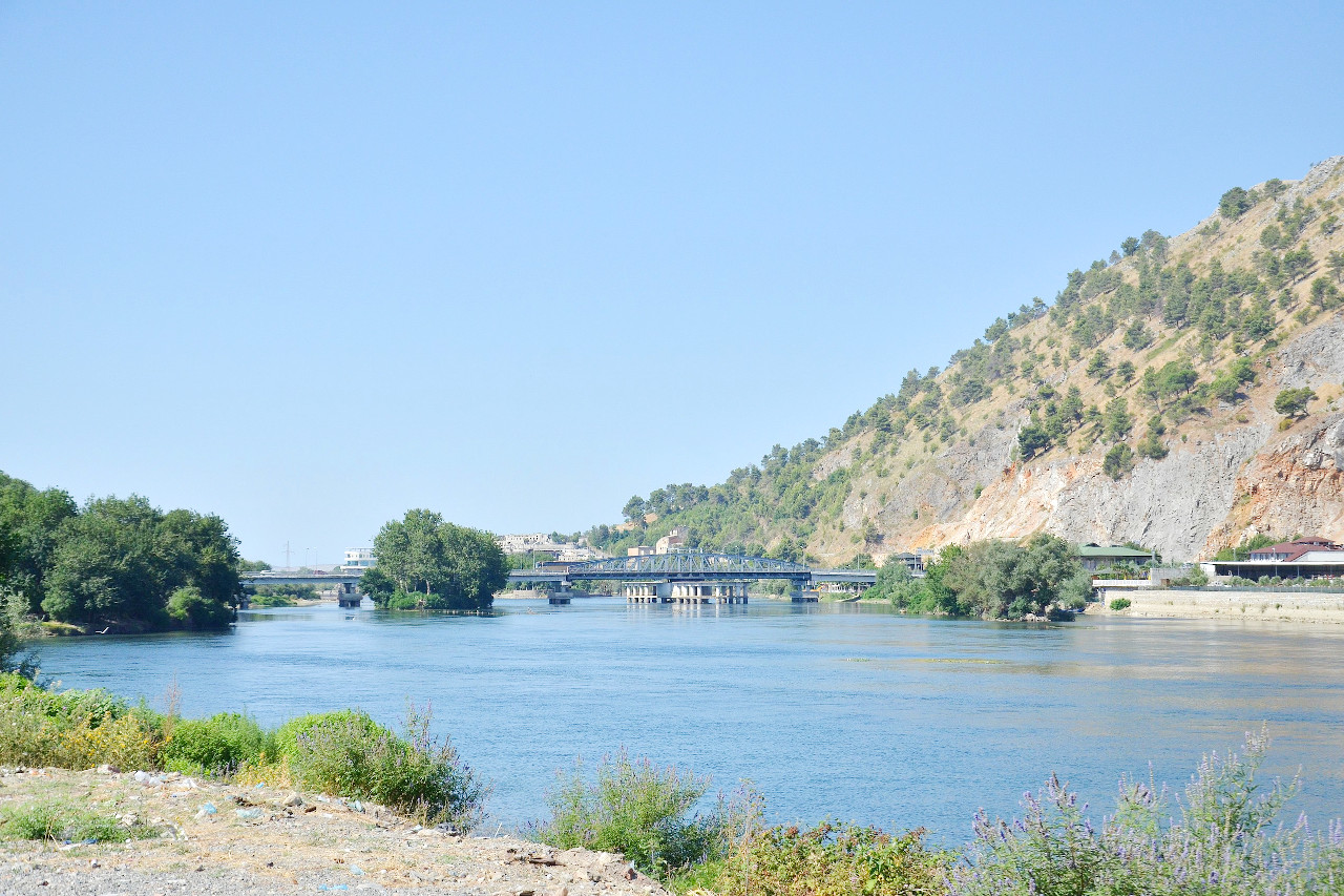
The coastlands of Albania have long, narrow bays with peninsulas and islands. The coastal plains extend inland from the coast for some thirty miles. These lowlands have a Mediterranean climate, and olives, vines, mulberries and cereals are grown. Parts of the plains are wetlands and marshes similar in type to those of Italy. This area is the most densely populated part of the country. Tirana is the capital; other cities of relative importance are Shkodër, Durrës, and Vlorë.
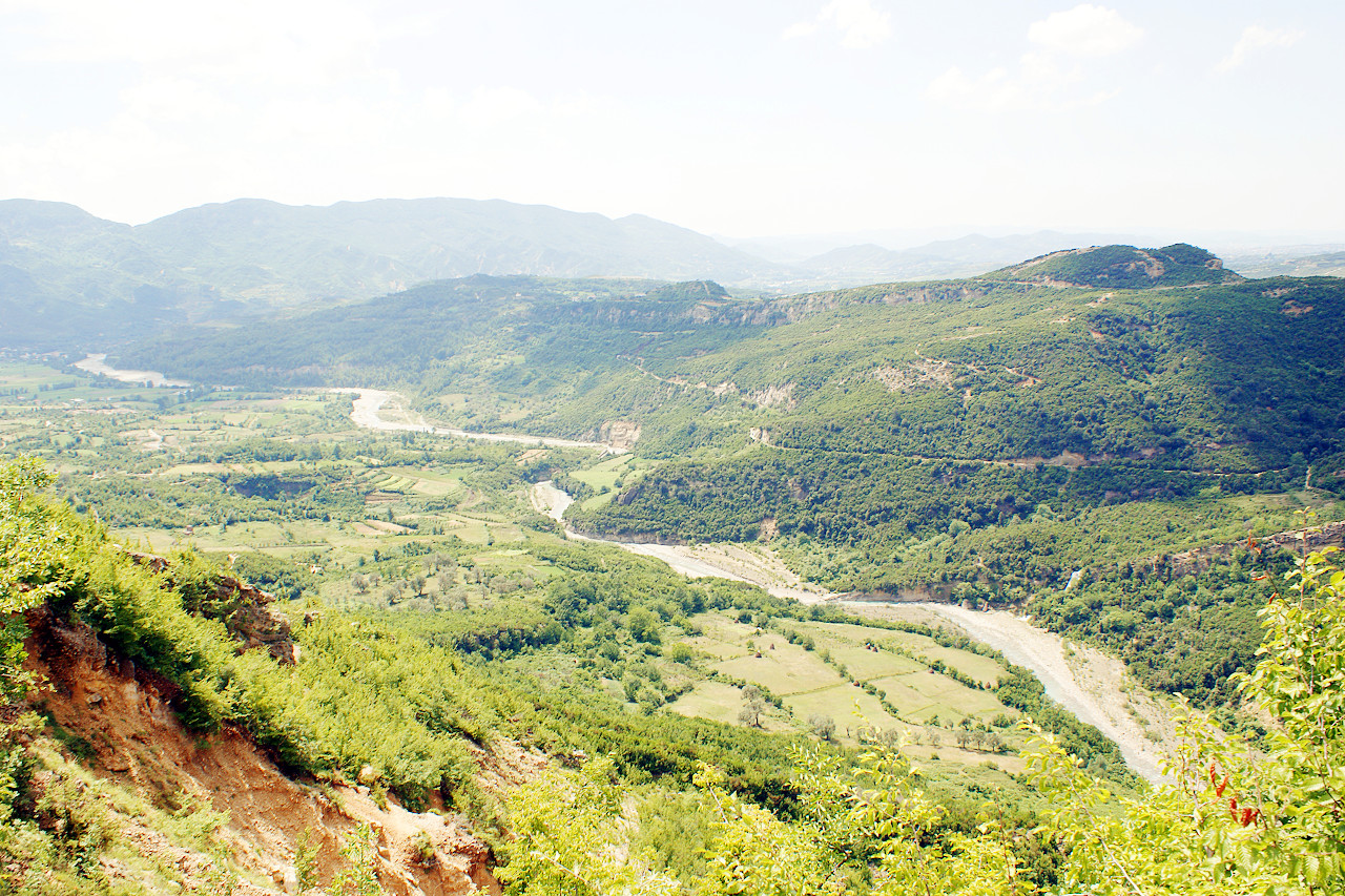
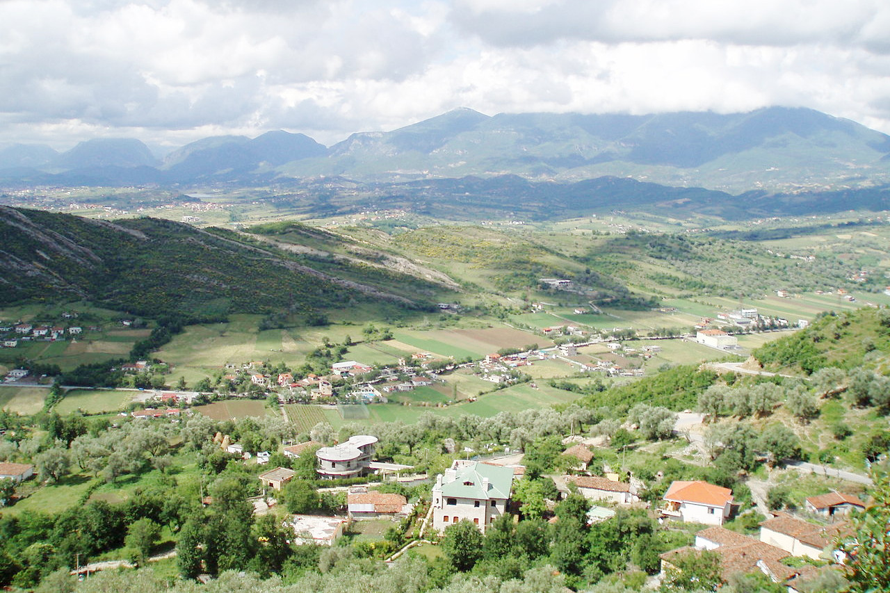
The remainder of Albania is mountainous. With about three-quarters of the country classed as hill or mountain, Albania has an average height above sea-level of 700 meters (2,300 feet)—about twice the average for Europe as a whole. The interior is a region of wild, often inaccessible, mountains. In the north, forests of oak, walnut, chestnut, elm, plane, pine and fir dominate the upper slopes. Mountain chains stretch along the northern, eastern and southern frontiers. The highest mountain is Mount Korab, 2,764 m / 9,068 ft, in the eastern chain. Valleys and lower slopes contain many villages and single houses located near springs and streams and sheltering farms. In the southeast of Albania are several fertile basins. Lake Ohrid occupies one, and the town of Korçë occupies a central location in another.
What is the nature of Albania like?
The southern coastal lowlands of Albania have typical Mediterranean plants including scrub oak, drought resisting evergreens, olives, and grapes. The hills, with their winter snows and higher rainfall, have grasslands with mixed forests. Albania possesses many splendid forests; the principal trees are the oak, beech, ash, plane, celtis, poplar and walnut, which give way in the higher regions to the pine and fir.
What is the climate of Albania like?
See our main article: The Climate of Albania
In the coastal lowlands the winters are mild and the summers hot: temperatures often reaching 30ºC (85ºF). In the highlands, however, the winters are cold, with temperatures as low as -10ºC (10ºF). Rainfall is plentiful, reaching 1500 mm (60 inches) a year, the highest rainfall levels being in the northern mountains. Summer is a dry season, when only eight per cent of the annual rain falls and when the sky is usually cloudless.
| Climate data for Tirana | |||||||||||||
|---|---|---|---|---|---|---|---|---|---|---|---|---|---|
| Month | Jan | Feb | Mar | Apr | May | Jun | Jul | Aug | Sep | Oct | Nov | Dec | Year |
| Average high °C (°F) | 11.6 (52.9) | 12.9 (55.2) | 15.6 (60.1) | 19.0 (66.2) | 23.8 (74.8) | 27.7 (81.9) | 30.7 (87.3) | 30.7 (87.3) | 27.3 (81.1) | 21.8 (71.2) | 17.1 (62.8) | 13.0 (55.4) | 21.0 (69.8) |
| Daily mean °C (°F) | 6.7 (44.1) | 7.8 (46.0) | 10.0 (50.0) | 13.4 (56.1) | 18.0 (64.4) | 21.6 (70.9) | 24.0 (75.2) | 23.8 (74.8) | 20.7 (69.3) | 16.0 (60.8) | 11.7 (53.1) | 8.1 (46.6) | 15.2 (59.4) |
| Average low °C (°F) | 1.8 (35.2) | 2.6 (36.7) | 4.5 (40.1) | 7.9 (46.2) | 12.1 (53.8) | 15.6 (60.1) | 17.2 (63.0) | 16.9 (62.4) | 14.1 (57.4) | 10.1 (50.2) | 6.3 (43.3) | 3.2 (37.8) | 9.4 (48.9) |
| Average precipitation mm (inches) | 143 (5.6) | 132 (5.2) | 115 (4.5) | 104 (4.1) | 103 (4.1) | 68 (2.7) | 42 (1.7) | 46 (1.8) | 78 (3.1) | 114 (4.5) | 172 (6.8) | 148 (5.8) | 1,266 (49.8) |
| Source: Deutscher Wetterdienst | |||||||||||||
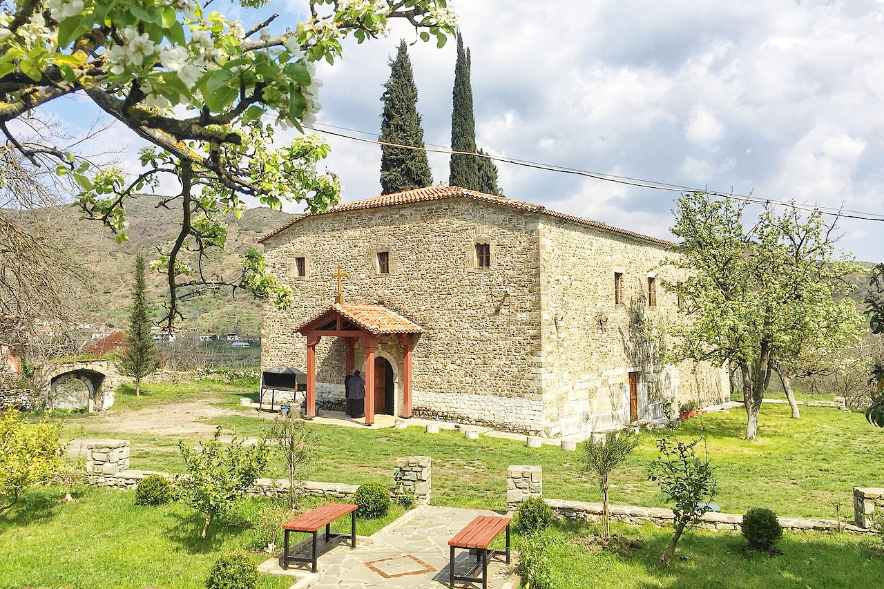 Saint Jovan's Vladimir Church, Shijon
The official websites
Albania
Be Taken by Albania
| Location: | Southeastern Europe on the eastern shore of the Adriatic Sea |
| Coordinates: | 41° 00′ N, 20° 00′ E |
| Size: | • 335 km N-S; 150 km E-W • 210 miles N-S; 95 miles E-W |
| Terrain: | Rugged and mountainous, with mountains running from north to south. The remainder is mostly coastal lowlands |
| Climate: | Mediterranean climate on the coast with hot, dry summers and rainy winters. A continental climate in the east with hot summers and cold winters with heavy snow |
| Highest point: | Korab 2,764 m / 9,068 ft |
| Forest: | 20% (2010 est.) (source) |
| Population: | 2,845,955 (2020 est.) |
| Population density: | Low-to-Medium (98/km²) |
| Capital: | Tirana |
| Languages: | Albanian, Greek, Aromanian, Macedonian |
| Human Development Index: | High (0.795) |
| Currency: | Lek |