The Climate of
Mongolia
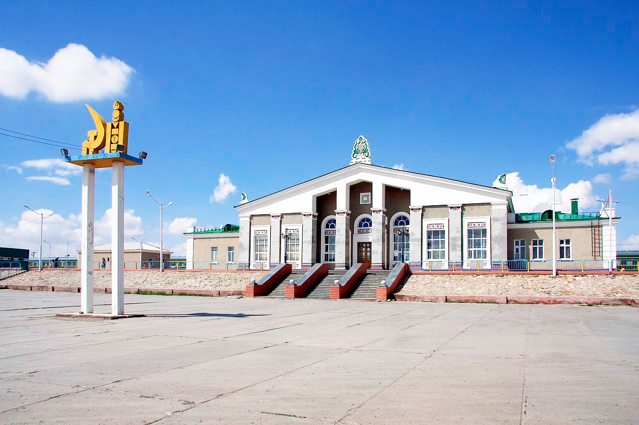
 Sainshand railway station, Gobi desert
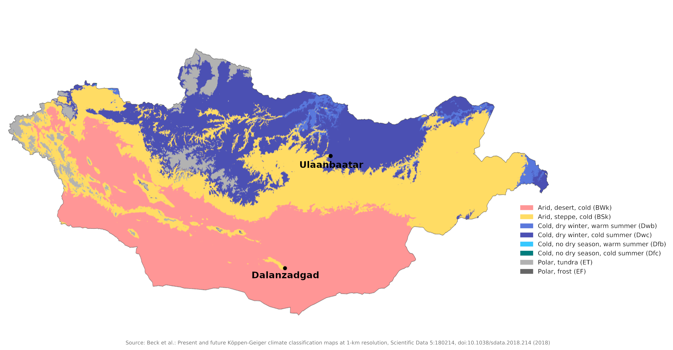
Climate Map
 Climate map of Mongolia
What is the climate of Mongolia like?
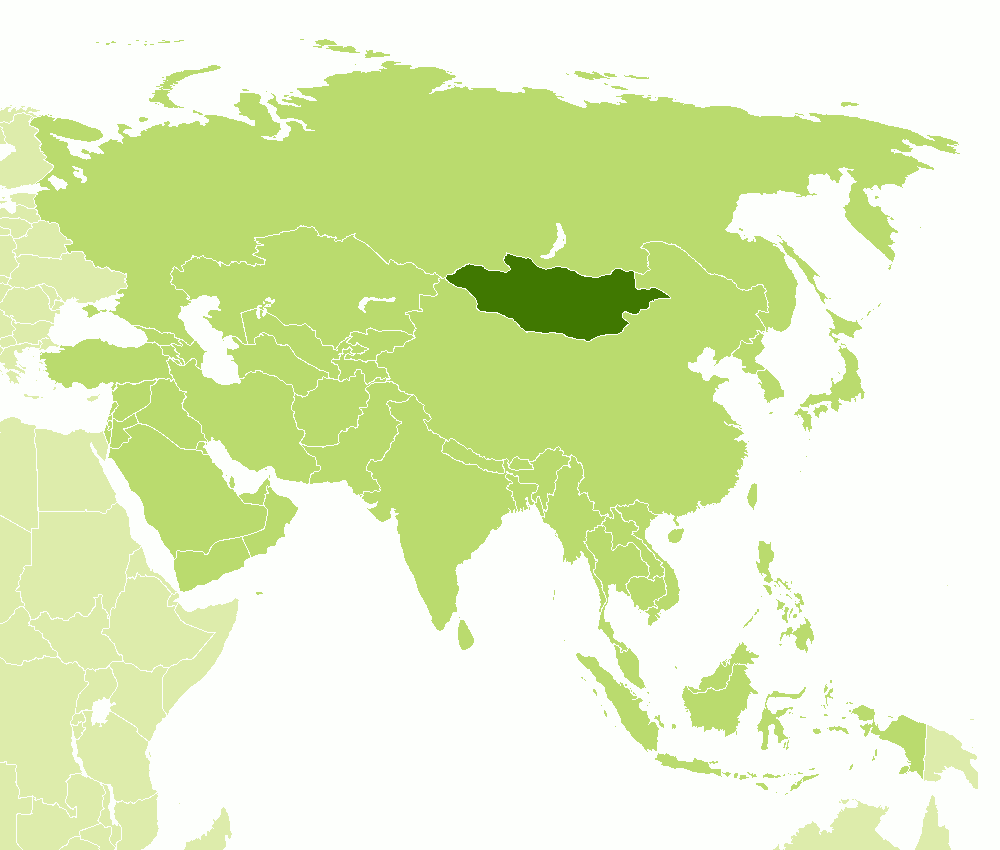
Mongolia is a large but very sparsely populated country in the heart of Asia. It is bordered by Russia on the north and China on the south. It is almost three times the size of France yet it has a population of a little over three million. In the west and north there are mountains rising to over 3,000 meters (10,000 feet) but there are extensive areas of flat or undulating plains which are desert in the south and steppe grassland in the north and east.
Mongolia is high, cold, and dry. It has an extreme continental type of climate with long, cold winters and short summers, during which most precipitation falls. In winter (at worst between October and April) the area is encompassed by great masses of cold air, forming huge high pressure zones. In the short and relatively warm summer, in-blowing winds, remnants of the southwest monsoon, combine with low pressure systems and produce modest precipitation, often in the form of brief and localized cloudbursts. There are two climatic zones: the continental zone in the north, and the desert in the south. The country's high altitude results in inhospitably cold, dry, and harsh weather. Temperatures can fluctuate radically each day, dropping drastically at night, and they differ greatly from season to season. Winters are especially long, with freezing temperatures from October to April. The temperature can plunge as low as -40°C (-40°F) in January. Mongolia's average winter temperature is -24°C (-13°F). Spring is a brief windy and stormy transition period of five to six weeks around May. Summer lasts from June to August, with an average temperature of around 20°C (65°F), ranging from 10° to 25°C (50° to 76°F). Autumn is a five- to six-week transition period around September.
Rainfall is everywhere low. Most of Mongolia's rainfall occurs from May to September when moist air is able to penetrate the interior under the influence of the Chinese summer monsoon. Winter is almost entirely dry, with occasional light snow, except in the western mountains where snow is heavier. Rainfall is heavier in the north, and nearly nonexistent in the southern Gobi Desert. Mongolia's annual average rainfall is a low 200 to 220 millimeters (8 to 9 inches), receiving an average of 350 millimeters (14 inches) in the north and fewer than 100 millimeters (4 inches) in the south.
More than half of the country is covered by permafrost, making construction, road building and mining difficult. All rivers and freshwater lakes freeze over in winter, and small streams usually freeze to the bottom. Summer weather in Mongolia is characterized by extreme variability and short-term unpredictability, and annual averages hide large variations in precipitation, frost dates, and the occurrence of snowstorms and spring dust storms. Although winters are generally cold and clear, there are occasional blizzards that do not shed much snow but blanket the grasses with enough snow and ice to make grazing impossible and kill livestock.
Winter winds, except in sudden blizzards, are generally weak, local, and mainly from the north. In summer and autumn, moister winds emanate from the southwest. Annual average relative humidity is benign, varying from 45 percent to 75 percent, year-round.
Conditions during the short summer are quite pleasant, but during the long, cold winter very warm clothing is required and, when strong winds arise, wind chill can be very severe. On many days during the winter, however, winds are light, the sky is clear and there is abundant sunshine. The atmosphere is rarified and bracing, in this land of "Everlasting Blue Sky." The country usually has at least 250 cloudless days a year, and it is usually at the center of a region of high atmospheric pressure.
North
Precipitation is highest in the north and averages 200 to 350 millimeters (8 to 14 inches) per year. Ulaanbaatar shows the conditions in much of the north of the country. Ulaanbaatar is located at 1,350 meters (4,430 feet) above sea level in the valley of the Tuul river. Located in the relatively water-rich north, it receives an annual average of 270 millimeters (11 inches) of precipitation, which falls almost exclusively in July and August. Ulaanbaatar has an average annual temperature of -1°C (31°F) and a frost-free period that extends on average from mid-June to late August. Grains, mainly wheat, are grown in the valleys of the Selenge River system to the north, but yields vary widely and unpredictably due to the amount and timing of rain and the date the frost ends.
| Climate data for Ulaanbaatar | |||||||||||||
|---|---|---|---|---|---|---|---|---|---|---|---|---|---|
| Month | Jan | Feb | Mar | Apr | May | Jun | Jul | Aug | Sep | Oct | Nov | Dec | Year |
| Average high °C (°F) | −15.6 (3.9) | −9.6 (14.7) | −0.7 (30.7) | 9.7 (49.5) | 17.8 (64.0) | 22.5 (72.5) | 24.5 (76.1) | 22.3 (72.1) | 16.7 (62.1) | 7.6 (45.7) | −5.0 (23.0) | −13.5 (7.7) | 6.4 (43.5) |
| Daily mean °C (°F) | −21.6 (−6.9) | −16.6 (2.1) | −7.4 (18.7) | 2.0 (35.6) | 10.1 (50.2) | 15.7 (60.3) | 18.2 (64.8) | 16.0 (60.8) | 9.6 (49.3) | 0.5 (32.9) | −11.9 (10.6) | −19.0 (−2.2) | −0.4 (31.3) |
| Average low °C (°F) | −25.9 (−14.6) | −22.2 (−8.0) | −13.6 (7.5) | −4.3 (24.3) | 3.3 (37.9) | 9.6 (49.3) | 12.9 (55.2) | 10.6 (51.1) | 3.6 (38.5) | −4.8 (23.4) | −15.7 (3.7) | −22.9 (−9.2) | −5.8 (21.6) |
| Average precipitation mm (inches) | 2 (0.1) | 3 (0.1) | 4 (0.2) | 10 (0.4) | 21 (0.8) | 46 (1.8) | 64 (2.5) | 70 (2.8) | 27 (1.1) | 10 (0.4) | 6 (0.2) | 4 (0.2) | 267 (10.5) |
| Source: www.pogodaiklimat.ru | |||||||||||||
South
The south of the country is the Gobi desert. Dalanzadgad shows the drier conditions of southern Mongolia. Here annual rainfall is around 100 to 200 millimeters (4 to 8 inches), but some regions that receive no rainfall at all most years. The name Gobi derives from the Mongolian word govi, meaning steppe or dry grassland with enough vegetation to support camels. Mongolians distinguish Govi from the desert proper, although the distinction is not always obvious to outsiders unfamiliar with the Mongolian landscape. The Govi rangeland is fragile and easily destroyed by overgrazing, leading to the expanse of the true desert, a stony desert where not even Bactrian camels can survive.
| Climate data for Dalanzadgad | |||||||||||||
|---|---|---|---|---|---|---|---|---|---|---|---|---|---|
| Month | Jan | Feb | Mar | Apr | May | Jun | Jul | Aug | Sep | Oct | Nov | Dec | Year |
| Average high °C (°F) | −7.6 (18.3) | −3.7 (25.3) | 4.4 (39.9) | 13.5 (56.3) | 21.4 (70.5) | 26.2 (79.2) | 27.5 (81.5) | 25.9 (78.6) | 20.1 (68.2) | 12.3 (54.1) | 2.0 (35.6) | −5.5 (22.1) | 11.4 (52.5) |
| Daily mean °C (°F) | −14.7 (5.5) | −11.2 (11.8) | −3.0 (26.6) | 6.1 (43.0) | 14.2 (57.6) | 19.2 (66.6) | 21.0 (69.8) | 19.3 (66.7) | 13.1 (55.6) | 4.8 (40.6) | −5.1 (22.8) | −12.6 (9.3) | 4.3 (39.7) |
| Average low °C (°F) | −21.1 (−6.0) | −17.3 (0.9) | −9.3 (15.3) | −0.8 (30.6) | 7.0 (44.6) | 12.4 (54.3) | 14.8 (58.6) | 13.3 (55.9) | 6.9 (44.4) | −1.6 (29.1) | −11.2 (11.8) | −18.3 (−0.9) | −2.1 (28.2) |
| Average precipitation mm (inches) | 1.4 (0.06) | 1.1 (0.04) | 3.3 (0.13) | 5.3 (0.21) | 11.8 (0.46) | 18.1 (0.71) | 32.8 (1.29) | 32.1 (1.26) | 13.1 (0.52) | 4.4 (0.17) | 2.0 (0.08) | 1.0 (0.04) | 126.4 (4.97) |
| Source: NOAA | |||||||||||||
References
- E. A. Pearce, Charles Gordon Smith, (1990) The Hutchinson World Weather Guide, John Murray Press. ISBN 1859863426
- Timothy L. Gall, (ed.), (2003), Worldmark Encyclopedia of the Nations, Eleventh Edition, Thomson Gale
- Federal Research Division, Library of Congress, (1991), Mongolia: a country study. Claitor's Pub. Division.
- Historical Evaluation and Research Organization, (1970), Area handbook for Mongolia. United States Government Printing Office.
- Hugh Chisholm, (ed.), (1911), Encyclopædia Britannica, Eleventh edition, Cambridge University Press
The Climate of
Mongolia

In summary:
Mongolia has an arid continental climate with a wide seasonal range of temperature and low rainfall. Winters are long and very cold. There is a swift transition in April to a short, warm summer and an equally rapid return to the winter cold in October.
Most of Mongolia's rainfall occurs from May to September. Annual precipitation ranges from 250 to 380 mm (10 to 15 in) in mountain areas to less than 100 mm (4 in) in the south.