The Climate of
Peru
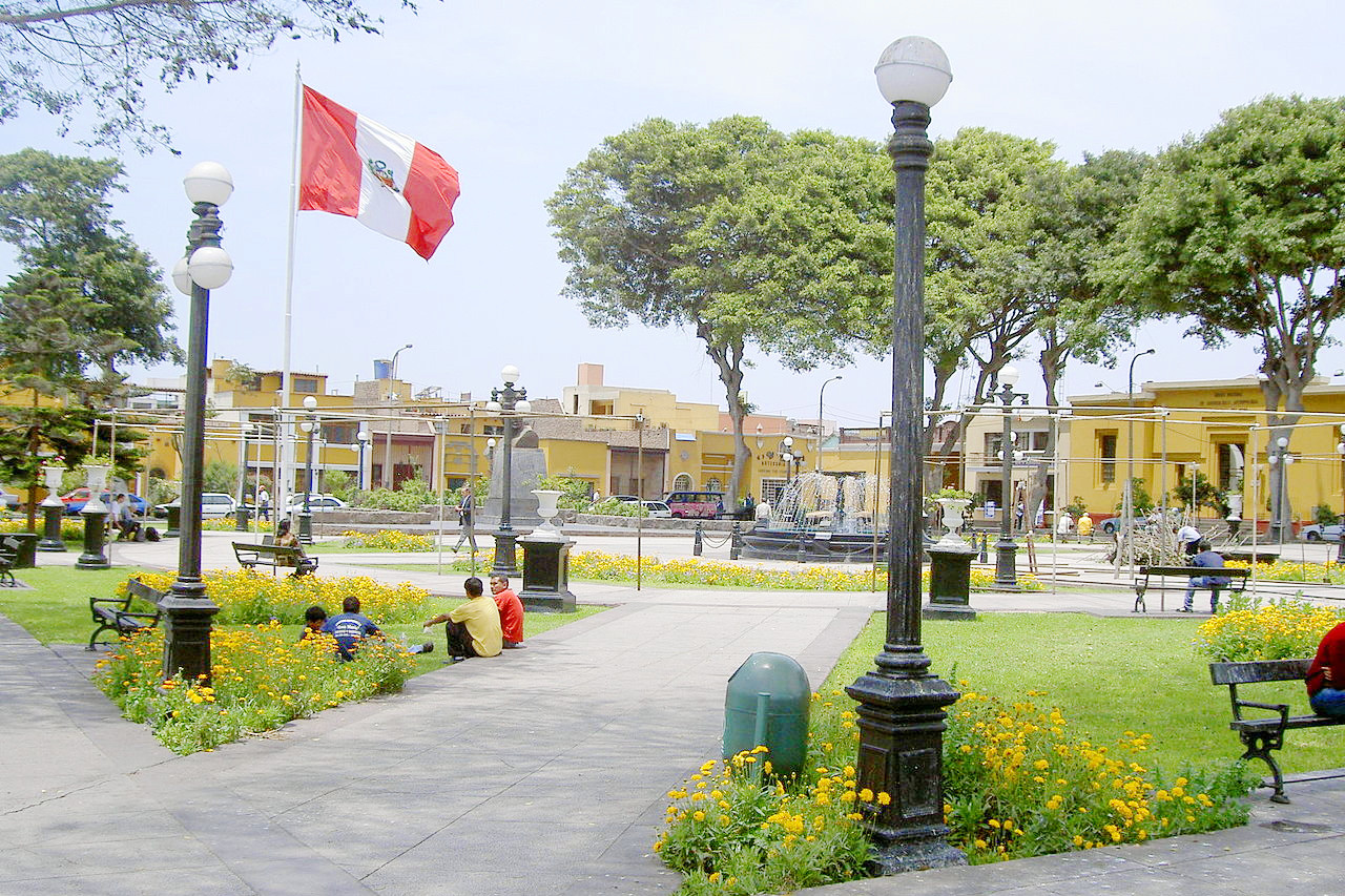 Plaza Bolívar, the main square in the Pueblo Libre district of Lima
Climate Map
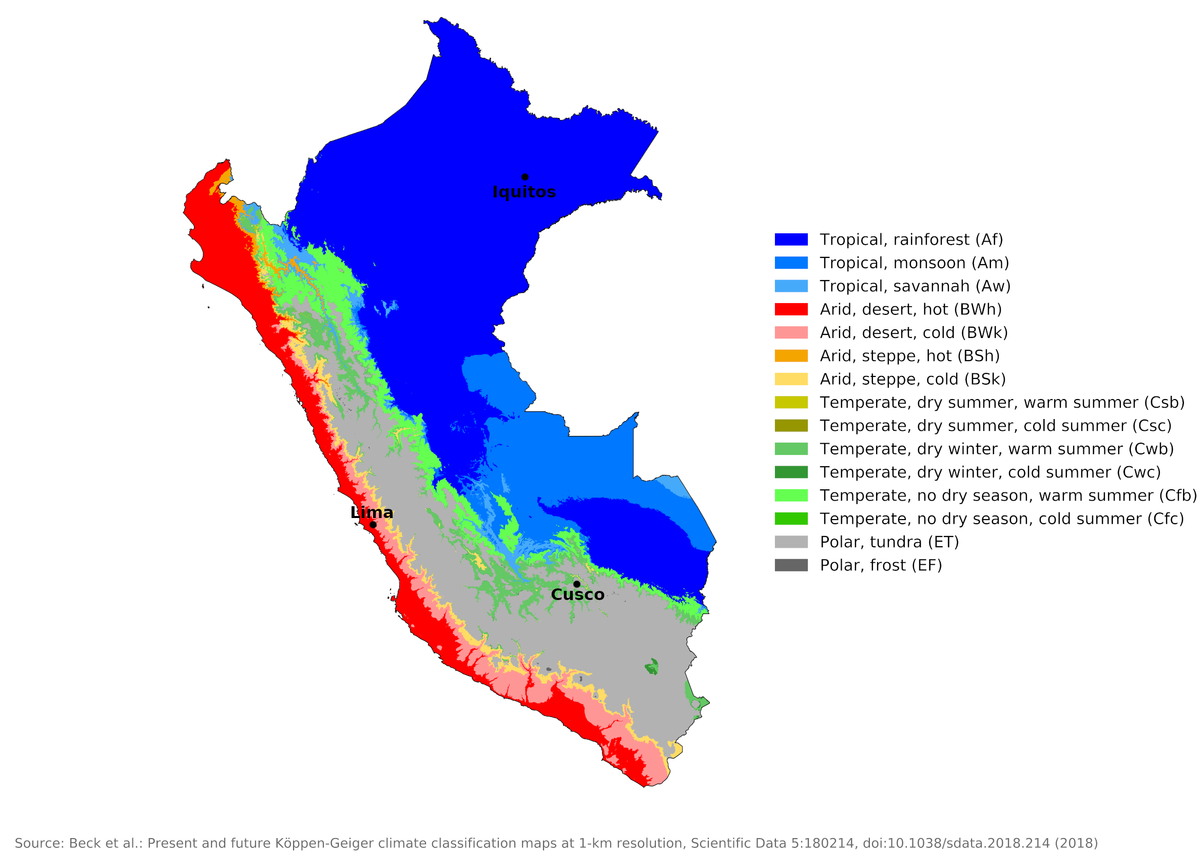 Climate map of Peru
What is the climate of Peru like?
Peru is twice the size of France or the state of Texas and stretches between the g between the equator and 18°S. It has a long coastline on the Pacific Ocean and is bordered by Ecuador on the north, Brazil and Bolivia on the east, and Chile on the south. The central part of Peru includes the large mountainous and plateau region of the Andes, with numerous peaks rising to over 6,000 meters (20,000 feet) and extensive plateau areas between 3,000 and 4,300 meters (10,000–14,000 feet). There is a very narrow coastal plain on the Pacific coast, while the land east of the Andes drops steeply into the forested lowlands of the Amazon Basin.
Peru has two seasons that correspond to rainfall rather than to temperature. Because of extremes in altitude, average temperatures vary greatly between regions. The Coast is warm all year, averaging 20°C (68°F)—it is an arid, desert area, but the cold ocean current cools the breezes, producing a sea mist with the inshore winds on the coastal plain. In the Andes, temperatures average 12°C (54°F) all year, and a rainy season extends from October to April. To the east are the jungles of the Amazon Basin, tropical in all months with heavy rainfall.
Most of the rain and humidity comes from easterly trade winds that blow across the Amazon Basin. Because the mountains absorb almost all of the rain, the coastal plain is dry year-round, with Lima falling an average of less than 25 millimeters (one inch) annually. In extreme contrast, the eastern forests receive an average annual rainfall of 2,500 millimeters (100 inches); in some years these areas are deluged with up to 3,500 millimeters (140 inches).
The Coastal Region
The Pacific Coast region has an extremely unusual arid desert climate. This is caused by the cold water of the Humboldt Current flowing north. This area is a continuation of the coastal desert of northern Chile. The cold sea water keeps temperatures low for a tropical latitude almost to the equator and there is very little variation from month to month. The drought is so severe that in some places several years have passed without any rain worth mentioning. And yet the region experiences periods of humidity as high as 90 percent from June to September.
Temperatures along the coast rise near the equator in the north, where the summer can be blazingly hot, and fall to cooler levels in the south. The otherwise dry coastal strip frequently experiences low clouds and fog, locally called Garúa. In winter, from May to October, this sea mist sometimes condenses into a light drizzle. This is another unusual feature for such an arid climate. If climatic conditions are right, there can be a sudden burst of delicate plant life at certain places made possible by the heavy mist. Normally, however, the mist is only sufficient to dampen the air, and the sand remains bleakly sterile.
The northern coastal areas experience a notable change in weather as a result of the El Niño phenomenon, which occurs for a few weeks every four to ten years. Temperature rises, clouds build and torrential rains can fall for many days. It's as if the equatorial cloud and rain belt that normally lies to the north along the coasts of Ecuador and Colombia has shifted south. Such unusual and unexpected heavy rains can cause widespread damage. At the same time, the sea temperature off the coast rises and the cold current retreats to the south. It is most likely in December and January. El Niño has a major impact on global climate, fisheries, agriculture, and wildlife.
The climate for Lima is representative of the climate of the coastal district, although the city is a short distance inland. Midday temperatures are slightly higher here than on the coast. Lima averages just one to two hours of sunshine per day during the sunless period, while this increases to five to seven hours per day in the warmer months of December through April.
| Climate data for Lima (1961–1990) | |||||||||||||
|---|---|---|---|---|---|---|---|---|---|---|---|---|---|
| Month | Jan | Feb | Mar | Apr | May | Jun | Jul | Aug | Sep | Oct | Nov | Dec | Year |
| Average high °C (°F) | 26.1 (79.0) | 26.8 (80.2) | 26.3 (79.3) | 24.5 (76.1) | 22.0 (71.6) | 20.1 (68.2) | 19.1 (66.4) | 18.8 (65.8) | 19.1 (66.4) | 20.3 (68.5) | 22.1 (71.8) | 24.4 (75.9) | 22.5 (72.5) |
| Daily mean °C (°F) | 22.1 (71.8) | 22.7 (72.9) | 22.2 (72.0) | 20.6 (69.1) | 18.8 (65.8) | 17.5 (63.5) | 16.7 (62.1) | 16.2 (61.2) | 16.4 (61.5) | 17.3 (63.1) | 18.7 (65.7) | 20.7 (69.3) | 19.2 (66.6) |
| Average low °C (°F) | 19.4 (66.9) | 19.8 (67.6) | 19.5 (67.1) | 17.9 (64.2) | 16.4 (61.5) | 15.6 (60.1) | 15.2 (59.4) | 14.9 (58.8) | 14.9 (58.8) | 15.5 (59.9) | 16.6 (61.9) | 18.2 (64.8) | 17.2 (63.0) |
| Average precipitation mm (inches) | 0.8 (0.03) | 0.4 (0.02) | 0.4 (0.02) | 0.1 (0.00) | 0.3 (0.01) | 0.7 (0.03) | 1.0 (0.04) | 1.5 (0.06) | 0.7 (0.03) | 0.2 (0.01) | 0.1 (0.00) | 0.2 (0.01) | 6.4 (0.25) |
| Source: Deutscher Wetterdienst | |||||||||||||
The Andean Highlands
The mountain and plateaux of the Andes in Peru are much cooler due to the altitude. There are two basic Andean seasons, the rainy season, locally referred to as winter ("invierno"), from October through April and the dry season of summer ("verano") in the remaining months. The climate of Cuzco in the south of the country illustrates the moderate temperatures in all months and the only rainy season in high sun between November and March. The heavier cloud cover during the rainy season prevents the temperature from rising higher at this time.
Another consequence of the high altitude is that there is a large daily temperature variation, which is fairly low at night. Nighttime frosts can occur at these altitudes during the dry season. Above 3,000 meters (10,000 feet), visitors can suffer from altitude sickness. To the east are the Montaña forests of the eastern mountain slopes—the temperature is warmer but still fairly moderate, with no frost or great heat.
| Climate data for Cusco (1961-1990) | |||||||||||||
|---|---|---|---|---|---|---|---|---|---|---|---|---|---|
| Month | Jan | Feb | Mar | Apr | May | Jun | Jul | Aug | Sep | Oct | Nov | Dec | Year |
| Average high °C (°F) | 18.8 (65.8) | 18.8 (65.8) | 19.1 (66.4) | 19.7 (67.5) | 19.7 (67.5) | 19.4 (66.9) | 19.2 (66.6) | 19.9 (67.8) | 20.1 (68.2) | 20.9 (69.6) | 20.6 (69.1) | 20.8 (69.4) | 19.8 (67.6) |
| Daily mean °C (°F) | 12.9 (55.2) | 12.7 (54.9) | 12.8 (55.0) | 12.7 (54.9) | 12.0 (53.6) | 11.4 (52.5) | 10.8 (51.4) | 11.5 (52.7) | 12.7 (54.9) | 13.6 (56.5) | 13.6 (56.5) | 13.2 (55.8) | 12.5 (54.5) |
| Average low °C (°F) | 6.6 (43.9) | 6.6 (43.9) | 6.3 (43.3) | 5.1 (41.2) | 2.7 (36.9) | 0.5 (32.9) | 0.2 (32.4) | 1.7 (35.1) | 4.0 (39.2) | 5.5 (41.9) | 6.0 (42.8) | 6.5 (43.7) | 4.3 (39.7) |
| Average precipitation mm (inches) | 160.0 (6.30) | 132.9 (5.23) | 108.4 (4.27) | 44.4 (1.75) | 8.6 (0.34) | 2.4 (0.09) | 3.9 (0.15) | 8.0 (0.31) | 22.4 (0.88) | 47.3 (1.86) | 78.6 (3.09) | 120.1 (4.73) | 737 (29) |
| Source: NOAA | |||||||||||||
The Amazonian Lowlands
The Amazonian lowlands include the humid tropics of the Amazon jungle and rivers. It covers nearly two-thirds of Peru but contains only about 11 percent of the country's population. The region begins high in the eastern Andean cloud forests, and descends with the rush of silt-laden Andean rivers to the relatively flat, densely forested, Amazonian plain.
The climate and weather in the eastern lowlands of the Amazon basin is typically tropical in all months. Temperatures are warm to hot year-round, with a single rainy season during high sun. This is exemplified by the climate of Iquitos in the Amazon Basin.
| Climate data for Iquitos (1961–1990) | |||||||||||||
|---|---|---|---|---|---|---|---|---|---|---|---|---|---|
| Month | Jan | Feb | Mar | Apr | May | Jun | Jul | Aug | Sep | Oct | Nov | Dec | Year |
| Average high °C (°F) | 31.6 (88.9) | 31.7 (89.1) | 31.9 (89.4) | 31.0 (87.8) | 30.6 (87.1) | 30.4 (86.7) | 30.9 (87.6) | 31.6 (88.9) | 32.1 (89.8) | 31.9 (89.4) | 31.9 (89.4) | 31.7 (89.1) | 31.4 (88.5) |
| Daily mean °C (°F) | 25.9 (78.6) | 25.7 (78.3) | 25.7 (78.3) | 25.4 (77.7) | 25.8 (78.4) | 25.1 (77.2) | 24.9 (76.8) | 25.4 (77.7) | 26.2 (79.2) | 26.5 (79.7) | 26.6 (79.9) | 26.5 (79.7) | 25.8 (78.4) |
| Average low °C (°F) | 22.1 (71.8) | 22.0 (71.6) | 22.1 (71.8) | 22.1 (71.8) | 21.9 (71.4) | 21.3 (70.3) | 20.8 (69.4) | 21.1 (70.0) | 21.4 (70.5) | 21.8 (71.2) | 22.1 (71.8) | 23.2 (73.8) | 21.8 (71.2) |
| Average precipitation mm (inches) | 279.0 (10.98) | 226.7 (8.93) | 279.0 (10.98) | 309.8 (12.20) | 273.7 (10.78) | 190.1 (7.48) | 181.9 (7.16) | 164.6 (6.48) | 189.0 (7.44) | 241.9 (9.52) | 260.2 (10.24) | 282.4 (11.12) | 2,878.3 (113.32) |
| Source: NOAA | |||||||||||||
References
- E. A. Pearce, Charles Gordon Smith, (1990) The Hutchinson World Weather Guide, John Murray Press. ISBN 1859863426
- Timothy L. Gall, (ed.), (2003), Worldmark Encyclopedia of the Nations, Eleventh Edition, Thomson Gale
- Federal Research Division, Library of Congress, (1993), Peru: a country study. Claitor's Pub. Division. ISBN 0844407747.
- Hugh Chisholm, (ed.), (1911), Encyclopædia Britannica, Eleventh edition, Cambridge University Press
The Climate of
Peru
In summary:
Peru has two seasons that correspond to rainfall rather than to temperature. Because of extremes in altitude, average temperatures vary greatly between regions. The Coast is warm all year, averaging 20°C (68°F)—it is an arid, desert area, but the cold ocean current cools the breezes, producing a sea mist with the inshore winds on the coastal plain. In the Andes, temperatures average 12°C (54°F) all year, and a rainy season extends from October to April. To the east are the jungles of the Amazon Basin, tropical in all months with heavy rainfall.
Every four to ten years, the El Niño current originating from the central Pacific Ocean brings flooding rains and unusually warm temperatures to Peru.