The Climate of
Romania
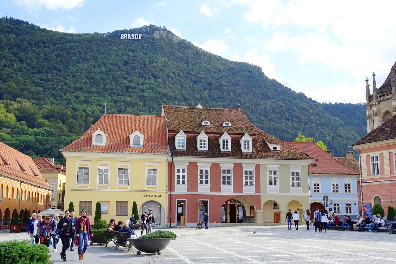 Closius-Hiemesch-Giesel houses of Brașov
Climate Map
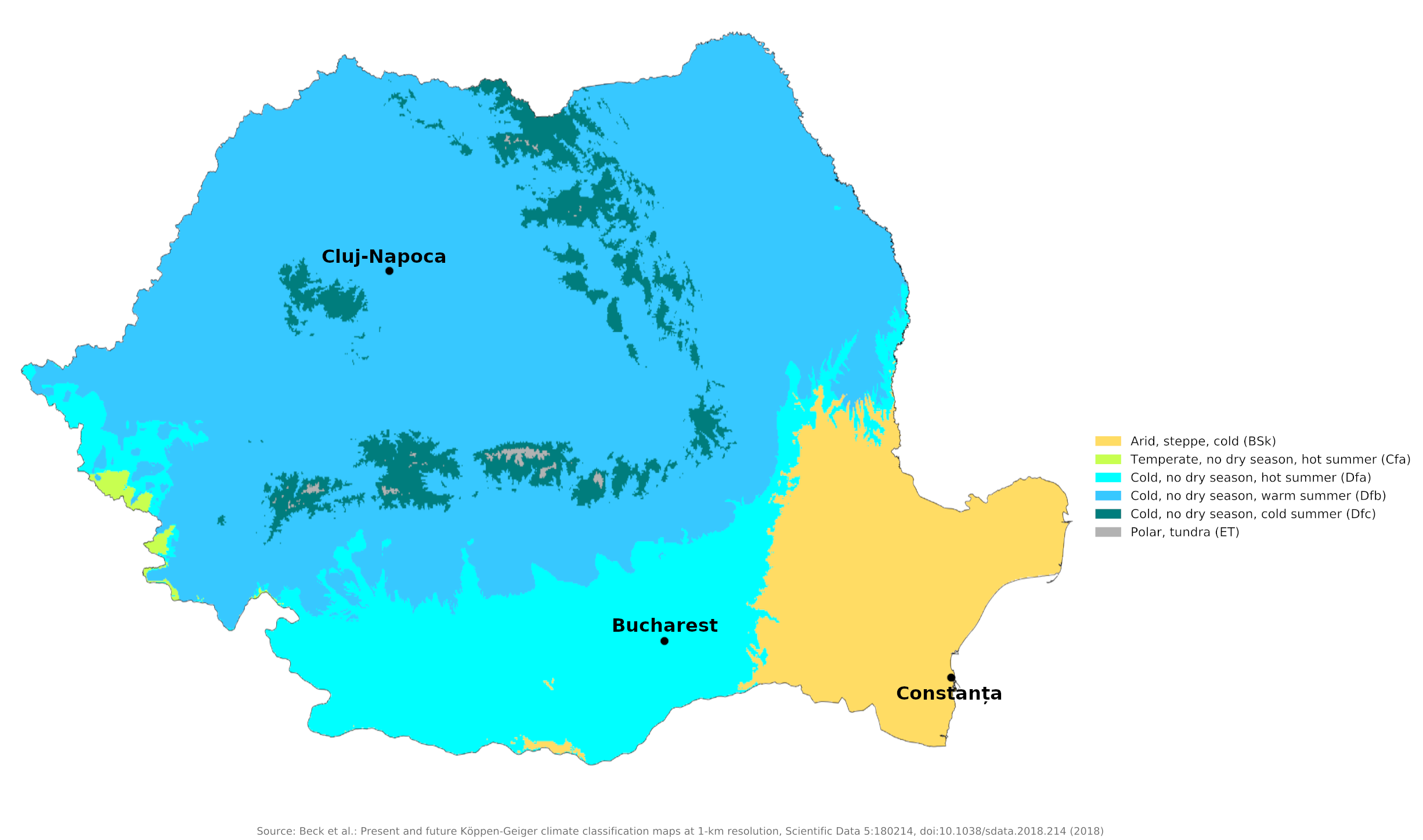 Climate map of Romania
What is the climate of Romania like?
Romania is a nearly landlocked country in Southeastern Europe. It has a short coastline on the Black Sea, south of the Danube estuary. Its southern border is with Bulgaria; it is bordered on the west by Serbia and Hungary, north by Ukraine, and east by Moldova. The east and south of the country are low-lying and rather flat; the center and west encompass the Carpathian Mountains and their foothills, with ridges and peaks rising over 1,800 meters (6,000 feet).
Because of its position on the southeastern portion of the European continent, Romania has a transitional continental climate with moderating influences from the Black Sea and variations in altitude. The climatic conditions are somewhat modified by the varied relief of the country. The Carpathians serve as a barrier to Atlantic air masses, limiting their oceanic influences to the west and center of the country, where winters are milder and rainfall is heavier. The mountains also block the continental influences from Russia, which bring frosty winters and less rain to the south and southeast. In the extreme southeast, Mediterranean influences ensure a milder, maritime climate.
In general, Romania has cold, snowy winters and warm summers. The weather can be changeable at any time of the year and there is significant variation from year to year. In dry summers, the plains to the north and east can suffer from drought as hot, dry winds blow from the east. In winter, the worst weather conditions occur when cold winds from the same region sweep across the country. Winter is the time with the least rainfall. Summers in Romania are generally warm and sunny with an average of nine to ten hours of sunshine per day. The winter sun is quite low, averaging just two to three hours a day.
Away from the Black Sea coast, there is not much variation in climate from one part of the country to another, apart from the cooler and wetter summers in the Carpathian Mountains. During cold spells in winter, frost can be as severe on the plains as it is on the mountains. Temperature extremes are greater on the plains to the east and south, where the continental influence is strongest. Average temperatures in the capital Bucharest are -3°C (27°F) in January and 23°C (73°F) in July. The Bucharest and Cluj-Napoca climates represent conditions to the east and west of the Carpathians, respectively.
| Climate data for Bucharest (1981–2010) | |||||||||||||
|---|---|---|---|---|---|---|---|---|---|---|---|---|---|
| Month | Jan | Feb | Mar | Apr | May | Jun | Jul | Aug | Sep | Oct | Nov | Dec | Year |
| Average high °C (°F) | 2.8 (37.0) | 5.5 (41.9) | 11.4 (52.5) | 18.0 (64.4) | 24.0 (75.2) | 27.7 (81.9) | 29.8 (85.6) | 29.8 (85.6) | 24.6 (76.3) | 17.9 (64.2) | 9.8 (49.6) | 3.8 (38.8) | 17.1 (62.8) |
| Daily mean °C (°F) | −1.3 (29.7) | 0.4 (32.7) | 5.4 (41.7) | 11.2 (52.2) | 16.8 (62.2) | 20.6 (69.1) | 22.5 (72.5) | 22.0 (71.6) | 16.9 (62.4) | 11.0 (51.8) | 4.7 (40.5) | 0.2 (32.4) | 10.8 (51.4) |
| Average low °C (°F) | −4.8 (23.4) | −4.0 (24.8) | 0.1 (32.2) | 4.9 (40.8) | 9.6 (49.3) | 13.6 (56.5) | 15.4 (59.7) | 14.9 (58.8) | 10.5 (50.9) | 5.4 (41.7) | 0.6 (33.1) | −3.4 (25.9) | 5.2 (41.4) |
| Average precipitation mm (inches) | 37 (1.5) | 37 (1.5) | 44 (1.7) | 50 (2.0) | 56 (2.2) | 83 (3.3) | 70 (2.8) | 56 (2.2) | 64 (2.5) | 53 (2.1) | 46 (1.8) | 48 (1.9) | 643 (25.3) |
| Average snowfall cm (inches) | 13.7 (5.4) | 11.0 (4.3) | 10.5 (4.1) | 1.5 (0.6) | 0.0 (0.0) | 0.0 (0.0) | 0.0 (0.0) | 0.0 (0.0) | 0.0 (0.0) | 0.0 (0.0) | 8.8 (3.5) | 10.5 (4.1) | 56.0 (22.0) |
| Source: www.pogodaiklimat.ru | |||||||||||||
| Climate data for Cluj-Napoca (1981–2010) | |||||||||||||
|---|---|---|---|---|---|---|---|---|---|---|---|---|---|
| Month | Jan | Feb | Mar | Apr | May | Jun | Jul | Aug | Sep | Oct | Nov | Dec | Year |
| Average high °C (°F) | 0.5 (32.9) | 3.0 (37.4) | 9.5 (49.1) | 15.8 (60.4) | 21.2 (70.2) | 23.8 (74.8) | 25.9 (78.6) | 25.8 (78.4) | 20.9 (69.6) | 15.2 (59.4) | 7.4 (45.3) | 1.6 (34.9) | 14.2 (57.6) |
| Daily mean °C (°F) | −2.6 (27.3) | −0.9 (30.4) | 4.5 (40.1) | 10.1 (50.2) | 15.1 (59.2) | 17.9 (64.2) | 19.8 (67.6) | 19.5 (67.1) | 15.0 (59.0) | 9.8 (49.6) | 3.5 (38.3) | −1.3 (29.7) | 9.2 (48.6) |
| Average low °C (°F) | −5.7 (21.7) | −4.8 (23.4) | −0.6 (30.9) | 4.3 (39.7) | 8.9 (48.0) | 12.0 (53.6) | 13.7 (56.7) | 13.2 (55.8) | 9.2 (48.6) | 4.4 (39.9) | −0.3 (31.5) | −4.2 (24.4) | 4.2 (39.6) |
| Average precipitation mm (inches) | 25.7 (1.01) | 24.5 (0.96) | 31.0 (1.22) | 50.9 (2.00) | 66.9 (2.63) | 90.5 (3.56) | 85.7 (3.37) | 65.9 (2.59) | 48.5 (1.91) | 37.2 (1.46) | 32.1 (1.26) | 35.5 (1.40) | 594.4 (23.40) |
| Average snowfall cm (inches) | 6.0 (2.4) | 11.5 (4.5) | 5.8 (2.3) | 1.3 (0.5) | 0.0 (0.0) | 0.0 (0.0) | 0.0 (0.0) | 0.0 (0.0) | 0.0 (0.0) | 0.5 (0.2) | 2.6 (1.0) | 5.8 (2.3) | 33.5 (13.2) |
| Source: World Meteorological Organization | |||||||||||||
Rainfall, although adequate throughout the country, decreases from west to east and from mountains to plains. Rainfall is usually rather light except in the higher parts of the Carpathians. Average annual rainfall ranges from about 380 millimeters (15 inches) in the eastern lowland region of Dobrogea to 1,250 millimeters (50 inches) or more in the Carpathian Mountains. Spring and summer are the wettest seasons and thunderstorms are most common.
Winter precipitation consists mainly of snow. Snow lies thirty to fifty days a year in low elevations and up to 100 days in the mountains. The mildest area in winter is along the Black Sea coast (see Constanța's climate). Inland, the Danube and other rivers usually freeze over in winter. The change from winter conditions to summer conditions is often quite abrupt and spring is a short but changeable season in Romania. Late summer and autumn are often rather dry.
| Climate data for Constanța (1981–2010) | |||||||||||||
|---|---|---|---|---|---|---|---|---|---|---|---|---|---|
| Month | Jan | Feb | Mar | Apr | May | Jun | Jul | Aug | Sep | Oct | Nov | Dec | Year |
| Average high °C (°F) | 4.5 (40.1) | 5.7 (42.3) | 9.3 (48.7) | 14.1 (57.4) | 20.0 (68.0) | 24.7 (76.5) | 27.2 (81.0) | 27.1 (80.8) | 22.7 (72.9) | 17.4 (63.3) | 11.3 (52.3) | 6.2 (43.2) | 15.9 (60.6) |
| Daily mean °C (°F) | 1.3 (34.3) | 2.0 (35.6) | 5.5 (41.9) | 10.3 (50.5) | 16.1 (61.0) | 20.7 (69.3) | 23.2 (73.8) | 23.0 (73.4) | 18.6 (65.5) | 13.5 (56.3) | 7.7 (45.9) | 3.0 (37.4) | 12.1 (53.8) |
| Average low °C (°F) | −1.4 (29.5) | −0.7 (30.7) | 2.7 (36.9) | 7.3 (45.1) | 12.5 (54.5) | 16.9 (62.4) | 19.1 (66.4) | 19.0 (66.2) | 14.9 (58.8) | 10.3 (50.5) | 4.9 (40.8) | 0.3 (32.5) | 8.8 (47.8) |
| Average precipitation mm (inches) | 27.6 (1.09) | 24.0 (0.94) | 34.0 (1.34) | 31.8 (1.25) | 37.9 (1.49) | 40.4 (1.59) | 37.5 (1.48) | 35.2 (1.39) | 42.1 (1.66) | 36.8 (1.45) | 45.6 (1.80) | 37.0 (1.46) | 429.9 (16.93) |
| Average snowfall cm (inches) | 7.0 (2.8) | 7.0 (2.8) | 4.2 (1.7) | 0.0 (0.0) | 0.0 (0.0) | 0.0 (0.0) | 0.0 (0.0) | 0.0 (0.0) | 0.0 (0.0) | 0.0 (0.0) | 5.5 (2.2) | 3.4 (1.3) | 27.1 (10.7) |
| Source: World Meteorological Organization | |||||||||||||
When is the best time to visit Romania?
Romania has hot, sunny summers. Winters are cold and dry, with heavy, periodic snowfalls in the mountains. There are long, mild, and sunny autumns; spring is sunny too, but cooler.
References
- E. A. Pearce, Charles Gordon Smith, (1990) The Hutchinson World Weather Guide, John Murray Press. ISBN 1859863426
- Timothy L. Gall, (ed.), (2003), Worldmark Encyclopedia of the Nations, Eleventh Edition, Thomson Gale
- Federal Research Division, Library of Congress, (1991), Romania: a country study. Claitor's Pub. Division.
- Hugh Chisholm, (ed.), (1911), Encyclopædia Britannica, Eleventh edition, Cambridge University Press
The Climate of
Romania
In summary:
Romania’s climate is a humid continental one, with moderating influences from the Black Sea and variations due to altitude. In general, winters are cold and summers are warm. Average January temperatures range from -4°C to 0°C (25–32°F). During the summer, the highest temperatures are recorded in the south, averaging 24°C (75°F). Temperatures decrease toward the high elevations.
Rainfall decreases from west to east and from the mountains to the plains, with an annual average of between 1250 mm (50 in) in the mountains to lows of 380 mm (15 in) in the lowlands.