The Climate of
Tunisia
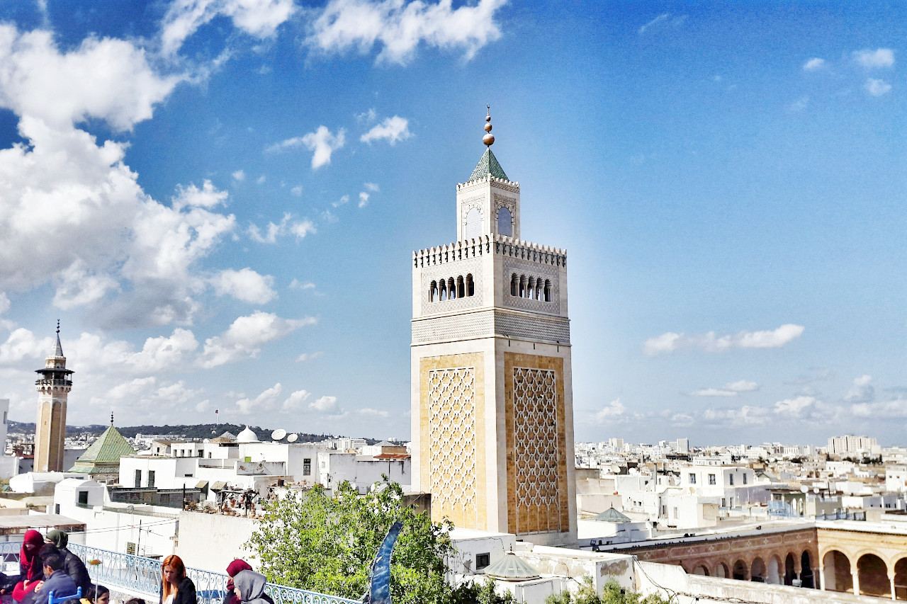
 Minaret of the Zitouna Mosque, Tunis
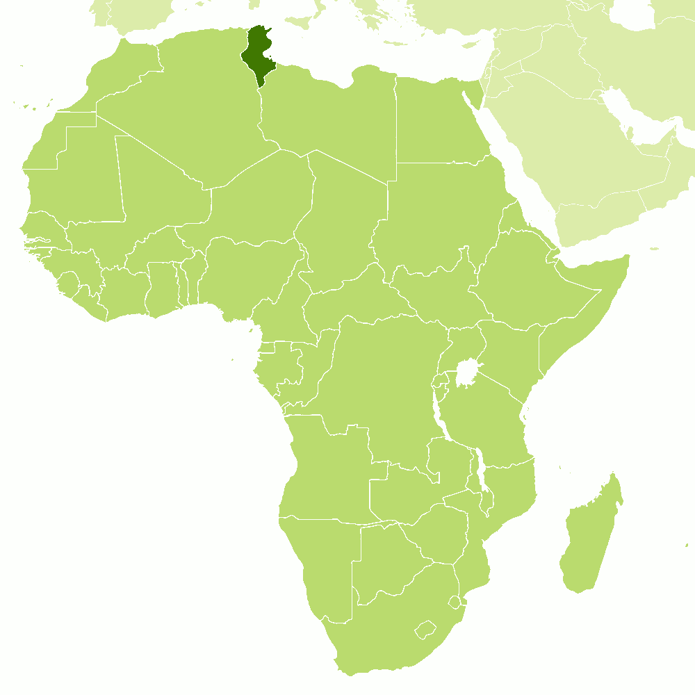
Climate Map
 Climate map of Tunisia
What is the climate of Tunisia like?
Tunisia is a small country on the southern shores of the Mediterranean; most of its coastline faces eastwards on the Gulf of Gabes. It has a western boundary with Algeria and a southern border with Libya. Although only about the same size as England, it is geographically diverse. Tunisia includes three major geographical regions; in the north a narrow coastal strip backed by mountains; a central and western district of mountain and plateau or 'tell' country; and a low-lying region in the south which is either steppe or desert, the fringe of the Sahara.
The three features that influence Tunisia's climate are the Mediterranean Sea, the Atlas mountains, and the Sahara with its hot and dry sirocco winds. A Mediterranean climate is characteristic of the northern coastal zone. Temperatures are higher in the interior and the south. Tunisia has developed a large tourist trade, taking advantage of a Mediterranean climate with mild to warm, sunny winters and hot summers which are almost completely dry. Most of the major tourist centres and hotels are situated on the coast and near the main towns: Tunis, Bizerta, Sfax, and Sousse.
Along the Mediterranean coast, temperatures are moderate—the average temperature is 18°C (64°F). Temperatures in the southern interior, which forms part of the Sahara Desert, are very hot. The summer season in the north (May–September) is hot and dry. In the winter months (October–April), the climate is mild with frequent rains. Temperatures at the capital city of Tunis range from 8°C (46°F) to 16°C (61°F) in January, and 22°C (72°F) to 34°C (93°F) in August.
Daily sunshine amounts are everywhere large, ranging from between seven and eight hours in winter to as much as twelve hours in summer. The occasional very hot, dry, and dusty wind bringing air from the Sahara can affect any part of the country, particularly in spring, when a depression moving into the Gulf of Gabes from the west induces southerly winds on its eastern flank. This wind and associated weather is similar to the khamsin of Egypt but goes under the local name of chili. When this occurs, temperatures may rise above 45°C (112°F), bringing a risk of heat exhaustion; but such extreme conditions are rare and for most of the year the climate of Tunisia is pleasant. Temperatures on the coast are moderated by daily sea breezes, while the higher temperatures inland are rendered less exhausting by low humidity.
Northern Tunisia
The coastal regions, particularly in the north, and the northern mountains have moderate winter rainfall. Occasional rain may occur in the early summer and autumn and this can take the form of heavy but rare downpours. In the wettest parts of the hills annual rainfall ranges between 600 and 900 millimeters (24 to 32 inches). Snow may occur on about ten days a year in the higher parts, but is very rare on the coast. Tunis is representative of the coastal regions.
| Climate data for Tunis (1981–2010) | |||||||||||||
|---|---|---|---|---|---|---|---|---|---|---|---|---|---|
| Month | Jan | Feb | Mar | Apr | May | Jun | Jul | Aug | Sep | Oct | Nov | Dec | Year |
| Average high °C (°F) | 16.1 (61.0) | 16.8 (62.2) | 19.0 (66.2) | 21.7 (71.1) | 26.1 (79.0) | 30.6 (87.1) | 33.8 (92.8) | 34.1 (93.4) | 30.4 (86.7) | 26.5 (79.7) | 21.2 (70.2) | 17.3 (63.1) | 24.5 (76.0) |
| Daily mean °C (°F) | 11.6 (52.9) | 11.9 (53.4) | 13.8 (56.8) | 16.2 (61.2) | 20.2 (68.4) | 24.3 (75.7) | 27.2 (81.0) | 27.7 (81.9) | 24.7 (76.5) | 21.1 (70.0) | 16.3 (61.3) | 12.8 (55.0) | 19.0 (66.2) |
| Average low °C (°F) | 7.6 (45.7) | 7.7 (45.9) | 9.2 (48.6) | 11.4 (52.5) | 14.8 (58.6) | 18.6 (65.5) | 21.3 (70.3) | 22.2 (72.0) | 20.1 (68.2) | 16.8 (62.2) | 12.2 (54.0) | 8.9 (48.0) | 14.2 (57.6) |
| Average precipitation mm (inches) | 63.1 (2.48) | 49.2 (1.94) | 39.2 (1.54) | 38.5 (1.52) | 23.6 (0.93) | 12.9 (0.51) | 4.0 (0.16) | 7.1 (0.28) | 56.3 (2.22) | 47.7 (1.88) | 54.8 (2.16) | 75.2 (2.96) | 471.6 (18.58) |
| Source: NOAA | |||||||||||||
Central Tunisia
Rainfall in central Tunisia and the southern hills on the Algerian border is lower. Prolonged droughts are frequent in this region. Inland winter temperatures may drop quite low with occasional frosts. Summer temperatures are higher than near the coast. Gafsa illustrates inland conditions.
In the central Tunisian steppes, occasional watercourses flow southward out of the hills after heavy rains but evaporate in salt flats. The Chott el Jerid, the largest of southern Tunisia’s salt lakes, is dry during half of the year but is flooded to form a shallow salt lake during the winter months.
| Climate data for Gafsa (1981–2010) | |||||||||||||
|---|---|---|---|---|---|---|---|---|---|---|---|---|---|
| Month | Jan | Feb | Mar | Apr | May | Jun | Jul | Aug | Sep | Oct | Nov | Dec | Year |
| Average high °C (°F) | 15.3 (59.5) | 17.5 (63.5) | 21.0 (69.8) | 24.9 (76.8) | 29.8 (85.6) | 34.9 (94.8) | 37.9 (100.2) | 37.5 (99.5) | 32.6 (90.7) | 27.3 (81.1) | 20.8 (69.4) | 16.1 (61.0) | 26.3 (79.3) |
| Daily mean °C (°F) | 9.6 (49.3) | 11.3 (52.3) | 14.6 (58.3) | 18.1 (64.6) | 22.8 (73.0) | 27.3 (81.1) | 30.2 (86.4) | 30.0 (86.0) | 25.9 (78.6) | 21.1 (70.0) | 14.8 (58.6) | 10.5 (50.9) | 19.7 (67.4) |
| Average low °C (°F) | 4.0 (39.2) | 5.2 (41.4) | 8.1 (46.6) | 11.4 (52.5) | 15.7 (60.3) | 19.8 (67.6) | 22.4 (72.3) | 22.8 (73.0) | 19.8 (67.6) | 15.3 (59.5) | 9.2 (48.6) | 5.2 (41.4) | 13.2 (55.8) |
| Average precipitation mm (inches) | 26.1 (1.03) | 7.8 (0.31) | 14.3 (0.56) | 17.9 (0.70) | 12.5 (0.49) | 4.8 (0.19) | 1.4 (0.06) | 4.5 (0.18) | 19.8 (0.78) | 16.4 (0.65) | 18.8 (0.74) | 16.9 (0.67) | 161.2 (6.36) |
| Source: NOAA | |||||||||||||
Southern Tunisia
The climate becomes progressively drier towards the south of Tunisia and summer temperatures can rise very high inland, since this area has a virtual Sahara climate. There can be large changes in daily temperatures, the thermometer plummeting after dusk. Rainfall can occasionally be heavy in spring and autumn although days with rain are rare.
| Climate data for Tataouine (1961–1990) | |||||||||||||
|---|---|---|---|---|---|---|---|---|---|---|---|---|---|
| Month | Jan | Feb | Mar | Apr | May | Jun | Jul | Aug | Sep | Oct | Nov | Dec | Year |
| Average high °C (°F) | 15.8 (60.4) | 18.5 (65.3) | 21.3 (70.3) | 24.9 (76.8) | 29.4 (84.9) | 33.7 (92.7) | 36.2 (97.2) | 36.2 (97.2) | 34.9 (94.8) | 31.5 (88.7) | 22.7 (72.9) | 16.9 (62.4) | 26.8 (80.3) |
| Daily mean °C (°F) | 11.3 (52.3) | 13.2 (55.8) | 15.9 (60.6) | 18.7 (65.7) | 22.9 (73.2) | 26.8 (80.2) | 29.2 (84.6) | 29.4 (84.9) | 28.5 (83.3) | 25.2 (77.4) | 17.5 (63.5) | 12.0 (53.6) | 20.9 (69.6) |
| Average low °C (°F) | 6.8 (44.2) | 7.8 (46.0) | 10.4 (50.7) | 12.4 (54.3) | 16.5 (61.7) | 19.9 (67.8) | 22.1 (71.8) | 22.4 (72.3) | 22.0 (71.6) | 18.9 (66.0) | 12.4 (54.3) | 7.1 (44.8) | 14.9 (58.8) |
| Average precipitation mm (inches) | 19.3 (0.76) | 9.8 (0.39) | 17.0 (0.67) | 10.2 (0.40) | 7.0 (0.28) | 0.6 (0.02) | 0.1 (0.00) | 1.7 (0.07) | 8.7 (0.34) | 13.4 (0.53) | 7.6 (0.30) | 11.9 (0.47) | 107.3 (4.23) |
| Source: Institut National de la Météorologie | |||||||||||||
References
- E. A. Pearce, Charles Gordon Smith, (1990) The Hutchinson World Weather Guide, John Murray Press. ISBN 1859863426
- Timothy L. Gall, (ed.), (2003), Worldmark Encyclopedia of the Nations, Eleventh Edition, Thomson Gale
- Federal Research Division, Library of Congress, (1986), Tunisia: a country study. Claitor's Pub. Division.
- Hugh Chisholm, (ed.), (1911), Encyclopædia Britannica, Eleventh edition, Cambridge University Press
The Climate of
Tunisia

In summary:
Tunisia consists of two climatic zones, a Mediterranean influence in the north and Saharan in the south. The summer season in the north, from May through September, is hot and dry; the winter, which extends from October to April, is mild with frequent rain. Temperatures at the capital city of Tunis average 12°C (53°F) in January, and 28°C (82°F) in August.
Rainfall averages around 500 millimeters (20 inches) in the northern part of the country, but in the south it drops below 200 millimeters (8 inches).