
_-_37153251680.jpg)
.jpg)
The Geography of
Afghanistan
Why visit Afghanistan?
Afghanistan is a land of vastness whose resources are limitless; a land of beautiful deserts and barren mountains filled with narrow gorges and beautiful valleys. The Hindu Kush mountains form a spine from northwest to southeast where they meet the impressive Pamir, Karakoran and Himalayan mountain ranges. Narrow river valleys and mountain passes have served as trade routes for thousands of years.
Contents
Map
 Relief map of Afghanistan
What is the landscape of Afghanistan like?
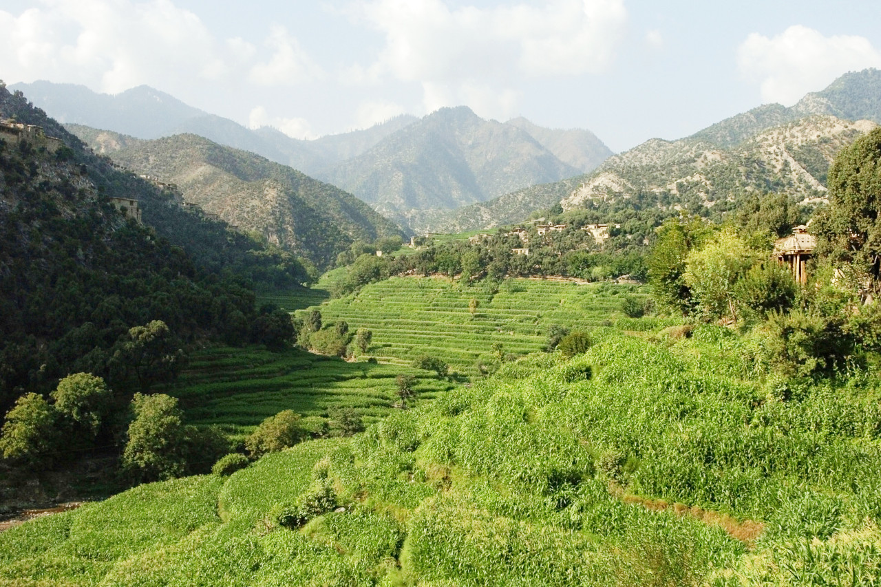
Afghanistan is an extremely mountainous country with dramatic and often spectacular landscapes. The Hindu Kush, the most important of the mountain systems, is an extension of the Himalayas. From northeast to southwest, the Hindu Kush Mountains divide Afghanistan into three major regions: 1) the northern plains area, which contains the country's most fertile soil; 2) the central highlands, which form part of the Himalaya Mountains and comprise roughly two-thirds of the country's area; 3) the southwestern plateau, which accounts for one-fourth of the land.
Northern Plains
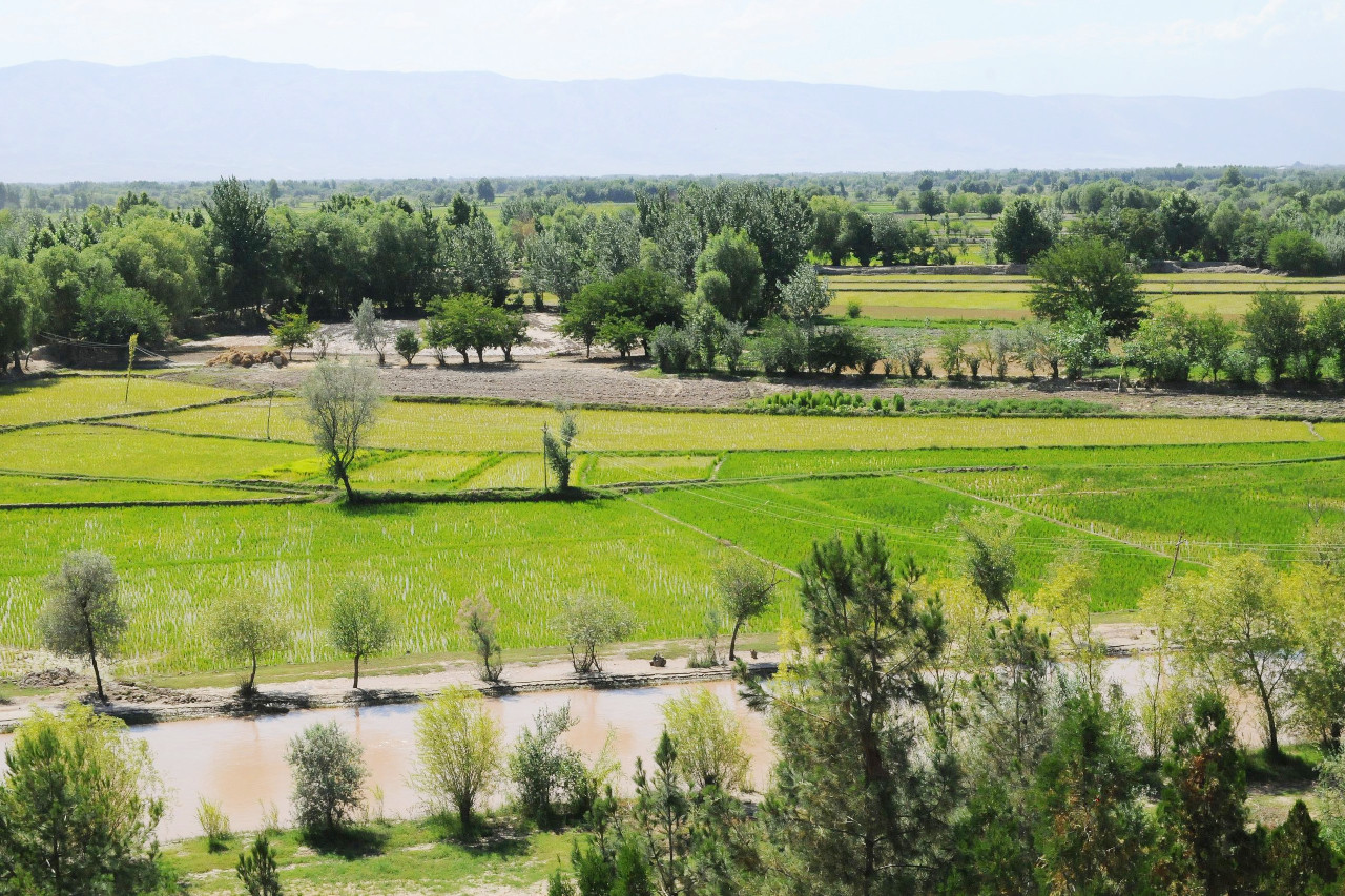
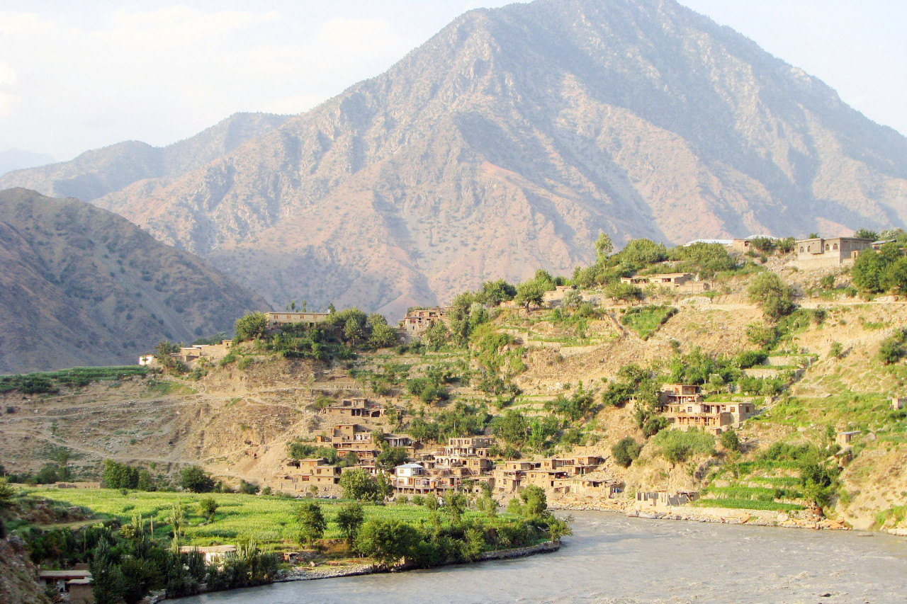
The rolling hills and plains north of the Hindu Kush form the southern boundary of the Central Asian steppe. These fertile plains have long been home to Turkic peoples such as Uzbeks, Turkmens, Kazakhs and others. Much of Afghanistan's wealth is generated in this region. Here the elevation drops to about 460 meters (1,500 feet), allowing for the growth of cotton, fruits, grains, ground nuts, and other crops. The plains are the country's breadbasket and produce most of Afghanistan's food. They are also rich in mineral deposits. The main urban centers are Mazar-e-Sharif and Kunduz.
Central Highlands
_-_37153251680.jpg&oldid=680107970)
.jpg&oldid=593468694)
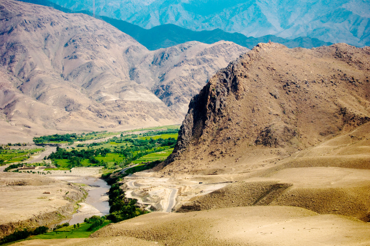
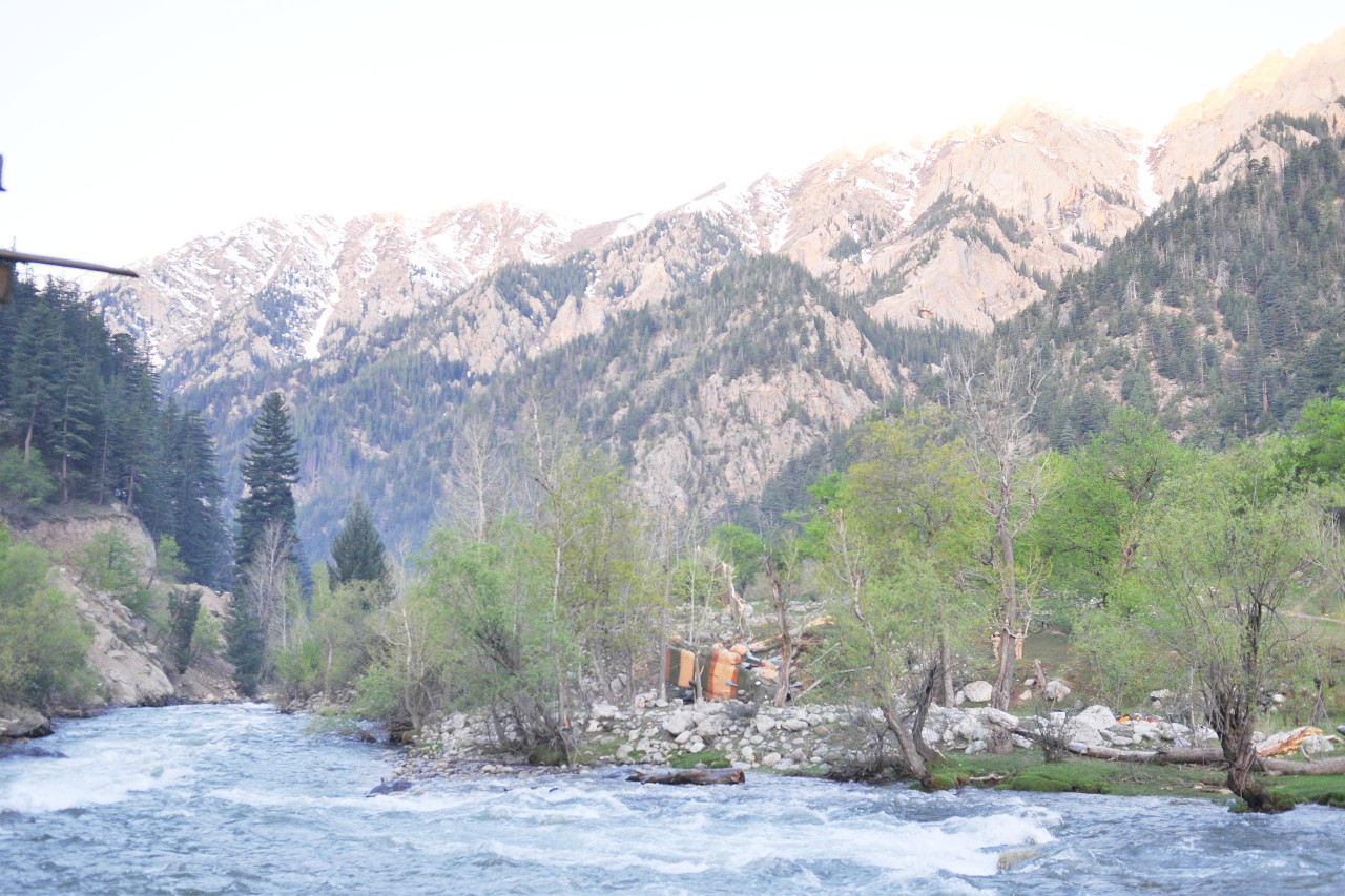
Mountains traverse the center of Afghanistan, running generally in a northeast-southwest direction. Of the total land area, around fifty percent lies above 2,000 meters (6,500 feet). The Hindu Kush, the most important of the mountain systems, is an extension of the Himalayas. The Hindu Kush has rugged ranges with sharp peaks, deep valleys, and many almost impenetrable barriers.
From northeast to southwest, the Hindu Kush Mountains divide Afghanistan into three major regions: Central Afghanistan, a plateau with an average elevation of 1,800 meters (6,000 feet), contains many small fertile valleys. To the north, the altitude drops to about 460 meters (1,500 feet), permitting the growth of cotton, fruits, grains, ground nuts, and other crops. Southwestern Afghanistan is a desert, hot in summer and cold in winter. In addition, the Wakhan corridor, lying between Tajikistan and Pakistan, is a narrow panhandle in the northeast Hindu Kush.
The highest mountains are over 7,000 meters (23,000 feet) above sea level and are found in the eastern part of the country in the Wakhan corridor. In comparison, Mount Everest, which has the highest elevation in the world, stands 8,849 meters (29,032 feet) above sea level. The mountains of the Hindu Kush diminish in height as they stretch westward. Toward the middle of the range, near Kabul, they extend from 4,500 to 6,000 meters (15,000–20,000 feet) above sea level. In the western portion of the range they attain heights of 3,500 to 4,500 meters (11,500–15,000 feet) and at the extreme western border are lower still. The average altitude of the Hindu Kush is 4,500 meters (15,000 feet). Other mountain ranges, usually considered to be offshoots of the Hindu Kush system, form part of the central highland's westward thrust but spread out from the central core. These mountain ranges include the Koh-i-Baba, Salang, Safed Koh, Sulaiman, Khwaja Amran, and Paropamisus mountains.
In addition to the mountain peaks and high passes, the highlands consist of narrow gorges, wide valleys, deserts and meadows. Control of passes (like the Khyber Pass, which leads into Pakistan) and deep valleys (like the Panjsheer Valley northeast of the capital) has long been a requirement for controlling the country. Home to the indomitable Pashtun tribes of military folklore, these mountains are also said to support the remnants of the marauding armies of Genghis Khan, the Hazara community who converted to the Shia branch of Islam under Persian influence during the Safavid period.
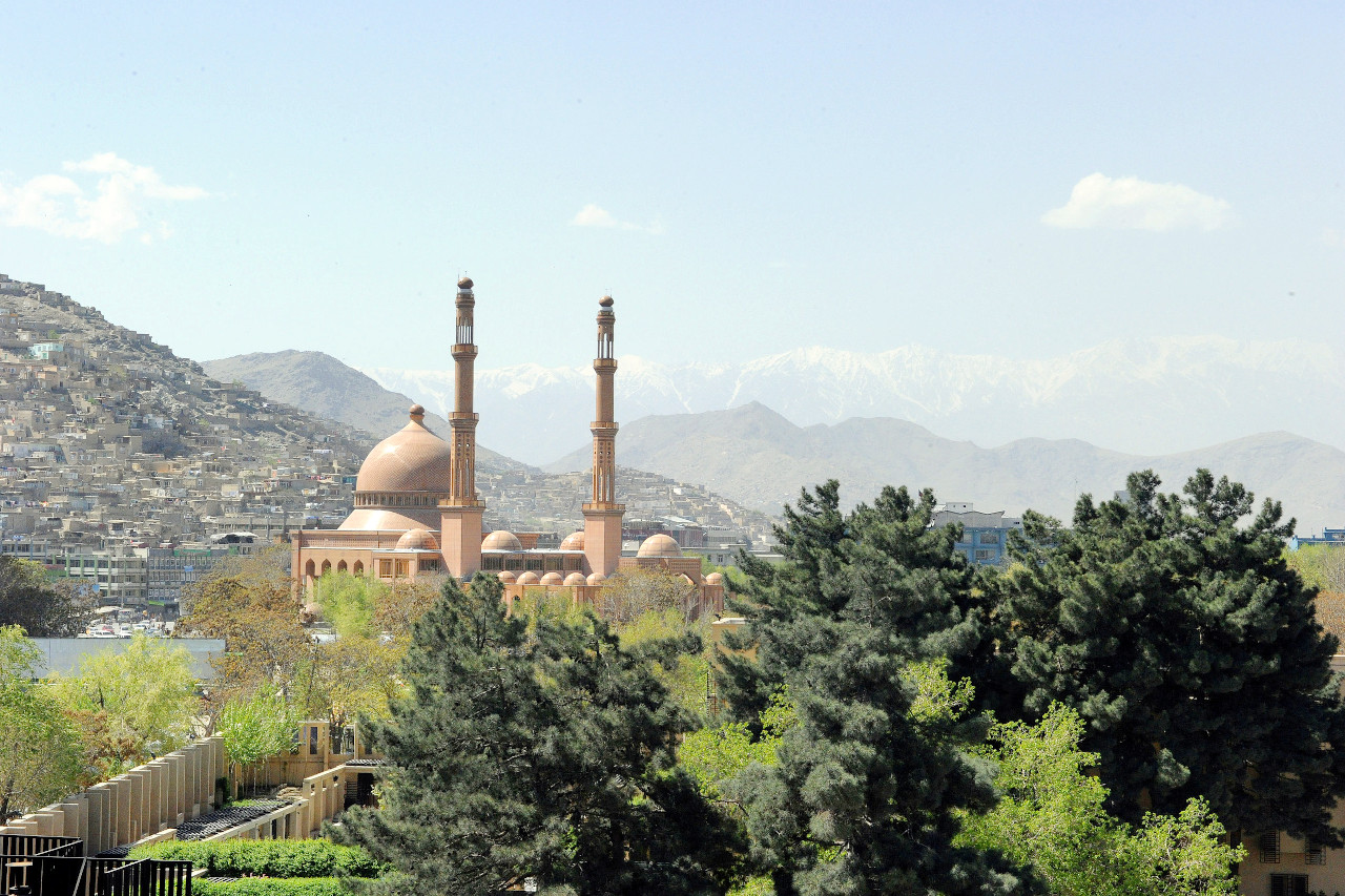
At over 1,800 meters (5,900 feet) above sea level, Kabul is one of the highest capital cities in the world on the edge of the mountain ranges. Other significant population centers in the highlands are the Hazara town of Bamiyan at an elevation of 2,800 meters (9,200 feet), the multi-ethnic town of Ghazni at over 2,200 meters (7,200 feet), and the Pashtun center of Jalalabad on the eastern rim of the range.
Southern Plateau
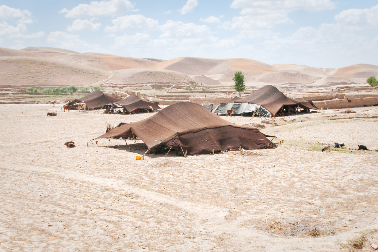
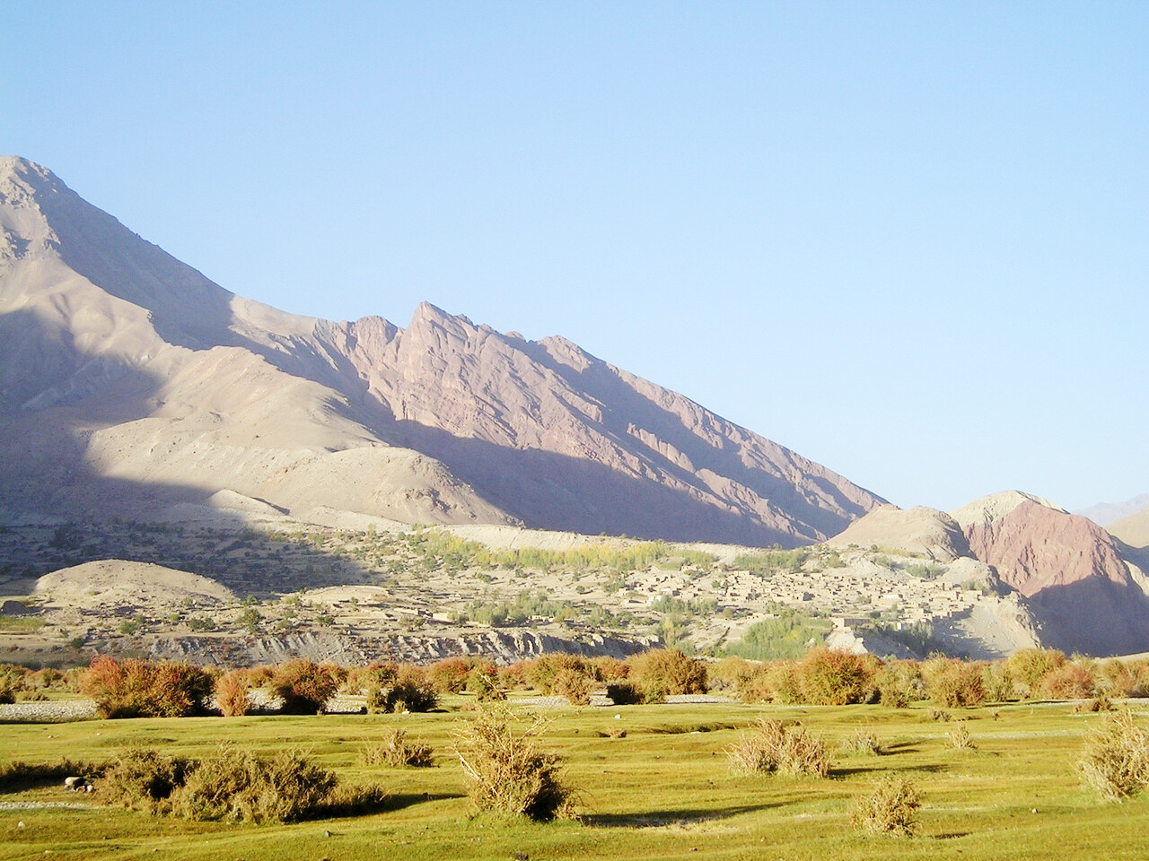
South of the Hindu Kush, the Southern Plateau consists of arid salt flats, rocky expanses and sandy deserts. With the exception of the Helmand and Hari Rud river systems and their various irrigated tributaries, the soil of much of the region is barren. This region is a desert, hot in summer and cold in winter.
The southern plateau and its capital Kandahar is the traditional Pashtun heartland and formed the center of the Durrani Empire in the 18th and 19th centuries. Towards the western edge of the plateau, Persian influence increases and Pashtun dominance gives way to Dari (Persian)-speaking Aimaqs, Tajiks and Iranians. The main urban center on the western edge of the plateau is Herat, a quintessentially Iranian city and a UNESCO World Heritage Site.
What is the nature of Afghanistan like?
Afghanistan's has experienced significant ecological problems consisting of deforestation, drought, soil degradation, and overgrazing. Consequently, only 1 to 2% of Afghanistan's land area is forest land. There are hundreds of varieties of trees, shrubs, vines, flowers, and fungi. The country is particularly rich in such medicinal plants as rue, wormwood, and asafetida; fruit and nut trees are found in many areas. Native fauna include the fox, lynx, wild dog, bear, mongoose, shrew, hedgehog, hyena, jerboa, hare, and wild varieties of cats, asses, mountain goats, and mountain sheep.
What is the climate of Afghanistan like?
See our main article: The Climate of Afghanistan
The climate of Afghanistan ranges from semi-arid to arid, with wide variations in temperature, both between seasons and between different times of day. Its summers are hot and dry, but its winters are bitterly cold. The central highlands have a cold, mountain climate.
Strong winds blow between June and September. In much of the country, rainfall is sparse and irregular, and mostly occurring between October and April. Rainfall is generally heavier in the eastern part of the country than in the western regions. Afghan summers are generally dry, cloudless, and hot. Most of the precipitation in the mountains falls in the form of snow—and sometimes as hail.
| Climate data for Kabul (1956–1983) | |||||||||||||
|---|---|---|---|---|---|---|---|---|---|---|---|---|---|
| Month | Jan | Feb | Mar | Apr | May | Jun | Jul | Aug | Sep | Oct | Nov | Dec | Year |
| Average high °C (°F) | 4.5 (40.1) | 5.5 (41.9) | 12.5 (54.5) | 19.2 (66.6) | 24.4 (75.9) | 30.2 (86.4) | 32.1 (89.8) | 32.0 (89.6) | 28.5 (83.3) | 22.4 (72.3) | 15.0 (59.0) | 8.3 (46.9) | 19.5 (67.1) |
| Daily mean °C (°F) | −2.3 (27.9) | −0.7 (30.7) | 6.3 (43.3) | 12.8 (55.0) | 17.3 (63.1) | 22.8 (73.0) | 25.0 (77.0) | 24.1 (75.4) | 19.7 (67.5) | 13.1 (55.6) | 5.9 (42.6) | 0.6 (33.1) | 12.1 (53.8) |
| Average low °C (°F) | −7.1 (19.2) | −5.7 (21.7) | 0.7 (33.3) | 6.0 (42.8) | 8.8 (47.8) | 12.4 (54.3) | 15.3 (59.5) | 14.3 (57.7) | 9.4 (48.9) | 3.9 (39.0) | −1.2 (29.8) | −4.7 (23.5) | 4.3 (39.7) |
| Average precipitation mm (inches) | 34.3 (1.35) | 60.1 (2.37) | 67.9 (2.67) | 71.9 (2.83) | 23.4 (0.92) | 1.0 (0.04) | 6.2 (0.24) | 1.6 (0.06) | 1.7 (0.07) | 3.7 (0.15) | 18.6 (0.73) | 21.6 (0.85) | 312.0 (12.28) |
| Source: NOAA | |||||||||||||
 The Kunar River flows from Nuristan province into northern Kunar province
Afghanistan
This Is the Home of the Brave
| Location: | Southern Asia, north and west of Pakistan, east of Iran |
| Coordinates: | 34° 00′ N, 67° 00′ E |
| Size: | • 1230 km N-S; 1610 km E-W • 760 miles N-S; 1000 miles E-W |
| Terrain: | Mostly rugged mountains; plains in north and southwest |
| Climate: | Arid to semiarid; cold winters and hot summers |
| Highest point: | Noshaq 7,492 m / 24,580 ft |
| Forest: | 1.8% (2018 est.) |
| Population: | 38,346,720 (2022 est.) |
| Population density: | Low (48/km²) |
| Capital: | Kabul |
| Languages: | Afghan Persian or Dari (official, lingua franca) 77%, Pashto (official) 48%, Uzbeki 11%, English 6%, Turkmani 3%, Urdu 3%, Others |
| Human Development Index: | Low (0.478) |
Related entries
-
Iran
• A Different Experience -
Pakistan
• It's Beautiful, It's Pakistan -
Tajikistan
• Feel the Friendship -
Turkmenistan
• The Heart of the Great Silk Road -
Uzbekistan
• Naturally Irresistible!