The Climate of
Afghanistan
.jpg) Band-e-Amir in Bamyan Province
Band-e-Amir in Bamyan Province
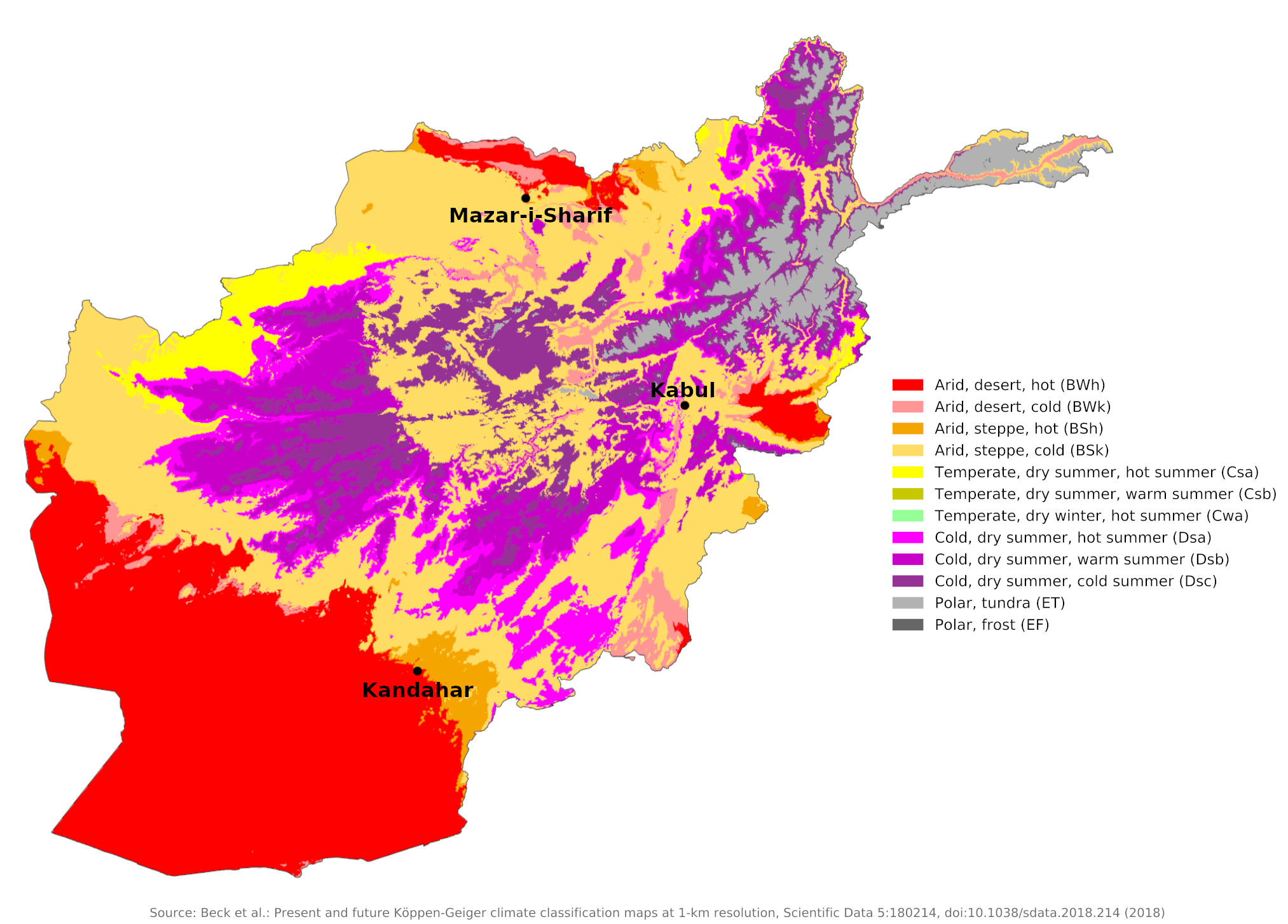
Climate Map
 Climate map of Afghanistan
What is the climate of Afghanistan like?
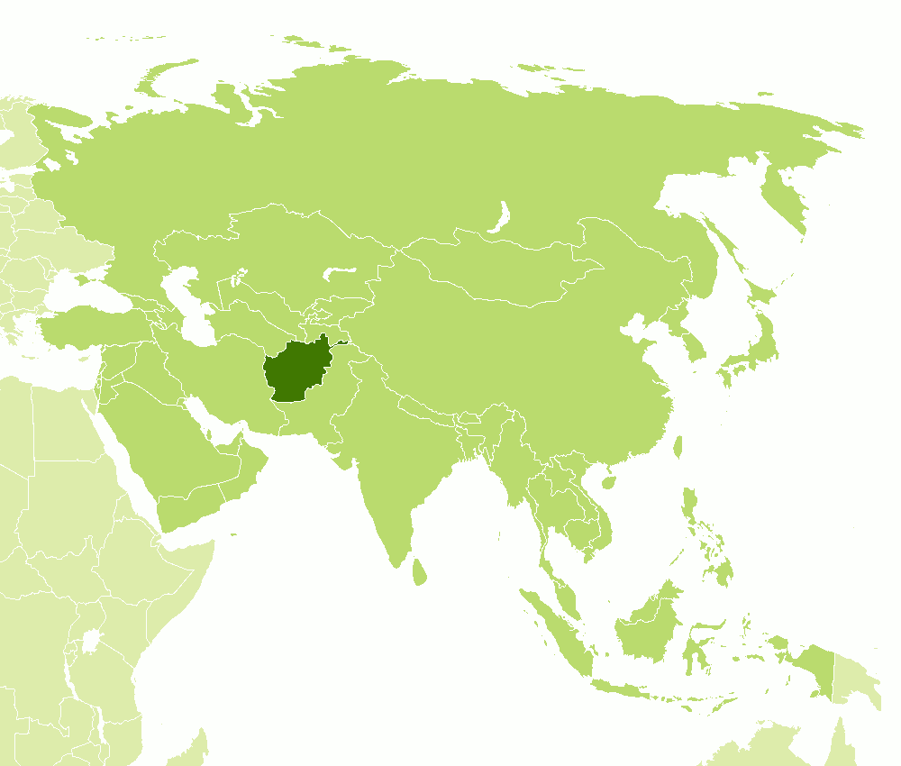
Afghanistan is bordered by Tajikistan, Turkmenistan, and Uzbekistan on the north, Pakistan on the east and south, and Iran on the west. In the extreme east it has a very short boundary with China in the high Pamir Mountains. Much of the country is mountainous; the highest peaks in the Pamirs and Hindu Kush rise to over 6,600 meters (20,000 feet). The lowest parts of the country are in the southwest along the Iranian border and in the north along the border with Turkmenistan and Uzbekistan.
Afghanistan experiences a harsh continental climate typical of an arid or semiarid steppe, with cold winters and dry summers. Winters can be severe, and this is accentuated by the altitude of much of the country. Summers are everywhere warm, except in the highest areas, and at lower levels temperatures sometimes rise very high indeed. Winter and spring are the seasons of most changeable weather and most of the annual rainfall occurs at this time. Afghanistan is the most easterly country to experience the influence of the Mediterranean Sea, which is the source of most of the depressions that bring the winter rain and snow.
In much of the country, rainfall is sparse and irregular, averaging 200 to 300 millimeters (8 to 12 inches) and mostly occurring between October and April. Rainfall is generally heavier in the eastern part of the country than in the western regions. Precipitation generally fluctuates greatly during the course of the year in all parts of the country. Surprise rainstorms often transform the episodically flowing rivers and streams from puddles to torrents.
Afghan summers are generally dry, cloudless, and hot. Humid air from the Persian Gulf sometimes produces summer showers and thunderstorms in the southwest. Most of the precipitation in the mountains falls in the form of snow—and sometimes as hail.
On the intermountain plateaus the winds do not blow very strongly, but in the Sistan Basin on the Iranian border there are severe blizzards that occur during the winter, generally December through February. In the western and southern regions a northerly wind, known as the "wind of 120 days," blows during the summer months of June to September. This wind can have a velocity of up to 180 kilometers per hour (110 miles per hour) and is usually accompanied by intense heat, drought, and sand storms, bringing much hardship to the inhabitants of the desert and steppe lands. Dust and whirlwinds frequently occur during the summer months on the lowlands in the southern part of the country. Rising at midday or in the early afternoon, these winds raise high clouds of dust.
Sunshine amounts range from six to seven hours a day in winter to as much as twelve to thirteen in summer. Because of the large range of temperature conditions found in Afghanistan, there is both a danger of heat exhaustion or even heatstroke in the lower regions in summer and of exposure, wind chill, and frostbite in the mountains in winter.
Regions
The Mountains
The mountains represent a distinct climatic region of Afghanistan. The mountain regions of the northeast are subarctic with dry and cold winters. In the mountains bordering Pakistan, a divergent fringe effect of the monsoon, generally coming from the southeast, brings tropical air masses that determine the climate between July and September. At times, these air masses can advance into central and southern Afghanistan, bringing increased humidity and some rain.
January temperatures may drop to -15°C (5°F) or lower in the highest mountain areas. In the mountains the annual mean precipitation, much of which is snowfall, increases eastward. Precipitation in these regions and the eastern monsoon area is about 400 millimeters (16 inches) per year. The Wakhan Corridor, however, which has temperatures ranging from 9°C (48°F) in the summer to below -21°C (-6°F) in the winter, receives fewer than 100 millimeters (4 inches) of rainfall annually. Permanent snow covers the highest mountain peaks. In the mountainous region adjacent to northern Pakistan, the snow is often more than two meters deep during the winter months. Valleys often become snow traps as the high winds sweep much of the snow from mountain peaks and ridges.
Kabul represents the climatic conditions over most of the mountainous center and east of the country. Summertime temperatures in Kabul, the capital of Afghanistan, can vary from 15°C (60°F) at sunrise to 38°C (100°F) by noon. The mean January temperature in Kabul is -2°C (28°F).
| Climate data for Kabul (1956–1983) | |||||||||||||
|---|---|---|---|---|---|---|---|---|---|---|---|---|---|
| Month | Jan | Feb | Mar | Apr | May | Jun | Jul | Aug | Sep | Oct | Nov | Dec | Year |
| Average high °C (°F) | 4.5 (40.1) | 5.5 (41.9) | 12.5 (54.5) | 19.2 (66.6) | 24.4 (75.9) | 30.2 (86.4) | 32.1 (89.8) | 32.0 (89.6) | 28.5 (83.3) | 22.4 (72.3) | 15.0 (59.0) | 8.3 (46.9) | 19.5 (67.1) |
| Daily mean °C (°F) | −2.3 (27.9) | −0.7 (30.7) | 6.3 (43.3) | 12.8 (55.0) | 17.3 (63.1) | 22.8 (73.0) | 25.0 (77.0) | 24.1 (75.4) | 19.7 (67.5) | 13.1 (55.6) | 5.9 (42.6) | 0.6 (33.1) | 12.1 (53.8) |
| Average low °C (°F) | −7.1 (19.2) | −5.7 (21.7) | 0.7 (33.3) | 6.0 (42.8) | 8.8 (47.8) | 12.4 (54.3) | 15.3 (59.5) | 14.3 (57.7) | 9.4 (48.9) | 3.9 (39.0) | −1.2 (29.8) | −4.7 (23.5) | 4.3 (39.7) |
| Average precipitation mm (inches) | 34.3 (1.35) | 60.1 (2.37) | 67.9 (2.67) | 71.9 (2.83) | 23.4 (0.92) | 1.0 (0.04) | 6.2 (0.24) | 1.6 (0.06) | 1.7 (0.07) | 3.7 (0.15) | 18.6 (0.73) | 21.6 (0.85) | 312.0 (12.28) |
| Source: NOAA | |||||||||||||
The South
The highest temperatures and the lowest precipitation prevail in the drought-ridden, poorly watered southern plateau region, which extends over the boundaries with Iran and Pakistan. The lower parts of the country have a semi-arid or desert climate. Kandahar is representative of this region. Here winters are milder but there may be spells of very cold weather for a few days at a time. Summers are sunny and generally very hot, except in the higher mountains.
| Climate data for Kandahar (1964–1983) | |||||||||||||
|---|---|---|---|---|---|---|---|---|---|---|---|---|---|
| Month | Jan | Feb | Mar | Apr | May | Jun | Jul | Aug | Sep | Oct | Nov | Dec | Year |
| Average high °C (°F) | 12.2 (54.0) | 14.8 (58.6) | 21.6 (70.9) | 28.1 (82.6) | 34.1 (93.4) | 39.1 (102.4) | 40.2 (104.4) | 38.2 (100.8) | 34.0 (93.2) | 27.5 (81.5) | 21.0 (69.8) | 15.4 (59.7) | 27.2 (81.0) |
| Daily mean °C (°F) | 5.1 (41.2) | 7.8 (46.0) | 13.9 (57.0) | 20.2 (68.4) | 25.4 (77.7) | 30.0 (86.0) | 31.9 (89.4) | 29.4 (84.9) | 23.5 (74.3) | 17.5 (63.5) | 11.0 (51.8) | 7.3 (45.1) | 18.6 (65.4) |
| Average low °C (°F) | 0.0 (32.0) | 2.4 (36.3) | 7.1 (44.8) | 12.3 (54.1) | 15.8 (60.4) | 19.5 (67.1) | 22.5 (72.5) | 20.0 (68.0) | 13.5 (56.3) | 8.5 (47.3) | 3.3 (37.9) | 1.0 (33.8) | 10.5 (50.9) |
| Average precipitation mm (inches) | 54.0 (2.13) | 42.0 (1.65) | 41.1 (1.62) | 18.7 (0.74) | 2.2 (0.09) | 0 (0) | 2.3 (0.09) | 1.0 (0.04) | 0 (0) | 2.3 (0.09) | 7.0 (0.28) | 20.0 (0.79) | 190.6 (7.52) |
| Source: NOAA | |||||||||||||
The North
The climate of the Turkistan Plains, which extend northward from the Northern Foothills, represents a transition between mountain and steppe climates. Aridity increases and temperatures rise with descending altitudes, becoming the highest along the lower Amu Darya river and in the western parts of the plains. See the climate of Mazar-i-Sharif.
| Climate data for Mazar-i-Sharif (1959–1983) | |||||||||||||
|---|---|---|---|---|---|---|---|---|---|---|---|---|---|
| Month | Jan | Feb | Mar | Apr | May | Jun | Jul | Aug | Sep | Oct | Nov | Dec | Year |
| Average high °C (°F) | 8.0 (46.4) | 10.7 (51.3) | 16.3 (61.3) | 24.3 (75.7) | 31.2 (88.2) | 37.0 (98.6) | 38.9 (102.0) | 36.9 (98.4) | 31.9 (89.4) | 24.7 (76.5) | 16.4 (61.5) | 10.8 (51.4) | 23.9 (75.1) |
| Daily mean °C (°F) | 2.6 (36.7) | 5.1 (41.2) | 10.8 (51.4) | 17.9 (64.2) | 24.5 (76.1) | 29.9 (85.8) | 33.3 (91.9) | 29.9 (85.8) | 23.9 (75.0) | 16.7 (62.1) | 9.1 (48.4) | 5.1 (41.2) | 17.4 (63.3) |
| Average low °C (°F) | −2.1 (28.2) | 0.0 (32.0) | 5.1 (41.2) | 11.3 (52.3) | 16.6 (61.9) | 22.5 (72.5) | 25.9 (78.6) | 23.8 (74.8) | 17.1 (62.8) | 9.4 (48.9) | 3.2 (37.8) | 0.0 (32.0) | 11.1 (51.9) |
| Average precipitation mm (inches) | 28.9 (1.14) | 34.8 (1.37) | 43.8 (1.72) | 28.3 (1.11) | 11.2 (0.44) | 0.2 (0.01) | 0.0 (0.0) | 0.0 (0.0) | 0.1 (0.00) | 3.9 (0.15) | 13.5 (0.53) | 21.7 (0.85) | 186.4 (7.32) |
| Source: NOAA | |||||||||||||
References
- E. A. Pearce, Charles Gordon Smith, (1990), The Hutchinson World Weather Guide, John Murray Press. ISBN 1859863426
- Timothy L. Gall, (ed.), (2003), Worldmark Encyclopedia of the Nations, Eleventh Edition, Thomson Gale
- Federal Research Division, Library of Congress, (2001), Afghanistan: a country study. Claitor's Pub. Division. ISBN 1579807445
- Hugh Chisholm, (ed.), (1911), Encyclopædia Britannica, Eleventh edition, Cambridge University Press
The Climate of
Afghanistan

In summary:
The climate of Afghanistan ranges from semi-arid to arid, with wide variations in temperature, both between seasons and between different times of day. Its summers are hot and dry, but its winters are bitterly cold. The central highlands have a cold, mountain climate.
Strong winds blow between June and September. In much of the country, rainfall is sparse and irregular, and mostly occurring between October and April. Rainfall is generally heavier in the eastern part of the country than in the western regions. Afghan summers are generally dry, cloudless, and hot. Most of the precipitation in the mountains falls in the form of snow—and sometimes as hail.