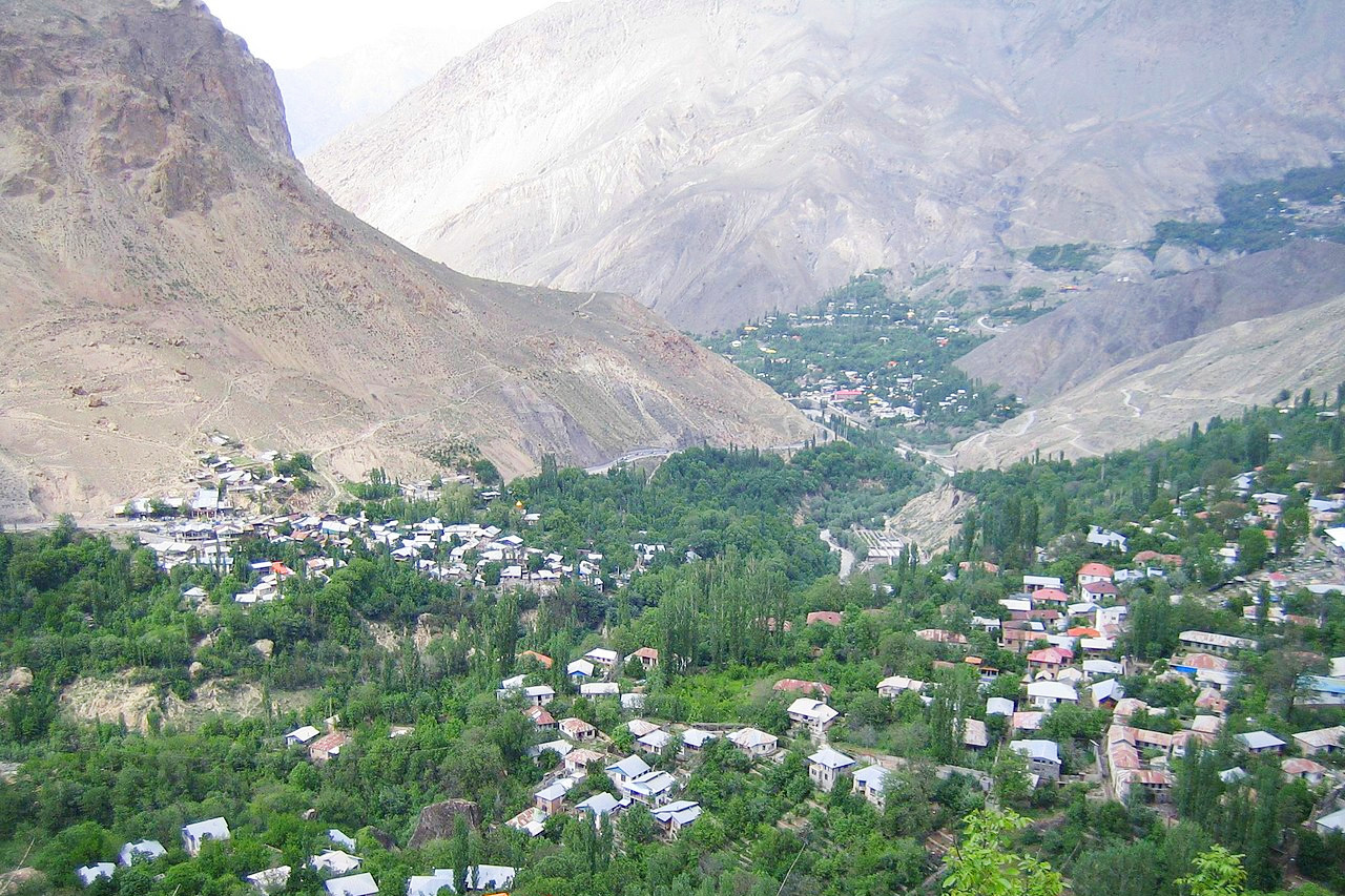
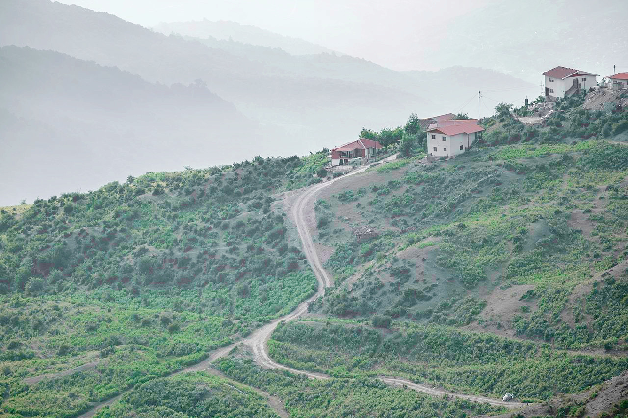
 Village of Shahandasht and Mount Damavand, Mazandaran Province
The Geography of
Iran
Why visit Iran?
Iran is a land of high mountains, deep valleys, great flatlands and vast arid deserts. It has long been a gateway from neighboring Iraq, Turkey, and the Arab states to Central Asia. The country is famous for its rich history and culture, and as the home of ancient empires. There are various museums and places of interest to visit, but one of the most popular forms of recreation is simply to go hiking in the mountains or bird watching.
Map
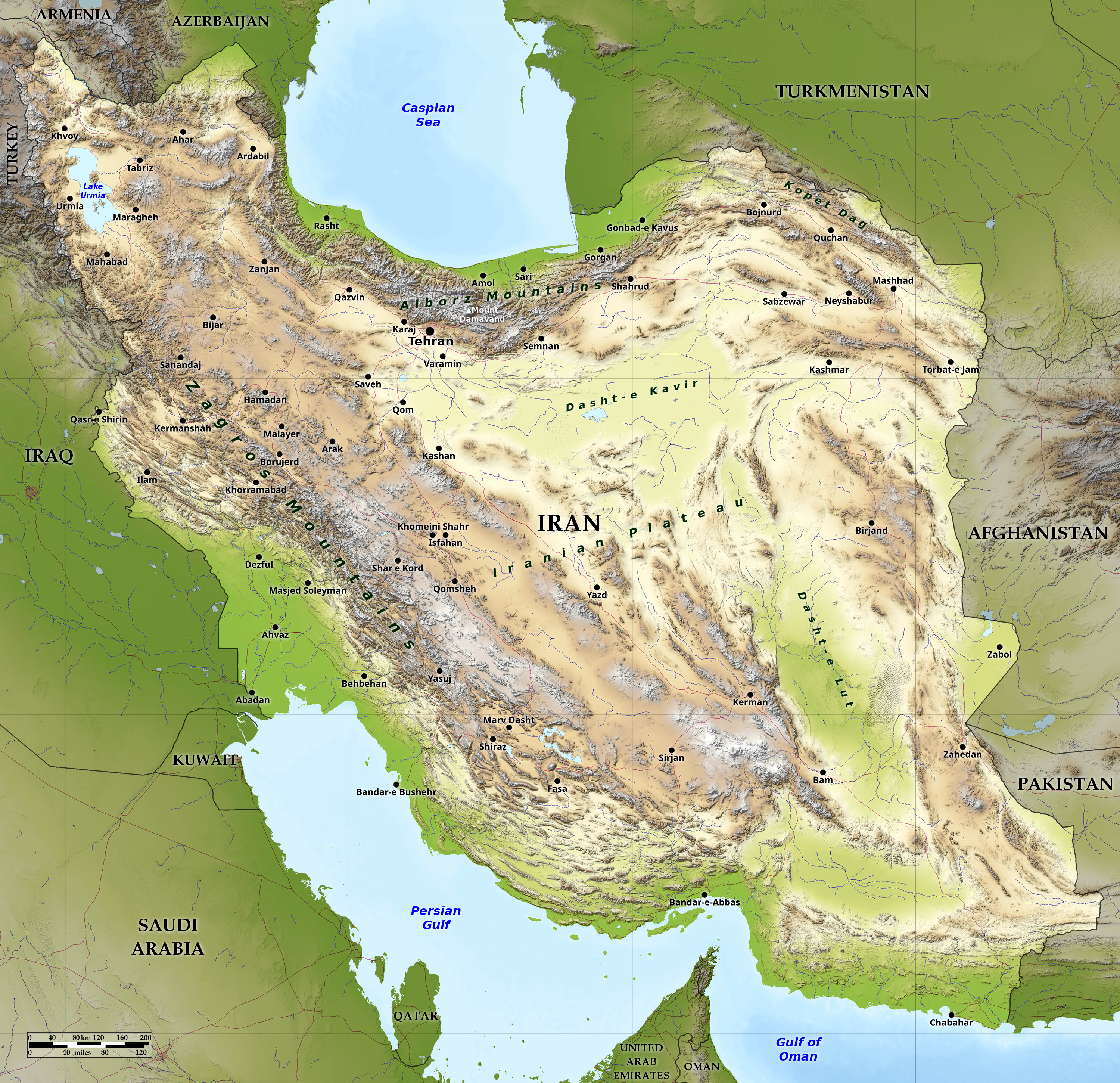 Relief map of Iran
What is the landscape of Iran like?
Iran consists of rugged mountains surrounding high interior basins which contain deserts and salt marshes. The Caspian Sea is in the north and the Persian Gulf and Gulf of Oman are in the south. Settlement is mainly in the mountain regions, along the coasts, and in some oases.
Mountains
The main mountain chain is the Zagros Mountains, a series of parallel ridges interspersed with plains which runs northwest to southeast through Iran. Many peaks in the Zagros exceed 3,000 meters (10,000 feet) above sea level, and at least five peaks in the south-central region of the country are higher than 4,000 meters. As the Zagros chain continues into southeastern Iran, the average elevation declines dramatically, to less than 1,500 meters (5,000 feet). The Zagros Range extends down to the Persian Gulf and Gulf of Oman coasts in rocky cliffs. There are forests of oaks and other deciduous trees in the Zagros Mountains. Iran’s major oil fields are located in the Zagros foothills in the southwest.
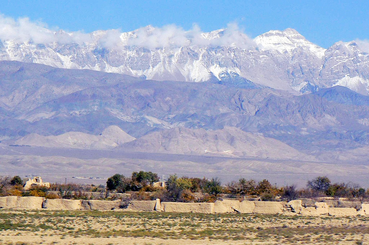
A narrow but high range, the Alborz Mountains, curves from west to east along the Caspian Sea shoreline. Iran’s capital, the sprawling city of Tehran, is located on the south side of the Elburz range. Located northeast of Tehran, Mount Damāvand at 5,671 metres (18,606 feet), is the country's highest peak, and the highest mountain on the Eurasian landmass west of the Hindu Kush range.
Interior Plateau
The center of Iran consists of several closed basins that collectively are referred to as the Central Plateau. The average elevation of this plateau is about 900 meters, but several of the mountains that tower over it exceed 3,000 meters.
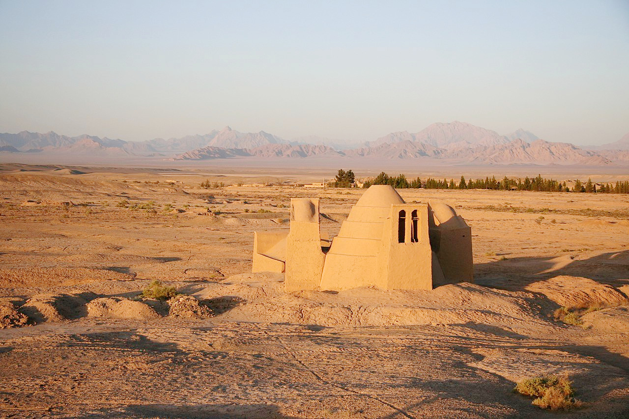
The eastern part of the plateau is covered by two deserts, the Dasht-e Kavīr (Salt Desert) and the Dasht-e Lūt (Desert of Emptiness). Except for some scattered oases, these deserts are uninhabited. These are some of the hottest places on Earth, and the deserts can go without rain for years at a time. Sand mountains rise up to 475 meters (1,560 feet) in the east and there are also sand dunes moved by wind. The region contains an interior area lacking in all life forms.
The outer deserts are scrubland, habitats for rare Asiatic cheetahs and koulans (Asian zebras). Inner desert areas are covered with hard layers of stones, gravel, and pebbles. Salt lakes and marshes create salt flats when they dry out. Scattered oases, linked by roads, are shaded by groves of date palms, poplars, and other trees.
Lowlands
Iran has two notable expanses of lowlands: the Khuzestan Plain in the southwest and the Caspian Sea coastal plain in the north. The Khuzestan Plain is a flat, roughly triangular extension of the Mesopotamia Plain averaging about 160 kilometers in width. It extends about 120 kilometers inland, then meets abruptly with the first foothills of the Zagros. Much of the Khuzestan Plain is covered with marshes. There are fairly broad coastal lowlands in southeast Iran, but annual rainfall is low.
The Caspian coastal plain is both longer and narrower. It extends about 640 kilometers along the Caspian shore, but its greatest width is less than 50 kilometers. Rainfall is plentiful along the Caspian coastal plain, where winters generally are mild, with rare frosts, and summers are warm and humid.
What is the nature of Iran like?
Less than one-tenth of the country is forested. Iran has forests in the Caspian region, in the west and southwest and in the northeast regions. The most extensive growths are found on the mountain slopes rising from the Caspian Sea, with stands of oak, ash, elm, cypress, and other valuable trees. On the plateau proper, areas of scrub oak appear on the best-watered mountain slopes, and villagers cultivate orchards and grow the plane tree, poplar, willow, walnut, beech, maple, and mulberry. Wild plants and shrubs spring from the barren land in the spring and afford pasturage, but the summer sun burns them away.
A rich variety of animals can be found in Iran. Desert animals include rabbits, deer, onagers, rodents, and birds of prey, such as buzzards. In the mountains and forests there are bears, and wild sheep and goats, gazelles, wild asses, wild pigs, panthers, and foxes abound.
What is the climate of Iran like?
See our main article: The Climate of Iran
Iran has an arid and semiarid climate with subtropical areas along the coasts. There are four seasons: spring, summer, a brief autumn, and winter. The central deserts and Persian Gulf coast are especially hot in summer. The average annual temperature in southern Iran is between 25°C and 30°C (77°F and 86°F).
Iran’s climate is dry; on the plateau, the annual rainfall does not exceed 300 mm (12 in), with the deserts receiving less than 130 mm (5 in). The Caspian coast is warm and humid throughout the year, with annual rainfall around 1000 mm (40 in).
| Climate data for Tehran (1988–2005) | |||||||||||||
|---|---|---|---|---|---|---|---|---|---|---|---|---|---|
| Month | Jan | Feb | Mar | Apr | May | Jun | Jul | Aug | Sep | Oct | Nov | Dec | Year |
| Average high °C (°F) | 6.1 (43.0) | 8.1 (46.6) | 12.9 (55.2) | 19.8 (67.6) | 25.0 (77.0) | 31.2 (88.2) | 33.9 (93.0) | 33.5 (92.3) | 29.3 (84.7) | 22.4 (72.3) | 14.3 (57.7) | 8.6 (47.5) | 20.4 (68.8) |
| Daily mean °C (°F) | 2.3 (36.1) | 4.4 (39.9) | 9.2 (48.6) | 14.9 (58.8) | 19.8 (67.6) | 25.6 (78.1) | 28.5 (83.3) | 27.6 (81.7) | 23.4 (74.1) | 17.2 (63.0) | 9.9 (49.8) | 4.8 (40.6) | 15.6 (60.1) |
| Average low °C (°F) | −1.5 (29.3) | −0.2 (31.6) | 4.0 (39.2) | 9.8 (49.6) | 14 (57) | 19.6 (67.3) | 22.6 (72.7) | 21.9 (71.4) | 17.5 (63.5) | 11.6 (52.9) | 5.4 (41.7) | 1.0 (33.8) | 10.5 (50.8) |
| Average precipitation mm (inches) | 63.1 (2.48) | 66.5 (2.62) | 83.3 (3.28) | 50.1 (1.97) | 27.1 (1.07) | 4.0 (0.16) | 4.2 (0.17) | 3.2 (0.13) | 3.4 (0.13) | 16.5 (0.65) | 41.3 (1.63) | 66.3 (2.61) | 429 (16.9) |
| Source: Iran Meteorological Organization | |||||||||||||
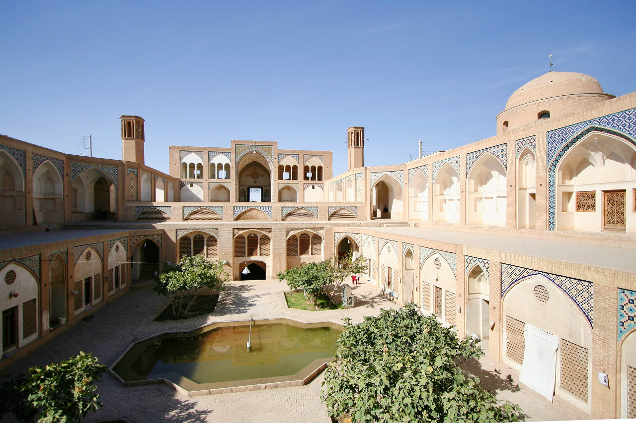 Inner courtyard of Agha Bozorg Mosque in Kashan
The official websites
Iran
A Different Experience
| Location: | Middle East, bordering the Gulf of Oman, the Persian Gulf, and the Caspian Sea, between Iraq and Pakistan |
| Coordinates: | 32° 00′ N, 53° 30′ E |
| Size: | • 1650 km N-S; 1810 km E-W • 1025 miles N-S; 1120 miles E-W |
| Terrain: | Rugged, mountainous rim; high, central basin with deserts, mountains; small, discontinuous plains along both coasts |
| Climate: | Mostly arid or semiarid, subtropical along Caspian coast |
| Highest point: | Mount Damavand 5,671 m / 18,606 ft |
| Forest: | 7% (2018 est.) |
| Population: | 87,590,873 (2023 est.) |
| Population density: | Low (48/km²) |
| Capital: | Tehran |
| Languages: | Persian Farsi (official), Azeri and other Turkic dialects, Kurdish, Gilaki and Mazandarani, Luri, Balochi, Arabic |
| Human Development Index: | High (0.783) |