The Geography of
Bhutan
Why visit Bhutan?
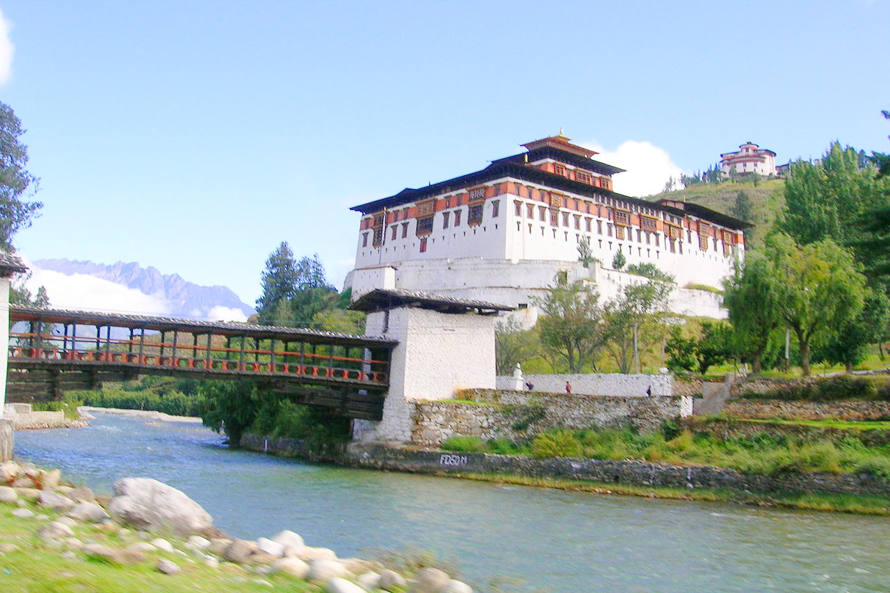
Bhutan is a land of dark and steep valleys, with the high tops of mountains lost in the clouds, constituting altogether a scene of extraordinary magnificence and sublimity. It is a beautiful country; its rugged mountains, fast-flowing rivers and thick forests are always attractive. Majestic fortresses and monasteries are spread over the country, and there is not a home without an altar dedicated to the Buddha.
Contents
Map
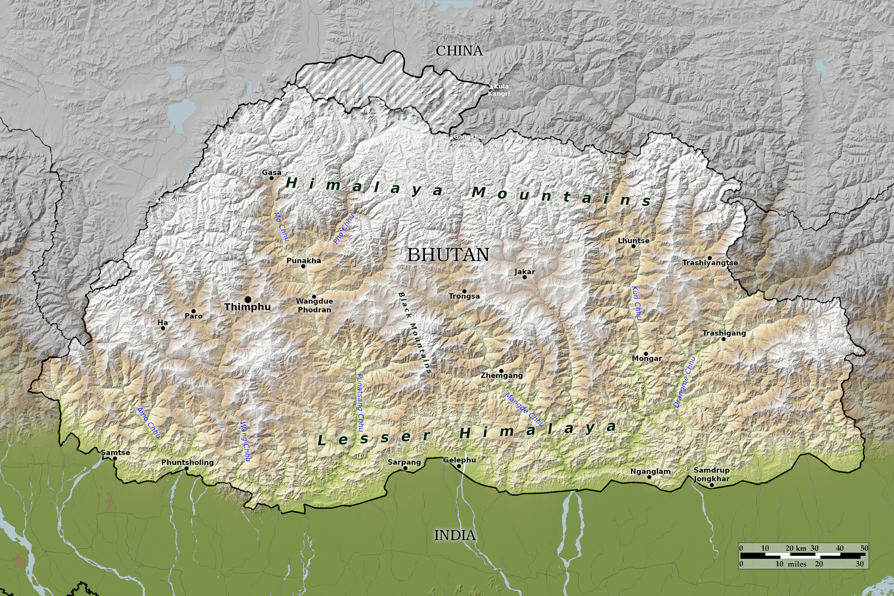 Relief map of Bhutan
What is the landscape of Bhutan like?
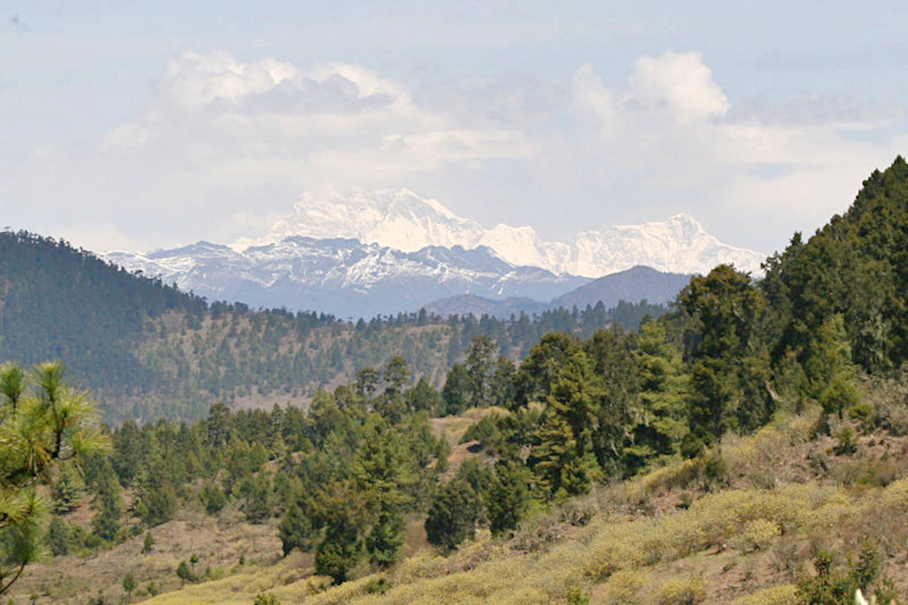
Bhutan has one of the most rugged mountainous regions in the world, ranging in elevation from 160 meters (525 feet) to more than 7,000 meters (23,000 feet) above sea level, in some cases at distances of less than 100 kilometers (60 miles) from each other. Bhutan's highest peak is Gangkhar Puensum at 7,570 meters (24,836 feet) on the border with China. Other high peaks include Kula Kangri, which sits at 7,528 meters (24,698 feet) in disputed territory claimed by China; and Jomolhari, overlooking the Chumbi Valley to the west, at 7,326 meters (24,035 feet). Around nineteen other peaks exceed 7,000 meters (23,000 feet).
To the north, the snow-capped Great Himalayan Range reaches elevations of over 7,500 meters (24,600 feet) above sea level and stretches along the Bhutan-China border. The northern region consists of an arc of glaciated mountain peaks with an arctic climate at the highest elevations. Fed by fresh snow each winter and slowly melting in the summer, the glaciers bring large amounts of fresh water to Bhutan and its downstream areas each year. The Alpine valleys in this region provide grazing land for the cattle herded by a sparse population of shepherds.
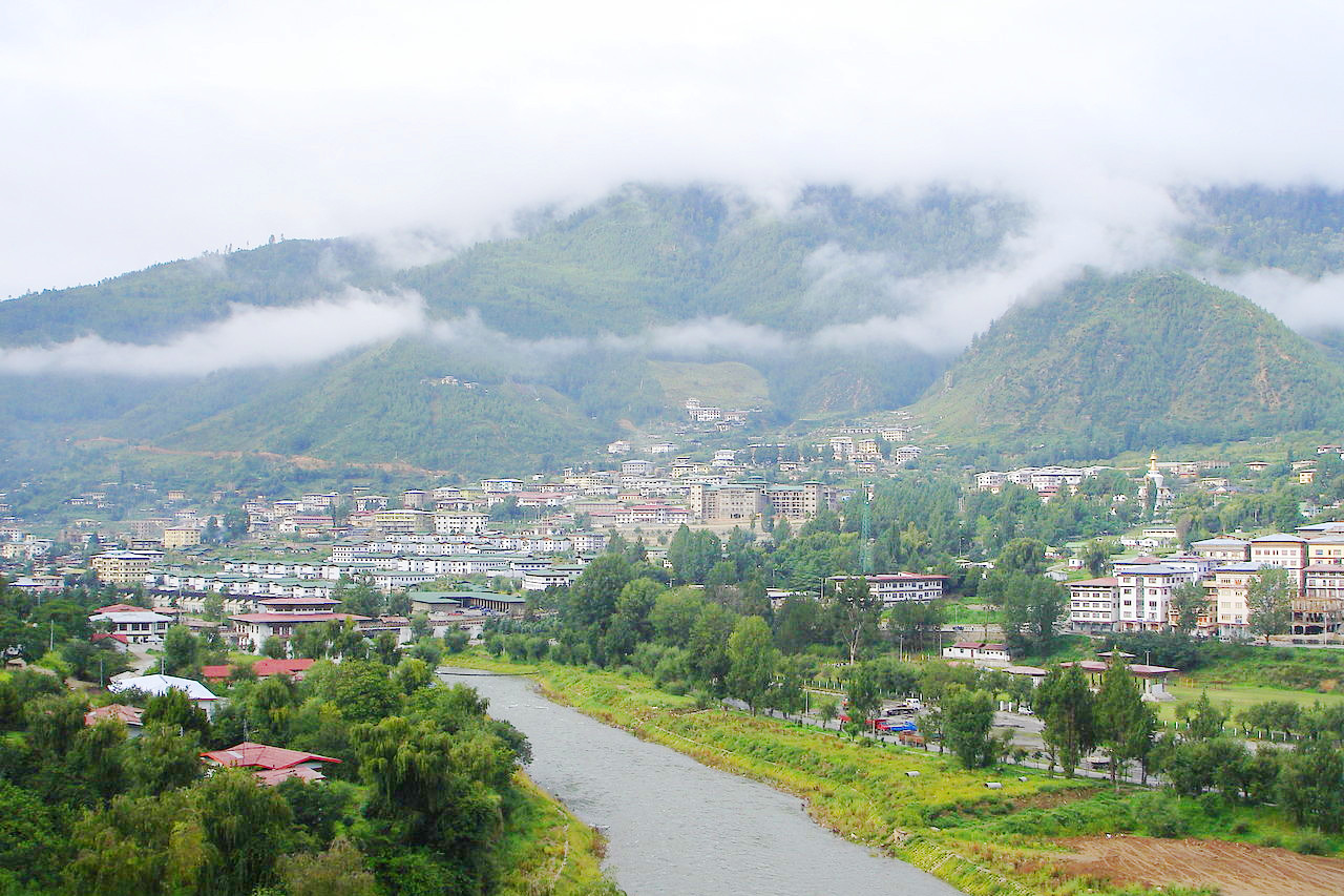
The Inner Himalayas are a southern spur of the Great Himalayan Range. Most of the major towns in Bhutan, including the capital city, Thimphu, lie in this belt. The topography features broad valleys, deep gorges, and fast-flowing rivers.The Black Mountains (locally: Dungshing Gang) in central Bhutan form a watershed between two major river systems, the Mo Chhu and the Drangme Chhu (chhu means river). The peaks in the Black Mountains range from 1,500 to 2,700 meters (4,900–8,850 feet) above sea level, and the fast-flowing rivers have carved spectacular gorges in the lower mountain regions. East Bhutan is divided by another southern spur, the Donga Range. Western Bhutan has fertile, cultivated valleys and terraced river basins.
To the south, the Southern Hills or Siwalik Hills, the foothills of the Himalayas, are covered with dense deciduous forest, alluvial river valleys, and mountains rising to 1,500 meters (4,900 feet) above sea level. The foothills descend into the subtropical Duars Plain. Most of the actual Duars plain is in India, and ten to fifteen kilometers (6–10 miles) penetrate Bhutan. The Bhutan Duars consists of two parts. Bordering the foothills of the Himalayas, the Northern Duars have rugged, sloping terrain and dry, porous soil with dense vegetation and abundant wildlife. The southern duars have moderately fertile soil, heavy savanna grass, dense mixed jungle, and freshwater springs. Overall, the Duars provide the largest amount of fertile flatland in Bhutan. Rice and other crops are grown on the plains and mountain slopes up to an altitude of 1,200 meters (3,900 feet). Bhutan's main trading town—Phuntsholing—lies in the duars, reflecting the meaning of the name, which is derived from the Hindi 'dwar' meaning gateway. Rhinos, tigers, leopards, elephants and other wildlife inhabit the region.
What is the nature of Bhutan like?

Bhutan is blessed with an outstanding natural environment, and is recognized as a global biodiversity hotspot. Forests account for more than 70 percent of the country's land cover. In the south, there are foothills that are covered with dense tropical forests; this dDense jungle growth is characteristic at altitudes below 1,500 meters (5,000 feet). Above that height the central zone consists of fertile valleys, the mountain slopes of which are covered with forest, including beech, ash, birch, maple, cypress, and yew. At 2,400–2,700 meters (8,000–9,000 feet) are forests of oak and rhododendron. Above this level, firs and pines grow to the tree line. Above this are the high Himalayas, featuring alpine meadows and snow-capped mountains.
Mammal species in the wild number close to two hundred, and Bhutan is home to some of the world's most threatened species, such as the Bengal tiger, snow leopard, Asian elephant, red panda, golden langur, and takin—Bhutan's national animal. The relative abundance of wild animals is attributed to the Buddhist reluctance to take life. In the lower parts of southern Bhutan, mammals include the goral, sambar deer, bear, and Indian rhinoceros; in the higher regions are snow deer, musk deer, and barking deer.
What is the climate of Bhutan like?
See our main article: The Climate of Bhutan
Because of the irregular terrain, the climate varies greatly from place to place. The south has a hot, humid, subtropical climate, with heavy rainfall, while the inland hills have a temperate climate, with hot summers, cool winters, and moderate rainfall. The mountainous areas are cold most of the year, and are relatively dry. Thimphu experiences dry winter months (December through February) and almost no precipitation until March
| Climate data for Thimphu (1996-2017) | |||||||||||||
|---|---|---|---|---|---|---|---|---|---|---|---|---|---|
| Month | Jan | Feb | Mar | Apr | May | Jun | Jul | Aug | Sep | Oct | Nov | Dec | Year |
| Average high °C (°F) | 14.8 (58.6) | 16.6 (61.9) | 19.3 (66.7) | 22.4 (72.3) | 24.8 (76.6) | 26.7 (80.1) | 27.0 (80.6) | 27.3 (81.1) | 26.0 (78.8) | 23.7 (74.7) | 19.7 (67.5) | 16.6 (61.9) | 22.1 (71.7) |
| Daily mean °C (°F) | 6.3 (43.3) | 8.5 (47.3) | 11.6 (52.9) | 15.1 (59.2) | 18.2 (64.8) | 21.0 (69.8) | 21.8 (71.2) | 21.7 (71.1) | 20.3 (68.5) | 16.3 (61.3) | 11.5 (52.7) | 7.9 (46.2) | 15.0 (59.0) |
| Average low °C (°F) | −2.2 (28.0) | 0.3 (32.5) | 3.8 (38.8) | 7.9 (46.2) | 11.6 (52.9) | 15.3 (59.5) | 16.5 (61.7) | 16.1 (61.0) | 14.6 (58.3) | 9.0 (48.2) | 3.2 (37.8) | −0.8 (30.6) | 8.0 (46.4) |
| Average rainfall mm (inches) | 6.3 (0.25) | 9.2 (0.36) | 20.4 (0.80) | 29.9 (1.18) | 49.8 (1.96) | 97.7 (3.85) | 152.8 (6.02) | 120.8 (4.76) | 73.9 (2.91) | 43.1 (1.70) | 1.2 (0.05) | 3.7 (0.15) | 608.9 (23.97) |
| Source: National Center for Hydrology and Meteorology | |||||||||||||
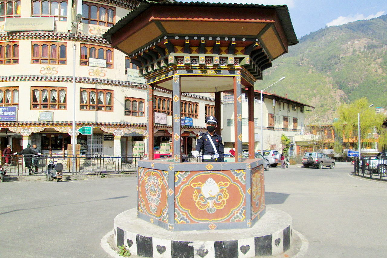
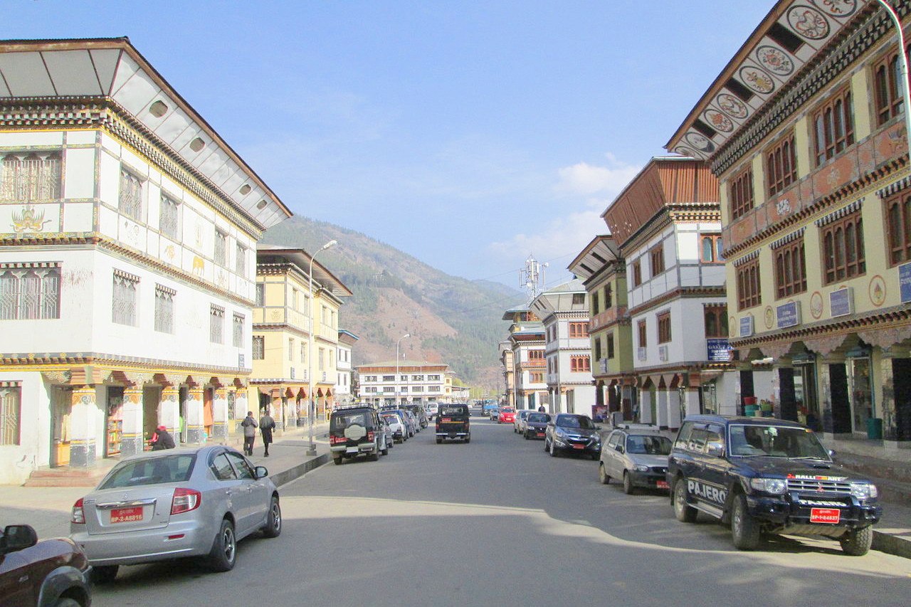
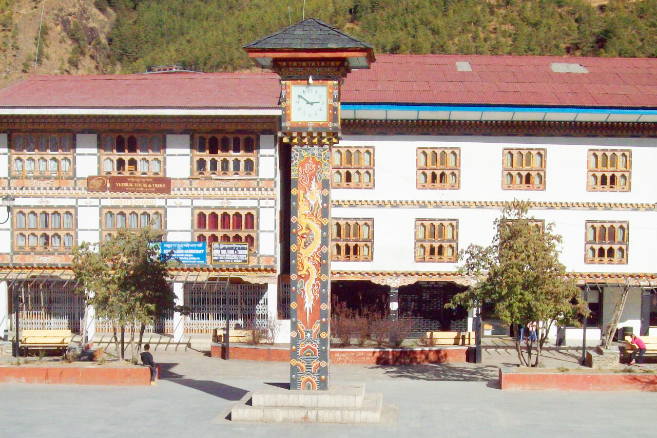 Clock Tower Square, Thimphu
The official websites
Bhutan
Happiness is a place
| Location: | Southern Asia, between China and India |
| Coordinates: | 27° 30′ N, 90° 30′ W |
| Size: | • 175 km N-S; 335 km E-W • 110 miles N-S; 210 miles E-W |
| Terrain: | Mostly mountainous with fertile valleys |
| Climate: | Tropical in southern plains; cool winters and hot summers in central valleys; severe winters and cool summers in Himalayas |
| Highest point: | Gangkhar Puensum 7,570 m / 24,840 ft |
| Forest: | 85.5% (2018 est.) |
| Population: | 867,775 (2022 est.) |
| Population density: | Low (19/km²) |
| Capital: | Thimphu |
| Languages: | Sharchopkha 28%, Dzongkha (official) 24%, Lhotshamkha 22%, other 26% |
| Human Development Index: | Medium (0.666) |
Related entries
-
Nepal
• On Top of the World -
India
• Atithi Devo Bhava -
Bangladesh
• Visit before the tourists come -
China
• Explore the World with Us