The Climate of the
Central African Republic
_Figure_27.jpg) Forest of the Dzanga-Ndoki National Park
Forest of the Dzanga-Ndoki National Park
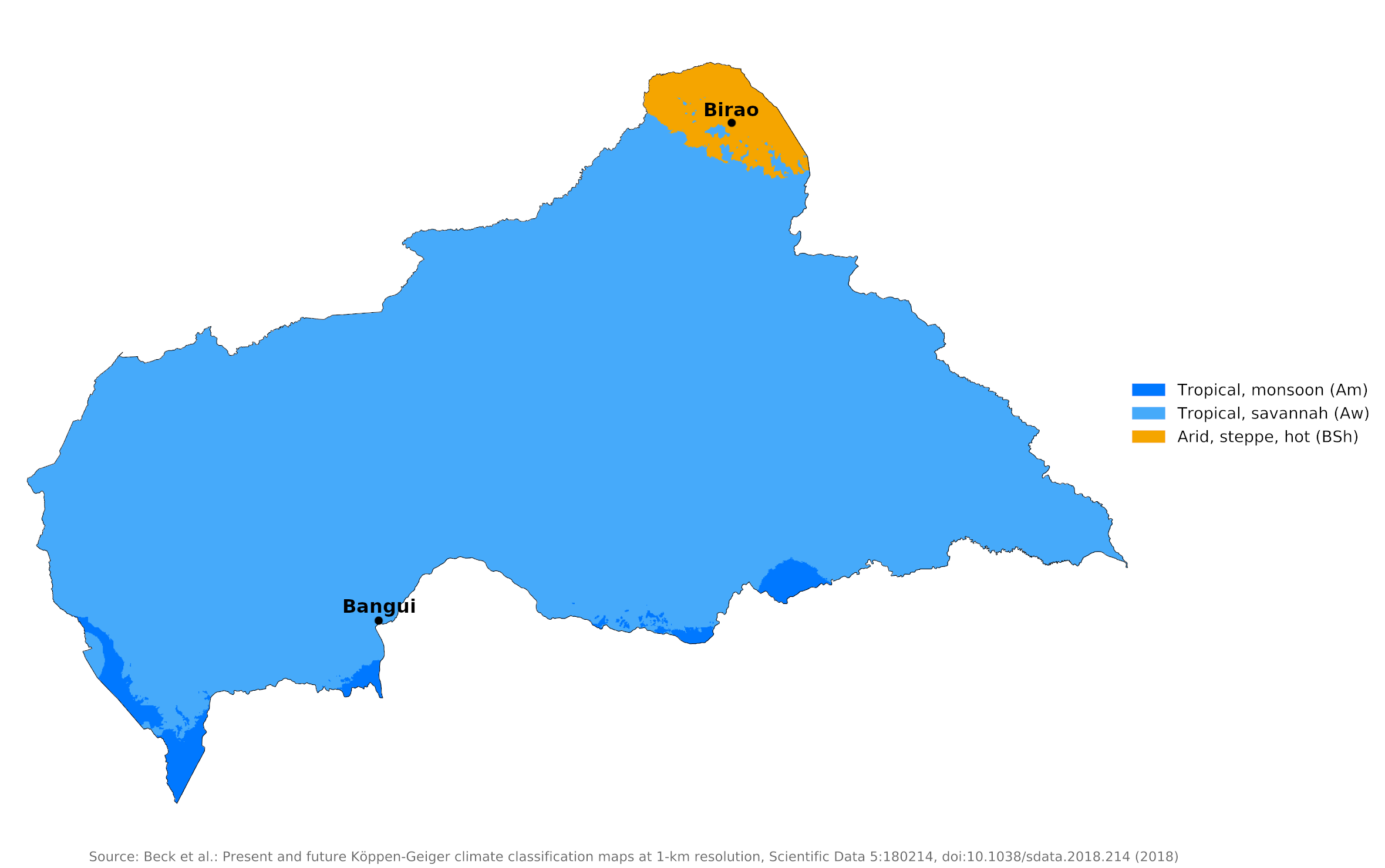
Climate Map
 Climate map of the Central African Republic
What is the climate of the Central African Republic like?
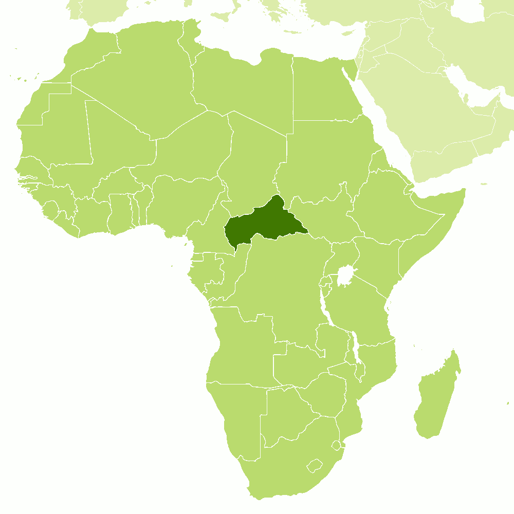
The Central African Republic is a landlocked state situated just north of the Equator. Rather larger than France, it is very sparsely populated. It is bordered on the north by Chad, on the east by South Sudan, on the south by the Democratic Republic of Congo and the Congo Republic, and on the west by Cameroon.
The climate of the Central African Republic is tropical, but is also moderated by rainfall and altitude. Temperatures average around 27°C (80°F) all year. Rainfall varies, increasing from north to south.
The northern part of the country is relatively dry, with an annual average rainfall of about 750 to 1,000 millimeters (30 to 40 inches). The northeast, with a semiarid climate, is the driest part of the country (see Birao). Daytime temperatures rise quite high in the period preceding the main rainy season between May and October. During the rest of the year rainfall is light and sparse.
| Climate data for Birao | |||||||||||||
|---|---|---|---|---|---|---|---|---|---|---|---|---|---|
| Month | Jan | Feb | Mar | Apr | May | Jun | Jul | Aug | Sep | Oct | Nov | Dec | Year |
| Average high °C (°F) | 34.7 (94.5) | 37.3 (99.1) | 39.4 (102.9) | 39.7 (103.5) | 37.9 (100.2) | 35 (95) | 31.4 (88.5) | 30.8 (87.4) | 32.1 (89.8) | 34.5 (94.1) | 35 (95) | 33.6 (92.5) | 35.1 (95.2) |
| Daily mean °C (°F) | 23.7 (74.7) | 26 (79) | 28.8 (83.8) | 30.4 (86.7) | 30.2 (86.4) | 28.3 (82.9) | 25.7 (78.3) | 25.3 (77.5) | 25.9 (78.6) | 26.5 (79.7) | 23.9 (75.0) | 22.5 (72.5) | 26.4 (79.6) |
| Average low °C (°F) | 12.7 (54.9) | 14.8 (58.6) | 18.3 (64.9) | 21.1 (70.0) | 22.5 (72.5) | 21.6 (70.9) | 20.1 (68.2) | 19.8 (67.6) | 19.7 (67.5) | 18.6 (65.5) | 12.8 (55.0) | 11.4 (52.5) | 17.8 (64.0) |
| Average precipitation mm (inches) | 0 (0) | 0 (0) | 1 (0.0) | 20 (0.8) | 67 (2.6) | 107 (4.2) | 189 (7.4) | 193 (7.6) | 146 (5.7) | 38 (1.5) | 1 (0.0) | 0 (0) | 762 (29.8) |
| Source: Climate-Data.org | |||||||||||||
The southern half of the country has a more equatorial type of climate. The annual rainfall is between 1,500 and 2,000 millimeters (60 to 80 inches), falling in all months but with a relatively drier period from December to February at the time of low sun. Temperatures at Bangui have an average minimum and maximum range from 20°C (68°F) to 34°C (93°F). Bangui is typical of conditions in the south of the country.
| Climate data for Bangui | |||||||||||||
|---|---|---|---|---|---|---|---|---|---|---|---|---|---|
| Month | Jan | Feb | Mar | Apr | May | Jun | Jul | Aug | Sep | Oct | Nov | Dec | Year |
| Average high °C (°F) | 32.9 (91.2) | 33.9 (93.0) | 33.5 (92.3) | 32.9 (91.2) | 31.9 (89.4) | 30.9 (87.6) | 29.9 (85.8) | 29.9 (85.8) | 30.6 (87.1) | 30.7 (87.3) | 31.4 (88.5) | 31.8 (89.2) | 31.7 (89.1) |
| Daily mean °C (°F) | 26.0 (78.8) | 27.1 (80.8) | 27.4 (81.3) | 27.1 (80.8) | 26.5 (79.7) | 25.3 (77.5) | 25.1 (77.2) | 25.1 (77.2) | 25.4 (77.7) | 25.5 (77.9) | 25.7 (78.3) | 25.7 (78.3) | 26.0 (78.8) |
| Average low °C (°F) | 19.5 (67.1) | 20.2 (68.4) | 21.3 (70.3) | 21.4 (70.5) | 21.1 (70.0) | 19.7 (67.5) | 20.3 (68.5) | 20.3 (68.5) | 20.2 (68.4) | 20.2 (68.4) | 20.0 (68.0) | 19.3 (66.7) | 20.3 (68.5) |
| Average precipitation mm (inches) | 20 (0.8) | 39 (1.5) | 116 (4.6) | 142 (5.6) | 167 (6.6) | 134 (5.3) | 174 (6.9) | 240 (9.4) | 185 (7.3) | 190 (7.5) | 89 (3.5) | 24 (0.9) | 1,520 (59.9) |
| Source: Deutscher Wetterdienst | |||||||||||||
References
- E. A. Pearce, Charles Gordon Smith, (1990) The Hutchinson World Weather Guide, John Murray Press. ISBN 1859863426
- Timothy L. Gall, (ed.), (2003), Worldmark Encyclopedia of the Nations, Eleventh Edition, Thomson Gale
- Hugh Chisholm, (ed.), (1911), Encyclopædia Britannica, Eleventh edition, Cambridge University Press
The Climate of
Central African Republic

In summary:
The climate is of the Central African Republic is tropical, with temperatures averaging around 27°C (80°F) all year.
There is abundant rainfall of about 1800 mm (70 in) annually in the south, decreasing to about 750 mm (30 in) in the extreme northeast. The main rainy season is between May and October.