The Climate of
Chad
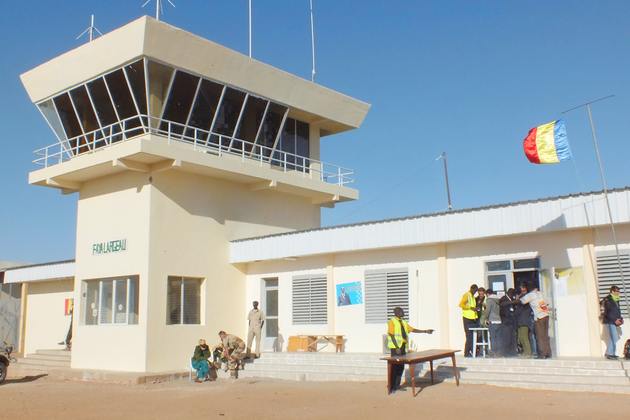
 Faya-Largeau Airport
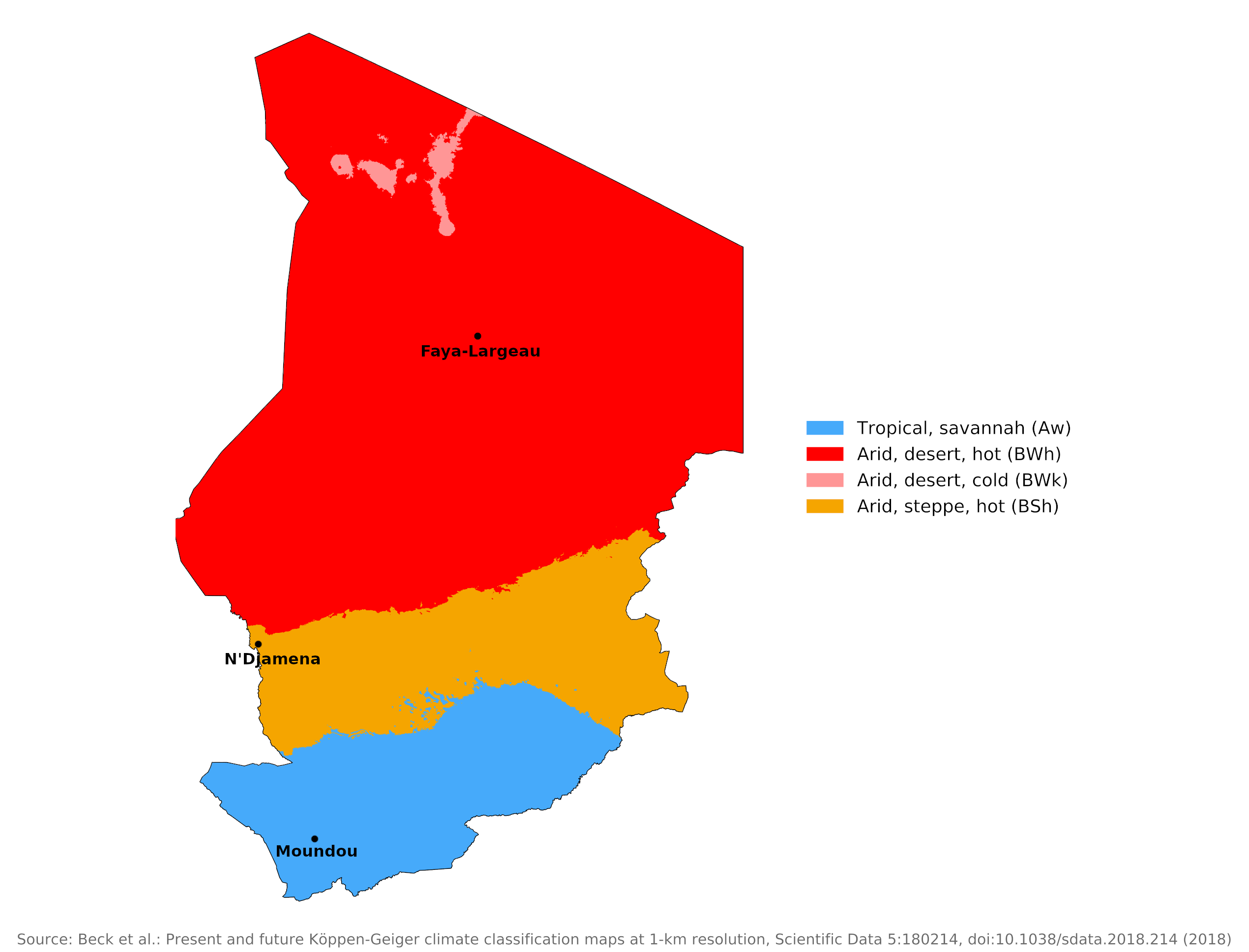
Climate Map
 Climate map of Chad
What is the climate of Chad like?
Chad is a country slightly larger than Egypt and located in interior West Africa. It is rather sparsely populated as the northern part of the country includes part of the Sahara. Chad is bounded on the north by Libya, on the east by Sudan, on the south by the Central African Republic, on the southwest by Cameroon, and on the west by Nigeria and Niger.
Chad has three climate zones from north to south. In the north, the Sahara fluctuates between extreme temperatures from day to night. In the central Sahel, where the capital N'Djamena is located, average daily temperatures in April range from 25°C to 41°C (77°F to 106°F) and from 14°C to 33°C (57°F to 91°F) in December. Temperatures are more moderate in the South Sudan region. The most extreme temperatures in the country range from -12°C (10°F) to 50°C (122°F).
Except for the far north, most regions are characterized by alternating wet and dry seasons. During the rainy season, winds from the southwest push the wetter maritime air north across the African continent, where it meets the continental mass and slides beneath it along a front called the "intertropical convergence zone." In the middle of the dry season, the intertropical convergence zone shifts south of Chad, taking the rain with it. This weather system contributes to the formation of three major climate and vegetation regions.
Because of sparse rainfall and northern harmattan (hot, dry) winds, the country suffers from periodic droughts (periods with almost no rainfall). Locust plagues (large swarms of grasshoppers which destroy vegetation) are also a problem.
North
The northern half of the country, the Sahara, is practically rainless. Here the climate is hot all year round with plenty of sunshine. Much of this area receives only traces of rain during the entire year; In the Sahara, annual rainfall averages just 25 millimeters (1 inch). Faya-Largeau, lying beyond the northern limit of the summer rain belt, is representative of this area.
Scattered small oases and occasional wells provide water for a few date palms or small plots of millet and garden crops. In much of the north, the average daily maximum temperature can reach 32°C (90°F) during January, the coolest month of the year, and about 45°C (113°F) during May, the hottest month. On occasion, strong winds from the northeast produce violent sandstorms.
| Climate data for Faya-Largeau (1961–1990) | |||||||||||||
|---|---|---|---|---|---|---|---|---|---|---|---|---|---|
| Month | Jan | Feb | Mar | Apr | May | Jun | Jul | Aug | Sep | Oct | Nov | Dec | Year |
| Average high °C (°F) | 26.4 (79.5) | 29.4 (84.9) | 33.6 (92.5) | 39.1 (102.4) | 41.0 (105.8) | 42.1 (107.8) | 41.0 (105.8) | 40.2 (104.4) | 39.8 (103.6) | 36.5 (97.7) | 31.1 (88.0) | 27.6 (81.7) | 35.7 (96.3) |
| Daily mean °C (°F) | 20.0 (68.0) | 22.2 (72.0) | 26.0 (78.8) | 30.8 (87.4) | 33.0 (91.4) | 34.1 (93.4) | 33.4 (92.1) | 33.1 (91.6) | 32.7 (90.9) | 29.5 (85.1) | 24.5 (76.1) | 21.0 (69.8) | 28.4 (83.1) |
| Average low °C (°F) | 13.6 (56.5) | 15.0 (59.0) | 18.4 (65.1) | 22.4 (72.3) | 25.0 (77.0) | 26.1 (79.0) | 25.8 (78.4) | 26.0 (78.8) | 25.9 (78.6) | 22.5 (72.5) | 17.9 (64.2) | 14.4 (57.9) | 21.1 (70.0) |
| Average precipitation mm (inches) | 0.0 (0.0) | 0.0 (0.0) | 0.0 (0.0) | 0.1 (0.00) | 0.4 (0.02) | 0.3 (0.01) | 3.0 (0.12) | 7.0 (0.28) | 0.8 (0.03) | 0.1 (0.00) | 0.0 (0.0) | 0.0 (0.0) | 11.7 (0.46) |
| Source: World Meteorological Organization | |||||||||||||
Center
The semi-arid Sahel zone forms a belt about 500 kilometers (300 miles) wide through the middle of the country. The climate in this transition zone is divided into a rainy season (from June to September) and a dry season (from October to May). In the northern Sahel, thorny shrubs and acacias grow wild, while date palms, grains and garden crops are grown in scattered oases. The central Sahel zone is characterized by drought-resistant grasses and small trees. It rains more often here than in the Sahara. For example, N'Djamena records an annual average rainfall of 510 millimeters (20 inches). During the hot season in April and May, maximum temperatures often exceed 40°C. In the southern part of the Sahel, rainfall is sufficient to allow crops to be cultivated on non-irrigated land, and millet and sorghum are grown.
| Climate data for N'Djamena (1961-1990) | |||||||||||||
|---|---|---|---|---|---|---|---|---|---|---|---|---|---|
| Month | Jan | Feb | Mar | Apr | May | Jun | Jul | Aug | Sep | Oct | Nov | Dec | Year |
| Average high °C (°F) | 32.4 (90.3) | 35.2 (95.4) | 38.7 (101.7) | 41.0 (105.8) | 39.9 (103.8) | 37.2 (99.0) | 33.5 (92.3) | 31.6 (88.9) | 33.7 (92.7) | 36.9 (98.4) | 35.8 (96.4) | 33.5 (92.3) | 35.8 (96.4) |
| Daily mean °C (°F) | 23.4 (74.1) | 25.9 (78.6) | 29.9 (85.8) | 32.9 (91.2) | 32.9 (91.2) | 30.9 (87.6) | 28.3 (82.9) | 27.0 (80.6) | 28.2 (82.8) | 29.4 (84.9) | 26.8 (80.2) | 24.2 (75.6) | 28.3 (83.0) |
| Average low °C (°F) | 14.3 (57.7) | 16.6 (61.9) | 21.0 (69.8) | 24.8 (76.6) | 25.8 (78.4) | 24.7 (76.5) | 23.1 (73.6) | 22.4 (72.3) | 22.7 (72.9) | 21.8 (71.2) | 17.8 (64.0) | 14.8 (58.6) | 20.8 (69.5) |
| Average precipitation mm (inches) | 0.0 (0.0) | 0.0 (0.0) | 0.3 (0.01) | 10.3 (0.41) | 25.8 (1.02) | 51.0 (2.01) | 143.8 (5.66) | 174.4 (6.87) | 84.3 (3.32) | 20.3 (0.80) | 0.1 (0.00) | 0.0 (0.0) | 510.3 (20.1) |
| Source: World Meteorological Organization | |||||||||||||
South
The wetter Sudan region covers the southern part of the country. Between April and October, the rainy season brings between 750 and 1,250 millimeters (30–50 inches) of rain. Temperatures are high all year round. Average temperatures in Moundou, the largest city in the southwest, range from 25°C (76°F) in the cool season of December and January to around 31°C (88°F) in the hot months of March, April and May.
The Sudan region is predominantly savannah or plain covered with a mixture of tropical or subtropical grasses and forests. Growth is lush during the rainy season but turns brown and dormant during the five-month dry season between November and March.
| Climate data for Moundou (1961-1990) | |||||||||||||
|---|---|---|---|---|---|---|---|---|---|---|---|---|---|
| Month | Jan | Feb | Mar | Apr | May | Jun | Jul | Aug | Sep | Oct | Nov | Dec | Year |
| Average high °C (°F) | 34.1 (93.4) | 36.7 (98.1) | 38.6 (101.5) | 38.0 (100.4) | 35.7 (96.3) | 32.3 (90.1) | 30.2 (86.4) | 29.8 (85.6) | 30.7 (87.3) | 33.1 (91.6) | 35.1 (95.2) | 34.2 (93.6) | 34.0 (93.2) |
| Daily mean °C (°F) | 24.6 (76.3) | 27.5 (81.5) | 30.6 (87.1) | 31.1 (88.0) | 29.6 (85.3) | 27.2 (81.0) | 25.7 (78.3) | 25.4 (77.7) | 25.8 (78.4) | 27.1 (80.8) | 26.3 (79.3) | 24.4 (75.9) | 27.1 (80.8) |
| Average low °C (°F) | 15.1 (59.2) | 18.3 (64.9) | 22.5 (72.5) | 24.2 (75.6) | 23.5 (74.3) | 22.1 (71.8) | 21.2 (70.2) | 21.0 (69.8) | 20.8 (69.4) | 21.0 (69.8) | 17.4 (63.3) | 14.6 (58.3) | 20.1 (68.2) |
| Average precipitation mm (inches) | 0.0 (0.0) | 0.2 (0.01) | 4.6 (0.18) | 39.2 (1.54) | 89.8 (3.54) | 147.7 (5.81) | 257.8 (10.15) | 284.8 (11.21) | 200.1 (7.88) | 57.1 (2.25) | 1.5 (0.06) | 0.0 (0.0) | 1,082.8 (42.63) |
| Source: World Meteorological Organization | |||||||||||||
References
- E. A. Pearce, Charles Gordon Smith, (1990) The Hutchinson World Weather Guide, John Murray Press. ISBN 1859863426
- Timothy L. Gall, (ed.), (2003), Worldmark Encyclopedia of the Nations, Eleventh Edition, Thomson Gale
- Federal Research Division, Library of Congress, (1990), Chad: a country study. Claitor's Pub. Division.
- Hugh Chisholm, (ed.), (1911), Encyclopædia Britannica, Eleventh edition, Cambridge University Press
The Climate of
Chad

In summary:
The northern half of the country, the Sahara desert, is virtually rainless. Here the climate is hot around the year. The southern half of the country, is part of the Sahel belt, where rain occurs during the period of high sun between May and September, although the country suffers from periodic droughts.
The rain season last from April (in the south) or July (farther north) through October.