The Climate of
Liberia
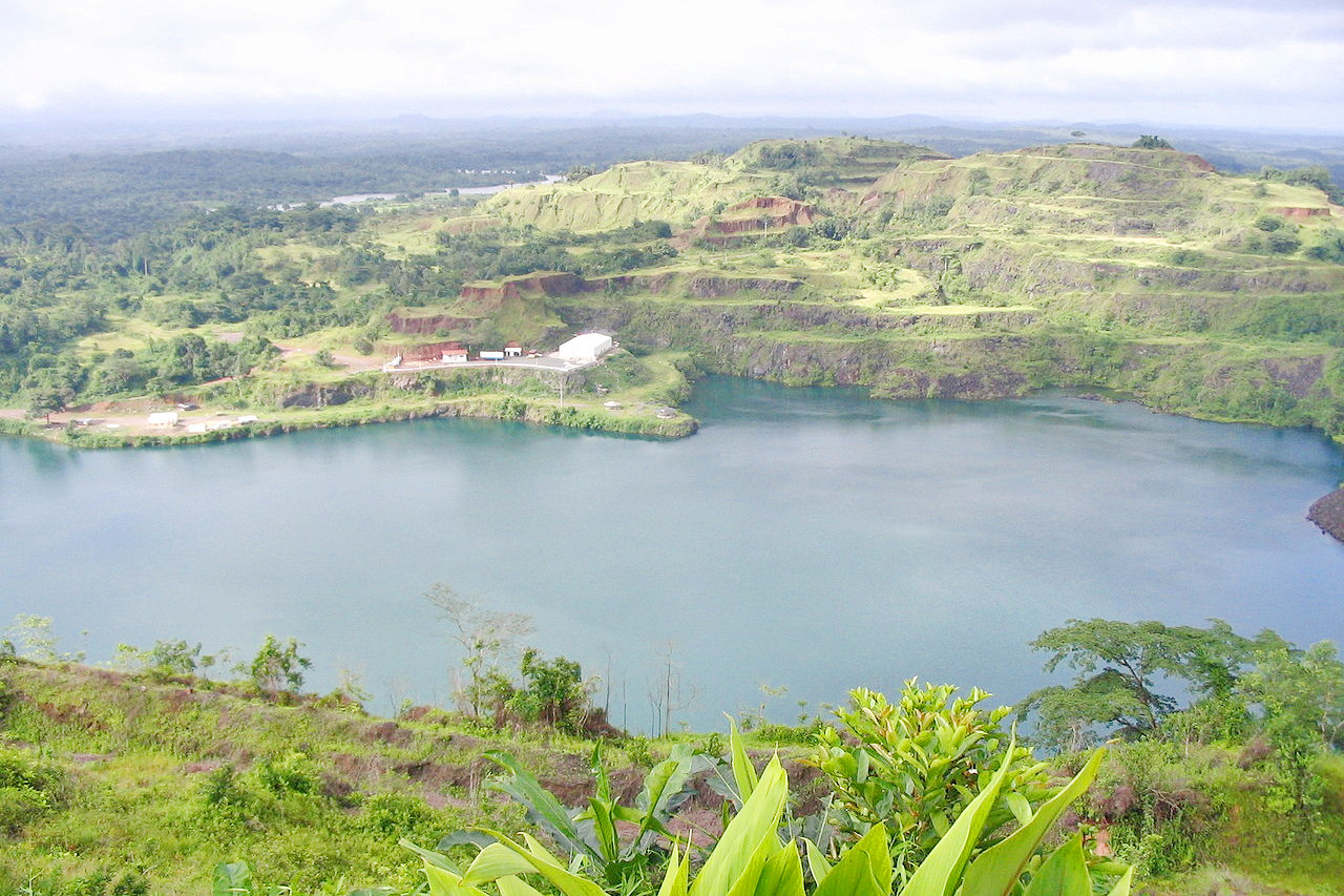
 Lake Bomi, Tubmanburg
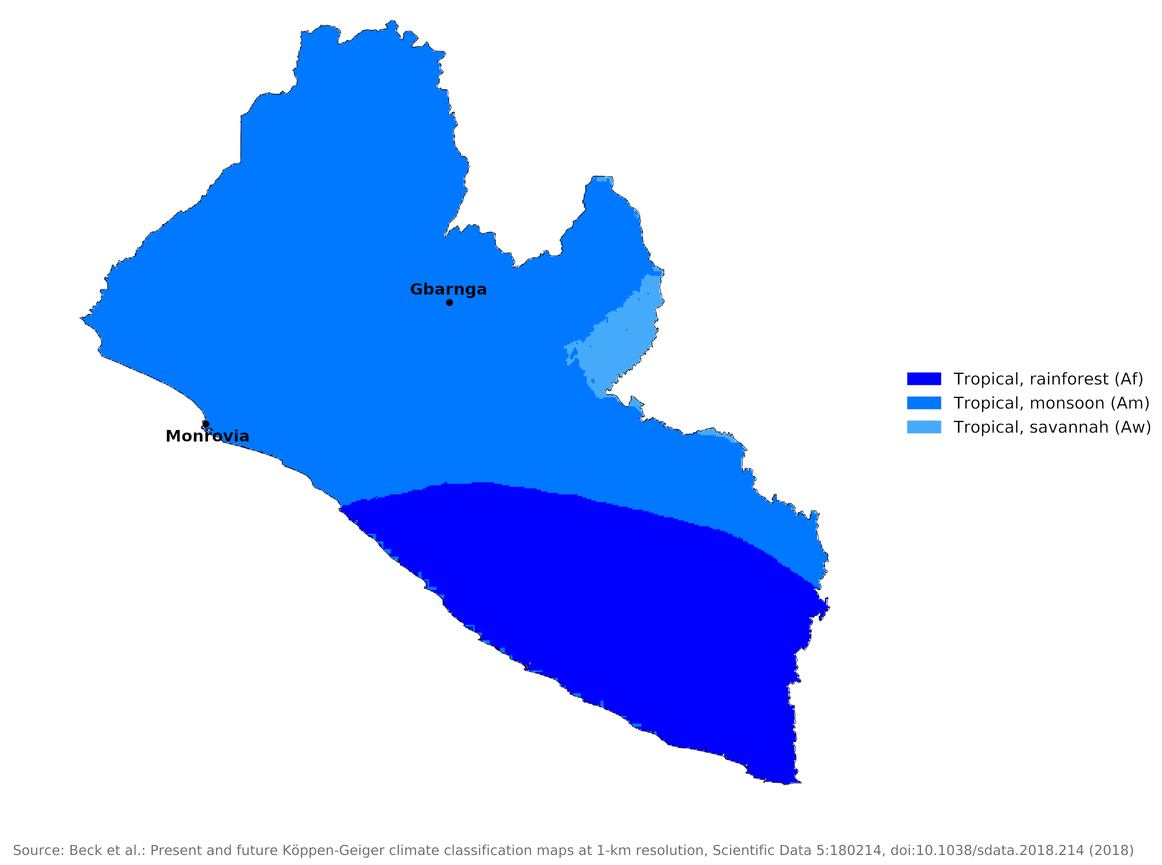
Climate Map
 Climate map of Liberia
What is the climate of Liberia like?
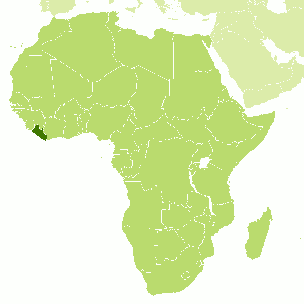
Liberia, Africa’s oldest republic, is located at the western edge of the continent, on the Atlantic coast between Sierra Leone and Côte d’Ivoire. It is about as large as England and has an extensive coastal plain and inland rises to a plateau with a maximum altitude of about 1,000 meters (3,300 feet). The climate of the country is similar to that of Sierra Leone.
Liberia has a hot, humid, tropical climate with little change in temperature throughout the year. Days vary little in length, and sunshine is relatively intense and uniform. The mean is 27°C (81°F), with temperatures rarely exceeding 36°C (97°F) or falling below 20°C (68°F). Generally, temperatures decline a little during the height of the rainy season.
On the coast ocean breezes temper the tropical heat, sometimes accompanied by the dry desert wind called the harmattan, which blows in December. Temperatures are cooler in the interior highlands than along the coast. Inland, particularly at the higher altitudes, the daily range in temperature may be 15°C (27°F) or more.
Liberia experiences heavier rainfall than that in most regions of West Africa. Seasons in Liberia are determined by the alternating north to south movements of continental and maritime air masses which brings a distinct wet season between late April and mid-November. In parts of Liberia there is a brief drier season in August so that the summer rains may have a double maximum.
With the exception of a small part of the country in the southeast, the single rainy season begins in April or May, increases slowly in May or June, peaks in July or (more commonly) August and September, and tapers off in October (but can last until November). Some locations along the coast, notably Monrovia, and its immediate hinterland, receive very heavy rainfall earlier and may then experience a slight decrease in rainfall—referred to as the "middle dries"—for several weeks before the heavy rains return in August and September. Farther to the southeast, the "middle dries" are somewhat more pronounced and last a little longer, but their duration and intensity are not sufficient to make the period a true dry season. In the Southeast, the rainy season begins in April, lasts two or three months, and is followed by a dry period of two or three months; a second rainy season begins in September and lasts into November.
The coastal region has the heaviest rainfall, ranging from between 4,000 and 5,000 millimeters (160–200 inches) annually in the northwest to nearly 2,500 millimeters (100 inches) in the far southeast. Monrovia and its immediate vicinity receive an average of more than 4,600 millimeters (180 inches) of rain annually. Generally, precipitation diminishes inland, although rainfall increases again in the highlands of the northernmost portion of Liberia.
Humidity is high, averaging 70 to 90 percent, especially along the coast, but it may drop between December and March, when the dust-laden harmattan blows from the Sahara.
| Climate data for Monrovia | |||||||||||||
|---|---|---|---|---|---|---|---|---|---|---|---|---|---|
| Month | Jan | Feb | Mar | Apr | May | Jun | Jul | Aug | Sep | Oct | Nov | Dec | Year |
| Average high °C (°F) | 31.8 (89.2) | 32.0 (89.6) | 31.8 (89.2) | 31.5 (88.7) | 30.5 (86.9) | 28.3 (82.9) | 27.2 (81.0) | 26.8 (80.2) | 27.7 (81.9) | 29.4 (84.9) | 30.3 (86.5) | 30.0 (86.0) | 29.8 (85.6) |
| Daily mean °C (°F) | 26.2 (79.2) | 27.1 (80.8) | 27.6 (81.7) | 27.8 (82.0) | 27.4 (81.3) | 26.0 (78.8) | 25.1 (77.2) | 24.9 (76.8) | 25.4 (77.7) | 26.1 (79.0) | 26.7 (80.1) | 26.4 (79.5) | 26.4 (79.5) |
| Average low °C (°F) | 22.0 (71.6) | 23.4 (74.1) | 23.7 (74.7) | 23.8 (74.8) | 23.9 (75.0) | 23.4 (74.1) | 23.0 (73.4) | 22.9 (73.2) | 23.3 (73.9) | 23.2 (73.8) | 23.5 (74.3) | 22.5 (72.5) | 23.2 (73.8) |
| Average precipitation mm (inches) | 51 (2.0) | 71 (2.8) | 120 (4.7) | 154 (6.1) | 442 (17.4) | 958 (37.7) | 797 (31.4) | 354 (13.9) | 720 (28.3) | 598 (23.5) | 237 (9.3) | 122 (4.8) | 4,624 (181.9) |
| Source: Deutscher Wetterdienst | |||||||||||||
| Climate data for Gbarnga | |||||||||||||
|---|---|---|---|---|---|---|---|---|---|---|---|---|---|
| Month | Jan | Feb | Mar | Apr | May | Jun | Jul | Aug | Sep | Oct | Nov | Dec | Year |
| Average high °C (°F) | 32.1 (89.8) | 33.1 (91.6) | 32.5 (90.5) | 32.3 (90.1) | 31.3 (88.3) | 30.4 (86.7) | 29.1 (84.4) | 28.1 (82.6) | 29.8 (85.6) | 31.1 (88.0) | 31.3 (88.3) | 31.5 (88.7) | 31.1 (87.9) |
| Daily mean °C (°F) | 25.1 (77.2) | 25.2 (77.4) | 25.3 (77.5) | 25.7 (78.3) | 25.3 (77.5) | 24.8 (76.6) | 24.1 (75.4) | 23.2 (73.8) | 24.5 (76.1) | 25.5 (77.9) | 25.8 (78.4) | 25.1 (77.2) | 25.0 (76.9) |
| Average low °C (°F) | 18.1 (64.6) | 17.4 (63.3) | 18.1 (64.6) | 19.1 (66.4) | 19.3 (66.7) | 19.2 (66.6) | 19.2 (66.6) | 18.3 (64.9) | 19.2 (66.6) | 20 (68) | 20.3 (68.5) | 18.7 (65.7) | 18.9 (66.0) |
| Average precipitation mm (inches) | 20 (0.8) | 61 (2.4) | 150 (5.9) | 179 (7.0) | 194 (7.6) | 216 (8.5) | 221 (8.7) | 204 (8.0) | 384 (15.1) | 236 (9.3) | 110 (4.3) | 38 (1.5) | 2,013 (79.1) |
| Source: Climate-Data.org | |||||||||||||
References
- E. A. Pearce, Charles Gordon Smith, (1990) The Hutchinson World Weather Guide, John Murray Press. ISBN 1859863426
- Timothy L. Gall, (ed.), (2003), Worldmark Encyclopedia of the Nations, Eleventh Edition, Thomson Gale
- Federal Research Division, Library of Congress, (1984), Liberia: a country study. Claitor's Pub. Division.
- Hugh Chisholm, (ed.), (1911), Encyclopædia Britannica, Eleventh edition, Cambridge University Press
The Climate of
Liberia

In summary:
The climate is tropical and humid, with little change in temperature throughout the year. The mean is 27°C (81°F), with temperatures rarely exceeding 36°C (97°F) or falling below 20°C (68°F). On the coast the heat is tempered by an almost constant breeze.
Most rain falls during the rainy season between April and November. Yearly rainfall is as high as 5100 mm (200 in) on the coast, decreasing to about 2000 mm (80 in) in areas farthest inland.