The Climate of
Sierra Leone
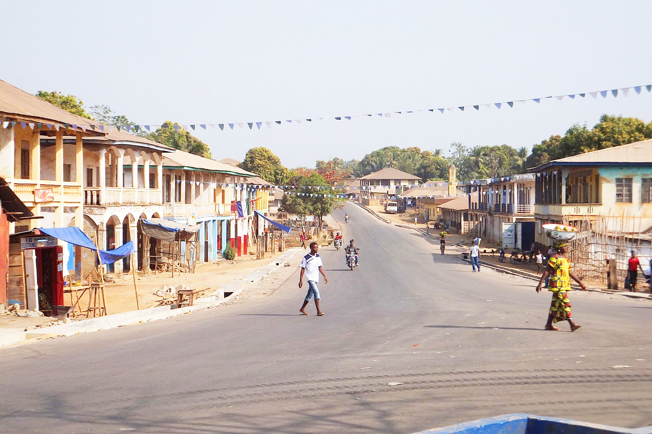 Magburaka, in the Northern Province
Climate Map
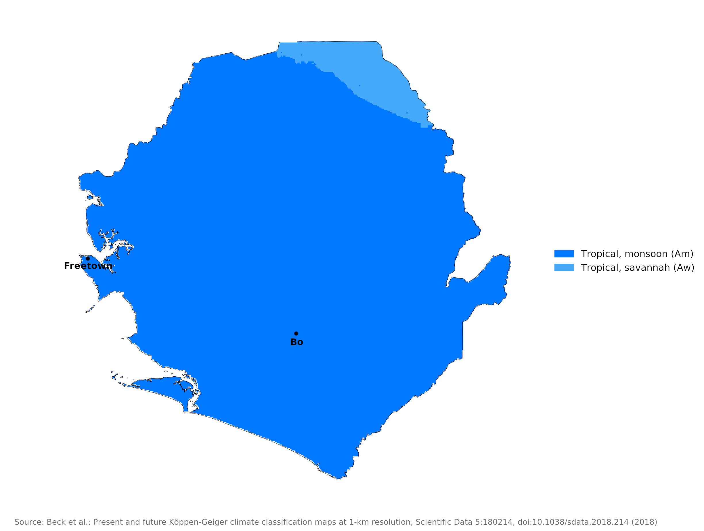 Climate map of Sierra Leone
What is the climate of Sierra Leone like?
Sierra Leone is a compact country in the southwestern part of West Africa. It is bounded on the north by Guinea, on the southeast by Liberia. Its coastline faces southwest towards the Atlantic Ocean and include an extensive coastal plain rising inland to a broad, moderately elevated plateau interspersed with occasional hills and mountains.
Because it is so close to the equator, Sierra Leone has a tropical climate with constantly high temperatures and, throughout most of the year, high humidity. The mean temperature is about 27°C (81°F) on the coast and almost as high on the eastern plateau.
In this part of Africa the intertropical belt of cloud and rain migrates northwards and southwards with the apparent movement of the overhead sun but lagging behind by some four to six weeks. From November to April, during the period of low sun, the weather is generally dry with many fine, hot, sunny days. The season of high sun, from May to October, is the rainy season. The rainfall increases to a peak in July and August and then decreases until rain has almost ceased by December. Along the coast the total annual rainfall is heavy everywhere, 4,000 to 4,500 millimeters (160 to 180 inches), and it averages around 3,000 millimeters (120 inches) in much of the country.
Temperatures are consistently high around the year on the coast and, during the dry season, rise even higher inland. During the rainy season the coastal region is most uncomfortable because of the high relative humidity which rarely drops below 80% during the daytime. The combination of constant high temperature and humidity makes this an uncomfortable climate. High temperatures inland are to some extend mitigated by the lower humidity. The harmattan, a persistent northeast wind from the Sahara Desert, which blows during the dry season, is a hot, dry wind, and is often dust-laden.
Sunshine amounts are rather low on the coast, particularly during the wet season when they average two to three hours a day. These figures rise inland. During the dry season they rise to eight to nine hours a day inland, but in some places on the coast they may be as low as five to six.
Freetown illustrates conditions around the year in the coastal districts of Sierra Leone. The climate of Bo shows inland conditions in the south of the country.
| Climate data for Freetown (1961-1990) | |||||||||||||
|---|---|---|---|---|---|---|---|---|---|---|---|---|---|
| Month | Jan | Feb | Mar | Apr | May | Jun | Jul | Aug | Sep | Oct | Nov | Dec | Year |
| Average high °C (°F) | 29.9 (85.8) | 30.3 (86.5) | 30.9 (87.6) | 31.2 (88.2) | 30.9 (87.6) | 30.1 (86.2) | 28.7 (83.7) | 28.4 (83.1) | 29.0 (84.2) | 29.9 (85.8) | 30.1 (86.2) | 29.7 (85.5) | 29.9 (85.9) |
| Daily mean °C (°F) | 27.3 (81.1) | 27.6 (81.7) | 28.1 (82.6) | 28.5 (83.3) | 28.3 (82.9) | 27.4 (81.3) | 26.3 (79.3) | 25.9 (78.6) | 26.4 (79.5) | 27.1 (80.8) | 27.7 (81.9) | 27.5 (81.5) | 27.3 (81.2) |
| Average low °C (°F) | 23.8 (74.8) | 24.0 (75.2) | 24.4 (75.9) | 24.8 (76.6) | 24.4 (75.9) | 23.6 (74.5) | 23.1 (73.6) | 23.0 (73.4) | 23.1 (73.6) | 23.4 (74.1) | 24.0 (75.2) | 24.1 (75.4) | 23.8 (74.9) |
| Average precipitation mm (inches) | 8.0 (0.31) | 6.0 (0.24) | 28.0 (1.10) | 68.0 (2.68) | 214.0 (8.43) | 522.0 (20.55) | 1,190 (46.85) | 1,078 (42.44) | 800.0 (31.50) | 333.0 (13.11) | 148.0 (5.83) | 38.0 (1.50) | 4,433 (174.54) |
| Source: NOAA | |||||||||||||
| Climate data for Bo | |||||||||||||
|---|---|---|---|---|---|---|---|---|---|---|---|---|---|
| Month | Jan | Feb | Mar | Apr | May | Jun | Jul | Aug | Sep | Oct | Nov | Dec | Year |
| Average high °C (°F) | 32.2 (90.0) | 33.8 (92.8) | 34.3 (93.7) | 33.4 (92.1) | 32.0 (89.6) | 30.4 (86.7) | 28.6 (83.5) | 28.4 (83.1) | 29.4 (84.9) | 30.8 (87.4) | 31.2 (88.2) | 31.2 (88.2) | 31.3 (88.3) |
| Daily mean °C (°F) | 25.4 (77.7) | 26.6 (79.9) | 27.3 (81.1) | 27.3 (81.1) | 26.5 (79.7) | 25.6 (78.1) | 24.7 (76.5) | 24.4 (75.9) | 24.9 (76.8) | 25.5 (77.9) | 25.9 (78.6) | 25.4 (77.7) | 25.8 (78.4) |
| Average low °C (°F) | 19.2 (66.6) | 20.3 (68.5) | 20.5 (68.9) | 22.0 (71.6) | 22.1 (71.8) | 21.9 (71.4) | 21.9 (71.4) | 21.9 (71.4) | 21.7 (71.1) | 21.5 (70.7) | 21.5 (70.7) | 20.3 (68.5) | 21.2 (70.2) |
| Average precipitation mm (inches) | 5.8 (0.23) | 15.8 (0.62) | 41.6 (1.64) | 114.2 (4.50) | 254.7 (10.03) | 328.5 (12.93) | 429.3 (16.90) | 488.9 (19.25) | 428.2 (16.86) | 338.4 (13.32) | 148.9 (5.86) | 22.3 (0.88) | 2,616.6 (103.02) |
| Source: NOAA | |||||||||||||
References
- E. A. Pearce, Charles Gordon Smith, (1990) The Hutchinson World Weather Guide, John Murray Press. ISBN 1859863426
- Timothy L. Gall, (ed.), (2003), Worldmark Encyclopedia of the Nations, Eleventh Edition, Thomson Gale
- The American University, (1976), Area Handbook for Sierra Leone. United States Government Printing Office.
- Hugh Chisholm, (ed.), (1911), Encyclopædia Britannica, Eleventh edition, Cambridge University Press
The Climate of
Sierra Leone
In summary:
Sierra Leone has a tropical climate. The mean temperature is about 27°C (81°F) on the coast and almost as high on the eastern uplands.
There is a rainy season from May through October, and a dry season from November to April. Annual rainfall is high, averaging 4,400 mm (180 in) at Freetown, and more than 3,150 millimeters (125 inches) in most of the country.