The Climate of the
Ivory Coast
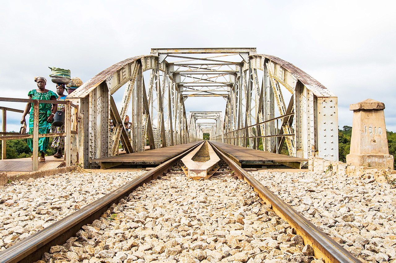 Bridge over the N'Zi river at Dimbokro
Climate Map
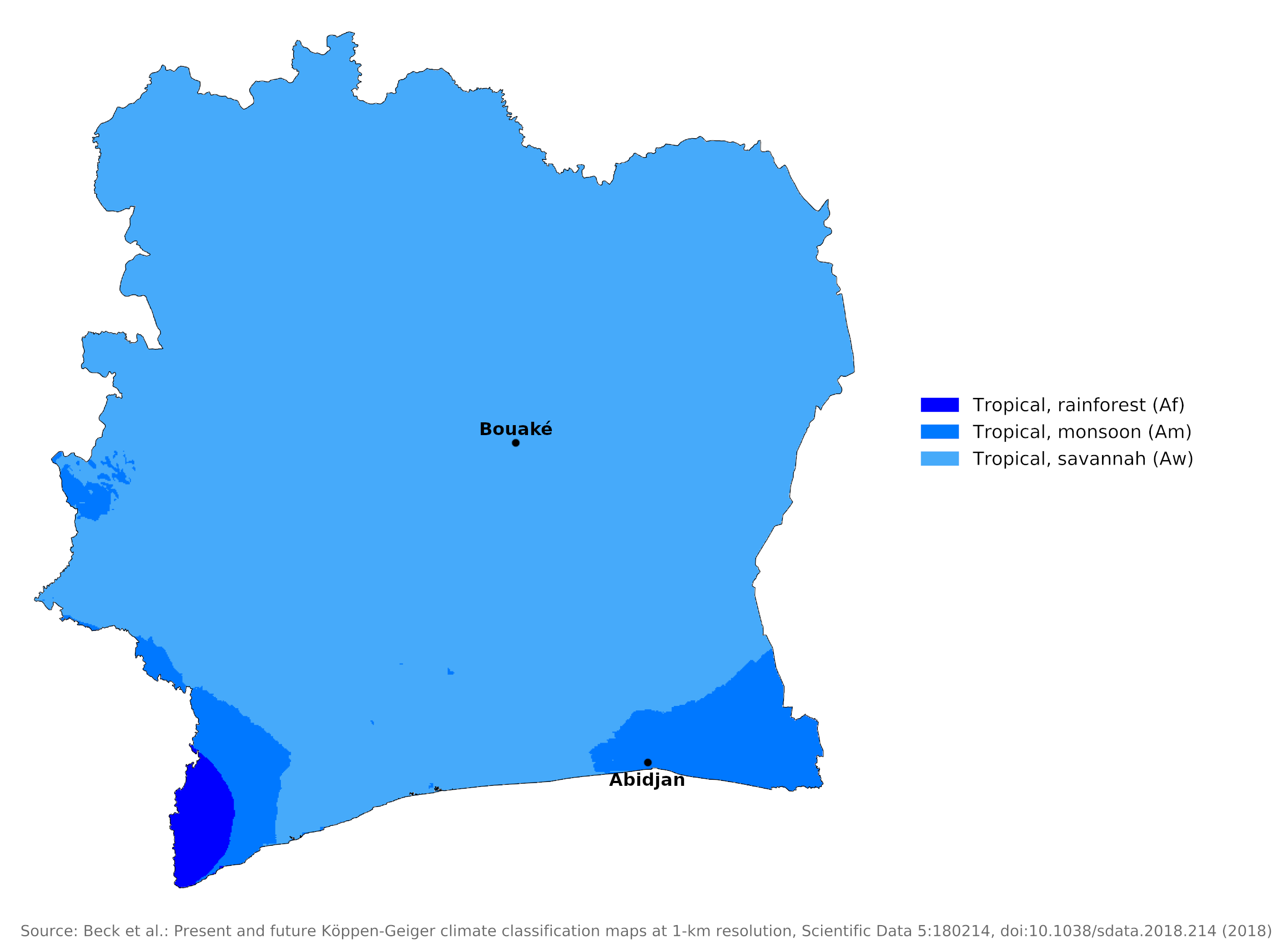 Climate map of Côte d'Ivoire
What is the climate of Côte d'Ivoire like?
Côte d'Ivoire is situated in West Africa with a coastline on the Gulf of Guinea between Liberia on the west and Ghana on the east. Inland is shares borders with Guinea, Mali, and Burkina Faso.
Côte d'Ivoire has a warm, humid climate that transitions from equatorial to tropical. Seasons can be distinguished more clearly by precipitation and wind direction than by temperature. Continental and maritime air masses, following the Sun's apparent north-south movement, determine the cycle of seasons associated with heat and cold further from the equator.
During half of the year, a warm maritime air mass pushes over Ivory Coast in response to the sun's northward movement. Ahead of that, a low-pressure belt or intertropical front brings warm air, rain, and prevailing winds from the southwest. When the solar cycle reverses, a dry continental air mass moves south across the nation, allowing the dusty "harmattan" wind to dominate. Winds are gentle, rarely exceeding fifteen to twenty kilometers per hour (8–12 mph).
Average temperatures are between 25°C and 30°C (77–86°F) and range from 10°C to 40°C (50–104°F). Temperatures are higher in the north but may exceed 30°C even in the south. Annual and daily ranges of both temperature and humidity are small along the coast but increase progressively toward the north.
The coastal region has two rainy seasons, one peaking in May or June, the other in October, but in the north there is a single rainy season starting in May or June. The greatest annual rainfall, about 2,000 millimeters (79 inches), is along the coast and in the southwest. The coastal region has a long dry season from December to April, followed by heavy rains from May to September. Farther north, there is only one wet and one dry season, with rainfall heaviest in summer, culminating in September, and lightest in January. The country’s lightest rainfall is in the northeast, averaging 1,100 mm (43 inches) annually.
The climate of the coastal region is represented by Abidjan which is wetter than Accra in Ghana. On the coast the period from December to February is least likely to experience rainy days. Rainfall becomes progressively less inland and the two separate rainy seasons merge into a single wet season; there is a much longer dry season at the time of low sun. At this time temperatures are warm to hot with a very low relative humidity and the dust-laden harmattan, wind blows from the northeast. From December to February the harmattan affects the whole country, except a strip along the coast. The coast has southwesterly winds, the dry harmattan reaching right to the coast on only a few days.
| Climate data for Abidjan | |||||||||||||
|---|---|---|---|---|---|---|---|---|---|---|---|---|---|
| Month | Jan | Feb | Mar | Apr | May | Jun | Jul | Aug | Sep | Oct | Nov | Dec | Year |
| Average high °C (°F) | 30.5 (86.9) | 31.0 (87.8) | 31.1 (88.0) | 31.2 (88.2) | 30.4 (86.7) | 28.7 (83.7) | 27.4 (81.3) | 26.9 (80.4) | 27.6 (81.7) | 29.2 (84.6) | 30.5 (86.9) | 30.3 (86.5) | 29.6 (85.3) |
| Daily mean °C (°F) | 26.8 (80.2) | 27.7 (81.9) | 27.9 (82.2) | 27.7 (81.9) | 26.9 (80.4) | 25.8 (78.4) | 24.7 (76.5) | 24.5 (76.1) | 25.6 (78.1) | 26.8 (80.2) | 27.4 (81.3) | 27.0 (80.6) | 26.6 (79.9) |
| Average low °C (°F) | 23.5 (74.3) | 24.6 (76.3) | 24.9 (76.8) | 24.9 (76.8) | 24.6 (76.3) | 23.7 (74.7) | 22.9 (73.2) | 22.1 (71.8) | 22.3 (72.1) | 23.6 (74.5) | 24.4 (75.9) | 23.8 (74.8) | 23.8 (74.8) |
| Average precipitation mm (inches) | 16.3 (0.64) | 48.9 (1.93) | 106.7 (4.20) | 141.3 (5.56) | 293.5 (11.56) | 561.8 (22.12) | 205.7 (8.10) | 36.8 (1.45) | 80.5 (3.17) | 137.7 (5.42) | 143.3 (5.64) | 75.1 (2.96) | 1,847.6 (72.75) |
| Source: Deutscher Wetterdienst | |||||||||||||
Conditions in the north are well represented by Bouaké in the center of the country, where minimum and maximum temperatures in the dry season, average 22° and 34°C (72° and 93°F). The range is from 21° to 28°C (70° to 82°F) in August, the coolest month.
| Climate data for Bouaké | |||||||||||||
|---|---|---|---|---|---|---|---|---|---|---|---|---|---|
| Month | Jan | Feb | Mar | Apr | May | Jun | Jul | Aug | Sep | Oct | Nov | Dec | Year |
| Average high °C (°F) | 33.0 (91.4) | 33.5 (92.3) | 33.8 (92.8) | 32.7 (90.9) | 31.0 (87.8) | 29.9 (85.8) | 27.8 (82.0) | 27.7 (81.9) | 28.5 (83.3) | 30.1 (86.2) | 31.3 (88.3) | 31.7 (89.1) | 30.9 (87.6) |
| Daily mean °C (°F) | 26.6 (79.9) | 27.8 (82.0) | 27.8 (82.0) | 27.0 (80.6) | 26.1 (79.0) | 25.0 (77.0) | 24.1 (75.4) | 23.8 (74.8) | 24.3 (75.7) | 25.0 (77.0) | 25.7 (78.3) | 25.7 (78.3) | 25.7 (78.3) |
| Average low °C (°F) | 20.6 (69.1) | 21.8 (71.2) | 22.3 (72.1) | 22.0 (71.6) | 21.7 (71.1) | 21.2 (70.2) | 20.8 (69.4) | 20.9 (69.6) | 21.1 (70.0) | 21.3 (70.3) | 21.3 (70.3) | 20.3 (68.5) | 21.3 (70.3) |
| Average precipitation mm (inches) | 12.5 (0.49) | 40.0 (1.57) | 83.8 (3.30) | 126.4 (4.98) | 123.7 (4.87) | 147.2 (5.80) | 117.5 (4.63) | 128.0 (5.04) | 168.1 (6.62) | 107.9 (4.25) | 30.2 (1.19) | 14.6 (0.57) | 1,099.9 (43.30) |
| Source: NOAA | |||||||||||||
References
- E. A. Pearce, Charles Gordon Smith, (1990) The Hutchinson World Weather Guide, John Murray Press. ISBN 1859863426
- Timothy L. Gall, (ed.), (2003), Worldmark Encyclopedia of the Nations, Eleventh Edition, Thomson Gale
- Federal Research Division, Library of Congress, (1991), Côte d'Ivoire: a country study. Claitor's Pub. Division.
- Hugh Chisholm, (ed.), (1911), Encyclopædia Britannica, Eleventh edition, Cambridge University Press
The Climate of
Côte d'Ivoire
In summary:
Côte d’Ivoire has a warm, humid climate that transitions from equatorial to tropical. Temperatures average between 25°C (75°F) and 32°C (90°F), with extremes of 10°C (50°F) to 40°C (104°F) depending on the time of year and the area of the country.
In the north, heavy rains occur between June and October, averaging 1100 millimeters (43 inches) annually. Along the coast and the southwest, some rain falls in most months, but rain is heaviest between May and September, with average rainfall of 1100 to 2000 millimeters (43 to 87 inches) annually. The major dry season lasts from December to April.