The Climate of
Nigeria
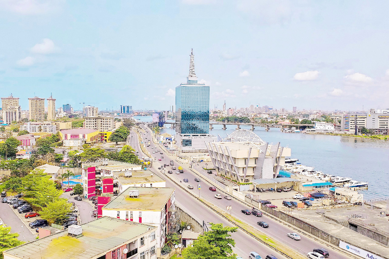
 Civic Towers and surrounding areas, Victoria Island, Lagos
Climate Map
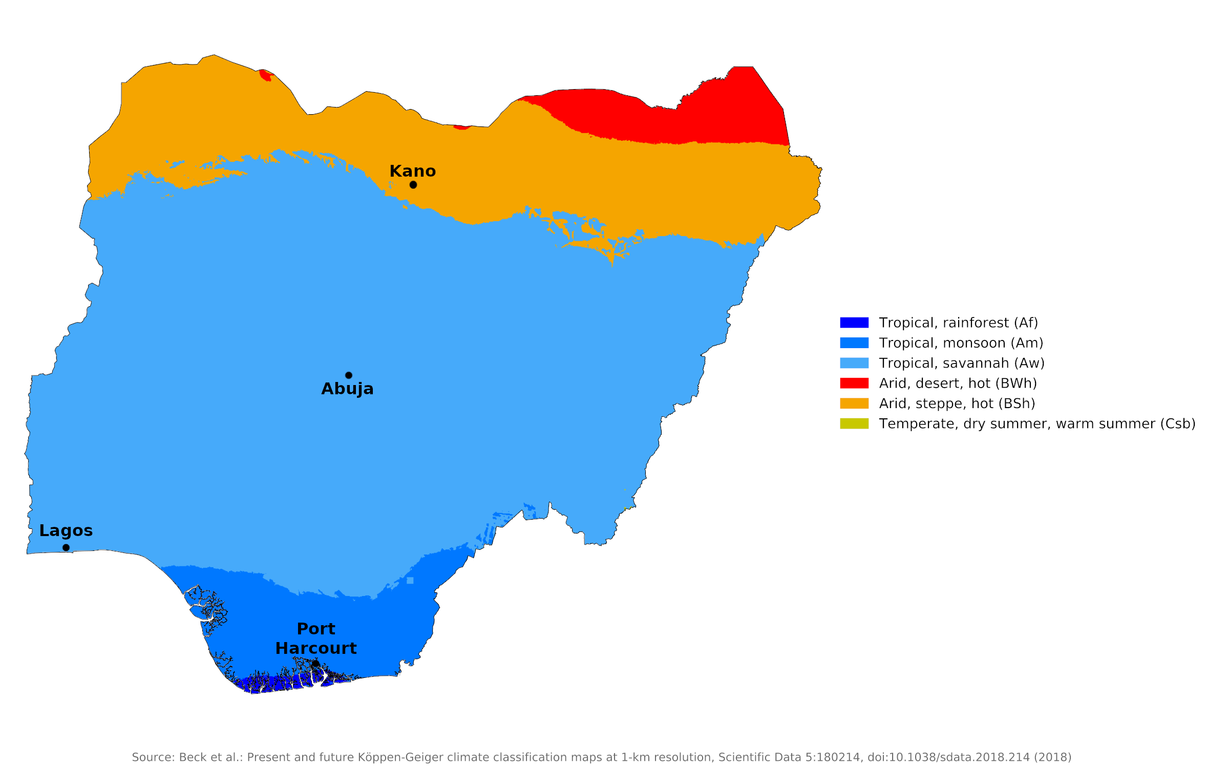
 Climate map of Nigeria
What is the climate of Nigeria like?
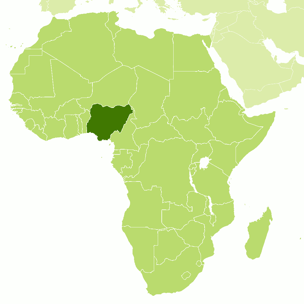
Nigeria is located in western Africa and borders the Gulf of Guinea. The country also shares borders with Chad, Cameroon, Benin, and Niger. It is about one and a half times the size of the state of Texas and extends north to 14°N. A vast low coastal plain rises gradually inland to hill and plateau country with an average elevation of 450 to 900 meters (1,500–3,000 feet). Nigeria only has significantly higher mountains in the southeast.
The climate in Nigeria varies from equatorial in the south to tropical in the middle and arid in the north. The seasons are not sharply demarcated near the coast. Temperatures rarely exceed 33°C (91°F), but humidity is very high and nights are hot. Inland, there are two distinct seasons: a rainy season from April to October with generally lower temperatures, and a dry season from November to March with midday temperatures in excess of 38°C (100°F) but relatively cool nights as low as 12°C (54°F). Temperatures are more moderate on the Jos plateau in the center of the country. Although average temperatures vary little from coastal to inland areas, inland areas, especially in the northeast, have greater extremes.
Nigeria experiences a marked alternation of wet and dry seasons in most areas. Two air masses control rainfall—moist northward-moving maritime air coming from the Atlantic Ocean and dry continental air coming south from the African landmass. The weather is dominated by the annual migration of the intertropical cloud belt and the associated heavy rain, high humidity and relatively low temperatures. The northern side of this cloud and rain belt experiences drier and sunnier weather with higher temperatures. The cloud and rain belt lies on the south side of the point where the southwest to westerly winds of the Guinea monsoon give way to the northeast trade winds, or harmattan, which are dry and bring higher temperatures. The discontinuity between these winds, often referred to as the intratropical convergence, overlies or is near the coast in December and January and moves north to about 20°N in July and August. It then reverses somewhat faster between September and December back south. Thus, much of Nigeria and the western region experiences two rainy seasons when the intertropical convergence moves north or south; but in the north the two rainy seasons merge into a single rainy season between July and September.
In the coastal and south-eastern parts of Nigeria, the rainy season usually begins in February or March, when humid Atlantic air known as the south-west monsoon invades the country. The beginning of the rains is usually marked by the appearance of strong winds and strong but isolated squalls. The scattered quality of these precipitations is particularly noticeable in the north during dry years, when some small areas can experience copious amounts of rain, while other places are completely dry. In April or early May most years, the rainy season is underway in most of the area south of the Niger and Benue river valleys. Farther north, the rains usually don't come until June or July. In most of northern Nigeria, the peak of the rainy season occurs in August, when air from the Atlantic blankets the whole country. In southern regions, this period marks the fall in precipitation in August. Although rarely completely dry, this drop in precipitation, which is particularly pronounced in the southwest, allows a short dry period for the grain harvest.
From September to November, the northeast trade winds generally bring a season of clear skies, moderate temperatures, and lower humidity for most of the country. From December to February, however, the north-east trade winds blow strongly and often bring a load of fine dust from the Sahara. Known locally as harmattan, these dusty winds often appear as a dense fog, blanketing everything with a layer of fine particles. The harmattan is more common in the north but affects all of the country except for a narrow strip along the southwest coast. However, an occasional strong harmattan can sweep as far south as Lagos, bringing relief from the capital's high humidity and driving clouds of dust out to sea.
On or near the coast maximum rainfall occurs between May and July with a second maximum in September or October. Although no month is completely dry in the south near the coast, the main dry period is between December and February. In the north there is a longer dry season between October and April. At this time there is very little rain in the north and temperatures are warm to hot with very low relative humidity. At this time of year, the often dusty Harmattan blows from the northeast every day.
December to February has the fewest rainy days on the coast and this dry season is more noticeable than the 'little dry season' between July and September. Inland, and especially towards the north, the arrival time of the rains and the amount of rain can vary from year to year.
There is a considerable range in total annual rainfall across Nigeria. The wettest parts of Nigeria are the coastal region of the Niger Delta and the mountainous border with Cameroon in the southeast. Here annual rainfall exceeds 2,500 millimeters (100 inches) compared to 1,250 to 1,500 millimeters (50 to 60 inches) in much of western and central Nigeria. In the far north, annual rainfall is less than 1,000 millimeters (40 inches) almost everywhere, and as low as 600 millimeters (24 inches) in some places. Here the rainy season is rather short and the dry season longer. Droughts have become more common in recent years, particularly in the drier regions in the north.
The climate of Port Harcourt and Lagos is representative of the south coast of Nigeria. Abuja is representative of the inland districts of the center and Kano represents the arid northern region. Temperatures rise sharply in the north in the period from March to May before the onset of rains, but the rainy season can be just as uncomfortable due to the higher humidity brought by humid southwest winds. On the coast, high humidity and consistently high temperatures with very little relief make the weather rather uncomfortable all year round.
In the north of the country there is an average of six hours of sunshine per day during the rainy season, up to ten hours in the dry season. Near the coast, it averages about three hours a day during the wettest months, and six or seven hours during the driest time of the year.
| Climate data for Port Harcourt | |||||||||||||
|---|---|---|---|---|---|---|---|---|---|---|---|---|---|
| Month | Jan | Feb | Mar | Apr | May | Jun | Jul | Aug | Sep | Oct | Nov | Dec | Year |
| Average high °C (°F) | 32.4 (90.3) | 33.4 (92.1) | 32.6 (90.7) | 32.1 (89.8) | 31.2 (88.2) | 30.0 (86.0) | 28.8 (83.8) | 28.7 (83.7) | 29.3 (84.7) | 30.2 (86.4) | 31.3 (88.3) | 31.8 (89.2) | 31.0 (87.8) |
| Daily mean °C (°F) | 26.8 (80.2) | 28.0 (82.4) | 28.0 (82.4) | 27.7 (81.9) | 27.2 (81.0) | 26.4 (79.5) | 25.6 (78.1) | 25.6 (78.1) | 25.9 (78.6) | 26.3 (79.3) | 26.9 (80.4) | 26.6 (79.9) | 26.8 (80.1) |
| Average low °C (°F) | 21.2 (70.2) | 22.5 (72.5) | 23.3 (73.9) | 23.2 (73.8) | 23.2 (73.8) | 22.7 (72.9) | 22.4 (72.3) | 22.4 (72.3) | 22.4 (72.3) | 22.4 (72.3) | 22.4 (72.3) | 21.4 (70.5) | 22.5 (72.5) |
| Average precipitation mm (inches) | 22.2 (0.87) | 56.5 (2.22) | 116.3 (4.58) | 183.6 (7.23) | 222.7 (8.77) | 273.3 (10.76) | 356.5 (14.04) | 326.8 (12.87) | 367.1 (14.45) | 263.1 (10.36) | 96.9 (3.81) | 25.9 (1.02) | 2,310.9 (90.98) |
| Source: World Meteorological Organization | |||||||||||||
| Climate data for Lagos (1961–1990) | |||||||||||||
|---|---|---|---|---|---|---|---|---|---|---|---|---|---|
| Month | Jan | Feb | Mar | Apr | May | Jun | Jul | Aug | Sep | Oct | Nov | Dec | Year |
| Average high °C (°F) | 32.2 (90.0) | 33.2 (91.8) | 32.9 (91.2) | 32.2 (90.0) | 30.9 (87.6) | 29.3 (84.7) | 28.2 (82.8) | 28.3 (82.9) | 28.9 (84.0) | 30.3 (86.5) | 31.4 (88.5) | 31.8 (89.2) | 30.8 (87.4) |
| Daily mean °C (°F) | 27.3 (81.1) | 28.4 (83.1) | 28.5 (83.3) | 28.0 (82.4) | 27.0 (80.6) | 25.6 (78.1) | 25.2 (77.4) | 25.0 (77.0) | 25.5 (77.9) | 26.4 (79.5) | 27.2 (81.0) | 27.2 (81.0) | 26.8 (80.2) |
| Average low °C (°F) | 22.4 (72.3) | 23.7 (74.7) | 24.1 (75.4) | 23.7 (74.7) | 23.2 (73.8) | 21.9 (71.4) | 22.3 (72.1) | 21.8 (71.2) | 22.1 (71.8) | 22.4 (72.3) | 23.0 (73.4) | 22.5 (72.5) | 22.8 (73.0) |
| Average precipitation mm (inches) | 13.2 (0.52) | 40.6 (1.60) | 84.3 (3.32) | 146.3 (5.76) | 202.4 (7.97) | 315.5 (12.42) | 243.0 (9.57) | 121.7 (4.79) | 160.0 (6.30) | 125.1 (4.93) | 39.7 (1.56) | 14.8 (0.58) | 1,506.6 (59.31) |
| Source: Deutscher Wetterdienst | |||||||||||||
| Climate data for Abuja | |||||||||||||
|---|---|---|---|---|---|---|---|---|---|---|---|---|---|
| Month | Jan | Feb | Mar | Apr | May | Jun | Jul | Aug | Sep | Oct | Nov | Dec | Year |
| Record high °C (°F) | |||||||||||||
| Average high °C (°F) | 33.7 (92.7) | 37.1 (98.8) | 37.0 (98.6) | 34.9 (94.8) | 33.7 (92.7) | 30.4 (86.7) | 28.9 (84.0) | 28.4 (83.1) | 29.3 (84.7) | 30.1 (86.2) | 34.7 (94.5) | 34.8 (94.6) | 32.8 (91.0) |
| Daily mean °C (°F) | 26.1 (79.0) | 28.7 (83.7) | 30.5 (86.9) | 28.9 (84.0) | 28.6 (83.5) | 26.9 (80.4) | 25.9 (78.6) | 24.8 (76.6) | 25.4 (77.7) | 27.0 (80.6) | 28.0 (82.4) | 27.6 (81.7) | 27.4 (81.3) |
| Average low °C (°F) | 19.2 (66.6) | 22.2 (72.0) | 25.4 (77.7) | 24.5 (76.1) | 24.4 (75.9) | 23.4 (74.1) | 23.1 (73.6) | 22.4 (72.3) | 22.7 (72.9) | 23.6 (74.5) | 21.1 (70.0) | 20.8 (69.4) | 22.7 (72.9) |
| Average precipitation mm (inches) | 3 (0.1) | 7 (0.3) | 16 (0.6) | 73 (2.9) | 137 (5.4) | 187 (7.4) | 216 (8.5) | 272 (10.7) | 233 (9.2) | 117 (4.6) | 7 (0.3) | 2 (0.1) | 1,270 (50.1) |
| Source: Deutscher Wetterdienst | |||||||||||||
| Climate data for Kano (1981-2010) | |||||||||||||
|---|---|---|---|---|---|---|---|---|---|---|---|---|---|
| Month | Jan | Feb | Mar | Apr | May | Jun | Jul | Aug | Sep | Oct | Nov | Dec | Year |
| Average high °C (°F) | 29.0 (84.2) | 32.4 (90.3) | 36.4 (97.5) | 39.1 (102.4) | 37.1 (98.8) | 35.4 (95.7) | 32.0 (89.6) | 30.9 (87.6) | 32.3 (90.1) | 34.5 (94.1) | 33.1 (91.6) | 29.9 (85.8) | 33.5 (92.3) |
| Daily mean °C (°F) | 21.4 (70.5) | 24.3 (75.7) | 28.4 (83.1) | 31.8 (89.2) | 31.1 (88.0) | 29.6 (85.3) | 27.1 (80.8) | 26.1 (79.0) | 27.1 (80.8) | 27.9 (82.2) | 25.1 (77.2) | 22.1 (71.8) | 26.8 (80.2) |
| Average low °C (°F) | 13.7 (56.7) | 16.2 (61.2) | 20.4 (68.7) | 24.5 (76.1) | 25.0 (77.0) | 23.7 (74.7) | 22.1 (71.8) | 21.2 (70.2) | 21.9 (71.4) | 21.2 (70.2) | 17.1 (62.8) | 14.2 (57.6) | 20.1 (68.2) |
| Average precipitation mm (inches) | 0.0 (0.0) | 0.7 (0.03) | 1.9 (0.07) | 8.1 (0.32) | 71.3 (2.81) | 118.7 (4.67) | 209.0 (8.23) | 311.2 (12.25) | 137.0 (5.39) | 14.1 (0.56) | 1.0 (0.04) | 0.0 (0.0) | 873 (34.37) |
| Source: World Meteorological Organization | |||||||||||||
References
- E. A. Pearce, Charles Gordon Smith, (1990) The Hutchinson World Weather Guide, John Murray Press. ISBN 1859863426
- Timothy L. Gall, (ed.), (2003), Worldmark Encyclopedia of the Nations, Eleventh Edition, Thomson Gale
- Federal Research Division, Library of Congress, (1992), Nigeria: a country study. Claitor's Pub. Division. ISBN 0844407380
- Hugh Chisholm, (ed.), (1911), Encyclopædia Britannica, Eleventh edition, Cambridge University Press
The Climate of
Nigeria

In summary:
The climate in Nigeria varies from equatorial in the south, to tropical in the center, and arid in the north. Inland, the midday temperatures may surpass 38°C (100°F), but the nights can be cool, dropping as low as 12°C (54°F). Near the coast, temperatures rarely exceed 32°C (90°F), but humidity is high and nights are hot.
Average rainfall along the coast varies from about 1800 mm (70 in) in the west to about 4300 mm (170 in) in certain parts of the east. Inland, it decreases to around 1300 mm (50 in) over most of central Nigeria and only 500 mm (20 in) in the extreme north.