The Climate of
Guinea
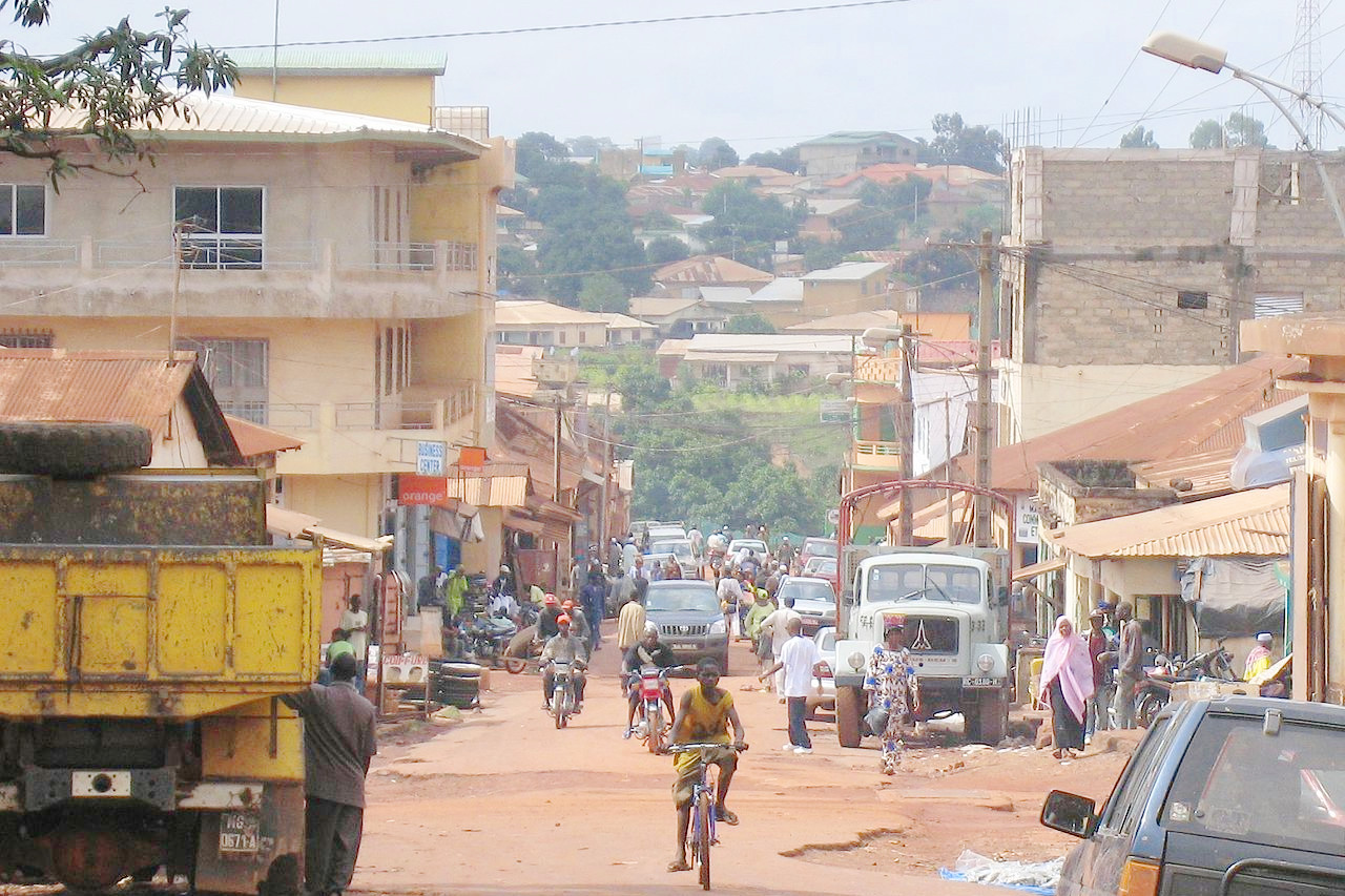 City of Labé
Climate Map
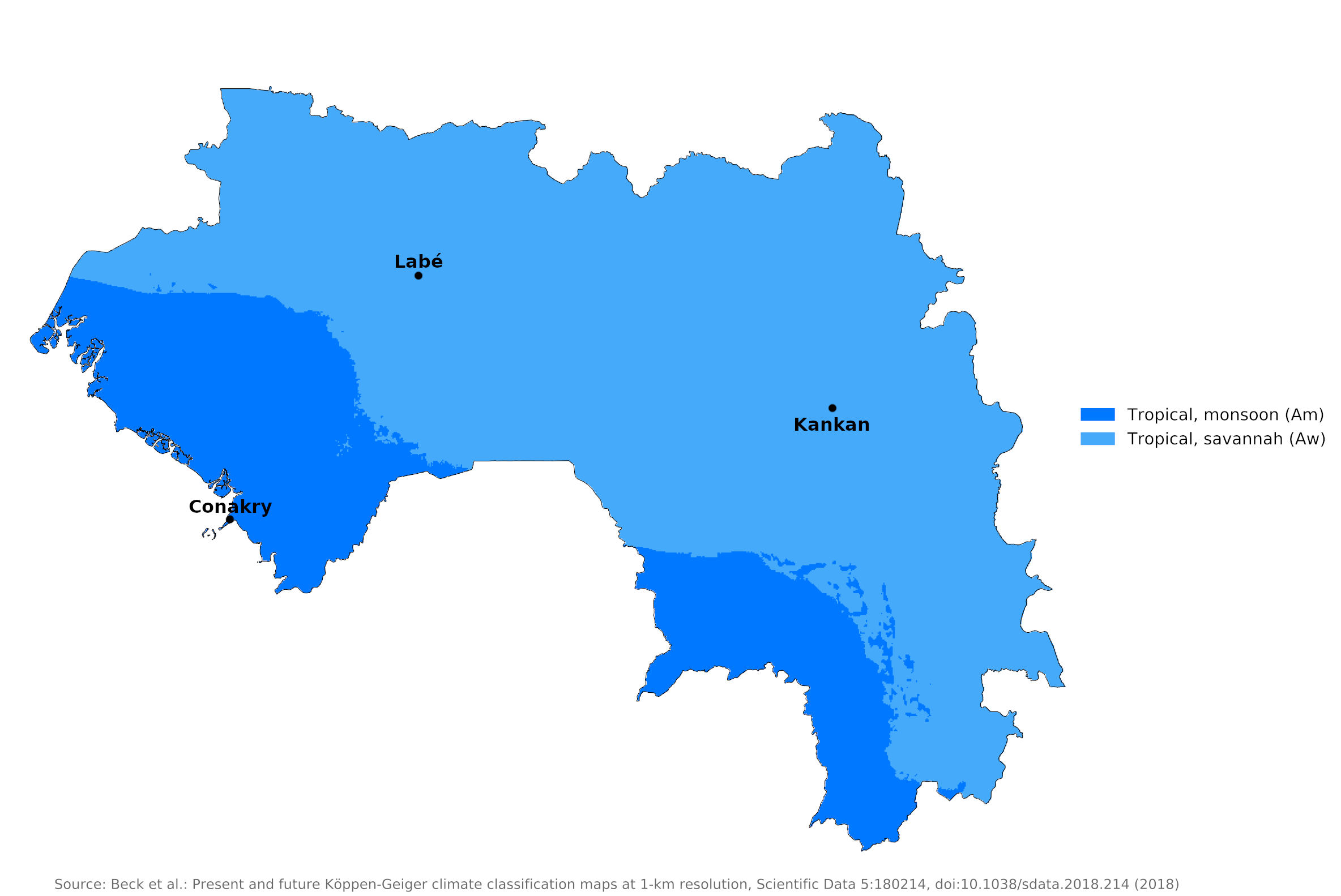 Climate map of Guinea
What is the climate of Guinea like?
Guinea is a West African country with an Atlantic coast. In terms of area, it is about the size of the United Kingdom. The country shares borders with Senegal, Mali, Côte d’Ivoire, Liberia, Sierra Leone, and Guinea-Bissau. Guinea is located around ten degrees north of the equator. It has an extensive coastal plain and inland the land rises to a plateau gradually sloping eastwards towards the upper Niger Valley.
There are basically two alternating seasons for the whole country. From November to March it rains little because there is a high pressure area in the north over the desert. The coastal region and much of the interior has a tropical climate with a long rainy season of six months, a relatively high and even annual temperature and high humidity.
Across the country, the weather is often unpredictable in both seasons. A rare thunderstorm with enough hail to turn the ground white can suddenly blow over Futa Jalon in mid-February, or a week of mild, clear skies can visit Conakry in early July.
The coast
On the coast, six months of dry weather are followed by six months of rain. The climate of the coastal region is represented by the climate of Conakry. Conakry's year-round average high temperature is 32°C (89°F) and low is 21°C (69°F). In Conakry, which lies on a promontory, it rains particularly heavily. Average rainfall is 3,800 millimeters (150 inches) per year. April is the hottest month; July and August are the wettest.
| Climate data for Conakry (1961-1990) | |||||||||||||
|---|---|---|---|---|---|---|---|---|---|---|---|---|---|
| Month | Jan | Feb | Mar | Apr | May | Jun | Jul | Aug | Sep | Oct | Nov | Dec | Year |
| Average high °C (°F) | 32.2 (90.0) | 33.1 (91.6) | 33.4 (92.1) | 33.6 (92.5) | 33.2 (91.8) | 31.8 (89.2) | 30.2 (86.4) | 29.9 (85.8) | 30.6 (87.1) | 30.9 (87.6) | 32.0 (89.6) | 32.2 (90.0) | 31.9 (89.4) |
| Daily mean °C (°F) | 26.1 (79.0) | 26.5 (79.7) | 27.0 (80.6) | 27.4 (81.3) | 27.5 (81.5) | 26.5 (79.7) | 25.5 (77.9) | 25.2 (77.4) | 25.6 (78.1) | 26.3 (79.3) | 27.0 (80.6) | 26.6 (79.9) | 26.4 (79.5) |
| Average low °C (°F) | 19.0 (66.2) | 20.2 (68.4) | 21.2 (70.2) | 22.0 (71.6) | 20.7 (69.3) | 20.2 (68.4) | 20.4 (68.7) | 20.8 (69.4) | 20.7 (69.3) | 20.4 (68.7) | 21.0 (69.8) | 20.1 (68.2) | 20.6 (69.1) |
| Average precipitation mm (inches) | 1 (0.0) | 1 (0.0) | 3 (0.1) | 22 (0.9) | 137 (5.4) | 396 (15.6) | 1,130 (44.5) | 1,104 (43.5) | 617 (24.3) | 295 (11.6) | 70 (2.8) | 8 (0.3) | 3,784 (149.0) |
| Source: NOAA | |||||||||||||
Central highlands
Rainfall in the central highlands—Futa Djallon—is much less (about 1,500 to 2,000 millimeters or 60 to 80 inches) and more erratic, and temperatures are lower; In addition, the daily temperature range is much larger, especially during the dry season when it can vary by 15°C (25°F) daily. The range in temperature and a relatively slow onset of the rainy season give the Futa Jalon a very pleasant climate. The climate of the highlands is represented by that of Labé.
There are more highlands in south-eastern Guinea, where rainfall averages about 2,800 cm (110 inches) per year; Temperatures are relatively mild due to the altitude, but with a large daily variation of around 18°C (32°F). At lower altitudes, temperatures resemble those of the coastal areas; at higher elevations, the nights can be quite cool all year-round. There is a tendency for rather violent storms to accompany the beginning of the rains.
| Climate data for Labé | |||||||||||||
|---|---|---|---|---|---|---|---|---|---|---|---|---|---|
| Month | Jan | Feb | Mar | Apr | May | Jun | Jul | Aug | Sep | Oct | Nov | Dec | Year |
| Average high °C (°F) | 31.8 (89.2) | 33.3 (91.9) | 34.4 (93.9) | 34.4 (93.9) | 33.8 (92.8) | 30.8 (87.4) | 28.3 (82.9) | 27.7 (81.9) | 28.2 (82.8) | 28.8 (83.8) | 31.0 (87.8) | 30.5 (86.9) | 31.1 (88.0) |
| Daily mean °C (°F) | 19.4 (66.9) | 21.3 (70.3) | 23.2 (73.8) | 26.1 (79.0) | 24.3 (75.7) | 22.9 (73.2) | 20.6 (69.1) | 21.5 (70.7) | 21.5 (70.7) | 21.6 (70.9) | 18.8 (65.8) | 19.1 (66.4) | 21.7 (71.1) |
| Average low °C (°F) | 5.7 (42.3) | 4.7 (40.5) | 5.2 (41.4) | 12.2 (54.0) | 15.1 (59.2) | 15.2 (59.4) | 15.0 (59.0) | 15.5 (59.9) | 14.8 (58.6) | 13.0 (55.4) | 8.4 (47.1) | 6.1 (43.0) | 10.9 (51.6) |
| Average precipitation mm (inches) | 2 (0.1) | 4 (0.2) | 9 (0.4) | 35 (1.4) | 141 (5.6) | 233 (9.2) | 315 (12.4) | 340 (13.4) | 288 (11.3) | 141 (5.6) | 34 (1.3) | 2 (0.1) | 1,544 (61) |
| Source: NOAA | |||||||||||||
Upper Guinea
In the northeast lie the savannahs of Upper Guinea. Here the precipitation is typically lower than in the Futa Djallon; The average daily temperature range is up to 15°C (25°F) and even more in the dry season. The driest part of Guinea is in the northeast along the border with Mali.
In Upper Guinea, the rainfall is around sixty inches a year. In the northeast, temperatures as high as 40°C (104°F) are fairly common during the dry season. A hot, dry wind, called the harmattan, blows southwest off the desert and directly affects Upper Guinea. Though the harmattan winds blow hot during the day, the nights are often uncomfortably cool. The coming of the rains in June are often marked by strong winds and impressive displays of lightning.
| Climate data for Kankan | |||||||||||||
|---|---|---|---|---|---|---|---|---|---|---|---|---|---|
| Month | Jan | Feb | Mar | Apr | May | Jun | Jul | Aug | Sep | Oct | Nov | Dec | Year |
| Average high °C (°F) | 36.5 (97.7) | 38.1 (100.6) | 38.9 (102.0) | 38.8 (101.8) | 37.1 (98.8) | 33.2 (91.8) | 32.2 (90.0) | 31.7 (89.1) | 32.7 (90.9) | 33.9 (93.0) | 34.7 (94.5) | 35.2 (95.4) | 35.3 (95.5) |
| Daily mean °C (°F) | 24.3 (75.7) | 26.3 (79.3) | 29.6 (85.3) | 30.1 (86.2) | 28.3 (82.9) | 26.4 (79.5) | 25.3 (77.5) | 25.1 (77.2) | 25.5 (77.9) | 26.4 (79.5) | 27.0 (80.6) | 23.8 (74.8) | 26.5 (79.7) |
| Average low °C (°F) | 10.8 (51.4) | 13.3 (55.9) | 17.0 (62.6) | 20.2 (68.4) | 19.6 (67.3) | 18.8 (65.8) | 18.9 (66.0) | 18.8 (65.8) | 18.9 (66.0) | 19.0 (66.2) | 13.9 (57.0) | 11.0 (51.8) | 16.7 (62.1) |
| Average precipitation mm (inches) | 2 (0.1) | 1 (0.0) | 24 (0.9) | 67 (2.6) | 134 (5.3) | 204 (8.0) | 262 (10.3) | 322 (12.7) | 304 (12.0) | 131 (5.2) | 20 (0.8) | 1.2 (0.05) | 1,472.2 (57.95) |
| Source: NOAA | |||||||||||||
References
- E. A. Pearce, Charles Gordon Smith, (1990) The Hutchinson World Weather Guide, John Murray Press. ISBN 1859863426
- Timothy L. Gall, (ed.), (2003), Worldmark Encyclopedia of the Nations, Eleventh Edition, Thomson Gale
- Allan Carpenter, (1976), Enchantment of Africa: Guinea, Chicago: Childrens Press. ISBN 0516045679
- Hugh Chisholm, (ed.), (1911), Encyclopædia Britannica, Eleventh edition, Cambridge University Press
The Climate of
Guinea
In summary:
The coast and much of the inland area have a tropical climate with a long rainy season of six months, a relatively high and uniform annual temperature, and high humidity. April is the hottest month; July and August are the wettest. Temperatures in the Highlands, or Fouta, are more moderate, and in the dry season they may vary daily by 15°C (25°F).
The coastal regions receive as much as 4300 mm (169 in) of monsoon rains annually, with half of the rainfall in July and August. The central highlands, receive about 1500 to 2000 mm (60 to 80 inches), while the southeast highlands receive 2800 mm (110 in) annually. The driest part of Guinea is in the northeast along the border with Mali.