The Geography of
Brittany
Why visit Brittany?
Brittany stands where the English Channel and the Atlantic meet. It seems remote from the rest of France. Here the old legends, customs and dress still survive, and the people are "different," being of Celtic origin. The coast is rocky, long and irregular, and is lined with reefs and innumerable little islets. The interior, by contrast has chains of round-topped hills. The hills nowhere exceed 400 m / 1300 feet in height, but from their wild nature they have the appearance of high mountains. Apple orchards, protected here from the ocean winds, furnish cider, the favorite drink of the region. Near Carnac are the menhirs, gigantic monuments in granite erected more than 4,000 years ago.
Contents
Map
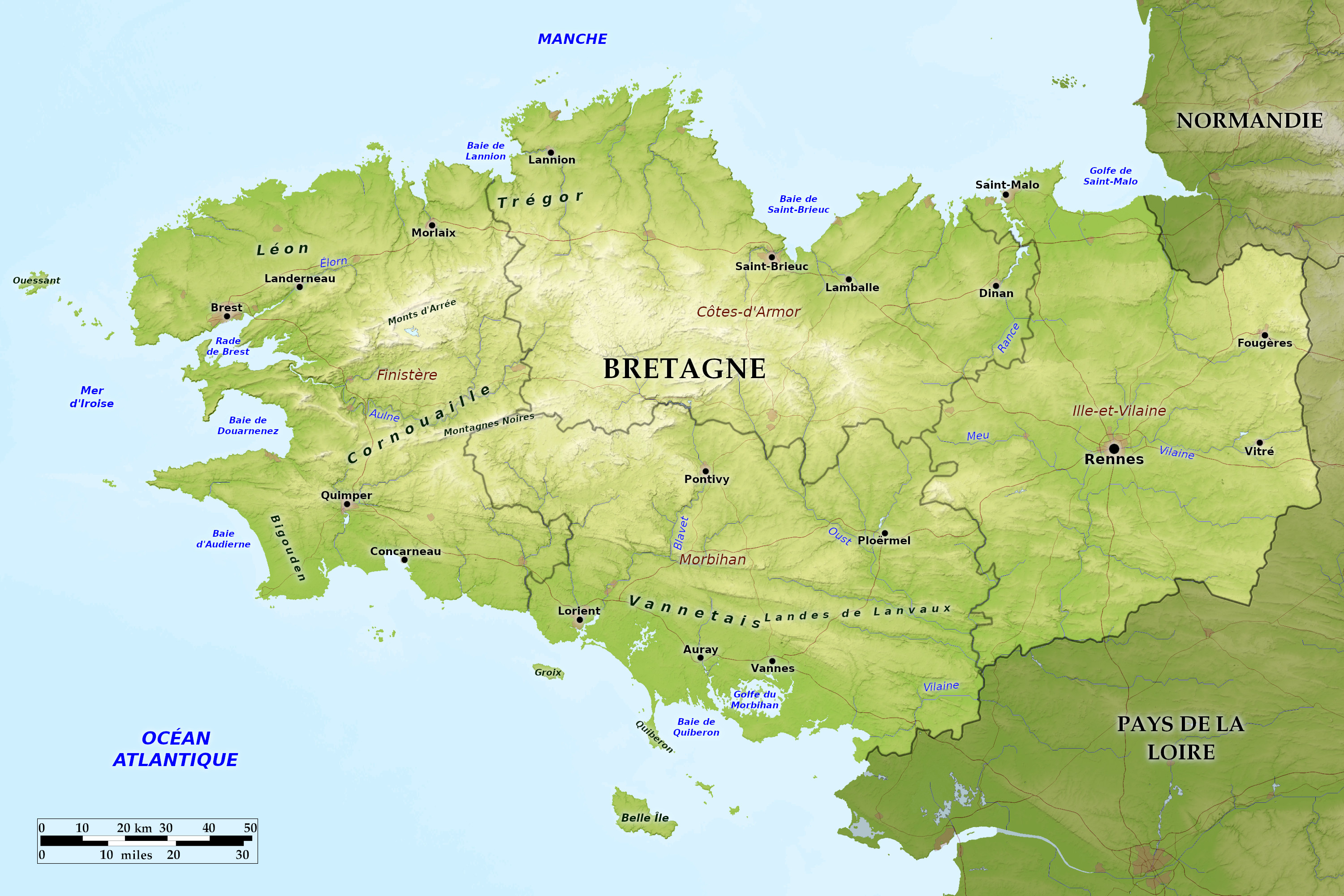 Relief map of Brittany
What is the landscape of Brittany like?
Brittany is an attractive holiday spot, partly because of its mild weather and beautiful scenery, and partly because of its interesting history. The scenery of the granite moorlands of central Brittany is very beautiful, and closely resembles that of southwest England. In the heart of Brittany are plateaus, partly covered with moorland, including the Montagnes Noires in the south, and the Monts d’Arrée in the north. These ranges are not high, but from their wild nature they recall high mountains.
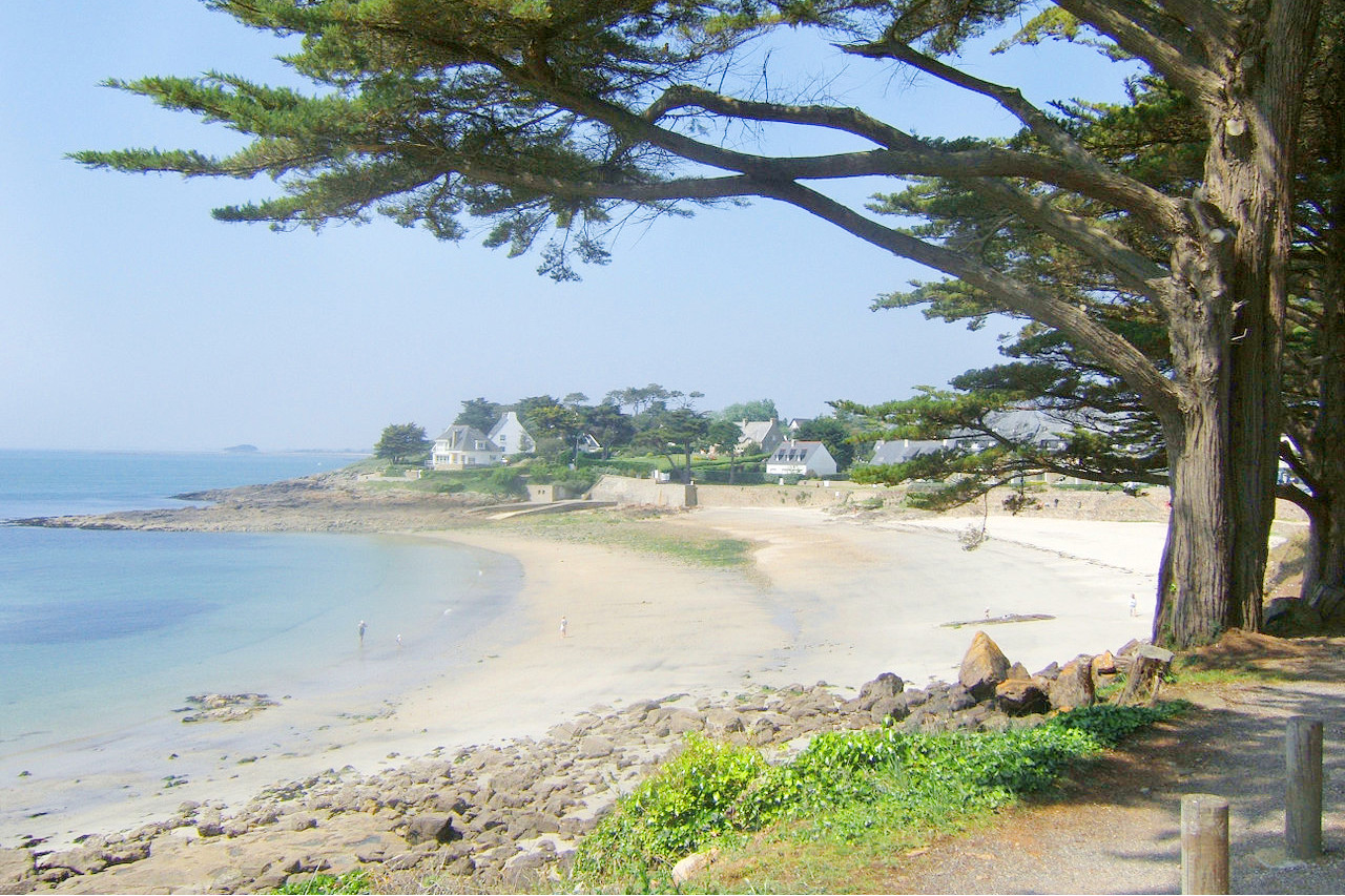
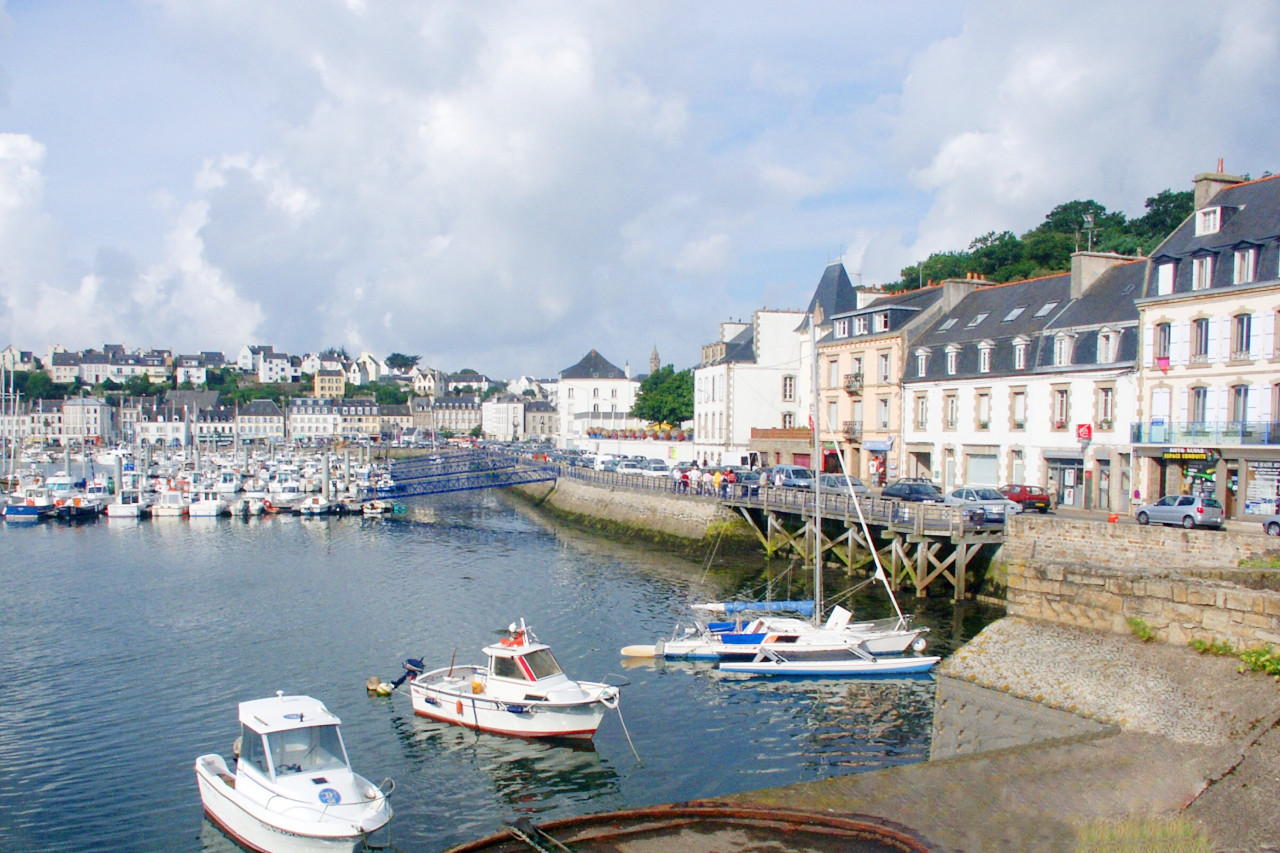
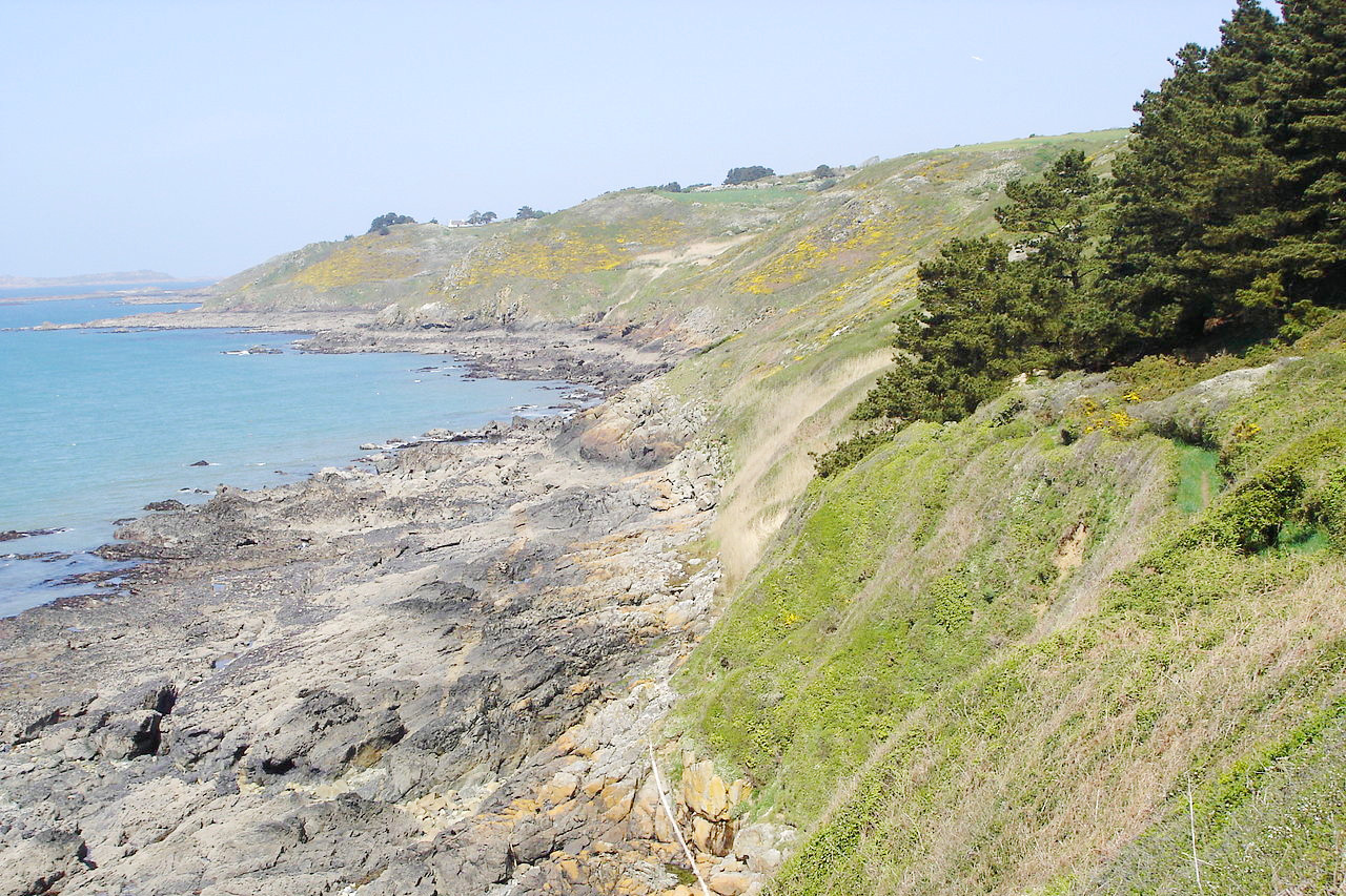
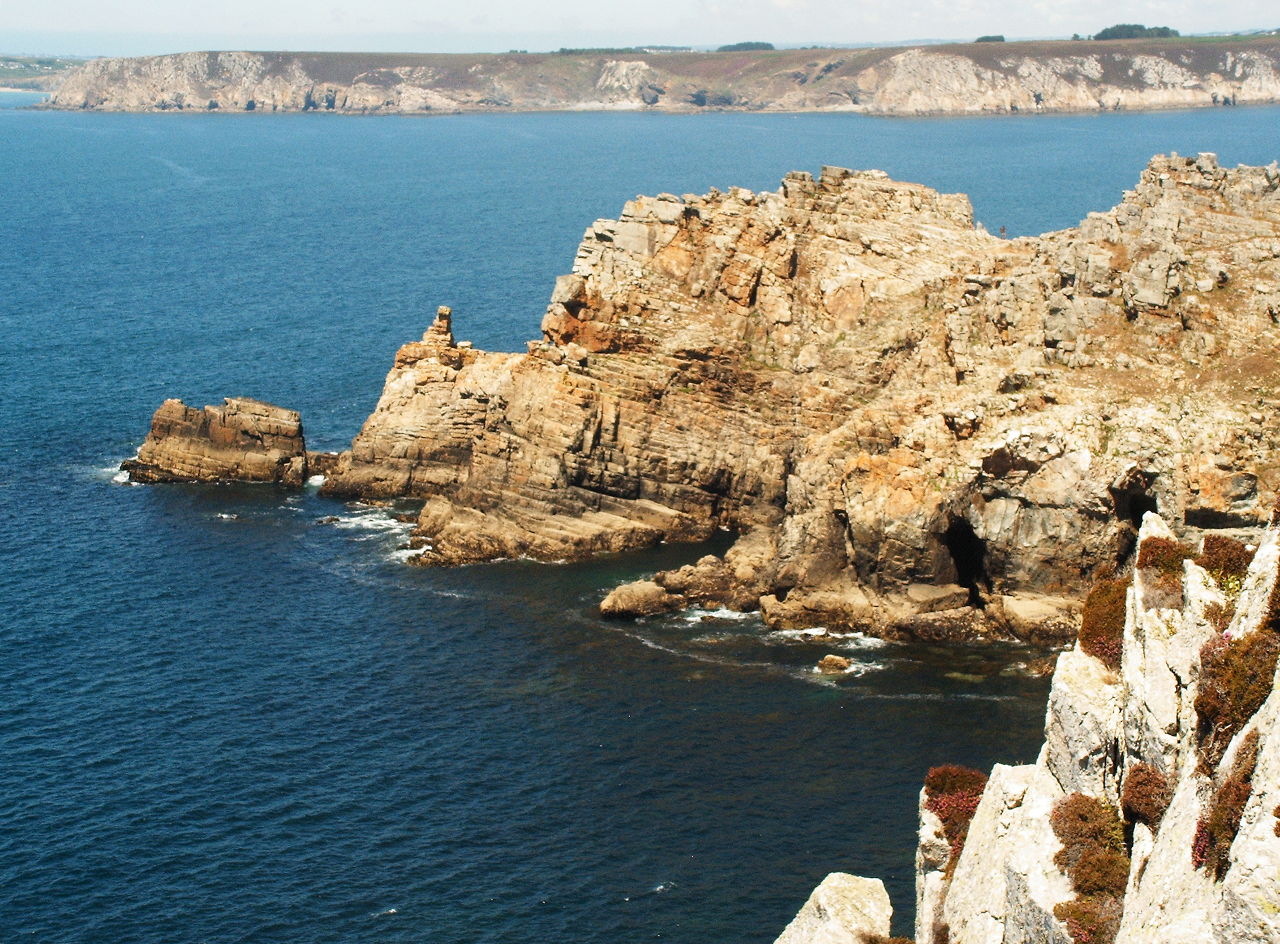
The coast line is rocky and rugged and indented by numerous estuaries, and is rocky and lined with reefs and islets, and the Bretons have a long seafaring tradition. The Pointe du Raz, the most western point of France, juts out into the Atlantic. St-Malo, across the harbor from Dinard, is a walled city with massive medieval ramparts. There are scores of delightful little fishing-villages along the Brittany coast where traditions are preserved, and then there are a number of small islands on which to stay. Climatically, too, the region is very similar to southwest England. The equable temperatures and rainfall give rise to luxuriant pastures, and there are extensive apple orchards for cider making.
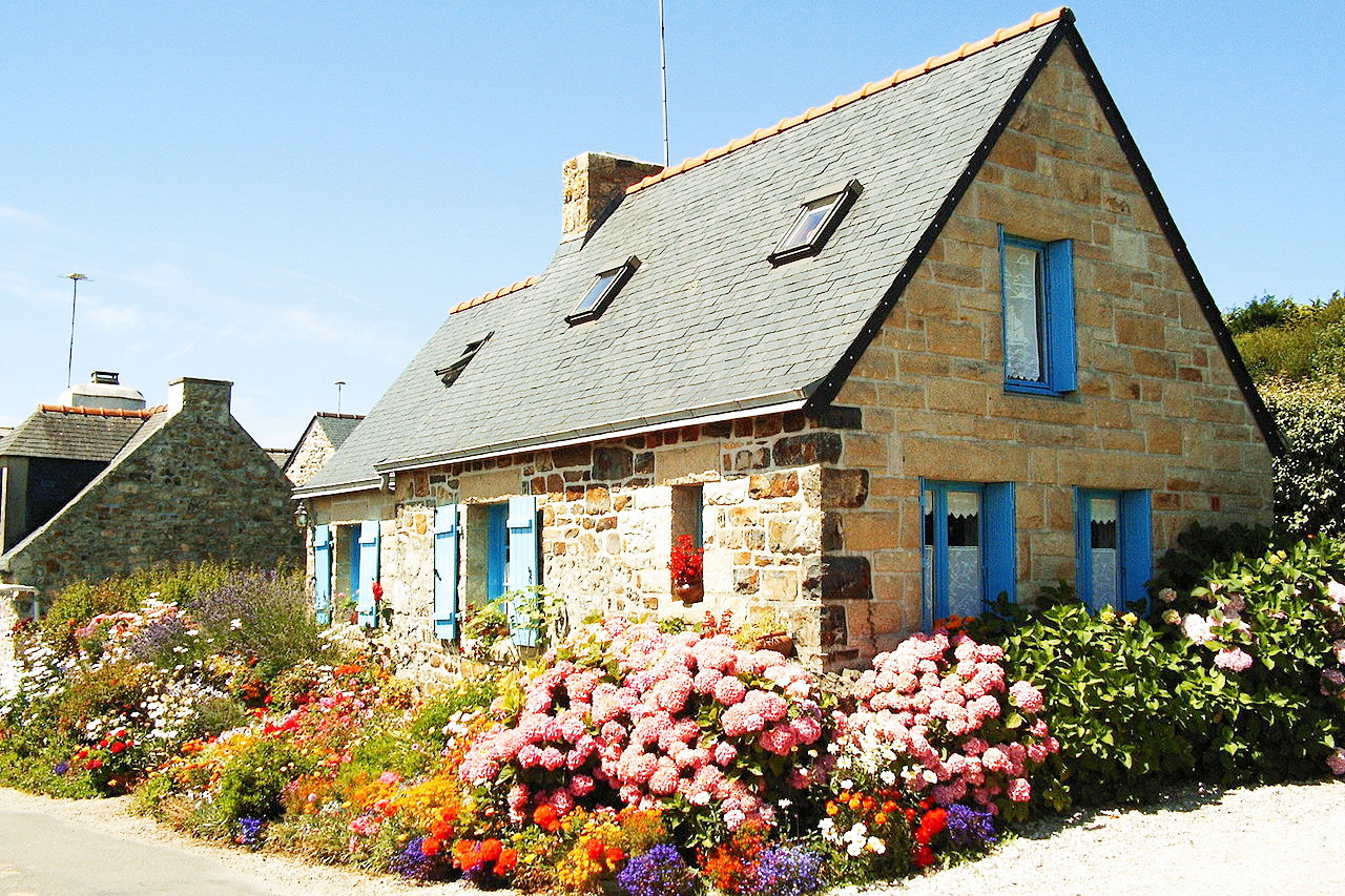
Culturally, Brittany can be divided into Breton Brittany in the west and Gallic Brittany in the east. Breton customs are most evident in the western portion of the region. The Bretons differ from the rest of the people of France. The Breton language is of Celtic origin, and they are descendants of early peoples who were pushed westward by successive invasions from the east. In speech, traditions and customs the Bretons are very similar to the Welsh and Cornish.
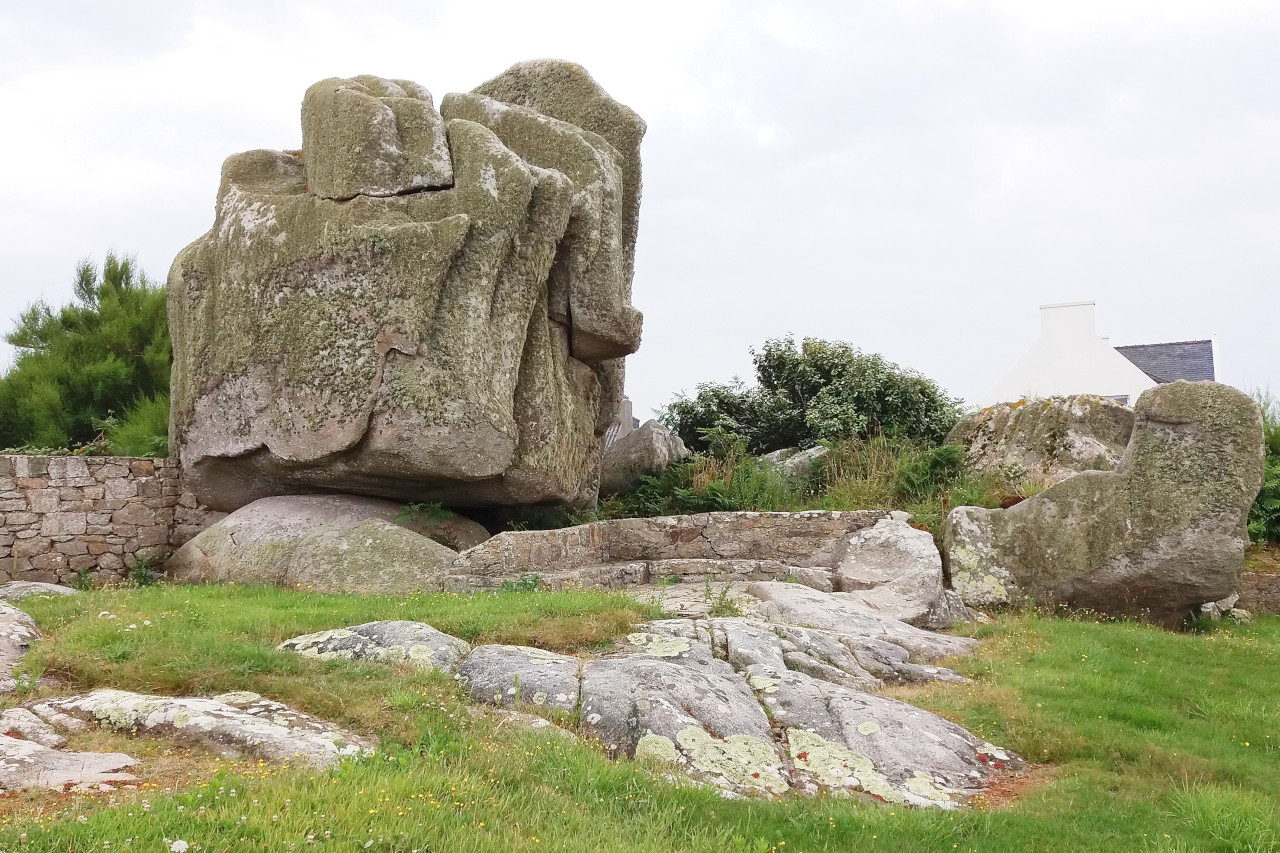
One of the most fascinating aspects of the culture of Brittany is the presence of megaliths, especially around the small town of Carnac near the Atlantic coast. Megaliths are large stones used in prehistoric architecture or monuments in various parts of Western Europe. The megaliths date from between 4,500 and 2,000 B.C. and are associated with Neolithic farmers and herders. The huge rock formations include menhirs (standing stones between 1 and 20 meters in height and weighing between 2 and 200 tonnes); dolmens (stone burial chambers); and tumuli (earthen mounds that cover the dolmens).
Almost every wild heath seems to possesses at least a standing stone, and some stones, such as the Menhir de Champ-Dolent and the granitic obelisk of Locmariaquer are huge.
The world-famous site is the wondrous stone arrays of Carnac—more than 3,000 prehistoric standing stones arranged in long rows. There is still a great deal of mystery surrounding the true significance of these incredible rock formations.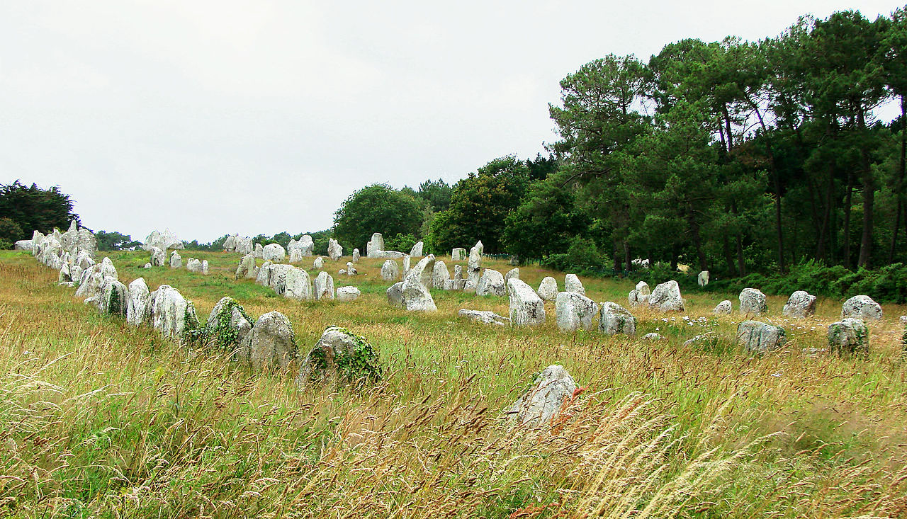 Stone rows of Carnac
What is the nature of Brittany like?
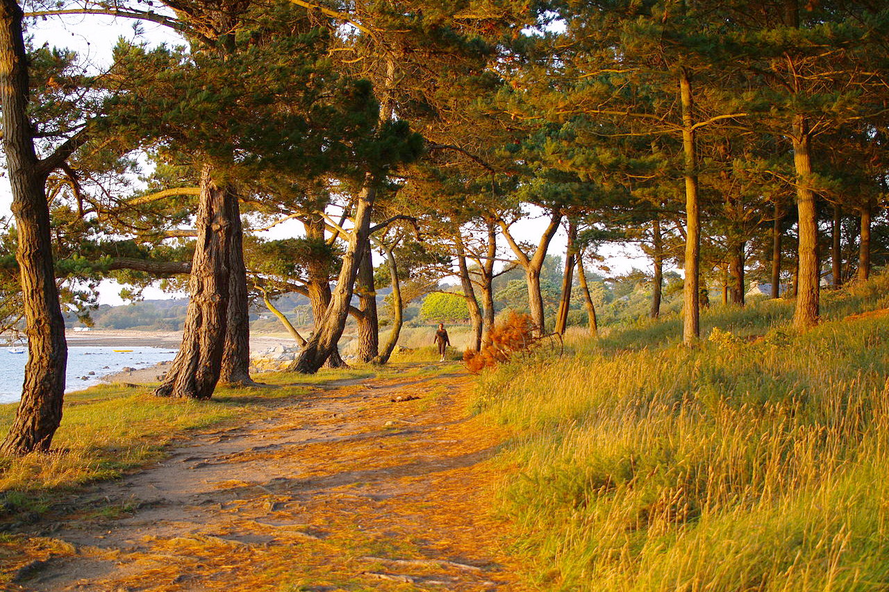
Brittany is known for its forests, moorlands, and fields enclosed by hedges. The landscape is one of rolling hills and rocky ravines. Heath, ferns, and broom abound on moors with wooded dells. The climate of the entire coast is so mild that there is almost no winter, and southern plants such as fuchsias and azaleas can grow outdoors the year round.
The coastline is known for its rocky coves and numerous lighthouses. Sandy beaches and intriguing inlets leading to picturesque small ports are also common. Abers, or deep inlets, are quite common along the northern coast. A number of beautiful and well-preserved islands lie offshore—especially along the southwestern coast, such as Belle-Île.
What is the climate of Brittany like?
The climate is maritime and variable. Owing to the influence of the Atlantic Ocean, the climate is normally quite mild. There is little frost in the region, even inland. During the summer months there are few hot spells, with temperatures ranging roughly between 18° and 24°C (65° to 75°F). There is also a high rate of sunshine—roughly 2,000 hours per year, equal to that along the Mediterranean. Nevertheless, the region has higher levels of rain, especially in the winter months.
| Climate data for Rennes (1981–2010) | |||||||||||||
|---|---|---|---|---|---|---|---|---|---|---|---|---|---|
| Month | Jan | Feb | Mar | Apr | May | Jun | Jul | Aug | Sep | Oct | Nov | Dec | Year |
| Average high °C (°F) | 8.7 (47.7) | 9.6 (49.3) | 12.7 (54.9) | 15.2 (59.4) | 18.9 (66.0) | 22.2 (72.0) | 24.5 (76.1) | 24.3 (75.7) | 21.6 (70.9) | 17.0 (62.6) | 12.1 (53.8) | 9.1 (48.4) | 16.4 (61.5) |
| Daily mean °C (°F) | 5.8 (42.4) | 6.1 (43.0) | 8.6 (47.5) | 10.5 (50.9) | 14.1 (57.4) | 17.1 (62.8) | 19.1 (66.4) | 19.0 (66.2) | 16.5 (61.7) | 13.1 (55.6) | 8.8 (47.8) | 6.2 (43.2) | 12.1 (53.8) |
| Average low °C (°F) | 3.0 (37.4) | 2.6 (36.7) | 4.5 (40.1) | 5.9 (42.6) | 9.3 (48.7) | 11.9 (53.4) | 13.8 (56.8) | 13.7 (56.7) | 11.4 (52.5) | 9.1 (48.4) | 5.5 (41.9) | 3.3 (37.9) | 7.9 (46.2) |
| Average precipitation mm (inches) | 67.6 (2.66) | 49.1 (1.93) | 51.6 (2.03) | 50.9 (2.00) | 67.2 (2.65) | 46.7 (1.84) | 49.1 (1.93) | 37.8 (1.49) | 59.0 (2.32) | 74.8 (2.94) | 67.5 (2.66) | 72.7 (2.86) | 694.0 (27.32) |
| Source: Meteo France | |||||||||||||
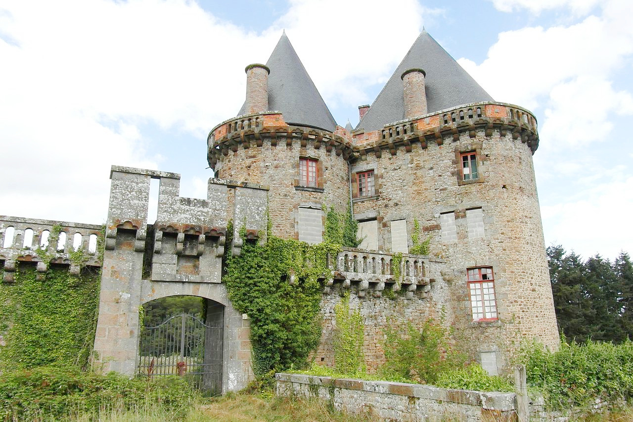
.JPG) Château de Kerduel, Côtes-d'Armor
Château de Kerduel, Côtes-d'Armor
.JPG&oldid=478982275)
The official websites
Brittany
France's Celtic corner
| Location: | Northwest France |
| Coordinates: | 48° 00′ N, 2° 45′ W |
| Size: | • 180 km N-S; 310 km E-W • 110 miles N-S; 190 miles E-W |
| Terrain: | Rocky coastline; moorland plateaus in the middle with low hills |
| Climate: | Maritime climate with mild summers and cool winters; year-round rainfall |
| Highest point: | Roc'h Ruz 385 m / 1263 ft |
| Forest: | 20% (2010 est.) (source) |
| Population: | 3,354,854 (2019) |
| Population density: | High (120/km²) |
| Capital: | Rennes |
| Languages: | French; Breton; Gallo |
| Human Development Index: | Very High (0.893) |