.jpg)
_city_limit_sign.JPG)
_entrée.jpg)
The Geography of
Normandy
Why visit Normandy?
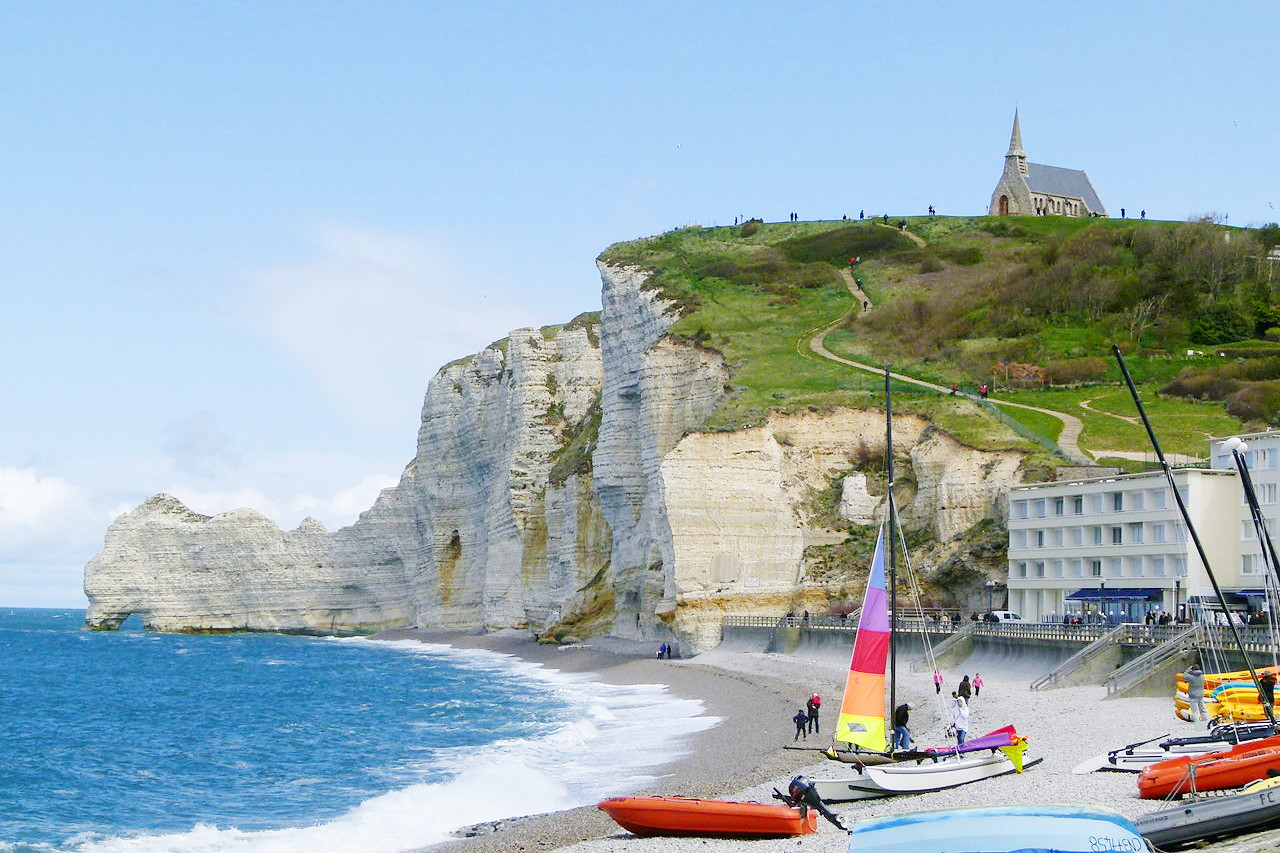
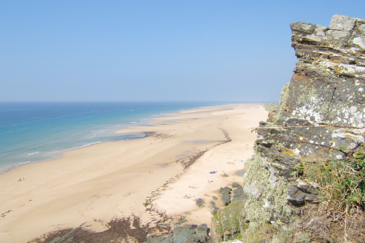
With beaches of fine sand and rocky coves, Normandy is a delightful region, with its medieval cities, fine museums and lovely churches. It is among the most attractive parts of France, noted for its swelling hills, beautiful valleys, and rich pasture, all traversed by winding rivers. It is equally famous for its medieval remains: ancient cities, cathedrals, abbeys, and churches, not confined merely to the larger towns, but scattered over the country seemingly in every village.
Contents
Map
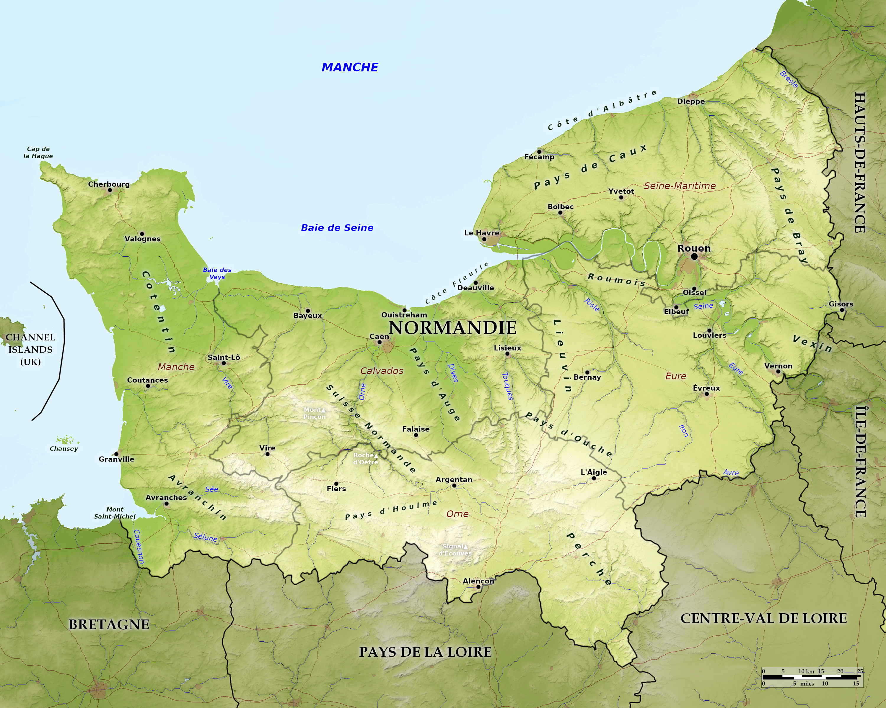 Relief map of Normandy
What is the landscape of Normandy like?
_Maison_de_l'association.jpg)
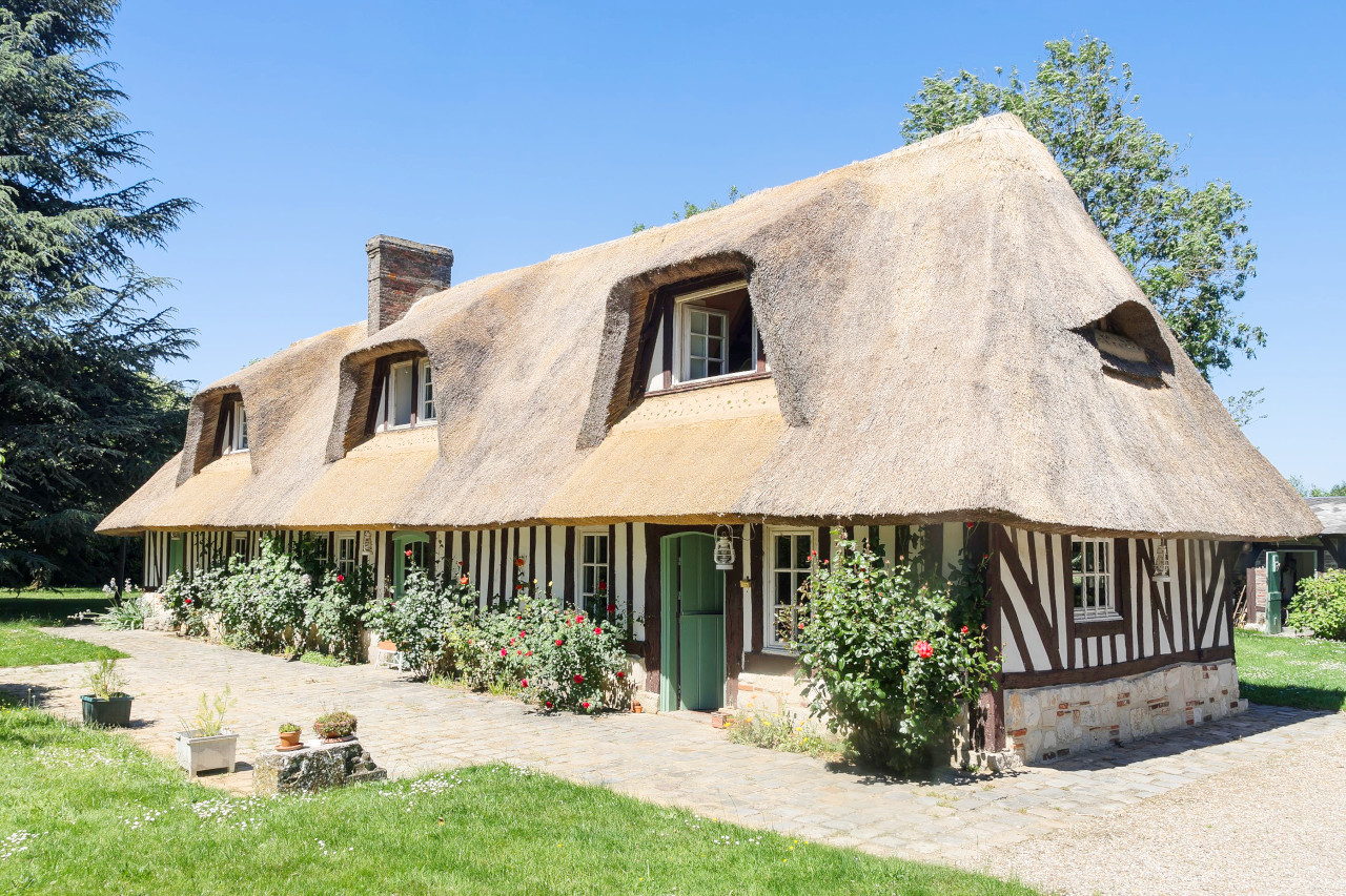
Normandy is one of the most attractive parts of France. Parts of the upper country are certainly a flat; but it also has sunny slopes and winding dales with hedgerows, orchards, thatched cottages, gardens, frequent village spires, and white chalk cliffs. Normandy is full of interest:—it is remarkable for the varied outline of swelling hills waving with crops; for beautiful valleys abounding in orchards, and in rich pasture crossed by winding rivers; for remains of medieval antiquity; ancient cities; noble cathedrals, abbeys, and churches scattered over the country, so that every village, in some parts, possesses a piece of ancient architecture.
.jpg&oldid=581764123)
_city_limit_sign.JPG&oldid=466663173)
_entr%C3%A9e.jpg&oldid=576157710)
_Maison_de_l%27association.jpg&oldid=641028636)
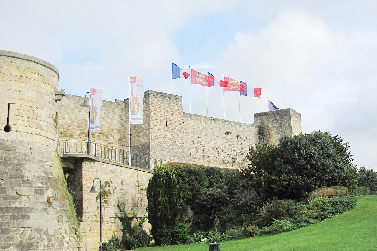
To the fans of medieval history, Normandy is a rich place. Rouen, a city possessing much of its old medieval character, contains a magnificent cathedral. In its vicinity are a great number of curious village churches. The ruined abbeys, Boscherville, Jumièges, etc., on the north bank of the Seine, are remarkable examples of Norman architecture; and the scenery of the Seine—the great water highway connecting Paris with its port of Le Havre—is always pleasant. Caen, with its abbeys, is also interesting; and the cathedrals of of Lisieux, and Coutances are noble edifices. Bayeux Cathedral (11th century) is a remarkable example of Norman-Gothic. Here you can see the famous 235-foot Bayeux Tapestry, depicting the conquest of England by William the Conqueror.
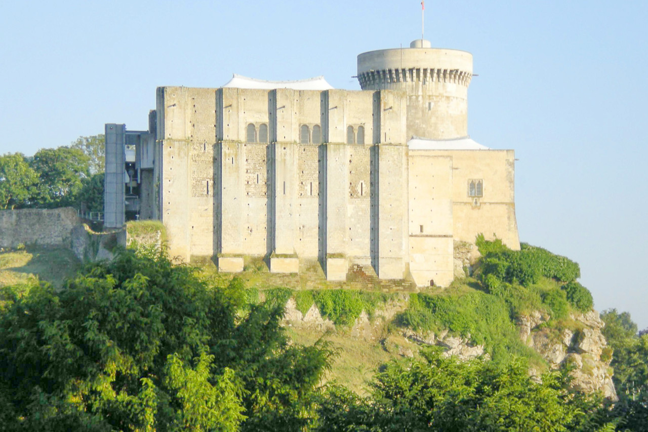
Normandy abounds in old castles; of which the most interesting, both from the point of view of history and scenery, are Chateau Gaillard, the favourite stronghold of Richard the Lionheart; Falaise, the birthplace of William the Conqueror; and several others which are the cradles of English nobility.
Above all in Normandy, there is the grandeur of Mont-St-Michel, the tiny island which stands between Normandy and Brittany. On its summit stands the towering abbey, one of the most remarkable medieval edifices in Europe. Its only approach is by a single cobblestoned street, thronged with tourists and lined with little shops and restaurants.
What is the nature of Normandy like?
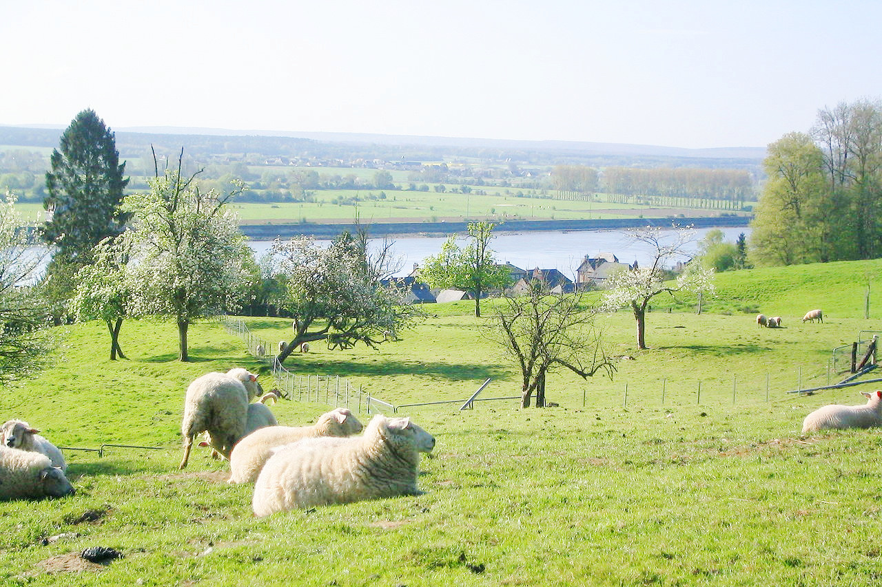
The region’s geography is dominated by the colors blue and green—the blue waters of the English Channel and the verdant green farmlands and fields of the interior. The geography of both Lower and Upper Normandy may remind many people of southern England because of the lush pastoral countryside. Lower Normanady is known as the land of the bocage, farmland subdivided by hedges and trees.
What is the climate of Normandy like?
The climate of Normandy is moist and temperate. Frequent rains promote lush vegetation. In some parts of the region—namely, in localized parts of the Cotentin peninsula and to the south—annual rainfall is more than 900 mm / 36 inches. Along the coast, summer and winter climates differ only slightly.
| Climate data for Rouen (1981–2010) | |||||||||||||
|---|---|---|---|---|---|---|---|---|---|---|---|---|---|
| Month | Jan | Feb | Mar | Apr | May | Jun | Jul | Aug | Sep | Oct | Nov | Dec | Year |
| Average high °C (°F) | 6.4 (43.5) | 7.3 (45.1) | 10.8 (51.4) | 13.7 (56.7) | 17.3 (63.1) | 20.3 (68.5) | 22.8 (73.0) | 22.8 (73.0) | 19.5 (67.1) | 15.0 (59.0) | 9.9 (49.8) | 6.6 (43.9) | 14.4 (57.9) |
| Daily mean °C (°F) | 3.7 (38.7) | 4.2 (39.6) | 7.0 (44.6) | 9.2 (48.6) | 12.7 (54.9) | 15.5 (59.9) | 17.8 (64.0) | 17.8 (64.0) | 14.9 (58.8) | 11.4 (52.5) | 7.0 (44.6) | 4.2 (39.6) | 10.5 (50.9) |
| Average low °C (°F) | 1.1 (34.0) | 1.1 (34.0) | 3.2 (37.8) | 4.7 (40.5) | 8.1 (46.6) | 10.7 (51.3) | 12.8 (55.0) | 12.8 (55.0) | 10.4 (50.7) | 7.8 (46.0) | 4.1 (39.4) | 1.7 (35.1) | 6.6 (43.9) |
| Average precipitation mm (inches) | 76.3 (3.00) | 60.4 (2.38) | 67.1 (2.64) | 59.2 (2.33) | 74.3 (2.93) | 63.7 (2.51) | 68.9 (2.71) | 65.1 (2.56) | 65.5 (2.58) | 83.5 (3.29) | 76.8 (3.02) | 90.9 (3.58) | 851.7 (33.53) |
| Source: Meteo France | |||||||||||||
_Pressoir_(Horse-driven_cider_mill).JPG) Repurposed cider press, Eure
Repurposed cider press, Eure
_Pressoir_(Horse-driven_cider_mill).JPG&oldid=388986809)
The official websites
Normandy
Delightful Normandy
| Location: | Northwest France |
| Coordinates: | 49° 00′ N, 0° 15′ E |
| Size: | • 210 km N-S; 275 km E-W • 130 miles N-S; 170 miles E-W |
| Terrain: | Rolling landscape with cliffs and long beaches |
| Climate: | Maritime climate with mild summers and cool winters; year-round rainfall |
| Highest point: | Signal d'Écouves 413 m / 1355 ft |
| Forest: | 19% (2010 est.) (source) |
| Population: | 3,325,032 (2019) |
| Population density: | High (110/km²) |
| Capital: | Rouen |
| Languages: | French; Norman |
| Human Development Index: | Very High (0.879) |