The Geography of
Northern Greece
Why visit Northern Greece?
Northern Greece—Macedonia and Thrace—is a region of comparatively unexplored natural beauty. Unlike the busy towns of the Peloponnese and central Greece, most towns in northern Greece have considerable appeal, with atmospheric old quarters of narrow streets and wood-framed houses. Macedonia is the birthplace of Alexander the Great, and the heart of an ancient empire, whereas Thrace has a more Turkish feel to it where eastern-style bazaars and minarets can be seen. The landscape varies from the country's highest mountains to sandy beaches. The Chalkidiki peninsula also has the holy Mount Athos.
Contents
Map
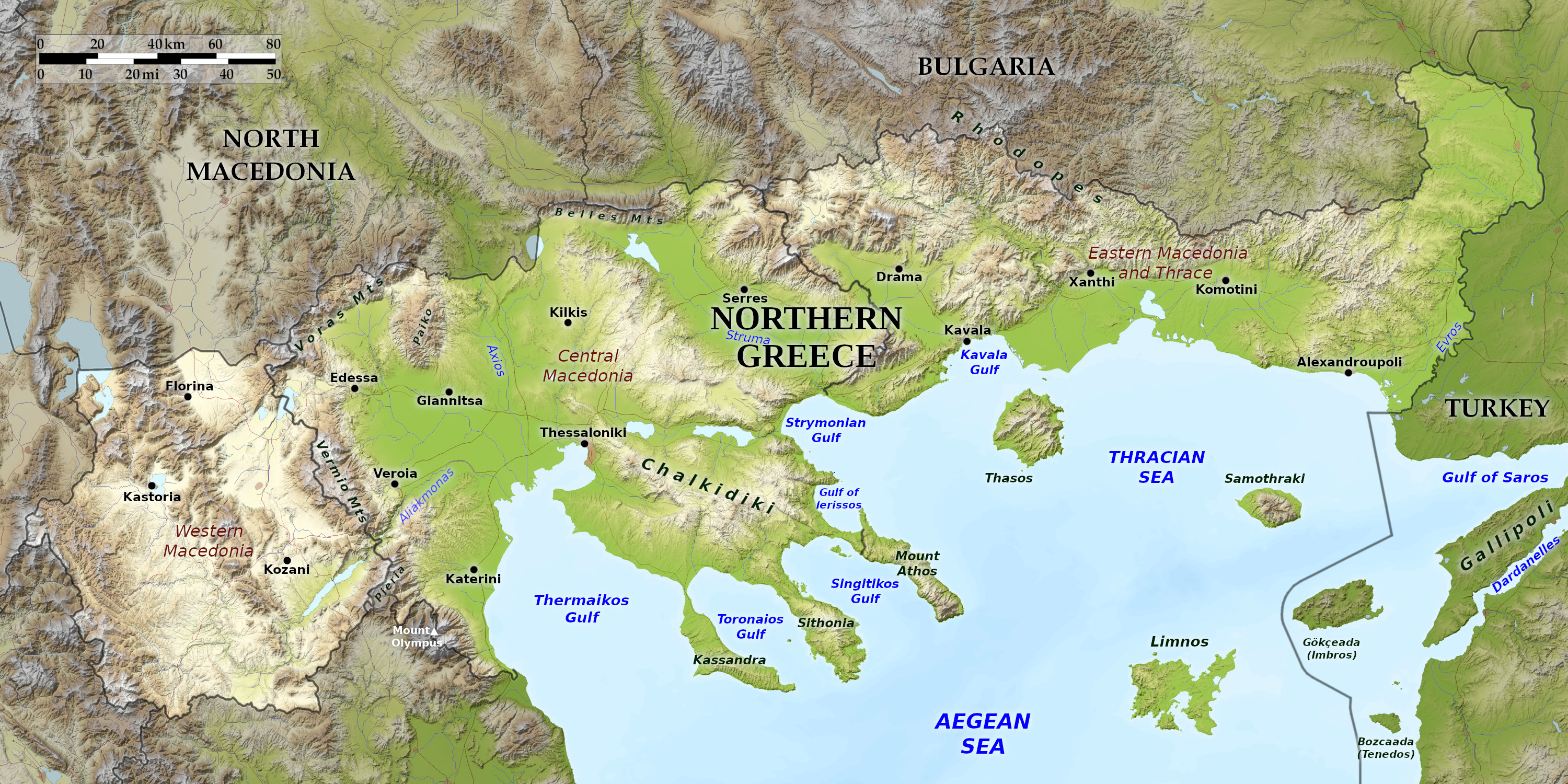 Relief map of Northern Greece
What is the landscape of Northern Greece like?
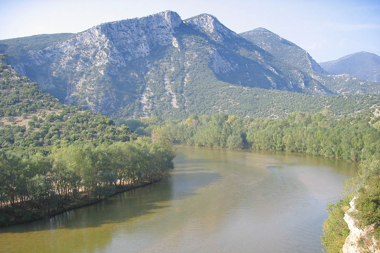
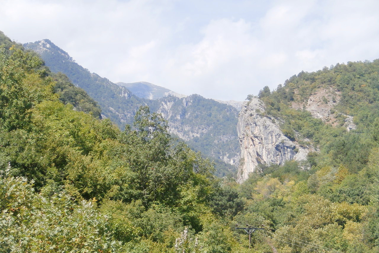
Northern Greece—Macedonia and Thrace—is the most fertile part of the country. A variety of mountain ranges cross this region, and the great chain of the Rhodopes, which continues northwestwards into Bulgaria, forms a natural boundary on the north. Magnificent forests still clothe these mountains.
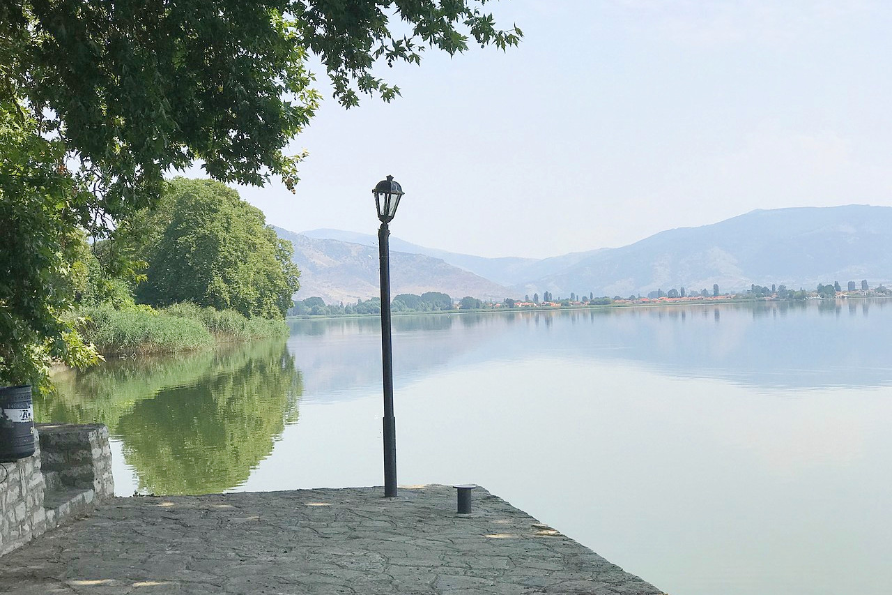
Large rivers too can be found in this region, and these rivers water the inland plains and have formed true alluvial plains near the sea. The river Axios (or Vardar) flows down from North Macedonia and finds its way to the Thermaic Gulf through the alluvial plains extending to the west of the city of Thessaloniki. In springtime the melted snows from the encircling mountains inundate the plains, but the fig, olive, and orange all grow on the shores of the Aegean Sea and in the sheltered valleys of the southern parts.
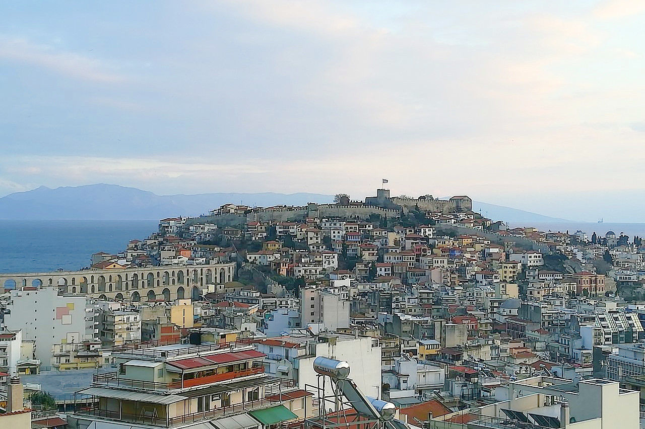
Thessaloniki is the second-largest city in Greece and a commercial seaport, once a thriving Byzantine metropolis. Landmarks include the Triumphal Arch of Emperor Galerius and several early basilicas. Kavala, the principal town of eastern Macedonia, is one of the loveliest seaside towns in Greece.
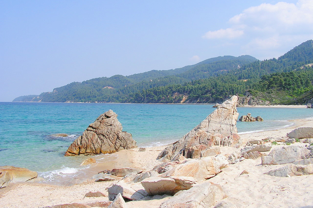
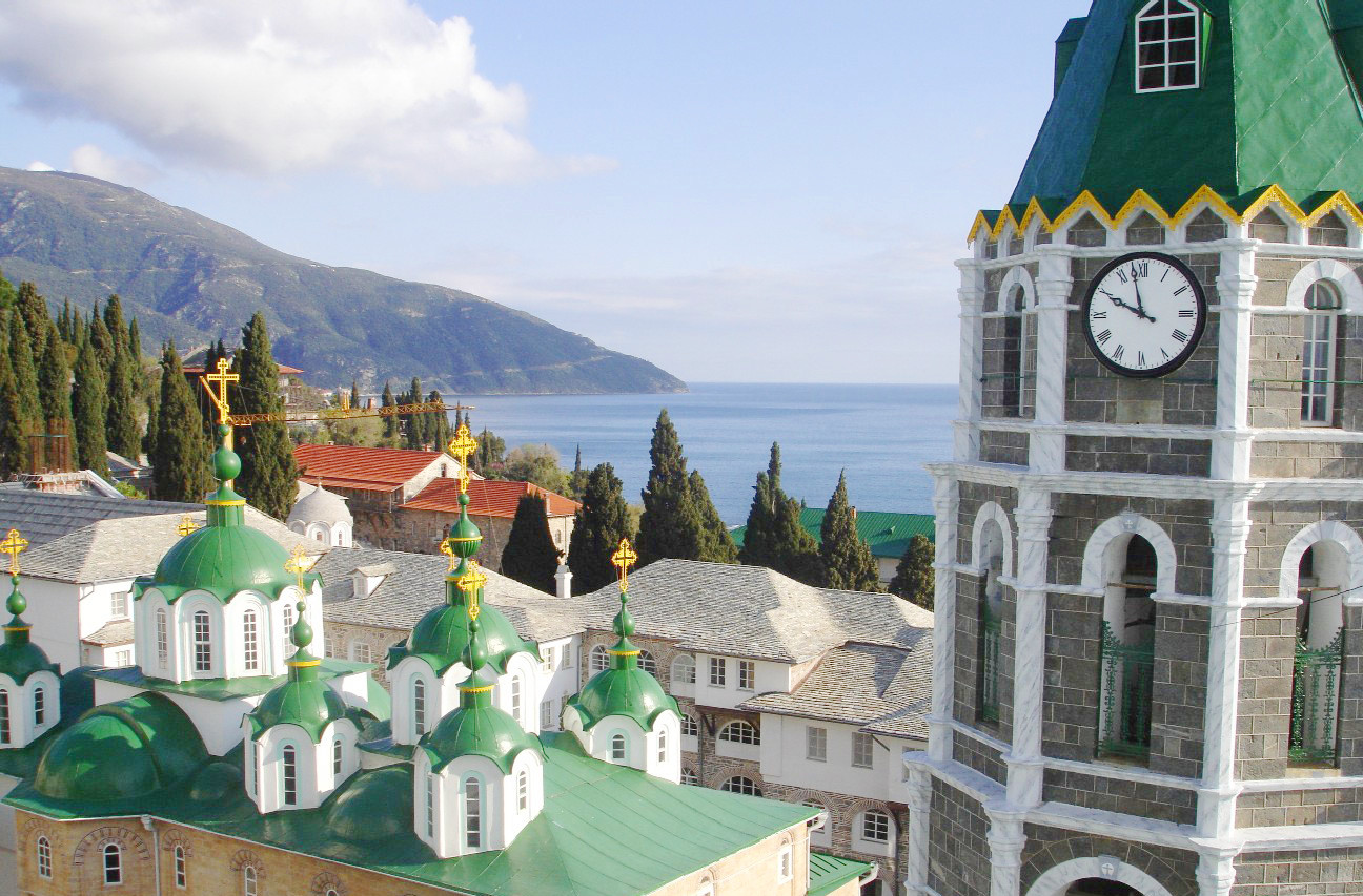
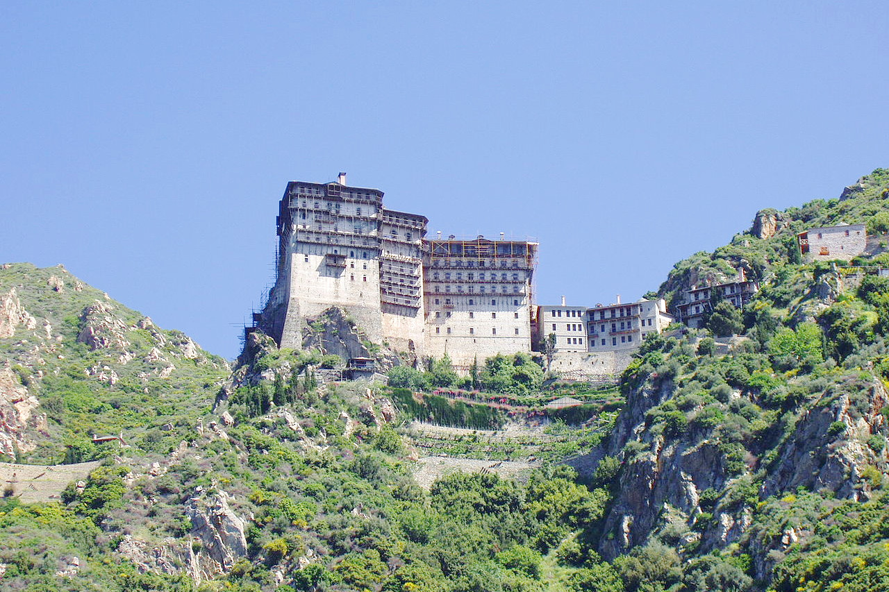
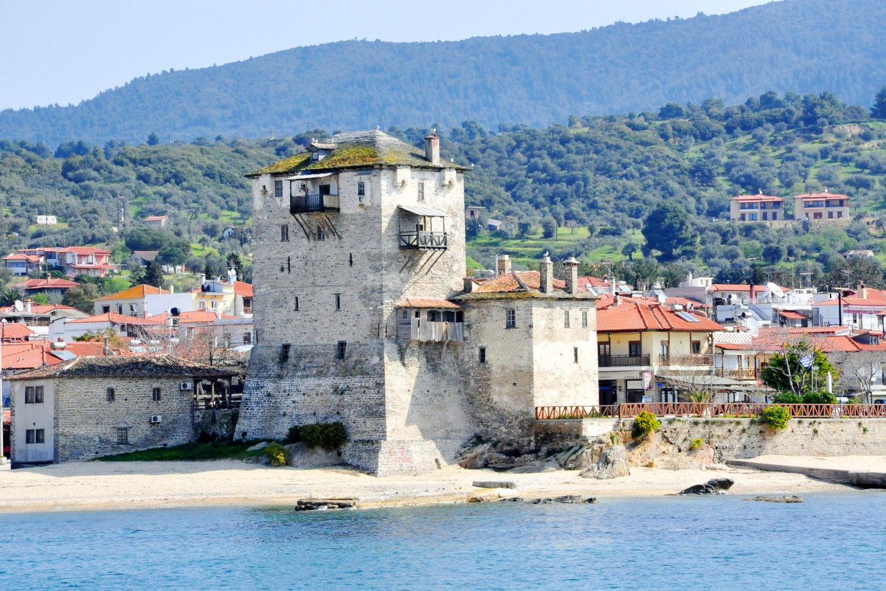
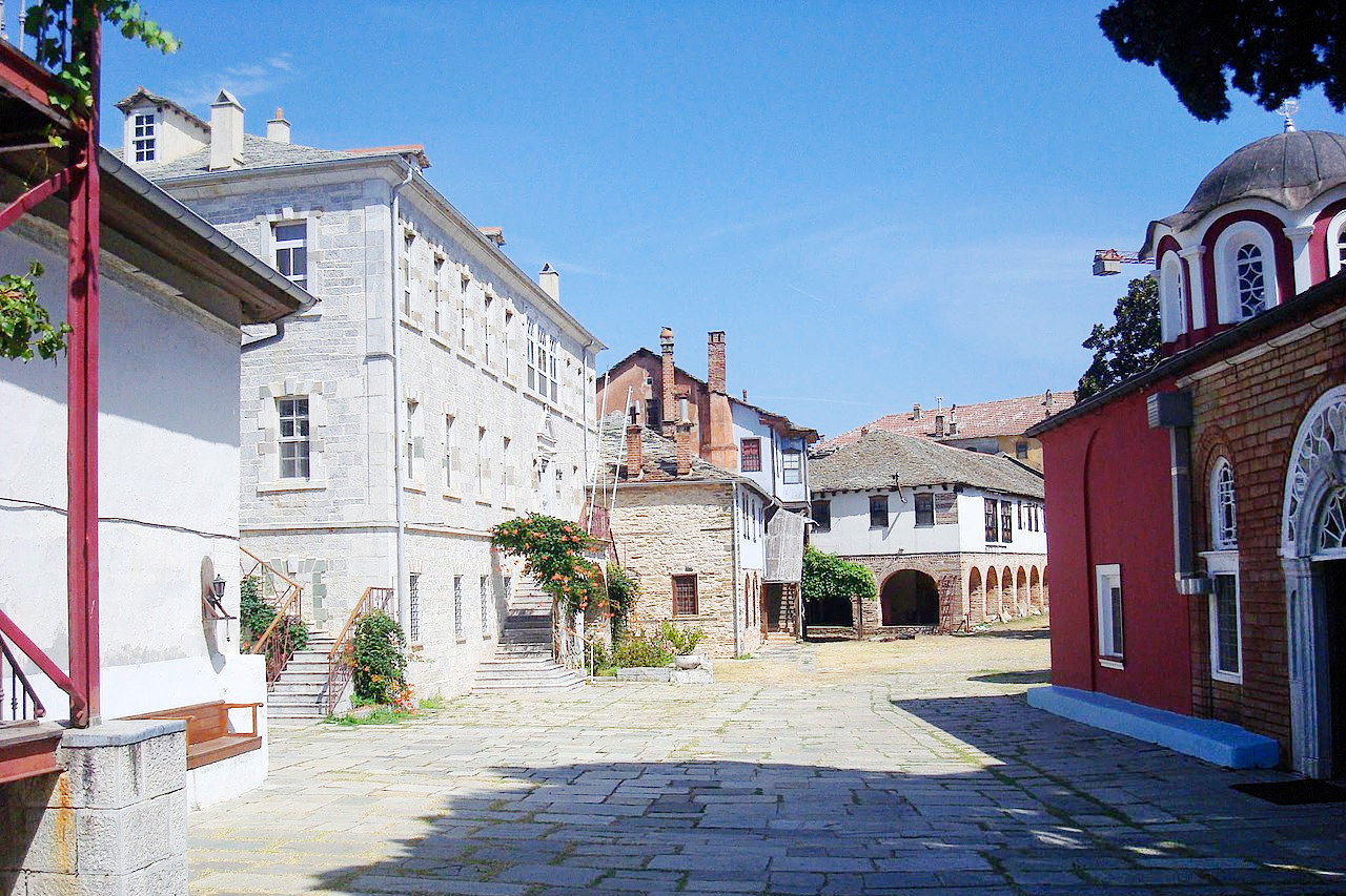
The coast-line is broken by the remarkable peninsula of Chalkidiki (Chalcidice), with its three promontories of Mount Athos, Sithonia and Kassandra which are known for their beautiful scenery. Mount Athos is the most eastern of the three promontories. The peninsula has a unique group of monastic communities, consisting of twenty large monasteries besides numerous hermitages and chapels. Access is restricted, and only men are permitted to visit the territory. The monks (around 2,000 of them) lead an ascetic life, devoting their time to farming, gardening, the care of bees and the manufacture of amulets, images, crucifixes, etc. At the end of the peninsula, the final peak, is Mount Athos itself. The peak rises like a pyramid, with a steep summit of white marble, to a height of 2,033 metres (6,670 ft); it can be seen at sunset all the way from from Turkey to the east, and the slopes of Olympus to the west.
What is the nature of Northern Greece like?
Macedonia and Thrace have a cooler, damper climate than much of Greece and hence a flourishing natural enviroment. On the border with Central Greece is Mount Olympos, the country's highest mountain, and in the northwest, on the border with Albania lie the Prespa Lakes, part of a wildlife reserve. With thickly forested mountains and tumbling rivers, Northern Greece resembles the Balkans more than other parts of Greece, and is one of the few parts of Greece where extensive tracts of native forests remain.
What is the climate of Northern Greece like?
The climate of northern Greece is primarily a Mediterranean one. Rainfall is fairly low across the year, but more evenly distributed. Summers are hot and fairly dry, but there is somewhat more rain than can be found further south. Winters are fairly dry, but with occasional snowfall. In the mountains, the climate becomes more continental with hot summers and cold winters.
| Climate data for Thessaloniki | |||||||||||||
|---|---|---|---|---|---|---|---|---|---|---|---|---|---|
| Month | Jan | Feb | Mar | Apr | May | Jun | Jul | Aug | Sep | Oct | Nov | Dec | Year |
| Average high °C (°F) | 9.3 (48.7) | 11.0 (51.8) | 14.3 (57.7) | 19.1 (66.4) | 24.6 (76.3) | 29.4 (84.9) | 31.7 (89.1) | 31.4 (88.5) | 27.1 (80.8) | 21.2 (70.2) | 15.5 (59.9) | 10.9 (51.6) | 20.5 (68.8) |
| Daily mean °C (°F) | 5.4 (41.7) | 6.8 (44.2) | 9.8 (49.6) | 14.3 (57.7) | 19.9 (67.8) | 24.7 (76.5) | 26.9 (80.4) | 26.4 (79.5) | 21.9 (71.4) | 16.5 (61.7) | 11.3 (52.3) | 7 (45) | 15.9 (60.7) |
| Average low °C (°F) | 1.5 (34.7) | 2.3 (36.1) | 4.7 (40.5) | 7.9 (46.2) | 12.6 (54.7) | 17.0 (62.6) | 19.3 (66.7) | 19.1 (66.4) | 15.4 (59.7) | 11.3 (52.3) | 7.1 (44.8) | 3.2 (37.8) | 10.1 (50.2) |
| Average precipitation mm (inches) | 37.7 (1.48) | 35 (1.4) | 37.9 (1.49) | 36.1 (1.42) | 44.2 (1.74) | 29.8 (1.17) | 23.8 (0.94) | 19.3 (0.76) | 29.8 (1.17) | 43.0 (1.69) | 52.8 (2.08) | 55.1 (2.17) | 444.5 (17.51) |
| Source: Hellenic National Meterological Service | |||||||||||||
.jpg) Rural church, Drosopigi, Florina
Rural church, Drosopigi, Florina
.jpg&oldid=471206501)
The official websites
Northern Greece
A centre of different civilizations
| Location: | Northern portion of Mainland Greece |
| Coordinates: | 40° 45′ N, 23° 45′ E |
| Size: | • 225 km N-S; 515 km E-W • 140 miles N-S; 320 miles E-W |
| Terrain: | Multiple mountain chains interspersed with large lowland basins |
| Climate: | Warm Mediterranean climate, with some summer rain and some winter snow |
| Highest point: | Mount Olympus 2,917 m / 9,570 ft |
| Forest: | 26% (2010 est.) (source) |
| Population: | 2,773,979 (2011) |
| Population density: | Low (63/km²) |
| Capital: | — |
| Languages: | Greek |
| Human Development Index: | Very high (0.888) |