The Geography of
Central Greece
Why visit Central Greece?
Central Greece is very mountainous. On its western side runs the massive chain of Pindos, which is the backbone of this part of Greece. Towards the northeast is Mount Olympus, the home of the gods. Attica extends in a south-easterly direction into the Aegean Sea like a promontory. It is washed on two sides by the sea, and the coast is broken up into numerous small bays and harbours. The city of Athens forms the central point while the rock of the Acropolis and the hills by which it is surrounded can be seen from all around
Contents
Map
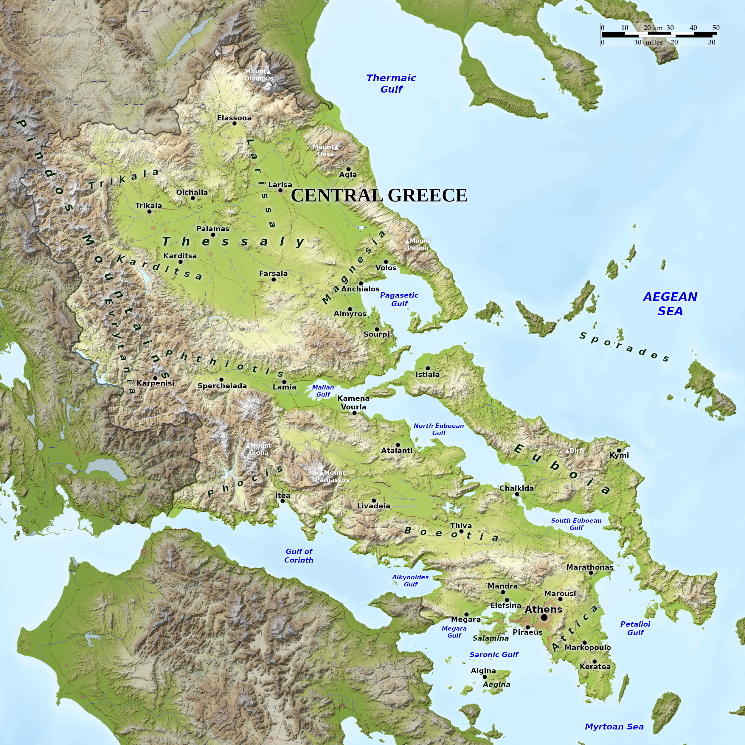 Relief map of Central Greece
What is the landscape of Central Greece like?
North
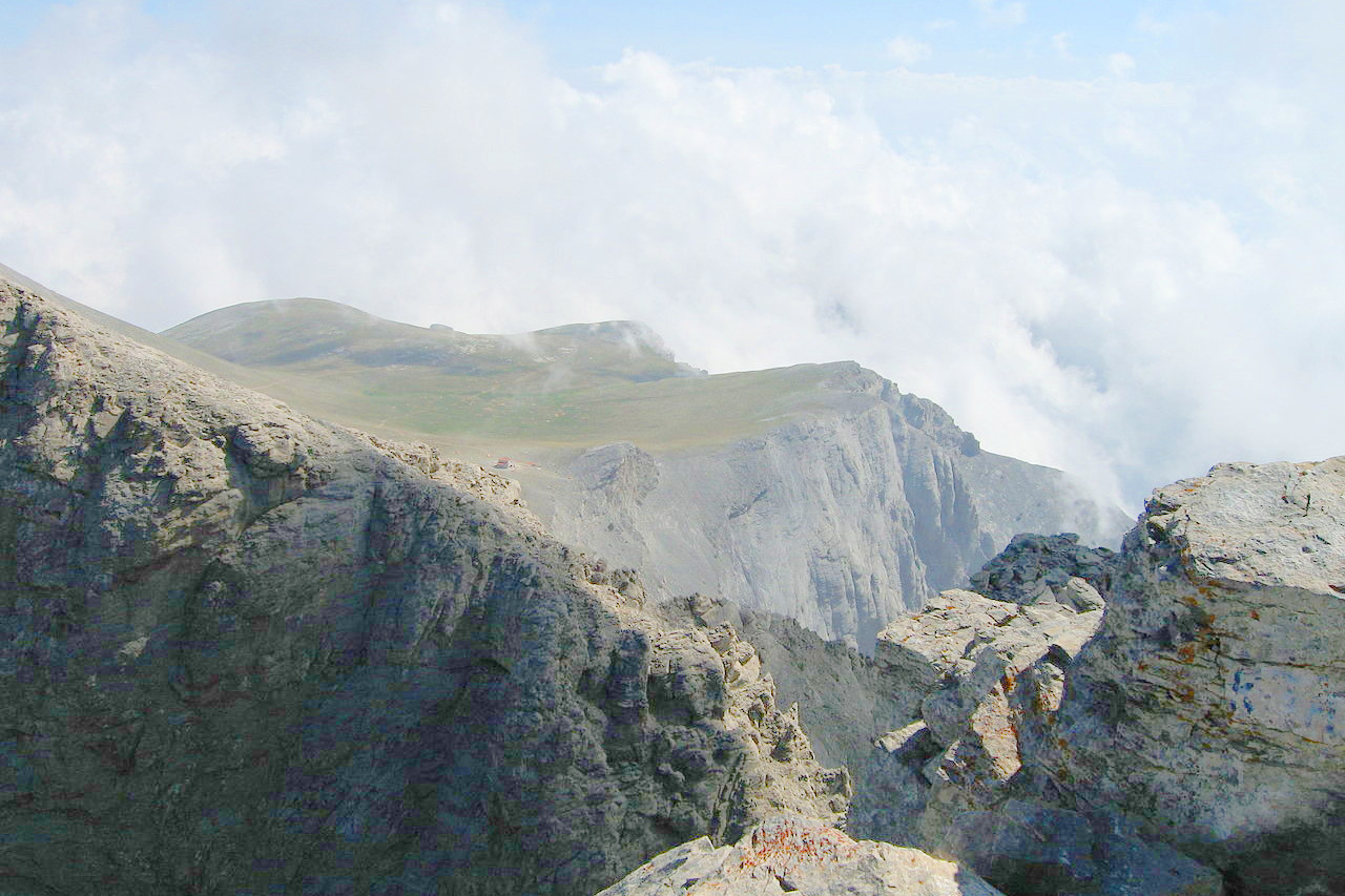
In the north of this region are the plains of Thessaly, shut in by high mountains on all sides and watered by a true river system. Thessaly forms an irregular square, extending for about sixty miles in each direction, and enclosed by mountain ranges. On its western side runs the massive chain of Pindos, which is the backbone of this part of Greece. Towards the northeast is Mount Olympus, the keystone of the whole mountain system.
Mount Olympus, the mythical home of the gods, which raises its snow-capped head mightily above sea and plain to a height of 2,917 meters (9,570 feet). It is covered with snow for great part of the year. It is a mountain of massive appearance, in many places rising in tremendous precipices broken by vast ravines, above which is the broad summit. The lower parts are densely wooded; the summit is naked rock.
The plain of Thessaly is the most level district of central Greece, but it is not a uniform unbroken surface, but is composed of a number of sections, divided by ranges of hills. The country is drained by a single river, the Pineios and its numerous tributaries. The chief city of these districts is Larissa.
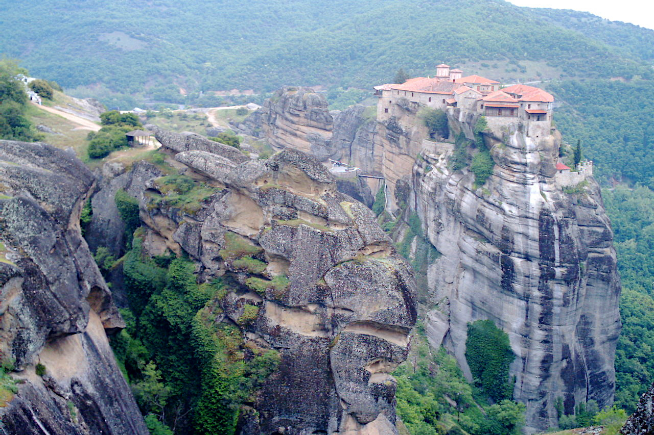
In the western part, on the northern side of the Pineios valley, two masses of rock are thrust southward into the plain, surmounted by isolated columns from 85 to 300 feet high. This rock formation, called Meteora, is home to a group of monasteries built on the summit of these pinnacles. The buildings are closely packed together; but access is deliberately difficult. For centuries they were only accessible only by aid of rope and net worked by a windlass from the top, or by a series of almost perpendicular ladders climbing the cliff. Nowadays, acces is simpler due to steps being carved into the rock during the 1920s.
South
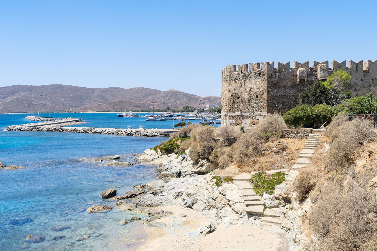
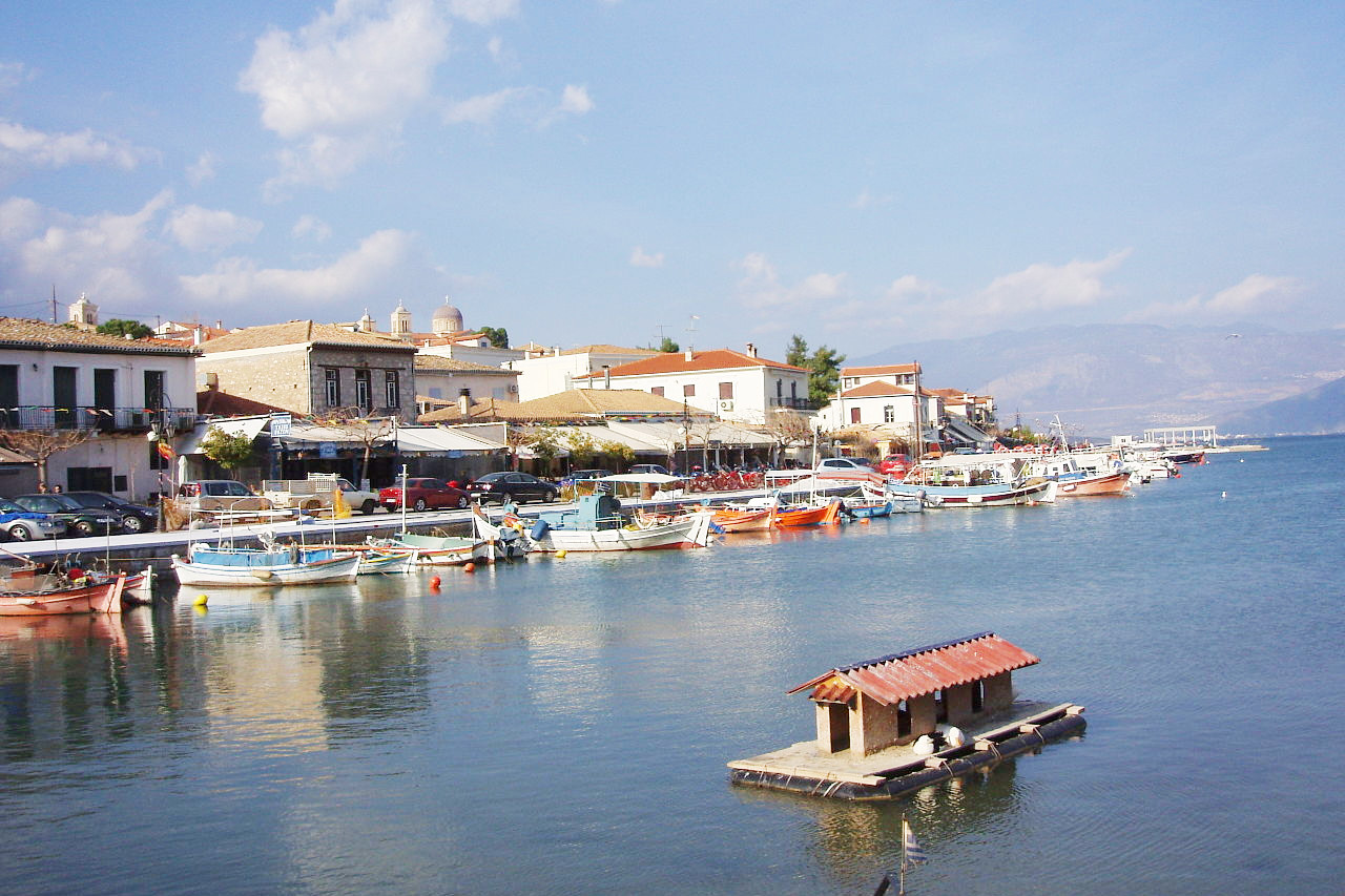
Attica extends in a southeasterly direction into the Aegean Sea like a promontory. It is washed on two sides by the sea, and the coast is broken up into numerous small bays and harbours. The surface of Attica, as of the rest of Greece, is very mountainous, especially to the west and north where it is separated from Boeotia by the small mountain ranges of Cithaeron and Parnitha. Between the hills lie several small plains of no great size, open on one side to the sea. On the west Attica connects to the Gulf of Corinth.
To the west of Athens lies the plain of Eleusis, from where on the sacred way, torchlight processions from Athens used to descend to the coast. At Eleusis, an ancient Greek city about 14 miles northwest of Athens are the remains of the sanctuary of Demeter, the home of the Eleusinian Mysteries, together with other ancient buildings.
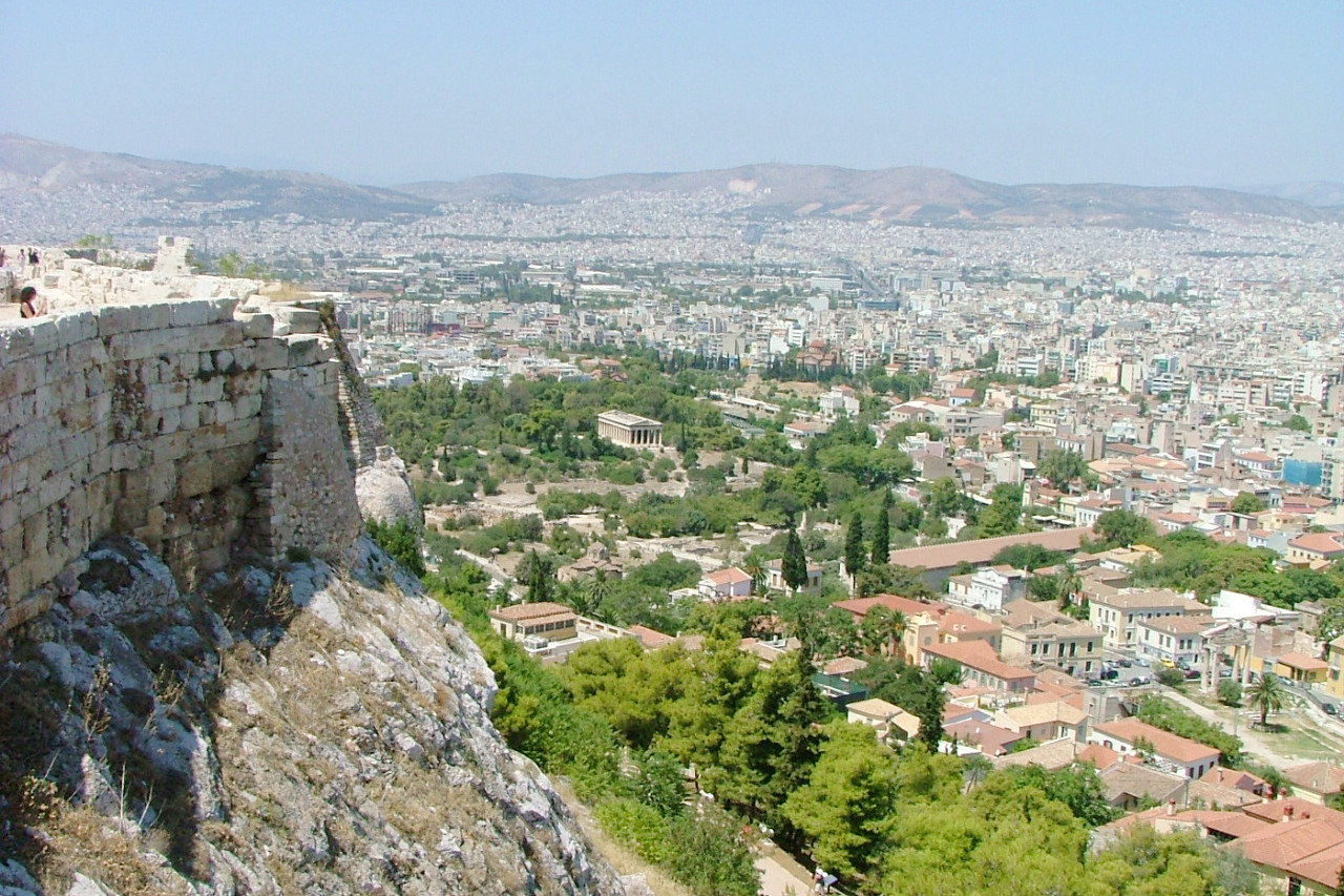
The plain of Athens is the most extensive of all—the city of Athens forms the central point while the rock of the Acropolis and the hills by which it is surrounded can be seen from all around.The deep bay which here runs into the land is bounded on its southern side by the rocky island of Salamis, which was at all times has been important to the Athenians on account of its closeness to their city; and the winding channel which separates the island from the mainland was the scene of the battle of Salamis where Xerxes, King of Persia, witnessed the destruction of his fleet.
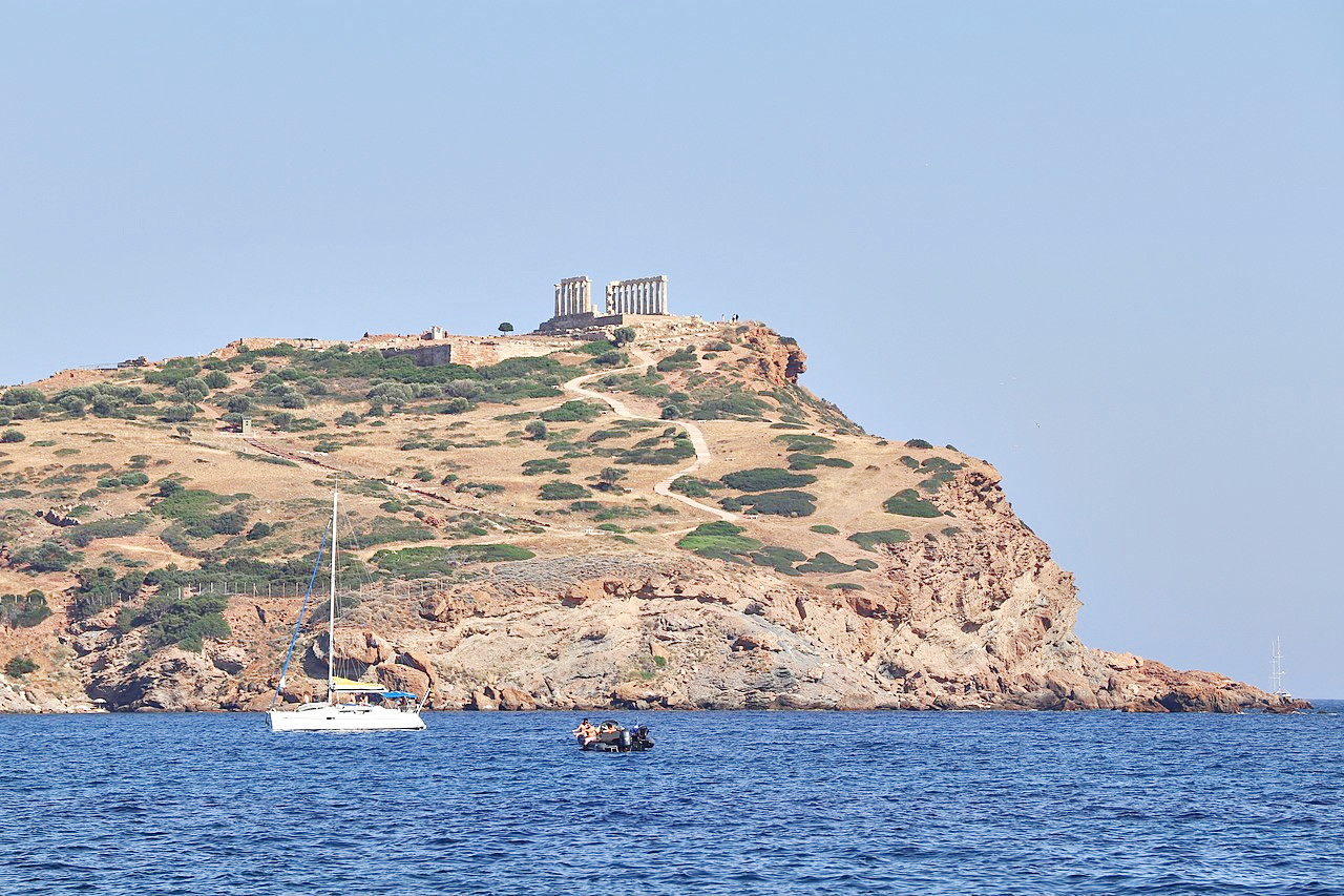
In the northeast corner of Attica is the little plain of Marathon, separated from the plain of Athens by Mount Pentelicus. About twenty-five miles from Athens, it was the scene of the battle against the Persians in 490 B.C. The bay in front is sheltered by the large island of Euboea. Euboea contains mountains reaching 6,000 feet in the middle of the island, and whereas Attica is one of the most densely settled parts of Greece, Euboea is one of the most rural regions. Of the other ancient sites in Attica the best-known is the Temple of Poseidon at Cape Sounion at the southernmost tip of the Attic peninsula. It forms a conspicuous object on the headland.
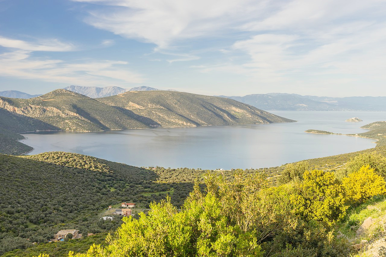
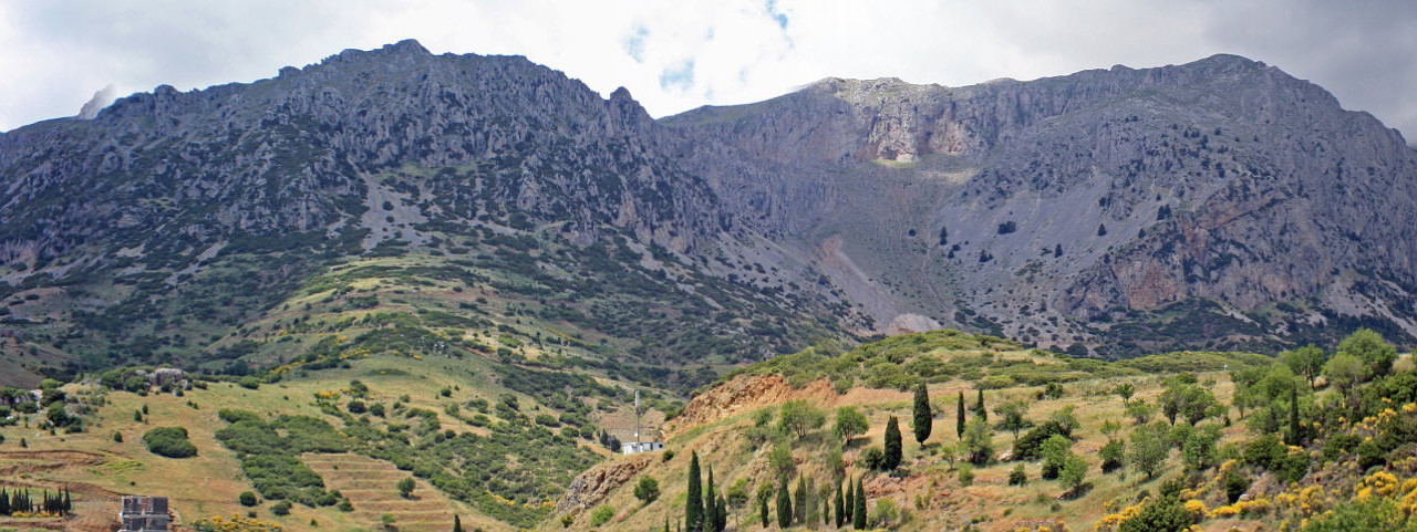
The West is dominated by the Gulf of Corinth which separates most of the Peloponnese from mainland Greece. From Patrai to Korinthos (Corinth), and all along the edge of the gulf, there are olive groves and plantations for currants, with a range of snow-clad mountains on one side and picturesque hills on the other. The Gulf of Corinth is often compared to the fjords of Norway, but its surroundings are rather more mild and modest. The traveler who enters from the west has a continuous view of Mount Parnassos, which rears its snow-clad summit among less famous mountains upon the opposite side of the gulf, and beside it is the beautiful Helicon, the haunt of the Muses.
In Phokida (Phocis) is Delphi, the seat of the famous oracle and the temple of Apollo. The oracle was consulted upon all affairs of importance, both by the people and the state. The ancient site stands at an altitude of twenty-one hundred and thirty feet above the gulf of Corinth and among the grandeur of the cliffs of Parnassos. Even in these modern times the gorges in the mountains are filled with a mysterious atmosphere which must have affected the imagination of the ancients.
 Mount Parnassus
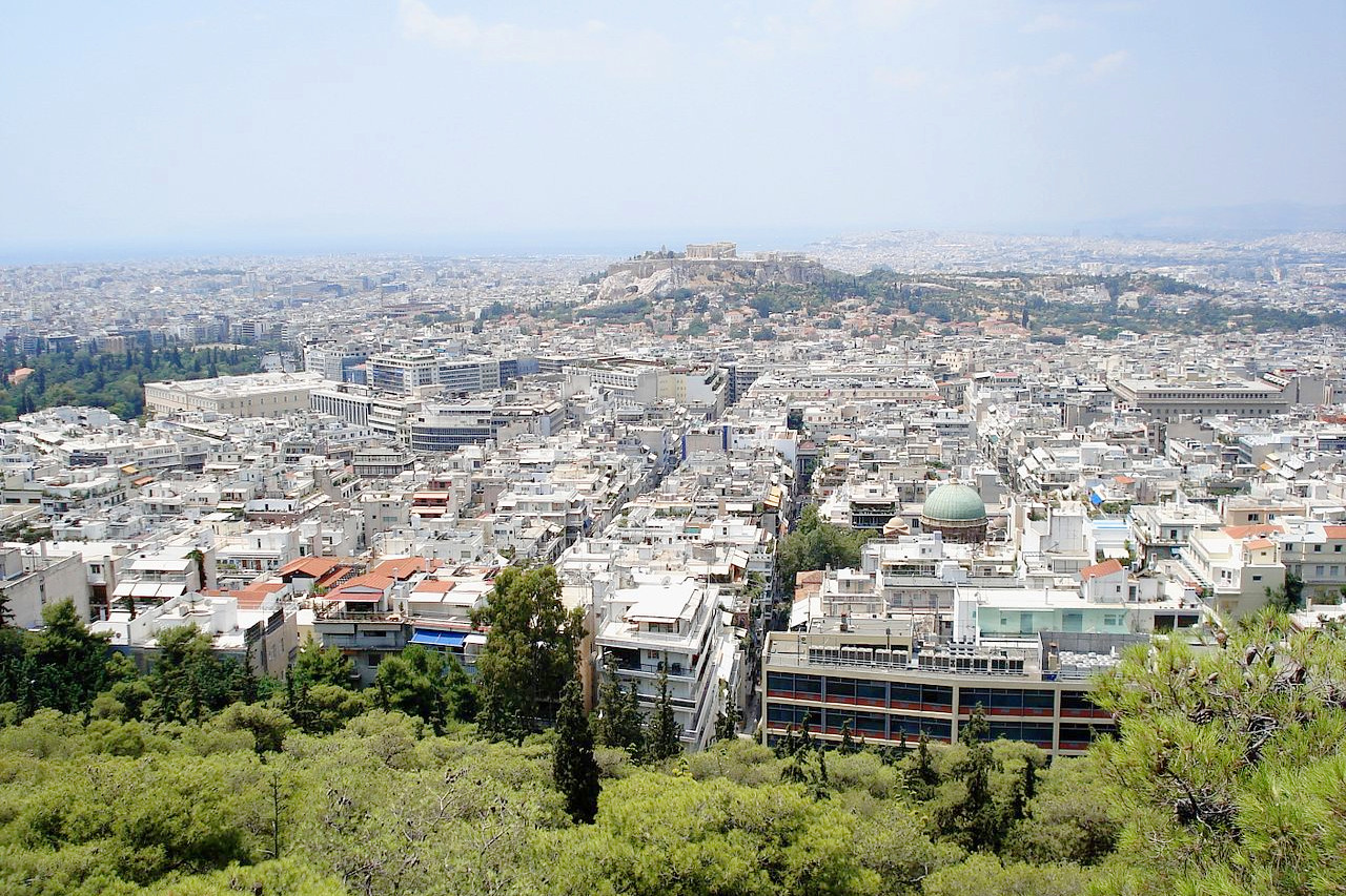
Athens
Athens is a city of marble. Many dwellings, buildings, and nearly all the public edifices are of that material, and even some of the streets are paved with it. Upon Mount Pentelicus overlooking the city are the quarries from which was hewn the marble for the Parthenon, the Temple of Jupiter, the Temple of Theseus and other famous structures of ancient Athens.
The Acropolis of Athens is the most famous hill in Europe. It is a mighty rock which rises five hundred feet in what was the center of ancient Athens. Toward the west there is a slope by which the summit is reached by a winding roadway. The Acropolis is visible from a long distance. It looms up in majesty as the city is approached from all directions. On the summit is the temple of the Parthenon, familiar to all the world.
What is the climate of Central Greece like?
The climate is purely Mediterranean, the summers are hot and very dry, the winters mild and rainy. Even on the higher ground, where winter temperatures are lower, summer temperatures remain fairly high and drought prevails. since the central parts are sufficiently high to give rise to low temperatures, particularly in winter, while the low-lying eastern basins are cut off from sea influences by the coastal mountains bordering the Aegean Sea. The interior is generally much more open to sea influences than in Thessaly, and the Mediterranean climate predominates, though even here the vegetation inclines to steppe in the northern basins.
| Climate data for Athens (1991–2020) | |||||||||||||
|---|---|---|---|---|---|---|---|---|---|---|---|---|---|
| Month | Jan | Feb | Mar | Apr | May | Jun | Jul | Aug | Sep | Oct | Nov | Dec | Year |
| Average high °C (°F) | 13.3 (55.9) | 14.2 (57.6) | 17.0 (62.6) | 21.1 (70.0) | 26.5 (79.7) | 31.6 (88.9) | 34.3 (93.7) | 34.3 (93.7) | 29.6 (85.3) | 24.4 (75.9) | 18.9 (66.0) | 14.4 (57.9) | 23.3 (73.9) |
| Daily mean °C (°F) | 10.2 (50.4) | 10.8 (51.4) | 13.1 (55.6) | 16.7 (62.1) | 21.8 (71.2) | 26.6 (79.9) | 29.3 (84.7) | 29.4 (84.9) | 25.0 (77.0) | 20.3 (68.5) | 15.6 (60.1) | 11.6 (52.9) | 19.2 (66.6) |
| Average low °C (°F) | 7.1 (44.8) | 7.3 (45.1) | 9.2 (48.6) | 12.3 (54.1) | 17.0 (62.6) | 21.6 (70.9) | 24.2 (75.6) | 24.4 (75.9) | 20.4 (68.7) | 16.2 (61.2) | 12.2 (54.0) | 8.7 (47.7) | 15.0 (59.0) |
| Average rainfall mm (inches) | 55.6 (2.19) | 44.4 (1.75) | 45.6 (1.80) | 27.6 (1.09) | 20.7 (0.81) | 11.6 (0.46) | 10.7 (0.42) | 5.4 (0.21) | 25.8 (1.02) | 38.6 (1.52) | 70.8 (2.79) | 76.3 (3.00) | 433.1 (17.06) |
| Source: Cosmos, National Observatory of Athens | |||||||||||||
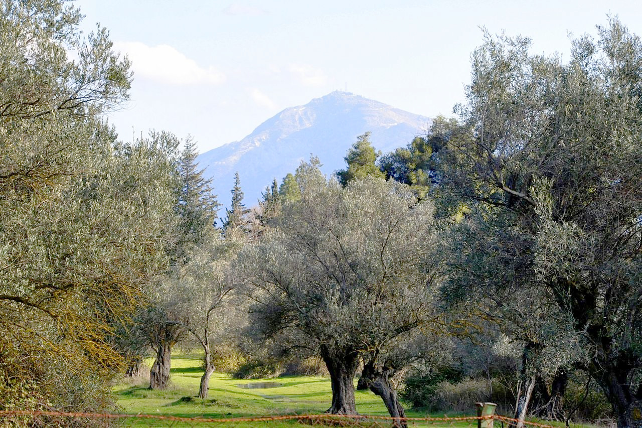
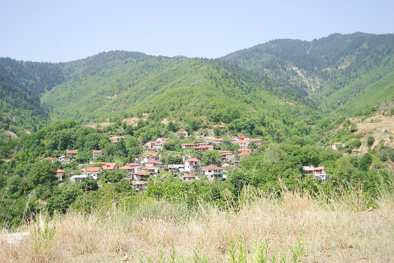 Village of Pitsiota, northwestern part of Phthiotis
The official websites
Central Greece
The very heart of Greece
| Location: | Eastern side of Mainland Greece |
| Coordinates: | 39° 00′ N, 22° 45′ E |
| Size: | • 290 km N-S; 305 km E-W • 180 miles N-S; 190 miles E-W |
| Terrain: | Many small plains surrounded by sea and mountains |
| Climate: | Mediterranean climate; hot, dry summers, mild wet winters |
| Highest point: | Mount Olympus 2,917 m / 9,570 ft |
| Forest: | 30% (2010 est.) (source) |
| Population: | 5,033,935 (2011) |
| Population density: | Medium (150/km²) |
| Capital: | — |
| Languages: | Greek |
| Human Development Index: | Very high (0.888) |