The Geography of
Western Greece
Why visit Western Greece?
Western Greece has a strong regional identity, having played a more minor role in ancient Greece and maintained a large degree of autonomy under the Turks. People come to Epirus to trek in the mountains, with its thick forests and tumbling rivers.
Contents
Map
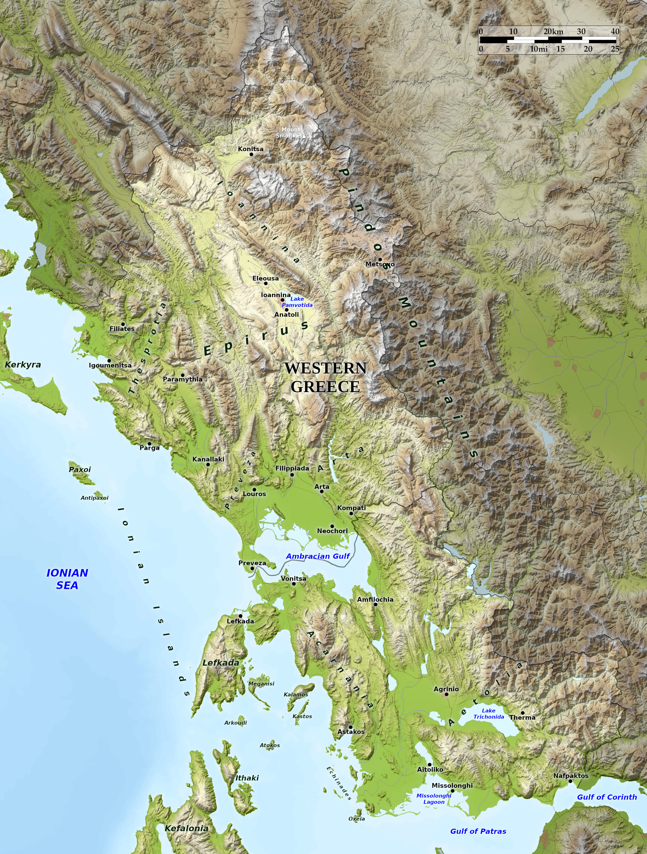 Relief map of Western Greece
What is the landscape of Western Greece like?
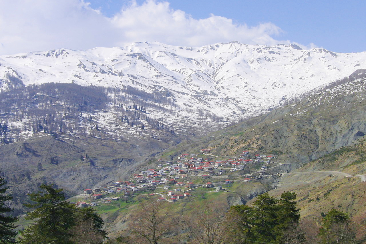
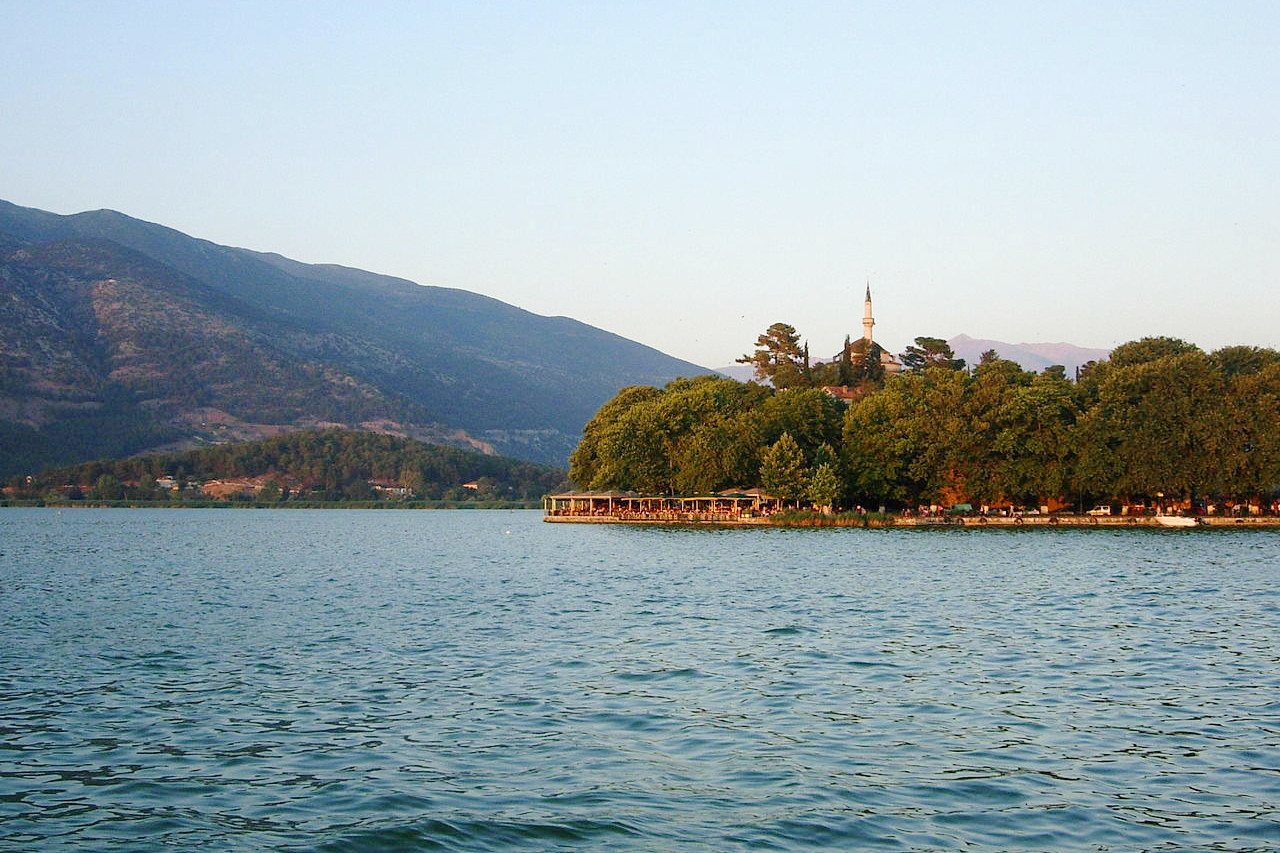
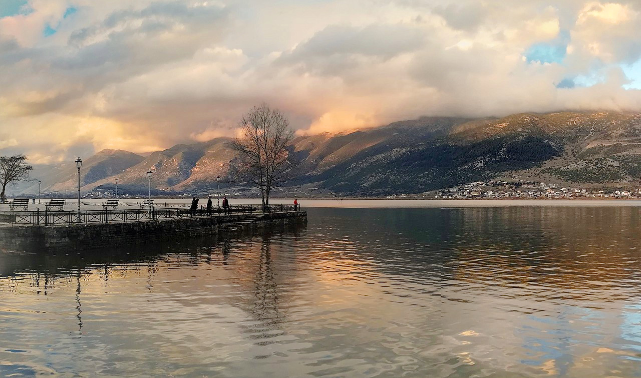
In the north is the region of Epirus. For the most part it is a peculiarly wild region, not so much because of its altitude than because of its greatly varied terrain. Rocky outcrops form parallel mountain chains, narrow, serrated, and with imposing cliffs; between them run deep valleys, with few settlements. Here the great rivers of northwestern Greece—Acheloos, Arachthos and Aoös—rise in the Pindus mountains. The capital of the region, Ioannina, is strikingly picturesque. At the foot of the grey limestone mass of the Mitsikeli mountains, which form part of the fine range of hills running north from the Ambracian Gulf, there lies a valley partly occupied by Lake Pamvotida; and the city is built on the slopes of a slight eminence, stretching down to the western shore.
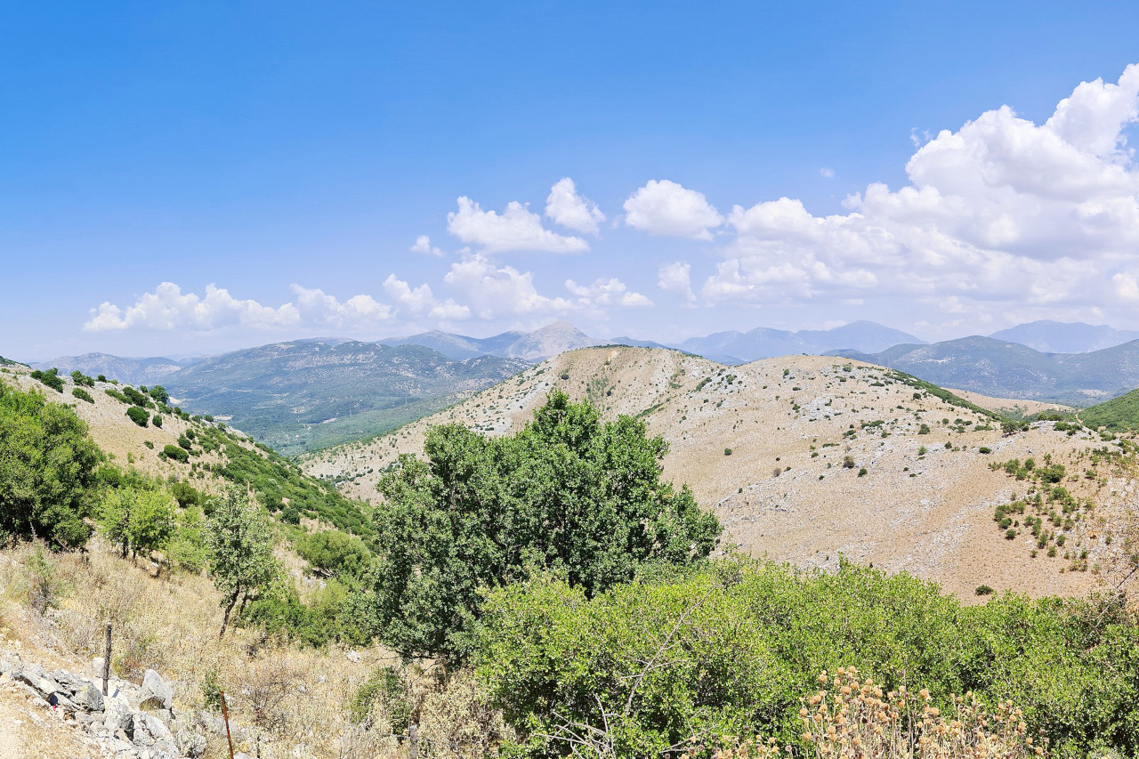
There are many local variations upon this general pattern. In the north, the valleys are more open and inviting, the roads are somewhat easier. But to the east the Pindus Mountains rise up to their great height at Mount Smolikas (2,637 m / 8,652 ft). The Pindus is a compact mountainous region but very difficult to traverse. These mountains receive the heaviest rainfall of Greece and are covered in trees such as the sweet chestnut and beech.
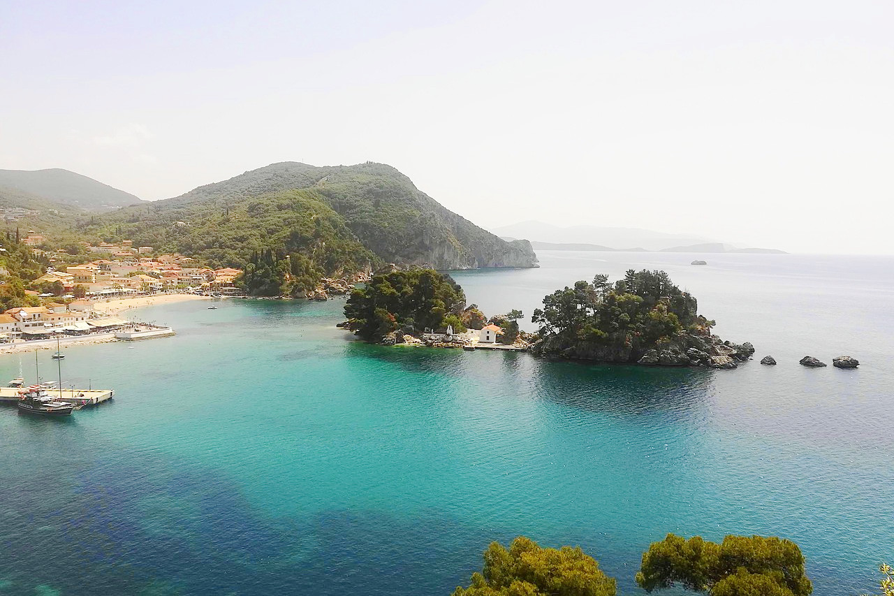
Towards the south the main rivers of Epirus flow southwards to the Gulf of Ambracia, often flowing through steep gorges. Around the Gulf is the lowland of Arta, a flat alluvial plain, whereas to the east, the land rises rapidly to high hills of sandstones and shales. In the far south are the provinces of Acarnania and Aetolia. Very hilly and often mountainous, southwards the hills yield to broad and swampy lowlands and hence to the broad Missolonghi lagoons.
What is the nature of Western Greece like?
Western Greece has extensive tracts of native forest, in stark contrast to southern and eastern Greece. The Pindus mountains also have several of Greece's highest peaks, and the flora and fauna are both spendid here. The Ambracian Gulf and Missolonghi lagoons are renowned too for their wonderful wildlife.
What is the climate of Western Greece like?
The climate of western Greece ranges from hot and humid summers to mild and short winters in the low-lying areas, and colder winters in the mountain areas. Summers are moderately dry, while winters are wet, with snowfall in the mountains.
| Climate data for Ioannina | |||||||||||||
|---|---|---|---|---|---|---|---|---|---|---|---|---|---|
| Month | Jan | Feb | Mar | Apr | May | Jun | Jul | Aug | Sep | Oct | Nov | Dec | Year |
| Average high °C (°F) | 9 (48) | 10.4 (50.7) | 13.7 (56.7) | 17.5 (63.5) | 23.0 (73.4) | 27.7 (81.9) | 31 (88) | 31 (88) | 26.1 (79.0) | 20.6 (69.1) | 14.7 (58.5) | 10 (50) | 20.0 (68.0) |
| Daily mean °C (°F) | 4.7 (40.5) | 6.1 (43.0) | 8.8 (47.8) | 12.4 (54.3) | 17.4 (63.3) | 21.9 (71.4) | 24.8 (76.6) | 24.3 (75.7) | 20.1 (68.2) | 14.9 (58.8) | 9.7 (49.5) | 5.9 (42.6) | 14.25 (57.65) |
| Average low °C (°F) | 0.2 (32.4) | 1.0 (33.8) | 3.2 (37.8) | 6.1 (43.0) | 9.8 (49.6) | 13 (55) | 15.2 (59.4) | 15.3 (59.5) | 12.2 (54.0) | 8.6 (47.5) | 4.8 (40.6) | 1.7 (35.1) | 7.5 (45.5) |
| Average precipitation mm (inches) | 122.5 (4.82) | 112.5 (4.43) | 94.9 (3.74) | 76.5 (3.01) | 66.9 (2.63) | 44.1 (1.74) | 31.7 (1.25) | 30.2 (1.19) | 62.4 (2.46) | 107.5 (4.23) | 168.8 (6.65) | 171.3 (6.74) | 1,089.3 (42.89) |
| Source: Greek National Weather Service | |||||||||||||
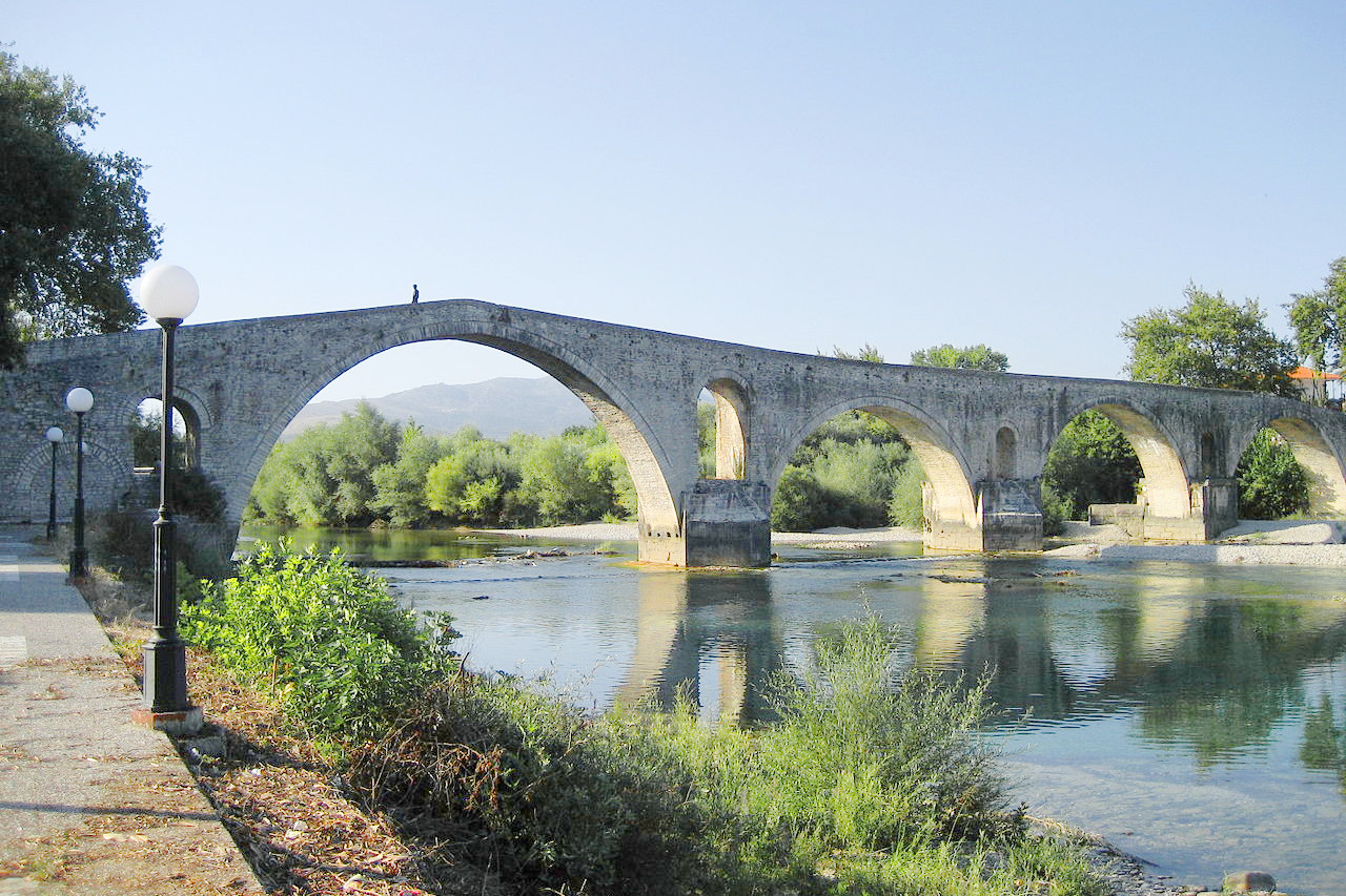 Bridge of Arta across the Arachthos river
The official websites
Western Greece
The pristine paradise of mainland Greece
| Location: | Western side of Mainland Greece |
| Coordinates: | 39° 15′ N, 21° 00′ E |
| Size: | • 235 km N-S; 175 km E-W • 145 miles N-S; 110 miles E-W |
| Terrain: | Very hilly with many mountain chains and deep valleys. Some coastal and inland plains |
| Climate: | Mediterranean climate: hot in the summer, but cool winters with rain and snow |
| Highest point: | Mount Smolikas 2,637 m / 8,652 ft |
| Forest: | 30% (2010 est.) (source) |
| Population: | 547,658 (2011) |
| Population density: | Low (38/km²) |
| Capital: | — |
| Languages: | Greek |
| Human Development Index: | Very high (0.888) |