_-_From_the_heights.jpg)
The Geography of
Liguria
Why visit Liguria?
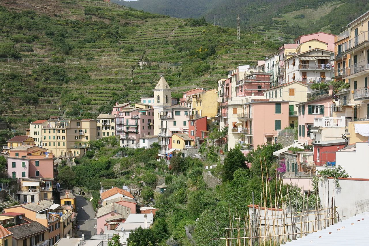
The narrow coastland of Liguria is known as the 'Italian Riviera'. The mountains here send down their ridges almost to the sea, and the scenery is exceedingly picturesque. Olive trees are cultivated in terraces up the face of the mountains in a warm, sunny climate, while the openings of the valleys are generally occupied by pretty towns or villages.
Contents
Map
 Relief map of Liguria
What is the landscape of Liguria like?
_-_From_the_heights.jpg&oldid=529076851)
.jpg&oldid=204756512)
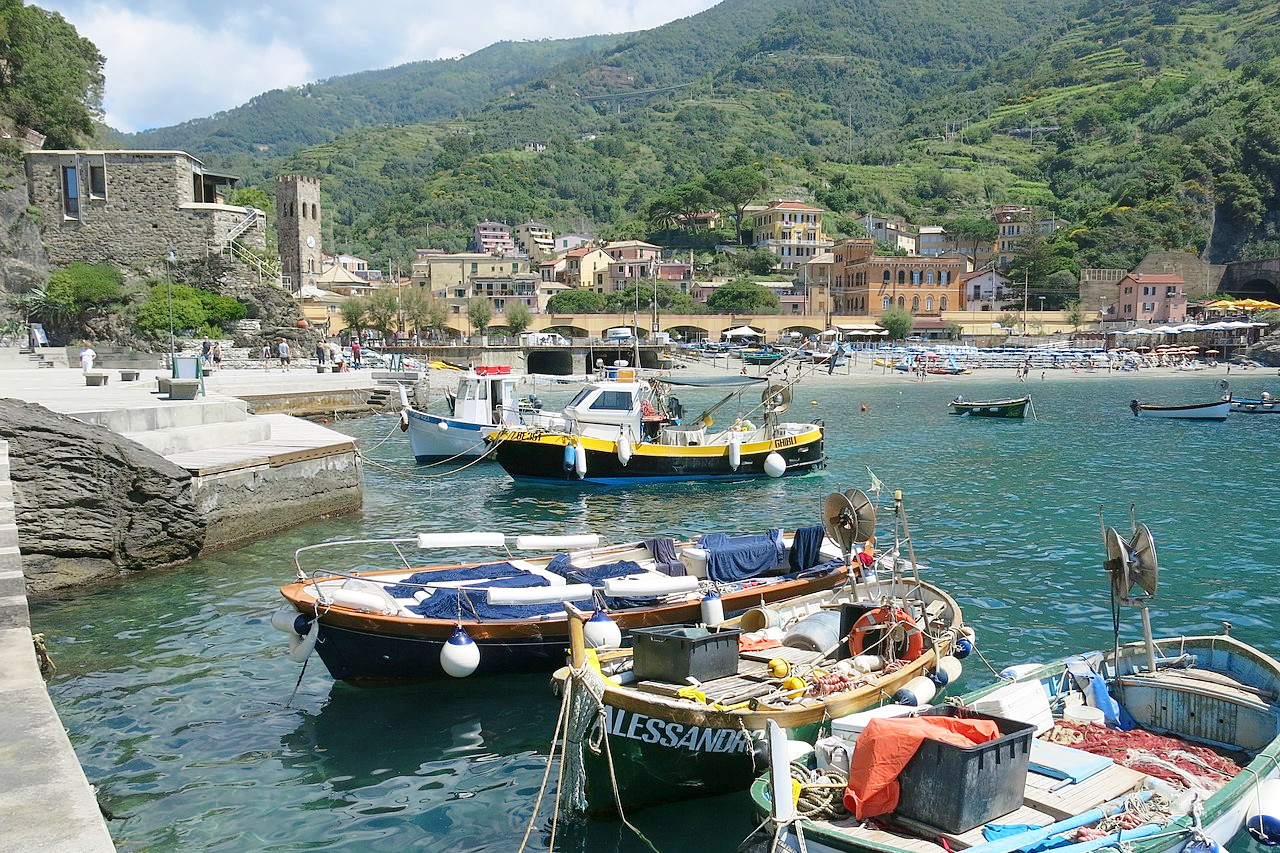
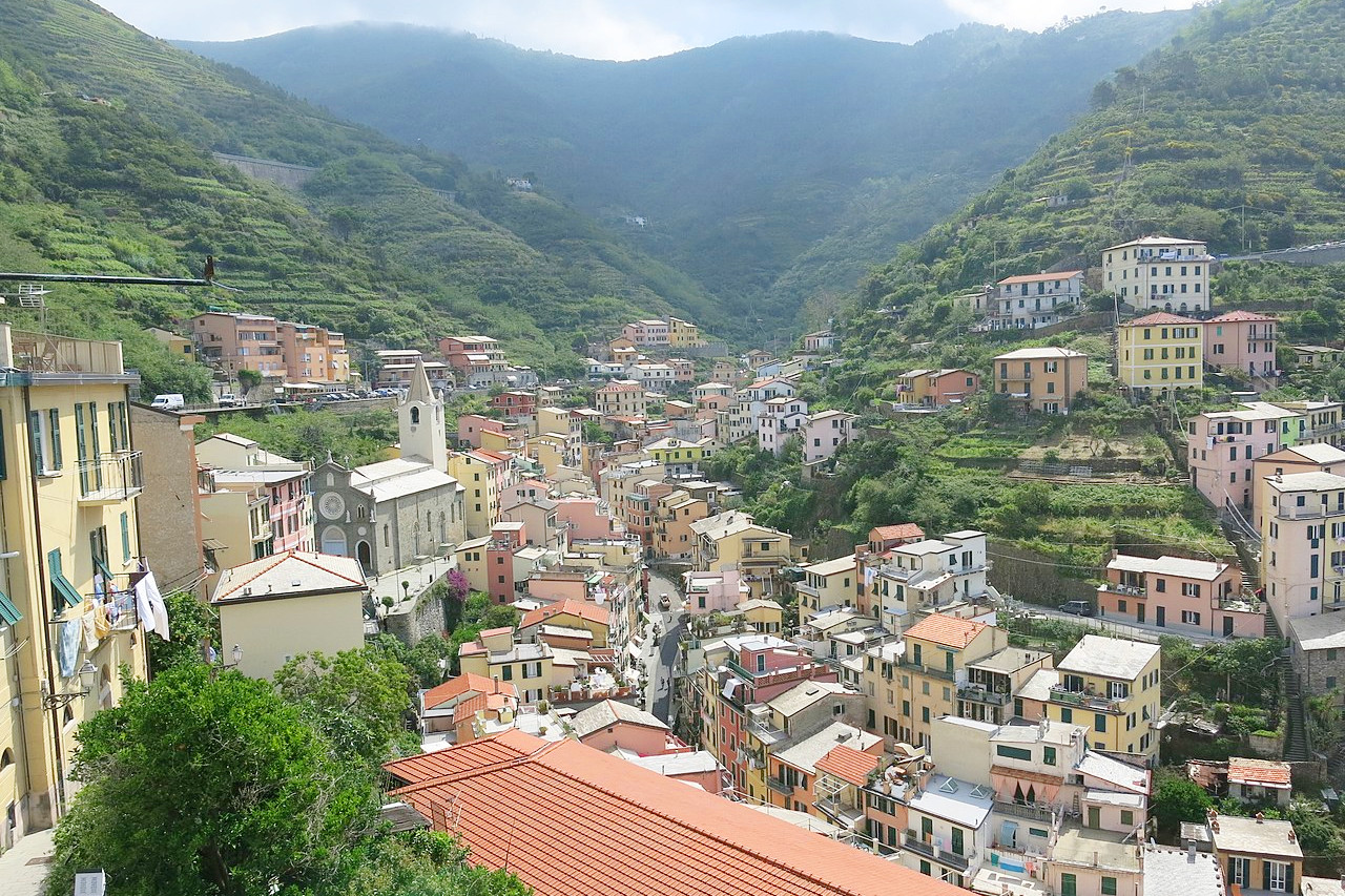
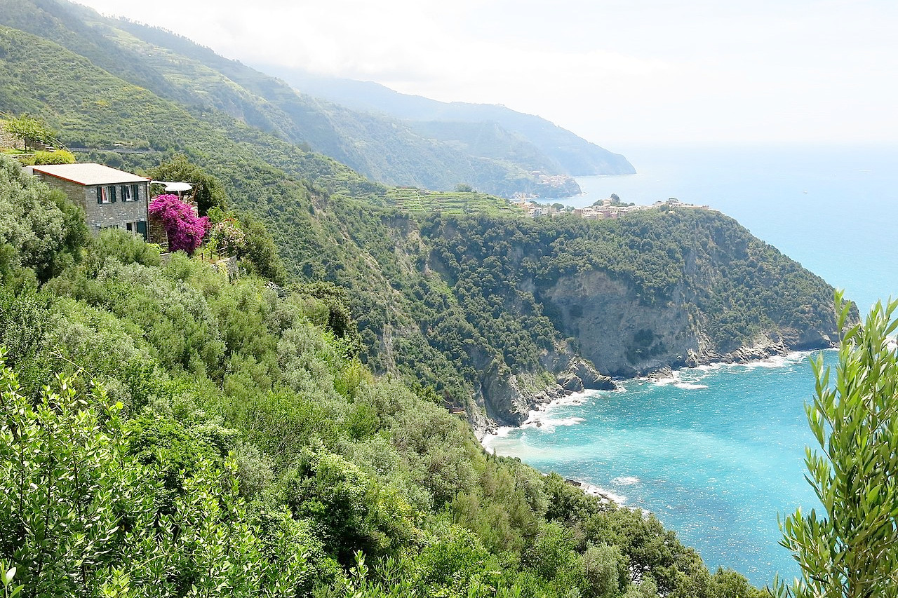
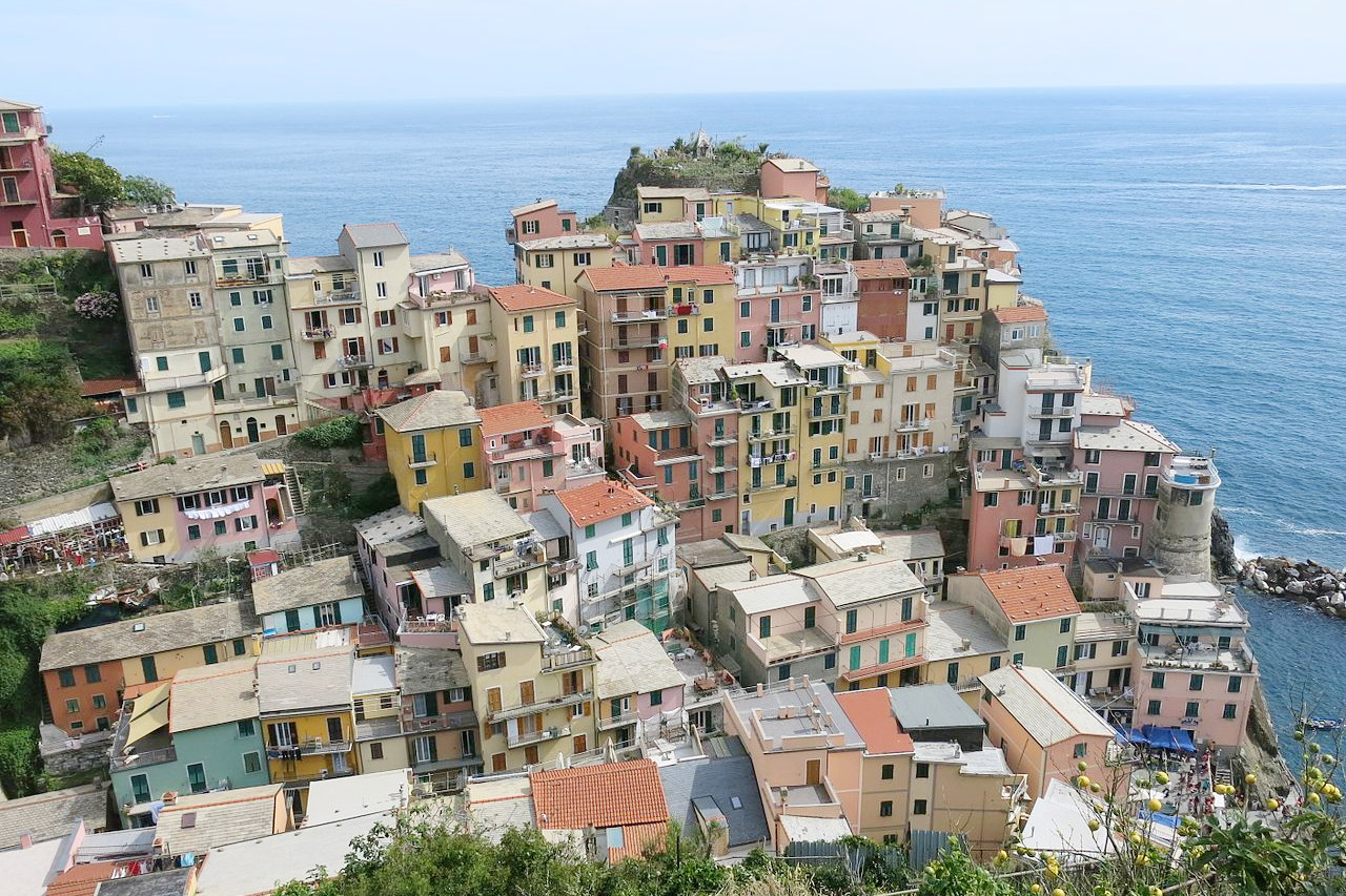
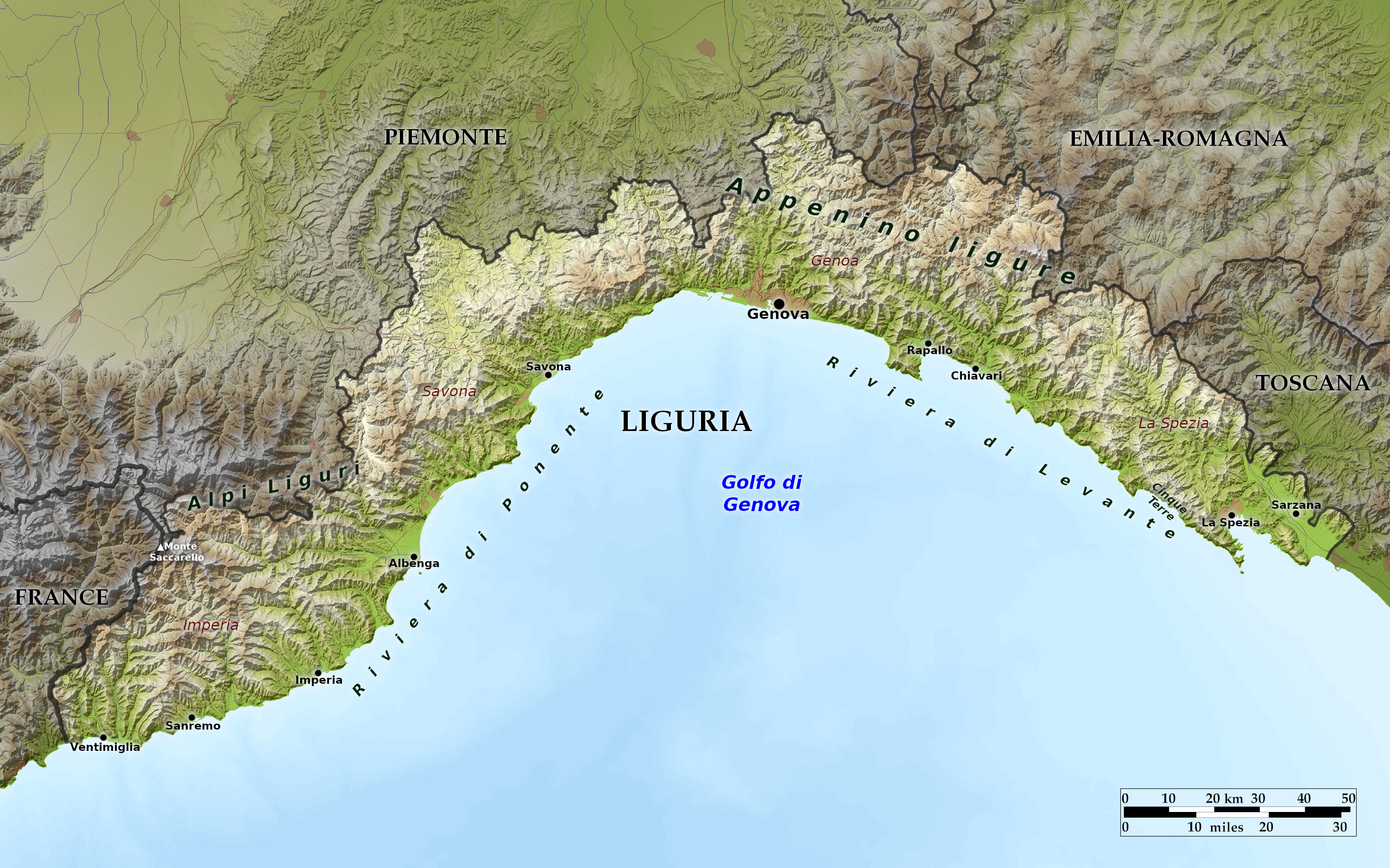
Liguria is a long coastal region that stretches along the Ligurian Sea from the French border to Tuscany. It is thin, squeezed between the sea and the Maritime Alps and the Ligurian Apennines. Almost the entire terrain is either mountainous or hilly. The region's mountains continue right to the shore, where they often tumble dramatically into the sea. Its coastline divides in two, the Riviera di Ponente to the west of Genoa and the Riviera di Levante to the east. Owing to the sheltered situation and the mildness of their climate, many of the coast towns are visited by tourists in winter as well as summer.
The towns, villages, old towers, and villas, impart an almost infinite variety to the scenery. One town occupies the top of a hill, and, seen from below, its old walls and towers stand out boldly against the sky; another is nestled in a harbor; a third is hidden in a hollow, and surrounded by vines, olive, orange, and lemon trees.
What is the nature of Liguria like?
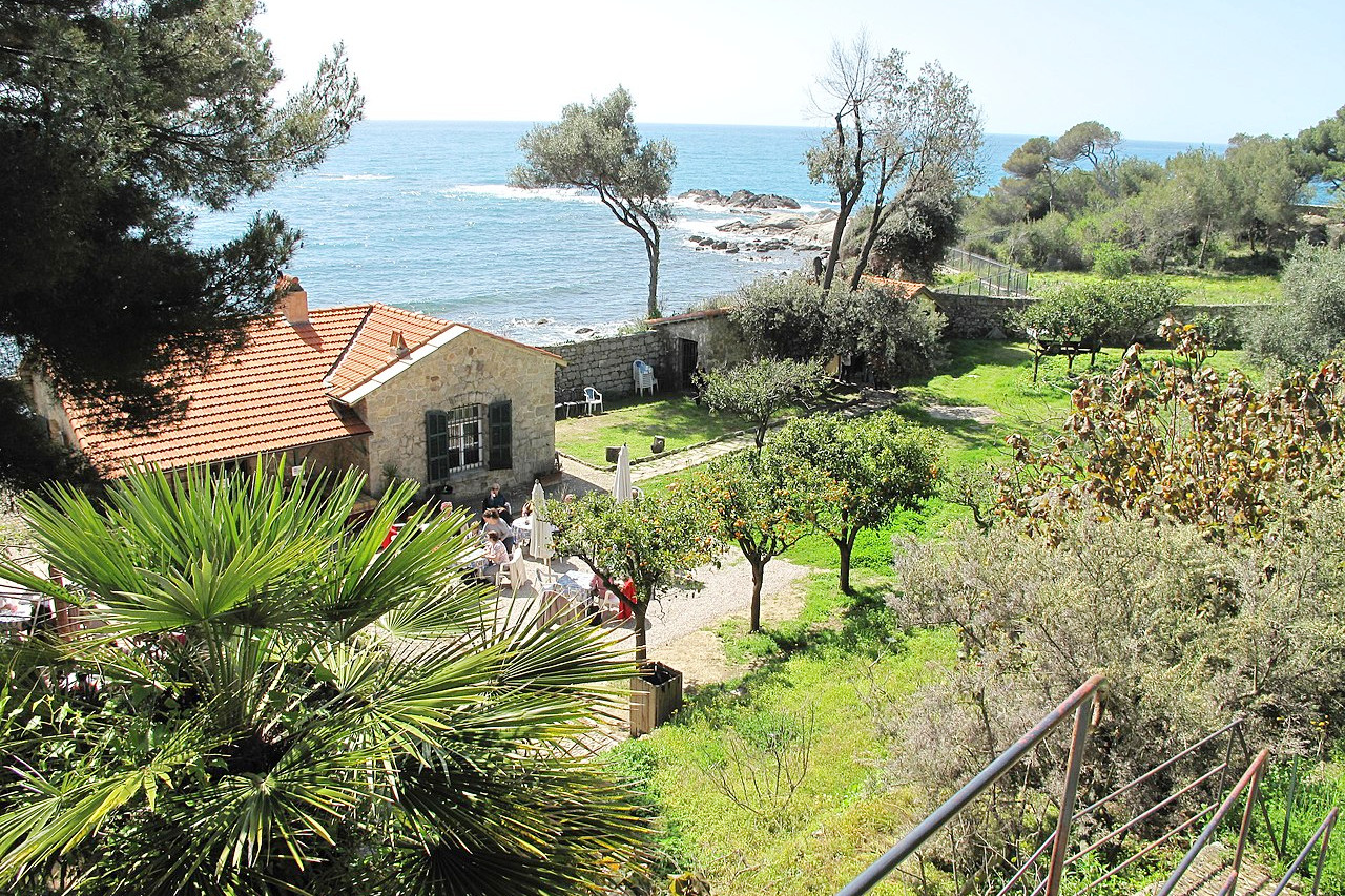
Liguria is a hevaily forested region of Italy. The largest forest areas are located inland. Beech forests cover the most humid slopes of the Apennines, elsewhere the beech is mixed with silver fir, Scots pine, and larch. There are also plantations of black pine and the Norway spruce. In hilly areas facing the sea, vines, olive and fruit trees are extensively grown, as are citrus fruits along the coast. In the coastal belt and in the adjoining hills are frequent forests of maritime pine and, more rarely, of Aleppo pine. The coastal Mediterranean scrub includes species such as broom, myrtle, strawberry tree, and holm oak. Subtropical palm trees and magnolia plants dot the shorelines.
What is the climate of Liguria like?
Liguria enjoys a Mediterranean climate, but one which is affected by the uneven terrain. The summer is only moderately hot but rather sultry. Normally daytime temperatures exceed 30°C only 3-4 times during the whole month of July, but the humidity is often high. Inland the climate is semi-continental and more extreme, with low winter temperatures. Vice versa the summer days are hot, but the daily averages during the summer are conditioned by the strong daily temperature range and the rather cool night temperatures. At altitude, summers are cool, dry and windy, and winter snow can sometimes reach the coasts.
| Climate data for Genoa (1971–2000) | |||||||||||||
|---|---|---|---|---|---|---|---|---|---|---|---|---|---|
| Month | Jan | Feb | Mar | Apr | May | Jun | Jul | Aug | Sep | Oct | Nov | Dec | Year |
| Average high °C (°F) | 11.5 (52.7) | 12.2 (54.0) | 14.6 (58.3) | 16.8 (62.2) | 20.5 (68.9) | 23.9 (75.0) | 27.3 (81.1) | 27.7 (81.9) | 24.4 (75.9) | 20.0 (68.0) | 15.1 (59.2) | 12.5 (54.5) | 18.9 (66.0) |
| Daily mean °C (°F) | 8.5 (47.3) | 9.1 (48.4) | 11.4 (52.5) | 13.7 (56.7) | 17.4 (63.3) | 20.8 (69.4) | 24.1 (75.4) | 24.4 (75.9) | 21.1 (70.0) | 16.9 (62.4) | 12.2 (54.0) | 9.5 (49.1) | 15.7 (60.3) |
| Average low °C (°F) | 5.5 (41.9) | 6.0 (42.8) | 8.2 (46.8) | 10.5 (50.9) | 14.2 (57.6) | 17.6 (63.7) | 20.9 (69.6) | 21.0 (69.8) | 17.9 (64.2) | 13.8 (56.8) | 9.2 (48.6) | 6.5 (43.7) | 12.6 (54.7) |
| Average rainfall mm (inches) | 101.8 (4.01) | 74.0 (2.91) | 81.7 (3.22) | 88.0 (3.46) | 72.4 (2.85) | 58.2 (2.29) | 24.2 (0.95) | 69.3 (2.73) | 136.4 (5.37) | 171.3 (6.74) | 108.8 (4.28) | 93.1 (3.67) | 1,079.2 (42.49) |
| Source: Servizio Meteorologico | |||||||||||||
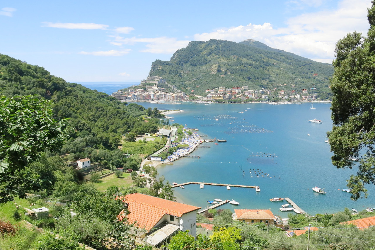 Palmaria island and Porto Venere
The official websites
Liguria
The Italian Riviera
| Location: | Northwest Italy |
| Coordinates: | 44° 30′ N, 8° 45′ E |
| Size: | • 100 km N-S; 205 km E-W • 60 miles N-S; 125 miles E-W |
| Terrain: | A long coastal region that stretches from the French border to Tuscany. Mountainous and hilly, with mountains continuing right to the shore |
| Climate: | Hot, sultry summers especially along the coasts. Cooler in the mountains with snowy winters |
| Highest point: | Monte Saccarello 2,201 m |
| Forest: | 63% (2010 est.) (source) |
| Population: | 1,557,533 (2017) |
| Population density: | High (290/km²) |
| Capital: | Genova (English: Genoa) |
| Languages: | Italian |
| Human Development Index: | Very High (0.898) |