The Geography of
Molise
Why visit Molise?
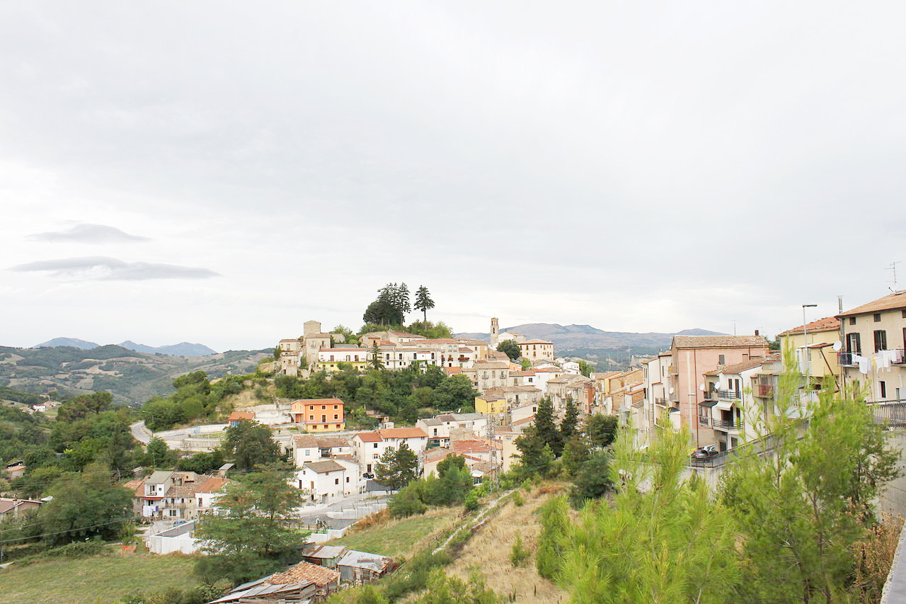
In Molise we approach the Southern Apennines. The region is very rural, spectacularly beautiful, but much less visited than its more famous neighbor Abruzzo.
Contents
Map
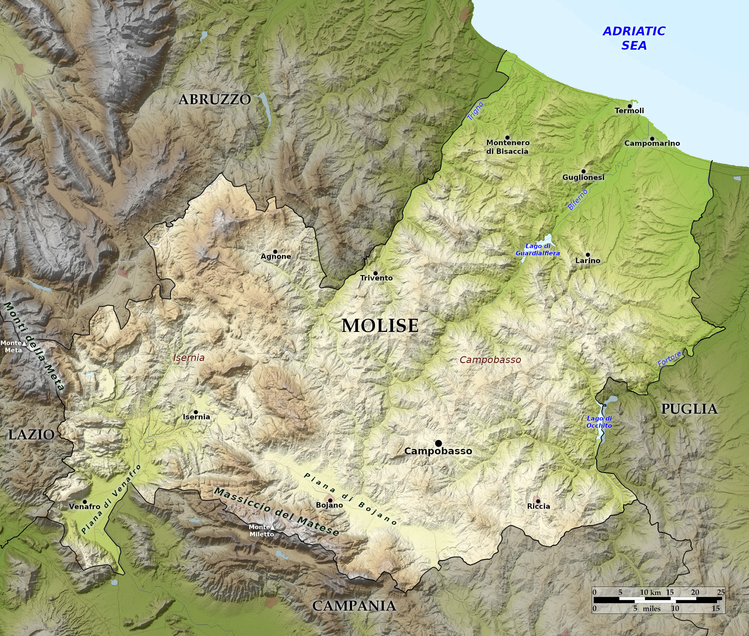 Relief map of Molise
What is the landscape of Molise like?
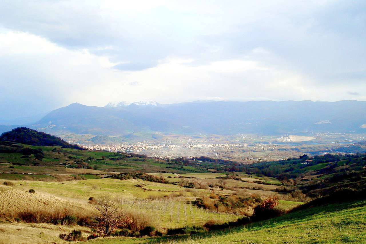
Molise occupies the Adriatic coast between Abruzzo and Apulia. Mountains make up much of the region, whereas the remainer is hilly. The mountains form part of the southern Apennines, and the region generally slopes northeast down toward the sea. The highest ridges form a horseshoe around Molise, with the Adriatic as the open side. In the south, the Matese ridge faces Campania, and the Meta ridge separates Molise, Abruzzo, and Lazio in the northwest corner of the region. Farther down the Abruzzese border toward the sea are the more gentle Frentani hills.
What is the nature of Molise like?
About thirty percent of Molise is covered by woodland. Coastal areas of Molise have forests of oak, downy oak and hornbeam, whereas the inland hills are characterised by the presence of oak, olive, pine, willow, holm oak, poplar, and alder. The lower mountains have mixed forests of oak, linden, maple and hornbeam. At higher altitudes, between 1000 and 2000 meters, beech is widespread, and sometimes the silver fir, and black pine.
What is the climate of Molise like?
The climate of Molise is a Mediterranean one, especially along the coasts, with hot summers and winters that are generally mild with rain . On the coast the climate is milder, as you proceed inland it becomes cooler and cooler and the temperatures drop somewhat.
| Climate data for Campobasso (1971–2000) | |||||||||||||
|---|---|---|---|---|---|---|---|---|---|---|---|---|---|
| Month | Jan | Feb | Mar | Apr | May | Jun | Jul | Aug | Sep | Oct | Nov | Dec | Year |
| Average high °C (°F) | 7.0 (44.6) | 7.5 (45.5) | 10.2 (50.4) | 13.4 (56.1) | 18.9 (66.0) | 23.2 (73.8) | 26.5 (79.7) | 26.6 (79.9) | 22.1 (71.8) | 16.7 (62.1) | 11.1 (52.0) | 8.1 (46.6) | 15.9 (60.6) |
| Daily mean °C (°F) | 4.3 (39.7) | 4.4 (39.9) | 6.7 (44.1) | 9.6 (49.3) | 14.7 (58.5) | 18.7 (65.7) | 21.7 (71.1) | 21.9 (71.4) | 18.0 (64.4) | 13.3 (55.9) | 8.3 (46.9) | 5.5 (41.9) | 12.3 (54.1) |
| Average low °C (°F) | 1.6 (34.9) | 1.4 (34.5) | 3.2 (37.8) | 5.8 (42.4) | 10.6 (51.1) | 14.1 (57.4) | 17.0 (62.6) | 17.2 (63.0) | 13.8 (56.8) | 9.9 (49.8) | 5.4 (41.7) | 2.9 (37.2) | 8.6 (47.4) |
| Average precipitation mm (inches) | 50.3 (1.98) | 55.8 (2.20) | 45.2 (1.78) | 51.7 (2.04) | 44.8 (1.76) | 32.6 (1.28) | 28.6 (1.13) | 36.2 (1.43) | 40.5 (1.59) | 48.9 (1.93) | 72.2 (2.84) | 53.4 (2.10) | 560.2 (22.06) |
| Source: Servizio Meteorologico | |||||||||||||
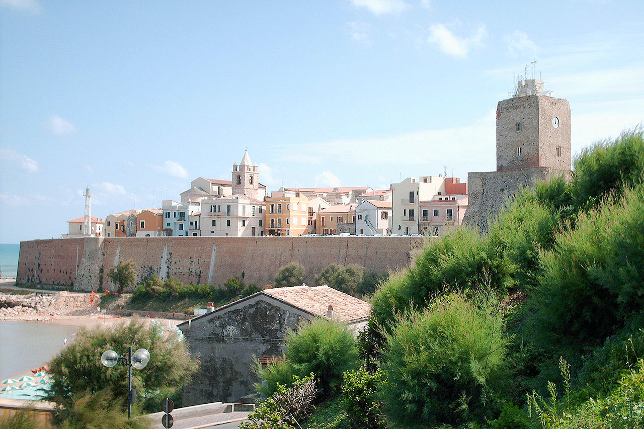
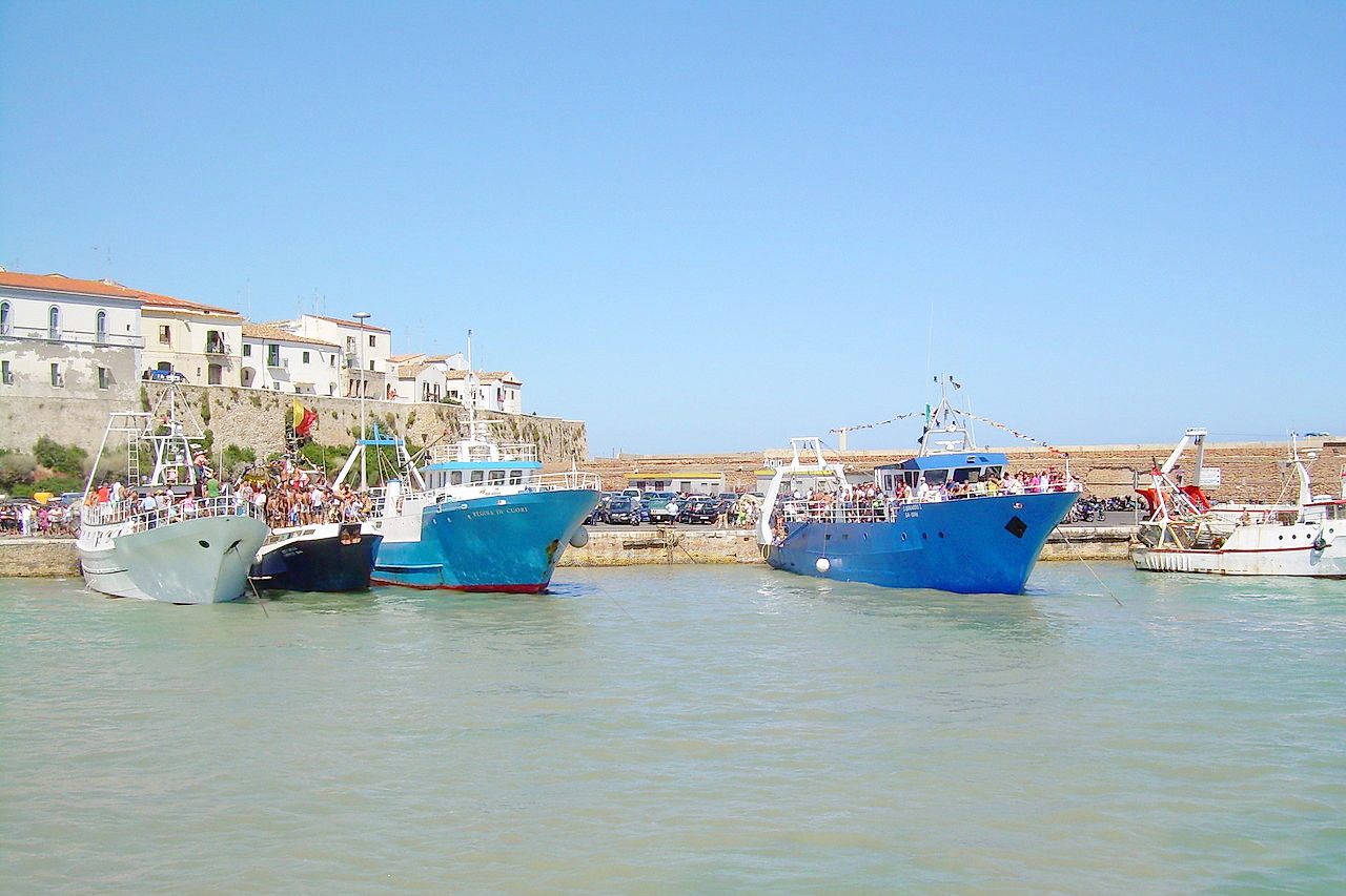 Harbor of Termoli
The official websites
Molise
Unexplored Italy
| Location: | Eastern Italy |
| Coordinates: | 41° 45′ N, 14° 45′ E |
| Size: | • 80 km N-S; 100 km E-W • 50 miles N-S; 60 miles E-W |
| Terrain: | Mountains and hills. Southern Apennines slope northeast down toward the sea |
| Climate: | Mediterranean climate, especially along the coast, with hot summers and cool winters. Cooler inland |
| Highest point: | Monte Meta 2,242 m |
| Forest: | 30% (2010 est.) (source) |
| Population: | 308,493 (2019) |
| Population density: | Low (70/km²) |
| Capital: | Campobasso |
| Languages: | Italian |
| Human Development Index: | Very High (0.872) |