The Geography of
Sicily
Why visit Sicily?
Sicily is the largest island in the Mediterranean. It has an amazing history, and its Greek cities were some of the most beautiful in the Hellenic world. It is a sunny island whose land is rich in contrasts, with a splndid coastline. In the east rises the majestic volcano Etna, still active, formed by successive eruptions.
Contents
Map
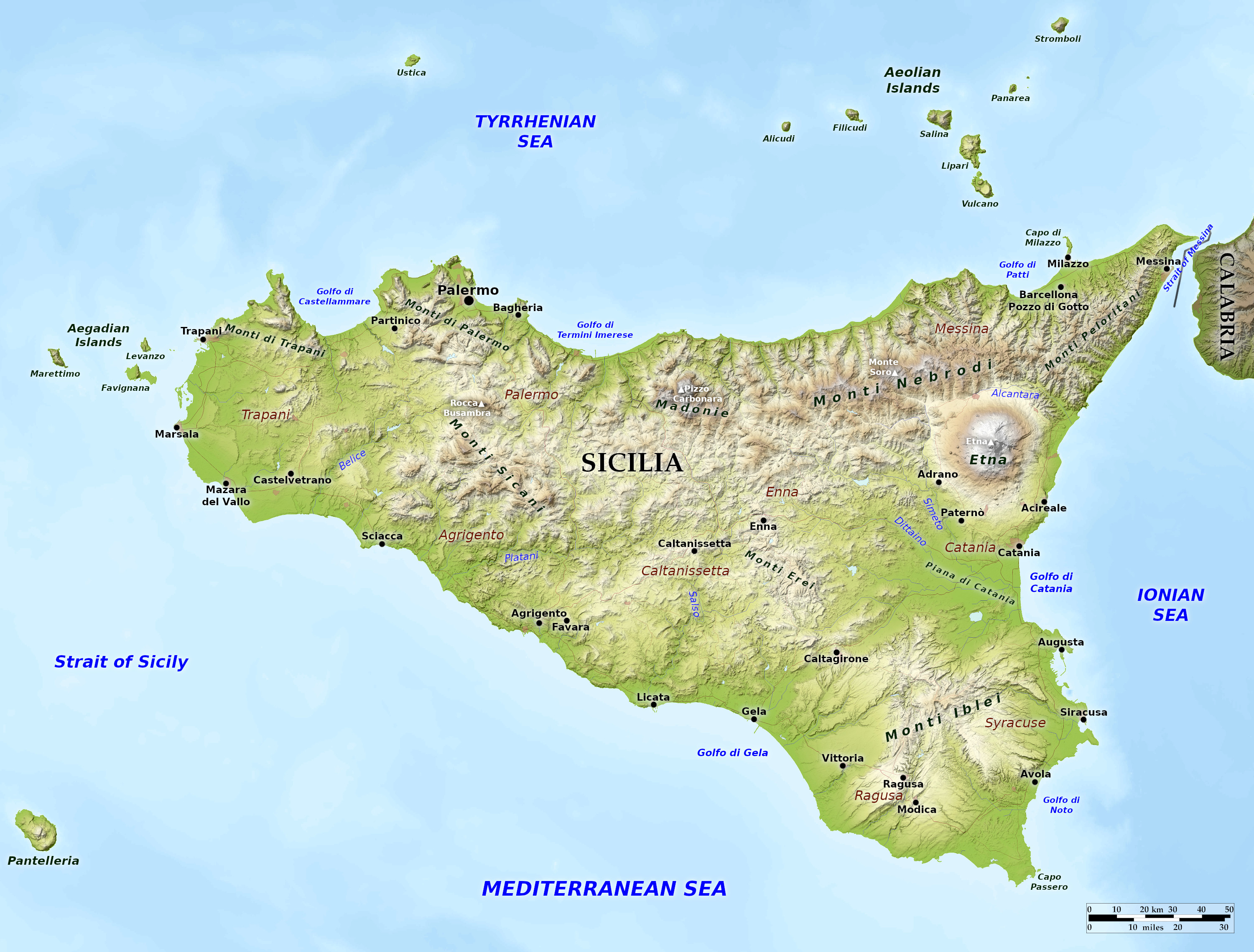
 Relief map of Sicily
What is the landscape of Sicily like?
Sicily is the largest island in the Mediterranean Sea. It is separated from Calabria and the rest of Italy by the 20-mile-long Strait of Messina, which is 2 miles wide at its narrowest point. The northern and eastern coasts are generally steep, with good harbours such as that of Palermo. The northern chain of mountains, running from Messina to Palermo is a continuation of the Calabrian Appenines. The lower slopes of all the heights form one continuous series of olive-yards and orange groves. Plains occupy only a small part of Sicily; the largest one is around Catania in the east.
Most of the island is made up of hills (60 percent) or mountains (25 percent). Some of the mountains are volcanic; Mount Etna, Europe’s greatest volcano, still erupts, releasing a never-ending supply of steam and smoke at its peak of 3,357 m (11,014 feet). This is the highest point of the island, with patches of snow on its summit all year round. From its base to the summit of its crater, the huge volcano forms a region apart; on its slopes there are rich pastures, vineyards, gardens, arable lands, and forests. Stromboli and Vulcano, two offshore islands in the Aeolian islands chain, are also volcanic. Other islands off Sicily’s coast include the Egadi Islands to its west and Pantelleria to the south.
What is the nature of Sicily like?
Sicily was originally covered by forest, but deforestation and soil erosion has cleared many of the Sicilian hillsides, especially towards the southwest. Large, contiguous forest areas still exist in the Monti Madonie and Monti Nebrodi ranges. Here grow cork oaks, beeches, pines, and the native fir—the Sicilian fir. Carob trees thrive on Monti Iblei in the southeast.
Despite ruthless clearings, Sicily is still very green, with 3000 different plant species. In addition to a variety of native plants, (e.g. orchids), many subtropical and tropical plants thrive on the island such as bougainvillea, jasmine, mimosa, rubber trees, and banana trees. Among the most important cultivated plants are grapevines and olive trees grown since Greek times. Citrus fruits and almond trees came to Sicily in medieval times. The fertile slopes of Mount Etna and the flat lowlands south of Catania are famed for their vegetable and fruit production.
What is the climate of Sicily like?
The climate of Sicily is a Mediterranean one, with hot summers and mild winters. On the coasts, especially the southwest, the summers are very hot, and it is not uncommon, especially in summer to experience the sirocco, the wind from the Sahara. Rainfall is scarce in some provinces and droughts are frequent. Along the northern coast, and inland, the temperature is lower, winters are colder and rainfall higher. High up on Mount Etna the climate is of an alpine type.
| Climate data for Palermo (1971-2000) | |||||||||||||
|---|---|---|---|---|---|---|---|---|---|---|---|---|---|
| Month | Jan | Feb | Mar | Apr | May | Jun | Jul | Aug | Sep | Oct | Nov | Dec | Year |
| Average high °C (°F) | 14.7 (58.5) | 14.5 (58.1) | 16.4 (61.5) | 18.7 (65.7) | 23.3 (73.9) | 27.2 (81.0) | 29.8 (85.6) | 30.5 (86.9) | 27.5 (81.5) | 23.5 (74.3) | 19.0 (66.2) | 15.8 (60.4) | 21.7 (71.1) |
| Daily mean °C (°F) | 11.8 (53.2) | 11.5 (52.7) | 13.0 (55.4) | 15.1 (59.2) | 19.3 (66.7) | 23.2 (73.8) | 25.7 (78.3) | 26.6 (79.9) | 23.8 (74.8) | 20.1 (68.2) | 15.9 (60.6) | 13.0 (55.4) | 18.3 (64.9) |
| Average low °C (°F) | 8.9 (48.0) | 8.5 (47.3) | 9.6 (49.3) | 11.4 (52.5) | 15.3 (59.5) | 19.2 (66.6) | 21.7 (71.1) | 22.7 (72.9) | 20.1 (68.2) | 16.7 (62.1) | 12.9 (55.2) | 10.2 (50.4) | 14.8 (58.6) |
| Average precipitation mm (inches) | 97.5 (3.84) | 109.9 (4.33) | 78.2 (3.08) | 65.1 (2.56) | 36.2 (1.43) | 17.9 (0.70) | 6.7 (0.26) | 31.8 (1.25) | 65.3 (2.57) | 105.6 (4.16) | 117.5 (4.63) | 123.7 (4.87) | 855.4 (33.68) |
| Source: Servizio Meteorologico | |||||||||||||
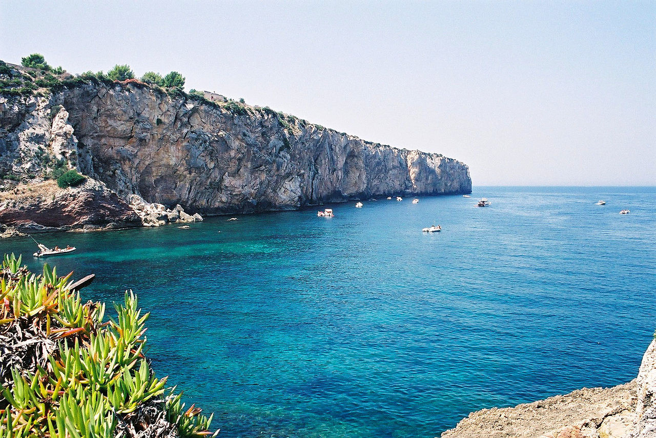
 Rocky coastline of Terrasini near Palermo
The official websites
Sicilia

The holiday island
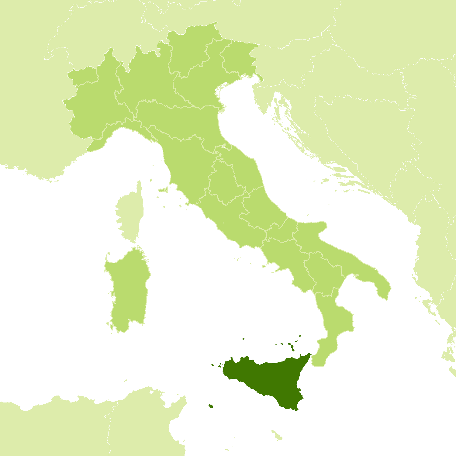
| Location: | Southwest Italy |
| Coordinates: | 37° 30′ N, 14° 00′ E |
| Size: | • 185 km N-S; 285 km E-W • 115 miles N-S; 175 miles E-W |
| Terrain: | An island of hills and mountains, including Mount Etna, Europe’s greatest volcano |
| Climate: | Hot and very long summers with frequent droughts. Mild and rainy winters, with snow at high altitude |
| Highest point: | Etna 3,343 m |
| Forest: | 15% (2010 est.) (source) |
| Population: | 4,969,147 (2019) |
| Population density: | Medium-to-High (190/km²) |
| Capital: | Palermo |
| Languages: | Italian; Sicilian |
| Human Development Index: | Very High (0.845) |
.jpg)
.jpg)