i.jpg)
i.jpg&oldid=456493197)
The Geography of
Calabria
Why visit Calabria?
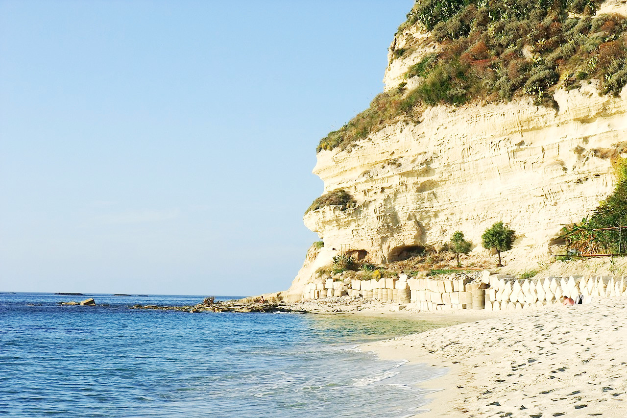
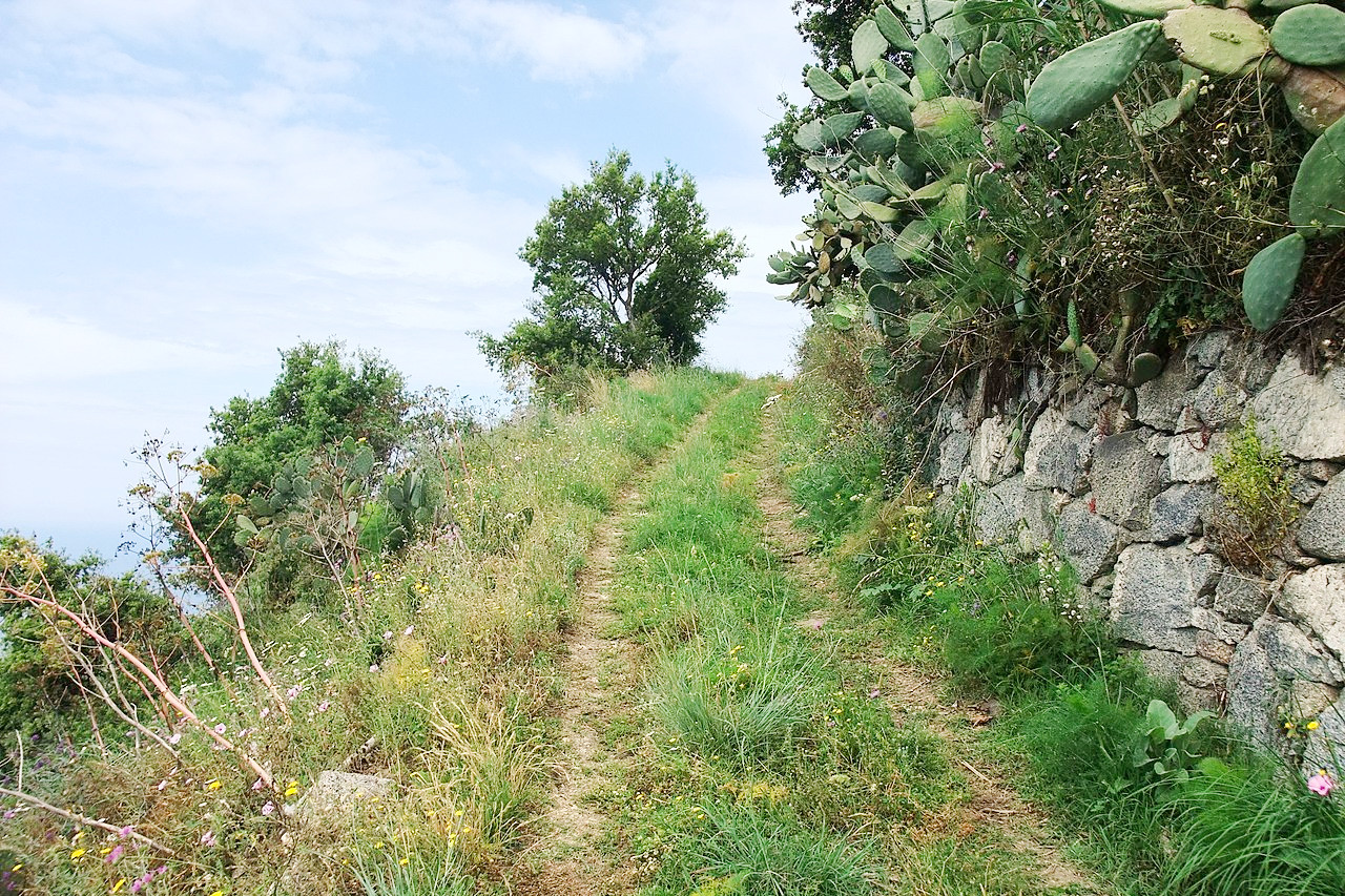
Calabria is a beautiful country, with a lush and sometimes wild countryside, and an unspoilt sea. This is the southern extremity of mainland Italy. The Apennines here are very much different from the rest of the range, being flanked on the east by a great mass of granitic mountains, and covered with forests. The coast of the Tyrrhenian Sea is just spectacular.
Contents
Map
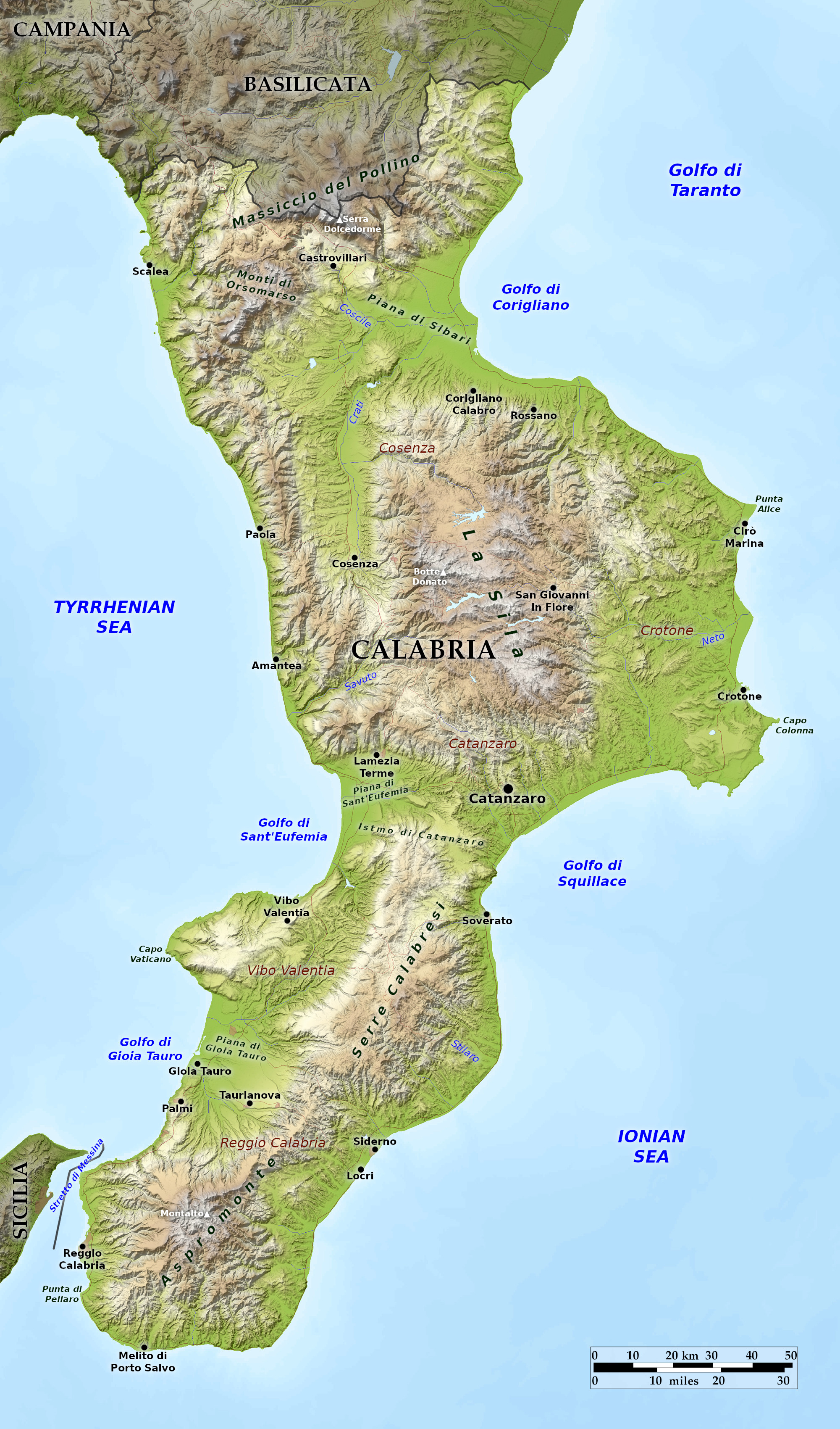 Relief map of Calabria
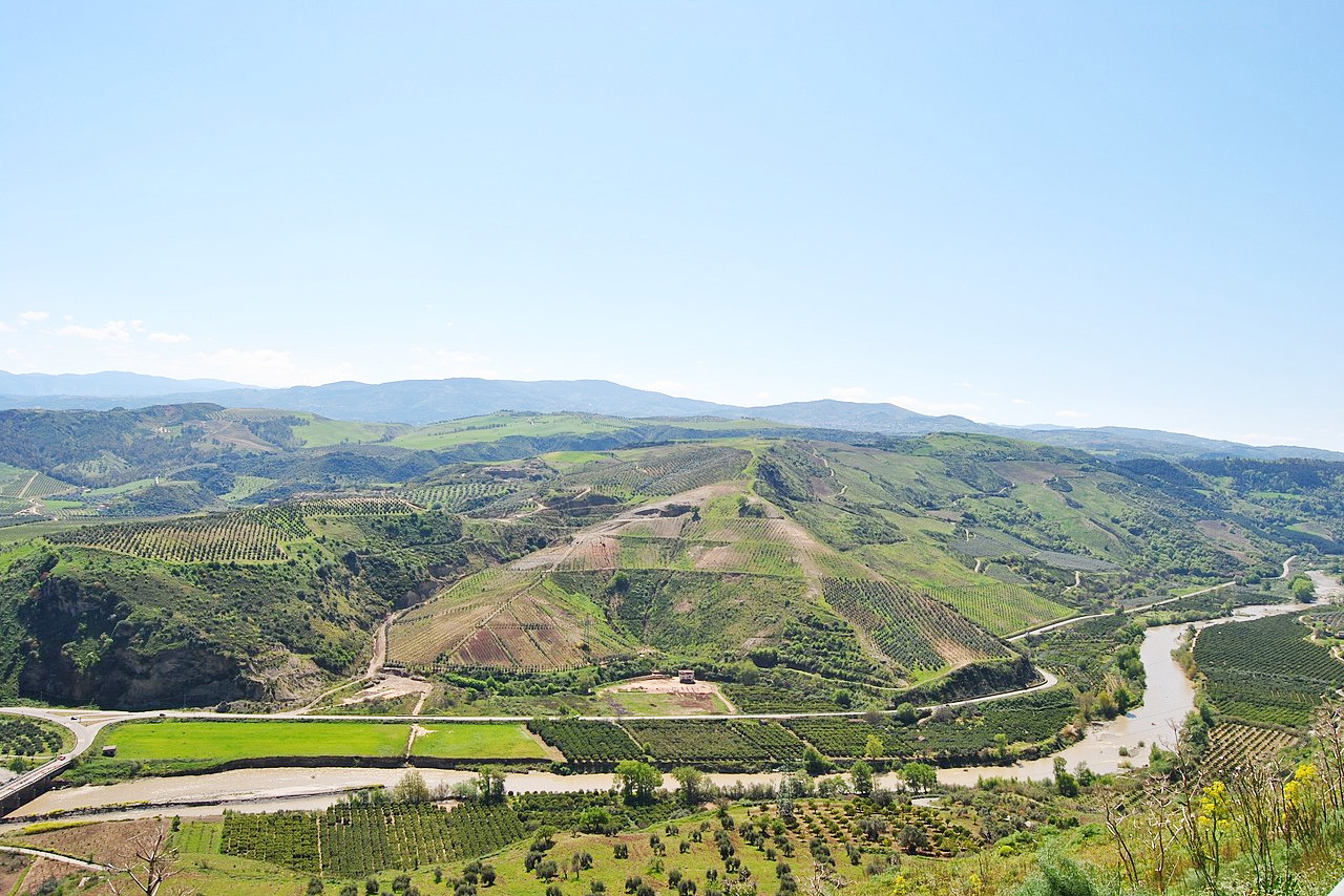
What is the landscape of Calabria like?
Frequently considered the "toe" of the Italian "boot," Calabria is a long peninsula separated from the rest of continental Italy to its north by Basilicata. On Calabria's eastern shore is the Ionian Sea, and on its western shore is the Tyrrhenian Sea. At the region's southern tip, the Strait of Messina separates Calabria from Sicily. The land is one of mountains and hills, with a few plains. This part of the Apennines is very much different from the rest of the range. The broken limestone range which is the true continuation of the chain keeps close to the west coast, being flanked on the east by a great mass of granitic mountains, rising to about 1,800 meters (6,000 feet), and covered with forests.The highest points in the region are in the Pollini range,which forms the border with Basilicata. Monte Pollini and Serra del Dolcedorme are Calabria's tallest peaks, each over 2,000 meters (7,000 feet).
The large Pollino National Park straddles the border with Basilicata. Below the mountains stretches a string of plateaus, or sile. These highlands are surprisingly green (sila derives from the Latin silva, forest), and are noted for their wildlife. A mass of hills fills up the "toe" peninsular all the way to Reggio. The two southern sile and much of the Aspromonte highlands at the southern end of the region are in two national parks, the Parco nazionale dell'Aspromonte and the Parco nazionale della Calabria established between 1968 and 1978.
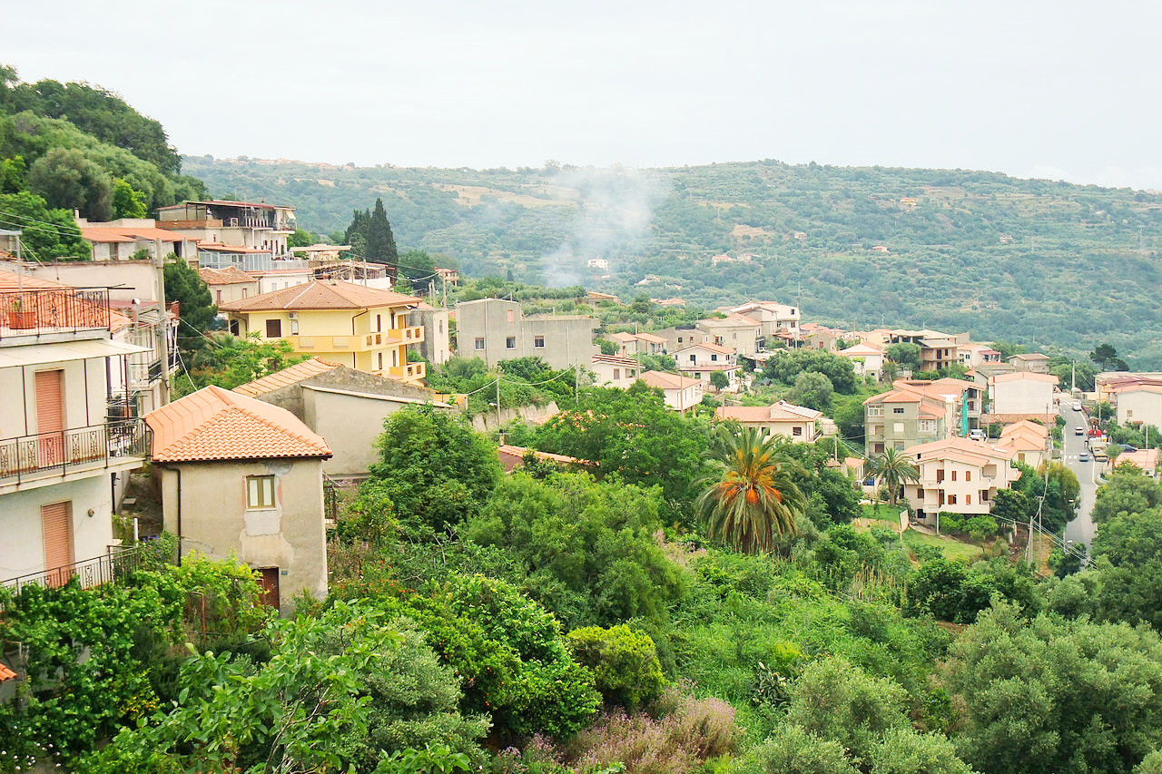
What is the nature of Calabria like?
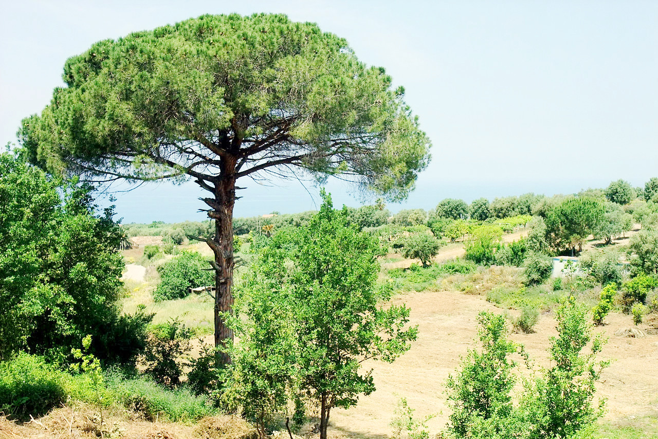
The vegetation of Calabria differs according to altitude. The Mediterranean plain runs from sea level up to 600 meters (2,000 feet) where there are olive trees, holm oaks and other plants typical of the Mediterranean climate. Above this there is a transitional hilly flora up to 1,000 meters (3,300 feet)—here chestnut trees and other oak species dominate. From 1,000 meters upwards, the mountain species begin, composed of beech, silver fir and black pine. The east coast bears a dense vegetation—the streams from the mountains are torrents, each flood bringing heaps of debris which get overgrown with flowering shrubs.
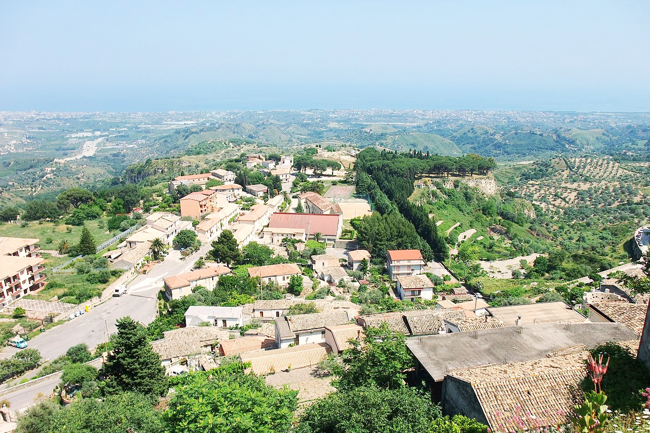
What is the climate of Calabria like?
The Calabrian climate is generally a Mediterranean one. The Ionian coast is drier than the Tyrrhenian, which has a milder climate. In general, the temperatures along the coasts never get very cold in winter and rarely become extreme in the summer months. In the mountains the climate is more of a continental one with cold winters and snow, summer is warm and there are occasional storms.
| Climate data for Reggio Calabria | |||||||||||||
|---|---|---|---|---|---|---|---|---|---|---|---|---|---|
| Month | Jan | Feb | Mar | Apr | May | Jun | Jul | Aug | Sep | Oct | Nov | Dec | Year |
| Average high °C (°F) | 15.3 (59.5) | 15.6 (60.1) | 17.1 (62.8) | 19.3 (66.7) | 23.8 (74.8) | 27.9 (82.2) | 31.1 (88.0) | 31.3 (88.3) | 28.2 (82.8) | 23.9 (75.0) | 19.7 (67.5) | 16.6 (61.9) | 22.5 (72.5) |
| Daily mean °C (°F) | 11.8 (53.2) | 11.8 (53.2) | 13.0 (55.4) | 15.1 (59.2) | 19.2 (66.6) | 23.2 (73.8) | 26.4 (79.5) | 26.7 (80.1) | 23.7 (74.7) | 19.8 (67.6) | 15.9 (60.6) | 13.1 (55.6) | 18.3 (65.0) |
| Average low °C (°F) | 8.2 (46.8) | 7.9 (46.2) | 9.0 (48.2) | 10.9 (51.6) | 14.7 (58.5) | 18.6 (65.5) | 21.6 (70.9) | 22.1 (71.8) | 19.3 (66.7) | 15.7 (60.3) | 12.1 (53.8) | 9.6 (49.3) | 14.1 (57.5) |
| Average precipitation mm (inches) | 69.6 (2.74) | 61.5 (2.42) | 50.7 (2.00) | 40.4 (1.59) | 19.8 (0.78) | 10.9 (0.43) | 7.0 (0.28) | 11.9 (0.47) | 47.5 (1.87) | 72.5 (2.85) | 81.7 (3.22) | 73.3 (2.89) | 546.8 (21.54) |
| Source: Servizio Meteorologico | |||||||||||||
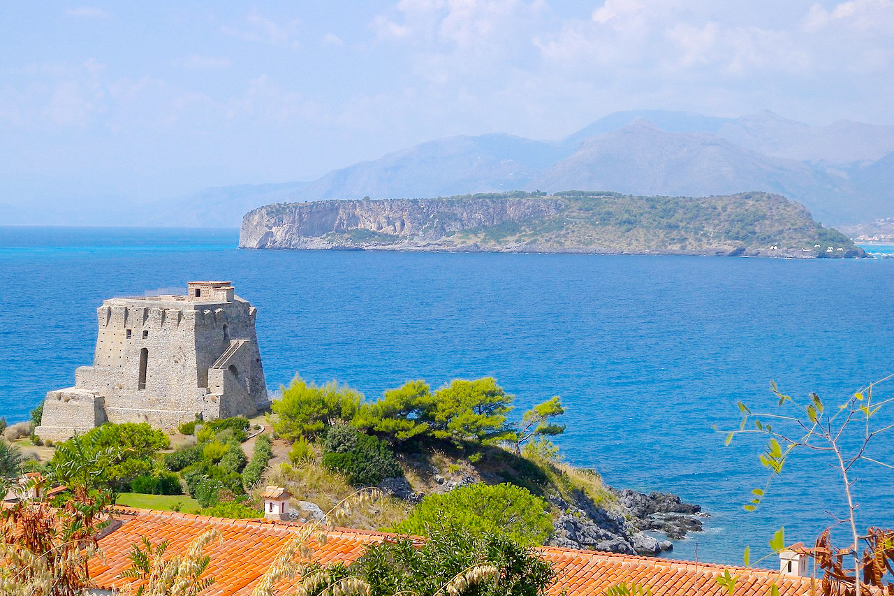
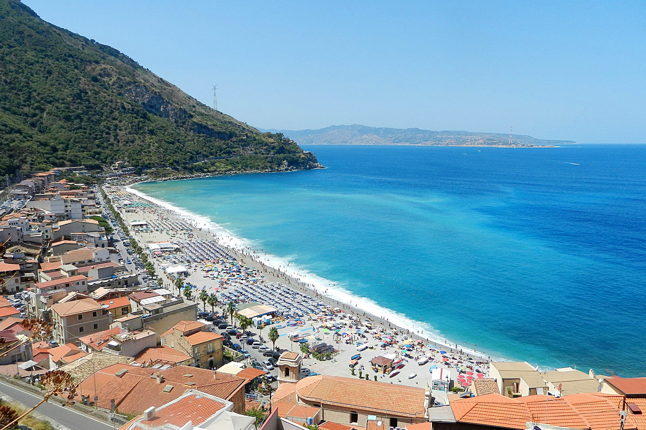 The beach of Scilla, looking towards Sicily
The official websites
Calabria
The soul of Italy
| Location: | Southwest Italy |
| Coordinates: | 39° 00′ N, 16° 30′ E |
| Size: | • 250 km N-S; 135 km E-W • 155 miles N-S; 85 miles E-W |
| Terrain: | A long peninsula of mountains and hills. Well-forested in the highlands. Some coastal plains |
| Climate: | Warm temperatures along the coasts, hot in the summer months. Cooler in the mountains with snowy winters and warm summers |
| Highest point: | Serra Dolcedorme 2,267 m / 7,438 ft |
| Forest: | 46% (2010 est.) (source) |
| Population: | 1,877,527 (2012) |
| Population density: | Medium (120/km²) |
| Capital: | Catanzaro |
| Languages: | Italian |
| Human Development Index: | Very High (0.845) |