.JPG)
.JPG&oldid=509904627)
The Geography of
Slovenia
Why visit Slovenia?
Any visitor to Slovenia will be struck by the variety of landscapes in this small country. To the north are the Karawanken Alps, tipped by snow for most of the year, and to the south the gentle green hills of Carniola. In the east, one finds the flatter landscape of the Pannonian plain stretching towards Hungary. The country has lakes and rivers, forests, hills, and plains, with hilltops and small villages dotting the landscape. Slovenia’s culture is diverse and includes influences from its neighbors Austria to the north, Hungary to the east, Italy to the southwest, as well as Croatia along its southern border.
Contents
Map
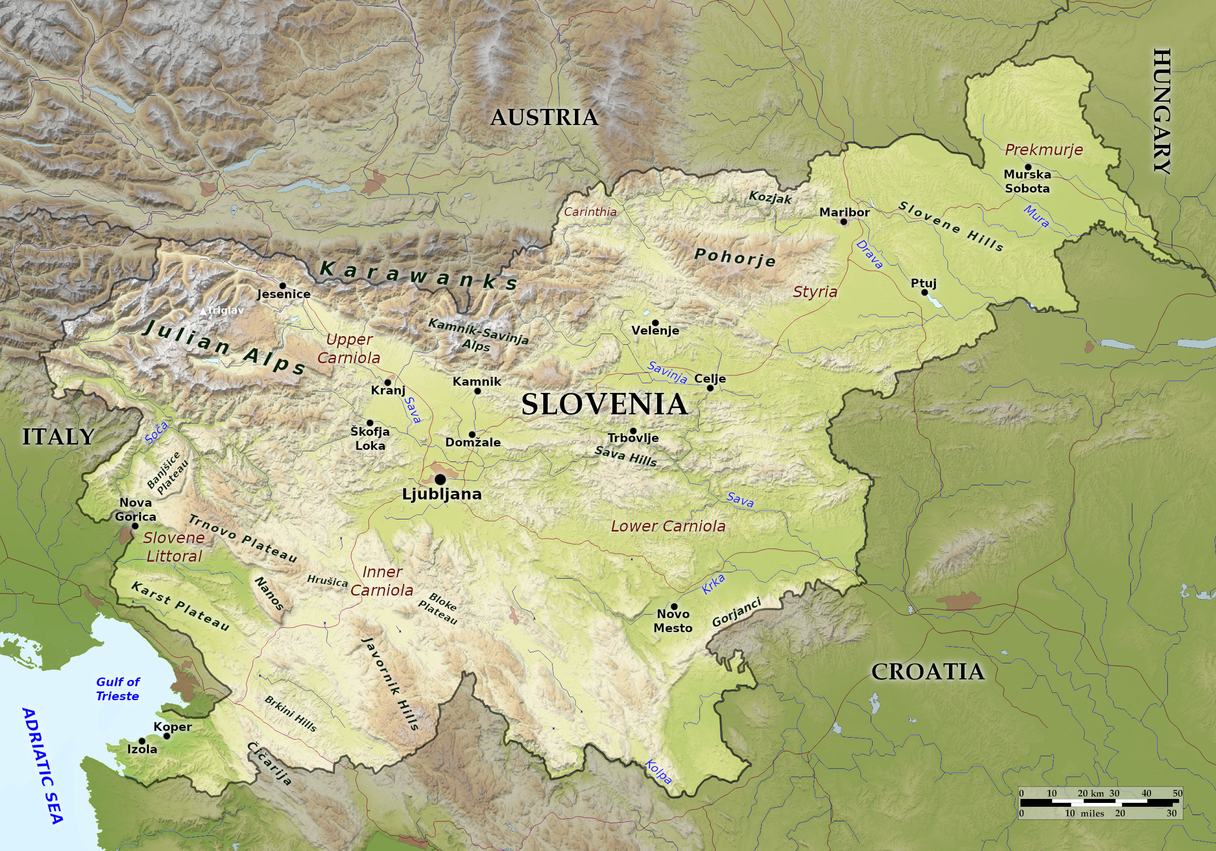 Relief map of Slovenia
What is the landscape of Slovenia like?
Slovenia only has a short coastline on the Adriatic Sea in the southwest where there are tiny Venetian-style harbours. Slovenia's only beaches are near Koper; elsewhere the coast between Izola and Piran is lined with steep cliffs that reach up to 80 meters (260 feet).
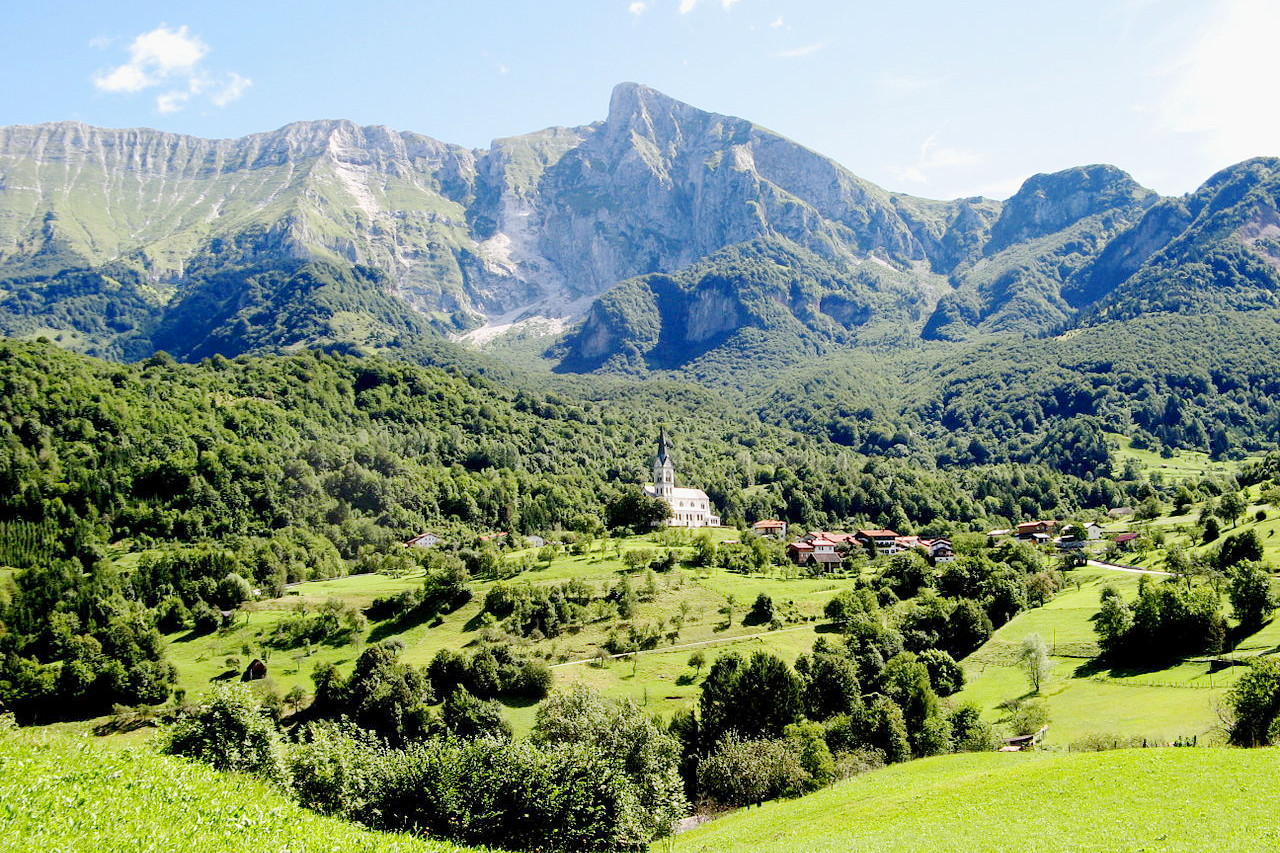
The Alps are the dominant feature throughout most of the country, especially in the north. The Julian Alps, which occupy the northwestern corner of the country, are the highest of Slovenia's alpine ranges and among the most rugged in Europe. Many summits here exceed 1,800 meters (5,900 feet), including Mount Triglav (2,864 m / 9,396 ft), the country's highest peak. The Karawanken Mountains run along the border with Austria; Mount Stol (2,236 m / 7,336 ft) is the highest peak in this system. The Kamnik-Savinja range lies on the southern side of the Karawankens.
The Alpine region abounds in beautiful summer and winter resorts, the most important of which are Bled, situated in a beautiful valley; the Lake of Bohinj, up among the mountains by the Italian frontier; and Planica, an Alpine resort, with the greatest ski-jump to its credit. The Slovene Alps are particularly attractive to climbers.
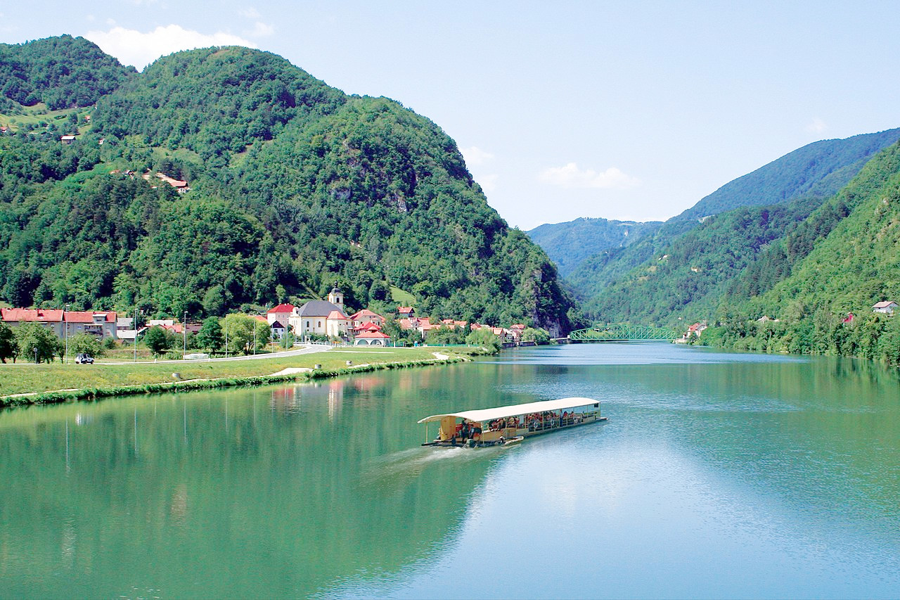
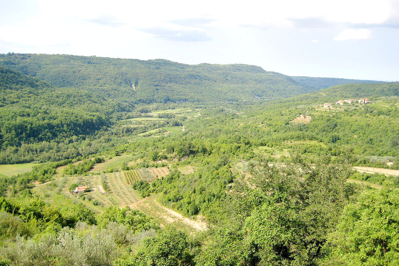
To the south are the gentler hills of Carniola, which rise to the limestone hills of the Dinaric Alps in the southwest. In the east is the flatter landscape of the Pannonian Plain, which includes wide valley basins, alluvial plains, sandy dunes, and low, rolling hills.
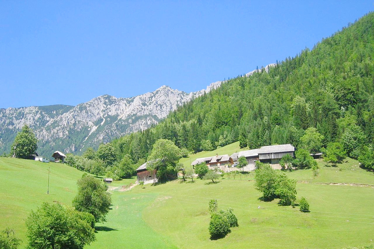
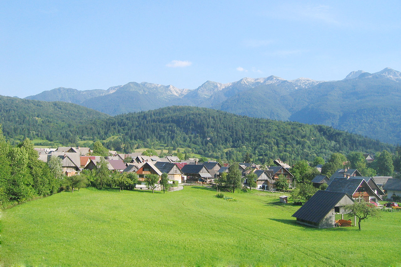
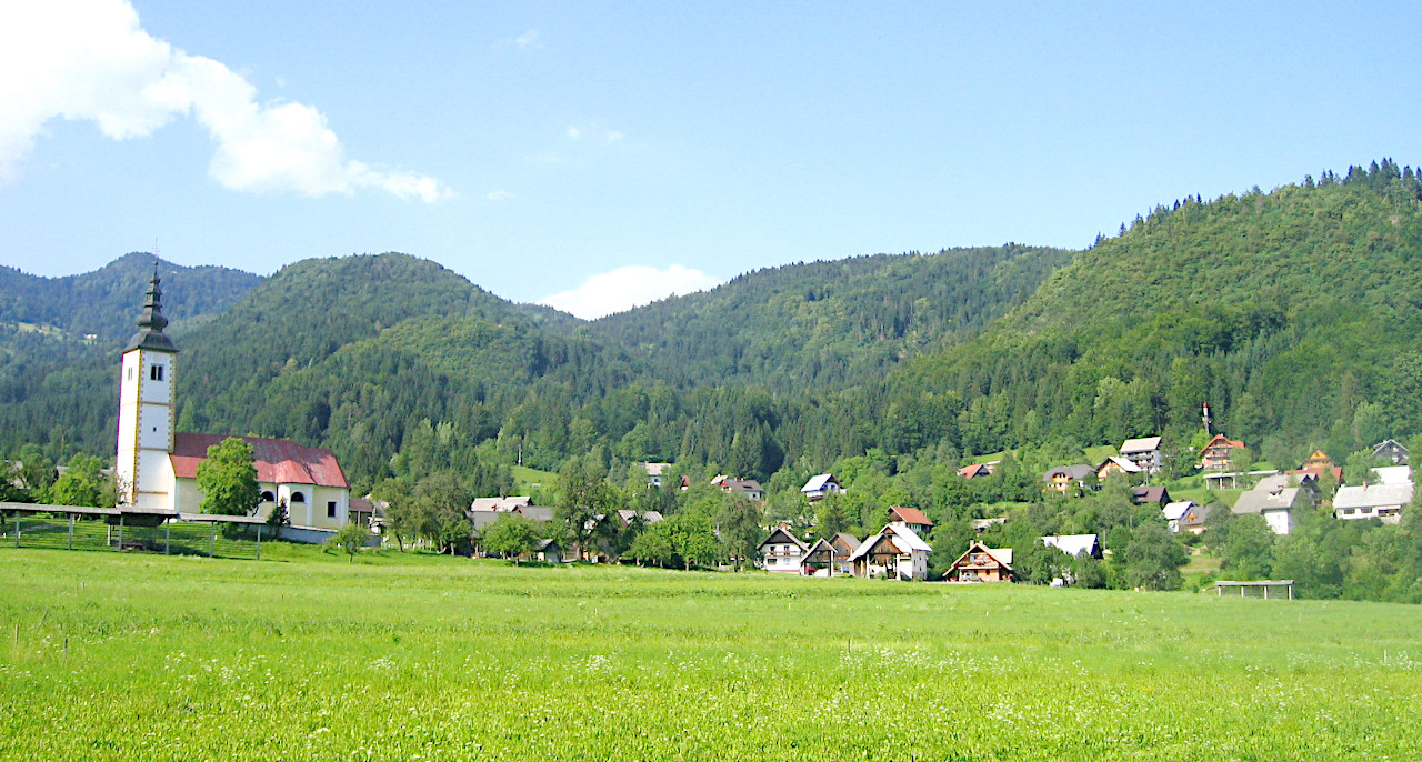 Village of Jereka in Upper Carniola
What is the nature of Slovenia like?
The region's climate has given Slovenia a wealth of diverse flora and fauna. Forests cover more than half of Slovenia making it the 'greenest' country in Europe next to Finland. Ferns, flowers, mosses, and common trees populate the landscape. Farmers plant vineyards on the hillsides and raise livestock in the fertile lowlands of the country. There are subtropical plants along the Adriatic Sea.
What is the climate of Slovenia like?
See our main article: The Climate of Slovenia
Slovenia has a moderately continental climate with warm summers and moderately cold winters. The climate varies from season to season, with Ljubljana shrouded in mists in autumn, covered with snow in winter, fresh and wet in the spring and basking in Mediterranean-style sunshine in summer.
Areas along the coast enjoy a warm Mediterranean climate while those in the mountains to the north have cold winters and rainy summers. The plateaus to the east, where Ljubljana is located, have a mild, more moderate climate with warm to hot summers and cold winters.
| Climate data for Ljubljana | |||||||||||||
|---|---|---|---|---|---|---|---|---|---|---|---|---|---|
| Month | Jan | Feb | Mar | Apr | May | Jun | Jul | Aug | Sep | Oct | Nov | Dec | Year |
| Average high °C (°F) | 3.4 (38.1) | 6.4 (43.5) | 11.4 (52.5) | 16.1 (61.0) | 21.4 (70.5) | 24.6 (76.3) | 27.3 (81.1) | 26.7 (80.1) | 21.6 (70.9) | 15.9 (60.6) | 8.8 (47.8) | 3.8 (38.8) | 15.6 (60.1) |
| Daily mean °C (°F) | 0.3 (32.5) | 1.9 (35.4) | 6.5 (43.7) | 10.8 (51.4) | 15.8 (60.4) | 19.1 (66.4) | 21.3 (70.3) | 20.6 (69.1) | 16.0 (60.8) | 11.2 (52.2) | 5.6 (42.1) | 1.2 (34.2) | 10.9 (51.6) |
| Average low °C (°F) | −2.5 (27.5) | −2.0 (28.4) | 1.7 (35.1) | 5.8 (42.4) | 10.3 (50.5) | 13.7 (56.7) | 15.5 (59.9) | 15.2 (59.4) | 11.5 (52.7) | 7.7 (45.9) | 2.8 (37.0) | −1.1 (30.0) | 6.6 (43.9) |
| Average precipitation mm (inches) | 69 (2.7) | 70 (2.8) | 88 (3.5) | 99 (3.9) | 109 (4.3) | 144 (5.7) | 115 (4.5) | 137 (5.4) | 147 (5.8) | 147 (5.8) | 129 (5.1) | 107 (4.2) | 1,362 (53.6) |
| Source: Slovenian Environment Agency (ARSO) | |||||||||||||
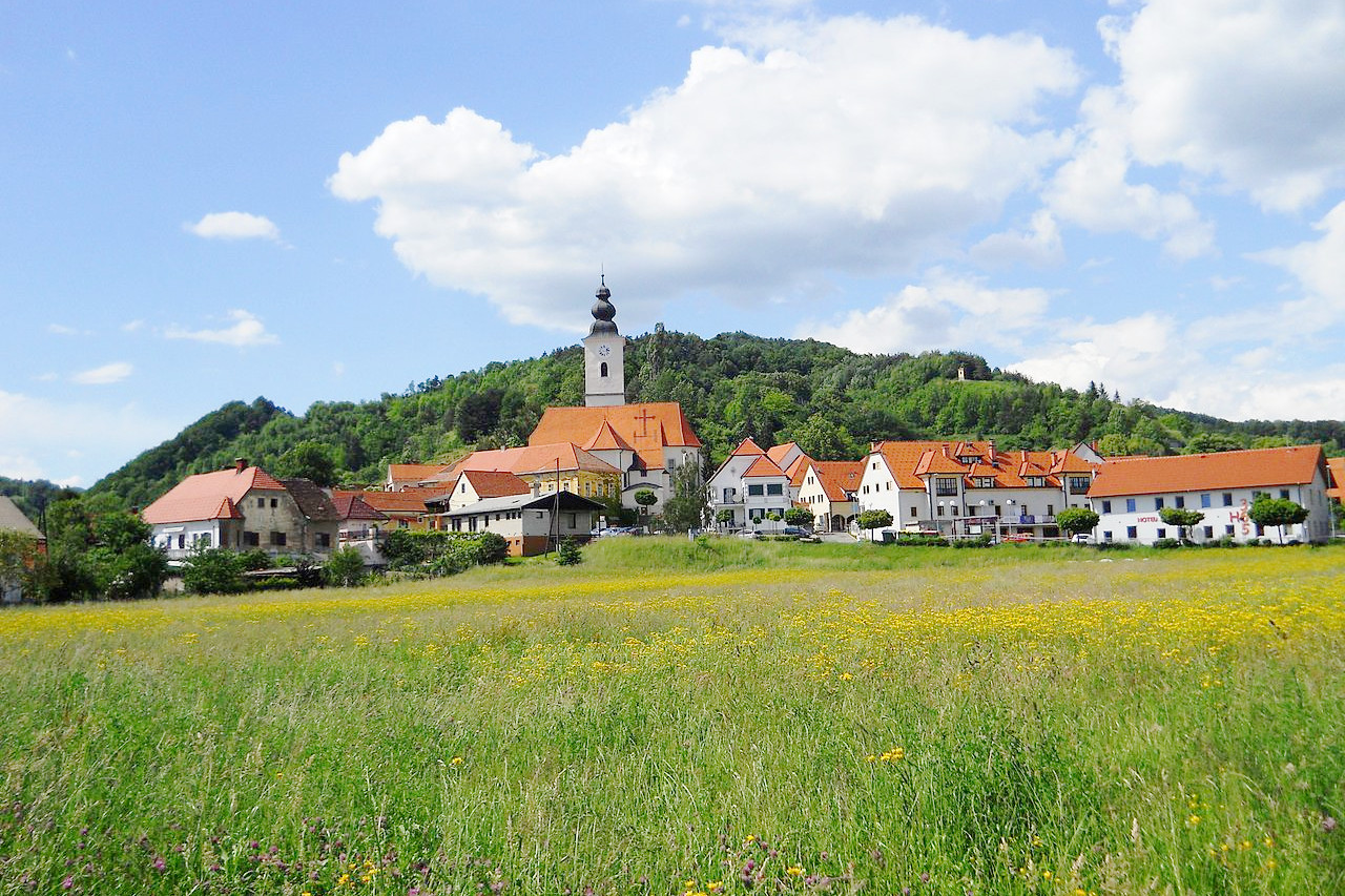
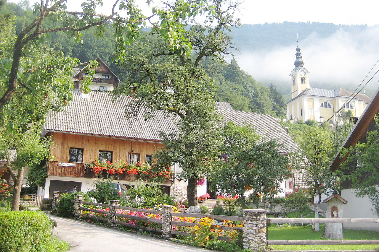 Village of Srednja Vas v Bohinju
The official websites
Slovenia
I Feel sLOVEnia
| Location: | Southern Europe at the northern end of the Adriatic Sea |
| Coordinates: | 46° 00′ N, 14° 45′ E |
| Size: | • 165 km N-S; 255 km E-W • 105 miles N-S; 160 miles E-W |
| Terrain: | Mostly mountain slopes of the southern Alps. Rolling hills and plains in the east |
| Climate: | A moderately continental climate with warm summers and cool winters |
| Highest point: | Triglav 2,864 m / 9,396 ft |
| Forest: | 63% (2010 est.) (source) |
| Population: | 2,108,708 |
| Population density: | Medium (103/km²) |
| Capital: | Ljubljana |
| Languages: | Slovene; Hungarian; Italian |
| Human Development Index: | Very High (0.917) |
| Currency: | Euro |