_arp.jpg)
The Geography of
Southwest England
Why visit Southwest England?
Southwest England is absolutely magical, with rolling hills and moorlands. The towns and villages are cozy, and there stunning places, from the mysterious Stonehenge, to the National Parks of Dartmoor and Exmoor. The landscape in most places can be described as hilly and rugged with villages, churches, mills and ports dotted along the way. There are lots of things to do in Southwest England, include going for walks, visiting interesting historical sites, and spending time at the beach.
Contents
Map
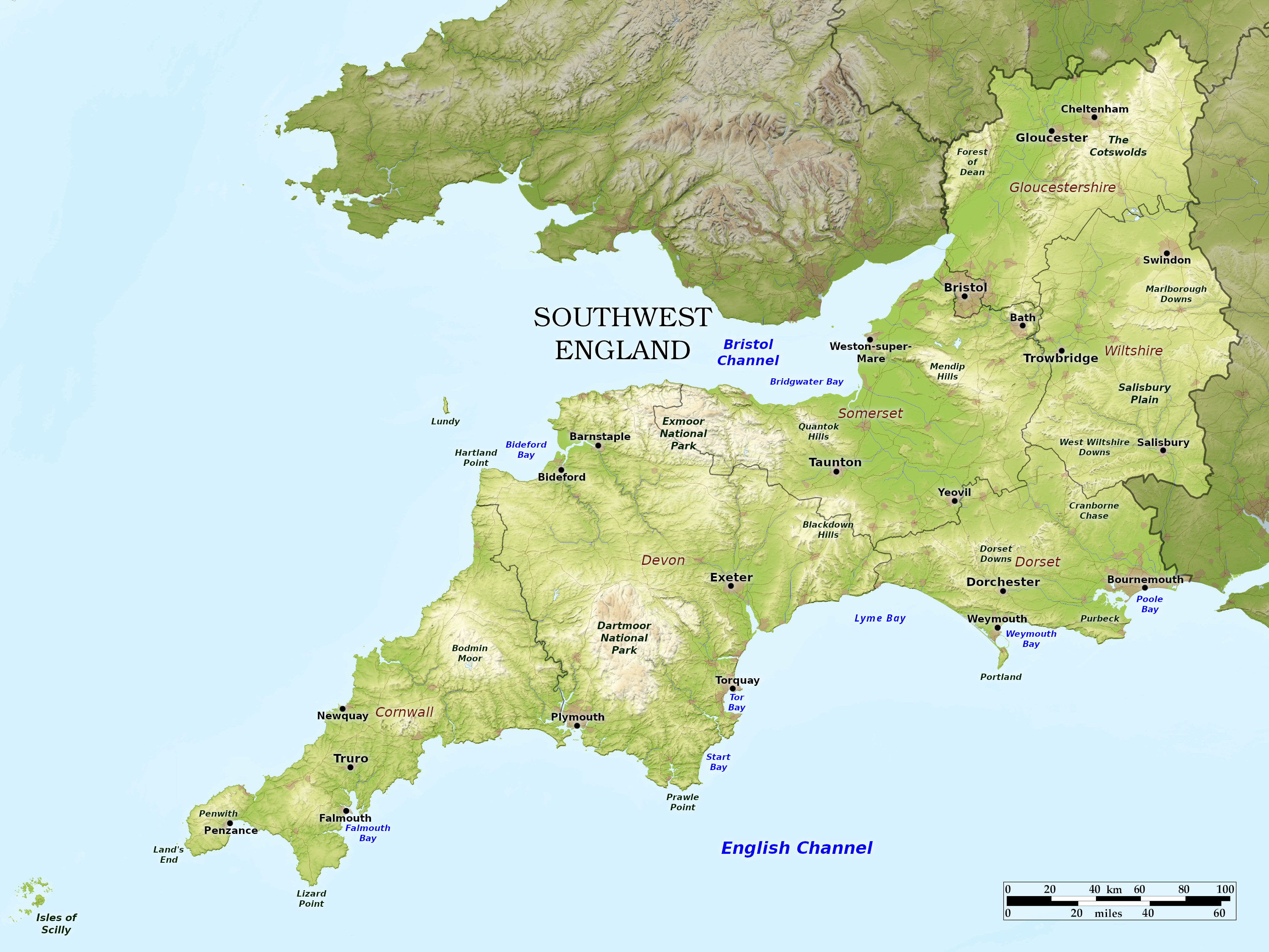 Relief map of Southwest England
What is the landscape of Southwest England like?
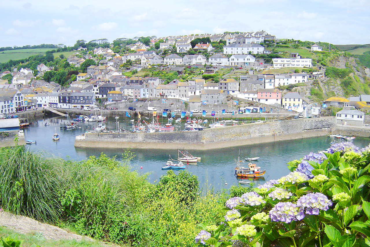
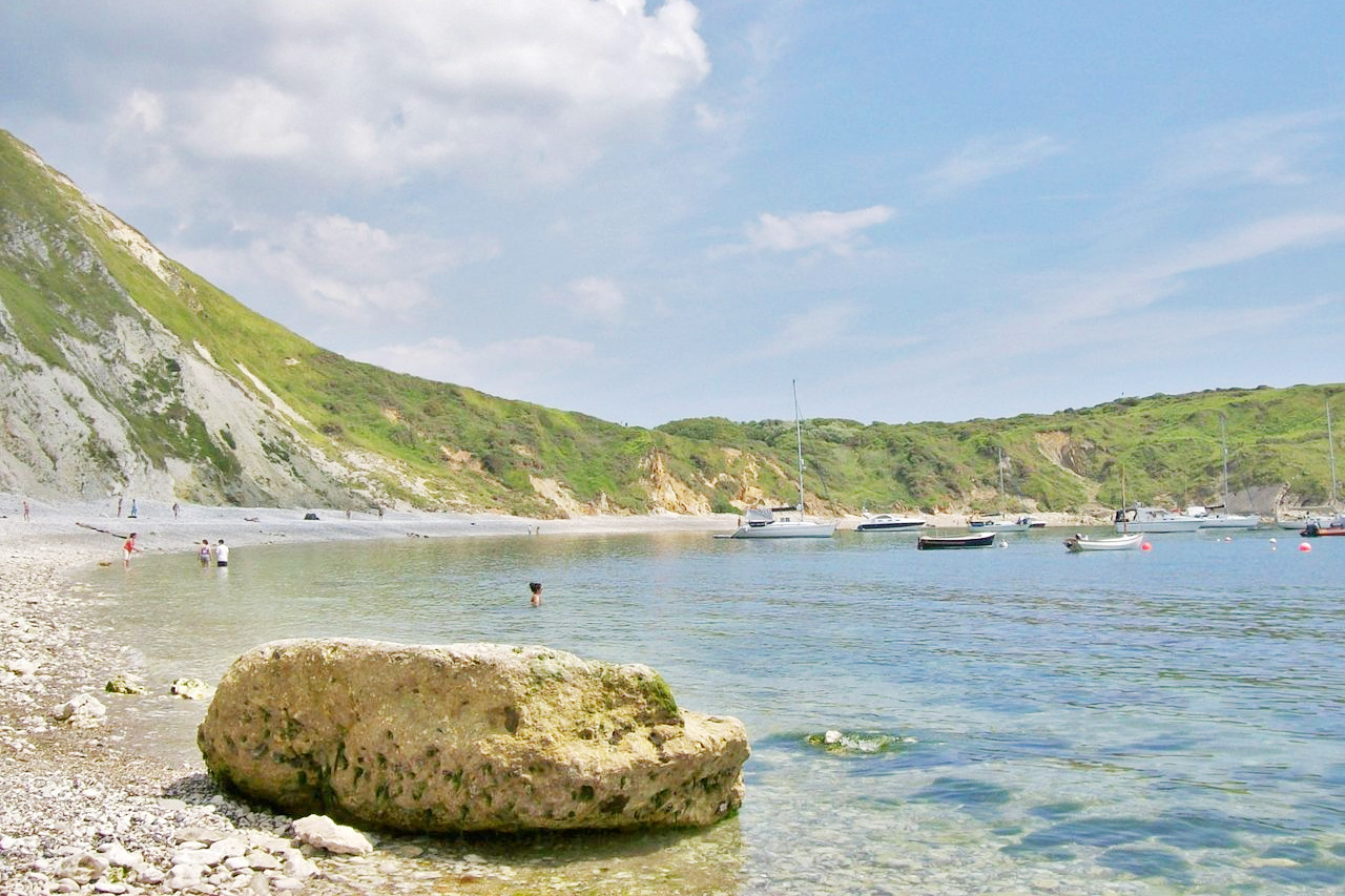
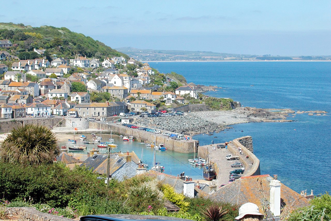
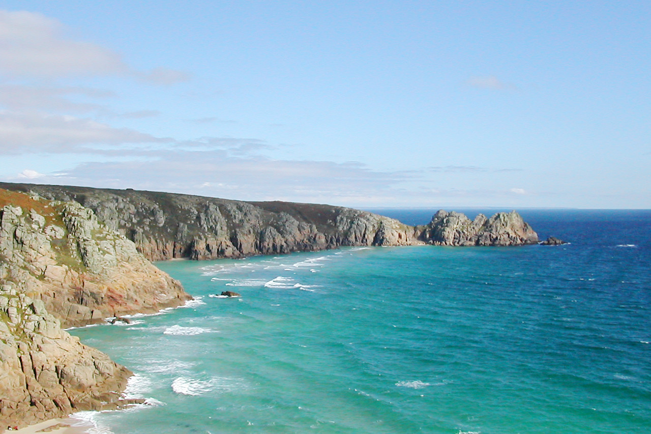
England's southwest—Somerset, Devon, and Cornwall—has a Gulf Stream-warmed climate making it mild even in winter, with beaches, lively villages, and a cove-dotted coast, where spring comes early. The most western and southern end of the England is Cornwall. It is really a peninsula, being bounded to the south by the English Channel, and to the northwest by the Celtic Sea. Along its north coast with its quaint little hamlets lies Tintagel with its memories of King Arthur. Cornwall is shaped somewhat like a horn of plenty, its length being about 80 miles, and terminates in two points, one called the Lizard, and the other Lands End. The Scilly Islands are included in the county.
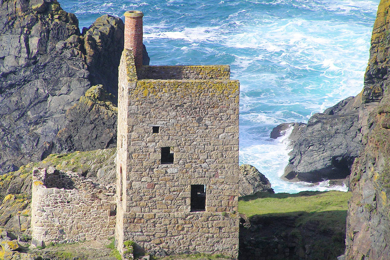
The general appearance of Cornwall is wild and inviting—a ridge of rugged hills stretching from east to west through its whole extent. Amid these hills are many valleys of great fertility, watered by numerous little rivers. The seacoast is marked by a grand and beautiful scenery, where the ruins of old tin mines nestle between sleepy fishing villages.
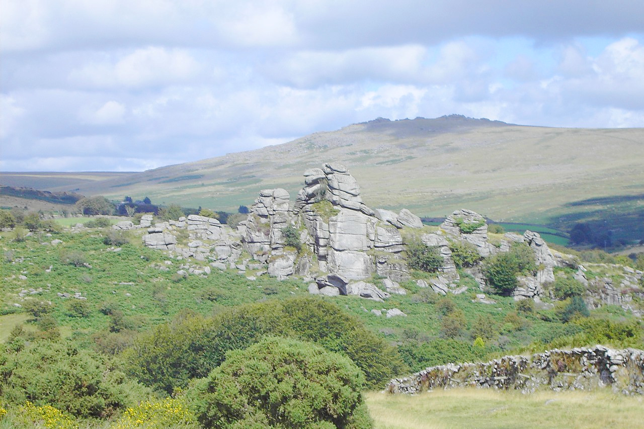
Devon, one of England's larger counties, is very varied. The landscape sometimes swells into low mountains, especially in the southwest where lies the wild and rugged district of Dartmoor Forest. To the south and east of this the county presents a delightful contrast of hills, vales, and rivers, and the Vale of Exeter is known for the beauty of its scenery.
Somerset is also a very varied county, presenting extended vales crossed by long ranges of steep and rugged hills. The most easterly are the Mendip Hills; broken at different points into deep caverns and chasms. Further west are the Quantock Hills, between which are fine valleys. On the borders of Devon lies the moorlands of Exmoor Forest, the highest point of which, Dunkery Beacon, is 519 m (1,703 feet) high. The city of Bath, first built by the Romans as a resort spot, is an outstanding place in the west of England. Today the architecture is late Georgian, of the 18th century, when Bath was the most fashionable town in England; the ruins of the Roman baths are interesting too.
_arp.jpg&oldid=456538708)
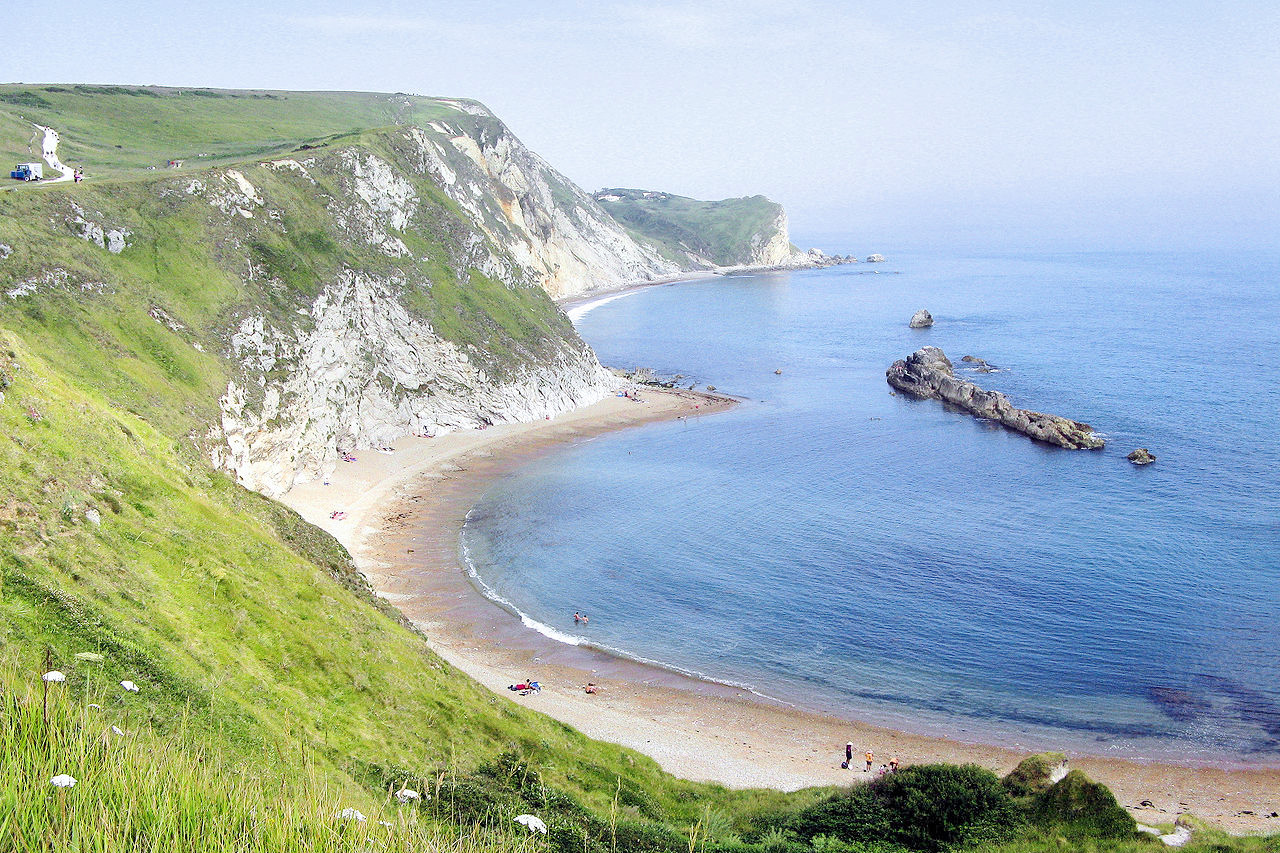
Dorset, a rich and fertile county, is a patchwork of farms, heathland, and prehistoric earthworks, set between villages of honey-coloured stone. It is crossed by a low range of hills called the Dorset Downs, whereas to the south the seas have carved magnificent cliffs.
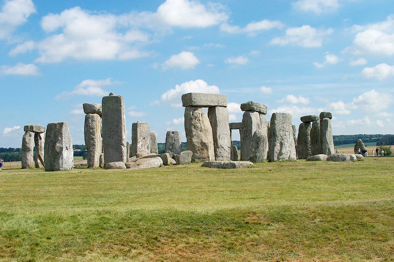
Wiltshire displays considerable beauty with rich meadowlands, and extensive woodlands. Salisbury is a charming city full of quaint, lovely old houses—Salisbury Cathedral has one of the most graceful spires of any building. The county is known for its Downs which have two main divisions, called Marlborough Downs and Salisbury Plain—an extensive rolling plateau whose wilds stretch beyond the limit of the eye. Here the ruins of prehistoric monuments are scattered. The weird prehistoric ruins of Stonehenge stand on the Salisbury Plain were constructed between 3000 BC to 2000 BC.
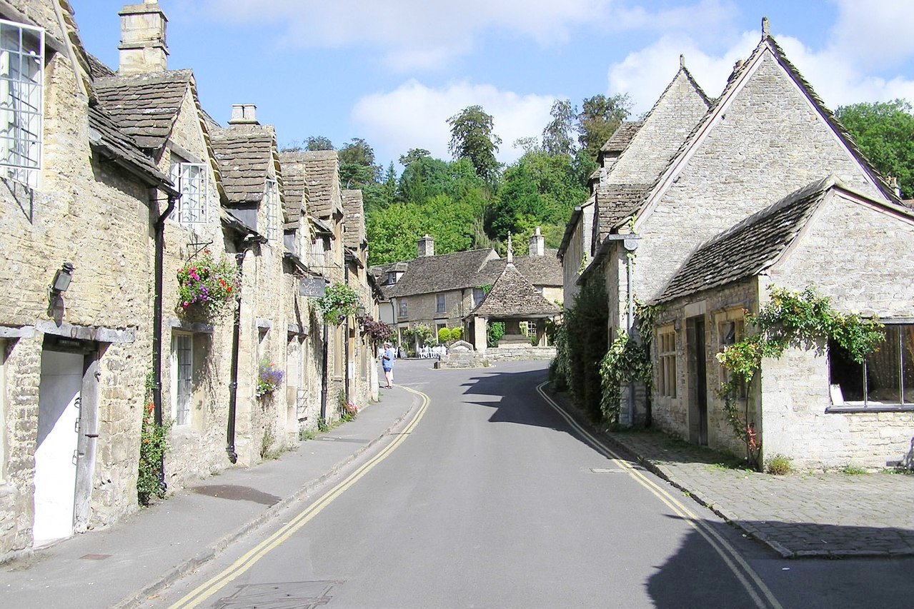
Gloucestershire ("Glostersher") has hill, dale, and forest. The city of Gloucester has a magnificent Perpendicular-Norman cathedral. In the east are the Cotswold hills, rolling and rugged, and abounding with little villages glowing grey-gold with the radiance of Cotswold stone. The villages have such quaint names as Stow-on-the-Wold, Chipping Campden, and Bourton-on-the-Water. To the west is the Forest of Dean, which, in addition to its oak and beech forests, was once a center for coal and iron mines.
What is the climate of Southwest England like?
South West England has a typically maritime climate with cool winters and warm summers with moderate rainfall all year round. Winter snow is not very common but is more frequent on the higher ground especially on the inland moorland areas such as Bodmin Moor, Dartmoor and Exmoor. The coast experiences higher temperatures, especially in winter, the rainfall is lower, and the coast receives the most sunshine, especially towards the south and southwest.
| Climate data for Bristol (1981–2010) | |||||||||||||
|---|---|---|---|---|---|---|---|---|---|---|---|---|---|
| Month | Jan | Feb | Mar | Apr | May | Jun | Jul | Aug | Sep | Oct | Nov | Dec | Year |
| Average high °C (°F) | 7.8 (46.0) | 7.9 (46.2) | 10.5 (50.9) | 13.3 (55.9) | 16.6 (61.9) | 19.6 (67.3) | 21.5 (70.7) | 21.2 (70.2) | 18.6 (65.5) | 14.5 (58.1) | 10.6 (51.1) | 8.0 (46.4) | 14.2 (57.6) |
| Daily mean °C (°F) | 5.0 (41.0) | 4.9 (40.8) | 7.1 (44.8) | 9.2 (48.6) | 12.4 (54.3) | 15.4 (59.7) | 17.4 (63.3) | 17.1 (62.8) | 14.7 (58.5) | 11.3 (52.3) | 7.7 (45.9) | 5.3 (41.5) | 10.6 (51.1) |
| Average low °C (°F) | 2.2 (36.0) | 1.9 (35.4) | 3.7 (38.7) | 5.0 (41.0) | 8.1 (46.6) | 11.1 (52.0) | 13.2 (55.8) | 13.0 (55.4) | 10.8 (51.4) | 8.1 (46.6) | 4.8 (40.6) | 2.5 (36.5) | 7.0 (44.6) |
| Average precipitation mm (inches) | 82.3 (3.24) | 53.8 (2.12) | 58.6 (2.31) | 49.3 (1.94) | 62.3 (2.45) | 55.2 (2.17) | 54.6 (2.15) | 64.2 (2.53) | 68.0 (2.68) | 85.4 (3.36) | 82.6 (3.25) | 85.9 (3.38) | 802.1 (31.58) |
| Source: Met Office | |||||||||||||
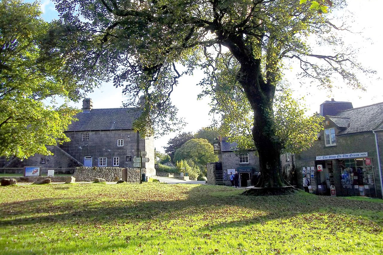 Widecombe in the Moor, Dartmoor, Devon
The official websites
South West England
Moorland and coastal villages
| Location: | Southwest Britain |
| Coordinates: | 51° 00′ N, 3° 15′ W |
| Size: | • 240 km N-S; 295 km E-W • 150 miles N-S; 185 miles E-W |
| Terrain: | Rolling hills; coastal plains in the north; moorland areas in the southwest |
| Climate: | Maritime climate with warm summers; cool winters; year-round rainfall |
| Highest point: | High Willhays 621 m / 2,039 ft |
| Forest: | 16% (2010 est.) (source) |
| Population: | 5,288,935 (2011) |
| Population density: | High (220/km²) |
| Capital: | — |
| Languages: | English; Cornish |
| Human Development Index: | Very High (0.928) |