.jpg)
.jpg)
_(1).JPG)
The Geography of
Southeast England
Why visit Southeast England?
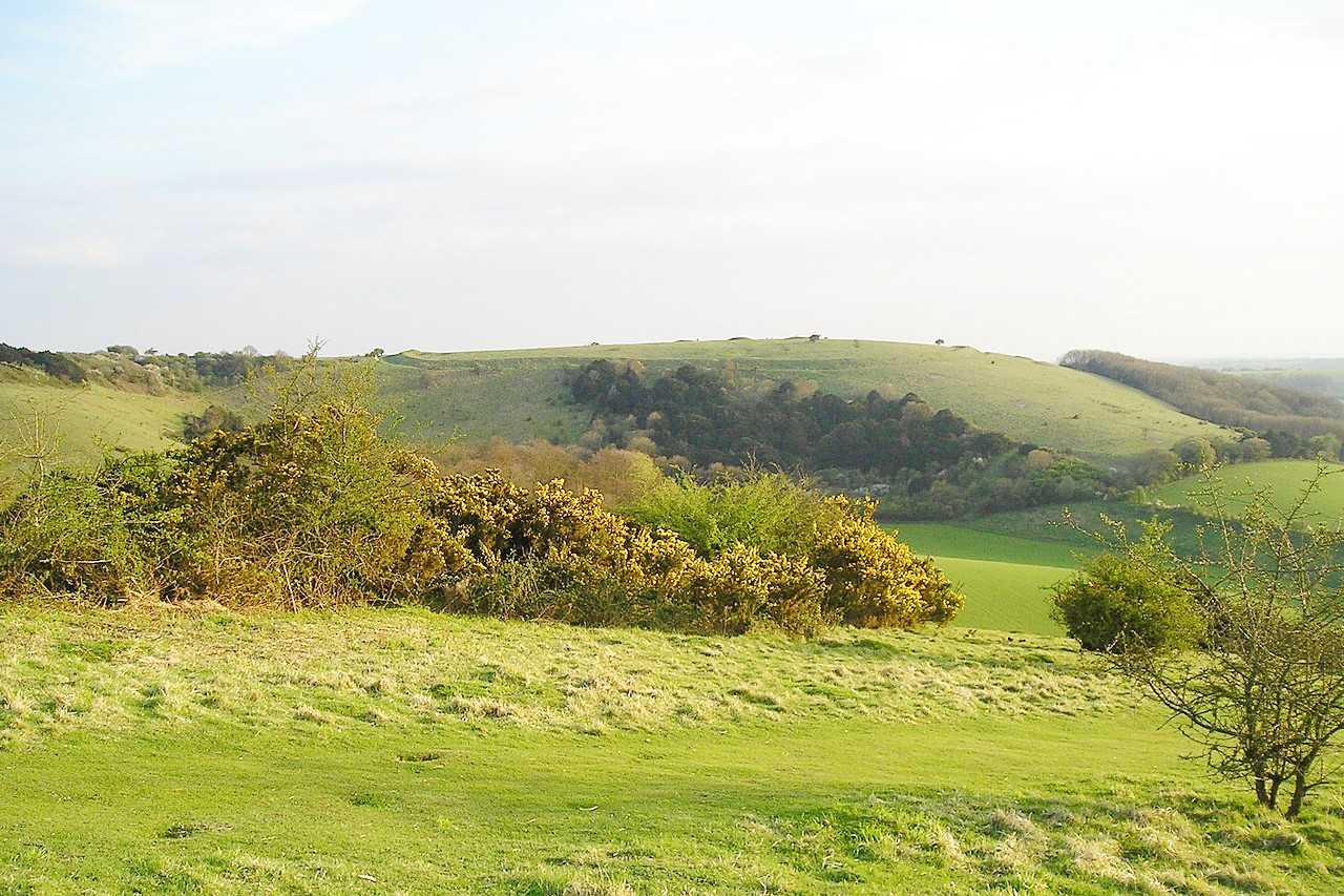
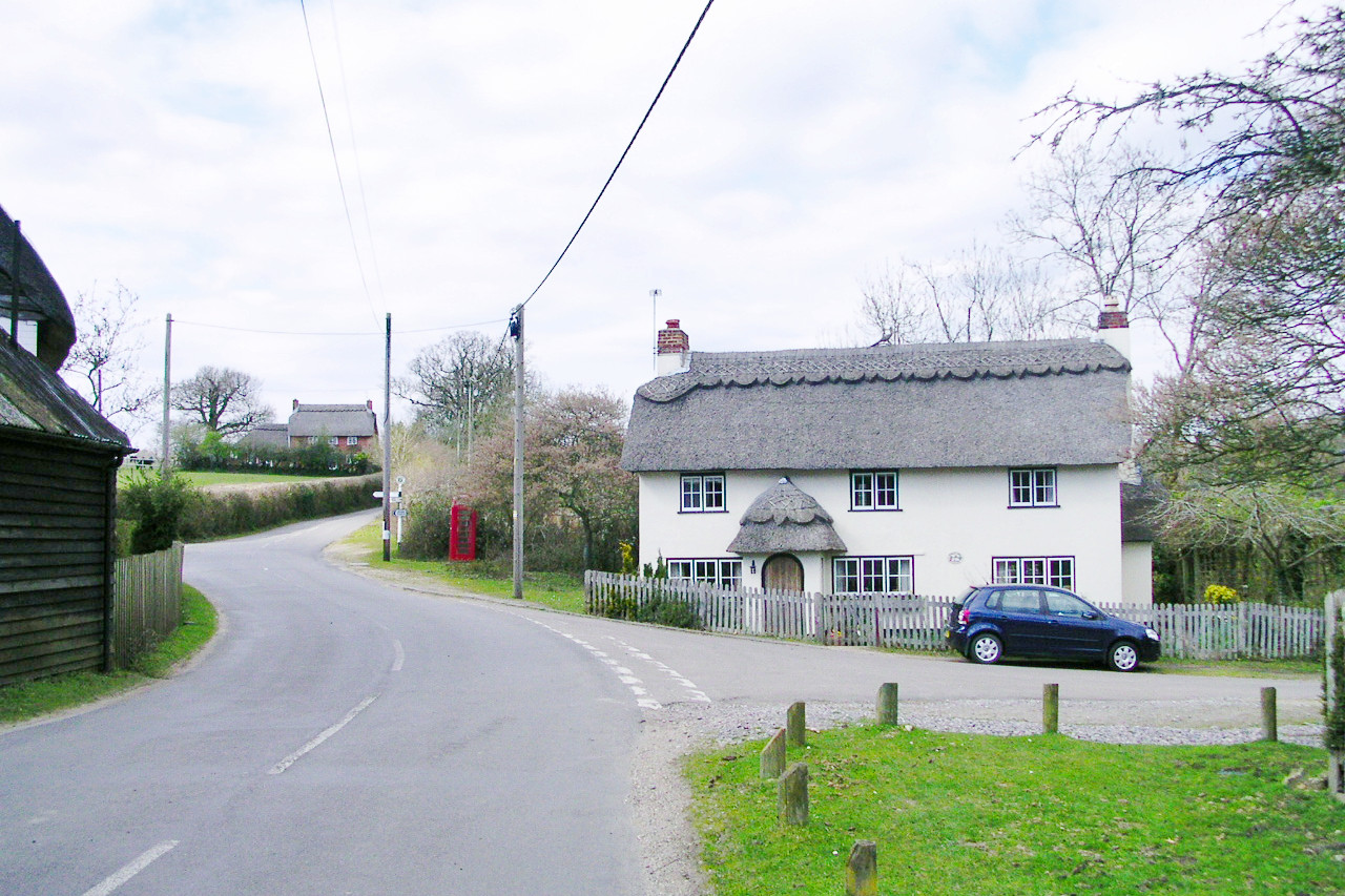
Southeast England is an area that stretches from the North Sea in the east to the Sussex Downs in the west, and includes some of Britain’s most picturesque villages. The southeast coast has long been a popular tourist destination because of its dramatic cliffs and sandy beaches. The combination of the sunny coastline, rolling countryside, and gentle seaside towns is always stunning.
Contents
Map
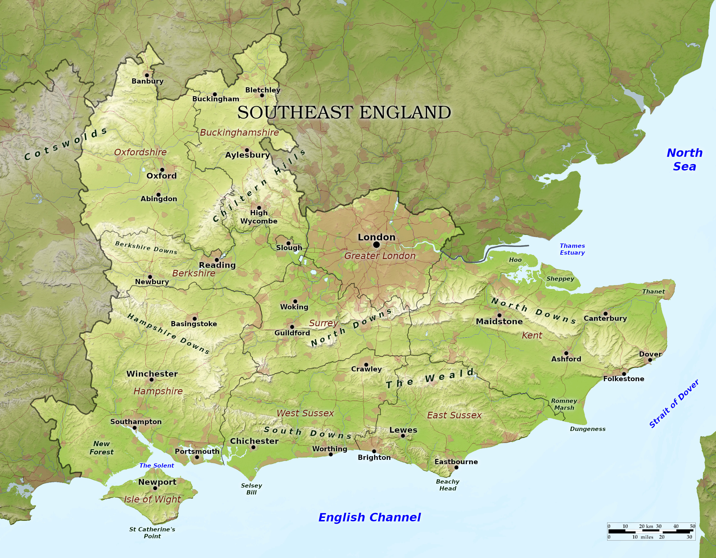 Relief map of Southeast England
What is the landscape of Southeast England like?
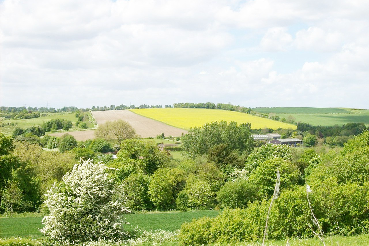
Oxfordshire and Buckinghamshire have a rich countryside watered by numerous rivers. In the northwest of Oxfordshire are the Cotswold Hills which extend into Gloucestershire. Elsewhere the county is in parts stony and woody, but otherwise fertile farming land. The famous university city of Oxford is surrounded by ancient traditions and a very scholarly atmosphere. In the southeast begin the Chiltern Hills which extend right across southern Buckinghamshire. These hills are chiefly composed of chalk intermixed with flints. Forests of beech trees can be found in the south, whereas the farmlands of the Vale of Aylesbury spread through the middle of the county.
Berkshire, a rather narrow county, contains many deep beds of chalk, and strata of fossil-shells; and there is also plenty of good oak and beech forests. The east includes Windsor Great Park—a former hunting ground of Windsor Castle. The west is dominated by the Berkshire Downs, a tamed landscape dotted with villages and market towns.
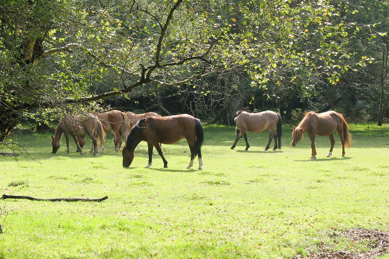
Hampshire is beautifully varied by gently rising hills and fruitful valleys, adorned with numerous villages, and interspersed with extensive woodlands. On the northern side great quantities of cereal crops are grown. William the Conqueror created the New Forest as a royal hunting ground in 1079, and very tame "wild ponies" still roam through it. Winchester was the capital of pre-Norman England. Winchester Cathedral is a lovely church containing an amazing mixture of architectural styles that blend together very happily.
On the south coast is the Isle of Wight—a small but beautiful island, divided by a narrow strait from the coast of Hampshire. It is divided into two parts by the Medina river, which enters the sea opposite the mouth of Southampton Water. The westernmost point of the island is called "the Needles," from the lofty rocks which stick out of the sea.
.jpg&oldid=468361829K)
.jpg&oldid=613211181)
_(1).JPG&oldid=473863377)
The whole countryside in Kent, Surrey and Sussex is dotted with quaint villages and the scenery is very beautiful. Surrey is an inland county, bordering London. It is contains long ridges of hills, extensive chalky downs, still covered with heath in some parts; as well as richly wooded dales and plains. The North Downs of Surrey, which are about 30 miles long, are low and wooded. Sussex, divided in modern times into two counties—East and West—is crossed by low ranges of hills. The Weald in the north, and the South Downs in the south. The middle abounds with meadows and arable land, and on the north are some extensive woods.
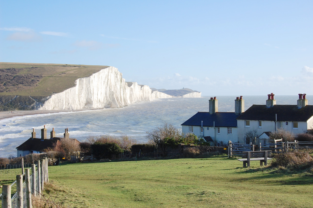
Kent is a great maritime county, forming the southeastern corner of the country. There is a great variation in the appearance of the county. The North Downs are range of chalky hills of various heights. A hard, chalky kind of soil extends to the eastern corner of the county, and hence round to Dover, where are seen the lofty "white cliffs" which are common in southeast England. In the south is the Weald, which extends into Sussex, a somewhat flattish, but wooded range of hills. The middle of the county is an intermixture of hill and dale, arable and pasture. Probably the most important place to visit in England, outside of London, is the ancient town of Canterbury. The magnificent Canterbury Cathedral was built during four centuries. The first church was consecrated on its site in 597 A.D. The grounds around the cathedral are lovely.
What is the climate of Southeast England like?
South East England has a milder climate than most areas of the UK, being protected against the more extreme weather of the Atlantic coast further west. The south coast sees consistently more sunshine than the inland areas, as sea breezes tend to clear any cloud from the coast. Rainfall too is below average, and the close proximity of the region to the Continent of Europe can result in cold spells in winter, but hot, humid weather in summer.
| Climate data for Reading (1981–2010) | |||||||||||||
|---|---|---|---|---|---|---|---|---|---|---|---|---|---|
| Month | Jan | Feb | Mar | Apr | May | Jun | Jul | Aug | Sep | Oct | Nov | Dec | Year |
| Average high °C (°F) | 7.7 (45.9) | 8.0 (46.4) | 10.8 (51.4) | 13.5 (56.3) | 17.0 (62.6) | 20.0 (68.0) | 22.4 (72.3) | 22.1 (71.8) | 19.0 (66.2) | 14.9 (58.8) | 10.7 (51.3) | 7.9 (46.2) | 14.5 (58.1) |
| Daily mean °C (°F) | 4.8 (40.6) | 4.8 (40.6) | 7.1 (44.8) | 9.1 (48.4) | 12.4 (54.3) | 15.3 (59.5) | 17.6 (63.7) | 17.3 (63.1) | 14.6 (58.3) | 11.2 (52.2) | 7.5 (45.5) | 5.1 (41.2) | 10.6 (51.1) |
| Average low °C (°F) | 1.9 (35.4) | 1.7 (35.1) | 3.4 (38.1) | 4.7 (40.5) | 7.7 (45.9) | 10.6 (51.1) | 12.7 (54.9) | 12.5 (54.5) | 10.3 (50.5) | 7.6 (45.7) | 4.4 (39.9) | 2.2 (36.0) | 6.7 (44.1) |
| Average precipitation mm (inches) | 61.0 (2.40) | 41.2 (1.62) | 44.5 (1.75) | 48.0 (1.89) | 46.4 (1.83) | 44.6 (1.76) | 46.0 (1.81) | 52.3 (2.06) | 50.3 (1.98) | 71.8 (2.83) | 66.3 (2.61) | 62.9 (2.48) | 635.4 (25.02) |
| Source: Met Office | |||||||||||||
The official websites
South East England
Rolling hills and chalky downs
| Location: | Southeast Britain |
| Coordinates: | 51° 15′ N, 0° 15′ W |
| Size: | • 180 km N-S; 205 km E-W • 115 miles N-S; 125 miles E-W |
| Terrain: | Ranges of low, rolling hills, and broad flat river plains |
| Climate: | Maritime climate with warm summers; cool winters; year-round rainfall |
| Highest point: | Walbury Hill 621 m / 2,039 ft |
| Forest: | 21% (2010 est.) (source) |
| Population: | 8,635,000 (excluding London) 18,060,000 (including London) |
| Population density: | High (452/km²; excluding London) |
| Capital: | — |
| Languages: | English |
| Human Development Index: | Very High (0.945) |