The Geography of the
English Midlands
Why visit the Midlands?
The Midlands is an area that is home to a wealth of natural beauty and historical places. In the past, the Midlands was one of England's most prosperous regions, and it still retains a lot of its old charm. The rolling hills and picturesque villages are all wonderfully scenic, and the region has plenty of attractions from ancient castles and cathedrals to battlefields and beautiful villages.
Contents
Map
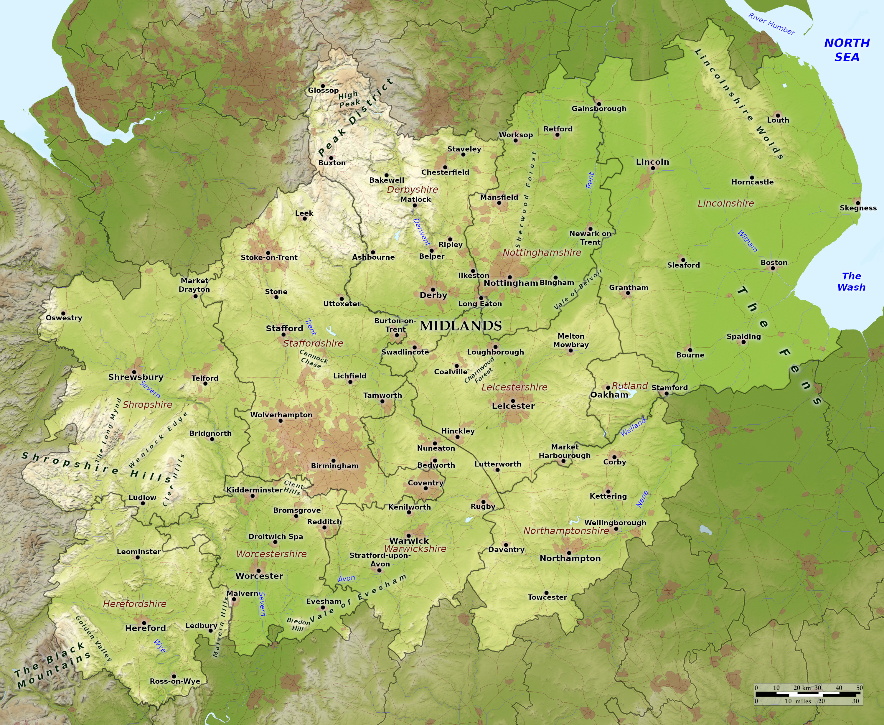 Relief map of the Midlands
What is the landscape of the English Midlands like?
In the east lies Lincolnshire, the coastal county. This is fen country, a naturally lowland marshland, of which a great portion has been drained. It is also known for the large, but shallow, bay between the coasts of Lincolnshire and Norfolk called The Wash. There is however a low hill range in the north of the county known as the Lincolnshire Wolds which form a bold, chalky ridge for about 40 miles.
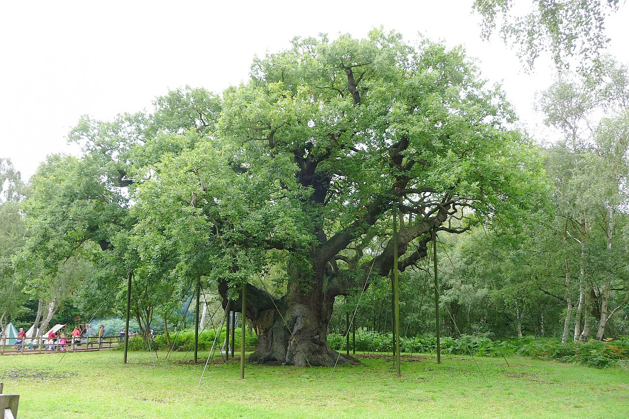
Heading west we reach Northamptonshire, Leicestershire and Rutland—a rolling landscape that is richly cultivated and in some parts finely wooded with ash and oak. Nottinghamshire's undulating countryside contains the remains of the great Sherwood Forest, renowned for the outlaw Robin Hood. This forest is however, much reduced from its medieval extent.
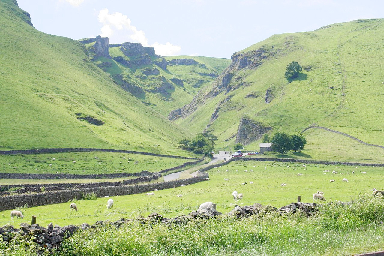
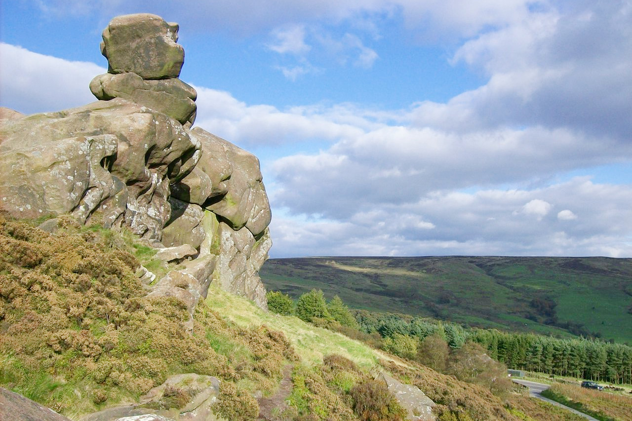
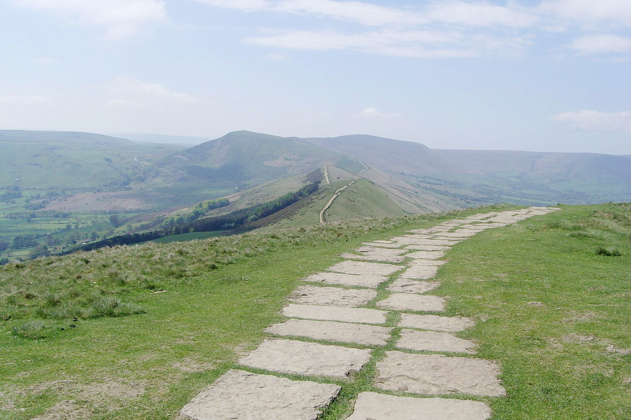
The great highlight of the Midlands though is the Peak District of Derbyshire. Here we have some of the finest hill scenery in England: from the richly wooded glens and valleys, to the wild moorland on the ranges of rocky hills, which reach a maximum height on Kinder Scout at 636 m (2,087 feet). The summit is a peaty moorland, through which project masses of rock. The dales and ravines among the heights are characteristic and beautiful. On the flanks of these beautiful dales bold cliffs and bastions of limestone stand out among rich woods. Waterworn caverns are common in many parts of the region.
The west of the region is a hill country with a great variety of scenery. Herefordshire is traversed by the River Wye, which is one of the most picturesque of the English rivers, and the whole country appears covered with orchards for the production of cider and perry.
In Shropshire there are ancient hills created by ancient volcanic action, but are now these hills are borderlands of wooded hillsides and half-timbered villages.
What is the climate of the English Midlands like?
The Midlands has a temperate maritime climate, with cool, cloudy, winters and warm summers with sunshine. Temperatures typically reach a high of about 22°C (70°F) in July and August, then dip to a low of freezing (0°C) in January. There can be some snow in the winter months, but rarely of blizzard proportions. The hills of the Peak District can see a month or two of continuous snow cover in some winters.
| Climate data for Nottingham (1991–2020) | |||||||||||||
|---|---|---|---|---|---|---|---|---|---|---|---|---|---|
| Month | Jan | Feb | Mar | Apr | May | Jun | Jul | Aug | Sep | Oct | Nov | Dec | Year |
| Average high °C (°F) | 7.5 (45.5) | 8.1 (46.6) | 10.5 (50.9) | 13.6 (56.5) | 16.7 (62.1) | 19.6 (67.3) | 22.0 (71.6) | 21.8 (71.2) | 18.7 (65.7) | 14.5 (58.1) | 10.4 (50.7) | 7.8 (46.0) | 14.3 (57.7) |
| Daily mean °C (°F) | 4.7 (40.5) | 5.0 (41.0) | 6.8 (44.2) | 9.1 (48.4) | 11.9 (53.4) | 14.9 (58.8) | 17.1 (62.8) | 17.0 (62.6) | 14.4 (57.9) | 11.0 (51.8) | 7.4 (45.3) | 4.9 (40.8) | 10.3 (50.5) |
| Average low °C (°F) | 1.9 (35.4) | 1.9 (35.4) | 3.0 (37.4) | 4.6 (40.3) | 7.2 (45.0) | 10.1 (50.2) | 12.1 (53.8) | 12.2 (54.0) | 10.1 (50.2) | 7.5 (45.5) | 4.4 (39.9) | 2.1 (35.8) | 6.5 (43.7) |
| Average precipitation mm (inches) | 50.7 (2.00) | 41.2 (1.62) | 40.6 (1.60) | 44.3 (1.74) | 46.3 (1.82) | 63.7 (2.51) | 61.8 (2.43) | 54.6 (2.15) | 49.2 (1.94) | 62.7 (2.47) | 56.9 (2.24) | 58.1 (2.29) | 630.0 (24.80) |
| Source: Met Office | |||||||||||||
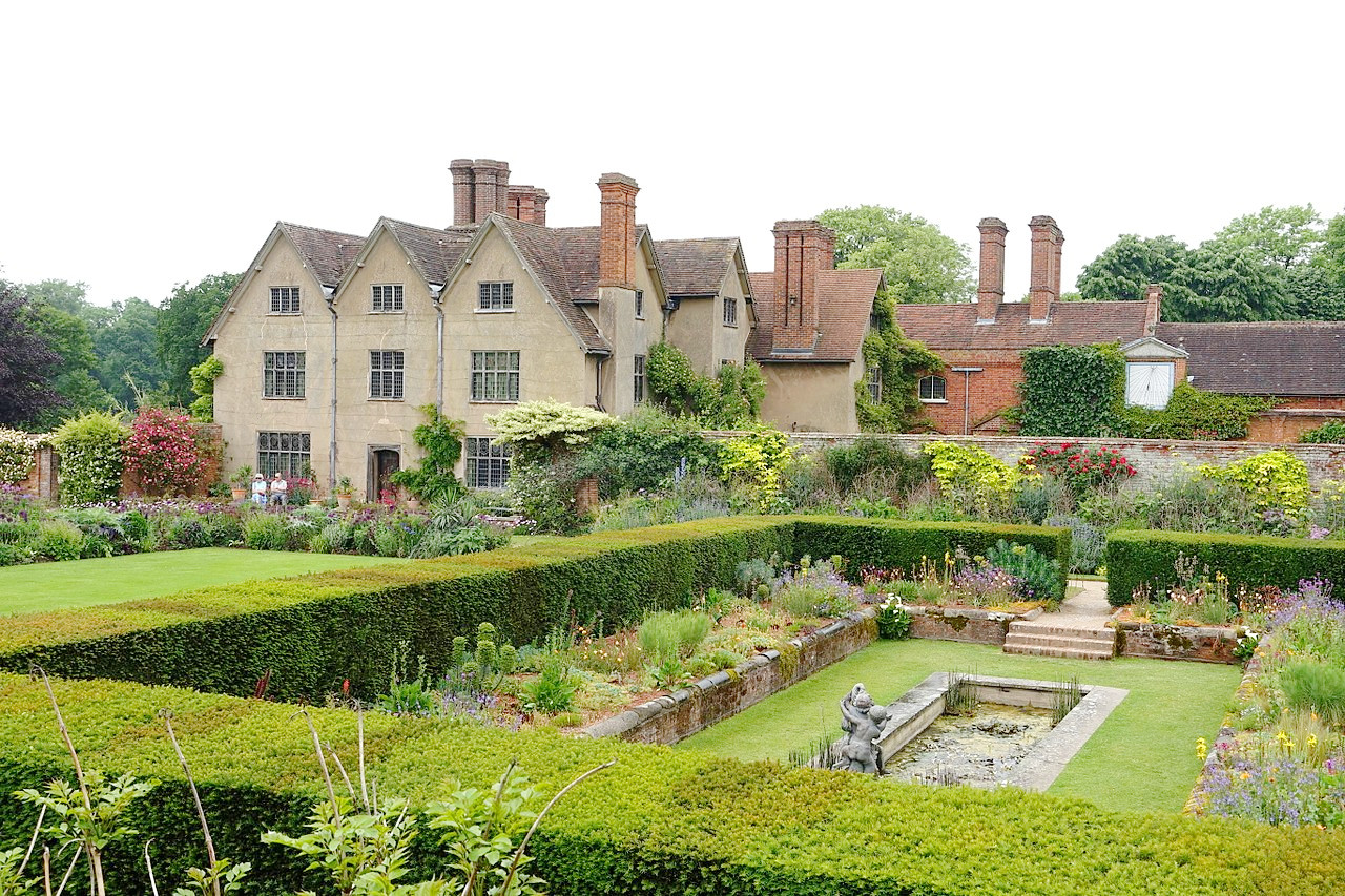
 Rushton Hall in Northamptonshire
The official websites
Midlands
The heart of England
| Location: | Central Britain |
| Coordinates: | 52° 45′ N, 1° 30′ W |
| Size: | • 200 km N-S; 240 km E-W • 125 miles N-S; 150 miles E-W |
| Terrain: | Low coastal plains in the east; ranges of low hills in the west; hills and moorland in the north |
| Climate: | Maritime climate with warm summers; cool winters; year-round rainfall |
| Highest point: | Black Mountain 704 m / 2,308 ft |
| Forest: | 14% (2010 est.) (source) |
| Population: | 10,517,149 (2011) |
| Population density: | High (375/km²) |
| Capital: | — |
| Languages: | English |
| Human Development Index: | Very High (0.917) |