The Geography of
Northern Ireland
Why visit Northern Ireland?
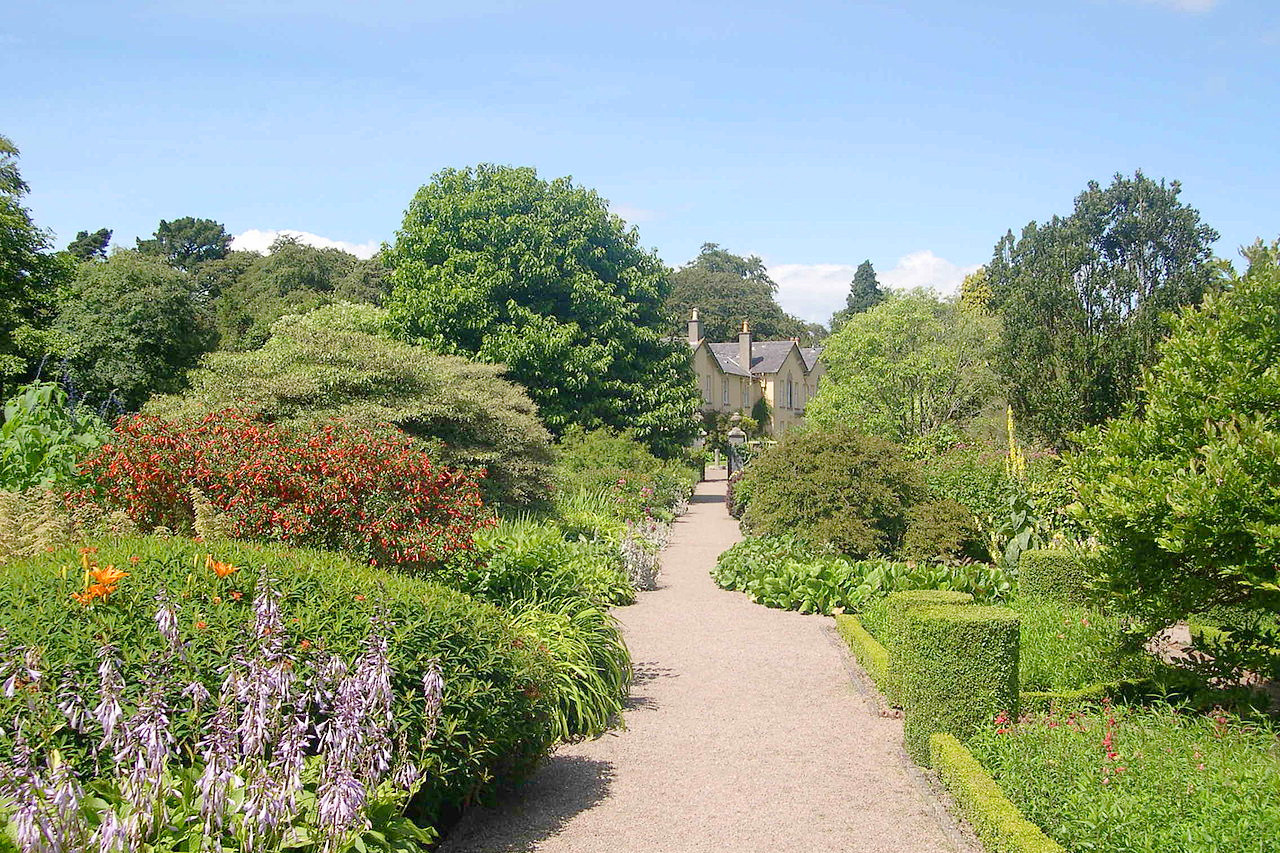
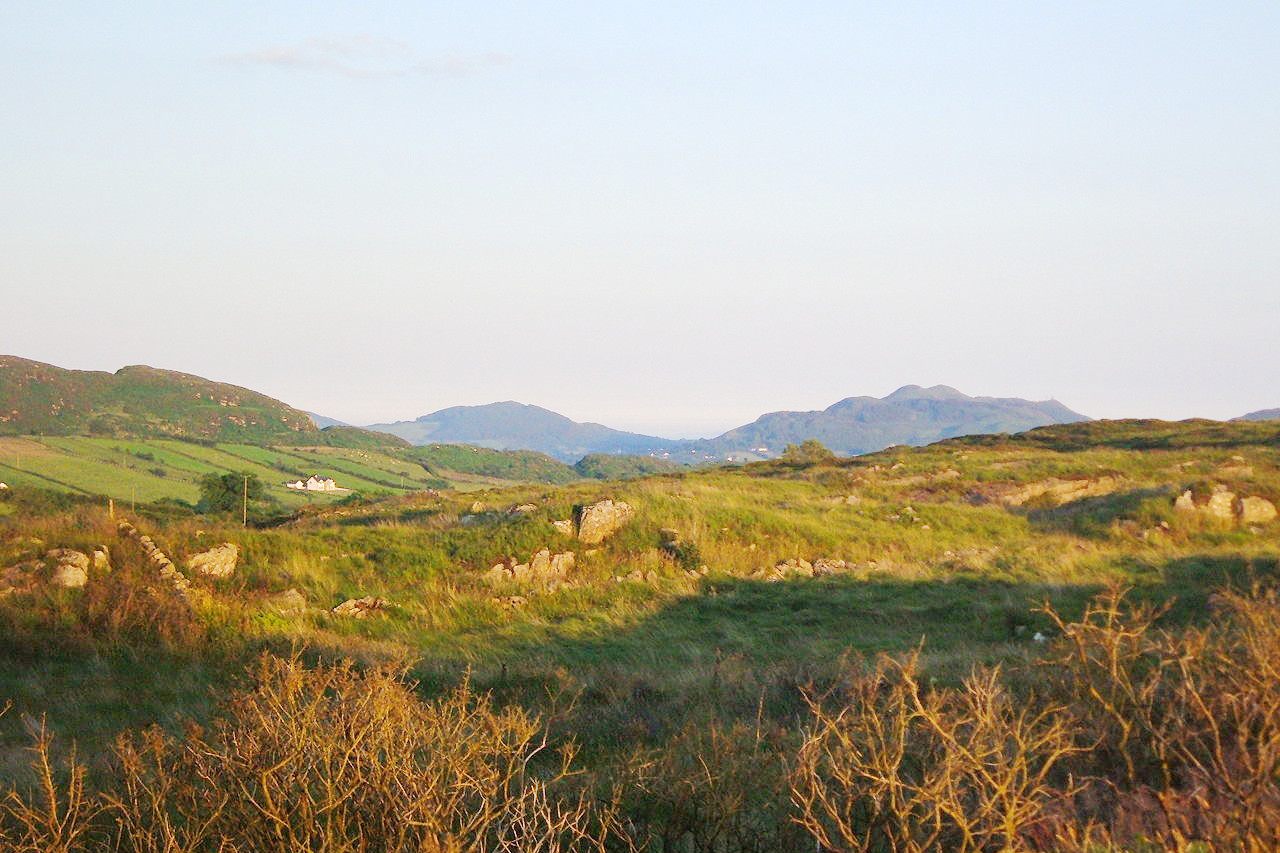
Northern Ireland has amazing scenery and history. From mountains to rolling hills, the country has it all. The coastline is a magnificent sight to behold, with cliffs, coves, and pristine beaches. The lakes and rivers are also very pretty. The history of Northern Ireland is also a major contributor to its beauty. The landscape is a product of centuries of strife and violence. But even after all that has occurred, the country is still stunning, and the people are friendly, welcoming, and helpful. There's always something to do whether it be sightseeing or going out for food.
Contents
Map
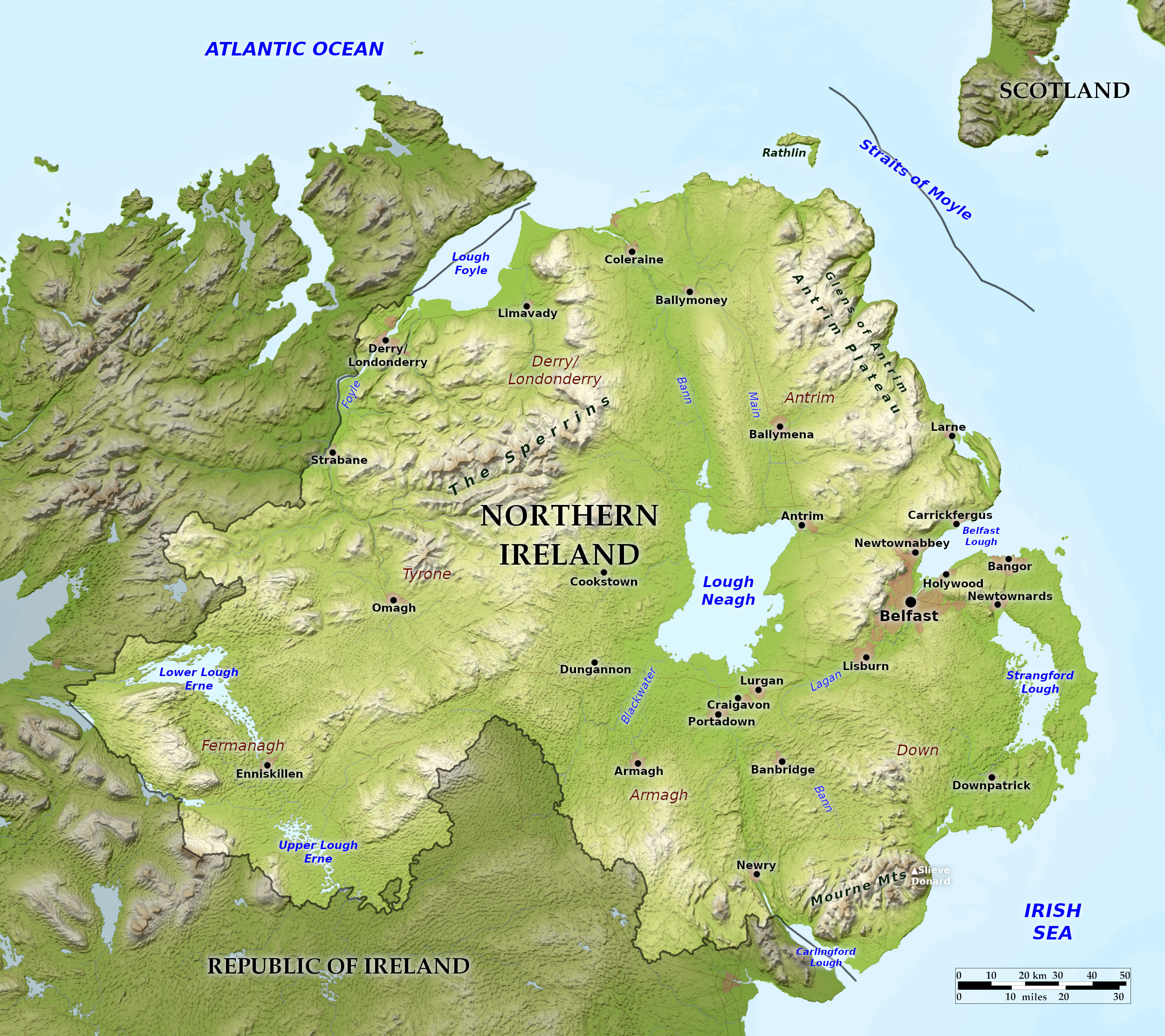 Relief map of Northern Ireland
What is the landscape of Northern Ireland like?
In the middle of Northern Ireland sits the resplendent Lough Neagh ("lokh nay") a rectangular lake about 20 miles (32 km) long. This lies in a depression with the rivers Bann and Blackwater entering from the south, and Bann flowing out on the north. In the east the River Lagan flows in a broad valley from the Mourne Mountains to Belfast Lough.
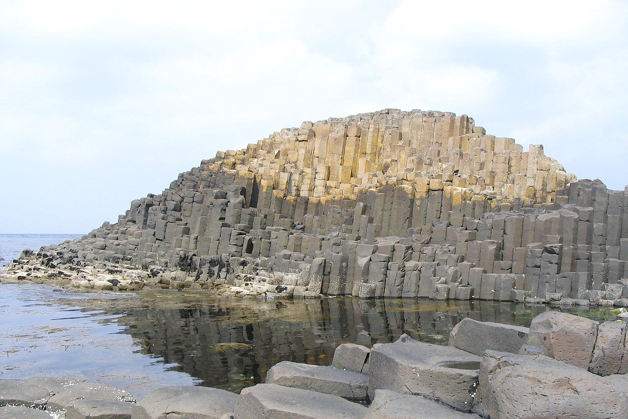
To the northeast are the stately heights of the Antrim plateau, which is mainly composed of basalt, a volcanic rock which sometimes splits so as to form hexagonal columns. This is well seen at the celebrated Giant's Causeway, with its myriad columns of bright red and yellow volcanic stone. Some of the cliff scenery is spectacular: belts of black columnar basalt alternating with layers of white chalk. In some parts of the plateau the chalk is exposed at the surface, and gives rise to typical chalk country, treeless downs and white trackways, and elsewhere to the famous Glens of Antrim with their steep, wooded valleys.
In the southeast are the Mourne Mountains which sweep down to the sea—an attractive landscape similar to that of southern Scotland. To the west of Lough Neagh is a region of rolling country and low heights, but this rises further north into the noble Sperrin mountains—a region not disimilar to the Scottish Highlands. County Armagh is famous for its lovely rose gardens. The city of Armagh has been the ecclesiastical center of Ireland for more than fifteen centuries. St. Patrick founded his church there.
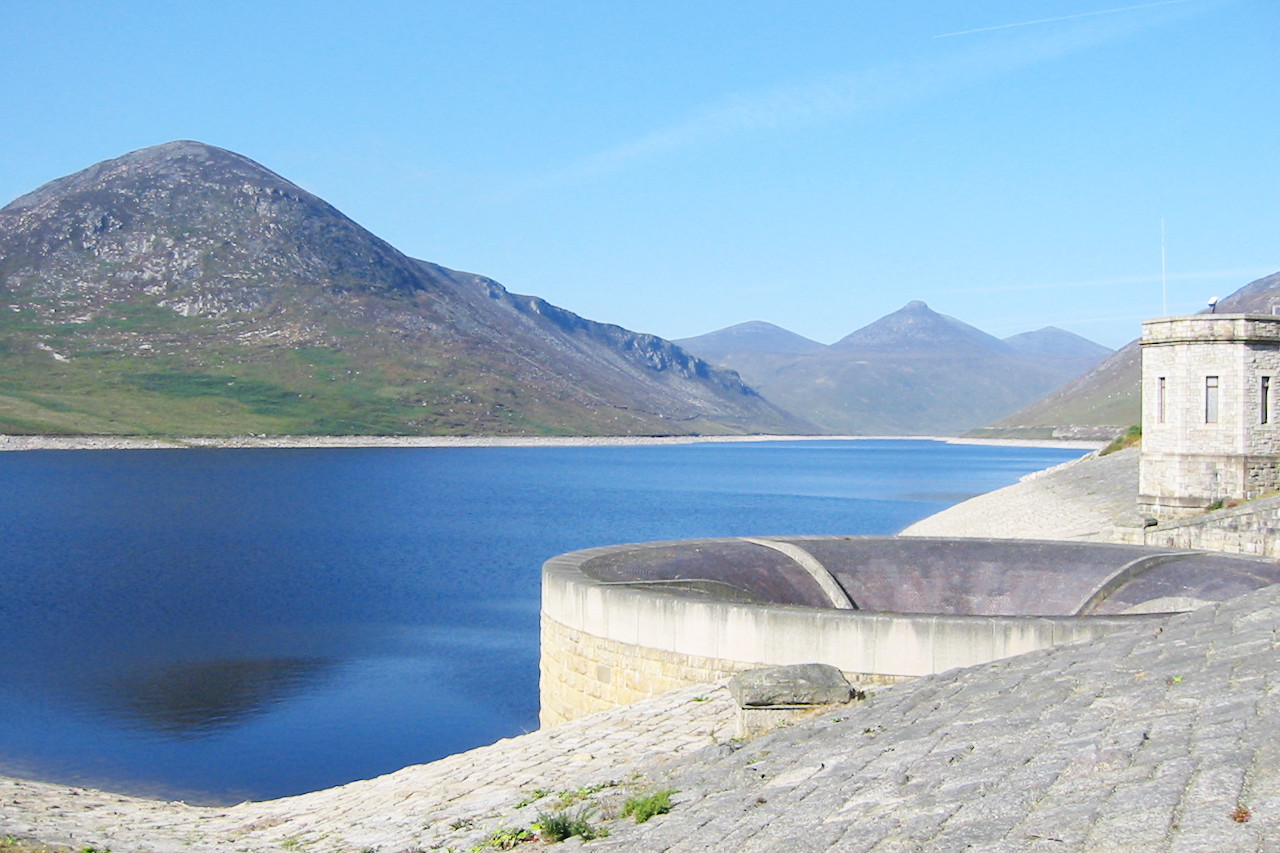
The western boundary of Northern Ireland is the River Foyle, whose broad valley lies between the Sperrin Mountains and the Mountains of Donegal in the Republic. In the far southwest, in County Fermanagh, are the two glistening lakes of Upper and Lower Lough Erne; these two lakes are studded with islands on which are the ruins of castles, shrines and monasteries.
What is the nature of Northern Ireland like?
The western hills are part of the ancient, eroded mountains that stretch from Scandinavia and Scotland to Ireland. The east is part of the fascinating landscape known as the Antrim Basalt Plateau which has eroded into a series of sheltered valleys. Lough Neagh, the largest lake in Northern Ireland, is located in the plateau. The lowlands are covered by thousands of glacial hills, called drumlins, which create a hummocky landscape.
What is the climate of Northern Ireland like?
See also our articles: The Climate of the United Kingdom and The Climate of Ireland
Like the rest of Ireland, the climate of Northern Ireland is influenced by the warm waters of the North Atlantic and consequently its climate is relatively mild in winter and rather cool and cloudy in summer. Rainfall is highest in the winter months, but rain can occur any time.
| Climate data for Belfast (1991–2020) | |||||||||||||
|---|---|---|---|---|---|---|---|---|---|---|---|---|---|
| Month | Jan | Feb | Mar | Apr | May | Jun | Jul | Aug | Sep | Oct | Nov | Dec | Year |
| Average high °C (°F) | 8.2 (46.8) | 8.8 (47.8) | 10.5 (50.9) | 12.8 (55.0) | 15.7 (60.3) | 17.2 (63.0) | 19.7 (67.5) | 19.4 (66.9) | 17.3 (63.1) | 13.8 (56.8) | 10.7 (51.3) | 8.4 (47.1) | 13.7 (56.7) |
| Daily mean °C (°F) | 5.2 (41.4) | 5.5 (41.9) | 6.8 (44.2) | 8.8 (47.8) | 11.4 (52.5) | 14.0 (57.2) | 15.6 (60.1) | 15.4 (59.7) | 13.5 (56.3) | 10.4 (50.7) | 7.4 (45.3) | 5.4 (41.7) | 9.9 (49.8) |
| Average low °C (°F) | 2.2 (36.0) | 2.1 (35.8) | 3.1 (37.6) | 4.7 (40.5) | 7.0 (44.6) | 9.7 (49.5) | 11.6 (52.9) | 11.5 (52.7) | 9.6 (49.3) | 6.9 (44.4) | 4.2 (39.6) | 2.3 (36.1) | 6.3 (43.3) |
| Average precipitation mm (inches) | 88.5 (3.48) | 70.3 (2.77) | 71.4 (2.81) | 60.4 (2.38) | 59.6 (2.35) | 69.0 (2.72) | 73.6 (2.90) | 85.0 (3.35) | 69.6 (2.74) | 95.8 (3.77) | 102.3 (4.03) | 93.3 (3.67) | 938.7 (36.96) |
| Source: Met Office | |||||||||||||
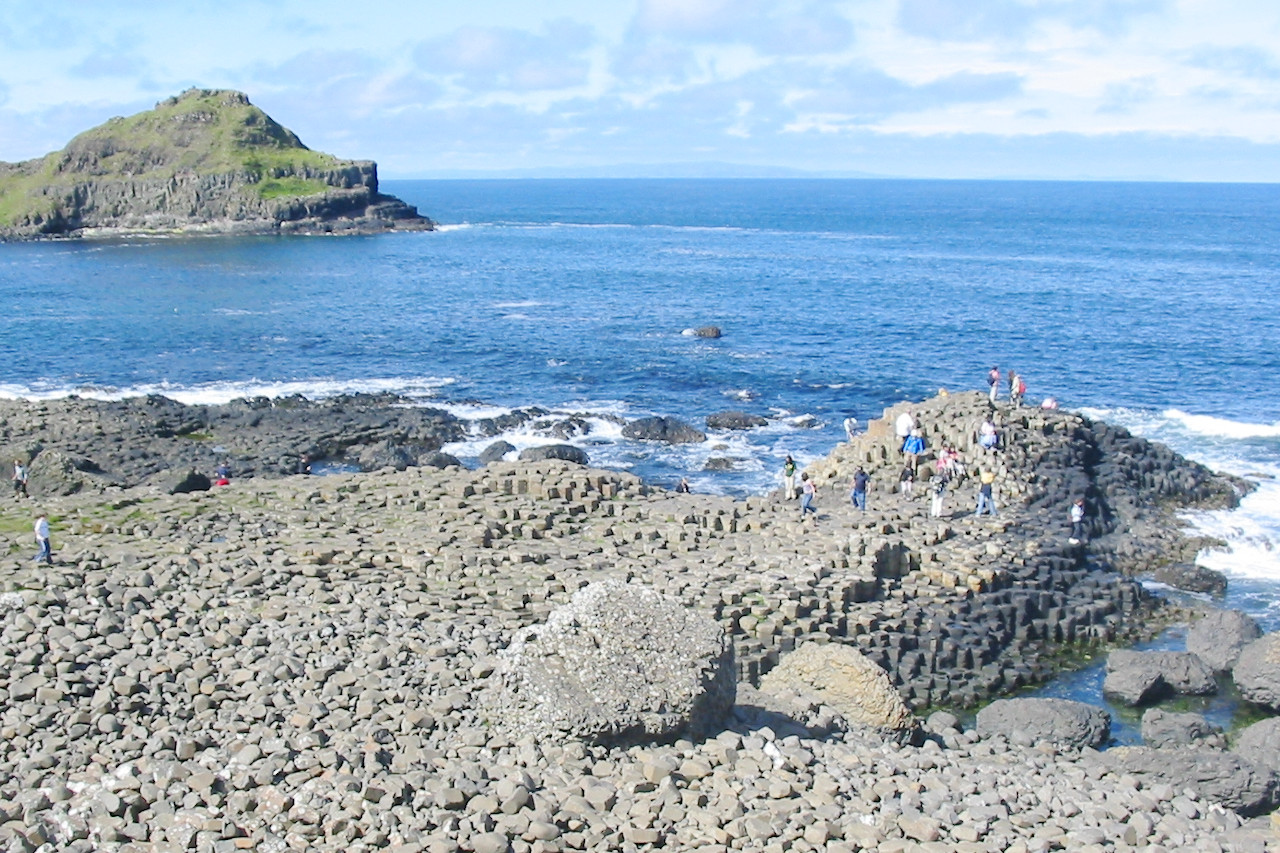 Summer at the Giant's Causeway
The official websites
Northern Ireland
Embrace a Giant Spirit
| Location: | Northeast Ireland |
| Coordinates: | 54° 45′ N, 6° 45′ W |
| Size: | • 140 km N-S; 175 km E-W • 90 miles N-S; 110 miles E-W |
| Terrain: | Undulating landscape with low ranges of hills |
| Climate: | Maritime climate with mild summers and cool winters; year-round rainfall |
| Highest point: | Slieve Donard 850 m / 2,790 ft |
| Forest: | 26% (2010 est.) (source) |
| Population: | 1,810,863 (2011) |
| Population density: | High (133/km²) |
| Capital: | Belfast |
| Languages: | English; Irish |
| Human Development Index: | Very High (0.899) |