The Geography of
Algeria
Why visit Algeria?
Algeria offers an unmatched variety of scenery and natural wonders to explore. The Algerian landscape is incredibly beautiful. The desert is stark, but it's punctuated by palm trees and olive trees. The coast is rocky and dramatic, with beautiful white-sand beaches. The mountains are absolutely stunning, with deep blue-green valleys and snow-capped peaks. There are also many ancient archaeological sites in Algeria if you're interested in ancient civilizations.
Map
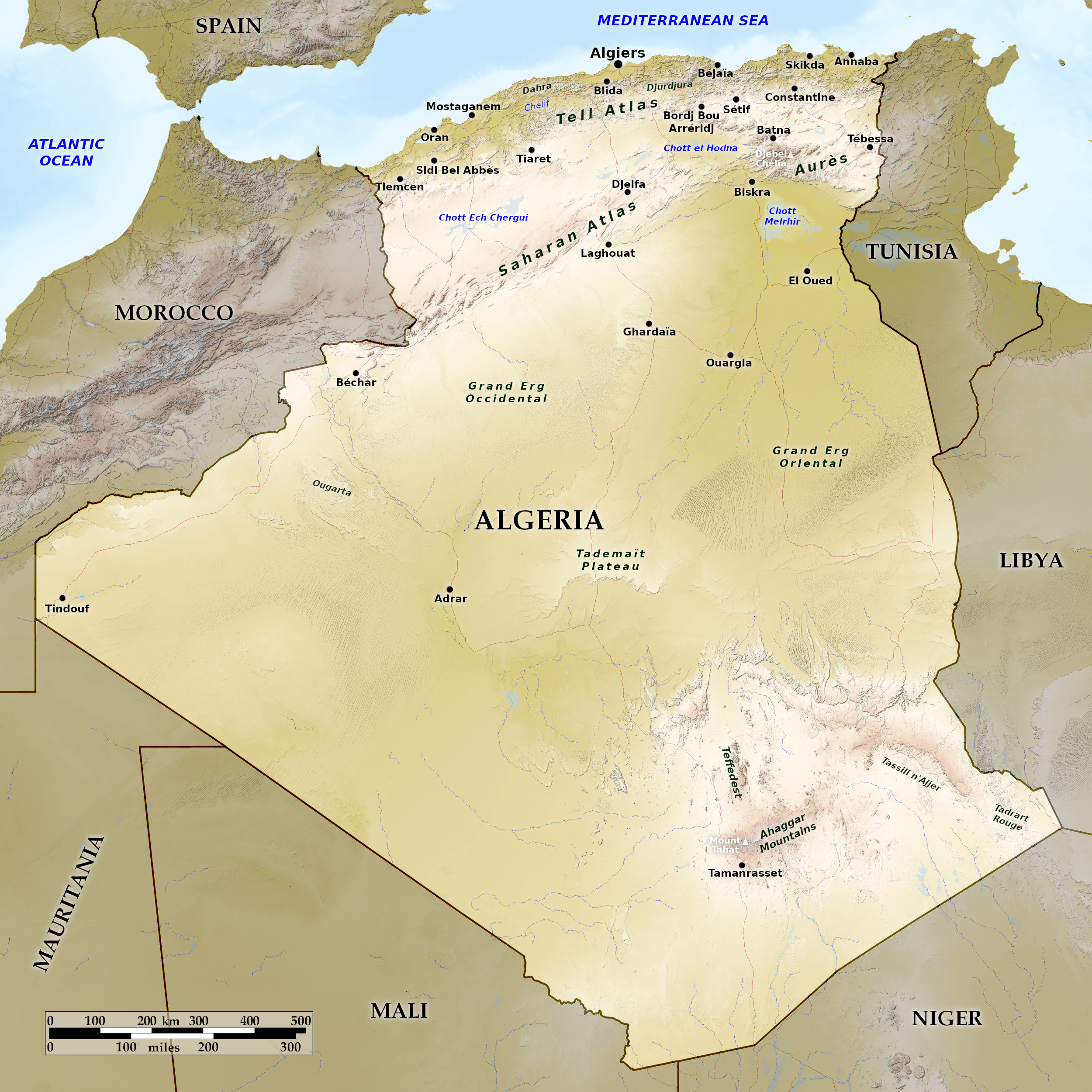 Relief map of Algeria
What is the landscape of Algeria like?
The natural divisions of Algeria are: the Tell, the High Plateaux, and the Sahara.
Coast
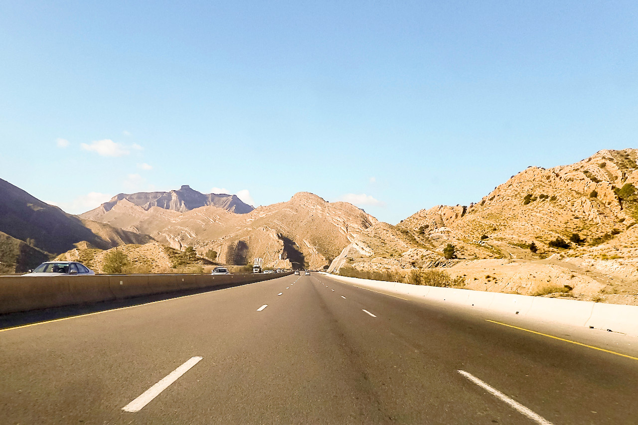
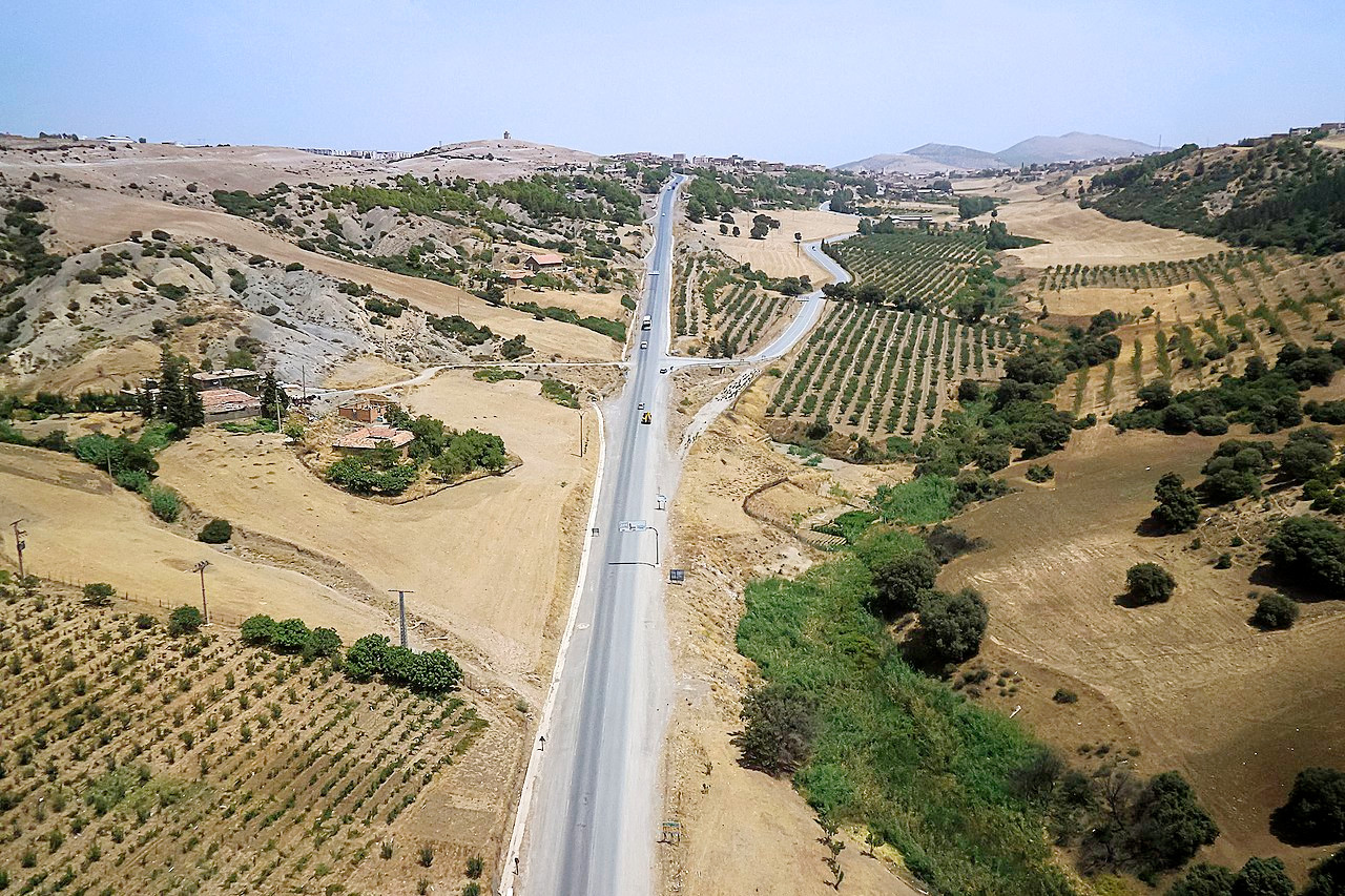
The whole fertile coast region, from 50 to 100 miles deep, is known (at least to Europeans) as the Tell. It is a hilly country of small mountains and wooded valleys, which can be understood as the northern ridge of the Atlas mountains. The land is intersected with rocky canons and fertile valleys, which occasionally broaden out into plains.
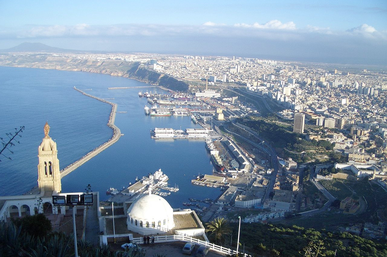
The western coast is bordered by hilly ramparts, broken only here and there in the bays by flat, sandy plains where the rivers flow out to sea. Near the Moroccan border lies Tlemcen—the city is perhaps the most interesting in Northern Algeria for its elegant blend of Berber and Al-Andalusian culture. The country is wild as you wind in and out of massive limestone rocks and up and down the side of bare hills patched with scrub. The first of the great plains is reached around Oran; here flows the principal river of Algeria, the Cheliff, which has its sources in the Saharan Atlas; it reaches the sea near Mostaganem after a course of 400 miles.
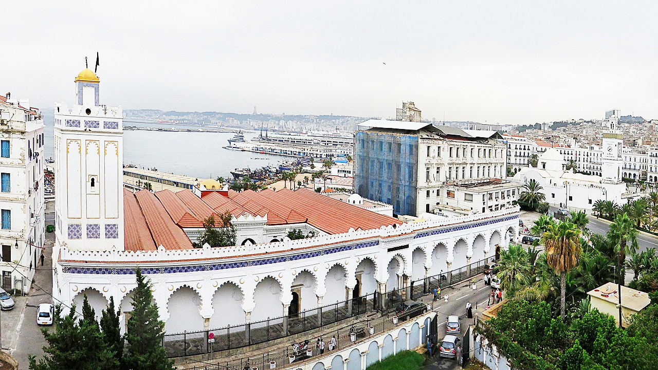
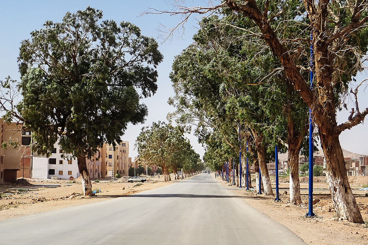
To the north of Cheliff valley is the Dahra range which overlooks the sea; it is covered in Mediterranean forest with scattered patches of farmland. Halfway along the coast you reach the city of Algiers—which gleams as a dazzling white series of terraces. This huge city stretches up its amphitheatre of hills overlooking the spacious harbour. It sits at the center the high plain of the Mitidja—an agricultural plain of fruit trees and olive groves.
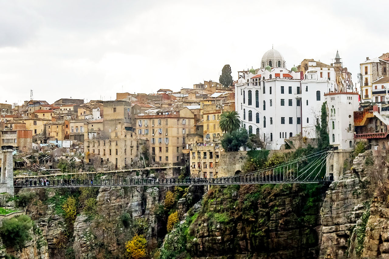
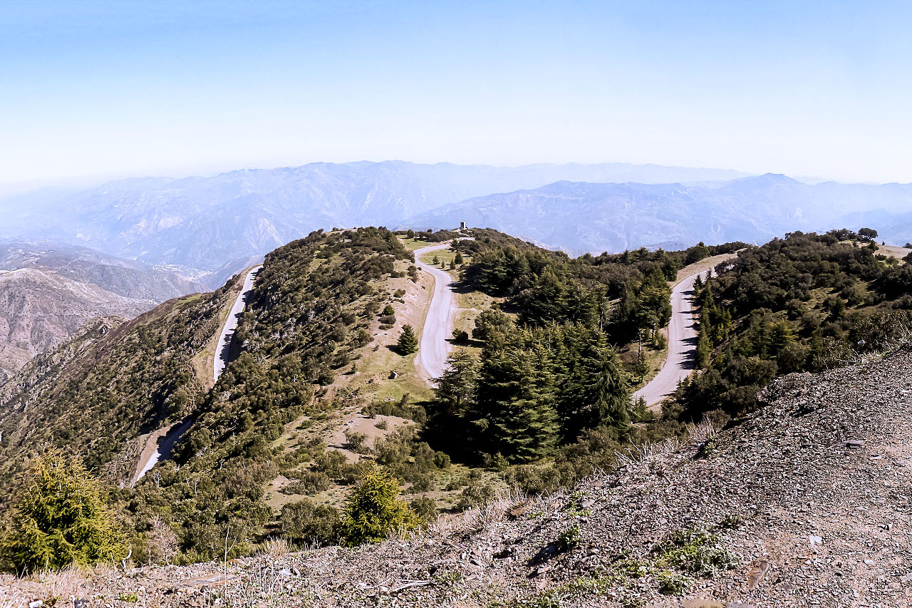
On the eastern coast of Algeria high mountains rise almost sheer from the sea leaving only a narrow strip of beach. The grandest scenery is to be found in the great mountain mass of the Djurdjura, a national park which for grandeur of scenery no other part of the coast can compare. Inland is the curious city of Constantine perched on its high rock, and southwards of Constantine are Roman ruins of the Tébessa Basilica; Trajan's city of Timgad is not far off. East of Skikda the mountains recede from the coast, and the rampart of hills reappears. Around Annaba the sea-coast is low and sandy.
Plateaux
Algeria is crossed by high ranges of the Atlas mountains which run nearly parallel to the coast, and rise in places over 2,000 meters (6,500 feet). These are commonly divided into two chains, distinguished as the Tell Atlas and Saharan Atlas. Between the ranges is a lofty table-land with an average elevation of 900 meters (3,000 feet), consisting of vast plains for the most part arid or covered with esparto grass, in the depressions of which are great salt lakes ("chotts").
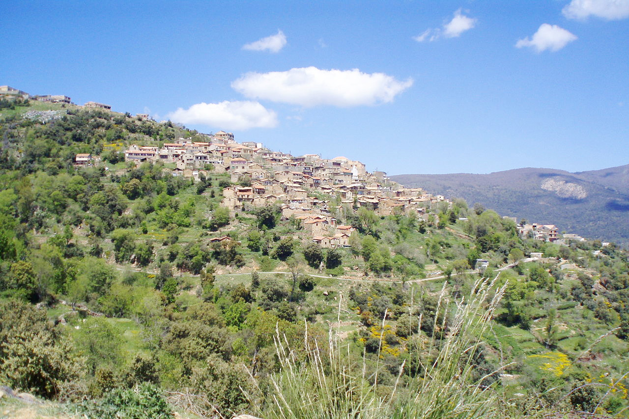
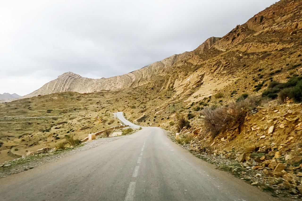
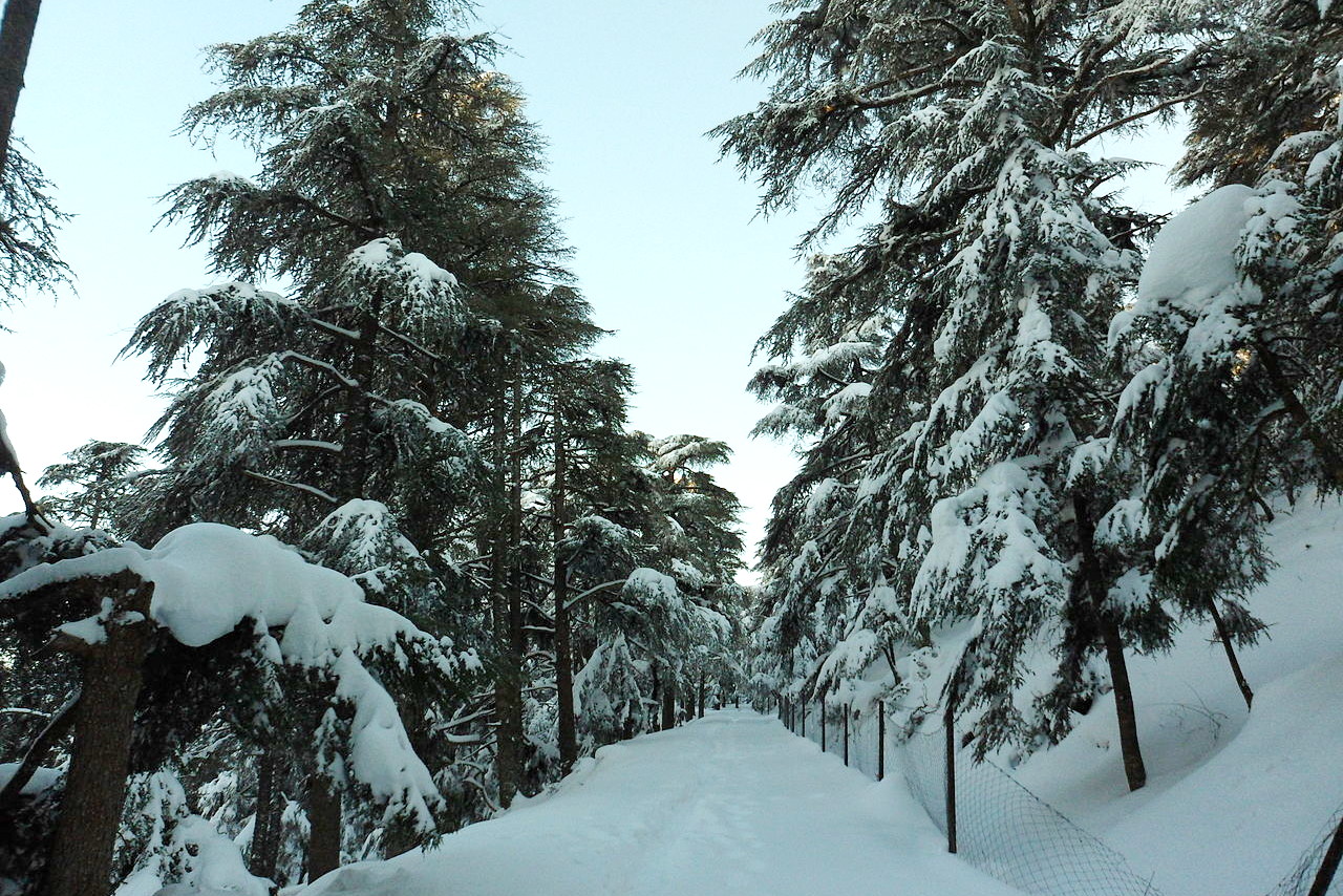
The Tell Atlas (otherwise the Little or Maritime Atlas) is composed of many distinct ranges, generally of no great height and crossed by numerous hills forming extensive table-lands and elevated valleys. Climbing through the Tell Atlas takes you through valleys, gorges, glens and downs until you reach the barren wind-swept uplands. South of the Djurdjura is the Biban range with a famous pass of the Bibans or Iron Gates between walls of rock, and once the sole access point to the highlands beyond.
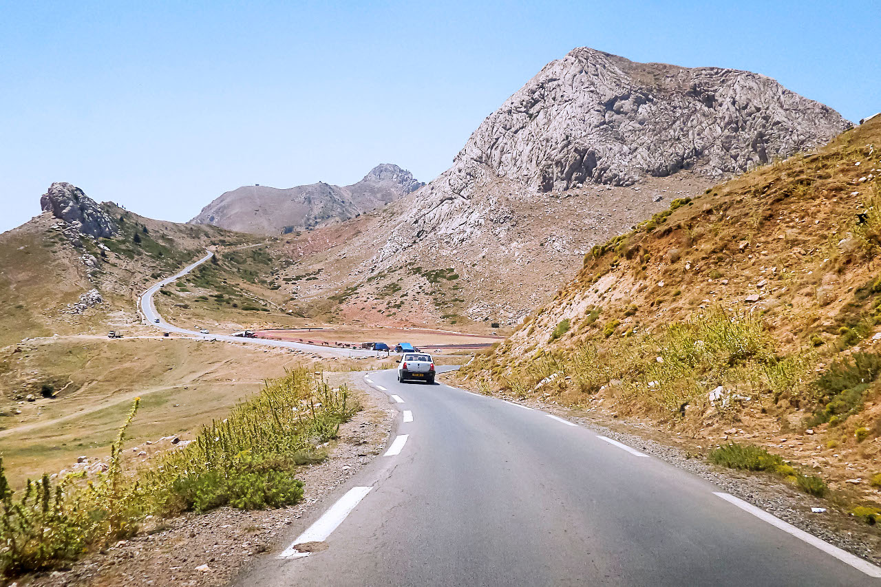
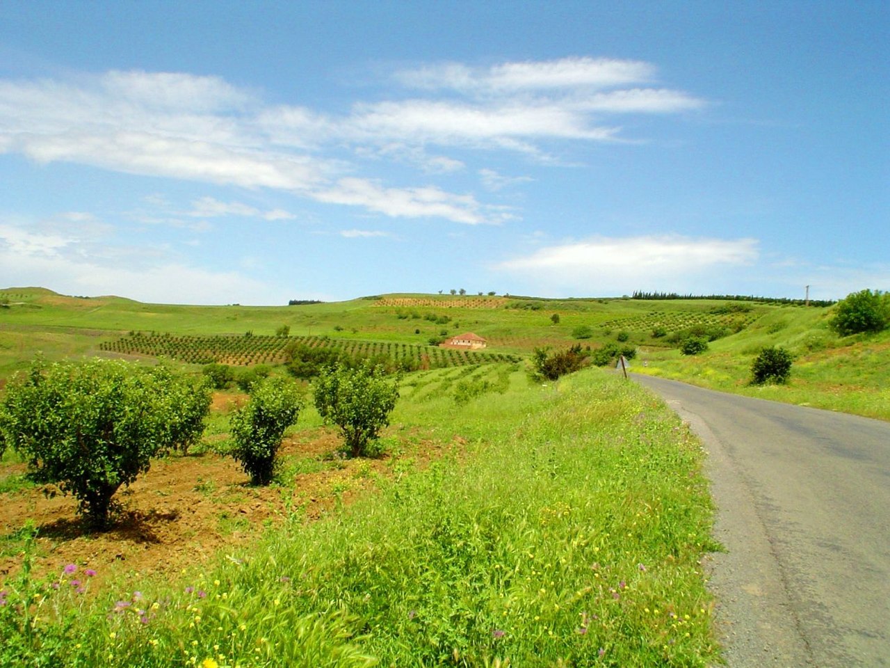
The High Plateaux runs from east to west between the Tell and the Saharan Atlas some 900 meters (3,000 feet) above sea level. The High Plateaux are a region of extremes of temperature and remind you that North Africa is a cold country with a hot sun. The Plateaux and their bordering hills are bare except for a sparse growth of small trees on the southern slopes. The uplands are, however, fair pasture, with large areas of esparto grass. Wherever water is found crops can be grown raised. The greatest height of the Plateaux is about 1,000 meters (3,300 feet).
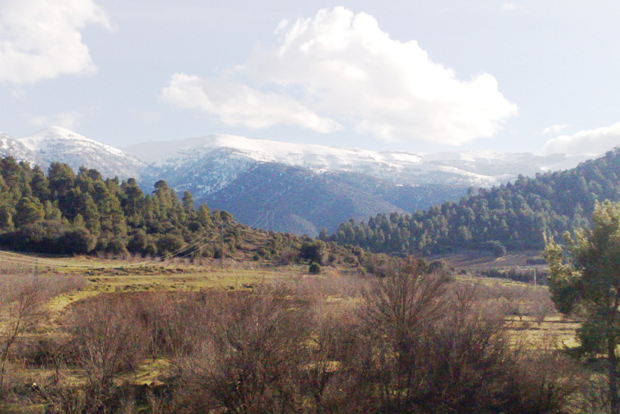
The Great, or Saharan Atlas contains some of the highest points in the country. In the east the two main chains of mountains merge into one in the Aurès stretching 75 miles from east to west, and 40 miles from north to south. Here stands Djebel Chélia, the highest point in the north of Algeria at 2,328 meters (7,638 feet). From here the Saharan Atlas slopes to the Sahara except where the mountains, as in the case of the Aurès, shows a sheer face towards the desert.
South
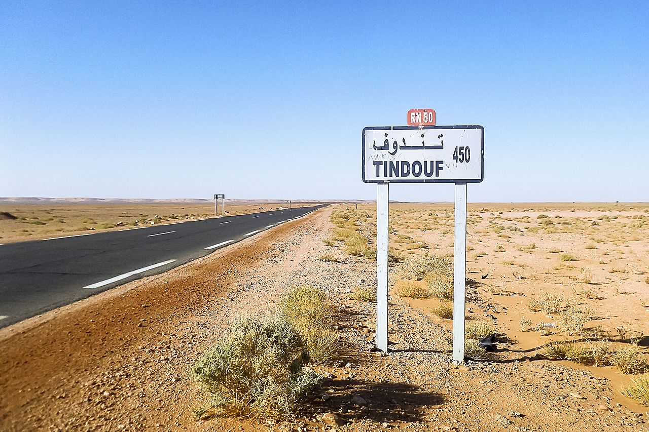
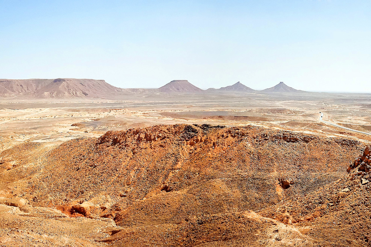
The south of Algeria is the Sahara, a veritable furnace, an immense desert. From Laghouat, to Ghardaia, through to Tamanrasset you will see little but desert for two thousand miles until you reach the first grasslands that lead to the Niger basin.
The desert varies considerably though. Tn some parts, towards Tunisia, the soil is a mixture of sand and clay; in other parts, to the west towards Morocco, are rocky districts and mountains, the rivers rushing from which produce the oases where there are canals for irrigation. In other directions the desert is a moving mass of sand-forming dunes. There is nothing quite like the oases of the Algerian South; they are unique in North Africa. The air and the light are wonderfully pure. You meet your first camel. The earth merges into sand. The sunburned rocks look thoroughly African.
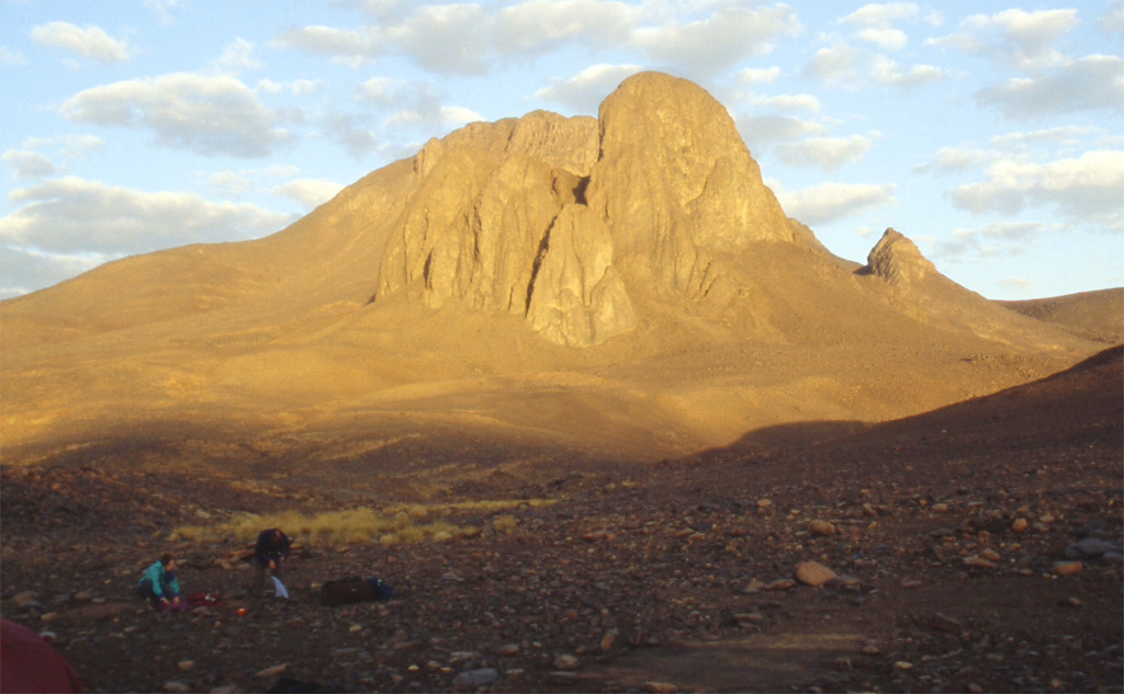
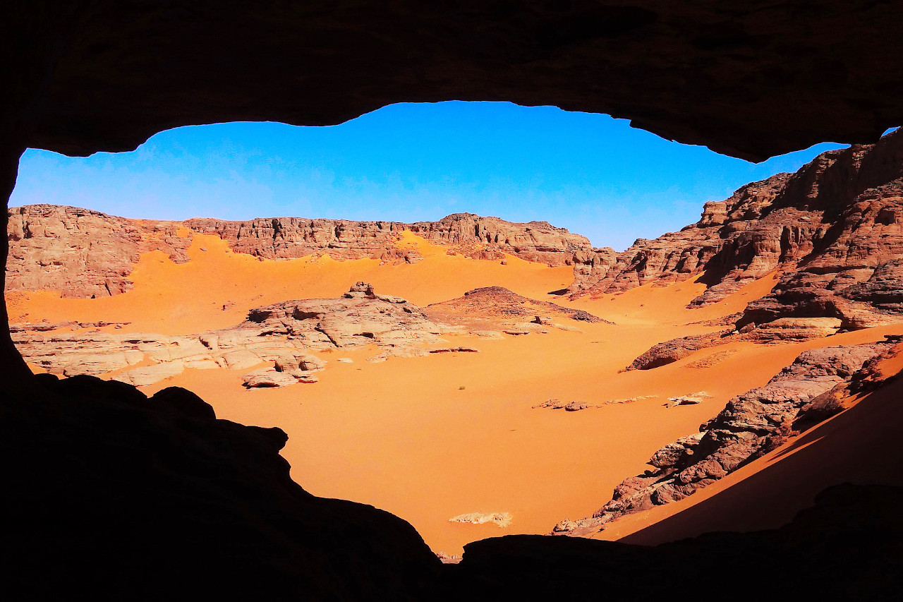
The southeast of Algeria is a mountainous region with an average elevation of more than 900 meters (3,000 feet) above sea level. The vegetation here is somewhat richer than in the surrounding desert and includes a very scattered woodland supporting a thin population of barbary sheep and the Dorcas gazelle. The highest mountain in Algeria is Mount Tahat at 2,908 metres (9,541 ft) in the Hoggar Mountains. In the far southeast is the Tadrart Rouge a red, rocky, mountain range famed for its ancient rock art depicting life when the region was over 5,000 years ago.
What is the nature of Algeria like?
The plants of the coastal district are distinctly Mediterranean. The agave and prickly pear, the myrtle, the olive and the dwarf palm grow luxuriantly. In one field may be seen masses of iris and narcissus; in another wild hyacinths, violets, and African cyclamen. The cultivated flowers are roses, carnations, geraniums, lilies, violets, jessamine and various creepers, most of which bloom throughout the winter. The fertility for which Algeria was renowned in olden times still continues; the valleys are watered by streams, and the hills are covered with fruit trees of every kind. The mountainous country near the coast are covered with forests of various species of oak, pine, fir, cedar, elm, ash, maple, olive, many of them of gigantic size, and other trees: on the slopes of the mountains the fig is quite common.
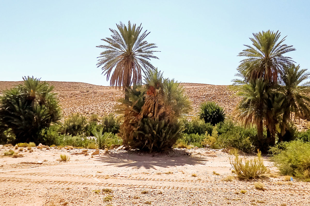
The plants of the high plateaus consists chiefly of grasses, notably various kinds of esparto. The Aleppo pine, and other species flourish in some parts. The Atlas cedar, a cedar native to the Atlas Mountains, can be found in the Tell Atlas. In the Saharan oases the characteristic tree is the date palm. The trees flower in March, and the fruit is ripe in October. The trees are up to 40 feet high, and flourish for 100 years.
What is the climate of Algeria like?
See our main article: The Climate of Algeria
.jpeg&oldid=387603993)
.jpg&oldid=266723390)
_%D9%82%D8%B1%D9%8A%D8%A9_%D9%82%D9%85%D8%B1%D8%A9_%D8%A8%D8%B9%D9%8A%D9%86_%D8%A7%D9%84%D8%B1%D9%8A%D8%B4_(38191679701).jpg&oldid=313832383)
The climate of the coast is generally very warm. The real heat only sets in seriously about the end of June; July, August, and September being very hot months. As a rule, the first rains begin to fall around October. The early part of the winter is very enjoyable during the months of October and November. January, February, and March have plenty of both sunshine and rain and the thermometer rarely falls to freezing-point. April and May resemble a fine summer. The climate of the interior is drier and the heat is much greater. On the plateaus the temperature passes from one extreme to the other; the winter is often very severe, and snow lies for six months on the higher peaks. The heat in the interior can become almost unbearable in the high summer. Between May and September the sirocco, or hot wind of the desert, sweeps at intervals over the entire country.
In the north, rain falls from November to March, and rain is not uncommon during other months except June, July, and August, which are very hot and rainless. In Algiers rain falls on 70 to 80 days during the year, but only a small proportion of these are entirely wet days, and much of the rain falls during the night. South of the Atlas rain is rare, and in many parts years can go by without any appreciable rainfall.
| Climate data for Algiers (1976–2005) | |||||||||||||
|---|---|---|---|---|---|---|---|---|---|---|---|---|---|
| Month | Jan | Feb | Mar | Apr | May | Jun | Jul | Aug | Sep | Oct | Nov | Dec | Year |
| Average high °C (°F) | 16.7 (62.1) | 17.4 (63.3) | 19.3 (66.7) | 20.9 (69.6) | 23.9 (75.0) | 28.2 (82.8) | 31.2 (88.2) | 32.2 (90.0) | 29.6 (85.3) | 25.9 (78.6) | 20.8 (69.4) | 17.9 (64.2) | 23.7 (74.7) |
| Daily mean °C (°F) | 11.1 (52.0) | 11.7 (53.1) | 13.2 (55.8) | 14.9 (58.8) | 18.1 (64.6) | 22.2 (72.0) | 25.1 (77.2) | 26.0 (78.8) | 23.6 (74.5) | 20.1 (68.2) | 15.3 (59.5) | 12.6 (54.7) | 17.8 (64.0) |
| Average low °C (°F) | 5.5 (41.9) | 5.9 (42.6) | 7.1 (44.8) | 8.8 (47.8) | 12.3 (54.1) | 16.1 (61.0) | 18.9 (66.0) | 19.8 (67.6) | 17.6 (63.7) | 14.2 (57.6) | 9.8 (49.6) | 7.2 (45.0) | 11.9 (53.4) |
| Average precipitation mm (inches) | 81.4 (3.20) | 72.7 (2.86) | 55.0 (2.17) | 58.4 (2.30) | 41.9 (1.65) | 8.5 (0.33) | 4.5 (0.18) | 8.2 (0.32) | 28.3 (1.11) | 58.8 (2.31) | 89.6 (3.53) | 91.0 (3.58) | 598.3 (23.56) |
| Source: World Meteorological Organization | |||||||||||||
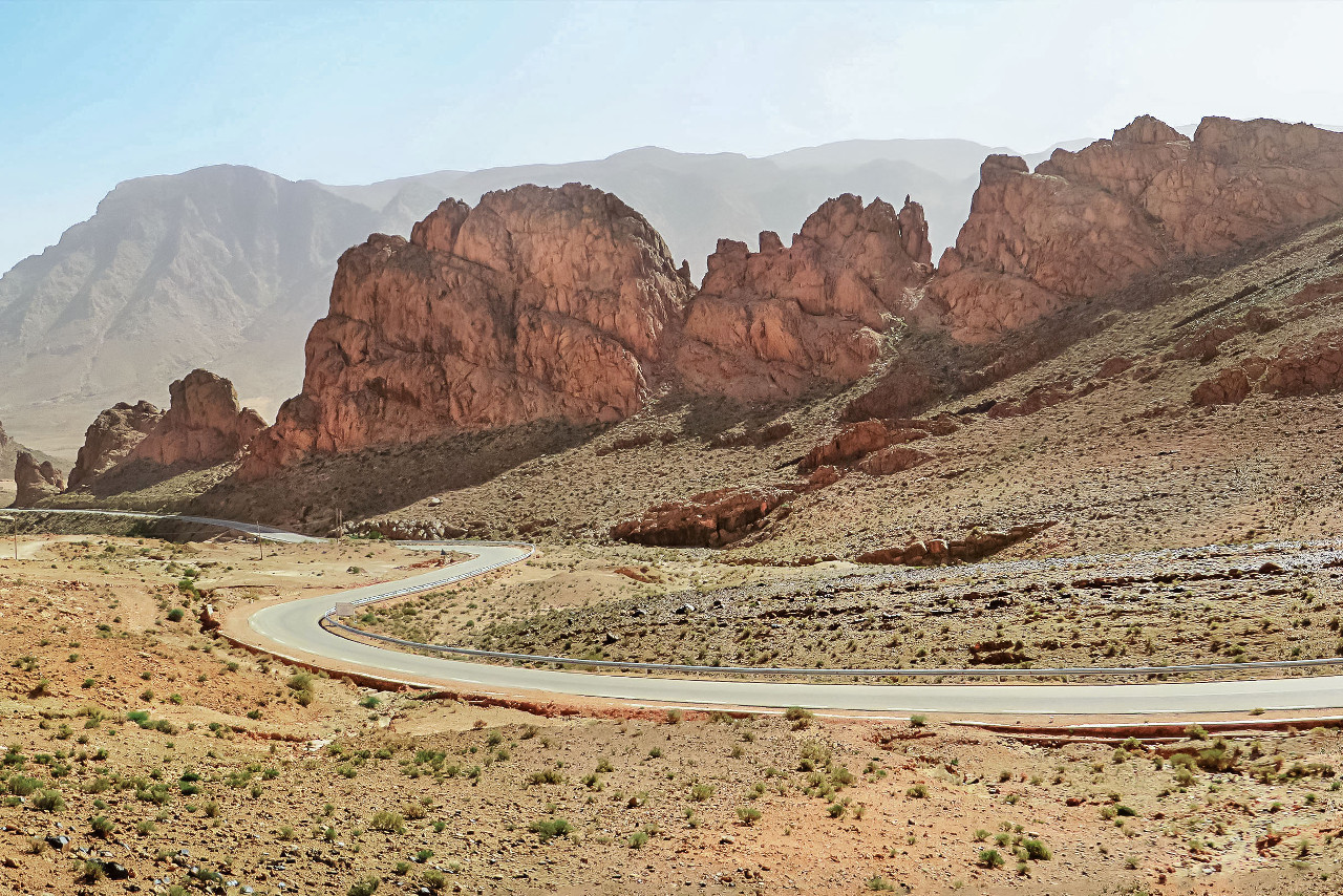
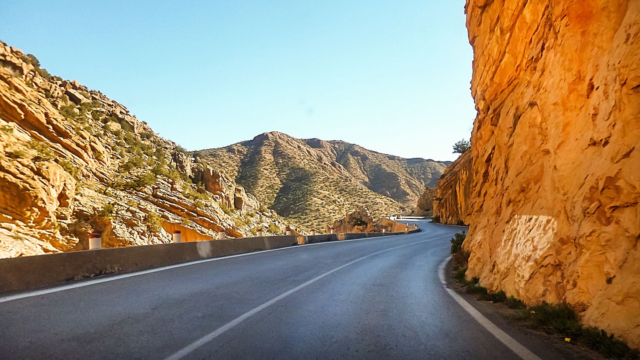 Tighanimine Gorges, Batna Province
Algeria
Algeria: voyage of the heart
| Location: | Northern Africa, bordering the Mediterranean Sea, between Morocco and Tunisia |
| Coordinates: | 28° 00′ N, 3° 00′ E |
| Size: | • 2,100 km N-S; 2,400 km E-W • 1,300 miles N-S; 1,500 miles E-W |
| Terrain: | Mostly high plateau and desert; Atlas Mountains in the far north and Hoggar Mountains in the south; narrow, discontinuous coastal plain |
| Climate: | Arid to semiarid; mild, wet winters with hot, dry summers along coast; drier with cold winters and hot summers on high plateau; sirocco is a hot, dust/sand-laden wind especially common in summer |
| Highest point: | Tahat 3,003 m / 9,852 ft |
| Forest: | 0.8% (2016 est.) |
| Population: | 42,972,878 (July 2020 est.) |
| Population density: | Low (18/km²) |
| Capital: | Algiers |
| Languages: | Arabic (official); French (lingua franca); Berber or Tamazight (official); dialects include Kabyle Berber (Taqbaylit), Shawiya Berber (Tacawit), Mzab Berber, Tuareg Berber (Tamahaq) |
| Human Development Index: | High (0.748) |
| Currency: | Dinar |