.jpg)
.jpg)
The Geography of
Cambodia
Why visit Cambodia?
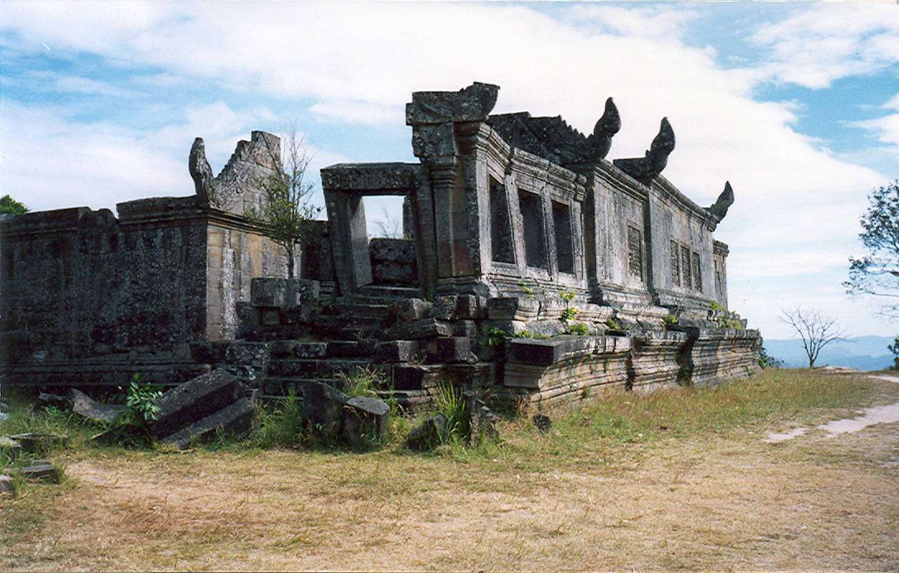
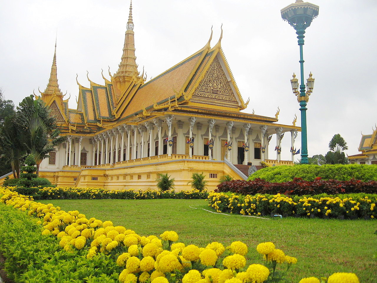
Cambodia is filled with natural wonders and stunning architecture. Even just visiting the major tourist destinations such as Angkor Wat and Banteay Srei is a sight to behold. The Khmer Empire was one of the most powerful empires in Southeast Asia and its legacy can still be seen today. Angkor Wat, Koh Ker and Preah Vihear are some of the most iconic monuments in Cambodia that offer visitors a glimpse into this ancient culture. This is an amazing country for anyone who is looking for a beautiful and magical experience.
Contents
Map
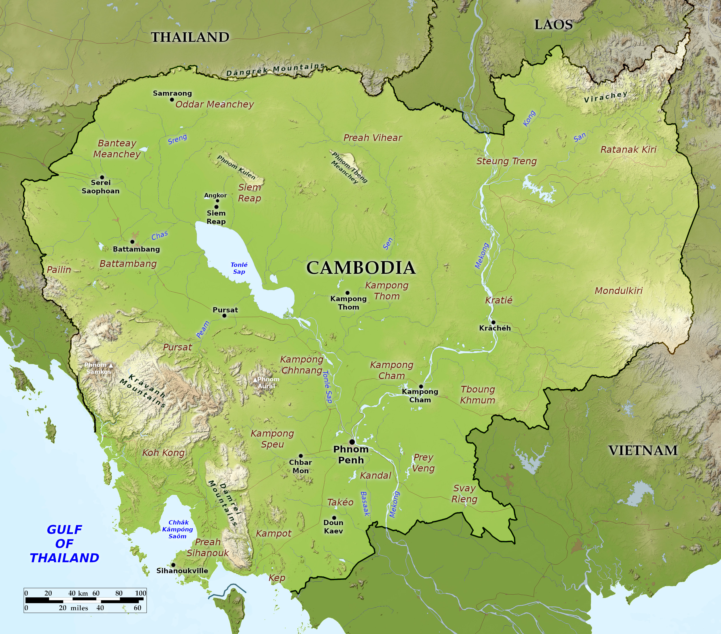 Relief map of Cambodia
What is the landscape of Cambodia like?
Cambodia's geographical features are: a vast central plain; mountain ranges to the southwest and to the north and east; and a coastal region fringed with islands and beaches.
Cambodian Plain
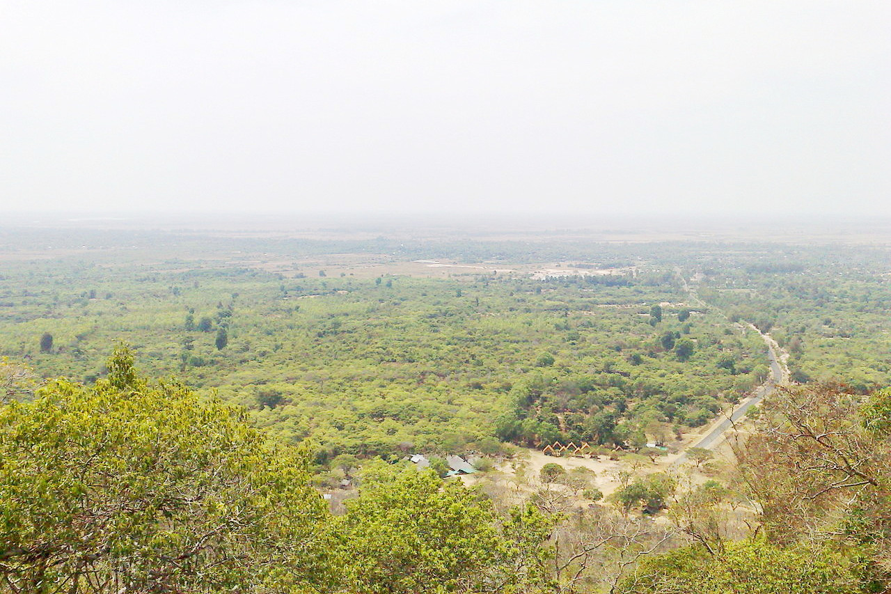
The largest part of Cambodia is the great Cambodian Plain consisting of the Tonlé Sap Basin and the Mekong Lowlands. To the south of this great basin is the Mekong Delta, which extends through Vietnam to the South China Sea. The Cambodian Plain is mostly level countryside, except in a few places where there are low, rounded hills. In northern and eastern regions, where as the land rises, the landscape becomes more rolling and dissected. The countryside varies from grassland plains to heavy forests to rice fields, marshlands, and deltas; most areas are near sea level.
The two most dominant features of this region are the Mekong River and Tonlé Sap lake. The Mekong’s annual flooding deposits rich river sediment that accounts for the fertility of the central plain. Other rivers flow across the plains and drain into the Tonlé Sap, and there are numerous small lakes and marshes east of the Mekong.
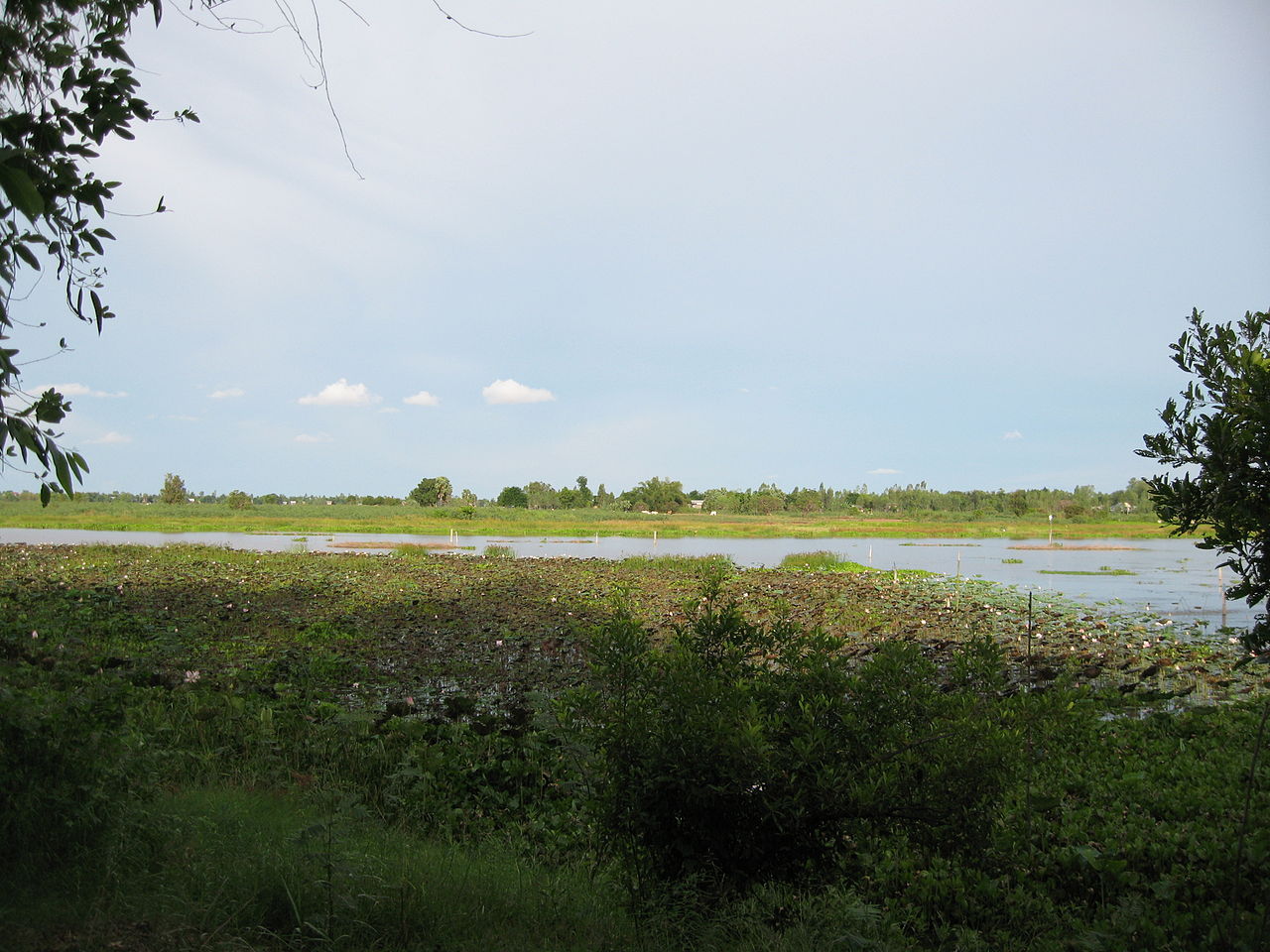
Tonlé Sap
.jpg)
Tonlé Sap is a massive lake connected to the Mekong at Phnom Penh by a 40- to 50-mile channel called the Tonlé Sap River. It is situated in a depression around 100 miles long and 20 miles wide. It is fed by several rivers and innumerable torrents, but the water level varies with the season. At low water, from November to June, the lake drains into the Mekong. In June the waters of the Mekong, swollen by the monsoon rains, rise and the water flow is reversed. The adjacent plains are flooded inundating the surrounding marshland. The lake supports a large fishing population; who take the fish by means of large nets at the end of the inundation. When the Mekong's waters reduce, the flow reverses, and water drains the engorged lake.
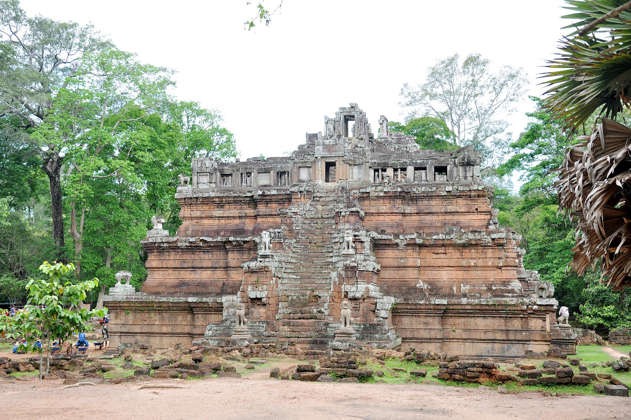
Angkor
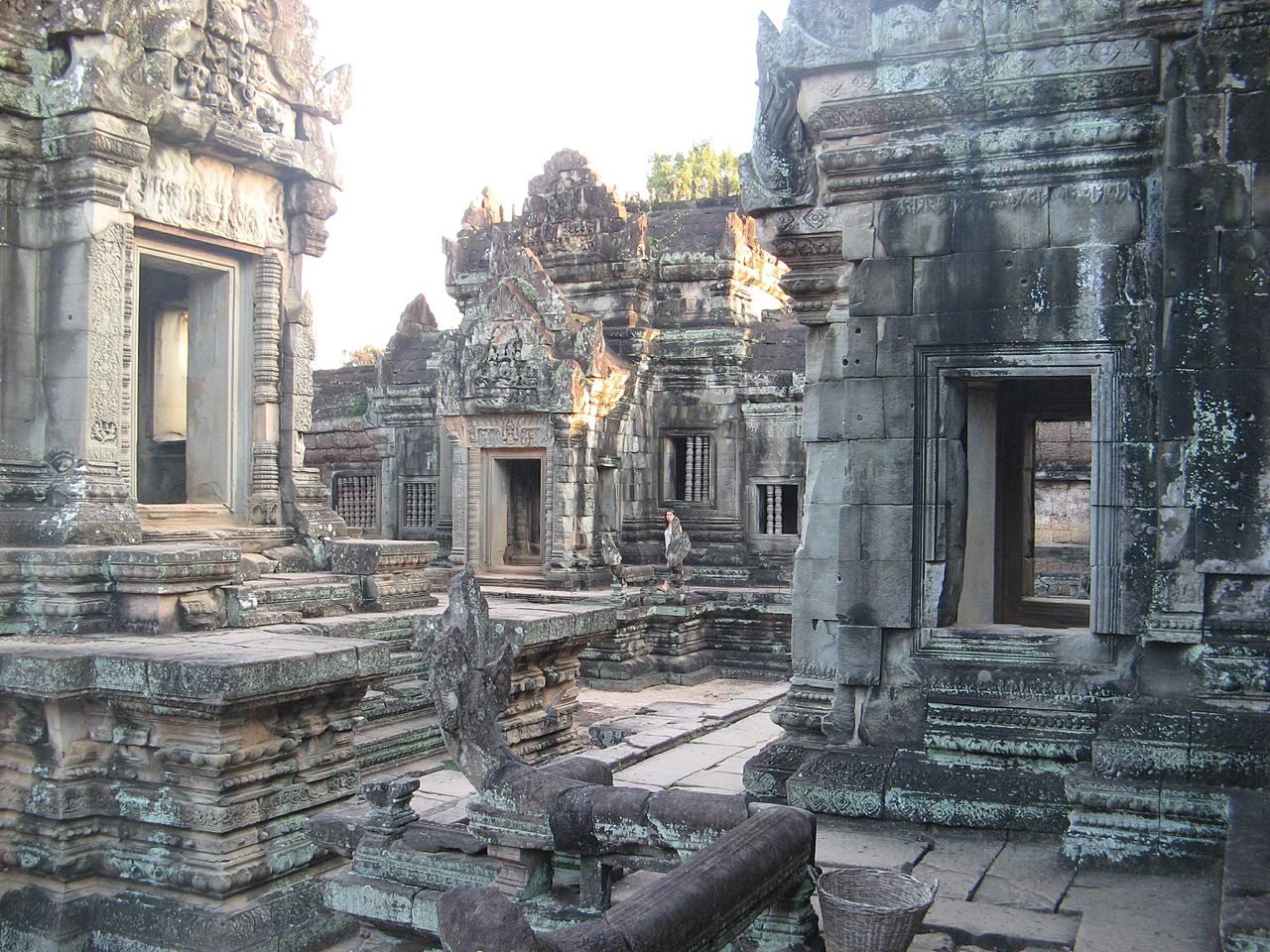
In forests to the north of the Tonlé Sap are the ruins of Angkor, the relic of the ancient Khmer civilization. The Angkorian period lasted from the early ninth century to the early fifteenth century. In terms of cultural accomplishments and political power, this was the golden age of Khmer civilization. The most famous of the remains are the city of Angkor Thom and the temple of Angkor Wat, both of which lie on the right bank of the river Siem Reap, a tributary of Tonlé Sap.
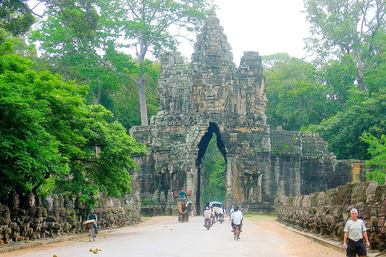
Angkor Thom lies about a quarter of a mile from the river. It consists of a rectangular enclosure, nearly 2 miles in each direction, surrounded by a wall from 20 to 30 ft. in height. Within the enclosure, which is entered by five monumental gates, are the remains of palaces and temples.
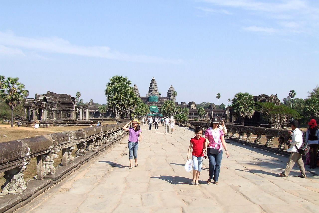
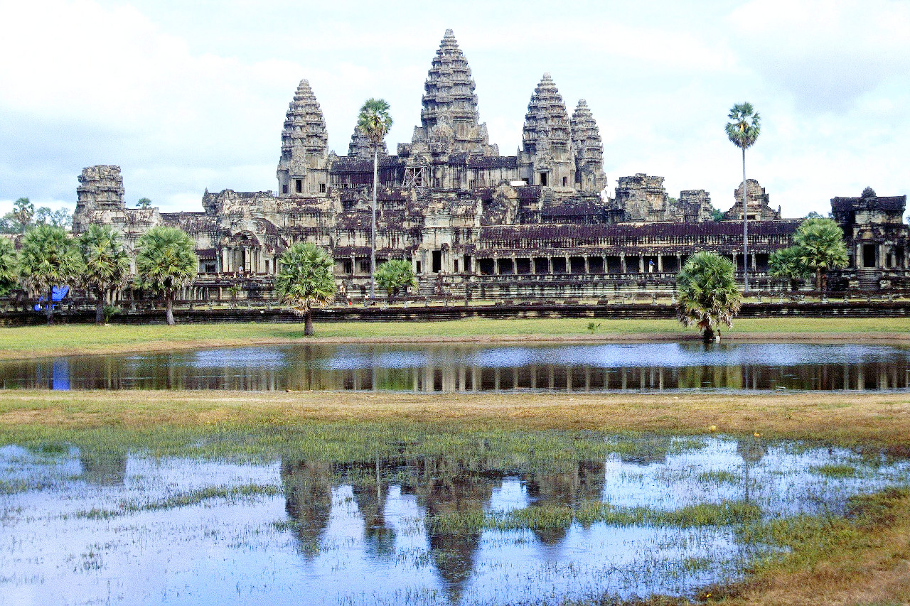
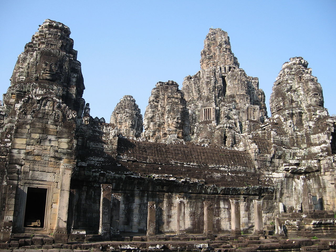
In the the first half of the 12th century the temple city complex of Angkor Wat was constructed. The temple was originally a Hindu one, but was later adapted to Buddhism. It lies less than a mile to the south of Angkor Thom, within a rectangular park surrounded by a moat. On the west side of the park a paved causeway, leading over the moat and under a magnificent gateway, extends to the chief entrance of the main building. The largest religious edifice in the world, Angkor Wat is considered the greatest single architectural work in Southeast Asia. The five towers at the center of the Angkor Wat complex represent the peaks of Mount Meru, the center of the universe.
Mekong River
The Mekong River is the great river of Cambodia. It has its origin in the Tibetan highlands, and is one of the top-ten longest rivers in the world. In Cambodia flows southward from the Cambodia-Laos border to a point below Krâchéh, where it turns west for about 50 kilometers and then turns southwest to Phnom Penh. Extensive rapids can be found above Krâchéh. From Kampong Cham it slopes very gently, and floods areas along the river from June to November.
Mekong Delta
The Mekong Delta begins in southern Cambodia. At Phnom Penh, the river splits into two channels: the eastern branch, still known as the Mekong, and the western branch, called the Bassac River (Tonle Bassac). These flow independently through the delta areas of Cambodia into Vietnam, draining the central plains.
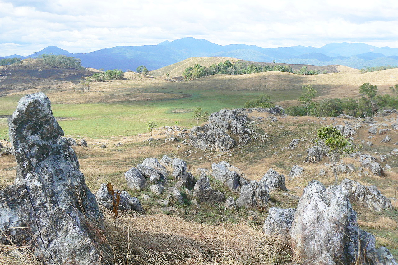
Southwest Mountains
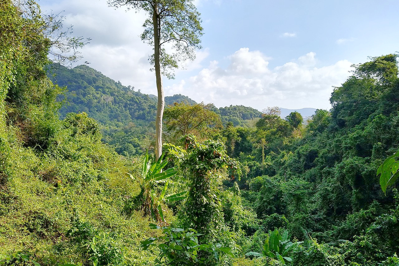
Southwest Cambodia is the region of the mountains. The two prominent mountain ranges are the Cardamom Mountains (Krâvanh Mountains) and the Elephant Mountains (Dâmrei Mountains). These ranges form a highland region that covers much of the land between Tonlé Sap and the Gulf of Thailand. The rain-drenched slopes are blanketed with virgin rain forest growing to heights of 45 meters (150 feet) or more.
The Cardamom Mountains run generally in a northwest-southeast direction, rising to more than 1,500 meters (5,000 feet). The highest mountain in Cambodia, Phnom Aural at 1,813 meters (5,948 feet), is in the eastern part of this range. The Cardamom Mountains are composed of rocky summits, deep valleys, and steep slopes on nearly every side. Several peaks reach over 1,350 meters (4,500 feet) and a large portion of the mountain range is covered by dense forest.
The Elephant Mountains are a range running toward the south and the southeast from the Cardamom Mountains. They rises to elevations of between 500 and 1,000 meters (1,600–3,200 feet). The Elephant Mountains have very steep slopes on every side, especially on the seaward side where they have an almost vertical face.
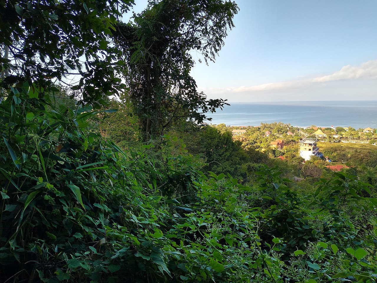
Southern coast
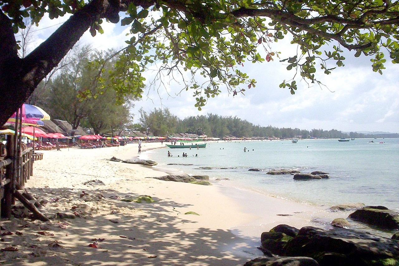
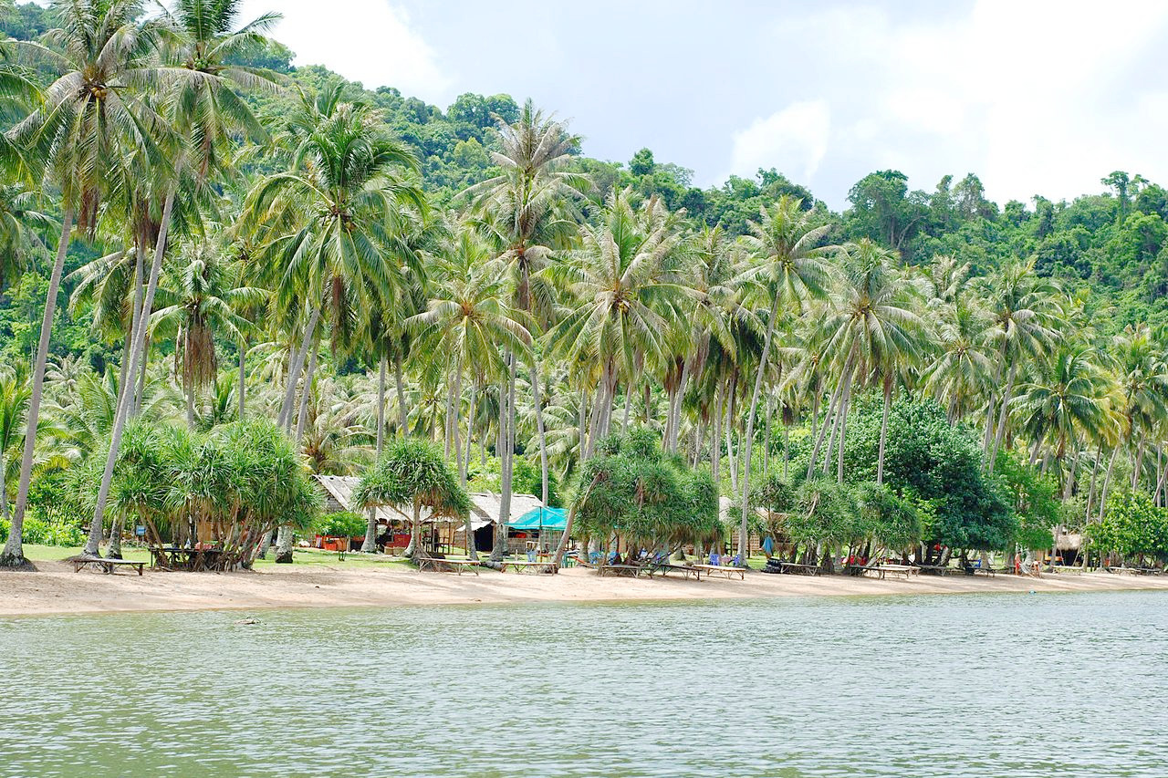
The Southern coast encompasses the narrow plains of southwestern Cambodia together with several small offshore islands. It is a narrow, forested region, moderately populated. Here are found evergreen forests, with open forests of pines are found at higher elevations. Along the coast are nearly impenetrable mangrove forests. The region contains Kampong Saom Bay, which faces the Gulf of Thailand.
Dângrêk Mountains
The Dângrêk Mountains lie on the border between Cambodia and Thailand. They form the northern rim of the Tonlé Sap Basin, and consist of a steep escarpment with an average elevation of about 500 meters (1,500 feet), the highest points of which reach more than 700 meters (2,300 feet). The escarpment faces southward and is the southern edge of the Khorat Plateau in Thailand. To the east lies the Mekong Valley, which separates the Dângrêk Mountains and the northeastern highlands.
Northeast mountains
Higher land in the northeast of Cambodia merges into the Central Highlands of southern Vietnam. These northeast mountains (known in English as the Annamite Range) encompass the Virachey National Park, forming the boundary between Cambodia and Laos. This is the southernmost spur of the rugged Himalayan Mountains originating in Tibet and China. It is a series of eroded plateaus, irregular in height and form, dominated by isolated peaks.
Southeast mountains
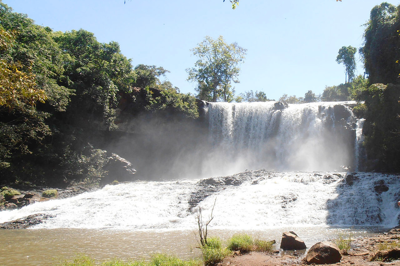
In southeast of Cambodia lies the large Mondulkiri (liturally: "Center of Mountains") province. This is a sparsely populated province, known for its forested hills and powerful waterfalls. The forests consists mainly of tropical forest in the higher elevations and bamboo on the lower slopes.
What is the nature of Cambodia like?
Plants
Forests cover large parts of Cambodia. Around two-thirds of the forests are deciduous, in which most of the trees shed their leaves during the dry season. In general these forests are of an open nature, with trees mostly small to medium in size. The dominant trees belong to the wood-oil family (Dipterocarpaceae) growing scatteringly and with little or no undergrowth. The remaining third is mostly moist evergreen forest composed of a wide variety of large trees often with more than 100 species within a small area. True rain forest is found in parts of the Cardamom and Elephant mountains in the southwest.
Appreciable stands of mangrove, composed of tall trees, grow along the coast. Bamboo is widespread in many areas, often forming extensive brakes; some bamboos flourish in the forests, others along the banks of streams and rivers, and still others in open arid areas.
Animals
Cambodia is one of the most biodiverse countries in Southeast Asia. Its forests serve as habitat for many endangered species, some of which have already disappeared in other neighboring countries. Of the two main leopard species, the clouded leopard and the Indochinese leopard are both endangered (the Indochinese leopard critically so). Among smaller cats, the leopard cat and jungle cat are widespread in forest habitats, whereas the Asian golden cat, marbled cat, and fishing cat are found only in localised areas.
Civets, a mostly nocturnal mammal, are found in many habitats, there being six species native to Cambodia. Similarly the binturong or "bearcat" is common in foothills and hills with good tree cover. Two bear species, the Asian black bear and the Sun bear inhabit forested reserves. The Sunda pangolin is found in forested habitats across the country. There are an estimated to 500 wild elephants in Cambodia, with the main concentration located in the Cardamom Mountains in the southwest, and the eastern plains of Mondulkiri Province.
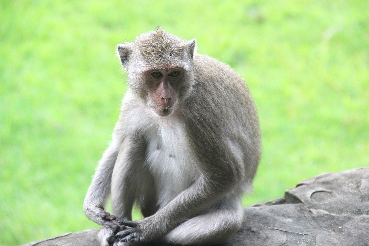
Cambodia has a wide range of primate species. Cambodia's two gibbon species are the pileated gibbon and the yellow-cheeked gibbon, both threatened species. Among monkeys, there are three macacque species, the northern pig-tailed macaque, crab-eating macaque, and the stump-tailed macaque. The black-shanked douc and the Indochinese lutung are both endangered monkey species of the forests and rarely seen. The smaller primates of Cambodia are the Bengal slow loris, Pygmy slow loris, and the Sunda flying lemur.
What is the climate of Cambodia like?
See our main article: The Climate of Cambodia
.jpg&oldid=595104670)
.jpg&oldid=595288171)
.jpg&oldid=602570402)
.jpg&oldid=518949368)
Cambodia's climate is dominated by the monsoons, which are known as tropical wet and dry monsoons. The wet, or southwest, monsoon brings the rainy season from mid-May to mid-September or to early October. Moisture-laden air is drawn landward from the Indian Ocean and rain falls daily. Rain is heaviest in the southwest mountains; these mountains, in turn, shelter the central plains where less rainfall is experienced, and the amount varies considerably from year to year. During the dry, or northeast, monsoon, from early November to March, the winds are reversed, and the monsoon sends back a flow of dryer and cooler air. Typhoons, which can devastate coastal Vietnam, rarely cause damage in Cambodia.
Temperatures are generally high throughout the year but are rarely excessive. Temperatures are fairly uniform throughout the lowlands with only small variations from the annual average of around 25°C. Maximum temperatures of higher than 32 °C, however, are common and, just before the start of the rainy season, they may rise to more than 38°C. Minimum temperatures rarely fall below 10°C.
| Climate data for Phnom Penh (1988–2013) | |||||||||||||
|---|---|---|---|---|---|---|---|---|---|---|---|---|---|
| Month | Jan | Feb | Mar | Apr | May | Jun | Jul | Aug | Sep | Oct | Nov | Dec | Year |
| Average high °C (°F) | 31.6 (88.9) | 33.2 (91.8) | 34.6 (94.3) | 35.3 (95.5) | 34.8 (94.6) | 33.8 (92.8) | 32.9 (91.2) | 32.7 (90.9) | 32.2 (90.0) | 31.4 (88.5) | 31.1 (88.0) | 30.8 (87.4) | 32.9 (91.2) |
| Daily mean °C (°F) | 26.6 (79.9) | 28.0 (82.4) | 29.4 (84.9) | 30.2 (86.4) | 30.0 (86.0) | 29.2 (84.6) | 28.7 (83.7) | 28.5 (83.3) | 28.2 (82.8) | 27.2 (81.0) | 27.1 (80.8) | 26.3 (79.3) | 28.3 (82.9) |
| Average low °C (°F) | 21.8 (71.2) | 22.8 (73.0) | 24.3 (75.7) | 25.5 (77.9) | 25.6 (78.1) | 24.9 (76.8) | 24.8 (76.6) | 24.6 (76.3) | 24.4 (75.9) | 24.2 (75.6) | 23.2 (73.8) | 21.9 (71.4) | 24.0 (75.2) |
| Average rainfall mm (inches) | 12.1 (0.48) | 6.6 (0.26) | 34.8 (1.37) | 78.8 (3.10) | 118.2 (4.65) | 145.0 (5.71) | 162.1 (6.38) | 182.7 (7.19) | 270.9 (10.67) | 248.1 (9.77) | 120.5 (4.74) | 32.1 (1.26) | 1,411.9 (55.58) |
| Source: Deutscher Wetterdienst | |||||||||||||
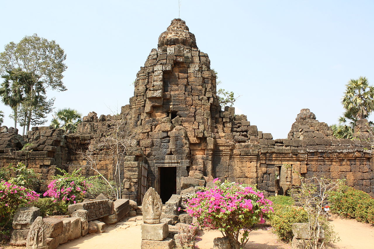 Ta Prohm temple, Takeo province
.JPG&oldid=158289354)
The official websites
Cambodia
The Kingdom of Wonder
| Location: | Southeastern Asia, bordering the Gulf of Thailand, between Thailand, Vietnam, and Laos |
| Coordinates: | 13° 00′ N, 105° 00′ E |
| Size: | • 475 km N-S; 580 km E-W • 295 miles N-S; 360 miles E-W |
| Climate: | Tropical; rainy, monsoon season (May to November); dry season (December to April); little seasonal temperature variation |
| Highest point: | Phnom Aural 1,810 m / 5938 ft |
| Forest: | 56.5% (2011 est.) |
| Population: | 16,926,984 (July 2020 est.) |
| Population density: | Medium (86/km²) |
| Capital: | Phnom Penh |
| Languages: | Khmer (official) 96.3%, other 3.7% (2008 est.) |
| Human Development Index: | Medium (0.594) |
| Currency: | Riel |