.jpg)
The Geography of
Chile
Why visit Chile?
Chile is a country of dramatic scenery and many climates. Cool waters stroke its shore and icy glaciers crown its peaks.No country in the world has such an extraordinary shape as Chile. Squeezed between the heights of the mountains and the depths of the sea, Chile is a geologic marvel.
Contents
Map
 Relief map of Chile
What is the landscape of Chile like?
Chile is a ribbon of land between the ocean and the crest of the Andes. It is approximately 2,650 miles long and averages 110 miles wide. Its area is a little greater than that of Texas, and the population is concentrated in the central third of the country. The country can be divided into three well-defined geographical regions:
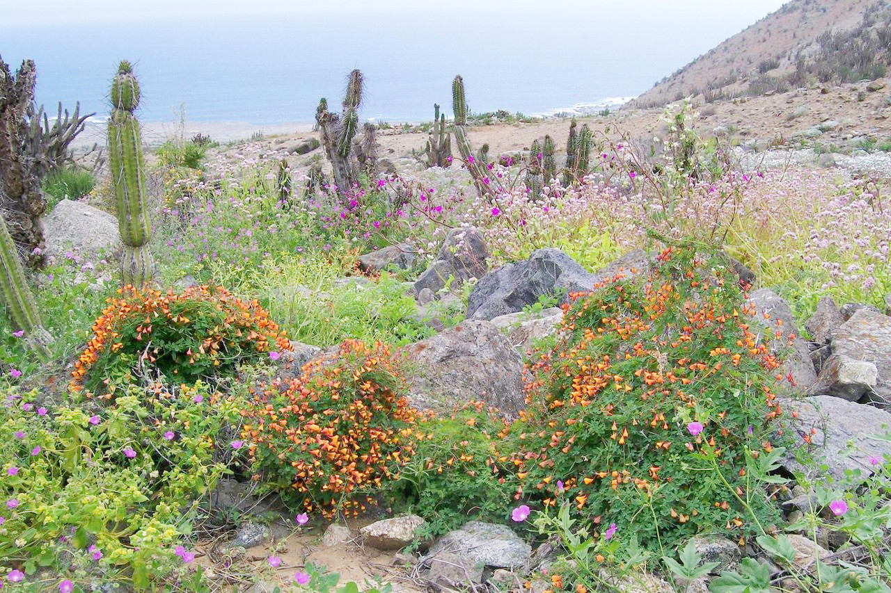
Northern Chile

Northern Chile is one of the driest regions in the world. The Andes cut off the trade-winds from the South Atlantic, and the Pacific winds are robbed of their moisture before they reach the land. The air near the coast is generally moist and often cloudy, but a shower of rain is extremely rare—on the average perhaps once a year. Plants of any kind are rare, and desert conditions prevail to above 3,000 meters (10,000 feet). The few rivers that flow down from the Andes disappear long before they reach the sea. It is however one of the great mining regions of the world.
Central Chile
.jpg)
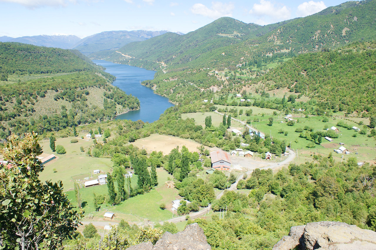
The northern desert slowly changes into the rich fertile region of Central Chile. This transition area is an orchard and vine region; it is here that the desert gives way slowly to semidesert and eventually to rich vegetation. Sunny central Chile is the garden of South America, known for its Mediterranean climate with mild wet winters and hot dry summers. In all it extends for some 700 miles, and is here where most of the inhabitants of the country live.
The Central Valley, running north and south through this region is the heart of the country. Dominating this region is Santiago, the capital. Situated in a beautiful setting with the snowcapped peaks of the Andes in the distance to the east, this city is the administrative and commercial centre of the valley.
Southern Chile
.jpg&oldid=455878420)
.jpg&oldid=482685133)
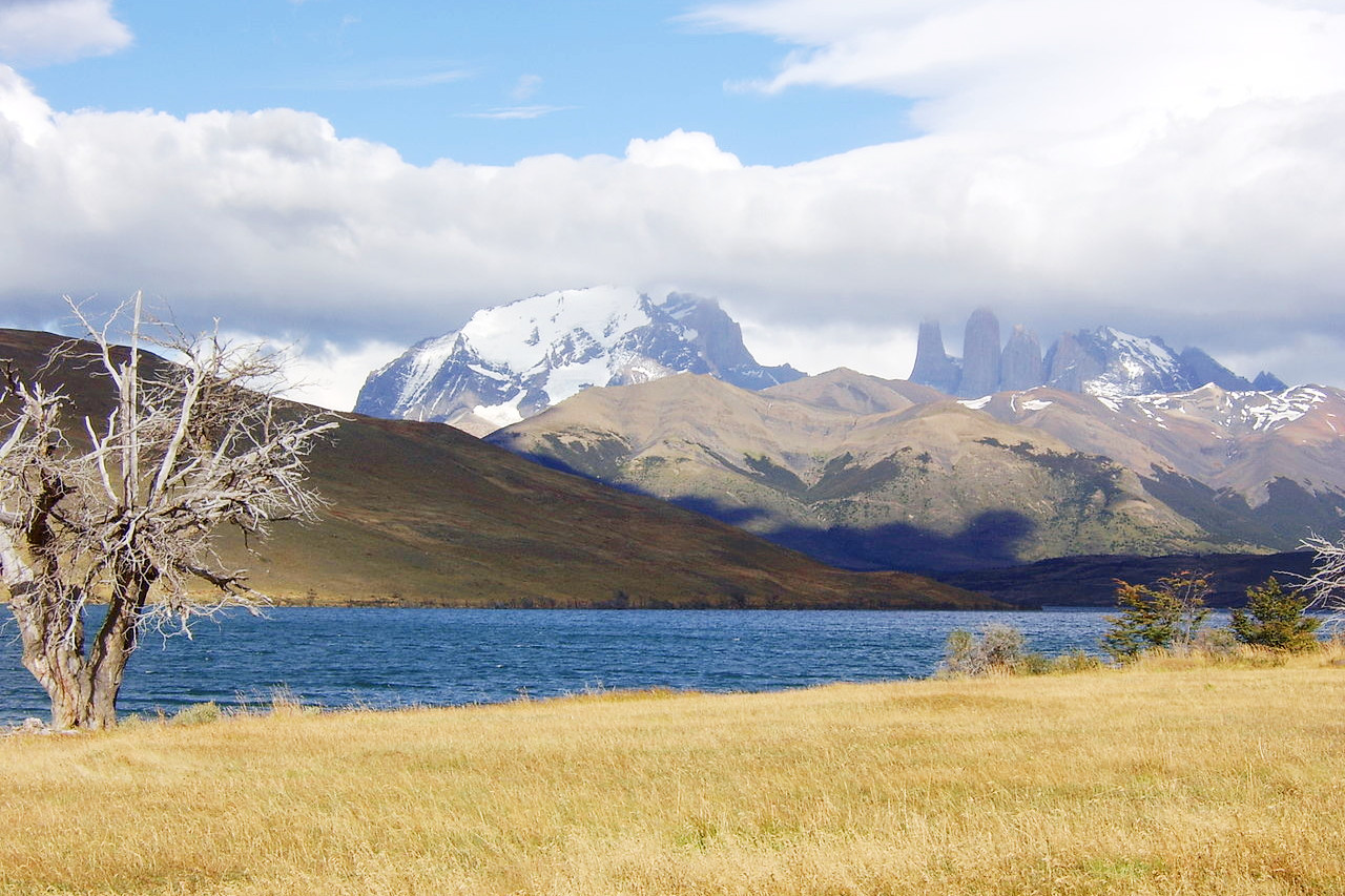
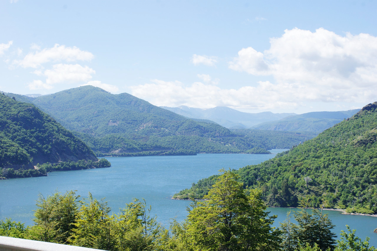
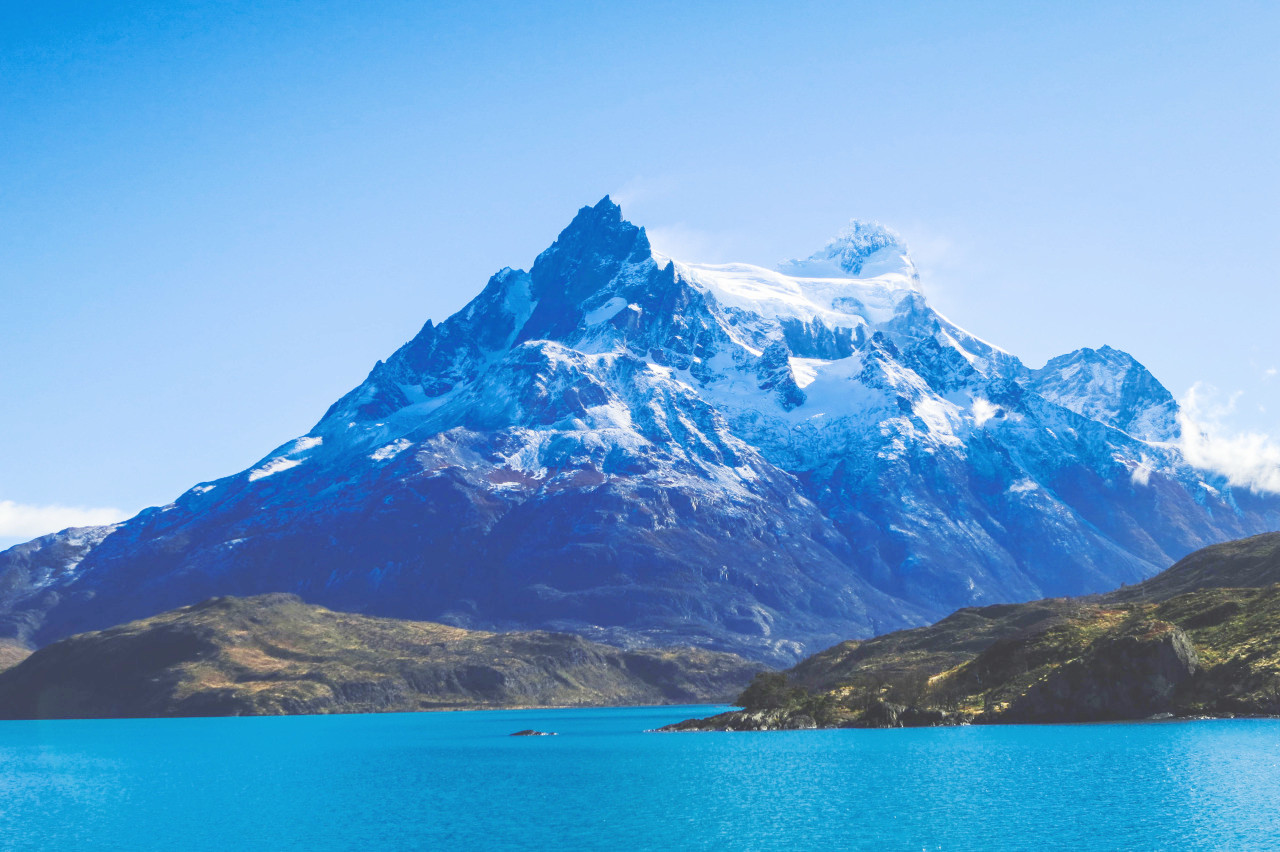
Southern Chile is a deeply indented, island-fringed coast, flanked by forest-clad mountains. It includes the most southerly portions of the Andes and coast ranges, largely broken up into islands and peninsulas, separated by deep, winding fiords. The population of the region is small. The prevalent westerly winds bring abundant rainfall, so that the islands and mountain slopes are clad with forests of fine trees, beech, pine, red oak, cypress, laurel, and cedar. This narrow strip of the country is as wet as Northern Chile is dry. Because of its fringe of islands, its fiords, its forest-covered mountains, its lofty peaks, and its numerous glaciers, Southern Chile is similar to Norway.
This southern group of islands—Tierra del Fuego—is separated from the tapering peninsula of the mainland by a narrow strait named after Magellan, the first explorer to sail through the channel into the Pacific Ocean. The explorer named the islands Tierra del Fuego, the Land of Fires because he saw so many native fires glowing on the islands at night. The main island is bordered on the south by the southern limits of the Andes; the remainder of it consists of open grassy plains. Its western section belongs to Chile, its eastern to Argentina.
What is the nature of Chile like?
Plants
In the middle region of Chile, at a latitude of about 40°S, the vegetation of Chile reaches its maximum growth. In this climate of no extreme cold, the flora is always green and of mixed variety; in luxuriance the plant-growth is almost tropical. The plains have the peumo tree, and forests of beech and cypress also occur. North of this middle region the rainfall diminishes, and the vegetation becomes thinner; the forests are confined to the mountain slopes, and the plains remain bare. The cacti are the last plants bordering on the arid plateau region of northern Chile. South of the central region, where the temperature decreases while the rainfall increases, are forests in which are found the Fitzroya—a unique conifer native to the Andes—,as well as the cypress and the beech. The most widely diffused plant introduced from Europe and other regions is the oak, which grows more rapidly in Chile than in the northern hemisphere.
Animals
In the northern Andes are all four members of the South American camelid family: the llama, alpaca, vicuña, and guanaco. These animals are hard to tell apart. The llama and alpaca are longhaired and valued for their wool. For that reason, they are tamed and held in corrals most of the time. The large huemul deer graze in herds. The huemul is found in many different habitats of Chile, but it is an endangered species because of overhunting. The southern forests shelter the Darwin fox, another endangered species. The tiny pudú, which is the world’s smallest deer and another endangered species, survives on Chiloé Island and a nearby island. The vizcacha is an Andean dweller. It looks like a large rabbit, but it is a rodent and a relative of the Chilean guinea pig and chinchilla, which are also Andean inhabitants.
Coastal areas teem with all kinds of bird life: seagulls, pelicans, petrels, and penguins. Sea swallows and cormorants are also abundant. Inland, Chilean flamingos busy themselves in winter by probing the mud of altiplano lakes for food. The giant Andean condor, Chile’s national bird, occasionally is seen in the mountains. Chile also has penguins. This flightless bird lives in scattered coastal colonies. Each colony has several thousand members. Most penguins spend the entire year in southern Chile, but in winter, some of them ride the Humboldt Current as far as northern Chile.
What is the climate of Chile like?
See our main article: The Climate of Chile
The climate of Chile is a maritime one. On the northern coast the winds in summer blow both toward the equator and toward the interior of the continent, and in winter it is almost free from storms. On the southern coast the strong westerly winds blow at all seasons of the year. The average temperatures at low altitudes vary during the year; during January they vary from 22°C (72°F) at the north to 10°C (50°F) at the south, and in July from 17°C (62°F) at the north to 0°C (32°F) in the south.
There is a marked contrast in the amount of rainfall in different parts of Chile. In the north, the country lies in a rainless zone of southeast trade winds and is consequently a desert. Rainfall steadily increases toward the south: the barren mining districts are replaced by green valleys and vine-clad hills. The agricultural zone extends south to about 40° latitude, where the rainfall becomes high: this is a region of extensive forests. South of 45° the size and variety of the trees begin to shrink as temperatures become lower.
| Climate data for Santiago (1981–2010) | |||||||||||||
|---|---|---|---|---|---|---|---|---|---|---|---|---|---|
| Month | Jan | Feb | Mar | Apr | May | Jun | Jul | Aug | Sep | Oct | Nov | Dec | Year |
| Average high °C (°F) | 30.1 (86.2) | 29.5 (85.1) | 27.4 (81.3) | 23.1 (73.6) | 18.5 (65.3) | 15.7 (60.3) | 15.3 (59.5) | 17.1 (62.8) | 19.5 (67.1) | 22.9 (73.2) | 26.1 (79.0) | 28.8 (83.8) | 22.8 (73.0) |
| Daily mean °C (°F) | 21.2 (70.2) | 20.3 (68.5) | 18.2 (64.8) | 14.4 (57.9) | 10.9 (51.6) | 9.0 (48.2) | 8.2 (46.8) | 9.8 (49.6) | 12.0 (53.6) | 15.0 (59.0) | 17.7 (63.9) | 20.1 (68.2) | 14.7 (58.5) |
| Average low °C (°F) | 13.3 (55.9) | 12.8 (55.0) | 11.4 (52.5) | 8.6 (47.5) | 6.4 (43.5) | 5.0 (41.0) | 3.9 (39.0) | 5.0 (41.0) | 6.7 (44.1) | 8.6 (47.5) | 10.3 (50.5) | 12.2 (54.0) | 8.7 (47.7) |
| Average precipitation mm (inches) | 0.6 (0.02) | 1.3 (0.05) | 6.1 (0.24) | 16.3 (0.64) | 55.5 (2.19) | 83.3 (3.28) | 75.9 (2.99) | 55.1 (2.17) | 27.2 (1.07) | 12.9 (0.51) | 6.2 (0.24) | 1.5 (0.06) | 341.8 (13.46) |
| Source: Dirección Meteorológica de Chile | |||||||||||||
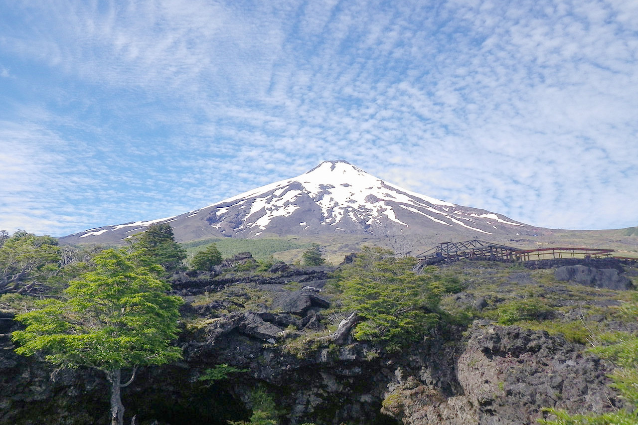 Villarrica Volcano near Pucon
The official websites
Chile
Where the Impossible is Possible
| Location: | The southwestern coast of South America |
| Coordinates: | 30° 00′ N, 71° 00′ W |
| Size: | • 4,270 km N-S; 355 km E-W • 2,650 miles N-S; 220 miles E-W |
| Terrain: | High mountains of the Andes in the east. Low mountains along the coast. Desert in the north. Islands and fjords in the south |
| Climate: | The north is a hot, arid desert; the middle has a Mediterranean climate; the south is cool and damp. Cold and snowy in the Andes |
| Highest point: | Nevado Ojos del Salado 6,893 m / 22,615 ft |
| Forest: | 24% (2015 est.) (source) |
| Population: | 18,430,408 (2022 est.) |
| Population density: | Low (25/km²) |
| Capital: | Santiago |
| Languages: | Spanish (national language). Other Amerindian languages |
| Human Development Index: | Very high (0.851) |
| Currency: | Chilean peso |