The Climate of
Angola
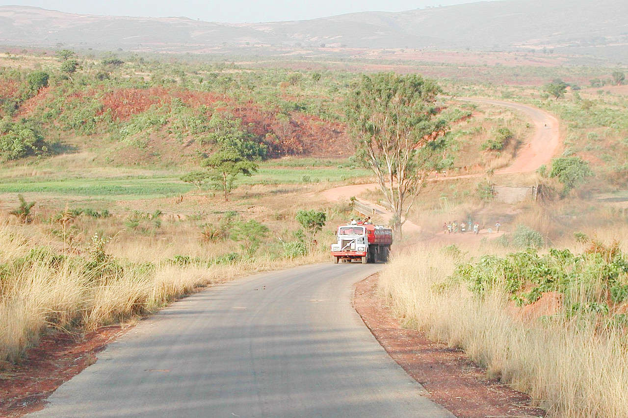
 Road between Ukuma and Huambo
Climate Map
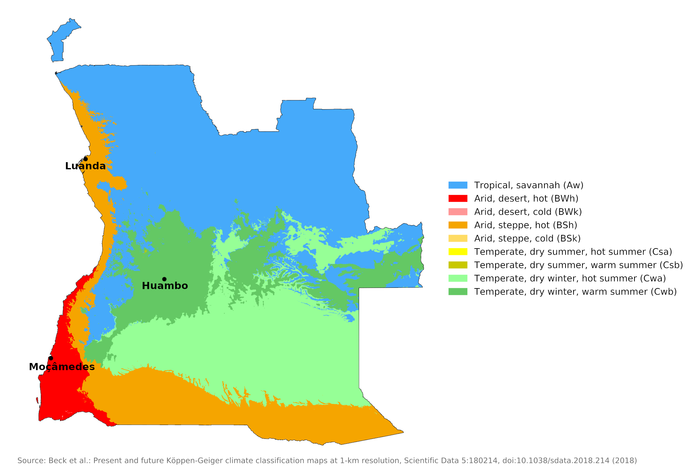
 Climate map of Angola
What is the climate of Angola like?
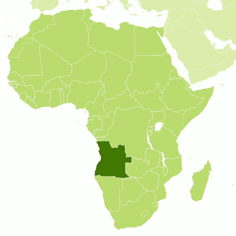
Angola is more than twice the size of France. It lies between 6° and 18° S in southern Africa with a coastline on the Atlantic Ocean. It is bordered by the Democratic Republic of the Congo on the north, by Zambia on the east and by Namibia on the south. There is a steep rise inland from a narrow coastal plain to a large interior plateau averaging between 600 and 1,200 meters (2,000–4,000 ft). The highest areas of the plateau rise to over 2,400 meters (8,000 feet). North and east of these higher areas, the land gradually slopes down towards the basins of the Congo and Zambezi rivers.
The climate of Angola is strongly influenced by the prevailing west and south-west winds. Like the rest of tropical Africa, Angola experiences distinct, alternating rainy and dry seasons. Two seasons are distinguished—a long dry season from May to September; and the rainy season from October to April. The heaviest rainfall occurs between November and March and is accompanied by violent storms.
In the north, the rainy season may last for as long as seven months—usually from September to April, with perhaps a brief slackening in January or February. In the south, the rainy season begins later, in November, and lasts until about February. The dry season ("cacimbo") is often characterized by a heavy morning mist. In general, precipitation is higher in the north, but at any latitude it is greater in the interior than along the coast and increases with altitude.
Over large parts of Angola, the weather and climate are typical of a tropical plateau—the climate of Huambo shows this very clearly. Here, both the day and especially the night temperatures are lowered by the altitude in order to create a pleasant, varied tropical climate. Above 1,500 meters (5,000 feet), temperatures are more temperate than tropical year-round, and frost is not unknown. The dry season is shortened by one to two months in the north of the country compared to Huambo, which has five practically rain-free months. Average annual precipitation ranges from 1,000 to 1,500 millimeters (40 to 60 inches) over most of the interior, with greater levels at higher elevations.
| Climate data for Huambo (1941–1970) | |||||||||||||
|---|---|---|---|---|---|---|---|---|---|---|---|---|---|
| Month | Jan | Feb | Mar | Apr | May | Jun | Jul | Aug | Sep | Oct | Nov | Dec | Year |
| Average high °C (°F) | 24.9 (76.8) | 25.2 (77.4) | 25.0 (77.0) | 25.5 (77.9) | 25.4 (77.7) | 24.6 (76.3) | 25.0 (77.0) | 27.2 (81.0) | 28.7 (83.7) | 27.3 (81.1) | 25.2 (77.4) | 24.9 (76.8) | 25.7 (78.3) |
| Daily mean °C (°F) | 19.8 (67.6) | 19.8 (67.6) | 19.8 (67.6) | 19.6 (67.3) | 18.0 (64.4) | 16.2 (61.2) | 16.6 (61.9) | 18.8 (65.8) | 21.0 (69.8) | 20.8 (69.4) | 19.8 (67.6) | 19.8 (67.6) | 19.2 (66.6) |
| Average low °C (°F) | 14.4 (57.9) | 14.2 (57.6) | 14.4 (57.9) | 13.7 (56.7) | 10.5 (50.9) | 7.8 (46.0) | 7.9 (46.2) | 10.3 (50.5) | 13.0 (55.4) | 14.2 (57.6) | 14.3 (57.7) | 14.3 (57.7) | 12.4 (54.3) |
| Average precipitation mm (inches) | 220 (8.7) | 179 (7.0) | 239 (9.4) | 146 (5.7) | 14 (0.6) | 0 (0) | 0 (0) | 1 (0.0) | 19 (0.7) | 119 (4.7) | 227 (8.9) | 234 (9.2) | 1,398 (55.0) |
| Source: Deutscher Wetterdienst | |||||||||||||
The coastal region of Angola has a very unusual climate for its latitude. Temperature and precipitation are greatly reduced in a strip about fifty miles wide, as a direct result of the cold Benguela current flowing south to north along the coast. This current is responsible for the fact that it hardly ever rains on the Namibian coast in the south. The same extreme aridity prevails in the southern coastal area of Angola, as shown by the climate of Moçâmedes. The coastal region is desert or semi-desert until Luanda in the north, but there is a gradual increase in rainfall northwards until it exceeds 600 millimeters (24 inches) per year in the far north.
| Climate data for Moçâmedes | |||||||||||||
|---|---|---|---|---|---|---|---|---|---|---|---|---|---|
| Month | Jan | Feb | Mar | Apr | May | Jun | Jul | Aug | Sep | Oct | Nov | Dec | Year |
| Average high °C (°F) | 27.0 (80.6) | 28.0 (82.4) | 28.9 (84.0) | 27.9 (82.2) | 25.8 (78.4) | 22.4 (72.3) | 20.6 (69.1) | 20.9 (69.6) | 22.4 (72.3) | 23.6 (74.5) | 25.3 (77.5) | 25.9 (78.6) | 24.9 (76.8) |
| Daily mean °C (°F) | 23.0 (73.4) | 24.7 (76.5) | 25.6 (78.1) | 24.2 (75.6) | 21.1 (70.0) | 18.3 (64.9) | 17.4 (63.3) | 17.9 (64.2) | 19.2 (66.6) | 20.4 (68.7) | 21.9 (71.4) | 22.5 (72.5) | 21.4 (70.5) |
| Average low °C (°F) | 19.1 (66.4) | 19.8 (67.6) | 20.7 (69.3) | 18.7 (65.7) | 14.7 (58.5) | 12.8 (55.0) | 13.0 (55.4) | 13.8 (56.8) | 14.9 (58.8) | 15.9 (60.6) | 17.1 (62.8) | 17.7 (63.9) | 16.5 (61.7) |
| Average precipitation mm (inches) | 7.2 (0.28) | 10.0 (0.39) | 17.1 (0.67) | 9.7 (0.38) | 0.1 (0.00) | 0.1 (0.00) | 0.2 (0.01) | 0.2 (0.01) | 0.3 (0.01) | 1.1 (0.04) | 2.1 (0.08) | 2.9 (0.11) | 51.0 (2.01) |
| Source: Deutscher Wetterdienst | |||||||||||||
| Climate data for Luanda (1961-1990) | |||||||||||||
|---|---|---|---|---|---|---|---|---|---|---|---|---|---|
| Month | Jan | Feb | Mar | Apr | May | Jun | Jul | Aug | Sep | Oct | Nov | Dec | Year |
| Average high °C (°F) | 29.5 (85.1) | 30.5 (86.9) | 30.7 (87.3) | 30.2 (86.4) | 28.8 (83.8) | 25.7 (78.3) | 23.9 (75.0) | 24.0 (75.2) | 25.4 (77.7) | 26.8 (80.2) | 28.4 (83.1) | 28.6 (83.5) | 27.7 (81.9) |
| Daily mean °C (°F) | 26.7 (80.1) | 28.5 (83.3) | 28.6 (83.5) | 28.2 (82.8) | 27.0 (80.6) | 23.9 (75.0) | 22.1 (71.8) | 22.1 (71.8) | 23.5 (74.3) | 25.2 (77.4) | 26.7 (80.1) | 26.9 (80.4) | 25.8 (78.4) |
| Average low °C (°F) | 23.9 (75.0) | 24.7 (76.5) | 24.6 (76.3) | 24.3 (75.7) | 23.3 (73.9) | 20.3 (68.5) | 18.7 (65.7) | 18.8 (65.8) | 20.2 (68.4) | 22.0 (71.6) | 23.3 (73.9) | 23.5 (74.3) | 22.3 (72.1) |
| Average precipitationl mm (inches) | 30 (1.2) | 36 (1.4) | 114 (4.5) | 136 (5.4) | 16 (0.6) | 0 (0) | 0 (0) | 1 (0.0) | 2 (0.1) | 7 (0.3) | 32 (1.3) | 31 (1.2) | 405 (16) |
| Source: Deutscher Wetterdienst | |||||||||||||
On the coast there are many low clouds and fog as a result of the warm air flowing over the cold sea surface. Coastal temperatures only rise to high levels when a strong offshore wind brings warmed air from inland. The almost constant sea breeze during the day keeps coastal temperatures low for a tropical region. Sunshine levels on the coast are rather low, averaging four to six hours a day. They are much higher inland, ranging from four to five hours a day in the rainy season to nine to ten hours in the dry season.
Due to the lower temperatures inland and the dry, cool nature of the coastal weather, Angola has a comfortable climate for a tropical country. Thus, at Luanda, the average annual temperature is about 26°C (79°F), but it is under 17°C (63°F) at Huambo on the temperate central plateau. The coolest months are July and August (in the middle of the dry season), when frost may sometimes form at higher altitudes.
References
- E. A. Pearce, Charles Gordon Smith, (1990) The Hutchinson World Weather Guide, John Murray Press. ISBN 1859863426
- Timothy L. Gall, (ed.), (2003), Worldmark Encyclopedia of the Nations, Eleventh Edition, Thomson Gale
- Federal Research Division, Library of Congress, (1991), Angola: a country study. Claitor's Pub. Division.
- Hugh Chisholm, (ed.), (1911), Encyclopædia Britannica, Eleventh edition, Cambridge University Press
The Climate of
Angola

In summary:
Angola’s temperatures and climates vary from region to region. The north has a wet, tropical (supports plant growth year round) climate; the east has a moderate tropical climate; and the southern central strip near the border with Namibia has hot, dry desert conditions. There are two seasons in Angola: a dry, cool winter and a hot, rainy summer. Temperatures are hotter along the coast and cooler on the central plateau.
Rainfall varies greatly by region. The annual average rainfall is 50 mm (2 in) near the southern coast (Moçâmedes); 340 mm (13 in) at the northern coast (Luanda); and as high as 1500 mm (59 in) in the northeast. Some regions of Angola suffer from occasional drought.