The Climate of
Zambia
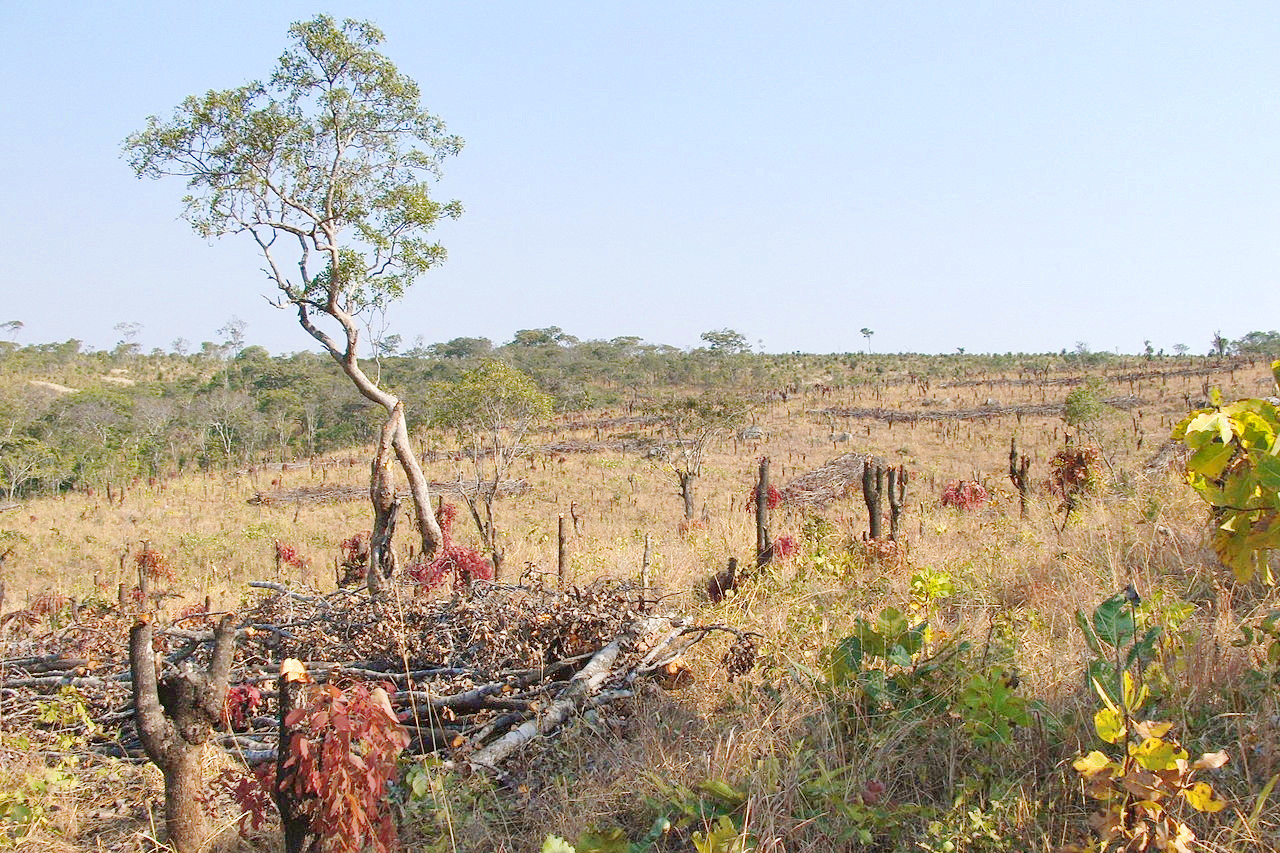 Landscape of Masase, Serenje District
Climate Map
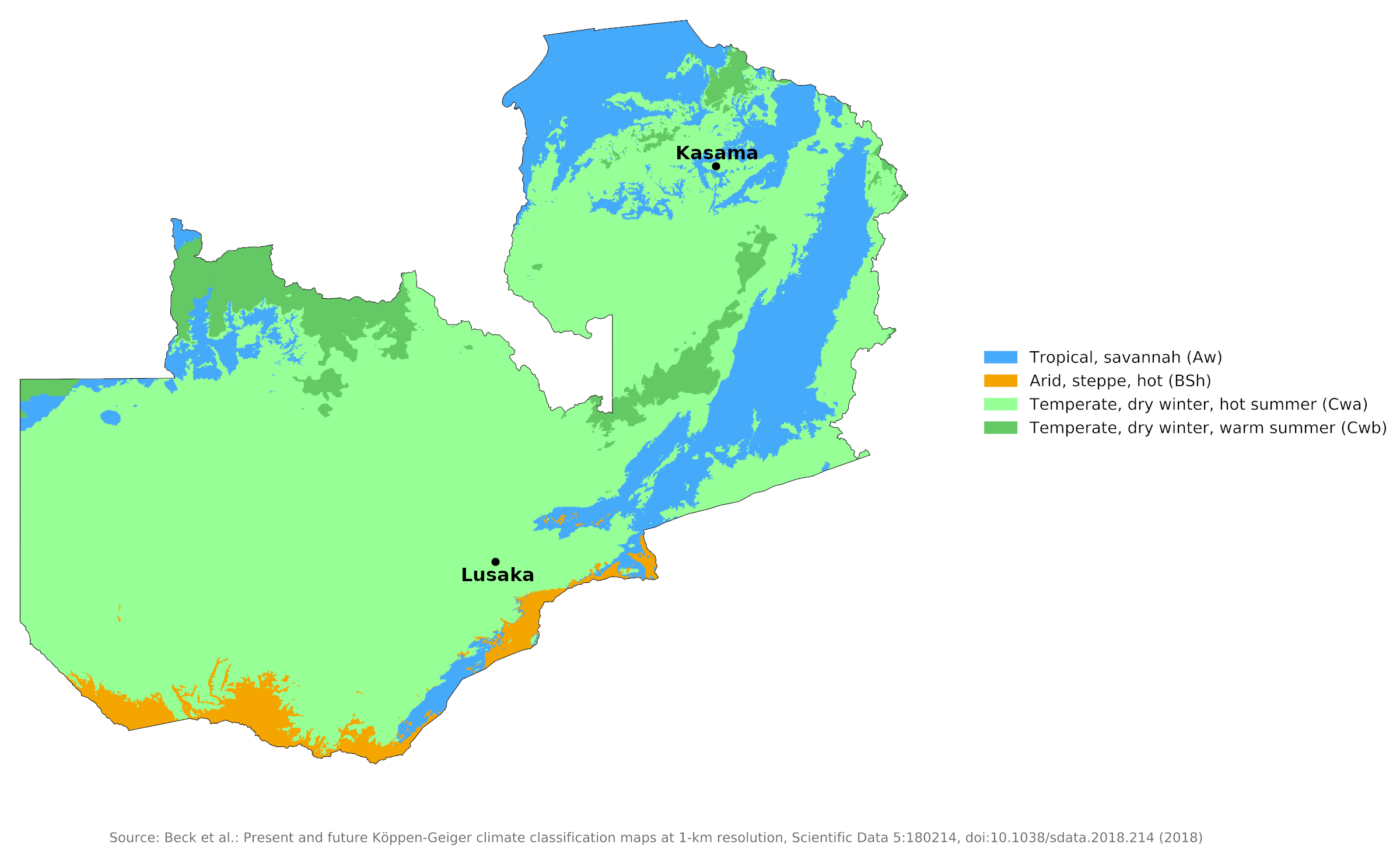 Climate map of Zambia
What is the climate of Zambia like?
Zambia is a landlocked country in south-central Africa. It is bordered on the north by the Democratic Republic of the Congo and Tanzania, east by Malawi, south by Zimbabwe, and west by Angola. Most of Zambia is a high plateau lying between 910 and 1,370 meters (3,000–4,500 feet) above sea level. In the northeast, the Muchinga Mountains exceed 1,800 meters (5,900 feet) in height. Only in the valleys of the major rivers: the Zambesi, Luangwa, and Kwafe Rivers, are there areas of land below 600 meters (2,000 feet).
Zambia experiences a cycle of wet and dry seasons that gives the country three seasons: the cool dry season lasts from April to August (June and July are the coldest months); the hot dry season begins in August and lasts until October or, especially in the east, until November; The warm rainy season begins in early November in the northwest, later further south and east, and lasts until March or April. The longest rainy season and heaviest annual rainfall occurs in the northwest and north of Lake Bangweulu in northeastern Zambia. Fluctuations in annual precipitation occur everywhere, but are greatest in areas with the least precipitation, i.e. in the south and in the low-lying areas in the east, where drought occurs from time to time.
Because of its high altitude, most of the country enjoys a pleasantly temperate climate. Above 1,200 meters (4,000 feet) temperatures around the year are typical of warm-temperate rather than tropical climates. During the long dry season there is abundant sunshine and the sun's rays are more powerful as a consequence of the altitude. The air temperature however, is rarely so high as to cause discomfort, and it is mitigated by the generally low humidity.
Lusaka, at 1,250 meters (4,100 feet), has an average minimum of 7°C (45°F) and an average maximum of 24°C (75°F) in July, with averages of 18°C (64°F) and 27°C (81°F), respectively, in January. The most uncomfortable season is the period from November to February, when both temperature and humidity are greatest and there is a smaller daily temperature range so that nights are not so cool. At altitudes above 1,000 to 1,500 meters (4,000–5,000 feet) frost is not uncommon at night during the dry season from April to August. This is a period of low sun and some days may be chilly if there is much cloud.
In the lowland areas, by contrast, the climate is rather more tropical with less of a cool season and high temperatures during the period of overhead sun between October and February. This period of high sun is also the rainy season. The climate of the lowlands is oppressive and sultry, particularly during the rainy season.
During the rainy season moist northerly to northeasterly winds produce moderate to heavy rainfall. The rainy season is long, beginning in the middle of November and lasting until April; heavy tropical storms occur often. Much of the rain is heavy and showery and accompanied by thunder, but periods of almost continuous rain lasting two or three days are by no means unusual. Rainfall is very rare during the period April to September.
Rainfall is generally highest in the northern provinces of Zambia, decreasing from north to south. Average annual rainfall is about 1,250 millimeters (50 inches) in the north and only 750 millimeters (30 inches) in the south. The capital city of Lusaka receives approximately 900 millimeters (35 inches) of rainfall each year.
Kasama, in the northeast, is representative of wetter parts of the country. Lusaka, farther south, is typical of the drier uplands.| Climate data for Kasama | |||||||||||||
|---|---|---|---|---|---|---|---|---|---|---|---|---|---|
| Month | Jan | Feb | Mar | Apr | May | Jun | Jul | Aug | Sep | Oct | Nov | Dec | Year |
| Average high °C (°F) | 26.3 (79.3) | 26.8 (80.2) | 26.8 (80.2) | 26.5 (79.7) | 26.0 (78.8) | 24.9 (76.8) | 24.9 (76.8) | 26.9 (80.4) | 29.8 (85.6) | 30.9 (87.6) | 28.9 (84.0) | 26.7 (80.1) | 27.1 (80.8) |
| Daily mean °C (°F) | 19.7 (67.5) | 19.9 (67.8) | 20.2 (68.4) | 20.2 (68.4) | 18.9 (66.0) | 17.2 (63.0) | 17.1 (62.8) | 18.9 (66.0) | 21.8 (71.2) | 23.1 (73.6) | 21.6 (70.9) | 20.1 (68.2) | 19.9 (67.8) |
| Average low °C (°F) | 16.1 (61.0) | 16.2 (61.2) | 16.1 (61.0) | 15.2 (59.4) | 12.5 (54.5) | 9.6 (49.3) | 9.3 (48.7) | 11.0 (51.8) | 13.8 (56.8) | 15.9 (60.6) | 16.4 (61.5) | 16.2 (61.2) | 14.0 (57.2) |
| Average precipitation mm (inches) | 285.3 (11.23) | 242.8 (9.56) | 233.1 (9.18) | 91.3 (3.59) | 10.5 (0.41) | 0.4 (0.02) | 0.1 (0.00) | 0.1 (0.00) | 3.0 (0.12) | 23.3 (0.92) | 158.3 (6.23) | 295.0 (11.61) | 1,343.2 (52.88) |
| Source: NOAA | |||||||||||||
| Climate data for Lusaka | |||||||||||||
|---|---|---|---|---|---|---|---|---|---|---|---|---|---|
| Month | Jan | Feb | Mar | Apr | May | Jun | Jul | Aug | Sep | Oct | Nov | Dec | Year |
| Average high °C (°F) | 27.4 (81.3) | 27.4 (81.3) | 27.5 (81.5) | 27.1 (80.8) | 25.8 (78.4) | 23.8 (74.8) | 24.0 (75.2) | 26.5 (79.7) | 30.3 (86.5) | 31.7 (89.1) | 30.4 (86.7) | 27.7 (81.9) | 27.5 (81.5) |
| Daily mean °C (°F) | 21.5 (70.7) | 21.5 (70.7) | 21.1 (70.0) | 19.9 (67.8) | 17.4 (63.3) | 15.2 (59.4) | 14.9 (58.8) | 17.3 (63.1) | 21.3 (70.3) | 23.5 (74.3) | 23.4 (74.1) | 21.7 (71.1) | 19.9 (67.8) |
| Average low °C (°F) | 17.6 (63.7) | 17.4 (63.3) | 16.4 (61.5) | 14.0 (57.2) | 10.7 (51.3) | 7.8 (46.0) | 7.2 (45.0) | 9.2 (48.6) | 12.9 (55.2) | 16.2 (61.2) | 17.4 (63.3) | 17.8 (64.0) | 13.7 (56.7) |
| Average precipitation mm (inches) | 245.4 (9.66) | 185.9 (7.32) | 95.0 (3.74) | 34.7 (1.37) | 3.1 (0.12) | 0.0 (0.0) | 0.1 (0.00) | 0.4 (0.02) | 1.7 (0.07) | 18.4 (0.72) | 89.3 (3.52) | 208.1 (8.19) | 882.1 (34.73) |
| Source: NOAA | |||||||||||||
References
- E. A. Pearce, Charles Gordon Smith, (1990) The Hutchinson World Weather Guide, John Murray Press. ISBN 1859863426
- Timothy L. Gall, (ed.), (2003), Worldmark Encyclopedia of the Nations, Eleventh Edition, Thomson Gale
- Federal Research Division, Library of Congress, (1979), Zambia: a country study. Claitor's Pub. Division.
- Hugh Chisholm, (ed.), (1911), Encyclopædia Britannica, Eleventh edition, Cambridge University Press
The Climate of
Zambia
In summary:
Although Zambia lies within the tropics, much of it has a warm temperate climate because of the altitude. The hottest months of the year are August through October, when daily temperatures often reach a high of 30°C to 32°C (86°F to 89°F). The months of May through July are only slightly cooler, with temperatures ranging from 17°C to 26°C (63°F to 79°F). At night, however, temperatures may drop as low as 5°C (41°F).
The rainy season begins in November and lasts until April; heavy tropical storms occur often. Rainfall decreases from north to south. Average annual rainfall is about 1250 mm (50 inches) in the north and 750 mm (30 inches) in the south.