The Climate of
Mali
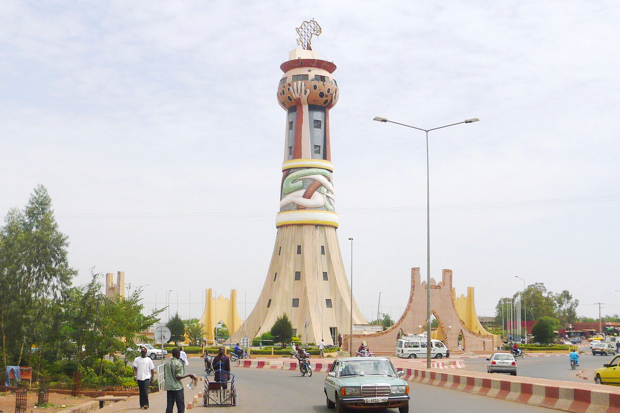 Tower of Africa, Bamako
Climate Map
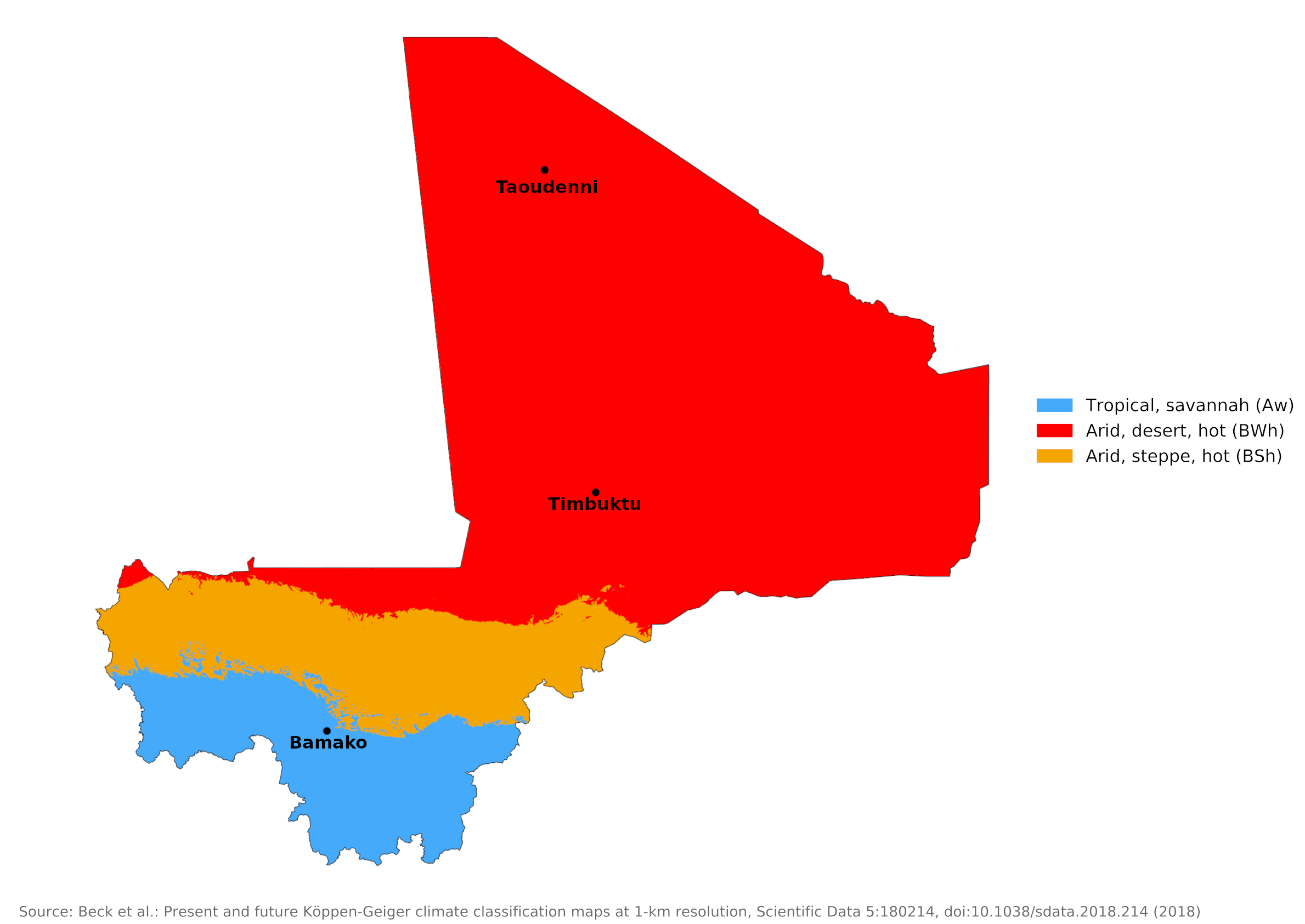 Climate map of Mali
What is the climate of Mali like?
Mali, a landlocked country, is located in West Africa and is crossed by the Niger River. It is on the southern side of the Sahara, in the Sahel belt. The country's terrain is mostly flat, dry and sandy. It has an area slightly larger than Egypt and is sparsely populated except in the south. It is bounded on the north by Algeria and Mauritania, on the east by Niger, on the south by Burkina Faso, Côte d’Ivoire, and Guinea, and on the west by Senegal.
In the south, annual rainfall is about 1,000 millimeters (40 inches) per year, and this decreases to practically zero in the Sahara north. In fact, the desert boundary is at about 15°N, where annual rainfall is about 400 millimeters (16 in). The duration of the rainy season and the reliability of rain also decrease from south to north. The rainy season here is the time of high sun from May to September, with the heaviest and most reliable rains coming in July and August. The period from November to March is practically rain-free everywhere. This is the dry season with warm to hot, sunny days with persistent northeast winds (the harmattan). The arrival of the rains is heralded by light to variable winds, and when the rains arrive the winds become sustained from the west to southwest. These winds bring cloudier and wetter air from the equatorial regions of the South Atlantic.
Temperatures are at their highest from March to May, before the wind direction changes. Much of the rain occurs in heavy downpours associated with thunderstorm squalls, which are more likely to occur in the afternoon or evening and die out at night. However, some prolonged periods of light rain or drizzle do occur. Humidity is low during the very hot period before the rains arrive. Although the heat at this time can be intense and stressful, it is no more uncomfortable than the slightly cooler but wetter conditions during the rainy season.
Bamako shows the heavier rainfall and longer rainy season in the south of the country. When the harmattan is strong, it is often dust laden, which in combination with high temperatures can be uncomfortable. Timbuktu shows conditions in central Mali at the northern limit of the summer rain belt. However, actual rainfall from year to year is extremely unpredictable.
| Climate data for Bamako (1950–2000) | |||||||||||||
|---|---|---|---|---|---|---|---|---|---|---|---|---|---|
| Month | Jan | Feb | Mar | Apr | May | Jun | Jul | Aug | Sep | Oct | Nov | Dec | Year |
| Average high °C (°F) | 33.4 (92.1) | 36.4 (97.5) | 38.5 (101.3) | 39.6 (103.3) | 38.5 (101.3) | 35.3 (95.5) | 32.1 (89.8) | 31.1 (88.0) | 32.2 (90.0) | 34.6 (94.3) | 35.3 (95.5) | 33.4 (92.1) | 35.0 (95.0) |
| Daily mean °C (°F) | 25.2 (77.4) | 28.2 (82.8) | 30.7 (87.3) | 32.4 (90.3) | 32.0 (89.6) | 29.5 (85.1) | 27.2 (81.0) | 26.5 (79.7) | 26.9 (80.4) | 28.0 (82.4) | 26.9 (80.4) | 25.1 (77.2) | 28.2 (82.8) |
| Average low °C (°F) | 17.0 (62.6) | 19.9 (67.8) | 22.9 (73.2) | 25.2 (77.4) | 25.4 (77.7) | 23.6 (74.5) | 22.2 (72.0) | 21.8 (71.2) | 21.6 (70.9) | 21.3 (70.3) | 18.4 (65.1) | 16.8 (62.2) | 21.3 (70.3) |
| Average precipitation mm (inches) | 0.6 (0.02) | 0.7 (0.03) | 2.1 (0.08) | 19.7 (0.78) | 54.1 (2.13) | 132.1 (5.20) | 224.1 (8.82) | 290.2 (11.43) | 195.9 (7.71) | 66.1 (2.60) | 5.2 (0.20) | 0.5 (0.02) | 991.3 (39.03) |
| Source: World Meteorological Organization | |||||||||||||
| Climate data for Timbuktu (1950–2000) | |||||||||||||
|---|---|---|---|---|---|---|---|---|---|---|---|---|---|
| Month | Jan | Feb | Mar | Apr | May | Jun | Jul | Aug | Sep | Oct | Nov | Dec | Year |
| Average high °C (°F) | 30.0 (86.0) | 33.2 (91.8) | 36.6 (97.9) | 40.0 (104.0) | 42.2 (108.0) | 41.6 (106.9) | 38.5 (101.3) | 36.5 (97.7) | 38.3 (100.9) | 39.1 (102.4) | 35.2 (95.4) | 30.4 (86.7) | 36.8 (98.2) |
| Daily mean °C (°F) | 21.5 (70.7) | 24.2 (75.6) | 27.6 (81.7) | 31.3 (88.3) | 34.1 (93.4) | 34.5 (94.1) | 32.2 (90.0) | 30.7 (87.3) | 31.6 (88.9) | 30.9 (87.6) | 26.5 (79.7) | 22.0 (71.6) | 28.9 (84.0) |
| Average low °C (°F) | 13.0 (55.4) | 15.2 (59.4) | 18.5 (65.3) | 22.5 (72.5) | 26.0 (78.8) | 27.3 (81.1) | 25.8 (78.4) | 24.8 (76.6) | 24.8 (76.6) | 22.7 (72.9) | 17.7 (63.9) | 13.5 (56.3) | 21.0 (69.8) |
| Average precipitation mm (inches) | 0.6 (0.02) | 0.1 (0.00) | 0.1 (0.00) | 1.0 (0.04) | 4.0 (0.16) | 16.4 (0.65) | 53.5 (2.11) | 73.6 (2.90) | 29.4 (1.16) | 3.8 (0.15) | 0.1 (0.00) | 0.2 (0.01) | 182.8 (7.20) |
| Source: World Meteorological Organization | |||||||||||||
About half of Mali lies in the southern Sahara and is practically rainless. Climate and weather are represented here by the Taoudenni salt mining settlement in the far north. The weather and climate of this region are typical of the Sahara: very hot and dry during the high sun from May to September; rather cooler, but still very warm and consistently sunny during the low season. Rare and sporadic rainfall is likely to occur during the hottest season, as occasional thunderstorms break out when the rain belt is at its northernmost position.
| Climate data for Taoudenni | |||||||||||||
|---|---|---|---|---|---|---|---|---|---|---|---|---|---|
| Month | Jan | Feb | Mar | Apr | May | Jun | Jul | Aug | Sep | Oct | Nov | Dec | Year |
| Average high °C (°F) | 26.2 (79.2) | 30 (86) | 32.5 (90.5) | 39.8 (103.6) | 42.6 (108.7) | 46.7 (116.1) | 47.9 (118.2) | 46.6 (115.9) | 44.1 (111.4) | 38.6 (101.5) | 31.6 (88.9) | 26.4 (79.5) | 37.8 (100.0) |
| Daily mean °C (°F) | 18.1 (64.6) | 21.1 (70.0) | 24.4 (75.9) | 29.8 (85.6) | 33.1 (91.6) | 37.2 (99.0) | 38.8 (101.8) | 37.8 (100.0) | 35.9 (96.6) | 30.4 (86.7) | 23.9 (75.0) | 18.6 (65.5) | 28.2 (82.8) |
| Average low °C (°F) | 9.9 (49.8) | 12.2 (54.0) | 16.3 (61.3) | 19.8 (67.6) | 23.6 (74.5) | 27.6 (81.7) | 29.6 (85.3) | 29 (84) | 27.6 (81.7) | 22.1 (71.8) | 16.2 (61.2) | 10.8 (51.4) | 20.4 (68.7) |
| Average precipitation mm (inches) | 0.5 (0.02) | 0.1 (0.00) | 0.0 (0.0) | 0.2 (0.01) | 0.2 (0.01) | 0.4 (0.02) | 3.0 (0.12) | 8.5 (0.33) | 5.4 (0.21) | 1.6 (0.06) | 0.5 (0.02) | 0.4 (0.02) | 20.8 (0.82) |
| Source: Weatherbase.com | |||||||||||||
References
- E. A. Pearce, Charles Gordon Smith, (1990) The Hutchinson World Weather Guide, John Murray Press. ISBN 1859863426
- Timothy L. Gall, (ed.), (2003), Worldmark Encyclopedia of the Nations, Eleventh Edition, Thomson Gale
- Hugh Chisholm, (ed.), (1911), Encyclopædia Britannica, Eleventh edition, Cambridge University Press
The Climate of
Mali
In summary:
Mali experiences a tropical savanna climate in the south becoming a desert climate in the north. Temperatures vary by season and region, with an average annual temperature of around 28°C (83°F). Temperatures are generally highest from March to May before the rains come.
The rainy season is from June to September, although this really only applies to the south, and rainfall varies considerably from year to year. Average annual rainfall in the far south approaches 1400 mm (55 in); in the semi-arid Sahel, rainfall averages only 200 mm (8 in); the northern desert regions rarely receive any rainfall.