The Climate of
Honduras
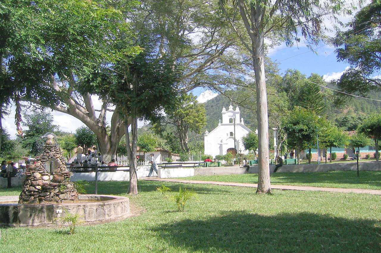 Central Park of Duyure
Climate Map
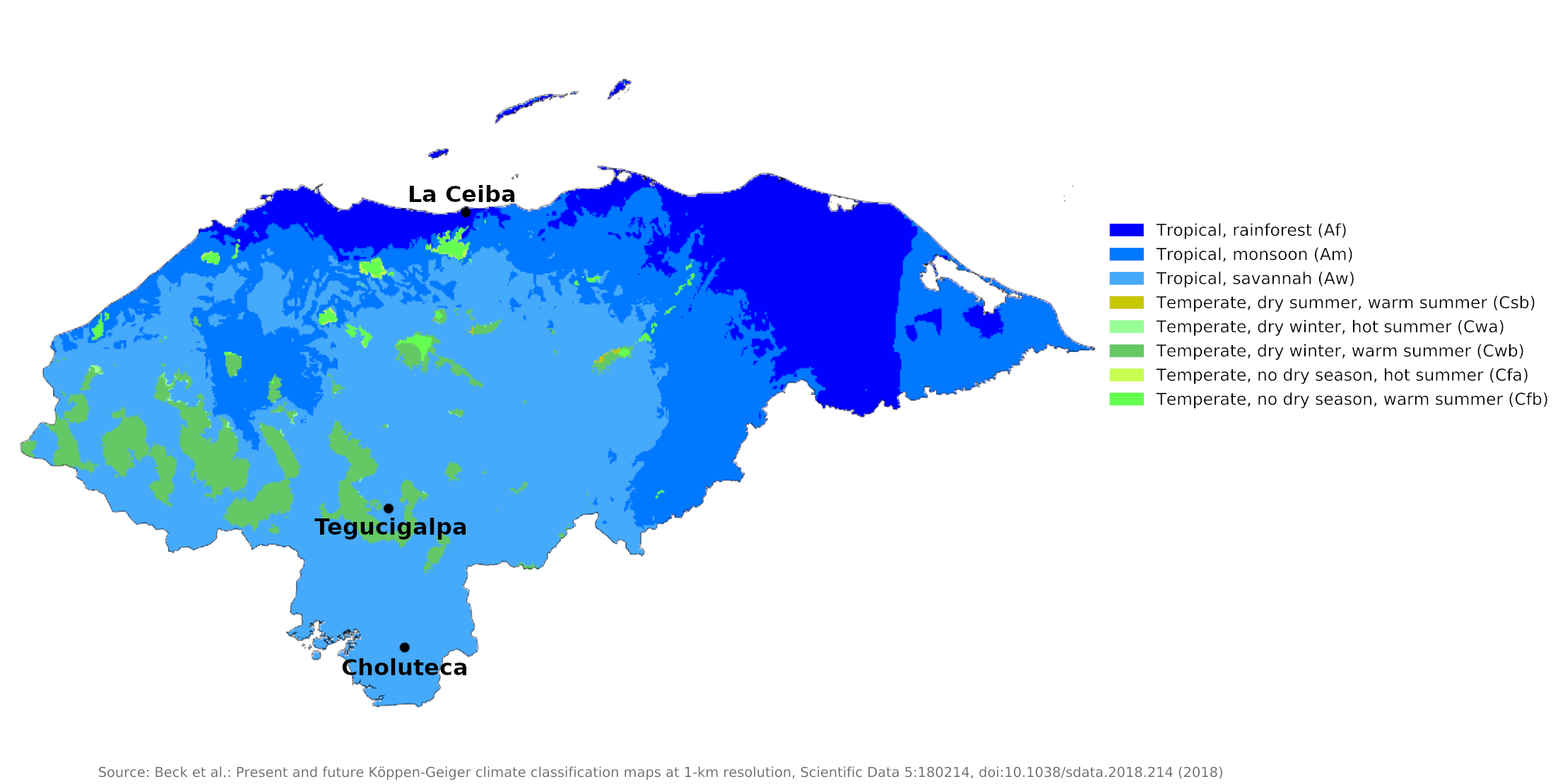 Climate map of Honduras
What is the climate of Honduras like?
Honduras is one of the larger countries of Central America. It is situated between 13° and 16°N, between Nicaragua to the south and Guatemala to the north. It has a western border with El Salvador and a very short coastline on the Pacific. In size it is similar to Pennsylvania and a little smaller than England.
Honduras has three distinct regions: an extensive highland interior and two narrow coastal lowlands. The interior, which constitutes approximately 80 percent of the country's terrain, is mountainous. The larger Caribbean lowlands are in the north and the narrow Pacific lowlands are in the south.
Honduras is generally warm throughout the year, with varying rainfall and humidity. Temperatures vary primarily with elevation instead of with the season. Land below 1,000 meters (3,300 feet) is commonly known as tierra caliente (hot land), between 1,000 and 2,000 meters (3,300–6,600 feet) tierra templada (temperate land), and above 2,000 meters (6,600 feet) tierra fria (cold land). The coastal lowlands average 27°C (81°F), but above 750 meters (2,500 feet) the average temperature drops to 23°C (73°F).
Lowlands
Both the Caribbean and Pacific lowlands are tierra caliente, with daytime highs averaging between 28°C and 32°C (82–90°F) throughout the year. The Pacific lowlands have a tropical wet and dry climate with high temperatures but a distinct dry season from November through April (see Choluteca). The Caribbean lowlands have a tropical wet climate with consistently high temperatures and humidity (see La Ceiba); rain here occurs in every month, and it's often quite heavy as the tropical storms move in, although there is usually a drier period between March and June when the wet trade winds are weakest.
In the Pacific lowlands, April, the last month of the dry season, brings the warmest temperatures; The rainy season is slightly cooler, although higher humidity during the rainy season makes those months feel more uncomfortable. In the Caribbean lowlands, the only relief comes from the year-round heat and humidity in December or January, when an occasional strong cold front from the north (a "norte") brings several days of strong north-west winds and slightly cooler temperatures.
| Climate data for Choluteca (1961–1990) | |||||||||||||
|---|---|---|---|---|---|---|---|---|---|---|---|---|---|
| Month | Jan | Feb | Mar | Apr | May | Jun | Jul | Aug | Sep | Oct | Nov | Dec | Year |
| Average high °C (°F) | 34.6 (94.3) | 35.7 (96.3) | 36.7 (98.1) | 35.1 (95.2) | 35.1 (95.2) | 33.1 (91.6) | 34.1 (93.4) | 34.1 (93.4) | 32.6 (90.7) | 32.6 (90.7) | 33.5 (92.3) | 34.3 (93.7) | 34.8 (94.6) |
| Daily mean °C (°F) | 28.6 (83.5) | 29.2 (84.6) | 30.1 (86.2) | 30.5 (86.9) | 29.2 (84.6) | 28.1 (82.6) | 28.8 (83.8) | 28.6 (83.5) | 27.4 (81.3) | 27.6 (81.7) | 28.1 (82.6) | 28.4 (83.1) | 28.7 (83.7) |
| Average low °C (°F) | 23.1 (73.6) | 23.0 (73.4) | 23.5 (74.3) | 24.5 (76.1) | 24.2 (75.6) | 23.4 (74.1) | 23.8 (74.8) | 23.6 (74.5) | 22.9 (73.2) | 22.8 (73.0) | 22.7 (72.9) | 23.0 (73.4) | 23.4 (74.1) |
| Average precipitation mm (inches) | 2.0 (0.08) | 5.2 (0.20) | 7.5 (0.30) | 31.0 (1.22) | 286.2 (11.27) | 267.3 (10.52) | 139.4 (5.49) | 244.6 (9.63) | 358.7 (14.12) | 275.6 (10.85) | 77.2 (3.04) | 8.5 (0.33) | 1,703.2 (67.06) |
| Source: NOAA | |||||||||||||
| Climate data for La Ceiba (1970–1990) | |||||||||||||
|---|---|---|---|---|---|---|---|---|---|---|---|---|---|
| Month | Jan | Feb | Mar | Apr | May | Jun | Jul | Aug | Sep | Oct | Nov | Dec | Year |
| Average high °C (°F) | 27.0 (80.6) | 27.6 (81.7) | 29.0 (84.2) | 30.1 (86.2) | 31.3 (88.3) | 31.3 (88.3) | 30.8 (87.4) | 30.9 (87.6) | 30.6 (87.1) | 29.5 (85.1) | 28.2 (82.8) | 27.3 (81.1) | 29.5 (85.1) |
| Daily mean °C (°F) | 23.8 (74.8) | 24.0 (75.2) | 25.6 (78.1) | 26.8 (80.2) | 28.2 (82.8) | 28.0 (82.4) | 27.5 (81.5) | 27.6 (81.7) | 27.4 (81.3) | 26.2 (79.2) | 25.2 (77.4) | 24.3 (75.7) | 26.2 (79.2) |
| Average low °C (°F) | 18.4 (65.1) | 18.4 (65.1) | 19.5 (67.1) | 20.7 (69.3) | 22.2 (72.0) | 22.6 (72.7) | 21.8 (71.2) | 21.8 (71.2) | 22.0 (71.6) | 21.2 (70.2) | 20.2 (68.4) | 19.1 (66.4) | 20.7 (69.3) |
| Average precipitation mm (inches) | 305.2 (12.02) | 330.0 (12.99) | 225.2 (8.87) | 120.5 (4.74) | 76.9 (3.03) | 154.6 (6.09) | 174.9 (6.89) | 197.3 (7.77) | 203.3 (8.00) | 423.8 (16.69) | 539.6 (21.24) | 478.9 (18.85) | 3,230.2 (127.17) |
| Source: NOAA | |||||||||||||
Highlands
The interior highlands range from tierra templada to tierra fria. Tegucigalpa, in a sheltered valley and at an altitude of 990 meters (3,250 feet), has a pleasant climate, with an average temperature ranging from 20°C (68°F) in January, the coolest month, to 24°C (75°F) in May, the warmest month. Above 2,000 meters (6,600 feet), temperatures can fall to near freezing at night, and frost sometimes occurs.
As with the Pacific coast, the interior highlands also have a distinct dry season lasting from November through April, and a wet season from May through October. Temperatures in this region decrease as elevation increases. Tegucigalpa is representative of the hilly country of the temperate tierra templada, where there is a larger daily temperature range and cooler nights than is found in the low-lying and hotter tierra caliente.
| Climate data for Tegucigalpa (1961–1990) | |||||||||||||
|---|---|---|---|---|---|---|---|---|---|---|---|---|---|
| Month | Jan | Feb | Mar | Apr | May | Jun | Jul | Aug | Sep | Oct | Nov | Dec | Year |
| Average high °C (°F) | 25.7 (78.3) | 27.4 (81.3) | 29.5 (85.1) | 30.2 (86.4) | 30.2 (86.4) | 28.6 (83.5) | 27.8 (82.0) | 28.5 (83.3) | 28.5 (83.3) | 27.3 (81.1) | 26.0 (78.8) | 25.4 (77.7) | 27.9 (82.2) |
| Daily mean °C (°F) | 19.5 (67.1) | 20.4 (68.7) | 22.1 (71.8) | 23.4 (74.1) | 23.6 (74.5) | 22.6 (72.7) | 22.1 (71.8) | 22.4 (72.3) | 22.2 (72.0) | 21.5 (70.7) | 20.4 (68.7) | 19.7 (67.5) | 21.7 (71.1) |
| Average low °C (°F) | 14.3 (57.7) | 14.5 (58.1) | 15.5 (59.9) | 17.1 (62.8) | 18.2 (64.8) | 18.2 (64.8) | 18.0 (64.4) | 18.0 (64.4) | 17.9 (64.2) | 17.6 (63.7) | 16.3 (61.3) | 15.0 (59.0) | 16.7 (62.1) |
| Average precipitation mm (inches) | 5.3 (0.21) | 4.7 (0.19) | 9.9 (0.39) | 42.9 (1.69) | 143.5 (5.65) | 158.7 (6.25) | 82.3 (3.24) | 88.5 (3.48) | 177.2 (6.98) | 108.9 (4.29) | 39.9 (1.57) | 9.9 (0.39) | 871.7 (34.32) |
| Source: NOAA | |||||||||||||
Rainfall
Average annual rainfall varies from over 3,000 millimeters (120 inches) along the northern Caribbean coast to about 850 millimeters (33 inches) around Tegucigalpa in the south. The Caribbean coast is vulnerable to hurricanes.
The interior highlands and Pacific lowlands have a dry season, known locally as "summer," from November to April. Almost all the rain in these regions falls during the "winter," from May to September. Total yearly amounts depend on surrounding topography; Tegucigalpa, in a sheltered valley, averages only 870 millimeters (34 inches) of precipitation.
Honduras lies within the hurricane belt, and the Caribbean coast is particularly vulnerable to hurricanes or tropical storms that travel inland from the Caribbean. Hurricanes occasionally form over the Pacific and move north to affect southern Honduras, but Pacific storms are generally less severe and their landfall rarer.
References
- E. A. Pearce, Charles Gordon Smith, (1990) The Hutchinson World Weather Guide, John Murray Press. ISBN 1859863426
- Timothy L. Gall, (ed.), (2003), Worldmark Encyclopedia of the Nations, Eleventh Edition, Thomson Gale
- Federal Research Division, Library of Congress, (2001), Honduras: a country study. Claitor's Pub. Division. ISBN 0844408360
- Hugh Chisholm, (ed.), (1911), Encyclopædia Britannica, Eleventh edition, Cambridge University Press
The Climate of
Honduras
In summary:
The northern Caribbean area and the southern coastal plain have a wet, tropical climate, but the interior highlands are drier and cooler. Coastal temperatures average 27°C (81°F), with lower temperatures at the higher elevations.
Central and southern regions experience a rainy period from May through October, and a dry season from November through April. Northern coastal districts however get heavy rain in autumn and winter.