The Climate of
Kyrgyzstan
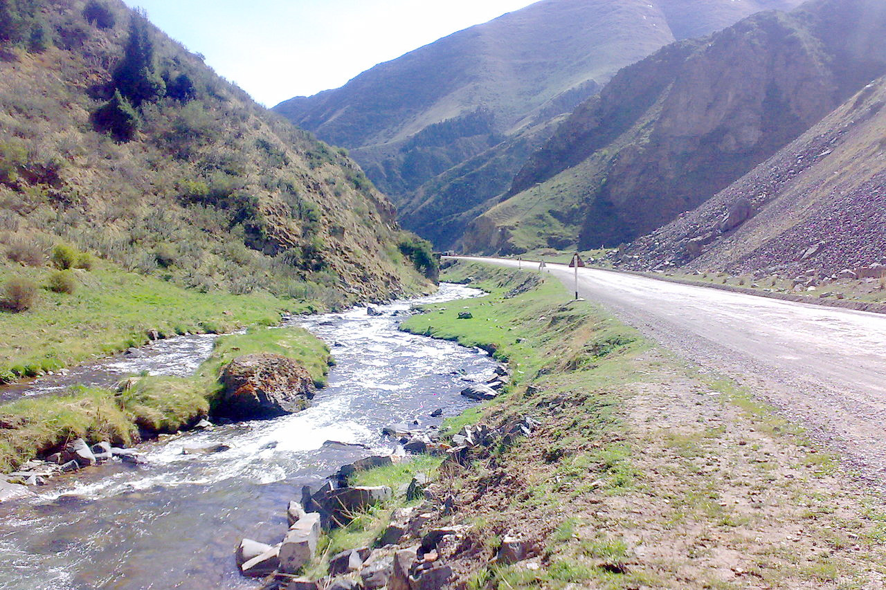
 Kichi-Karaunkyur River, Naryn Region
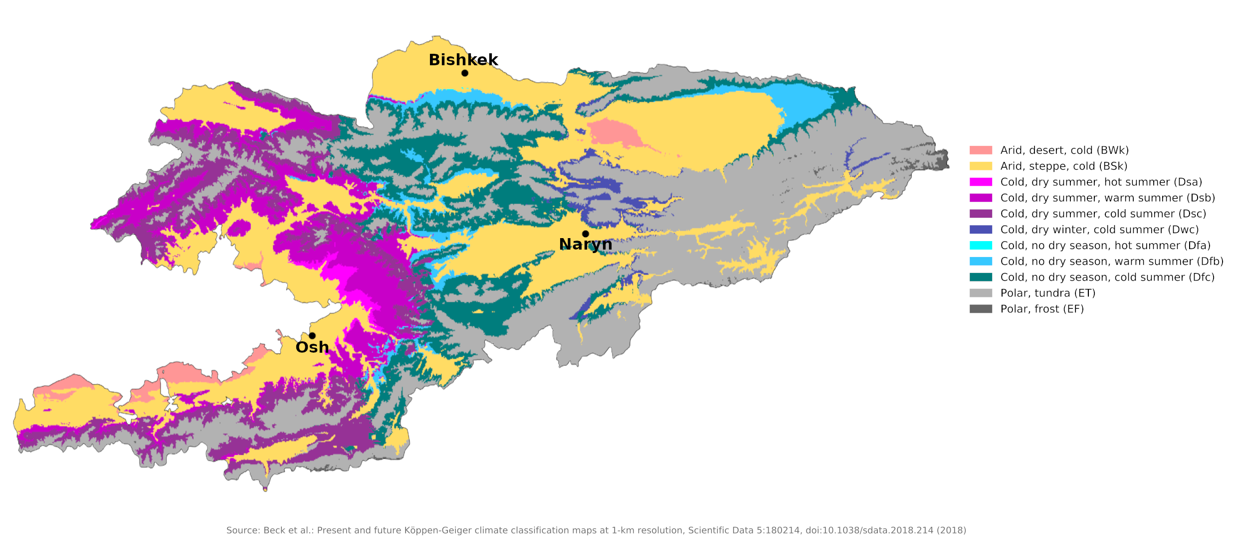
Climate Map
 Climate map of Kyrgyzstan
What is the climate of Kyrgyzstan like?
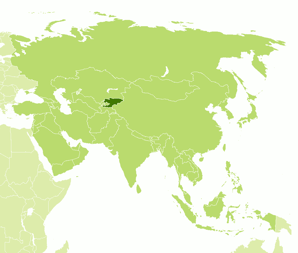
Kyrgyzstan is located in central Asia, west of China, south of Kazakhstan, east of Uzbekistan, and northeast of Tajikistan. It is part of a mountainous region, and includes peaks rising to over 6,000 meters (20,000 feet). These mountains carry snow the year round. However, because of the distance from the sea and the shelter of the Pamir and Himalayan ranges to the south and southeast, it is a rather dry region considering its height. Winters are cold but spring comes earlier than farther north.
Kyrgyzstan has a distinctly continental climate that has significant local variations. The country's climate is influenced chiefly by the mountains, Kyrgyzstan's position near the middle of the Eurasian landmass, and the absence of any body of water large enough to influence weather patterns.
Average temperatures vary significantly by region in Kyrgyzstan. The coldest January temperatures are in the mountain valleys, where readings can fall below -30°C (-22°F). The warmest January average is 0°C (32°F), near the southern city of Osh and around Lake Issyk-Kul, which never freezes. Indeed, its name means "warm lake" in Kyrgyz. The average temperature for July similarly varies from 26°C (78°F) in Bishkek, to a low of -10°C (14°F) on the highest mountain peaks.
Like temperatures, precipitation rates, which include snow as well as rainfall, are largely a product of Kyrgyzstan's mountains. Precipitation occurs to a greater extent in the western mountains and to a lesser extent in the flatter, lower regions of north-central Kyrgyzstan. Average precipitation levels range from 100 to 500 millimeters (4 to 20 inches) in the valleys and 180 to 1,000 millimeters (7 to 40 inches) in the mountains. Extremes vary from less than 100 millimeters (4 inches) per year on the west bank of Issyk-Kul to 2,000 millimeters (80 inches) per year in the mountains above the Fergana Valley.
| Climate data for Bishkek (1991–2020) | |||||||||||||
|---|---|---|---|---|---|---|---|---|---|---|---|---|---|
| Month | Jan | Feb | Mar | Apr | May | Jun | Jul | Aug | Sep | Oct | Nov | Dec | Year |
| Average high °C (°F) | 2.9 (37.2) | 5.1 (41.2) | 12.1 (53.8) | 18.7 (65.7) | 24.1 (75.4) | 29.5 (85.1) | 32.4 (90.3) | 31.4 (88.5) | 25.6 (78.1) | 18.5 (65.3) | 10.3 (50.5) | 4.6 (40.3) | 17.9 (64.2) |
| Daily mean °C (°F) | −2.7 (27.1) | −0.5 (31.1) | 6.2 (43.2) | 12.8 (55.0) | 17.8 (64.0) | 22.9 (73.2) | 25.5 (77.9) | 24.2 (75.6) | 18.7 (65.7) | 11.6 (52.9) | 4.2 (39.6) | −1.1 (30.0) | 11.6 (52.9) |
| Average low °C (°F) | −7.1 (19.2) | −4.9 (23.2) | 1.0 (33.8) | 6.9 (44.4) | 11.2 (52.2) | 16.1 (61.0) | 18.4 (65.1) | 16.9 (62.4) | 11.7 (53.1) | 5.6 (42.1) | −0.5 (31.1) | −5.2 (22.6) | 5.8 (42.4) |
| Average precipitation mm (inches) | 28 (1.1) | 37 (1.5) | 51 (2.0) | 75 (3.0) | 60 (2.4) | 34 (1.3) | 19 (0.7) | 15 (0.6) | 19 (0.7) | 37 (1.5) | 44 (1.7) | 37 (1.5) | 456 (18.0) |
| Average extreme snow depth cm (inches) | 5 (2.0) | 3 (1.2) | 1 (0.4) | 0 (0) | 0 (0) | 0 (0) | 0 (0) | 0 (0) | 0 (0) | 0 (0) | 1 (0.4) | 3 (1.2) | 5 (2.0) |
| Source: Pogoda.ru.net | |||||||||||||
| Climate data for Naryn (1991–2020) | |||||||||||||
|---|---|---|---|---|---|---|---|---|---|---|---|---|---|
| Month | Jan | Feb | Mar | Apr | May | Jun | Jul | Aug | Sep | Oct | Nov | Dec | Year |
| Average high °C (°F) | −8.7 (16.3) | −5.0 (23.0) | 4.4 (39.9) | 14.4 (57.9) | 18.7 (65.7) | 22.0 (71.6) | 25.3 (77.5) | 25.4 (77.7) | 21.5 (70.7) | 13.6 (56.5) | 4.8 (40.6) | −5.7 (21.7) | 10.9 (51.6) |
| Daily mean °C (°F) | −14.8 (5.4) | −11.0 (12.2) | −1.1 (30.0) | 8.1 (46.6) | 12.1 (53.8) | 15.2 (59.4) | 17.8 (64.0) | 17.7 (63.9) | 13.8 (56.8) | 6.4 (43.5) | −1.5 (29.3) | −11.4 (11.5) | 4.3 (39.7) |
| Average low °C (°F) | −19.4 (−2.9) | −15.9 (3.4) | −5.9 (21.4) | 2.3 (36.1) | 6.1 (43.0) | 8.8 (47.8) | 10.6 (51.1) | 10.3 (50.5) | 6.5 (43.7) | 0.8 (33.4) | −5.9 (21.4) | −15.7 (3.7) | −1.4 (29.4) |
| Average precipitation mm (inches) | 9 (0.4) | 15 (0.6) | 22 (0.9) | 35 (1.4) | 65 (2.6) | 66 (2.6) | 44 (1.7) | 24 (0.9) | 14 (0.6) | 17 (0.7) | 16 (0.6) | 13 (0.5) | 340 (13.5) |
| Source: Pogoda.ru.net | |||||||||||||
| Climate data for Osh | |||||||||||||
|---|---|---|---|---|---|---|---|---|---|---|---|---|---|
| Month | Jan | Feb | Mar | Apr | May | Jun | Jul | Aug | Sep | Oct | Nov | Dec | Year |
| Average high °C (°F) | 2.8 (37.0) | 4.3 (39.7) | 11.8 (53.2) | 18.3 (64.9) | 23.3 (73.9) | 27.6 (81.7) | 31.2 (88.2) | 30.5 (86.9) | 25.7 (78.3) | 17.9 (64.2) | 10.2 (50.4) | 4.4 (39.9) | 17.3 (63.2) |
| Daily mean °C (°F) | −0.5 (31.1) | 0.9 (33.6) | 7.9 (46.2) | 13.7 (56.7) | 18.2 (64.8) | 22.2 (72.0) | 25.1 (77.2) | 24.2 (75.6) | 19.7 (67.5) | 13.2 (55.8) | 6.4 (43.5) | 1.0 (33.8) | 12.6 (54.7) |
| Average low °C (°F) | −3.8 (25.2) | −2.6 (27.3) | 4.0 (39.2) | 9.0 (48.2) | 13.0 (55.4) | 16.7 (62.1) | 18.9 (66.0) | 17.8 (64.0) | 13.7 (56.7) | 8.5 (47.3) | 2.6 (36.7) | −2.5 (27.5) | 7.9 (46.3) |
| Average precipitation mm (inches) | 18 (0.7) | 36 (1.4) | 40 (1.6) | 54 (2.1) | 52 (2.0) | 31 (1.2) | 11 (0.4) | 12 (0.5) | 6 (0.2) | 24 (0.9) | 30 (1.2) | 28 (1.1) | 342 (13.3) |
| Source: Weather Atlas | |||||||||||||
References
- E. A. Pearce, Charles Gordon Smith, (1990) The Hutchinson World Weather Guide, John Murray Press. ISBN 1859863426
- Timothy L. Gall, (ed.), (2003), Worldmark Encyclopedia of the Nations, Eleventh Edition, Thomson Gale
- Federal Research Division, Library of Congress, (1997), Kazakstan, Kyrgyzstan, Tajikistan, Turkmenistan, and Uzbekistan: country studies. Claitor's Pub. Division. ISBN 0844409383
- Hugh Chisholm, (ed.), (1911), Encyclopædia Britannica, Eleventh edition, Cambridge University Press
The Climate of
Kyrgyzstan

In summary:
Kyrgyzstan's climate ranges from the continental to the alpine. The country experiences hot summers and cold winters. It is a rather dry region, surrounded by mountains which carry snow all year round.