The Climate of
Laos
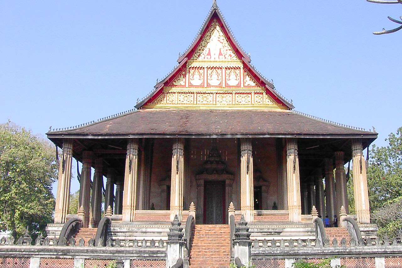
 Haw Phra Kaew temple in Vientiane
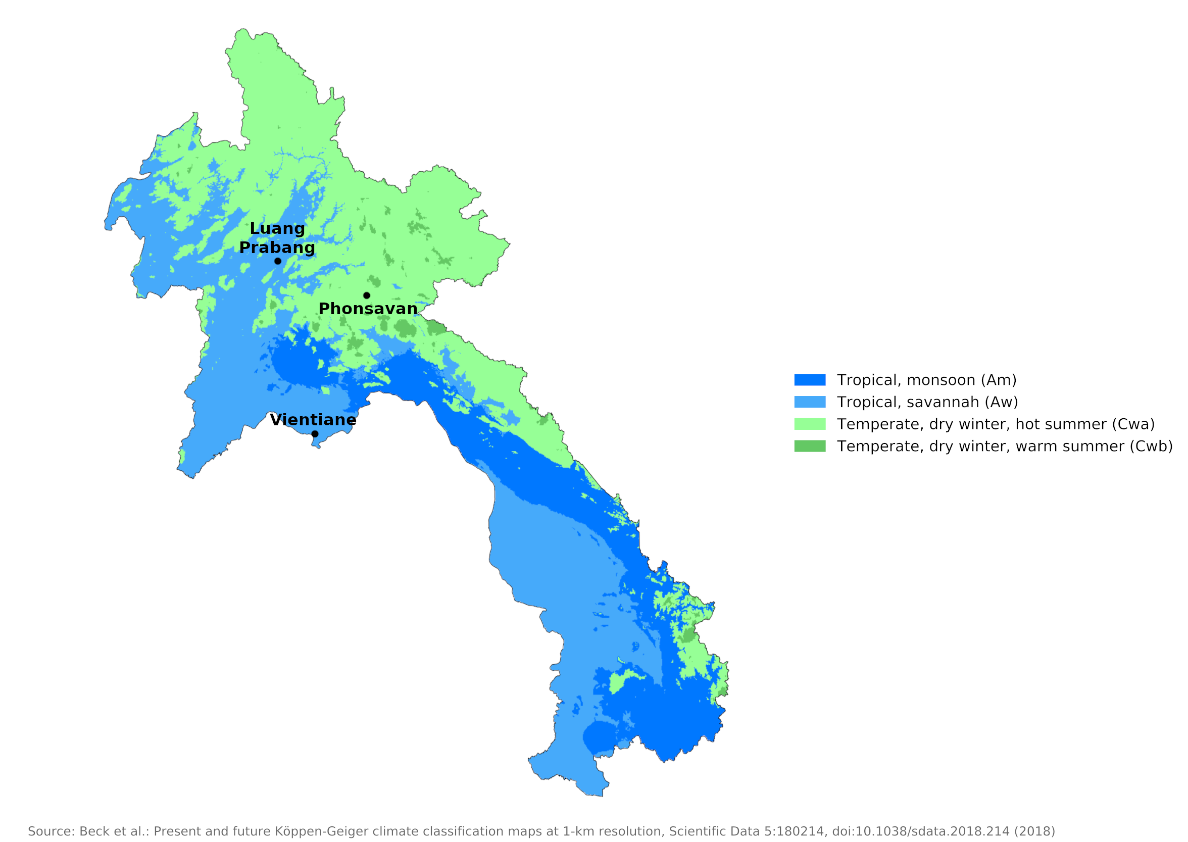
Climate Map
 Climate map of Laos
What is the climate of Laos like?
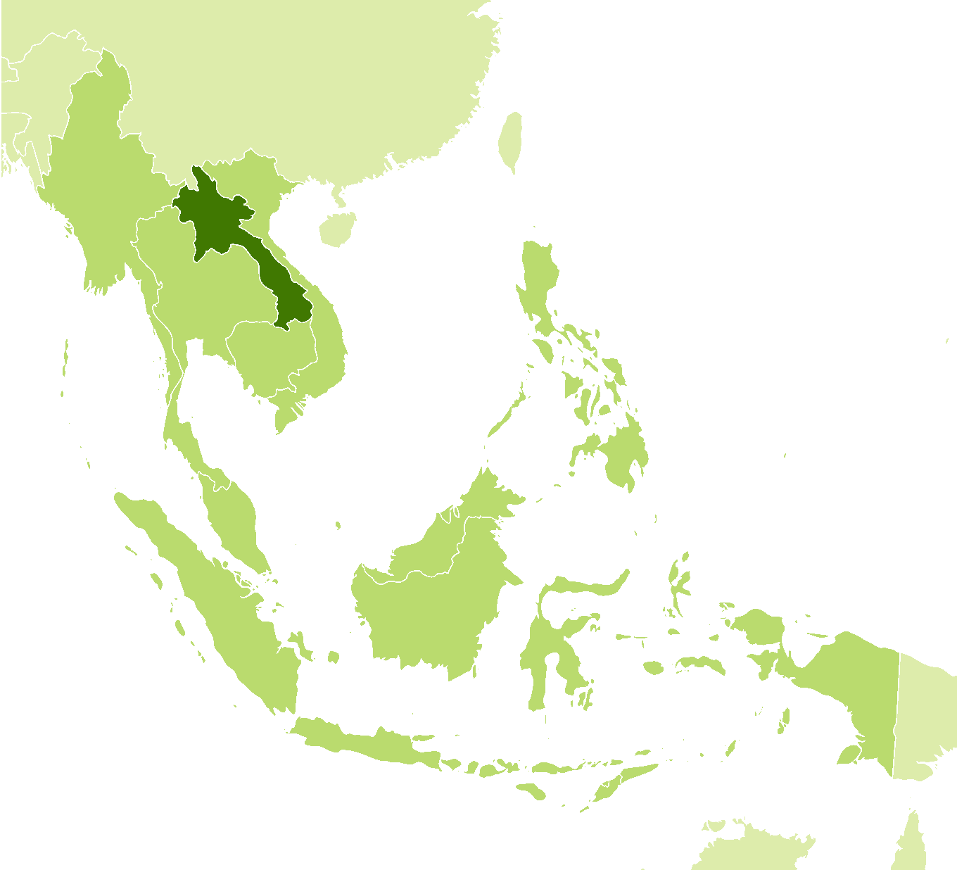
Laos is a landlocked country in Southeast Asia bordering Myanmar and China on the north, Vietnam on the east, Cambodia on the south, and Thailand on the west. It's about the size of the UK and much of the country is rather hilly and mountainous.
The climate of Laos is mainly influenced by the monsoon winds that set conditions across East Asia. The monsoon cycle results from changes in seasonal airflow over the vast Asian landmass and oceans to the south and east. In winter, the dry air over the continent becomes cold and dense, settles, and flows generally south. From its predominant direction in Laos, this winter airflow is referred to as the northeast monsoon. In summer the situation is reversed. The continental air warms up, rises and creates a large low-pressure area into which air masses flow from the oceans. These masses, heavily laden with moisture picked up while crossing the oceans, precipitate that moisture when they reach the continent. In terms of the direction of flow, the resulting winds are referred to as the southwest monsoon.
This cycle results in two distinct seasons: a wet season during the Southwest Monsoon, from May to October, and a dry season during the Northeast Monsoon, from November to April. The dry season can be subdivided into the cool dry season from November to February, and the hot dry season from March to April when temperatures can reach 40°C (104°F). In July and August, the rainiest months, it can rain for several days at a time. As the rainy season nears its end, the rain subsides and may only fall in the mornings and evenings. Gradually it fades away and then stops altogether; rain is rare by mid-November. Generally, monsoons occur at the same time across the country, although that time may vary significantly from one year to the next.
Average temperatures are 28°C (82°F) and range from highs of 40°C (104°F) along the Mekong in March and April to lows of 5°C (41°F) in the mountains in January. The average humidity is 70 to 80 percent. Temperatures are generally fairly high year-round, but the northern mountains can experience occasional cooler days during the northern monsoon winter season. As in northern Vietnam, the cooler, cloudier weather at this time is associated with bursts of colder continental air from China. Humidity is significantly lower during the dry season and the weather, despite the warmth, is more comfortable and pleasant than during the rather muggy days of the main monsoon rains.
Rainfall also varies regionally, with the highest amounts—3,700 millimeters (145 inches) annually—recorded on the Bolovens Plateau in southern Laos. Annual rainfall in Laos averages 1,750 millimeters (70 inches). Most rain falls during the rainy season between May and September or October. Rainfall can range from 1,250 to 2,300 millimeters (50 to 90 inches) during this period.
It typically rains at least 100 days a year in most parts of the country, and as much as 150 days or more in some areas. However, rainy days are concentrated in the rainy season, when it typically rains more than ten to more than twenty days a month. The rest of the year is dry and rather sunny. The relatively high average precipitation conceals years where rainfall may be only half or less of the norm, causing significant droughts. Such droughts often are regional, leaving other parts of the country unaffected.
Nighttime humidity percentages rise into, or close to, the nineties throughout the year in much of the country. During the dry season the humidity drops to about 50 percent in the early afternoon. Percentages in the rainy season, however, usually remain in the seventies.
Luang Prabang and Vientiane are representative of the lower parts of Laos. Phonsavan's climate reflects the cooler conditions found in the highlands.
| Climate data for Luang Prabang (1981–2010) | |||||||||||||
|---|---|---|---|---|---|---|---|---|---|---|---|---|---|
| Month | Jan | Feb | Mar | Apr | May | Jun | Jul | Aug | Sep | Oct | Nov | Dec | Year |
| Average high °C (°F) | 28.3 (82.9) | 31.6 (88.9) | 33.9 (93.0) | 35.1 (95.2) | 34.0 (93.2) | 32.9 (91.2) | 31.8 (89.2) | 31.8 (89.2) | 32.1 (89.8) | 31.4 (88.5) | 29.2 (84.6) | 27.0 (80.6) | 31.6 (88.9) |
| Daily mean °C (°F) | 19.5 (67.1) | 22.0 (71.6) | 24.9 (76.8) | 27.2 (81.0) | 27.5 (81.5) | 27.6 (81.7) | 26.9 (80.4) | 26.8 (80.2) | 26.4 (79.5) | 25.0 (77.0) | 21.9 (71.4) | 18.9 (66.0) | 24.6 (76.3) |
| Average low °C (°F) | 14.4 (57.9) | 15.2 (59.4) | 18.1 (64.6) | 21.4 (70.5) | 23.2 (73.8) | 24.0 (75.2) | 23.9 (75.0) | 23.7 (74.7) | 22.9 (73.2) | 21.2 (70.2) | 17.7 (63.9) | 14.3 (57.7) | 20.0 (68.0) |
| Average precipitation mm (inches) | 11.0 (0.43) | 15.5 (0.61) | 46.5 (1.83) | 109.5 (4.31) | 160.6 (6.32) | 193.7 (7.63) | 260.0 (10.24) | 277.5 (10.93) | 152.7 (6.01) | 103.8 (4.09) | 35.4 (1.39) | 17.4 (0.69) | 1,383.6 (54.47) |
| Source: World Meteorological Organization | |||||||||||||
| Climate data for Vientiane (1981–2010) | |||||||||||||
|---|---|---|---|---|---|---|---|---|---|---|---|---|---|
| Month | Jan | Feb | Mar | Apr | May | Jun | Jul | Aug | Sep | Oct | Nov | Dec | Year |
| Average high °C (°F) | 28.7 (83.7) | 30.8 (87.4) | 33.1 (91.6) | 34.6 (94.3) | 33.1 (91.6) | 32.2 (90.0) | 31.6 (88.9) | 31.2 (88.2) | 31.3 (88.3) | 31.2 (88.2) | 30.1 (86.2) | 28.3 (82.9) | 31.1 (88.0) |
| Daily mean °C (°F) | 22.4 (72.3) | 24.7 (76.5) | 27.1 (80.8) | 29.0 (84.2) | 28.4 (83.1) | 28.1 (82.6) | 27.7 (81.9) | 27.5 (81.5) | 27.3 (81.1) | 26.8 (80.2) | 24.8 (76.6) | 22.2 (72.0) | 26.3 (79.3) |
| Average low °C (°F) | 17.4 (63.3) | 19.6 (67.3) | 22.1 (71.8) | 24.5 (76.1) | 24.9 (76.8) | 25.2 (77.4) | 25.0 (77.0) | 24.8 (76.6) | 24.3 (75.7) | 23.4 (74.1) | 20.5 (68.9) | 17.3 (63.1) | 22.4 (72.3) |
| Average precipitation mm (inches) | 7.8 (0.31) | 15.3 (0.60) | 39.2 (1.54) | 92.8 (3.65) | 233.5 (9.19) | 264.6 (10.42) | 307.2 (12.09) | 332.9 (13.11) | 270.2 (10.64) | 96.6 (3.80) | 13.5 (0.53) | 3.7 (0.15) | 1,677.2 (66.03) |
| Source: World Meteorological Organization | |||||||||||||
| Climate data for Phonsavan | |||||||||||||
|---|---|---|---|---|---|---|---|---|---|---|---|---|---|
| Month | Jan | Feb | Mar | Apr | May | Jun | Jul | Aug | Sep | Oct | Nov | Dec | Year |
| Average high °C (°F) | 23.3 (73.9) | 25.7 (78.3) | 28.1 (82.6) | 28.7 (83.7) | 27.1 (80.8) | 27.2 (81.0) | 26.7 (80.1) | 26.5 (79.7) | 26.6 (79.9) | 28.4 (83.1) | 23.8 (74.8) | 21.7 (71.1) | 26.1 (79.1) |
| Daily mean °C (°F) | 16.1 (61.0) | 18.2 (64.8) | 21.1 (70.0) | 22.7 (72.9) | 23.1 (73.6) | 23.6 (74.5) | 23.2 (73.8) | 23.0 (73.4) | 22.2 (72.0) | 21.9 (71.4) | 17.7 (63.9) | 14.8 (58.6) | 20.6 (69.2) |
| Average low °C (°F) | 8.8 (47.8) | 10.7 (51.3) | 14.0 (57.2) | 16.6 (61.9) | 19.0 (66.2) | 20.0 (68.0) | 19.7 (67.5) | 19.4 (66.9) | 17.8 (64.0) | 15.4 (59.7) | 11.6 (52.9) | 7.8 (46.0) | 15.1 (59.1) |
| Average precipitation mm (inches) | 8.7 (0.34) | 15.8 (0.62) | 56.9 (2.24) | 145.2 (5.72) | 193.6 (7.62) | 193.0 (7.60) | 276.8 (10.90) | 300.9 (11.85) | 158.2 (6.23) | 63.6 (2.50) | 23.1 (0.91) | 8.4 (0.33) | 1,444.2 (56.86) |
| Source: World Meteorological Organization | |||||||||||||
When is the best time to visit Laos?
Laos has a rainy season lasting from May to October corresponding to the southwest monsoon and a dry season coinciding with the northeast monsoon and lasting from November to May. Both in northern and southern Laos the heat from April to September is excessive especially in the lowlands. December, January and February are the cool, dry months.
References
- E. A. Pearce, Charles Gordon Smith, (1990) The Hutchinson World Weather Guide, John Murray Press. ISBN 1859863426
- Timothy L. Gall, (ed.), (2003), Worldmark Encyclopedia of the Nations, Eleventh Edition, Thomson Gale
- Federal Research Division, Library of Congress, (1995), Laos: a country study. Claitor's Pub. Division. ISBN 0844408328
- Donald P. Whitaker, et al. (1972), Area handbook for Laos. U.S. Government Printing Office
- Hugh Chisholm, (ed.), (1911), Encyclopædia Britannica, Eleventh edition, Cambridge University Press
The Climate of
Laos

In summary:
Laos has a tropical monsoon climate with three seasons: a cool, dry season in November through February; a hot, dry season in March and April; and a rainy season in May through October. Temperatures average 28°C (82°F), ranging from highs of 40°C (104°F) along the Mekong in March and April to lows of 5°C (41°F) in the mountains in January.
Annual rainfall in Laos averages 1750 mm (69 inches). Most of this rain occurs during the southwest monsoon between May and October. Rainfall can be anywhere from 1250 to 2300 mm (50 to 90 inches) during this period.