The Climate of
Myanmar
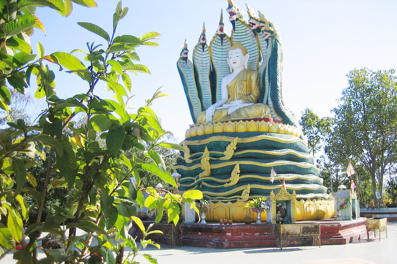
 Nagayon pagoda, Lashio
Climate Map
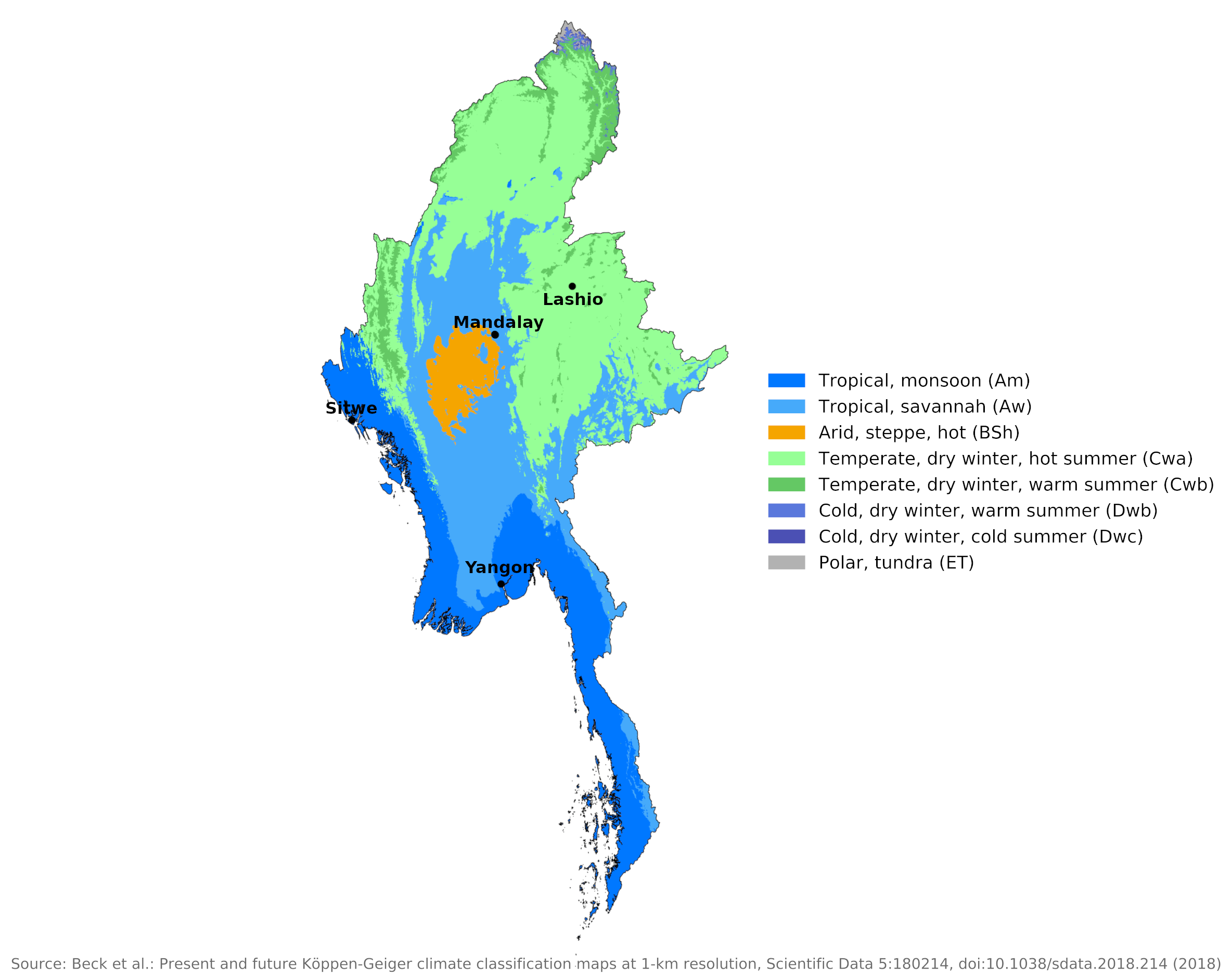
 Climate map of Myanmar
What is the climate of Myanmar like?
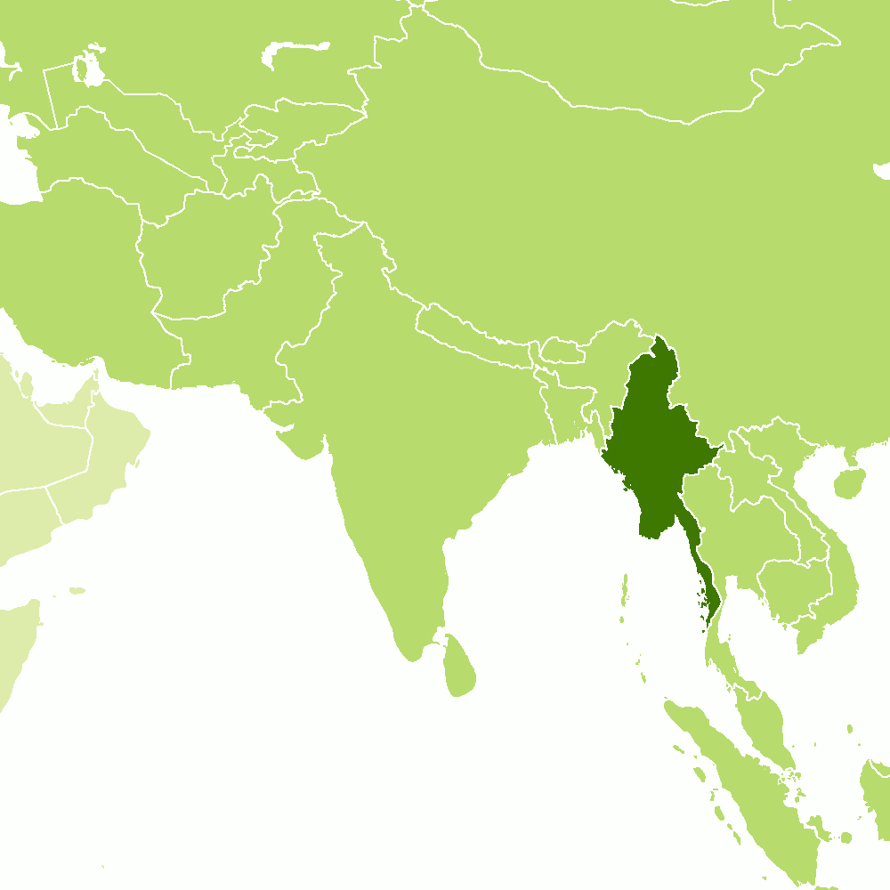
Myanmar is located in Southeast Asia and borders India and Bangladesh to the northwest, China to the northeast, Laos to the east, Thailand to the east and southeast, and the Indian Ocean to the south and west. The country is slightly larger than France. The center of the country to the coast is lowland, but much of Myanmar is mountainous, with the main mountains and hill ranges running north-south. The highest regions in the north include part of the eastern Himalayas that rise to over 5,500 meters (18,000 feet), but the average height of mountains elsewhere is 1,200 to 2,400 meters (4,000–8,000 feet).
Myanmar has a tropical climate with three seasons: a cool winter from November to February, a hot season from March to April and a rainy season from May to October. This seasonal contrast is a result of the great reversal in winds that occurs over South Asia. As in India, the dry season is dominated by the northeast monsoon, which blows overland from China.
Except for the northern highlands and, to a lesser degree, parts of the Shan Hills in the east, temperatures are high all year and the cool season is cool only by comparison with the hot season. The mean annual temperature for the country as a whole is about 27°C (80°F), but there is considerable variation between different parts of the country.
Differences in altitude within Myanmar and the degree of exposure to the rainy southwest monsoon are responsible for the main differences in climate within the country.
In the lowlands during the wet season the humidity is constantly high, and the temperature may reach 40°C (104°F). Here also there is comparatively little noticeable change from day to day, even though the cool season does bring some relief. The climate of upper Myanmar, particularly at elevations of about 300 to 1,220 meters (1,000 to 4,000 feet), is most temperate year-round. In the Shan Hills temperatures range 5 to 8°C (9 to 14°F) lower than those in the lowlands, making it the nation's most pleasant area. Many peaks in the high mountains of the north are snow-capped.
Although the country is under the influence of the monsoon, the amount of rainfall varies sharply by area. The coastal mountains and higher mountains to the north and east have abundant or heavy rainfall, ranging from 2,500 to 5,000 millimeters (100 to 200 inches) per year. The inner lowlands, sheltered from the direct effects of the southwest monsoon, get only 1,000 millimeters (40 inches) or even less (see Mandalay's climate). Across most of the country, at least three quarters of annual precipitation falls during the southwest monsoon season.
| Climate data for Mandalay (1981–2010) | |||||||||||||
|---|---|---|---|---|---|---|---|---|---|---|---|---|---|
| Month | Jan | Feb | Mar | Apr | May | Jun | Jul | Aug | Sep | Oct | Nov | Dec | Year |
| Average high °C (°F) | 29.6 (85.3) | 32.7 (90.9) | 36.6 (97.9) | 38.9 (102.0) | 36.9 (98.4) | 35.2 (95.4) | 35.1 (95.2) | 34.3 (93.7) | 34.0 (93.2) | 33.4 (92.1) | 31.1 (88.0) | 29.1 (84.4) | 33.9 (93.0) |
| Daily mean °C (°F) | 21.9 (71.4) | 24.4 (75.9) | 28.8 (83.8) | 31.9 (89.4) | 31.3 (88.3) | 30.8 (87.4) | 30.8 (87.4) | 30.2 (86.4) | 29.7 (85.5) | 28.8 (83.8) | 25.7 (78.3) | 22.2 (72.0) | 28.0 (82.4) |
| Average low °C (°F) | 13.7 (56.7) | 16.0 (60.8) | 20.4 (68.7) | 24.7 (76.5) | 25.9 (78.6) | 26.1 (79.0) | 26.2 (79.2) | 25.8 (78.4) | 25.4 (77.7) | 24.0 (75.2) | 19.9 (67.8) | 15.4 (59.7) | 22.0 (71.6) |
| Average precipitation mm (inches) | 0.9 (0.04) | 3.8 (0.15) | 5.8 (0.23) | 40.4 (1.59) | 130.0 (5.12) | 99.5 (3.92) | 74.7 (2.94) | 132.9 (5.23) | 157.1 (6.19) | 130.7 (5.15) | 36.4 (1.43) | 4.9 (0.19) | 817.1 (32.17) |
| Source: Norwegian Meteorological Institute | |||||||||||||
In the lowlands and especially on the coast, temperatures are hot all year round. The highest temperatures occur in the period from March to May, before the onset of the heaviest rainfall. Temperatures are lower in the hills, but for most of the year the weather in locations below 1,200 meters (4,000 feet) can be described as hot and tropical. The climate for Lashio is representative of inland locations at moderate elevations. On the coast, the high temperatures are made even more uncomfortable by the high humidity. Inland, too, the heat is oppressive during the rainy season for the same reason.
| Climate data for Lashio (1981–2010) | |||||||||||||
|---|---|---|---|---|---|---|---|---|---|---|---|---|---|
| Month | Jan | Feb | Mar | Apr | May | Jun | Jul | Aug | Sep | Oct | Nov | Dec | Year |
| Average high °C (°F) | 25.7 (78.3) | 28.1 (82.6) | 31.2 (88.2) | 32.8 (91.0) | 31.6 (88.9) | 30.7 (87.3) | 29.3 (84.7) | 29.6 (85.3) | 29.9 (85.8) | 29.3 (84.7) | 27.1 (80.8) | 25.2 (77.4) | 29.2 (84.6) |
| Daily mean °C (°F) | 15.5 (59.9) | 17.1 (62.8) | 20.4 (68.7) | 24.0 (75.2) | 25.4 (77.7) | 26.3 (79.3) | 25.6 (78.1) | 25.7 (78.3) | 25.4 (77.7) | 24.0 (75.2) | 20.2 (68.4) | 16.7 (62.1) | 22.2 (72.0) |
| Average low °C (°F) | 5.2 (41.4) | 6.1 (43.0) | 9.6 (49.3) | 15.1 (59.2) | 19.2 (66.6) | 21.8 (71.2) | 21.9 (71.4) | 21.8 (71.2) | 20.9 (69.6) | 18.7 (65.7) | 13.3 (55.9) | 8.1 (46.6) | 15.1 (59.2) |
| Average precipitation mm (inches) | 2.7 (0.11) | 5.9 (0.23) | 9.6 (0.38) | 57.1 (2.25) | 171.9 (6.77) | 178.3 (7.02) | 213.0 (8.39) | 290.9 (11.45) | 280.7 (11.05) | 175.6 (6.91) | 75.5 (2.97) | 10.0 (0.39) | 1,471.2 (57.92) |
| Source: Norwegian Meteorological Institute | |||||||||||||
The dry season is significantly cooler and more pleasant inland and particularly in the north of the country where the temperature drops with increasing altitude. The period from November to April is extremely dry across the country. At this time, when the country is dominated by the dry northeast monsoon, solar radiation is high, averaging seven to 10 hours a day. During the rainy season the weather is much cloudier and from June to September daily sunshine averages only three to four hours a day.
Climatic conditions at the wettest parts of the coast are illustrated by Sittwe. The climate for Yangon shows that here on the Irrawaddy Delta, where the coast runs west-east and is flat, there is less rainfall but temperature and humidity remain high year-round. The average annual temperature is 27°C (81°F); Average daily temperatures in Yangon range from 17° to 33°C (62–92°F) in January during the cool season and from 24° to 38°C (75–100°F) in April during the hot season.
| Climate data for Sittwe (1981–2010) | |||||||||||||
|---|---|---|---|---|---|---|---|---|---|---|---|---|---|
| Month | Jan | Feb | Mar | Apr | May | Jun | Jul | Aug | Sep | Oct | Nov | Dec | Year |
| Average high °C (°F) | 28.3 (82.9) | 29.9 (85.8) | 31.7 (89.1) | 33.0 (91.4) | 32.5 (90.5) | 29.7 (85.5) | 28.9 (84.0) | 29.3 (84.7) | 30.3 (86.5) | 31.3 (88.3) | 30.6 (87.1) | 28.9 (84.0) | 30.4 (86.7) |
| Daily mean °C (°F) | 21.5 (70.7) | 23.3 (73.9) | 26.1 (79.0) | 28.5 (83.3) | 28.7 (83.7) | 27.4 (81.3) | 26.8 (80.2) | 26.8 (80.2) | 27.3 (81.1) | 27.6 (81.7) | 28.4 (83.1) | 23.0 (73.4) | 26.3 (79.3) |
| Average low °C (°F) | 14.9 (58.8) | 16.6 (61.9) | 20.2 (68.4) | 24.0 (75.2) | 25.1 (77.2) | 24.8 (76.6) | 24.5 (76.1) | 24.5 (76.1) | 24.4 (75.9) | 24.0 (75.2) | 21.1 (70.0) | 17.1 (62.8) | 21.8 (71.2) |
| Average precipitation mm (inches) | 0.9 (0.04) | 13.3 (0.52) | 8.4 (0.33) | 35.6 (1.40) | 307.5 (12.11) | 1,168.1 (45.99) | 1,280.5 (50.41) | 965.2 (38.00) | 549.0 (21.61) | 288.7 (11.37) | 116.3 (4.58) | 15.1 (0.59) | 4,748.6 (186.95) |
| Source: Norwegian Meteorological Institute | |||||||||||||
| Climate data for Yangon (1981–2010) | |||||||||||||
|---|---|---|---|---|---|---|---|---|---|---|---|---|---|
| Month | Jan | Feb | Mar | Apr | May | Jun | Jul | Aug | Sep | Oct | Nov | Dec | Year |
| Average high °C (°F) | 33.2 (91.8) | 35.2 (95.4) | 36.7 (98.1) | 37.5 (99.5) | 34.2 (93.6) | 30.8 (87.4) | 30.3 (86.5) | 30.0 (86.0) | 30.9 (87.6) | 32.2 (90.0) | 33.1 (91.6) | 32.5 (90.5) | 33.1 (91.6) |
| Daily mean °C (°F) | 24.8 (76.6) | 26.5 (79.7) | 28.6 (83.5) | 31.0 (87.8) | 29.2 (84.6) | 27.4 (81.3) | 26.8 (80.2) | 26.9 (80.4) | 27.5 (81.5) | 27.6 (81.7) | 27.3 (81.1) | 25.0 (77.0) | 27.4 (81.3) |
| Average low °C (°F) | 16.7 (62.1) | 18.4 (65.1) | 21.0 (69.8) | 23.8 (74.8) | 24.3 (75.7) | 23.6 (74.5) | 23.2 (73.8) | 23.2 (73.8) | 23.2 (73.8) | 23.1 (73.6) | 21.3 (70.3) | 17.8 (64.0) | 21.6 (70.9) |
| Average precipitation mm (inches) | 0.4 (0.02) | 3.1 (0.12) | 12.4 (0.49) | 37.8 (1.49) | 328.1 (12.92) | 565.6 (22.27) | 605.8 (23.85) | 570.7 (22.47) | 393.7 (15.50) | 200.3 (7.89) | 58.6 (2.31) | 6.8 (0.27) | 2,783.3 (109.58) |
| Source: Norwegian Meteorological Institute | |||||||||||||
References
- E. A. Pearce, Charles Gordon Smith, (1990) The Hutchinson World Weather Guide, John Murray Press. ISBN 1859863426
- Timothy L. Gall, (ed.), (2003), Worldmark Encyclopedia of the Nations, Eleventh Edition, Thomson Gale
- The American University, (1971), Area Handbook for Burma. United States Government Printing Office.
- Hugh Chisholm, (ed.), (1911), Encyclopædia Britannica, Eleventh edition, Cambridge University Press
The Climate of
Myanmar

In summary:
Myanmar has a tropical climate with three seasons: a cool winter from November to February, a hot season in March and April, and a rainy season from May through October, when the southwest monsoon arrives. The average annual temperature is 28°C (82°F). Temperatures can dip below 0°C (32°F) in mountainous areas, and soar as high as 45°C (113°F) on the central plains.
Most of the country’s rainfall occurs during the monsoon from May to October. Annual average rainfall ranges from 5000 mm (200 in) along the coast to 750 mm (30 in) for central regions. Frost and snow occur in the high mountains of the north.