The Climate of
Malawi
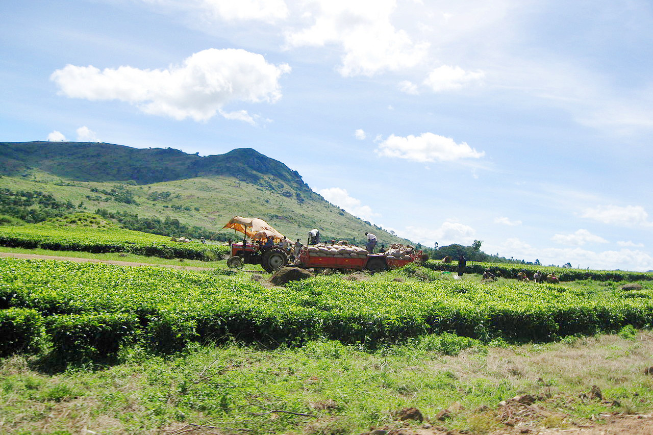 Tea plantation near Mulanje
Climate Map
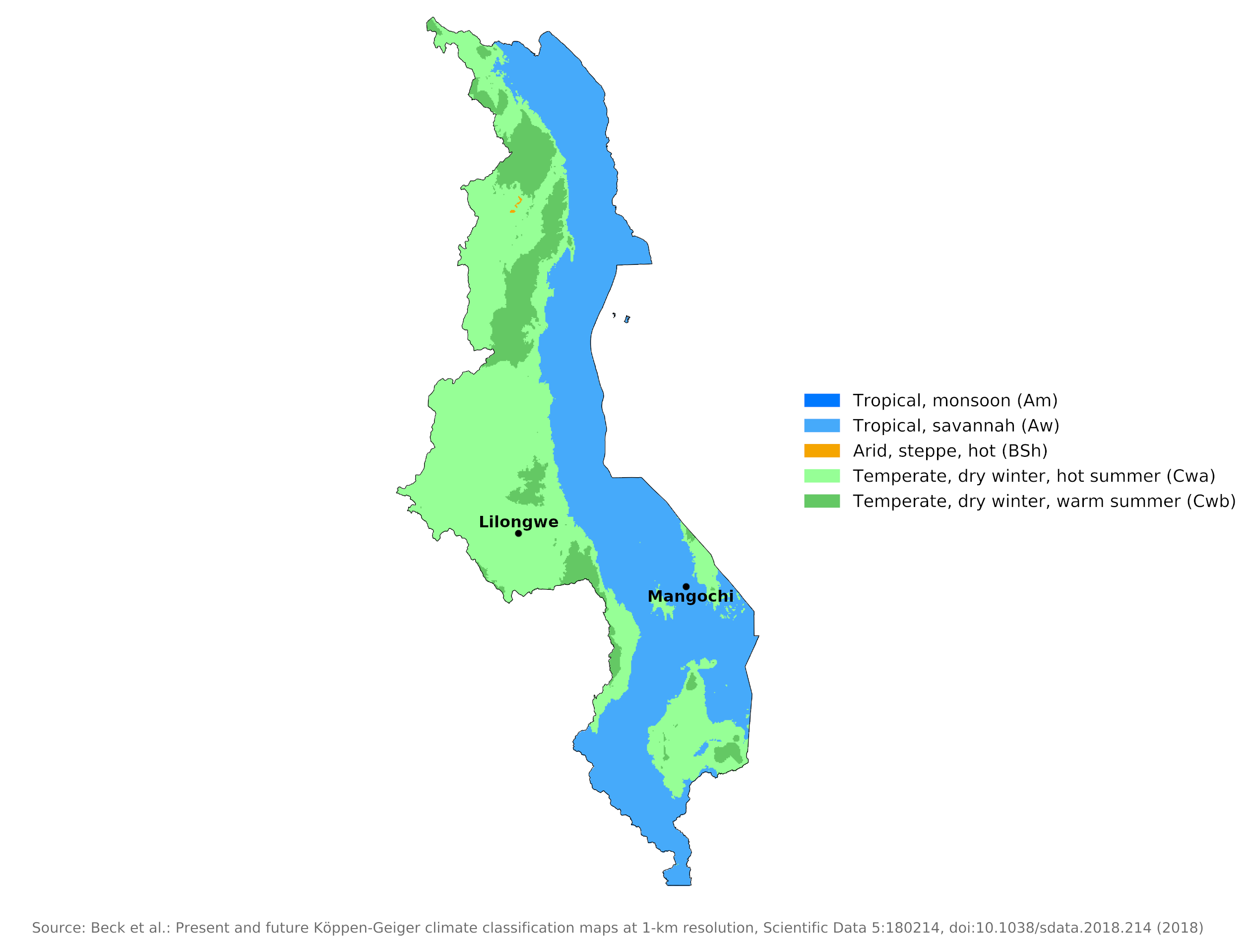 Climate map of Malawi
What is the climate of Malawi like?
Malawi is about as large as England, and is situated in south-central Africa. It is bordered on the north by Tanzania, on the east and south by Mozambique, and on the west by Zambia. It is a long, narrow country extending from north to south and containing within its borders the large Lake Malawi. It also has a rather diverse relief with mountains rising above 3,000 meters (10,000 feet) and land in the lower Shire valley below 180 meters (600 feet). It thus has a greater range of weather and climate than either Zambia or Zimbabwe.
Malawi's climate is tropical but moderated by the relatively high elevation of the country. The rainy season, early November through April, is generally cloudy, warm to hot, and humid; showers and thunderstorms are frequent. The dry season, early May through October, has clear or only partly cloudy skies, warm to hot days but cool nights, and comparatively low humidity.In practice, the year can be divided into four seasons: the cool (May to mid-August); the hot (mid-August to November); the rainy (November to April), with rains continuing longer in the northern and eastern mountains; and the post-rainy (April to May), with temperatures falling in May. Rainfall is heaviest along the northern coast of Lake Malawi, where the yearly average is more than 1,600 millimeters (64 inches). About 70 percent of the country averages about 750 to 1,000 millimeters (30 to 40 inches) annually. More than 90% of the annual precipitation at most locations occurs during the rainy season. During the dry season, amounts are mostly less than 25 millimeters (1 inch).
Apart from the lowlands in the south which are sultry, and oppressive, the weather and climate over the rest of the country are generally and pleasant. At times the weather can be surprisingly cold during the dry season, particularly above 1,500 meters (5,000 feet).
Lowlands
Variations in altitude lead to wide differences in climate in Malawi. The vast water surface of Lake Malawi has a cooling effect, but because of the low elevation, the lands surrounding the lake are typically tropical. There are long hot seasons and high humidity during the rainy season, with a mean annual temperature of 24°C (75°F). Frost is unknown here. The climate of Mangochi is representative of conditions in these tropical lowlands.
| Climate data for Mangochi | |||||||||||||
|---|---|---|---|---|---|---|---|---|---|---|---|---|---|
| Month | Jan | Feb | Mar | Apr | May | Jun | Jul | Aug | Sep | Oct | Nov | Dec | Year |
| Average high °C (°F) | 30.1 (86.2) | 30.0 (86.0) | 30.2 (86.4) | 29.5 (85.1) | 28.1 (82.6) | 26.5 (79.7) | 26.3 (79.3) | 28.3 (82.9) | 31.4 (88.5) | 33.6 (92.5) | 33.2 (91.8) | 31.0 (87.8) | 29.9 (85.8) |
| Daily mean °C (°F) | 25.5 (77.9) | 25.4 (77.7) | 25.3 (77.5) | 24.3 (75.7) | 22.1 (71.8) | 20.3 (68.5) | 20.1 (68.2) | 21.8 (71.2) | 24.5 (76.1) | 26.9 (80.4) | 27.3 (81.1) | 26.1 (79.0) | 24.1 (75.4) |
| Average low °C (°F) | 21.6 (70.9) | 21.5 (70.7) | 21.1 (70.0) | 19.8 (67.6) | 16.7 (62.1) | 14.2 (57.6) | 14.3 (57.7) | 15.4 (59.7) | 17.8 (64.0) | 20.8 (69.4) | 22.0 (71.6) | 22.0 (71.6) | 18.9 (66.0) |
| Average precipitation mm (inches) | 194.2 (7.65) | 200.8 (7.91) | 144.0 (5.67) | 36.6 (1.44) | 5.7 (0.22) | 4.4 (0.17) | 3.9 (0.15) | 1.5 (0.06) | 3.0 (0.12) | 15.9 (0.63) | 64.2 (2.53) | 172.0 (6.77) | 846.2 (33.31) |
| Source: NOAA | |||||||||||||
Highlands
Lilongwe, in Central Malawi, at an elevation of 1,050 meters (3,440 feet), has a moderately warm climate with adequate rainfall, similar to that of the uplands of much of Zambia and Zimbabwe. Daytime temperatures here rarely rise to very high or uncomfortable levels and there is abundant sunshine during the dry season when occasional frosts occur. The average daily minimum and maximum temperatures in November, the hottest month, are 17°C (63°F) and 29°C (84°F) respectively; those in July, the coolest month, are 7°C (45°F) and 23°C (73°F).
| Climate data for Lilongwe | |||||||||||||
|---|---|---|---|---|---|---|---|---|---|---|---|---|---|
| Month | Jan | Feb | Mar | Apr | May | Jun | Jul | Aug | Sep | Oct | Nov | Dec | Year |
| Average high °C (°F) | 24.8 (76.6) | 24.9 (76.8) | 24.7 (76.5) | 24.7 (76.5) | 23.2 (73.8) | 22.0 (71.6) | 21.4 (70.5) | 22.6 (72.7) | 25.9 (78.6) | 27.4 (81.3) | 27.3 (81.1) | 25.6 (78.1) | 24.6 (76.3) |
| Daily mean °C (°F) | 21.2 (70.2) | 21.1 (70.0) | 21.1 (70.0) | 20.2 (68.4) | 18.3 (64.9) | 16.2 (61.2) | 16.1 (61.0) | 17.3 (63.1) | 20.6 (69.1) | 22.4 (72.3) | 22.9 (73.2) | 21.8 (71.2) | 19.8 (67.6) |
| Average low °C (°F) | 18.2 (64.8) | 17.7 (63.9) | 17.3 (63.1) | 15.8 (60.4) | 13.1 (55.6) | 10.1 (50.2) | 9.9 (49.8) | 11.1 (52.0) | 13.8 (56.8) | 16.8 (62.2) | 18.5 (65.3) | 18.3 (64.9) | 15.1 (59.2) |
| Average precipitation mm (inches) | 223 (8.8) | 187 (7.4) | 128 (5.0) | 44 (1.7) | 12 (0.5) | 1 (0.0) | 0 (0) | 0 (0) | 1 (0.0) | 10 (0.4) | 63 (2.5) | 199 (7.8) | 869 (34.2) |
| Source: Deutscher Wetterdienst | |||||||||||||
References
- E. A. Pearce, Charles Gordon Smith, (1990) The Hutchinson World Weather Guide, John Murray Press. ISBN 1859863426
- Timothy L. Gall, (ed.), (2003), Worldmark Encyclopedia of the Nations, Eleventh Edition, Thomson Gale
- Central Intelligence Agency, (1971), Malawi Handbook.
- Hugh Chisholm, (ed.), (1911), Encyclopædia Britannica, Eleventh edition, Cambridge University Press
The Climate of
Malawi
In summary:
The lowlands are typically tropical with long hot seasons and high humidity in the rainy season, with a mean annual temperature of 24°C (75°F). Temperatures on the highland plateaus are cooler with a warm climate and adequate rainfall, with a mean annual temperature of 20°C (68°F).
The rainy season lasts from November to April, with rains continuing longer in the northern and eastern mountains. Rainfall is heaviest along the northern coast of Lake Malawi, where the average is more than 1600 mm (64 in) per year; the remainder of the country averages about 750–1000 mm (30–40 in) annually.