The Climate of
Mauritania
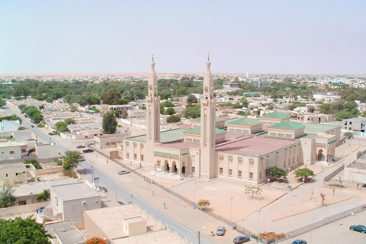 Saudi Mosque, Nouakchott
Climate Map
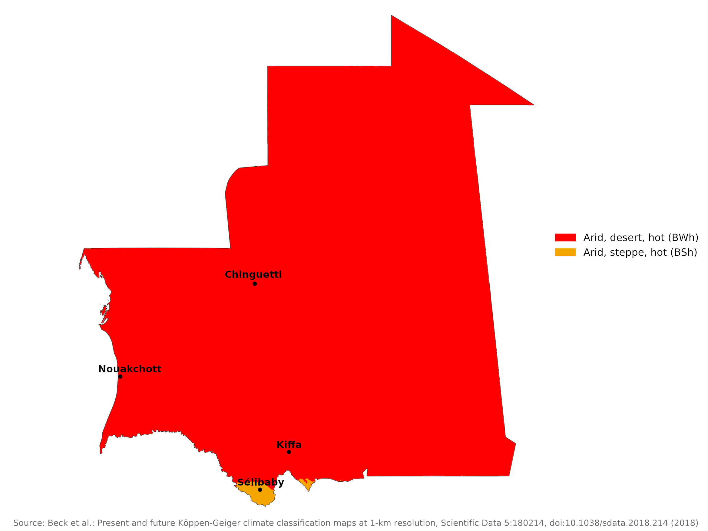 Climate map of Mauritania
What is the climate of Mauritania like?
Mauritania is a large but very sparsely populated country of West Africa, Mauritania occupies the western part of the Sahara desert with a coastline on the Atlantic Ocean and land borders with Western Sahara on the north, Algeria and Mali on the east, and Senegal on the south.
The climate is characterized by temperature extremes and sparse and irregular rainfall. The northern two-thirds of the country has an extremely hot, dry Saharan climate. The southern part of the country has a semi-desert Sahel climate. The coastal region, although still dry, has the most moderate temperatures due to the trade winds blowing in from the Atlantic Ocean. The harmattan, a hot dry wind, blows from the Sahara desert most of the year and is the dominant wind except along the narrow coastal strip, which is influenced by the oceanic trade winds.
Mauritania has a short rainy ("hivernage") season, from July to September, with average annual rainfall varying from 500 millimeters(20 inches) in the extreme south to under 100 millimeters (4 inches) in the northern two-thirds of the country. Belts of natural vegetation, matching the rainfall pattern, stretch east-west, ranging from traces of tropical forest along the Senegal River to scrub and savannah in the southeast. In the middle and in the north of the country you will find a sandy desert.
The north of the country is practically rain-free, but occasional downpours can occur at any time of the year. The southern half of the country experiences some unreliable and scant rainfall between June and October, when south-west winds (the West African monsoon) bring humid air from the South Atlantic. At this time of year there are more clouds and the air is quite humid. During the rest of the year, the prevailing winds are from the northeast, bringing very dry and sometimes dusty, hazy air from the northern Sahara. This is the harmattan of West Africa, which has very low humidity.
Sunshine is high all year round, averaging eight to ten hours a day. They are lowest in mid-winter when days are shorter, but are also reduced in mid-summer as this is the season when there is more cloud in the humid south-west winds. For much of the year the climate is too hot and dry during the day to be comfortable. Slightly cooler coastal conditions are due to daily sea breezes, but this is partially offset by higher humidity.
The Sahara
The Sahara zone makes up the northern two-thirds of the country. Afternoon temperatures in the hottest months average 40°C (104°F) and often exceed 46°C (115°F). Rain usually falls in August and September. Isolated storms often drop large amounts of water in a short period of time. In some places a year or even several years can pass without rain.
In December and January, temperatures range from 12°C (54°F) in the early morning to 24°C (75°F) in the afternoon. In May, June and July, temperatures range from 25°C (77°F) in the morning to over 40°C (104°F) in the afternoon. Throughout the year, the Harmattan often causes sandstorms.
| Climate data for Chinguetti | |||||||||||||
|---|---|---|---|---|---|---|---|---|---|---|---|---|---|
| Month | Jan | Feb | Mar | Apr | May | Jun | Jul | Aug | Sep | Oct | Nov | Dec | Year |
| Average high °C (°F) | 26.0 (78.8) | 28.6 (83.5) | 30.9 (87.6) | 33.5 (92.3) | 37.1 (98.8) | 40.5 (104.9) | 41.3 (106.3) | 40.4 (104.7) | 39.0 (102.2) | 36.0 (96.8) | 31.1 (88.0) | 26.2 (79.2) | 34.2 (93.6) |
| Daily mean °C (°F) | 18.8 (65.8) | 20.8 (69.4) | 23.2 (73.8) | 25.6 (78.1) | 29.1 (84.4) | 32.6 (90.7) | 33.5 (92.3) | 33.0 (91.4) | 31.8 (89.2) | 28.7 (83.7) | 23.9 (75.0) | 19.2 (66.6) | 26.7 (80.1) |
| Average low °C (°F) | 11.5 (52.7) | 13.0 (55.4) | 15.4 (59.7) | 17.7 (63.9) | 21.0 (69.8) | 24.7 (76.5) | 25.7 (78.3) | 25.5 (77.9) | 24.5 (76.1) | 21.3 (70.3) | 16.7 (62.1) | 12.2 (54.0) | 19.1 (66.4) |
| Average precipitation mm (inches) | 2 (0.1) | 2 (0.1) | 2 (0.1) | 0 (0) | 1 (0.0) | 2 (0.1) | 6 (0.2) | 18 (0.7) | 18 (0.7) | 7 (0.3) | 4 (0.2) | 2 (0.1) | 64 (2.5) |
| Source: Climate-data.org | |||||||||||||
The Sahel
The Sahel extends south of the Sahara to about 30 kilometers of the Senegal River. It forms an east-west belt of steppes and savannah grasslands. Herds of cattle, sheep and goats roam this zone in search of grazing land. Average summer temperatures in Kiffa in the south are around 35°C (95°F).
The rainy season begins earlier in the Sahel than in the Sahara, often lasting from June to October. Since farmers and herders depend on annual rainfall, delaying the start of the rainy season by a month can cause large losses and lead to mass migrations into Mali. The harmattan is the prevailing wind.
| Climate data for Kiffa | |||||||||||||
|---|---|---|---|---|---|---|---|---|---|---|---|---|---|
| Month | Jan | Feb | Mar | Apr | May | Jun | Jul | Aug | Sep | Oct | Nov | Dec | Year |
| Average high °C (°F) | 28 (82) | 32 (90) | 35 (95) | 39 (102) | 41 (106) | 41 (106) | 37 (99) | 36 (97) | 36 (97) | 37 (99) | 34 (93) | 30 (86) | 36 (97) |
| Daily mean °C (°F) | 23 (73) | 26 (79) | 28 (82) | 32 (90) | 35 (95) | 36 (97) | 33 (91) | 32 (90) | 32 (90) | 32 (90) | 28 (82) | 23 (73) | 30 (86) |
| Average low °C (°F) | 17 (63) | 18 (64) | 22 (72) | 26 (79) | 29 (84) | 30 (86) | 28 (82) | 27 (81) | 27 (81) | 26 (79) | 21 (70) | 17 (63) | 24 (75) |
| Average precipitation mm (inches) | 1 (0.0) | 1 (0.0) | 0 (0) | 0 (0) | 2 (0.1) | 22 (0.9) | 72 (2.8) | 120 (4.7) | 73 (2.9) | 15 (0.6) | 2 (0.1) | 2 (0.1) | 310 (12.2) |
| Source: Weatherbase | |||||||||||||
The Senegal River
The Senegal River Valley is a narrow belt of land stretching along the southern border of Mauritania.
The climate of the Senegal River Valley contrasts with that of the Sahara and Sahel zones. Rainfall is higher than other regions, and can reach 500 millimeters (20 inches) annually, typically between May and September. These rains, along with the annual flooding of the river, provide the basis for agriculture. The amount of precipitation varies greatly from year to year. Temperatures are cooler with less annual and daily variations than other regions.
| Climate data for Selibaby | |||||||||||||
|---|---|---|---|---|---|---|---|---|---|---|---|---|---|
| Month | Jan | Feb | Mar | Apr | May | Jun | Jul | Aug | Sep | Oct | Nov | Dec | Year |
| Average high °C (°F) | 33.5 (92.3) | 36.0 (96.8) | 38.7 (101.7) | 40.7 (105.3) | 41.1 (106.0) | 38.6 (101.5) | 34.7 (94.5) | 33.0 (91.4) | 34.2 (93.6) | 36.9 (98.4) | 36.3 (97.3) | 33.1 (91.6) | 36.4 (97.5) |
| Daily mean °C (°F) | 24.5 (76.1) | 26.7 (80.1) | 29.7 (85.5) | 32.4 (90.3) | 33.7 (92.7) | 32.4 (90.3) | 29.7 (85.5) | 28.4 (83.1) | 28.9 (84.0) | 29.7 (85.5) | 27.7 (81.9) | 24.8 (76.6) | 29.0 (84.2) |
| Average low °C (°F) | 15.5 (59.9) | 17.3 (63.1) | 20.6 (69.1) | 24.1 (75.4) | 26.2 (79.2) | 26.2 (79.2) | 24.6 (76.3) | 23.7 (74.7) | 23.5 (74.3) | 22.5 (72.5) | 19.0 (66.2) | 16.5 (61.7) | 21.6 (71.0) |
| Average precipitation mm (inches) | 0 (0) | 1 (0.0) | 0 (0) | 0 (0) | 3 (0.1) | 48 (1.9) | 109 (4.3) | 157 (6.2) | 109 (4.3) | 23 (0.9) | 1 (0.0) | 1 (0.0) | 452 (17.7) |
| Source: Climate-Data.org | |||||||||||||
The Coast
The coastal zone stretches along the Atlantic coast. The prevailing oceanic trade winds from the Canary Islands modify the influence of the harmattan and produce a humid but temperate climate. Rainfall here is minimal; in Nouakchott it averages less than 100 millimeters per year and occurs between July and September. The temperatures are more moderate than elsewhere. The average September temperature in the coastal town of Nouakchott is around 30°C (85°F) and 22°C (71°F) in January.
| Climate data for Nouakchott (1981–2010) | |||||||||||||
|---|---|---|---|---|---|---|---|---|---|---|---|---|---|
| Month | Jan | Feb | Mar | Apr | May | Jun | Jul | Aug | Sep | Oct | Nov | Dec | Year |
| Average high °C (°F) | 29.1 (84.4) | 30.8 (87.4) | 33.5 (92.3) | 34.8 (94.6) | 34.3 (93.7) | 34.7 (94.5) | 32.4 (90.3) | 33.0 (91.4) | 36.1 (97.0) | 36.7 (98.1) | 34.0 (93.2) | 31.0 (87.8) | 33.4 (92.1) |
| Daily mean °C (°F) | 21.5 (70.7) | 23.0 (73.4) | 24.2 (75.6) | 24.3 (75.7) | 25.8 (78.4) | 26.7 (80.1) | 27.3 (81.1) | 28.4 (83.1) | 29.6 (85.3) | 28.8 (83.8) | 25.8 (78.4) | 22.8 (73.0) | 25.7 (78.3) |
| Average low °C (°F) | 14.5 (58.1) | 16.4 (61.5) | 18.2 (64.8) | 19.1 (66.4) | 20.7 (69.3) | 22.8 (73.0) | 24.3 (75.7) | 25.4 (77.7) | 25.8 (78.4) | 23.8 (74.8) | 19.7 (67.5) | 16.9 (62.4) | 20.6 (69.1) |
| Average precipitation mm (inches) | 0.7 (0.03) | 1.5 (0.06) | 0.2 (0.01) | 0.1 (0.00) | 0.3 (0.01) | 1.9 (0.07) | 6.3 (0.25) | 36.8 (1.45) | 36.3 (1.43) | 6.3 (0.25) | 2.0 (0.08) | 2.8 (0.11) | 95.2 (3.75) |
| Source: Deutscher Wetterdienst | |||||||||||||
References
- E. A. Pearce, Charles Gordon Smith, (1990) The Hutchinson World Weather Guide, John Murray Press. ISBN 1859863426
- Timothy L. Gall, (ed.), (2003), Worldmark Encyclopedia of the Nations, Eleventh Edition, Thomson Gale
- Federal Research Division, Library of Congress, (1990), Mauritania: a country study. Claitor's Pub. Division.
- Hugh Chisholm, (ed.), (1911), Encyclopædia Britannica, Eleventh edition, Cambridge University Press
The Climate of
Mauritania
In summary:
The northern two-thirds of the country has an extremely hot, arid, Saharan climate. The southern part of the country has a semidesert, Sahelian climate. Average summer temperatures at Kiffa, in the south, are around 35°C (95°F). The coastal region, although still arid, has the most moderate temperatures. The average temperature in the coastal city of Nouakchott is around 26°C (78°F).
Northeasterly winds and the harmattan wind from the east keep Mauritania's climate dry, especially in the north. There is one rainy season from July to October. Annual rainfall on the coast averages about 100 mm (4 in).