The Climate of
Senegal
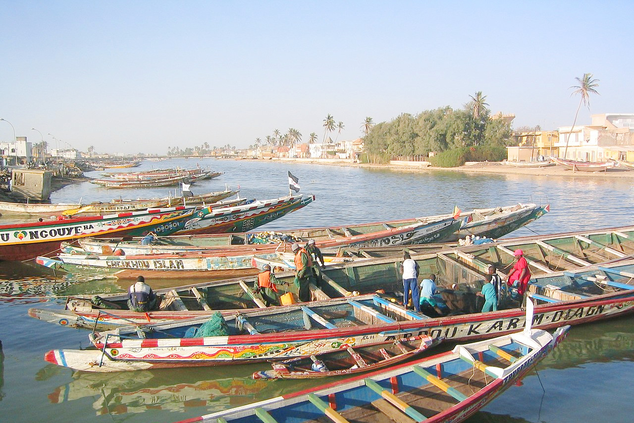
 Fishing boats of Île de Saint-Louis
Climate Map
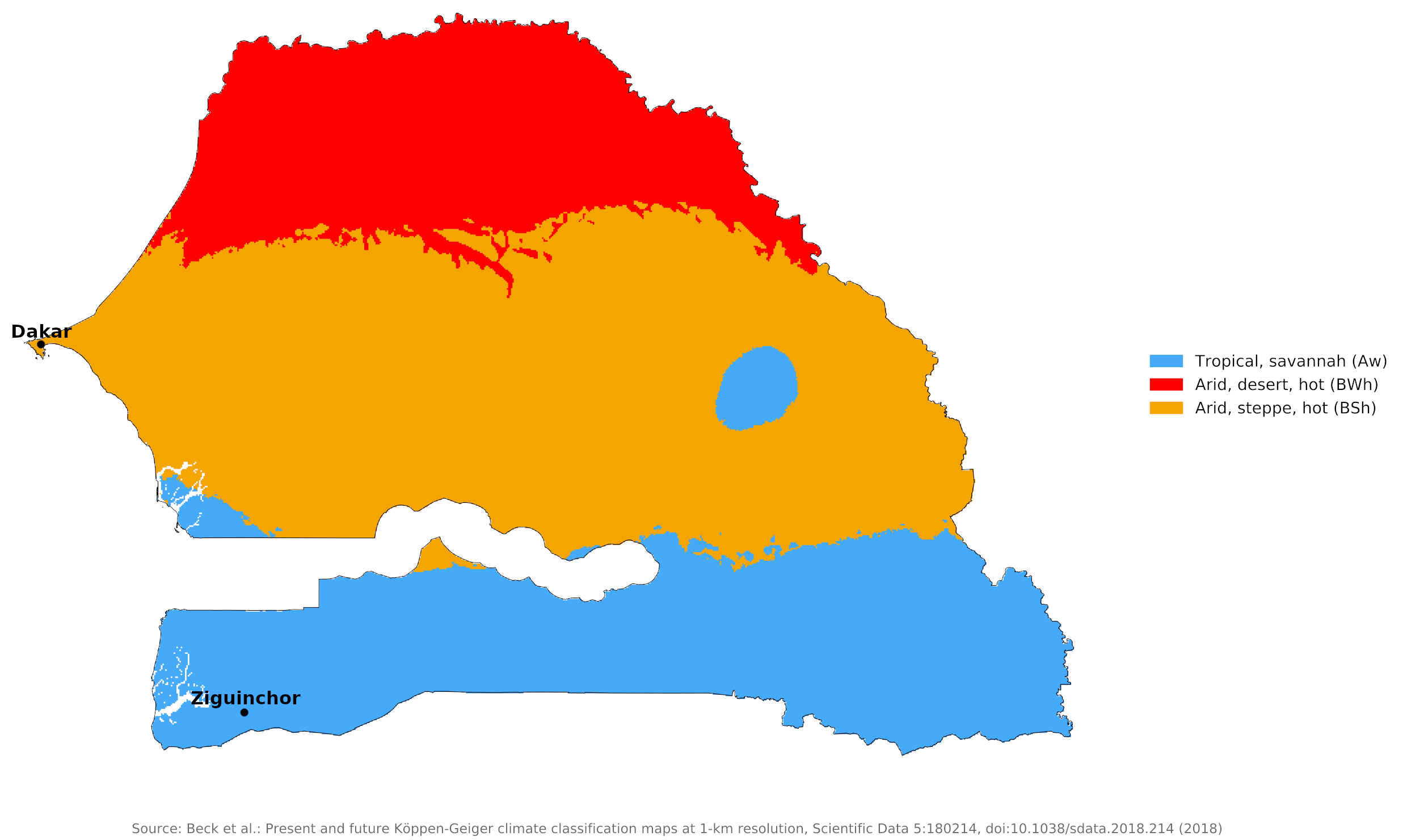
 Climate map of Senegal
What is the climate of Senegal like?
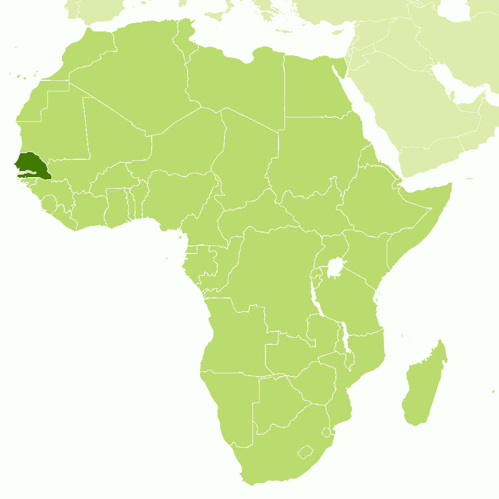
Senegal is on the west coast of Africa between 12° and 16°N. Its northern border with Mauritania is along the Senegal river. It has an eastern border with Mali and a southern border with Guinea and Guinea-Bissau. Senegal mostly surrounds Gambia to the west.
Senegal has a tropical climate with two well-defined dry and humid seasons resulting from alternating winds from the northeast. There is a single short rainy season between June and September at the time of high sun. Temperatures are high throughout the year but there is a relatively cooler period from December to April during which rain is very rare. The chief factors controlling the climate is latitude and distance from the sea. Temperatures are lowest along the coast and highest inland; rainfall is highest in the south and lowest in the north. At Dakar temperatures vary from 26°C (79°F) to 18°C (64°F) from December to April, and from 30°C (86°F) to 21°C (70°F) from May to November. The coastal area is fairly cool considering the latitude.
Rainfall increases from north to south in Senegal. The north of the country is affected by the intertropical belt of cloud and rain between June and September; during these months rain only falls on twenty to thirty days and the average annual rainfall is about 300 to 350 millimeters (12 to 14 inches). In the south annual rainfall increases to between 1,000 and 1,500 millimeters (40 to 60 inches) and falls on between sixty and ninety days (see Ziguinchor). Here the rainy season extends into October. At Dakar, in the centre of the country, rainfall amounts are between these two extremes. Northern Senegal, on the edge of the Sahara, experiences conditions similar to the Saharan districts of Mali and Mauritania.
Rainfall patterns are more erratic than in other parts of West Africa. Senegal's rainfall can vary, and the country has experienced long periods of drought. The amount for any given year may be normal, but the rainy season can vary greatly in beginning, length and end, particularly in central and northern Senegal.
There is a marked seasonal contrast between the wet season, when winds are from the southwest and west, blowing from the South Atlantic, and the dry season, when they blow from the northeast out of the Sahara. The southwesterlies are warm and humid while the northeasterly harmattan wind is hot and dry and frequently dust-laden. The harmattan wind can blow through the Sahel for many days. During the dry season, it blows out of the Sahara as a hot, dust-laden blast of air. Sudden thunderstorms with heavy downpours are frequent at the beginning and end of the rainy season, when gale force squalls and even occasional tornadoes can occur.
On the coast the humidity is increased by the frequent sea breezes, whereas inland the humidity is much lower during the time of the harmattan. Temperatures are also considerably higher inland than on the coast during the dry season, but they fall lower at night.
The climate of Senegal is most oppressive during the wet season, particularly on the coast, where there is a combination of high humidity and high night-time temperatures. Hours of sunshine average nine to ten a day throughout the year; sunshine hours are lower on the coast where there is more cloud and higher during the dry season.
| Climate data for Dakar (1981–2010) | |||||||||||||
|---|---|---|---|---|---|---|---|---|---|---|---|---|---|
| Month | Jan | Feb | Mar | Apr | May | Jun | Jul | Aug | Sep | Oct | Nov | Dec | Year |
| Average high °C (°F) | 25.3 (77.5) | 25.2 (77.4) | 25.4 (77.7) | 25.0 (77.0) | 26.0 (78.8) | 28.6 (83.5) | 30.0 (86.0) | 30.3 (86.5) | 30.7 (87.3) | 31.0 (87.8) | 29.8 (85.6) | 27.4 (81.3) | 27.9 (82.2) |
| Daily mean °C (°F) | 21.8 (71.2) | 21.6 (70.9) | 22.0 (71.6) | 22.1 (71.8) | 23.4 (74.1) | 26.1 (79.0) | 27.6 (81.7) | 27.8 (82.0) | 28.0 (82.4) | 28.2 (82.8) | 26.6 (79.9) | 24.2 (75.6) | 25.0 (76.9) |
| Average low °C (°F) | 18.3 (64.9) | 18.0 (64.4) | 18.5 (65.3) | 19.2 (66.6) | 20.7 (69.3) | 23.5 (74.3) | 25.1 (77.2) | 25.3 (77.5) | 25.2 (77.4) | 25.3 (77.5) | 23.3 (73.9) | 21.0 (69.8) | 22.0 (71.6) |
| Average precipitation mm (inches) | 1.0 (0.04) | 2.0 (0.08) | 0.3 (0.01) | 0.0 (0.0) | 0.1 (0.00) | 14.0 (0.55) | 51.0 (2.01) | 154.0 (6.06) | 133.0 (5.24) | 26.0 (1.02) | 9.2 (0.36) | 1.0 (0.04) | 391.6 (15.41) |
| Source: www.pogodaiklimat.ru | |||||||||||||
| Climate data for Ziguinchor | |||||||||||||
|---|---|---|---|---|---|---|---|---|---|---|---|---|---|
| Month | Jan | Feb | Mar | Apr | May | Jun | Jul | Aug | Sep | Oct | Nov | Dec | Year |
| Average high °C (°F) | 32.2 (90.0) | 34.4 (93.9) | 35.6 (96.1) | 35.6 (96.1) | 35.0 (95.0) | 33.3 (91.9) | 31.1 (88.0) | 29.4 (84.9) | 30.6 (87.1) | 31.7 (89.1) | 32.2 (90.0) | 30.6 (87.1) | 32.6 (90.8) |
| Daily mean °C (°F) | 24.5 (76.1) | 25.8 (78.4) | 27.5 (81.5) | 27.5 (81.5) | 28.6 (83.5) | 28.6 (83.5) | 27.2 (81.0) | 26.4 (79.5) | 27.0 (80.6) | 27.5 (81.5) | 27.0 (80.6) | 24.5 (76.1) | 26.8 (80.3) |
| Average low °C (°F) | 16.7 (62.1) | 17.2 (63.0) | 19.4 (66.9) | 19.4 (66.9) | 22.2 (72.0) | 23.9 (75.0) | 23.3 (73.9) | 23.3 (73.9) | 23.3 (73.9) | 23.3 (73.9) | 21.7 (71.1) | 18.3 (64.9) | 21.0 (69.8) |
| Average precipitation mm (inches) | 1 (0.0) | 1 (0.0) | 0 (0) | 0 (0) | 10.9 (0.43) | 120.9 (4.76) | 351.0 (13.82) | 556.0 (21.89) | 357.1 (14.06) | 154.9 (6.10) | 5.1 (0.20) | 1 (0.0) | 1,558.9 (61.26) |
| Source: Worldwide Bioclimatic Classification System | |||||||||||||
References
- E. A. Pearce, Charles Gordon Smith, (1990) The Hutchinson World Weather Guide, John Murray Press. ISBN 1859863426
- Timothy L. Gall, (ed.), (2003), Worldmark Encyclopedia of the Nations, Eleventh Edition, Thomson Gale
- Hugh Chisholm, (ed.), (1911), Encyclopædia Britannica, Eleventh edition, Cambridge University Press
The Climate of
Senegal

In summary:
Senegal has a tropical climate. Temperatures are lowest along the coast. At Dakar they vary from 26°C (79°F) to 18°C (64°F) from December to April, and from 30°C (86°F) to 21°C (70°F) from May to November.
The rainy season generally lasts from June through October. Rainfall is highest in the south and lowest in the north. The extreme north is semi-arid with rainfall as low as 300 mm (12 in). At Dakar, the average is 400 mm (16 in). In the far south annual rainfall increases to 1,500 mm (60 in).