The Climate of
Sudan
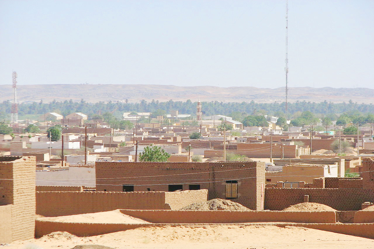
 Karima, a town in Northern State on a loop of the Nile
Climate Map
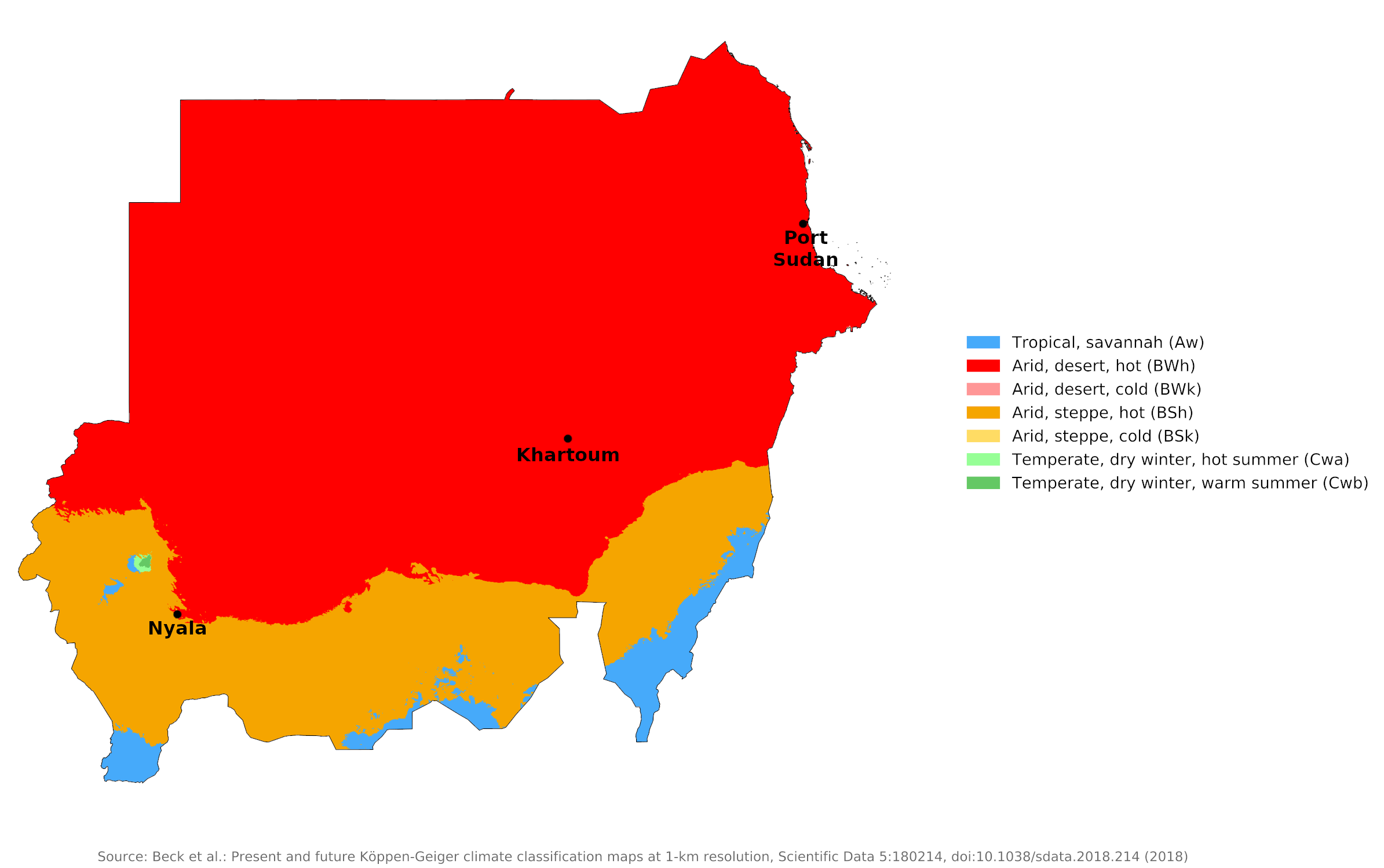
 Climate map of Sudan
What is the climate of Sudan like?
Sudan is a country in north-east Africa with a coast on the Red Sea. It is bordered by Egypt to the north, Eritrea and Ethiopia to the east, South Sudan to the south, and Chad to the west. Sudan lies entirely in the tropics; The land is generally a flat, featureless plain.
The climate in Sudan is hot and dry. Temperatures do not vary greatly with the seasons anywhere; The main climatic variables are rainfall and the length of the dry season. Variations in the length of the dry season depend on which of the two air currents predominate: dry north winds from the Sahara and Arabian Peninsula, or moist southwest winds from the Congo Basin and southeast winds from the Indian Ocean.
The northern part of the country is desert and has a climate similar to that of the Egyptian and Libyan Sahara. From Khartoum south to the southern border there is a progressive increase in annual rainfall from 150 millimeters (6 inches) to over 500 millimeters (20 inches). Most of the country is effectively in the Sahara Desert due to high evaporation during the very hot summer. November to February are the coolest months, with average January temperatures in Khartoum of 23°C (74°F).
The rainy season in Sudan is between April and October. The length of the rainy season shortens from four months in the south to about two months on the southern edges of the desert. The north is very dry—the occasional rains disappear into the parched sand and vast areas are deserted and bare of vegetation. The Red Sea coast and the coastal hills experience sporadic rainfall during the months of October to December.
The northern part of Sudan experiences nearly constant northeast winds year-round. In this dry air mass, the humidity is low during the day, which makes the very high daytime temperatures more bearable. During the cooler winter months, temperatures can occasionally drop quite low and early morning frosts are not unheard of in the desert. There is a progressive rise in temperature up to the highs reached in July and August when the thermometer rarely drops below 24°C (75°F) even at night.
In the southern part of Sudan, temperatures are the highest at the end of the dry season, when cloudless skies and dry air allow them to soar. In Khartoum, the hottest months are May and June, when average highs are 41°C (106°F), and temperatures can reach 48°C (118°F). Lows in Khartoum average 16°C (60°F) in January and have dropped as low as 6°C (43°F) after the passing of a cool front in winter.
From December to April, the entire country is under the influence of dry north-easterly winds. There is minimal rainfall countrywide, except for a small area in northwestern Sudan where the winds have passed over the Mediterranean and bring occasional light rains. Around May, the moist south-westerly winds reach southern Sudan. They bring slightly lower temperatures, higher humidity and more clouds. Originating in the Congo Basin, this humid southern air is the source of summer rain in Sudan. By July the moist air has reached Khartoum. The flow becomes weaker as it spreads north; and only rarely does the humid air reach the Egyptian border. In September, the dry north-easterly winds begin to strengthen and to push south, and by the end of November they cover the entire country.
In some years, the arrival of the southwesterlies and their rain in southern Sudan can be delayed, or they may not come at all. If that happens, severe drought follows.
An unpleasant and occasionally dangerous feature of the weather is the 'haboob', a local Arabic name for a violent but brief gust of wind that can kick up a thick cloud of dust or sand. This occurs in central Sudan when the moist southwesterly flow first arrives (May through July). The moist, unstable air forms thunderstorms in the heat of the afternoon. The initial downflow of air from an approaching storm produces a huge wall of dust and sand that can temporarily reduce visibility to zero. Haboobs are most likely to appear in the afternoons and evenings.
Port Sudan and Khartoum are representative of the northern coast and central regions of Sudan, respectively. Nyala shows conditions in the southwest all year round.
| Climate data for Port Sudan (1961–1990) | |||||||||||||
|---|---|---|---|---|---|---|---|---|---|---|---|---|---|
| Month | Jan | Feb | Mar | Apr | May | Jun | Jul | Aug | Sep | Oct | Nov | Dec | Year |
| Average high °C (°F) | 26.8 (80.2) | 27.0 (80.6) | 28.8 (83.8) | 31.4 (88.5) | 35.0 (95.0) | 38.5 (101.3) | 40.1 (104.2) | 40.2 (104.4) | 37.4 (99.3) | 33.4 (92.1) | 30.8 (87.4) | 28.8 (83.8) | 33.2 (91.8) |
| Daily mean °C (°F) | 23.3 (73.9) | 23.0 (73.4) | 24.3 (75.7) | 26.5 (79.7) | 29.3 (84.7) | 32.2 (90.0) | 34.1 (93.4) | 34.5 (94.1) | 32.1 (89.8) | 29.3 (84.7) | 27.3 (81.1) | 24.7 (76.5) | 28.4 (83.1) |
| Average low °C (°F) | 19.7 (67.5) | 19.0 (66.2) | 19.9 (67.8) | 21.6 (70.9) | 23.7 (74.7) | 25.9 (78.6) | 28.2 (82.8) | 28.9 (84.0) | 26.8 (80.2) | 25.3 (77.5) | 23.8 (74.8) | 21.3 (70.3) | 23.7 (74.7) |
| Average precipitation mm (inches) | 7.2 (0.28) | 0.9 (0.04) | 0.9 (0.04) | 0.2 (0.01) | 1.1 (0.04) | 0.2 (0.01) | 3.8 (0.15) | 1.4 (0.06) | 0.0 (0.0) | 13.9 (0.55) | 35.0 (1.38) | 10.0 (0.39) | 76.1 (3.00) |
| Source: NOAA | |||||||||||||
| Climate data for Khartoum (1971–2000) | |||||||||||||
|---|---|---|---|---|---|---|---|---|---|---|---|---|---|
| Month | Jan | Feb | Mar | Apr | May | Jun | Jul | Aug | Sep | Oct | Nov | Dec | Year |
| Average high °C (°F) | 30.7 (87.3) | 32.6 (90.7) | 36.5 (97.7) | 40.4 (104.7) | 41.9 (107.4) | 41.3 (106.3) | 38.5 (101.3) | 37.6 (99.7) | 38.7 (101.7) | 39.3 (102.7) | 35.2 (95.4) | 31.7 (89.1) | 37.0 (98.6) |
| Daily mean °C (°F) | 23.2 (73.8) | 25.0 (77.0) | 28.7 (83.7) | 31.9 (89.4) | 34.5 (94.1) | 34.3 (93.7) | 32.1 (89.8) | 31.5 (88.7) | 32.5 (90.5) | 32.4 (90.3) | 28.1 (82.6) | 24.5 (76.1) | 29.9 (85.8) |
| Average low °C (°F) | 15.6 (60.1) | 16.8 (62.2) | 20.3 (68.5) | 24.1 (75.4) | 27.3 (81.1) | 27.6 (81.7) | 26.2 (79.2) | 25.6 (78.1) | 26.3 (79.3) | 25.9 (78.6) | 21.0 (69.8) | 17.0 (62.6) | 22.8 (73.0) |
| Average precipitation mm (inches) | 0.0 (0.0) | 0.0 (0.0) | 0.1 (0.00) | 0.0 (0.0) | 3.9 (0.15) | 4.2 (0.17) | 29.6 (1.17) | 48.3 (1.90) | 26.7 (1.05) | 7.8 (0.31) | 0.7 (0.03) | 0.0 (0.0) | 121.3 (4.78) |
| Source: World Meteorological Organization | |||||||||||||
| Climate data for Nyala (1961-1990) | |||||||||||||
|---|---|---|---|---|---|---|---|---|---|---|---|---|---|
| Month | Jan | Feb | Mar | Apr | May | Jun | Jul | Aug | Sep | Oct | Nov | Dec | Year |
| Average high °C (°F) | 30.7 (87.3) | 32.8 (91.0) | 36.2 (97.2) | 37.1 (98.8) | 38.7 (101.7) | 35.3 (95.5) | 33.0 (91.4) | 32.2 (90.0) | 32.8 (91.0) | 34.4 (93.9) | 33.6 (92.5) | 31.0 (87.8) | 34.0 (93.2) |
| Daily mean °C (°F) | 23.1 (73.6) | 25.1 (77.2) | 28.3 (82.9) | 29.4 (84.9) | 31.3 (88.3) | 29.1 (84.4) | 27.7 (81.9) | 27.1 (80.8) | 26.9 (80.4) | 27.7 (81.9) | 26.5 (79.7) | 23.7 (74.7) | 27.2 (81.0) |
| Average low °C (°F) | 15.4 (59.7) | 17.3 (63.1) | 20.5 (68.9) | 21.7 (71.1) | 23.9 (75.0) | 22.9 (73.2) | 22.3 (72.1) | 21.9 (71.4) | 21.1 (70.0) | 21.1 (70.0) | 19.4 (66.9) | 16.5 (61.7) | 20.3 (68.5) |
| Average precipitation mm (inches) | 0.0 (0.0) | 0.0 (0.0) | 0.6 (0.02) | 2.3 (0.09) | 18.4 (0.72) | 49.3 (1.94) | 119.4 (4.70) | 118.3 (4.66) | 71.1 (2.80) | 18.9 (0.74) | 0.0 (0.0) | 0.0 (0.0) | 398.3 (15.67) |
| Source: NOAA | |||||||||||||
References
- E. A. Pearce, Charles Gordon Smith, (1990) The Hutchinson World Weather Guide, John Murray Press. ISBN 1859863426
- Timothy L. Gall, (ed.), (2003), Worldmark Encyclopedia of the Nations, Eleventh Edition, Thomson Gale
- Federal Research Division, Library of Congress, (2015), Sudan: a country study. Claitor's Pub. Division. ISBN 9780844407500
- Hugh Chisholm, (ed.), (1911), Encyclopædia Britannica, Eleventh edition, Cambridge University Press
The Climate of
Sudan

In summary:
Sudan has a hot and dry desert climate. Mean temperatures reach a high of 42°C (108°F) from March through June. November through February are the coolest months, with high temperatures of 32°C (90°F) and nighttime lows of 16°C (60°F). Average temperatures in the southern regions are 27°C (80°F).
Rainfall increases from north to south. In the north, annual rainfall totals are below 100 mm (4 in). The southern regions receive over 500 mm (20 in) of rain during the rainy season which lasts from April to October.