The Climate of
Uganda
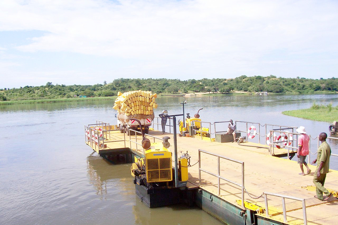 Crossing the White Nile near Murchison Falls National Park
Climate Map
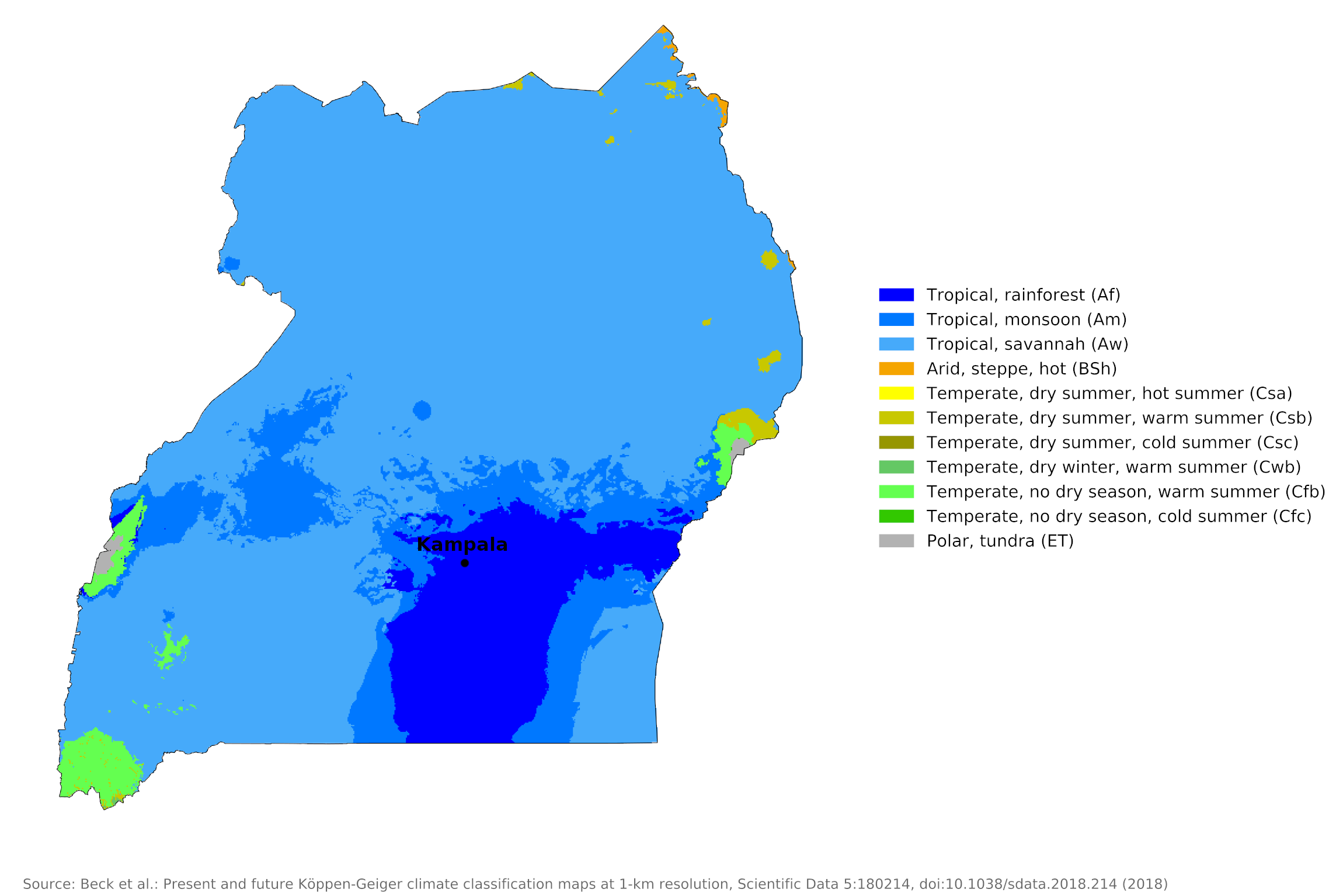 Climate map of Uganda
What is the climate of Uganda like?
Uganda is a landlocked East African country about the same size as the United Kingdom. It straddles the equator between 4°N and 1°S. It includes within its borders about half of Lake Victoria, the largest lake in Africa, about half of Lake Albert, and the whole of the smaller Lake Kyoga. These lakes form part of the source region of the White Nile, fed by the equatorial rains of Uganda and adjacent countries. The country is bordered on the north by South Sudan, east by Kenya, south by Tanzania and Rwanda, and west by the Democratic Republic of the Congo.
Uganda shares with Kenya and the Congo the same features of equatorial climate: there is plentiful sunshine, with temperatures moderated by the relatively high altitude of the country. Most of Uganda is a plateau 1,000 to 1,400 meters (3,500–4,500 feet) above sea level. In the west and southwest there are high mountains, including the Ruwenzori Range, which rise well over 3,000 meters (10,000 feet).
Although Uganda is on the equator, its climate is warm rather than hot, and temperatures vary little throughout the year. Temperature generally varies by altitude; in the lowest region near Lake Albert, the mean annual temperature is 25°C (77°F). At Kampala in the south, at 1,200 metres (4,000 feet), the mean annual temperature is 23°C (73°F). At Kabale in the southwest, at 2,000 metres (6,600 feet), the mean annual temperature is 16°C (73°F).
The sequence of weather and climate around the year is similar to that for Kenya. Much of Uganda, however, is rather wetter than Kenya. This is because of the influence of Lake Victoria, an important local source of atmospheric moisture, and thunderstorms; in addition, the west of the country is often influenced by moist southwesterly winds bringing rains from the Congo. The wettest areas are along the shores of Lake Victoria and the western mountain districts; these receive over 1,500 millimeters (60 inches) of rain per year. Parts of central and northeast Uganda receive less than 1,000 millimeters (40 inches) of rain per year; this is often much less since rainfall is unreliable from year to year.
Most of Uganda has the typical double rainy season found in the Kenya Highlands, usually beginning in early April and again in September. Towards the north these two rainy seasons tend to merge into a single long wet period between April and October, and a single dry period from November to March.
Over most of Uganda the weather is pleasant and not uncomfortable for much of the year. There is much sunny weather with daily hours of sunshine averaging from six to eight and only much less than this in the wetter mountain districts. Temperatures are never excessively high and humidity does not reach the consistently high levels found in equatorial lowlands. Wet spells lasting a day or two are not unusual but much of the rain comes in heavy thundery showers. There is no real cool season but the daily range of temperature is enough to make the nights cool rather than chilly.
Kampala, near Lake Victoria, is representative of conditions across much of the country.
| Climate data for Kampala | |||||||||||||
|---|---|---|---|---|---|---|---|---|---|---|---|---|---|
| Month | Jan | Feb | Mar | Apr | May | Jun | Jul | Aug | Sep | Oct | Nov | Dec | Year |
| Average high °C (°F) | 28.6 (83.5) | 29.3 (84.7) | 28.7 (83.7) | 27.7 (81.9) | 27.3 (81.1) | 27.1 (80.8) | 26.9 (80.4) | 27.2 (81.0) | 27.9 (82.2) | 27.7 (81.9) | 27.4 (81.3) | 27.9 (82.2) | 27.8 (82.0) |
| Daily mean °C (°F) | 23.2 (73.8) | 23.7 (74.7) | 23.4 (74.1) | 22.9 (73.2) | 22.6 (72.7) | 22.4 (72.3) | 22.0 (71.6) | 22.2 (72.0) | 22.6 (72.7) | 22.6 (72.7) | 22.5 (72.5) | 22.7 (72.9) | 22.7 (72.9) |
| Average low °C (°F) | 17.7 (63.9) | 18.0 (64.4) | 18.1 (64.6) | 18.0 (64.4) | 17.9 (64.2) | 17.6 (63.7) | 17.1 (62.8) | 17.1 (62.8) | 17.2 (63.0) | 17.4 (63.3) | 17.5 (63.5) | 17.5 (63.5) | 17.6 (63.7) |
| Average percipitation mm (inches) | 68.4 (2.69) | 63.0 (2.48) | 131.5 (5.18) | 169.3 (6.67) | 117.5 (4.63) | 69.2 (2.72) | 63.1 (2.48) | 95.7 (3.77) | 108.4 (4.27) | 138.0 (5.43) | 148.7 (5.85) | 91.5 (3.60) | 1,264.3 (49.77) |
| Source: World Meteorological Organization | |||||||||||||
References
- E. A. Pearce, Charles Gordon Smith, (1990) The Hutchinson World Weather Guide, John Murray Press. ISBN 1859863426
- Timothy L. Gall, (ed.), (2003), Worldmark Encyclopedia of the Nations, Eleventh Edition, Thomson Gale
- Federal Research Division, Library of Congress, (1992), Uganda: a country study. Claitor's Pub. Division. ISBN 0844407496
- Hugh Chisholm, (ed.), (1911), Encyclopædia Britannica, Eleventh edition, Cambridge University Press
The Climate of
Uganda
In summary:
Uganda has an equatorial climate, but since much of the country is on a high plateau the climate is warm rather than hot. At Lake Albert, annual temperatures range from 22° to 29°C (72° to 84°F). Temperatures are lower at higher altitudes, however. At Kampala, the average extremes are 17°C to 28°C (63°F to 82°F).
While most of Uganda receives an annual rainfall of at least 1,400 mm (40 in), the northeast receives only 700 mm (27 in). The areas around the lakes receive more rainfall on average. The city of Entebbe, on Lake Victoria, receives 1,600 mm (64 in).