.jpg)
.jpg)
The Geography of
Iceland
Why visit Iceland?
Iceland is a land of contrasts. The second largest island in Europe, it reaches to the very edge of the Arctic Circle. It is a land of fire and ice: there are deep coastal fjords, vast icefields, scores of volcanoes, and dramatic hot springs, an important source of heat for the island. Its people are among the most literate in the world; it was back in the 12th century that they developed the art of storytelling—the sagas—and later, writing. Their language has remained unchanged for centuries.
Contents
Map
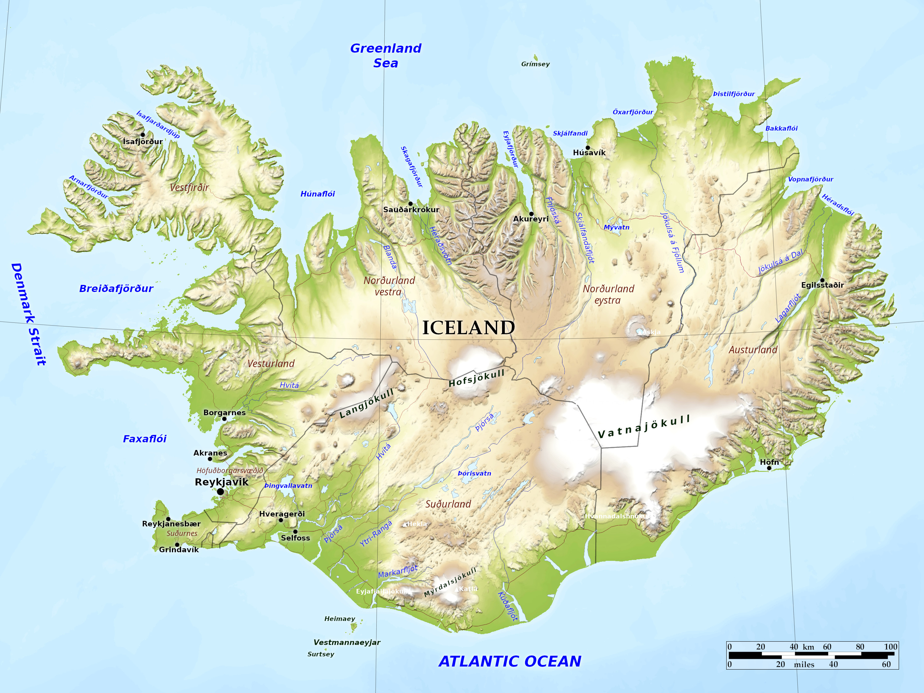 Relief map of Iceland
What is the landscape of Iceland like?
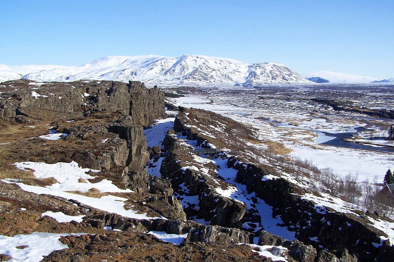
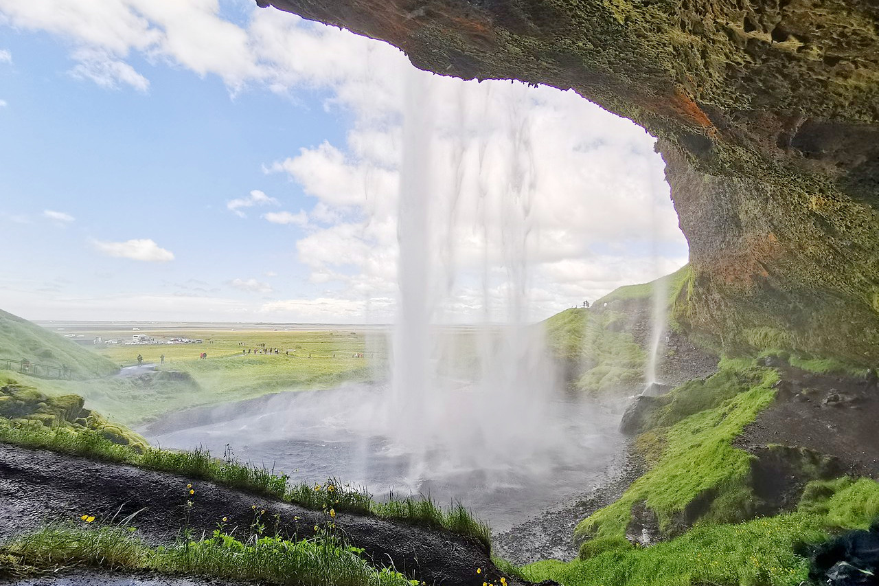
The landscape of Iceland is as unique as any geographical area in the world. It can be thought of as a large volcanic plateau, ringed by mountains, the highest of which is Hvannadalshnjúkur (2,110 m / 6,920 ft), in the south of the country. Lava fields cover about one-ninth of the country; glaciers cover about one-eighth. Geologically, the country is still very young and bears signs of still being in the making—the landscape often appears abrupt and jagged. There are also many lakes, snowfields, hot springs, and geysers (the word "geyser" itself is of Icelandic origin). Natural harbors are provided by fjords on the north, east, and west coasts.
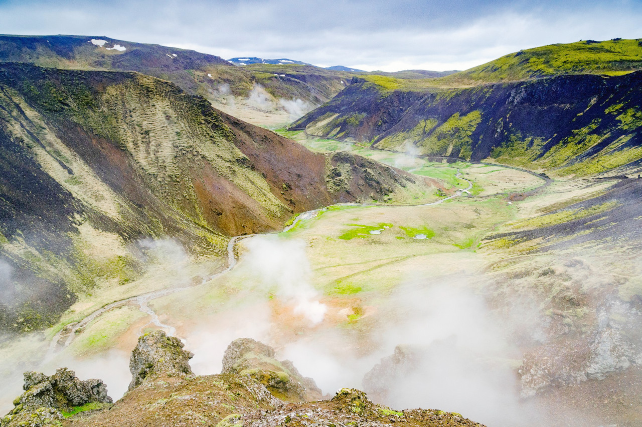
Iceland straddles the Mid-Atlantic Ridge, which is a volcanic fissure resulting from the continuing separation of the North American Plate and the Eurasian Plate. This plate activity is responsible for most of the volcanic and seismic activity in the country. This volcanic activity appears in the form of lava flows and hot springs. They are comparable with those of the North Island of New Zealand, and provide a feature unique in Europe.
.jpg&oldid=474754636)
.jpg&oldid=588428877)
The island is more densely populated with volcanoes than any other comparable region, with at least 200 volcanoes. Of these, thrity have been active in historic times, from which there have been more than 150 eruptions recorded since Iceland was first settled in the 9th century. It has been estimated that since the year 1500, Iceland's volcanoes have produced one third of the world's lava. As a result, lava covers about one eighth of the island's surface.
Among the many active volcanoes there is an average of about one eruption every five years. Many of them are blanketed by perpetual ice, such as those under the Vatnajökull glacier: Grímsvötn and Bardarbunga. The thermal contrast results in volcanic heat continuously melting the glacier ice above, which forms into large intricately dammed reservoirs. When these volcanoes become active, the eruption of lava and fire is accompanied by a flood of released waters. This phenomenon is called a "glacier burst."
Glaciers cover 11 percent of the total land area. Nearly all types of glaciers, from small cirque glaciers to extensive plateau icecaps, can be found. The biggest of these icecaps, Vatnajökull, with a maximum thickness of 1,000 meters (3,281 feet), is larger than all the glaciers in continental Europe put together.
What is the nature of Iceland like?
A thousand years ago forests of birch were a feature of Iceland’s landscape, but the period of human occupation has removed most of them. Birch today grows as a dwarf tree in Iceland, and spreads widely, particularly in the mountain regions of the northeast, as a shrub. Other trees include ash, aspen, and willow. The main plantlife is made up of grass, mosses, heather, and small shrubs. Over three hundred different species of flowers have been listed, but most of these are sparsely located.
The chief indigenous animal is the fox. Wild reindeer, introduced in the 18th century and once abundant, were almost exterminated and therefore have been protected in recent years; they are found chiefly in the northeastern highlands. The waters around Iceland abound in whales, many types of seals, and many kinds of fish. Dolphin, grampus, porpoise, and rorqual are numerous.
The bird life is rich. Over seventy species breed in Iceland, and many others are seen regularly during migration and while wintering on the island. The ptarmigan is a characteristic bird of Iceland. Its distribution extends all over the island, although it is far from common everywhere. Its population fluctuates in ten-year cycles. Other characteristic indigenous birds are swan, eagle, falcon, and gannet, all rare now and protected. Iceland has no reptiles or frogs and very little insect life.
.jpg) Þingeyri, Vestfirðir
Þingeyri, Vestfirðir
.jpg&oldid=599949509)
What is the climate of Iceland like?
See our main article: The Climate of Iceland
Although close to the Arctic Circle, Iceland’s climate is fairly mild because of the Gulf Stream, part of which almost encircles the island. The mean annual temperature at Reykjavík is about 5°C (about 41°F), with a range from -1°C (31°F) in January to 11°C (52°F) in July. In the northwestern, northern, and eastern coastal regions, temperatures are generally lower.
Annual rainfall in the north ranges from 300 to 700 mm (12 to 28 in); in the south, 1,250 to 2,000 mm (50 to 80 in); and in the mountains, up to 4,500 mm (180 in). Winters are long and fairly mild, summers short and cool. Summer days are long and nights short; in winter, days are short and nights long.
| Climate data for Reykjavík (1991–2020) | |||||||||||||
|---|---|---|---|---|---|---|---|---|---|---|---|---|---|
| Month | Jan | Feb | Mar | Apr | May | Jun | Jul | Aug | Sep | Oct | Nov | Dec | Year |
| Average high °C (°F) | 3.1 (37.6) | 3.3 (37.9) | 4.0 (39.2) | 6.8 (44.2) | 9.8 (49.6) | 12.7 (54.9) | 14.6 (58.3) | 13.9 (57.0) | 11.1 (52.0) | 7.5 (45.5) | 4.5 (40.1) | 3.3 (37.9) | 7.9 (46.2) |
| Daily mean °C (°F) | 0.7 (33.3) | 0.6 (33.1) | 1.2 (34.2) | 3.7 (38.7) | 6.7 (44.1) | 9.8 (49.6) | 11.6 (52.9) | 11.0 (51.8) | 8.2 (46.8) | 4.9 (40.8) | 2.2 (36.0) | 0.8 (33.4) | 5.1 (41.2) |
| Average low °C (°F) | −1.8 (28.8) | −1.9 (28.6) | −1.3 (29.7) | 1.2 (34.2) | 3.9 (39.0) | 7.7 (45.9) | 8.8 (47.8) | 8.7 (47.7) | 5.9 (42.6) | 2.7 (36.9) | −0.2 (31.6) | −1.6 (29.1) | 2.7 (36.8) |
| Average precipitation mm (inches) | 83.0 (3.27) | 85.9 (3.38) | 81.4 (3.20) | 56.0 (2.20) | 52.8 (2.08) | 43.8 (1.72) | 52.3 (2.06) | 67.3 (2.65) | 73.5 (2.89) | 74.4 (2.93) | 78.8 (3.10) | 94.1 (3.70) | 843.3 (33.20) |
| Average snowfall cm (inches) | 19.9 (7.8) | 17.1 (6.7) | 23.2 (9.1) | 12.1 (4.8) | 1.6 (0.6) | 0.0 (0.0) | 0.0 (0.0) | 0.0 (0.0) | 0.0 (0.0) | 1.4 (0.6) | 8.7 (3.4) | 17.8 (7.0) | 101.8 (40.1) |
| Source: Icelandic Meteorological Office | |||||||||||||
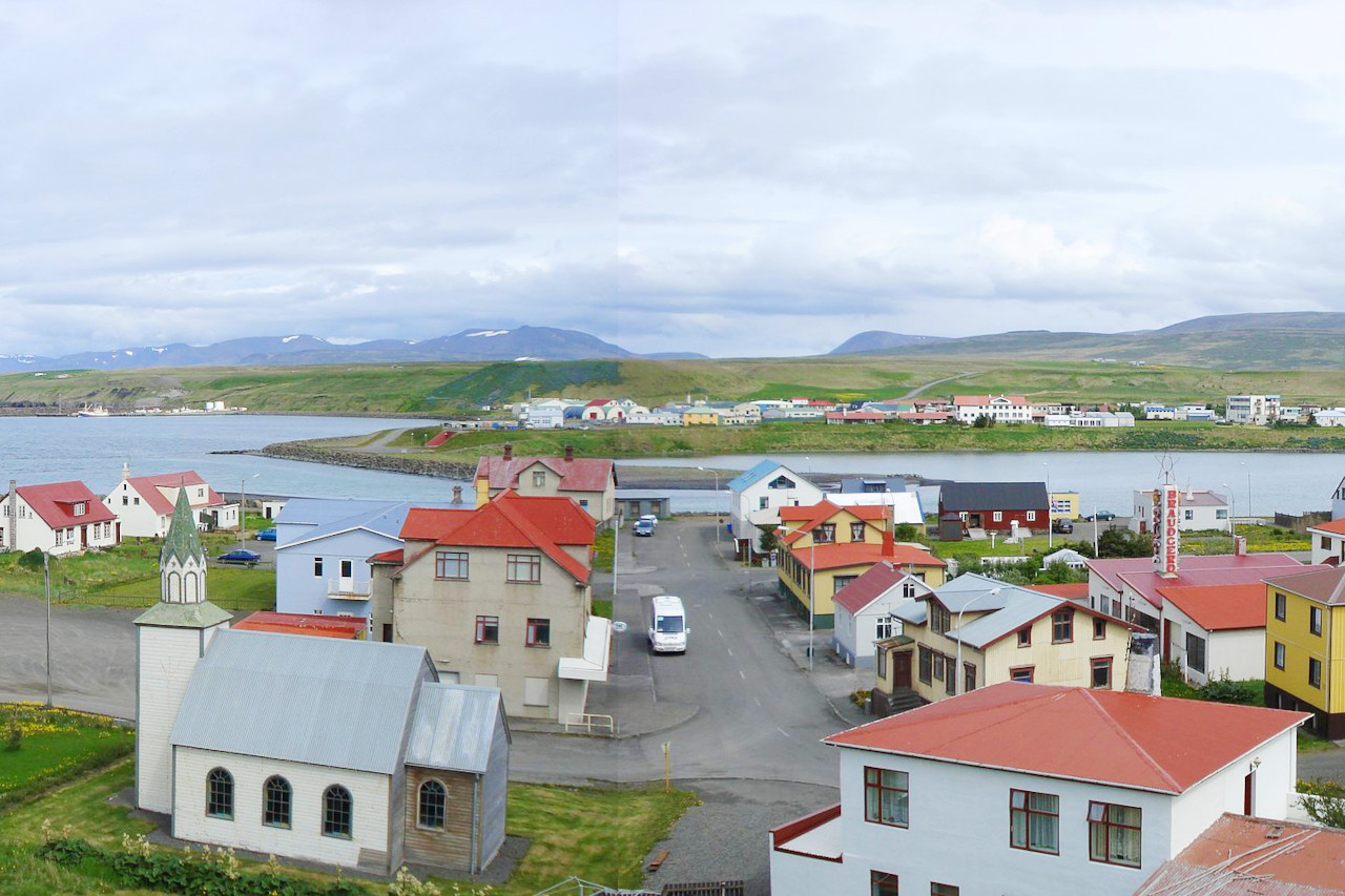 Blönduós, Norðurland vestra
The official websites
Iceland
The Land of Fire and Ice
| Location: | In the North Atlantic Ocean, just below the Arctic Circle |
| Coordinates: | 65° 00′ N, 18° 30′ W |
| Size: | • 350 km N-S; 525 km E-W • 215 miles N-S; 325 miles E-W |
| Terrain: | A central volcanic plateau, with snowfields and icecaps. Lowlands along the southwest coast and in the valleys |
| Climate: | Cool but temperate; moderated by North Atlantic Current; cool, windy winters; damp, mild summers |
| Highest point: | Hvannadalshnjúkur 2,110 m / 6,920 ft |
| Forest: | 4% (2010 est.) (source) |
| Population: | 357,603 (2022 est.) |
| Population density: | Very Low (3.5/km²) |
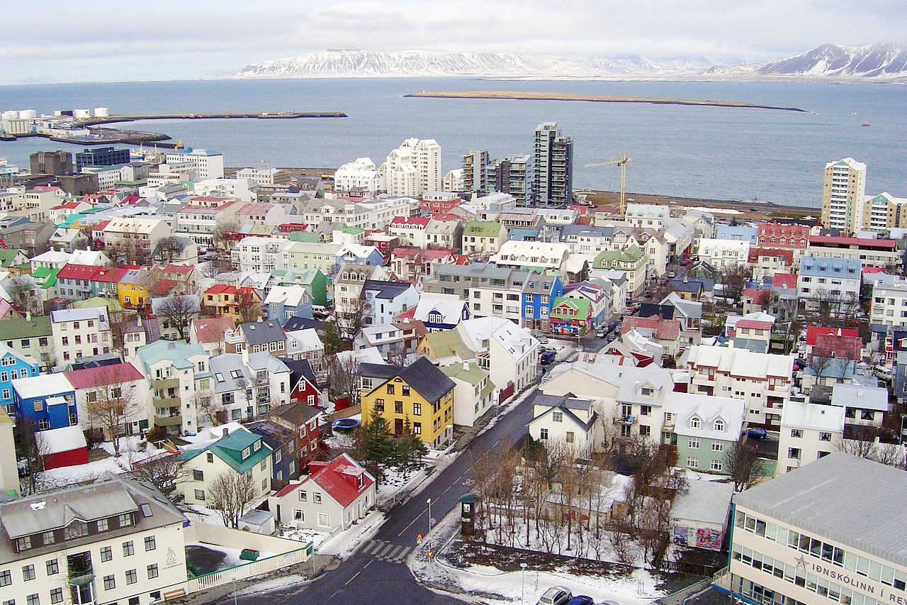
| Capital: | Reykjavík |
| Languages: | Icelandic. English widely spoken |
| Human Development Index: | Very high (0.959) |
| Currency: | Icelandic króna |