The Geography of
Basilicata
Why visit Basilicata?
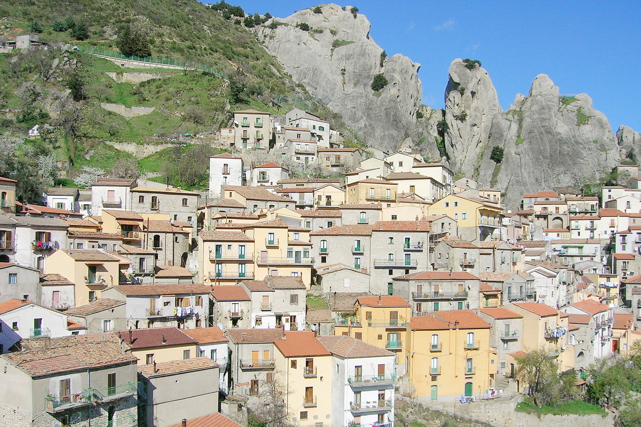
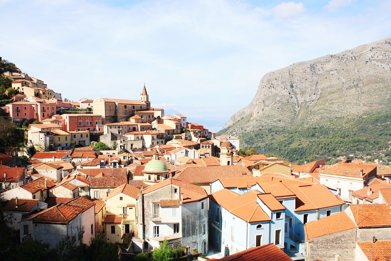
Basilicata is a wild and disjointed country, and largely mountainous. Considered one of the most isolated regions of Italy, and once a region of bandits and outlaws. Inland there is an absence of plains, the only flat parts being small plateaux and valley bottoms. The mountain summits are covered with forests.
Contents
Map
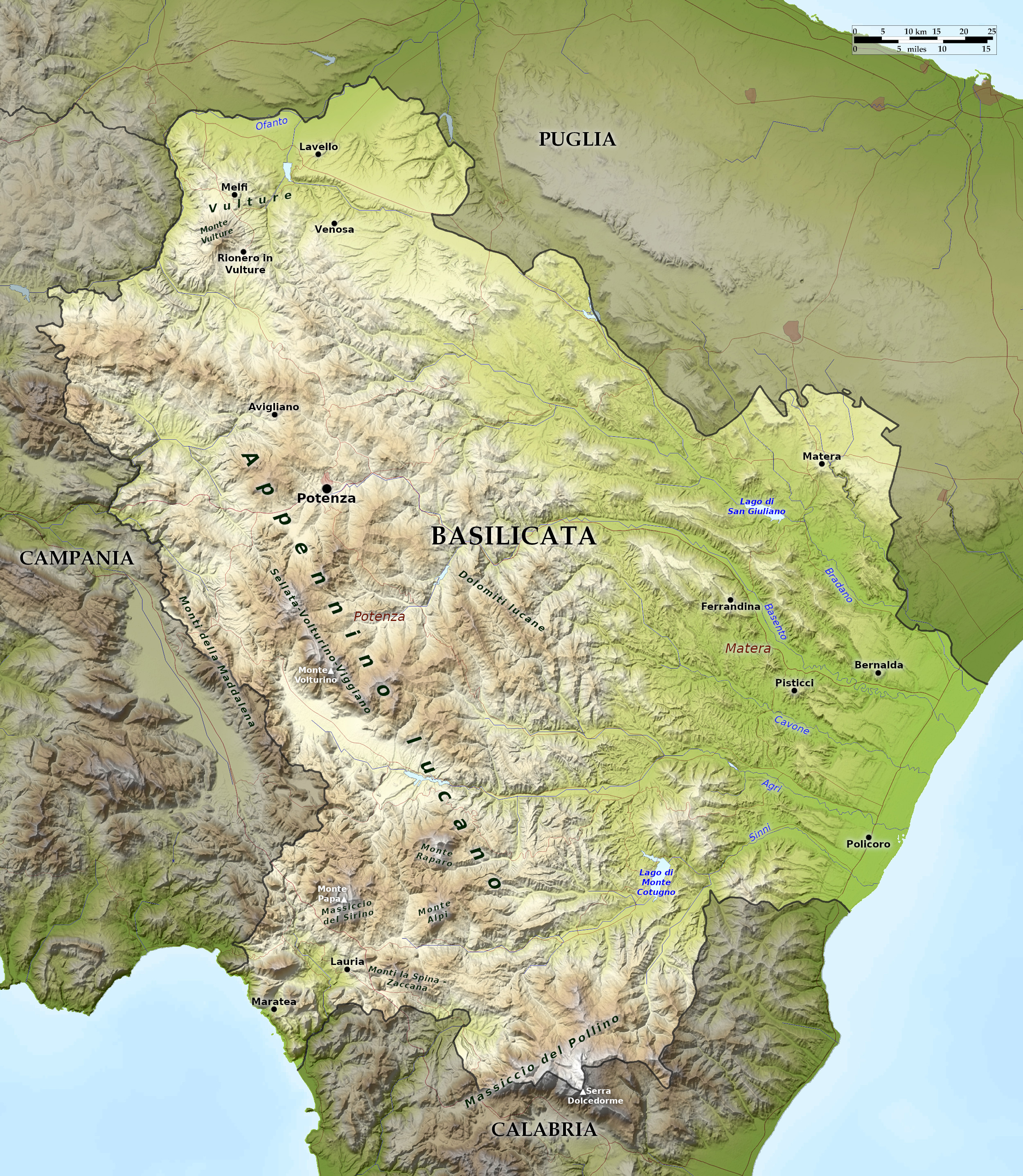 Relief map of Basilicata
What is the landscape of Basilicata like?
Basilicata is as a whole a mountainous region, dominated by the mountains of the Lucanian Apennines. The highest peak is Serra Dolcedorme (2,267 m / 7,438 ft) on the border of Calabria in the south. Monte Vulture, at the northwest corner, is an extinct volcano (1,326 m / 4,350 ft). Almost half of the region is mountains, and another 45 percent of Basilicata is hills. Along the Ionian shore the Metaponto plain, Basilicata's largest plain, spills into Apulia.
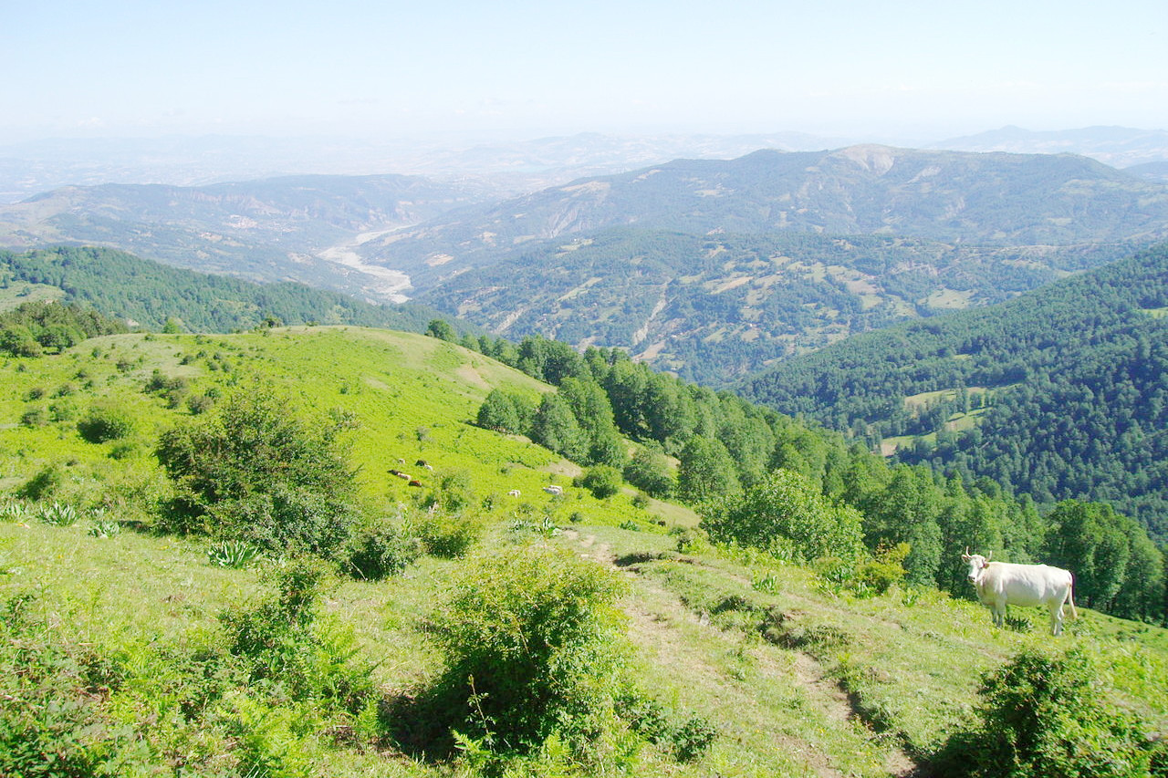
The north of the region has plateaus and low forested mountains with an average height of 1,200 to 1,500 meters. The mountains of the west and southwest represent the true Lucanian mountains with altitudes higher than 2,000 meters and a strong presence of forests. Hills dominate the center and east often with a large presence of eroded gullies. The Metaponto plain is in the southeast—it is an alluvial coastal plain with much agriculture and a low and sandy type of coastline.
What is the nature of Basilicata like?
The north of the region has forests that consist mainly of chestnut, turkey oak and beech trees, accompanied by tree and shrub species such as downy oak, sycamore and poplar. Southern mountains also feature the Italian alder and the Bosnian pine, emblem of the Pollino National Park, which stands imposing in groups or isolated. The Pollino area has, in addition to the Apennine forest, sandy and rocky places, where there is a low scrubland vegetation called garrigue. In other places the "Mediterranean steppe" predominates with perennial grasses with some specimens of juniper up to 900 meters (3,000 feet) altitude.
In the coastal areas there are sporadic woods with typical Mediterranean trees and shrubs such as the downy oak, the strawberry tree, the carob tree and the holm oak, the juniper, the mastic tree, the broom, and species of the "garrigue" such as the rockrose, the butcher's broom, the thorny thyme, the ferula and the asphodel. There are also many flowers.
What is the climate of Basilicata like?
The climate of Basilicata changes from area to area, but in general the climate of the region can be defined as continental, with Mediterranean characteristics only in the coastal areas. The coast has mild and rainy winters and hot and dry summers, but once you reach the hills, the winters become cold and foggy although the summers are still hot and dry. In the mountains which corresponds to almost half of the regional territory, the winters are very cold, with snow on the ground until mid-spring. Summers are moderately hot, although night temperatures can be very cool.
| Climate data for Potenza | |||||||||||||
|---|---|---|---|---|---|---|---|---|---|---|---|---|---|
| Month | Jan | Feb | Mar | Apr | May | Jun | Jul | Aug | Sep | Oct | Nov | Dec | Year |
| Average high °C (°F) | 6.9 (44.4) | 7.2 (45.0) | 9.7 (49.5) | 12.8 (55.0) | 18.1 (64.6) | 22.3 (72.1) | 25.7 (78.3) | 25.8 (78.4) | 21.7 (71.1) | 16.5 (61.7) | 11.0 (51.8) | 7.9 (46.2) | 15.5 (59.8) |
| Daily mean °C (°F) | 4.0 (39.2) | 4.1 (39.4) | 6.1 (43.0) | 8.8 (47.8) | 13.7 (56.7) | 17.5 (63.5) | 20.6 (69.1) | 20.7 (69.3) | 17.2 (63.0) | 12.7 (54.9) | 7.9 (46.2) | 5.1 (41.2) | 11.5 (52.8) |
| Average low °C (°F) | 1.2 (34.2) | 1.1 (34.0) | 2.5 (36.5) | 4.8 (40.6) | 9.2 (48.6) | 12.7 (54.9) | 15.4 (59.7) | 15.7 (60.3) | 12.7 (54.9) | 8.9 (48.0) | 4.7 (40.5) | 2.3 (36.1) | 7.6 (45.7) |
| Average precipitation mm (inches) | 55.7 (2.19) | 63.0 (2.48) | 48.6 (1.91) | 66.8 (2.63) | 42.8 (1.69) | 30.4 (1.20) | 26.1 (1.03) | 32.6 (1.28) | 46.2 (1.82) | 61.6 (2.43) | 73.3 (2.89) | 66.0 (2.60) | 613.1 (24.15) |
| Source: Servizio Meteorologico | |||||||||||||
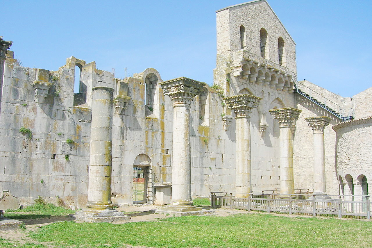
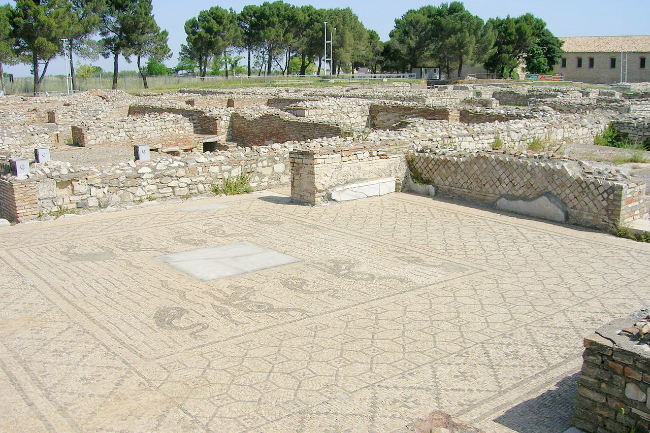 Ancient Roman mosaic in Venosa
The official websites
Basilicata
Italy's wild south
| Location: | Southern Italy |
| Coordinates: | 40° 30′ N, 16° 00′ E |
| Size: | • 140 km N-S; 130 km E-W • 85 miles N-S; 80 miles E-W |
| Terrain: | Almost half of the region is mountainous, the remainder is hilly with coastal plains |
| Climate: | Hot, dry summers with mild winters on the coast. Cooler and wetter in the mountains, with cold, snowy winters |
| Highest point: | Serra Dolcedorme 2,267 m |
| Forest: | 33% (2010 est.) (source) |
| Population: | 575,902 (2012) |
| Population density: | Low (58/km²) |
| Capital: | Potenza |
| Languages: | Italian |
| Human Development Index: | Very High (0.862) |