
The Geography of
Panamá
Why visit Panamá?
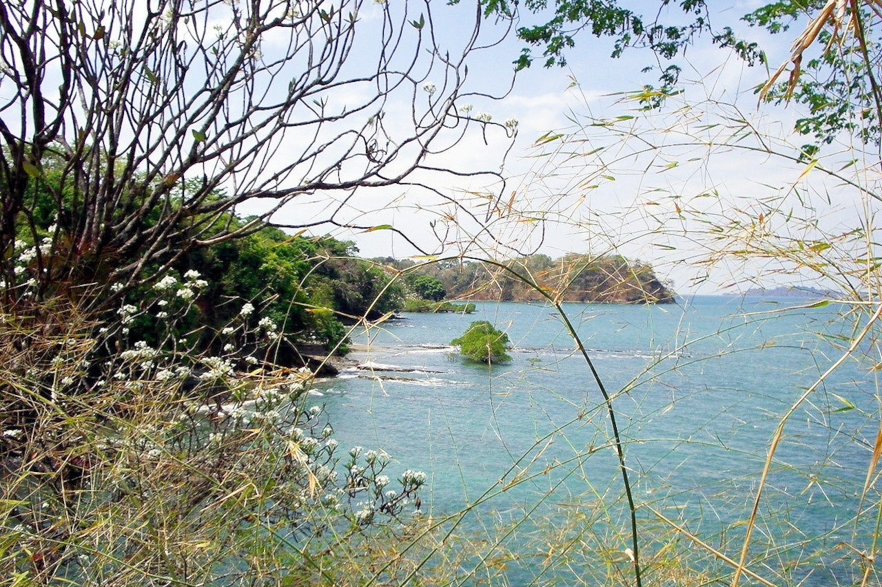
Panamá's beautiful islands, rich culture, varied plant and animal life, and historic canal attract visitors from around the world. The country excels in untrammeled natural beauty, from the cool, fertile highlands in the Chiriqui region to the thick lowland jungle and white-sand beaches of Panamá's tropical islands
Contents
Map
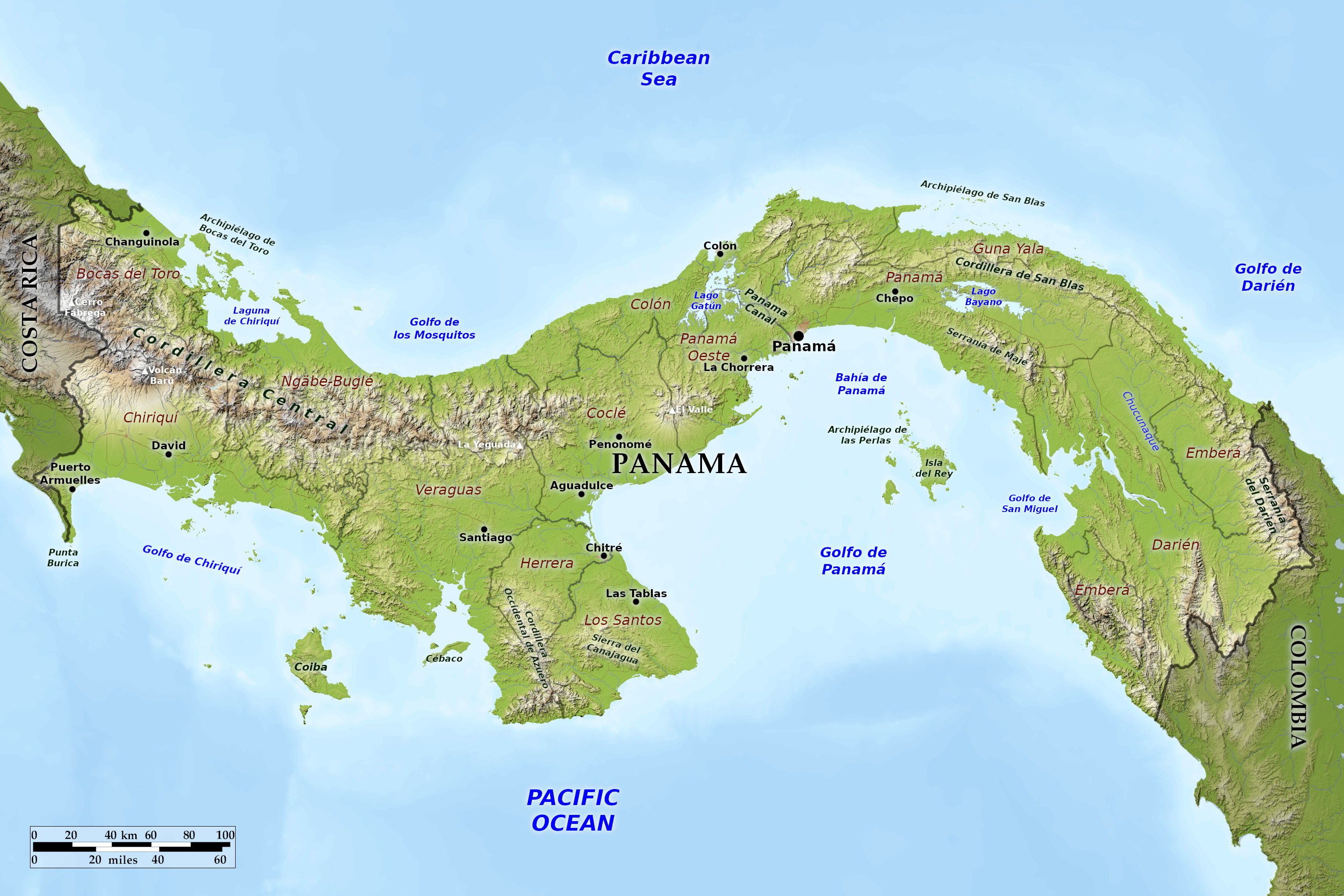 Relief map of Panamá
What is the landscape of Panamá like?
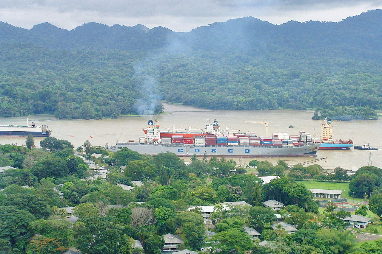
Panamá is located at the narrowest part of the Isthmus of Panamá, which connects North America and South America. To the east is Colombia and to the west is Costa Rica. Due to the S-shaped nature of the country, the directions are often surprising. For example, a passage through the Panamá Canal from the Pacific to the Caribbean is heading northwest rather than east, and in Panamá City the sunrise is over the Pacific.
Coasts
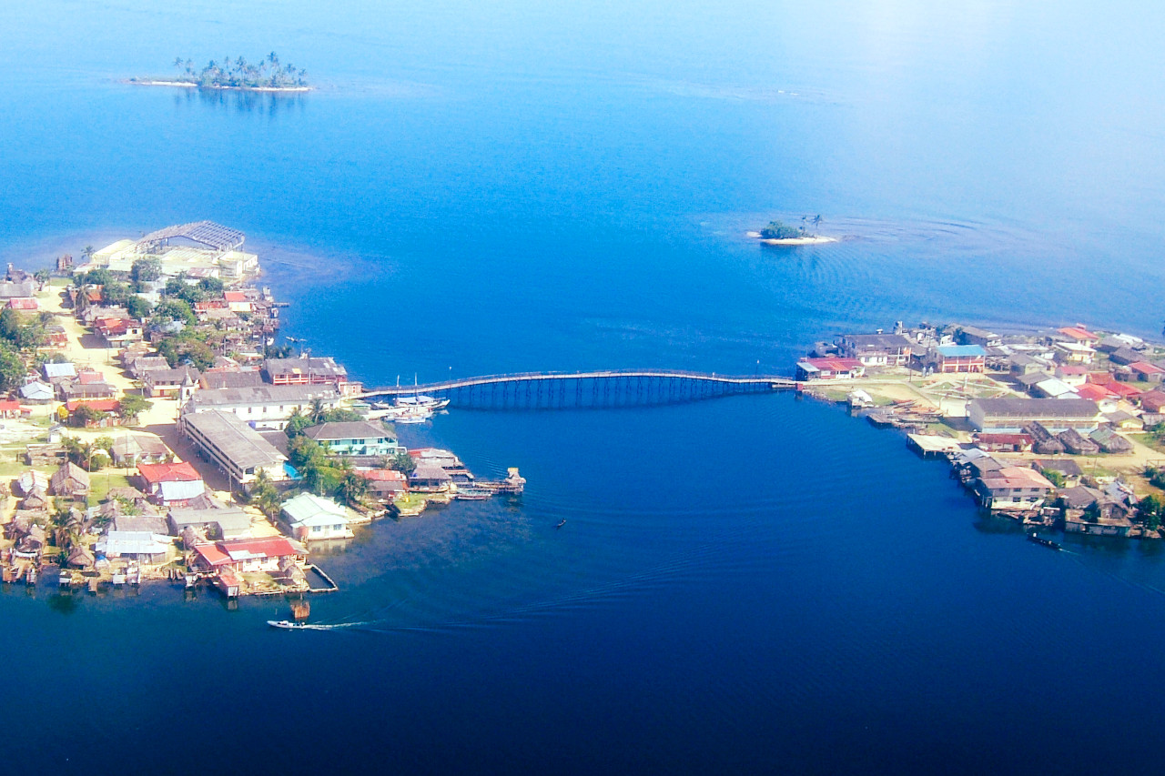
Panamá's two coasts are referred to as the Caribbean (or Atlantic) and Pacific rather than the north and south coasts. The Caribbean coast is characterized by several good natural harbors. The numerous islands of the Archipielago de Bocas del Toro near the border with Costa Rica separate the Bay of Almirante and the Lagoon of Chiriquí from the open Caribbean Sea. The more than 350 San Bias Islands near Colombia stretch more than 160 kilometers (100 miles) along the sheltered Caribbean coast.
The main port on the Pacific coast is Balboa at the Pacific entrance to the Panamá Canal. The main islands are those of the Archipielago de las Perlas in the middle of the Gulf of Panamá, the large Isla de Coiba in the Gulf of Chiriquí, and the picturesque island of Taboga, a tourist attraction that can be seen from Panamá City. In total there are about 1,000 islands off the Pacific coast.
The coastal waters of the Pacific are exceptionally shallow. Vast tidal flats extend up to 70 kilometers seaward from the coasts. As a result, the tidal range is extreme. A discrepancy of about 70 centimeters between high and low tide on the Caribbean coast is in stark contrast to over 700 centimeters on the Pacific coast
The Pacific coastal waters are extraordinarily shallow. Wide mud flats extend up to 70 kilometers (43 miles) seaward from the coastlines. As a consequence, the tidal range is extreme. A variation of about 70 centimeters (28 inches) between high and low water on the Caribbean coast contrasts sharply with over 700 centimeters (280 inches) on the Pacific coast.
Mountains

The dominant feature of the country's landform is the central ridge of mountains and hills that forms the Continental Divide. The divide is not part of the great mountain ranges of North America, and only near the Colombian border are there highlands related to the Andean system of South America. The spine that forms the mountains is the heavily eroded arch of an uplift from the sea floor in which peaks have been formed by volcanic intrusion.
The mountain range is called the Cordillera de Talamanca near the border with Costa Rica. Further east it becomes the Serrania de Tabasara, and the part of it closer to the lower saddle of the isthmus where the Canal is located is often referred to as the Sierra de Veraguas. Overall, the mountain range between Costa Rica and the Canal is commonly referred to as the Cordillera Central.
The country's highest point is Volcán Barú, which rises to nearly 3,500 meters (12,000 feet). The summit of a highland that encompasses the nation's richest soil, Volcán Barú is still referred to as a volcano despite being dormant for more than one thousand years.
Nearly 500 rivers criss-cross Panamá's rugged landscape. Many arise as fast upland streams, meandering in valleys and forming coastal deltas. The Rio Chagres is one of the longest and most vital of the approximately 150 rivers that flow into the Caribbean. Part of this river was dammed to create Gatún Lake, which forms much of the transit route between the locks near each end of the canal. The Rio Chepo is one of more than 300 rivers that flow into the Pacific. These Pacific oriented rivers are longer and slower than those on the Caribbean side. Their basins are also larger.
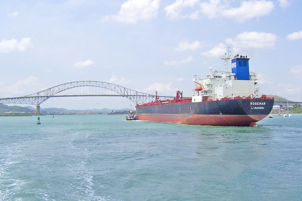 Bridge of the Americas, Panamá Canal
What is the nature of Panamá like?
Most of Panamá is dense rainforest with occasional patches of savannah or prairie. On the humid Caribbean coast, the forest is evergreen, while on the drier Pacific side, the forest is semi-deciduous. On the Pacific coast there are some regions with natural savannas. The tropical rainforests on the mountain slopes of the Caribbean region, especially in the Darién region near Colombia, have an extremely high biodiversity with species from North and South America. There are also dwarf forests and cloud forests in the mountains.
There are thousands of species of flowering plants, and these include the national flower, the Holy Ghost orchid. Mammals inhabiting the isthmus are the anteater, armadillo, bat, coati, deer, opossum, peccary, raccoon, tapir, and many varieties of monkey. Reptiles, especially alligators, are numerous along the coasts. Bird life is rich. Gatún Lake, formed by damming the Chagres River, is Panamá’s largest lake; it is an important bird habitat and includes the Barro Colorado wildlife refuge.
What is the climate of Panamá like?
See our main article: The Climate of Panamá
Panamá is tropical, but temperatures vary according to location and altitude. The annual average temperature on both coasts is 28°C (83°F), and it ranges from 10° to 19°C (50 to 66°F) at various mountain elevations. There is little seasonal change in temperature.
Rainfall averages 1,900 mm (75 in) in Panamá City and 3,300 mm (130 in) in Colón. The period of lightest rainfall is from January to March.
| Climate data for Panamá City (1971–2000) | |||||||||||||
|---|---|---|---|---|---|---|---|---|---|---|---|---|---|
| Month | Jan | Feb | Mar | Apr | May | Jun | Jul | Aug | Sep | Oct | Nov | Dec | Year |
| Average high °C (°F) | 31.7 (89.1) | 31.7 (89.1) | 32.2 (90.0) | 32.2 (90.0) | 31.1 (88.0) | 30.6 (87.1) | 30.6 (87.1) | 30.6 (87.1) | 30.0 (86.0) | 29.4 (84.9) | 30.0 (86.0) | 30.6 (87.1) | 31.0 (87.8) |
| Daily mean °C (°F) | 28.1 (82.6) | 28.1 (82.6) | 28.6 (83.5) | 28.9 (84.0) | 28.3 (82.9) | 27.8 (82.0) | 27.8 (82.0) | 27.8 (82.0) | 27.2 (81.0) | 27.0 (80.6) | 27.2 (81.0) | 27.5 (81.5) | 28.1 (82.6) |
| Average low °C (°F) | 24.4 (75.9) | 24.4 (75.9) | 25.0 (77.0) | 25.6 (78.1) | 25.6 (78.1) | 25.0 (77.0) | 25.0 (77.0) | 25.0 (77.0) | 24.4 (75.9) | 24.4 (75.9) | 24.4 (75.9) | 24.4 (75.9) | 24.8 (76.6) |
| Average precipitation mm (inches) | 29.3 (1.15) | 10.1 (0.40) | 13.1 (0.52) | 64.7 (2.55) | 225.1 (8.86) | 235.0 (9.25) | 168.5 (6.63) | 219.9 (8.66) | 253.9 (10.00) | 330.7 (13.02) | 252.3 (9.93) | 104.6 (4.12) | 1,907.2 (75.09) |
| Source: World Meteorological Organization | |||||||||||||
.jpg) Playa Blanca, Saboga
Playa Blanca, Saboga
.jpg&oldid=580106669)
The official websites
Panamá
Discovered by Nature
| Location: | Central America, bordering both the Caribbean Sea and the Pacific Ocean, between Colombia and Costa Rica |
| Coordinates: | 9° 00′ N, 80° 00′ W |
| Size: | • 275 km N-S; 650 km E-W • 170 miles N-S; 405 miles E-W |
| Terrain: | Interior mostly steep, rugged mountains with dissected, upland plains; coastal plains with rolling hills |
| Climate: | Tropical maritime; hot, humid, cloudy; prolonged rainy season (May to January), short dry season (January to May) |
| Highest point: | Volcán Barú 3,474 m / 11,398 ft |
| Forest: | 44% (2018 est.) |
| Population: | 4,337,768 (2022 est.) |
| Population density: | Low-to-medium (56/km²) |
| Capital: | Panamá City |
| Languages: | Spanish (official); indigenous languages; English |
| Human Development Index: | Very high (0.805) |