The Geography of
Costa Rica
Why visit Costa Rica?
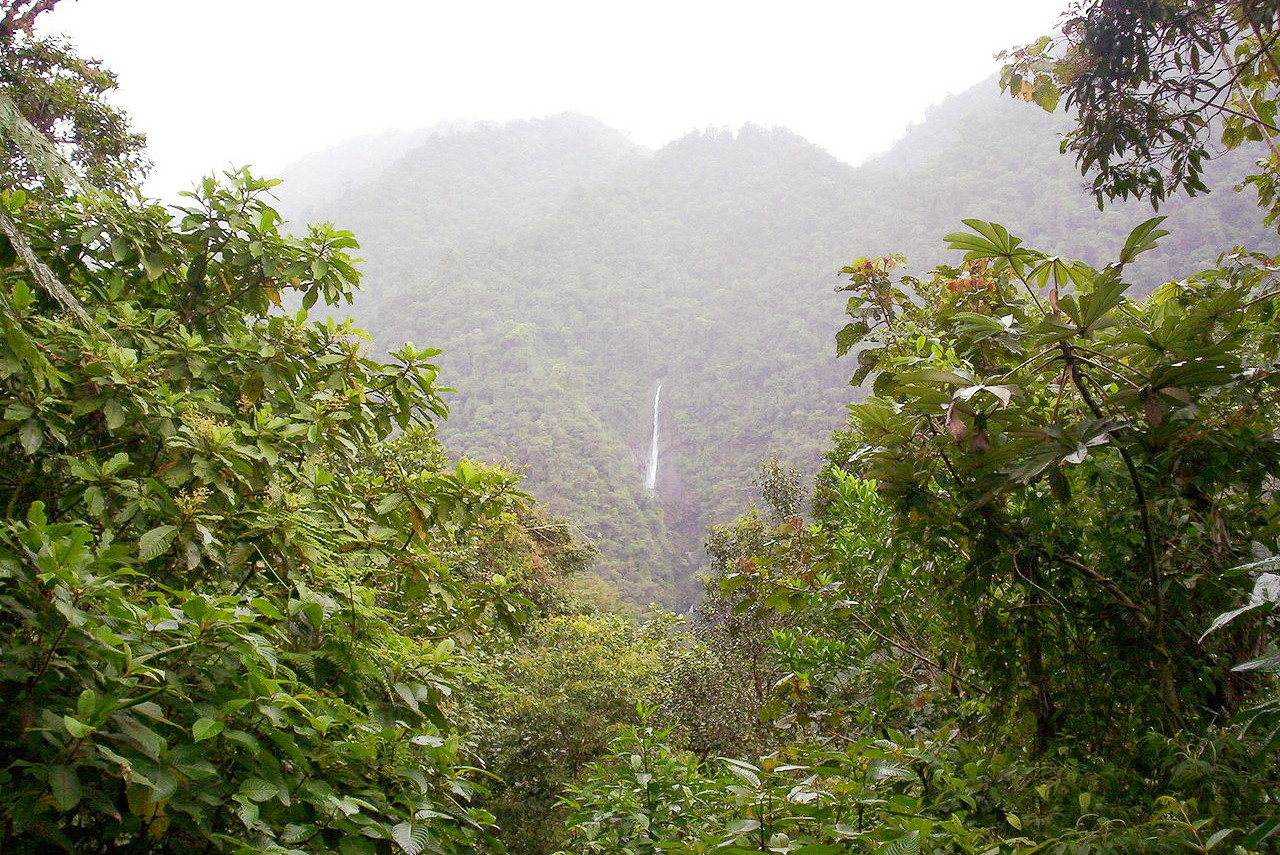
The beauty of Costa Rica is simply indescribable. It is an incredible country full of natural wonders. The scenery is lush and green, with many small rivers and creeks cutting through the mountainous landscape. Costa Rica is famous for its tropical forests, home to a great variety of trees and plants, as well as many different types of animals such as monkeys, toucans, and hummingbirds. Costa Rica is also home to over 450 types of butterflies, making it a great destination for butterfly lovers. Costa Rica is an absolute paradise for nature enthusiasts.
Contents
Map
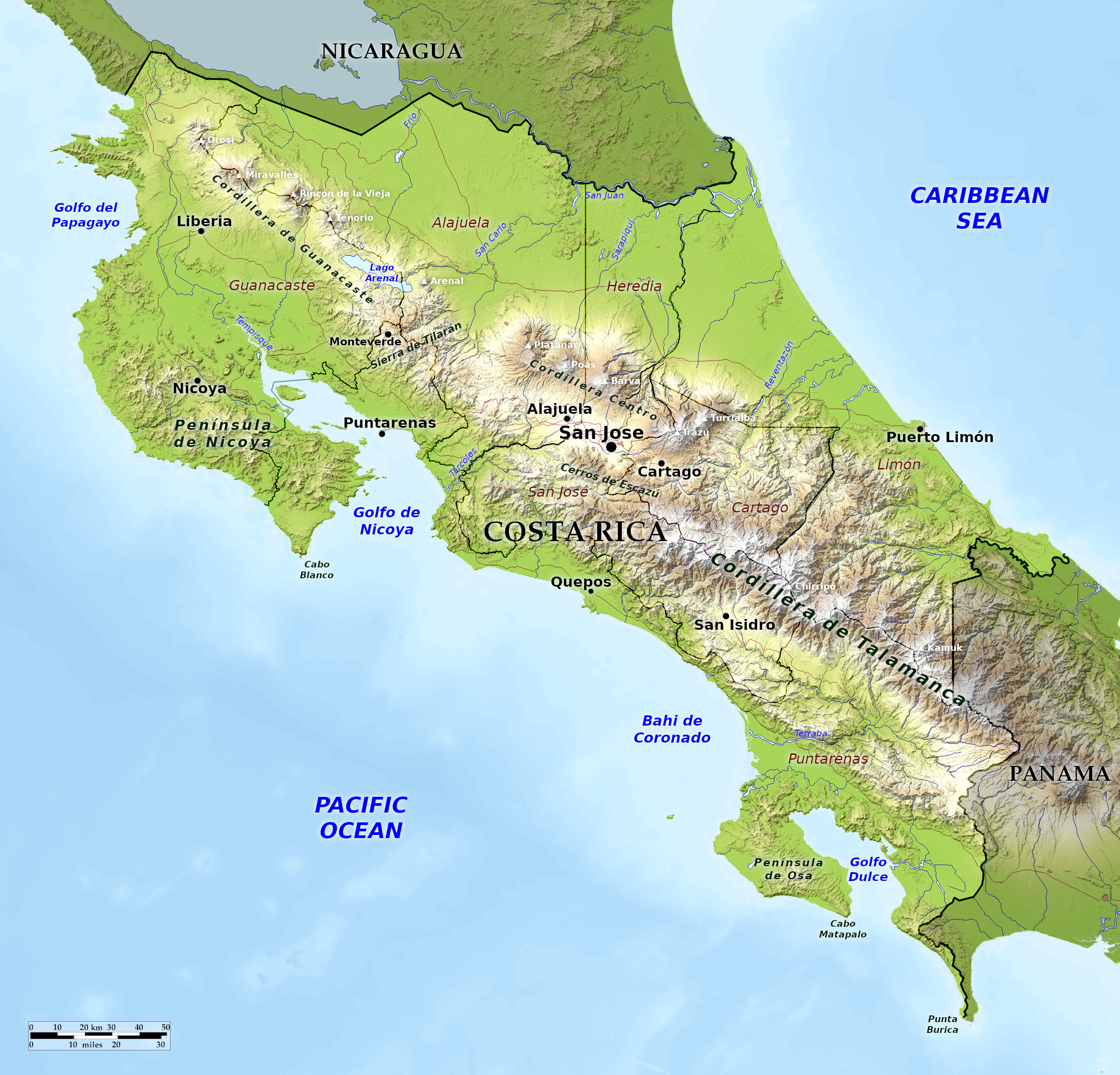 Relief map of Costa Rica
What is the landscape of Costa Rica like?
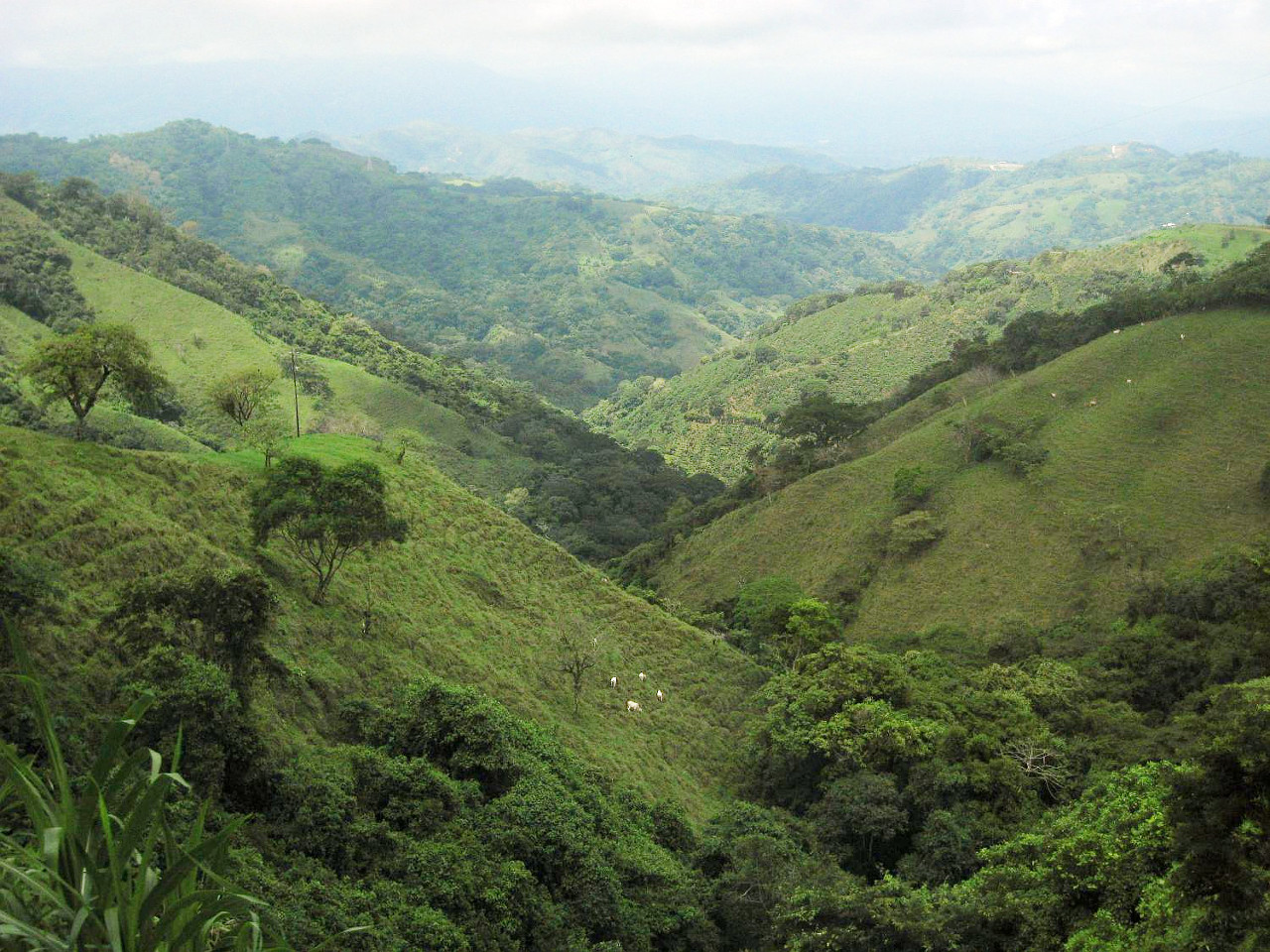
The central feature of Costa Rica are the mountain ranges—cordilleras—which form the spine of the country. These mountains do not form a continuous chain, but are divided into two main groups: the long extension to the Talamanca range in the south and the chain of volcanos in the the north. These are divided by the central valley around San José. On either side of the mountains are the coastal lowlands, which are generally narrow in the south, but broadening out towards the north.
Southern mountains
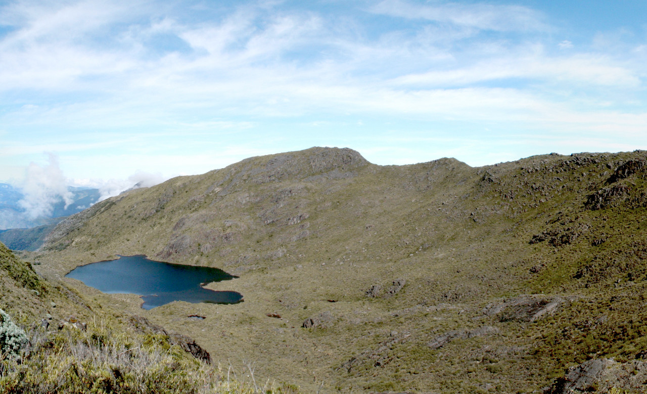
The south of the country is taken up by the Talamanca range of mountains, which runs southeast to northwest. This region is an unbroken expanse of mountains, rivers, and primeval forest. The Cordillera de Talamanca reaches in its highest peaks over 3,500 meters (11,500 feet). It continues south into Panama. There are no signs of recent volcanic activity in the Talamanca range, although tremors and landslides can occur. The Talamanca mountains have narrow crests and are very steep on the Atlantic side. The highest mountain in Costa Rica is Mount Chirripó, whose summit is at 3,821 meters (12,536 feet).
Central Valley
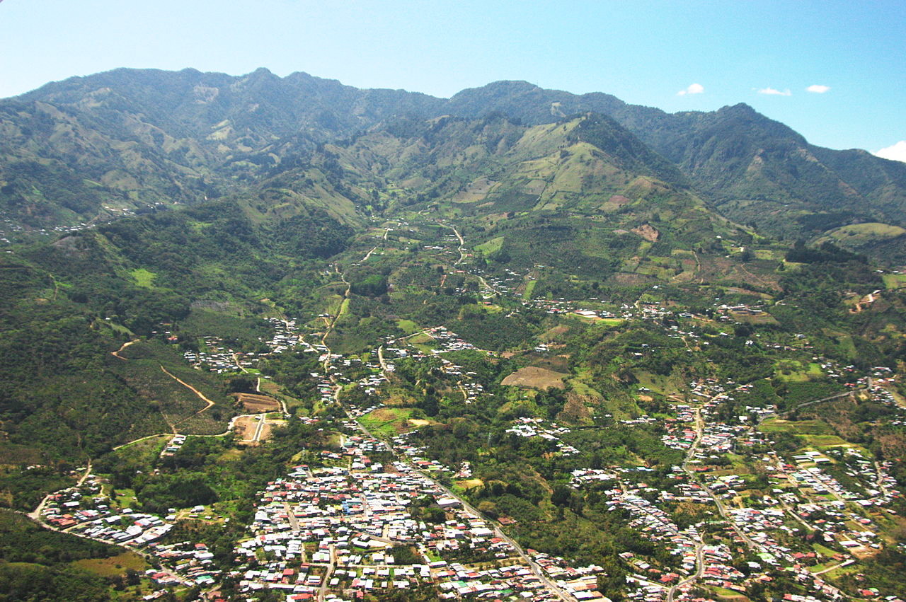
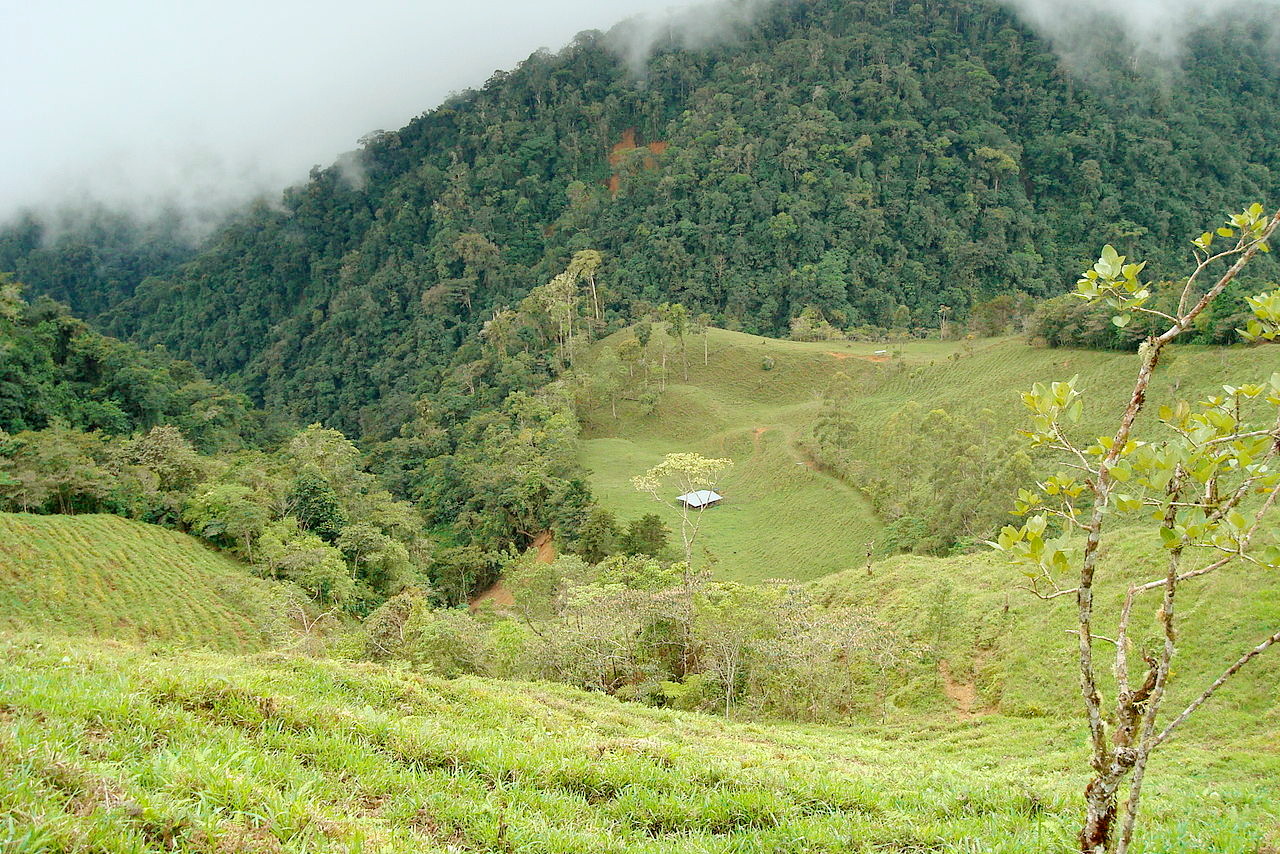
North of the Talamanca mountains there is a pronounced break, known as the Central Valley. This plateau region, while originally forested, is the most settled portion of the country, and has long since been cleared for agriculture and pasture. This is the country around the cities of Cartago and San José. The rivers Reventazón and Tárcoles rise here, and flow to the Caribbean and Pacific respectively in broad, deep valleys. The valleys are separated by the Ochomogo Pass, about twenty miles broad, and a little more than 1,500 meters (5,000 feet) above sea-level.
Central Range
The Cordillera Central is the first of a succession of volcanic cones which extend to the northwest. These peaks are still active volcanos—some have flooded craters, some have a constant escape of smoke and vapour. Destructive eruptions have occurred in this section in historical times, and severe earthquakes have previously destroyed the city of Cartago. Slight shocks occur almost annually.
The volcanos begin with the volcanic peaks of Irazú, 3,432 meters (11,260 feet), and Turrialba, 3,340 meters (10,958 feet). The Irazú has various craters, formed successively, each one contributing to the gradual rising of the mountains. The peak of Irazú is a point from which go various spurs and secondary mountains in opposite directions, one to the west and one to the east, the latter terminating in a crater where the Reventazón River takes its origin. From the top of Irazú, the whole of Costa Rica and both oceans are visible, and its ascent is relatively easy for the ambitious traveller.
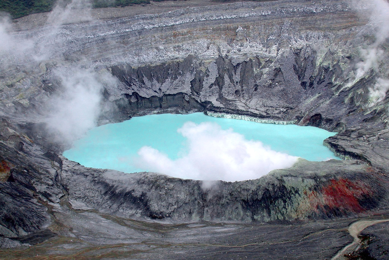
The chain of volcanos continues with Barva 2,906 meters (9,534 feet), Poás 2,708 meters (8,885 feet), and Platanar 2,267 meters (7,438 feet). On the summit of Poás there are two lakes, one whose blue waters sleep peacefully, and another strongly charged with sulphuric acid and is constantly boiling.
Northern mountains
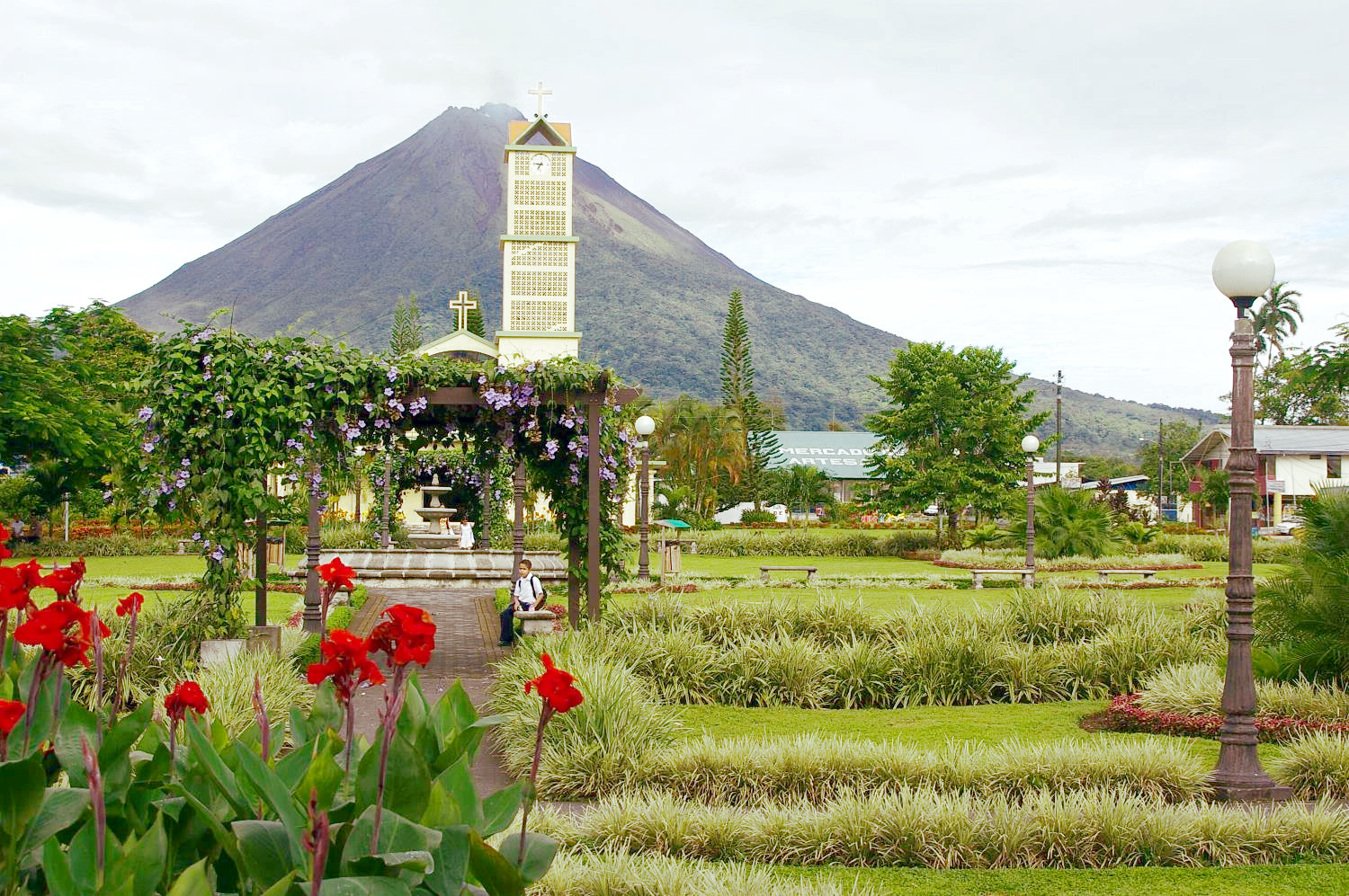
The more northerly range, begins with the volcano Arenal 1,670 meters (5,480 feet) which overlooks Lake Arenal (now a much enlarged reservoir providing hydroelectric power). Then the land changes to a highland for over 50 miles without a single volcano. The final group is an irregular, broad and volcano-dotted chain, about sixty miles long. There are a succession of four volcanic cones: Tenorio 1,916 meters (6,286 feet), Miravalles 2,028 meters (6,654 feet), Rincon de la Vieja 1,916 meters (6,286 feet), and finally Orosí 1,659 meters (5,443 feet). Then the mountains break down gradually on the northwest towards Lake Nicaragua.
Caribbean coast
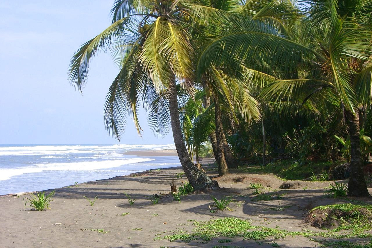
The Caribbean coast is generally low, and is unbroken by any large inlet or estuary. It is narrow in the south, covered with dense tropical forest and very humid. The trees are of great size, and are thick with creepers and lianas. At the lowest levels, especially near the rivers, jungles of palm catch the traveler's eye. Numerous rivers descend rapidly from the mountains in narrow valleys, separated by steep ridges. In the central districts around Puerto Limón, the Caribbean slope has been cleared for banana plantations and other types of agriculture.
The northern and northeastern part of the Costa Rica is similarly flat and low. The northeastern slopes of the volcanic hills send off many small rivers into Lake Nicaragua or its outlet, the Rio San Juan. The region is criss-crossed up by lagoons and natural channels which mingle their waters. This region has such a dense forest that many parts can only be reached by river.
Much of the east coast is separated from the Caribbean Sea by narrow sand banks of firm land, often containing long, narrow, deep lagoons. The main port on the east coast is Puerto Limón—the harbor faces the south, and is formed by a little peninsula on which Puerto Limón is situated. It is behind a narrow coral reef. The Talamanca coast lying south of Limon is made up of low, forest-covered swamps, except in places where hills extend to the ocean coast. The hills behind the Caribbean coast similarly have vast, dense, evergreen, virgin forests.
Pacific coast
The Pacific coast is quite different from the Caribbean coast. It is more hilly on the whole, and includes two mountainous peninsulas, besides the broad sweep of Coronada Bay and several small harbours.
The peninsula of Nicoya is partly an elevated plain and partly consists of hills and mountain ridges seldom attaining a greater height than 500 meters (1,500 feet), although there are many beautiful and fertile valleys. The Gulf of Nicoya extends fifty miles to the northwest and is a magnificent sheet of water, surrounded by green scenery. Some twenty islands, large and small, rocky and covered with vegetation, contribute to its beauty. The chief port town of Puntarenas is situated on the edge of this gulf.
Southeast of here the coast trends southeast in a long angular curve for about one hundred miles forming Coronado Bay. It is dominated by lofty hills, cut through at intervals by short impetuous rivers and a few estuaries.
In southwestern Costa Rica the Osa Península is separated from the mainland by the Golfo Dulce. Golfo Dulce, having a width of six miles, penetrates inland northwest about twenty-eight miles. Cabo Matapalo, which marks its western entrance, is deep and forest covered, but Punta Banco, opposite to it, is low. The southernmost point of Costa Rica is Punta Burica, which is the dividing line between Costa Rica and Panama, and projects straight south into the Pacific.
The Pacific coast has several more-or-less isolated groups of mountains. One of them is directly back of Puntarenas, and another on the Nicoya Peninsula opposite, making the scenery very attractive. The northwestern past, including the Nicoya peninsula is a region by itself.
The Pacific lands are somewhat different to the Carribean coast, in having a relatively dry climate and rainless summer. Thus there is a coastal zone of open forests and savannas which forms a belt fifteen miles in width, interspersed with more densely forested river valleys, islands of higher and thicker virgin forests, isolated trees or groups of trees. These savannas and open forests spread to a considerable extent over the northwest of the country and similarly over the coast-lands of Golfo Dulce.
What is the nature of Costa Rica like?
Few countries of the globe are as richly endowed by nature as Costa Rica. The country is home to a huge variety of plants and animals. Despite being less 0.1% of the world's total land area, Costa Rica's biodiversity accounts for over 5% of the world's plant and animal species. Over 50% of the country's total area is covered with forests and jungle. The country is a natural meeting place of the extremes of the North and the South American Continents, contributing to the great variety of plants and of animals.
Plants
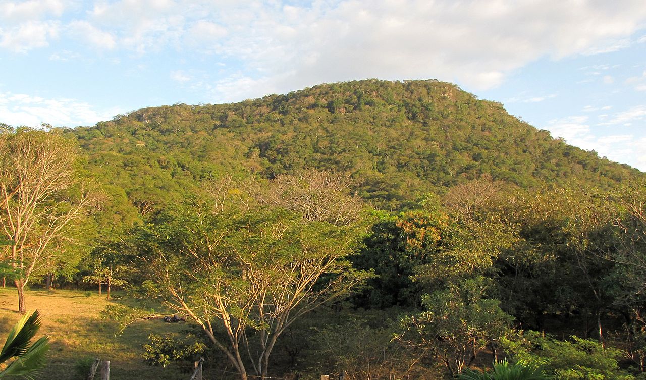
On the Pacific coast, where there is a pronounced dry season for four to five months, the natural vegetation here is dry tropical forests. These forests are characterized by the fact that the trees rarely grow to a height above thirty meters and that the vegetation closest to the ground is full of scrub and bushes. In the northwest the land becomes savanna dominated by crabgrass, sedge, etc., interspersed with solitary trees such as the guanacaste tree (Enterolobium cyclocarpum)—which is the national tree of Costa Rica. During the dry season the vegetation of the savannas almost disappears—the greater part of the trees and bushes shed their leaves and grasses become dry and brittle.
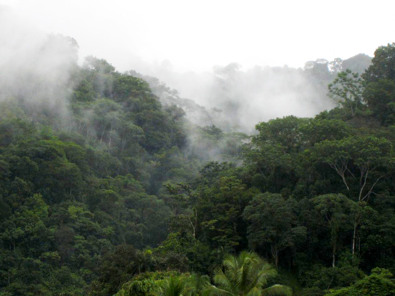
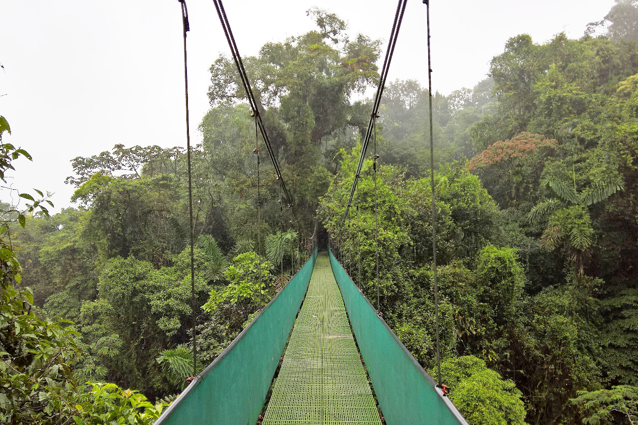
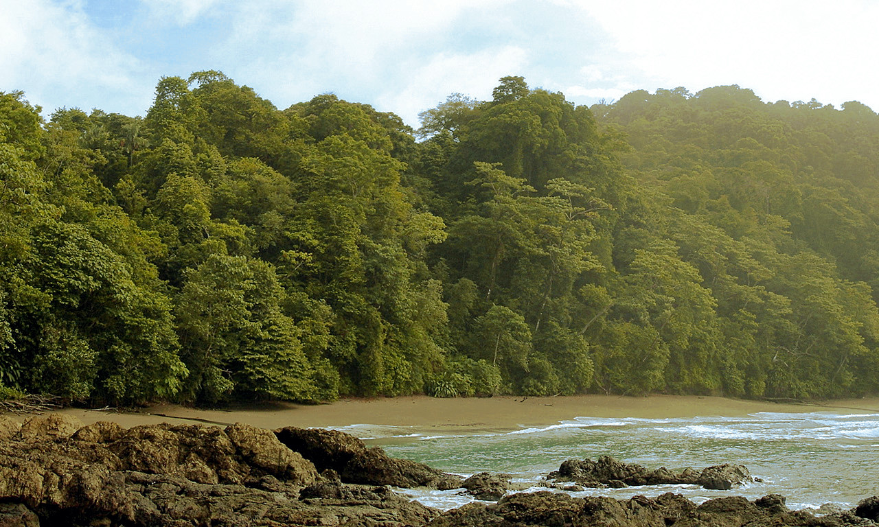
Most of Costa Rica's lowlands, however, have such a warm and wet climate that the trees can continue to grow most of the year. This type of rainforest, unlike the dry forests, remains green year-round and the trees grow to a height of up to 50 to 60 meters (165 to 195 feet). These hot lands are regions of virgin forests, and here are found the palms, the ferns, the vanilla, the rubber trees, the cacao, and an infinite variety of trees, including mahogany, Spanish cedar, guaiacum, mora, brazilwood, pink manjack, cotton tree, cashew, pepper plant, figs, etc. In the lowlands there also abound fruit trees—avocado, native plum trees, orange trees, bananas, and many others. Everywhere is a confusion of giant trees, some having branches and leaves in profusion, others with smooth trunks like elegant columns. Vines and lianas are seen everywhere, swinging from the trees in long strands. The trunks, branches, and even the leaves are covered with a multitude of ferns, lichens, bromeliads, and orchids. Everywhere there is underbrush, a mass of bushes, reeds, and climbing plants whose flowers are always brilliant.
The vegetation and the height of the trees decreases with altitude. Higher regions have small to medium-sized palms and tree ferns with very dense forests. In these areas there are plantations of coffee, sugarcane, and bananas in the warmest localities; corn, potatoes, and beans in the higher regions, where the fields are of vast extent. Above 2,000 meters (6,500 feet) begins the region of oaks and shrubby heathland, up to an altitude of 3,000 meters (9,800 feet). The forests become sparse, stunted and gnarled, due to the high winds. At the tops of the volcanoes there are myrtles, more or less stunted. Above 3,000 meters the land becomes one of sub-alpine grasslands and shrubs.
In addition to all these types of forests, Costa Rica is also noted for its wetlands and mangroves. Mangrove forests can be found nearly anywhere a river meets the sea. These forests form their own ecosystems, and protect marine species such as fish, crabs, sponges and coral, and are a home for many other species including monkeys, bats, and many birds.
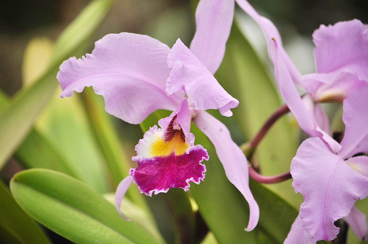
Costa Rica has a vast variety of flowers, native and naturalized. Especially to be remarked are the orchids—the country has more than 1,000 species of orchids, Monteverde being the region with the highest density of orchids on the planet.
Animals
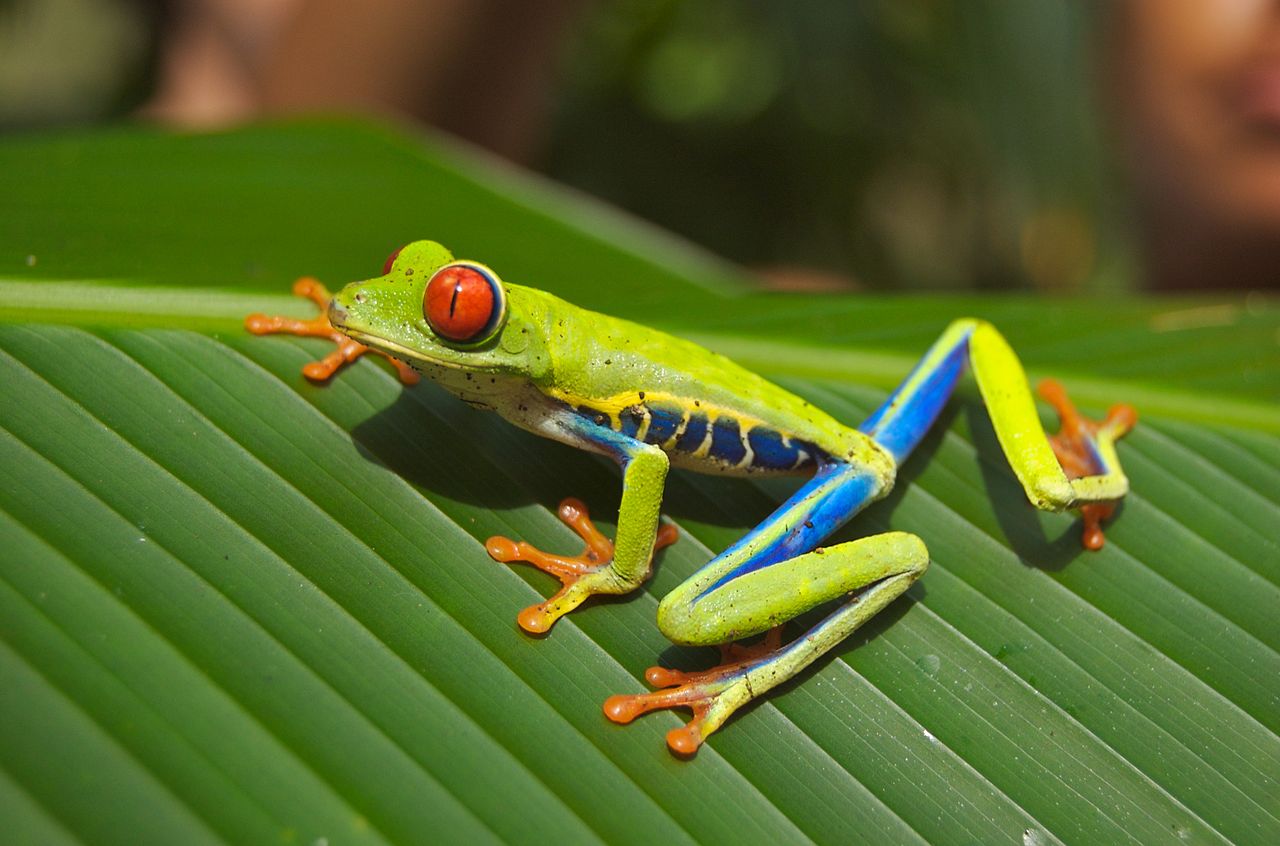
Costa Rica is a true paradise known for the remarkable variety of its animals. It shelters 230 species of mammals, 830 species of birds, 180 species of amphibians, 250 species of reptiles and 130 species of freshwater fish.
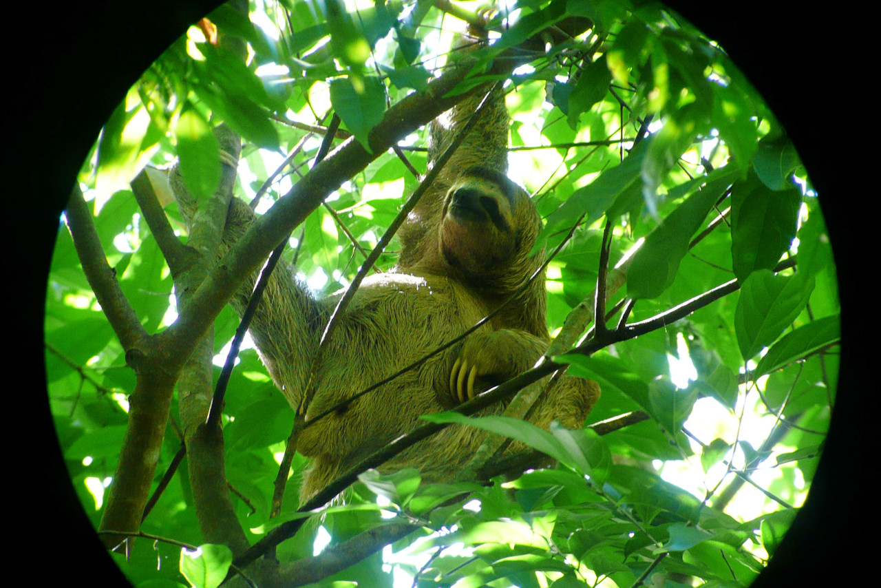
There are six species of cats: jaguar, cougar, oncilla, ocelot, margay, and jaguarundi, mostly living in nature reserves. There are four species of monkey, including the mantled howler which can be heard howling up to two miles away. There are many Central and South American mammals such as the white-nosed coati (Nasua narica); the kinkajou (Potos flavus); and the cacomistle (Bassariscus sumichrasti). There is an exceptionally large rodent, the Lowland paca (Cuniculus paca), with a body length up to 78 cm (31 inches). There are two species of sloth, and one tapir—Baird's Tapir (Tapirus bairdii). Special mention should be made of the endangered West Indian manatee (Trichechus manatus), which can be found in shallow rivers and estuaries. There are also over 100 bat species of which three species are vampire bat.
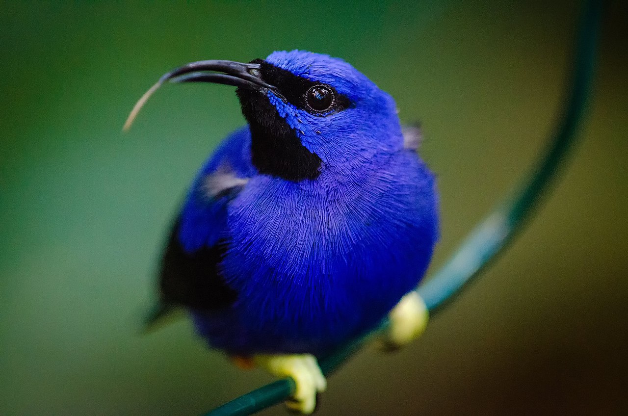
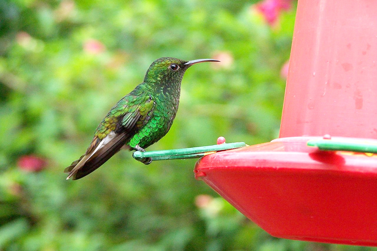
The forests abound with birds of marvelous beauty, among which must be mentioned the superb quetzal (Pharomachrus mocinno) with metal-green plumage; macaws of various colors, including the famous scarlet macaw; toucans with enormous beaks; quantities of hummingbirds, jewel-winged; and many little song birds. The Clay-colored thrush, known locally as the yigüirro, is the national bird of Costa Rica. Several endemic species, such as the orange-collared manakin, the yellow-billed cotinga, and the mangrove hummingbird, are found only in Costa Rica and in adjacent parts of western Panama.
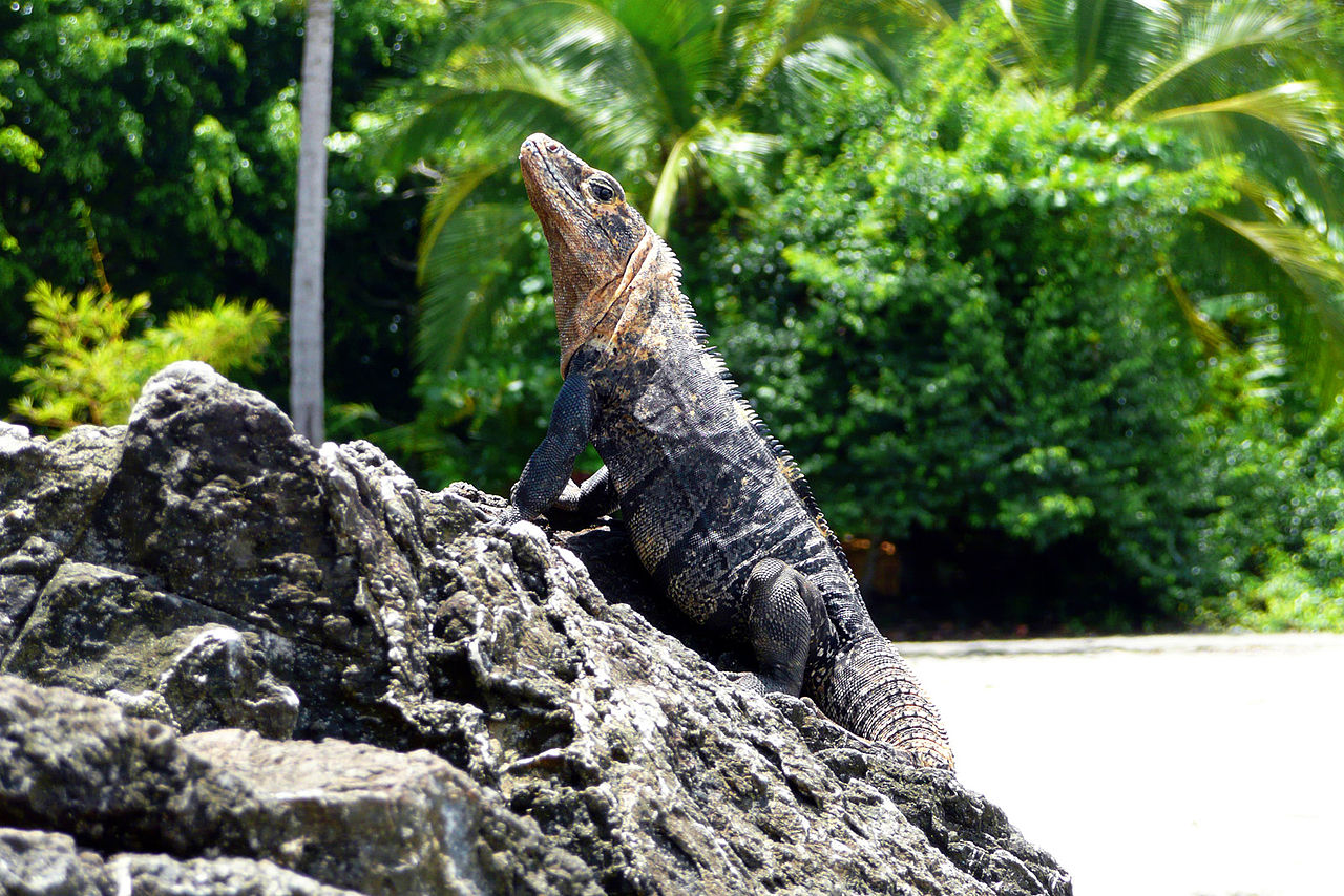
Costa Rica is home to about 175 species of amphibians, of which eighty-five percent are frogs. There are about 220 species of reptiles including sea turtles which lay eggs on the beaches. There are lizards of all kinds: geckos, iguanas, and caimans.
Notable insects in Costa Rica are bees, ants such as leaf ants and army ants, rhino beetles, and leaf grasshoppers. There are over 1,200 species of butterflies and at least 8,000 species of moths. Butterflies and moths are common year round, but are more present in the rainy season. Nine percent percent of all known butterfly species worldwide are found in Costa Rica, including representatives of the majestic Morpho genus with electric blue wings.
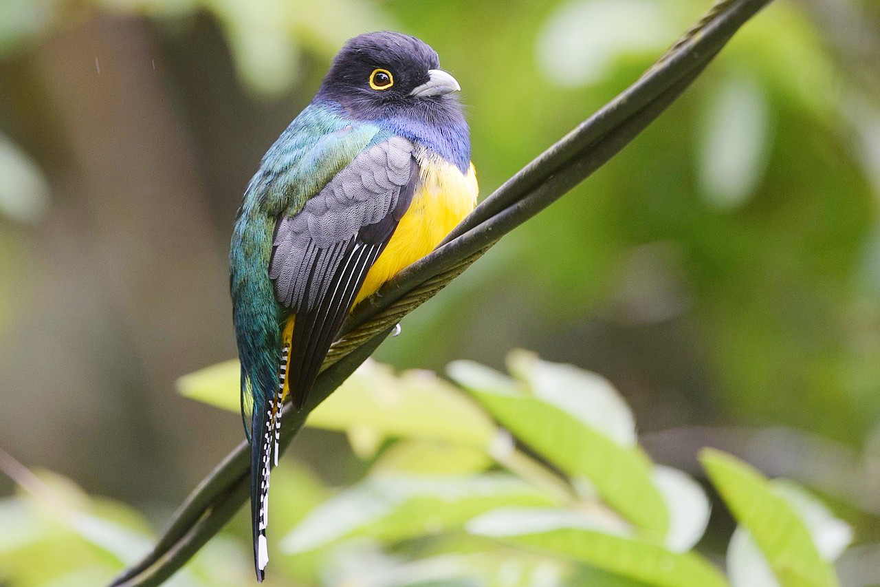 Gartered Trogon, Turrialba
What is the climate of Costa Rica like?
See our main article: The Climate of Costa Rica
Temperatures in Costa Rica are fairly constant throughtout the year, although slightly lower in the months from November to March. The climate varies greatly with altitude. The coastal lands and the foothills are always hot, with a mean annual temperature from 22°C to 27°C (72°F to 82°F). On the higher plateaux, for example around San José, the average is about 21°C (70°F). At high altitudes, above 2,250 meters (7,500 feet), frosts are frequent, but snow rarely falls.
The wet season lasts from May to November in the central regions and on the Pacific side; but on the Atlantic side the winds may bring rain in any month. The average rainfall is about 2,000 mm (80 inches) per year, but as cloud-bursts are common, it may locally rise to 3,800 mm (150 inches) or even more.
| Climate data for San José, Costa Rica | |||||||||||||
|---|---|---|---|---|---|---|---|---|---|---|---|---|---|
| Month | Jan | Feb | Mar | Apr | May | Jun | Jul | Aug | Sep | Oct | Nov | Dec | Year |
| Average high °C (°F) | 28.2 (82.8) | 29.1 (84.4) | 29.9 (85.8) | 30.3 (86.5) | 28.8 (83.8) | 28.2 (82.8) | 28.2 (82.8) | 28.3 (82.9) | 27.8 (82.0) | 27.1 (80.8) | 27.2 (81.0) | 27.9 (82.2) | 28.4 (83.1) |
| Daily mean °C (°F) | 22.6 (72.7) | 23.0 (73.4) | 23.5 (74.3) | 23.7 (74.7) | 22.9 (73.2) | 22.5 (72.5) | 22.6 (72.7) | 22.4 (72.3) | 22.0 (71.6) | 21.8 (71.2) | 21.9 (71.4) | 22.3 (72.1) | 22.6 (72.7) |
| Average low °C (°F) | 18.5 (65.3) | 18.7 (65.7) | 18.8 (65.8) | 19.1 (66.4) | 19.2 (66.6) | 19.0 (66.2) | 19.0 (66.2) | 18.8 (65.8) | 18.3 (64.9) | 18.5 (65.3) | 18.3 (64.9) | 18.3 (64.9) | 18.7 (65.7) |
| Average rainfall mm (inches) | 6.3 (0.25) | 10.2 (0.40) | 13.8 (0.54) | 79.9 (3.15) | 267.6 (10.54) | 280.1 (11.03) | 181.5 (7.15) | 276.9 (10.90) | 355.1 (13.98) | 330.6 (13.02) | 135.5 (5.33) | 33.5 (1.32) | 1,971 (77.61) |
| Source: NOAA | |||||||||||||
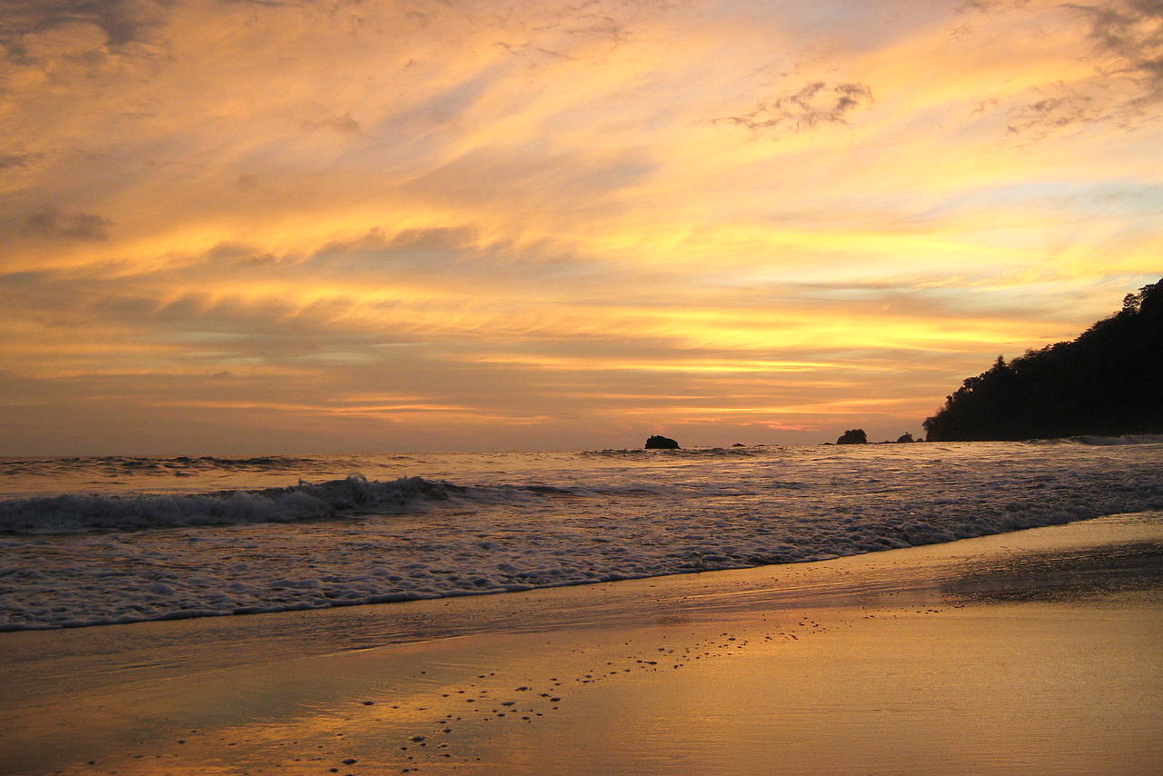
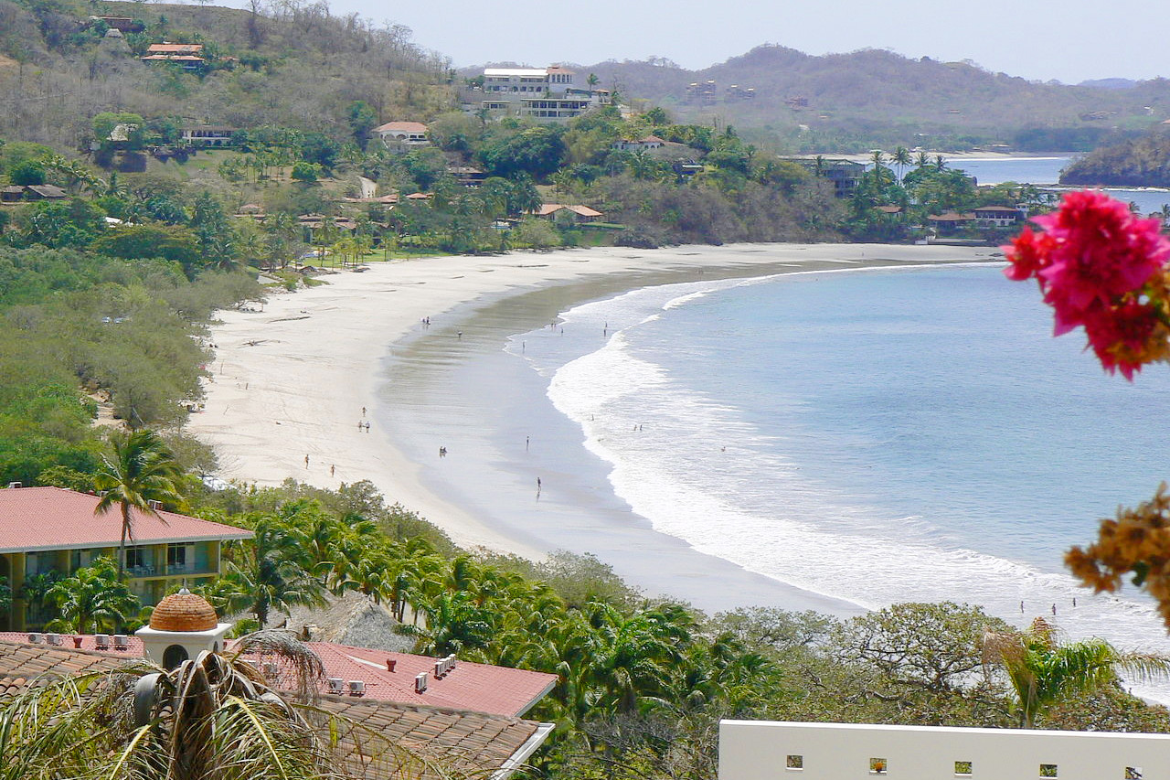
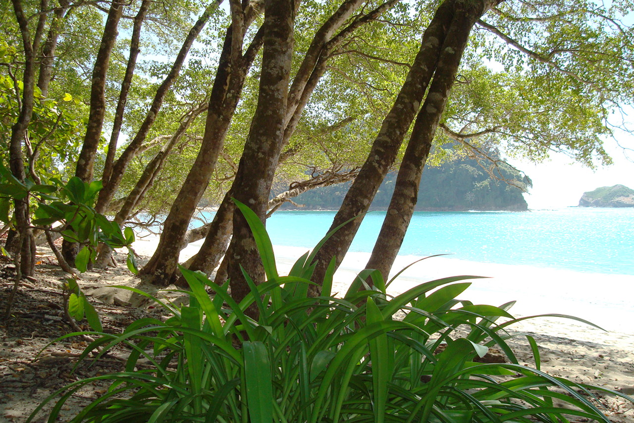 Tropical beach at Quepos
The official websites
Costa Rica
Pura Vida!
| Location: | Central America, bordering both the Caribbean Sea and the North Pacific Ocean, between Nicaragua and Panama |
| Coordinates: | 10° 00′ N, 84° 00′ W |
| Size: | • 360 km N-S; 380 km E-W • 230 miles N-S; 240 miles E-W |
| Climate: | Tropical and subtropical; dry season (December to April); rainy season (May to November); cooler in highlands |
| Highest point: | Cerro Chirripo 3,819 m / 12,530 ft |
| Terrain: | Coastal plains separated by rugged mountains including several major volcanoes |
| Forest: | 51.5% (2011 est.) |
| Population: | 5,097,988 (July 2020 est.) |
| Population density: | Medium (85/km²) |
| Capital: | San José |
| Languages: | Spanish (official), English |
| Human Development Index: | Very high (0.810) |
| Currency: | Colón |